Discover the mapped boundaries and natural terrain of this East African protected area.
Nyungwe National Park stands as a significant protected national park within Rwanda, offering a focal point for exploring the nation's unique geography and conservation landscapes. As a key protected area, its mapped boundaries define a region rich in natural terrain, contributing to the broader atlas of East African protected lands. Users can delve into the specific geographic context and landscape character of this national park, understanding its role within Rwanda's diverse natural environment for structured discovery.
Nyungwe National Park
National park
Structured park overview, official facts, and landscape profile for Nyungwe National Park
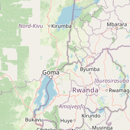
Geography guide, regional context, and park location map for Nyungwe National Park
Rwanda is a landlocked East African nation bordered by Uganda, Tanzania, Burundi, and the Democratic Republic of the Congo. The country features mountains in the west, savanna in the southeast, and several volcanoes in the northwest forming part of the Virunga chain. It has a tropical highland climate with two rainy and two dry seasons annually.
Rwanda lies in the Great Rift Valley of East Africa, bordered by Uganda to the north, Tanzania to the east, Burundi to the south, and the Democratic Republic of the Congo to the west. The western region features mountains and lakes, while the southeast consists of savanna. Several volcanoes forming part of the Virunga Mountains are located in the northwest.
Common questions about visiting, size, designation, and location context for Nyungwe National Park
Deepen your exploration by continuing the structured search for national parks and protected areas worldwide. Utilize the comprehensive filtering capabilities to compare different conservation landscapes and refine your understanding of global park geography. Discover more about the distribution and characteristics of protected natural areas.