Mori Atlas logo
National parkKhao Sam Roi Yot National Park

Discover the geographic identity and atlas context of this significant Thai national park.

Khao Sam Roi Yot National Park: Mapped Protected Landscape in Prachuap Khiri Khan Province

(Utthayan Haeng Chat Khao Sam Roi Yot)

Khao Sam Roi Yot National Park represents a vital protected natural area situated within Thailand's Prachuap Khiri Khan Province. This page serves as your gateway to understanding the park's specific geographic boundaries, its placement within the regional landscape of western Thailand, and its role as a significant national park entity. Explore the mapped terrain and conservation landscape that define Khao Sam Roi Yot National Park, offering a factual foundation for geographic discovery.

Coastal National ParkLimestone KarstWetlandsMangrove ForestRamsar SiteCave Systems

Khao Sam Roi Yot National Park

National park

Park overview

Structured park overview, official facts, and landscape profile for Khao Sam Roi Yot National Park

Khao Sam Roi Yot National Park park facts, protected area profile, and essential visitor context
Review the core facts for Khao Sam Roi Yot National Park, including designation, size, terrain, visitor scale, habitats, and operating context in one park-focused overview.

About Khao Sam Roi Yot National Park

Khao Sam Roi Yot National Park stands as a landmark in Thailand's conservation history as the first coastal national park established in the country. Located along the eastern shore of the Gulf of Thailand in Prachuap Khiri Khan Province, the park encompasses a remarkable diversity of landscapes within its 98 square kilometer boundary. The limestone hills that form the park's backbone represent a southern extension of the Tenasserim Hills, their jagged peaks creating a distinctive silhouette against the tropical sky. Between these hills lie extensive freshwater marshes, though significant portions have been converted to shrimp farms, highlighting ongoing tensions between conservation and development. The park's marine component includes coastal waters, two scenic beaches, and five uninhabited offshore islands that provide important habitat for seabirds and marine life. The park's accessibility from popular resort destinations like Hua Hin makes it a frequently visited protected area, with approximately 165,000 annual visitors exploring its trails, beaches, and caves. Beyond its natural significance, the park holds archaeological importance following the 2020 discovery of 3,000-year-old cave paintings in unmapped caverns within the limestone formations.

Quick facts and research context for Khao Sam Roi Yot National Park

Located approximately 58 kilometers south of Hua Hin in Prachuap Khiri Khan Province, Khao Sam Roi Yot covers 98 square kilometers with about 21 square kilometers being marine area. The park features Khao Krachom, the highest peak at 605 meters, and protects Thailand's largest freshwater marsh system. Established in 1966 as Thailand's inaugural coastal national park, it was later expanded in 1982. The park was designated a Ramsar Wetland site in 2008, recognizing its international importance as a coastal ecosystem. It receives approximately 165,000 visitors annually and is managed by Thailand's Department of National Parks, Wildlife and Plant Conservation.

Park context

Deeper park guide and search-rich context for Khao Sam Roi Yot National Park

Khao Sam Roi Yot National Park history, landscape, wildlife, and travel context
Explore Khao Sam Roi Yot National Park through its history, landscape character, ecosystems, wildlife, conservation priorities, cultural context, and seasonal travel timing in a structured park guide built for atlas discovery and search intent.

Why Khao Sam Roi Yot National Park stands out

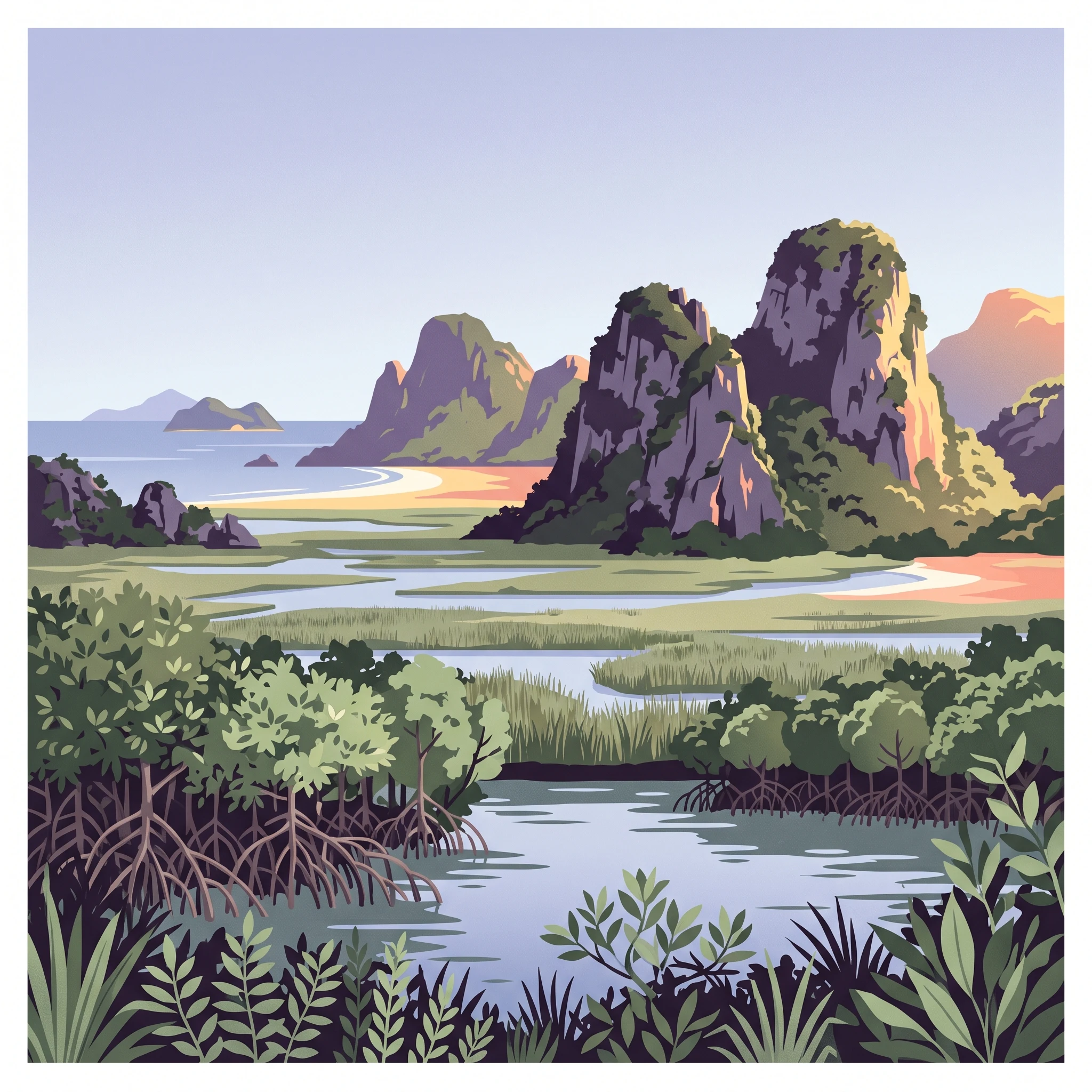
Khao Sam Roi Yot is best known for its striking limestone karst landscape rising dramatically from the Gulf of Thailand, the iconic Phraya Nakhon Cave with its historic pavilion built for King Chulalongkorn in 1890, and Thailand's largest freshwater marsh system. The park's dramatic coastline features two white sand beaches, Hat Laem Sala and Hat Sam Phraya, accessible by boat or hiking trails. The Phraya Nakhon Cave is particularly famous for the Khuha Kharuehat Pavilion, where sunlight directly illuminates the structure at certain times of year, creating a memorable visual spectacle that has become a provincial symbol. The mangrove-lined Klong Khao Daeng stream and the presence of rare wildlife including fishing cats and Irrawaddy dolphins further distinguish this coastal protected area.

Khao Sam Roi Yot National Park history and protected-area timeline

The historical significance of Khao Sam Roi Yot extends far beyond its designation as a national park in 1966. The area is believed to be where King Mongkut (Rama IV) hosted European guests on August 18, 1868, to observe a total solar eclipse. The king's personal interest in astronomy led him to calculate the date and location of the eclipse, and his predictions proved more accurate than those of French astronomers by approximately two seconds. Tragically, Mongkut contracted malaria during this event and died on October 1 of that year. The national park was formally created on June 28, 1966, with an initial area of approximately 61 square kilometers. On April 1, 1982, the park was significantly enlarged by adding another 37 square kilometers. Archaeological investigations continue to reveal the site's ancient significance, with cave paintings dating back 2,000 to 3,000 years discovered in 2020, adding a new dimension to the park's historical identity.

Khao Sam Roi Yot National Park landscape and geographic character

The landscape of Khao Sam Roi Yot is defined by its dramatic limestone karst topography rising abruptly from the coastal plain. The hills, reaching their highest point at Khao Krachom at 605 meters above sea level, create a spectacular backdrop of jagged peaks and steep cliffs. These limestone formations have been shaped by millions of years of erosion, resulting in caves, tunnels, and natural arches. Between the hills, the terrain flattens into extensive freshwater marshes that represent Thailand's largest such wetland system. The park's coastline features two notable white sand beaches: Hat Laem Sala, situated about 17 kilometers from park headquarters and accessible by boat from Ban Pu village, and Hat Sam Phraya. Five uninhabited islands lie just offshore, adding to the coastal scenery. The Klong Khao Daeng stream runs for approximately 4 kilometers through mangrove forests, where fresh and saltwater meet at its mouth, creating a unique estuarine environment.

Khao Sam Roi Yot National Park ecosystems, habitats, and plant life

The nature of Khao Sam Roi Yot encompasses a remarkable diversity of ecosystems within a relatively compact area. The park protects Thailand's largest freshwater marsh, a habitat of significant ecological importance that supports numerous species and provides critical flood regulation and water filtration functions. The mangrove forests along Klong Khao Daeng and other coastal areas contain several species including grey mangrove, red mangrove, and herbaceous seepweed, creating complex intertidal environments that serve as nurseries for fish and crustaceans. The marine areas within the park's boundaries support coral communities and provide habitat for marine mammals. The limestone hills themselves harbor specialized flora adapted to the rocky, well-drained conditions. The ecosystem diversity, from montane limestone forest through freshwater marsh to marine environments, makes this park particularly valuable for biodiversity conservation in peninsular Thailand.

Khao Sam Roi Yot National Park wildlife and species highlights

The wildlife of Khao Sam Roi Yot reflects the park's diverse habitats, with notable populations of both terrestrial and marine species. The bird community is particularly rich, with common kingfisher, black-capped kingfisher, collared kingfisher, little heron, little egret, and Javan pond-heron commonly observed throughout the park. The mangrove environments support a variety of crustaceans and fish including mudskippers, fiddler crabs, snapping shrimp, and mud creepers, while oysters thrive in the estuarine waters. Mammals found in the park include the crab-eating macaque, while rare species such as the mainland serow, dusky langur, and fishing cat occupy the more remote hill forest habitats. At sea, Irrawaddy dolphins are occasionally observed in the Gulf of Thailand waters adjacent to the park. The 2020 discovery of rock art depicting animals including what appears to be a serow provides evidence of the long-standing relationship between wildlife and this landscape.

Khao Sam Roi Yot National Park conservation status and protection priorities

Khao Sam Roi Yot holds significant conservation importance as Thailand's first coastal national park and as a designated Ramsar Wetland site. The park's Ramsar designation in 2008, under the official name Khao Sam Roi Yot Wetland, recognizes the international significance of its marsh and coastal ecosystems. The protected area safeguards critical habitat for numerous species, including several threatened mammals and important bird populations. However, the park faces ongoing conservation challenges. Of the approximately 69 square kilometers of marshes that historically existed in the area, only about 35 square kilometers fall within park boundaries, with significant portions converted to shrimp aquaculture. Efforts to expand the Ramsar designation to additional marsh areas continue. The protection of the limestone hills, beaches, marine areas, and offshore islands creates a comprehensive coastal conservation framework that addresses both terrestrial and marine biodiversity.

Khao Sam Roi Yot National Park cultural meaning and human context

The cultural context of Khao Sam Roi Yot extends from ancient times through the modern era of Thai conservation. The cave paintings discovered in 2020, dating back 2,000 to 3,000 years, provide evidence of prehistoric human presence and artistic expression in the region. More recently, the area gained prominence in Thai royal history when King Mongkut chose the location to observe the 1868 solar eclipse, demonstrating the site's significance for astronomical observation and its accessibility to the royal court. The most enduring cultural landmark is Phraya Nakhon Cave, where King Chulalongkorn (Rama V) visited in 1890 and for which the Khuha Kharuehat Pavilion was constructed. This elegant structure has become the symbol of Prachuap Khiri Khan Province, and subsequent kings including Vajiravudh and Bhumibol Adulyadej have also visited the cave. The park's name itself carries cultural weight, with local interpretation offering several origin stories including 'mountain with 300 peaks,' a reference to survivors from a Chinese junk, or a connection to a local plant species.

Top sights and standout views in Khao Sam Roi Yot National Park

Khao Sam Roi Yot offers visitors a compelling combination of natural beauty, geological wonders, and historical significance within a single protected area. The iconic Phraya Nakhon Cave, with its natural opening allowing sunlight to flood the interior and illuminate the historic Khuha Kharuehat Pavilion, represents the park's most celebrated feature. The dramatic limestone peaks, particularly when viewed from the beaches or as silhouettes against sunrise or sunset, provide outstanding photographic opportunities. The extensive marsh system, Thailand's largest, supports exceptional birdwatching, while boat trips to the offshore islands offer snorkeling and wildlife observation. The mangrove-lined Klong Khao Daeng provides a different ecosystem experience, where visitors can observe the meeting of fresh and saltwater and the specialized species that inhabit this transition zone. The recently discovered ancient cave paintings add an archaeological dimension that few other Thai national parks can claim.

Best time to visit Khao Sam Roi Yot National Park

Khao Sam Roi Yot can be visited year-round, though the optimal period falls during the cool dry season from November through February when temperatures range from 18 to 25 degrees Celsius and rainfall is minimal. This season offers the most comfortable conditions for hiking to Phraya Nakhon Cave, exploring the beach areas, and navigating the park's trails. The summer months from March to May bring warmer temperatures between 23 and 32 degrees Celsius, but still present good conditions for visitors willing to endure the heat. The monsoon season from June through September sees temperatures between 20 and 30 degrees Celsius with increased rainfall, which can limit some activities but also brings lush green landscapes and fewer crowds. Regardless of season, visitors planning to explore Phraya Nakhon Cave should consider that the famous sunlight illumination of the pavilion occurs at specific times during certain months, making advance research advisable for those seeking this experience.
Park location guide

Geography guide, regional context, and park location map for Khao Sam Roi Yot National Park

Khao Sam Roi Yot National Park park geography, regions, and map view in Thailand
Understand where Khao Sam Roi Yot National Park sits in Thailand through a broader geographic reading of the surrounding landscape, nearby location context, and its mapped position within the national park landscape.

How Khao Sam Roi Yot National Park fits into Thailand

Thailand is a Southeast Asian nation formerly called Siam, located in mainland Southeast Asia. It operates as a unitary parliamentary constitutional monarchy under King Vajiralongkorn. The country borders Myanmar, Laos, Cambodia, and Malaysia, with maritime boundaries involving Vietnam, Indonesia, and India. Thailand has a population of nearly 66 million and covers approximately 513,120 km². Historically, the Sukhothai Kingdom marks the beginning of Thai history, followed by the powerful Ayutthaya Kingdom.

Wider geography shaping Khao Sam Roi Yot National Park in Thailand

Thailand occupies mainland Southeast Asia with borders to Myanmar (west/northwest), Laos (east/northeast), Cambodia (southeast), and Malaysia (south). The country has coastline along the Gulf of Thailand to the southeast and the Andaman Sea to the southwest. The territory covers approximately 513,120 km².

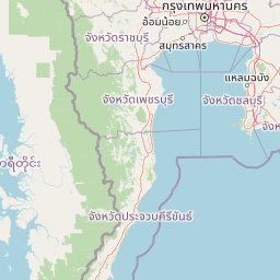
Map view of Khao Sam Roi Yot National Park

Use this park location map to pinpoint Khao Sam Roi Yot National Park in Thailand, understand its exact geographic position, and read its mapped placement within the surrounding landscape more clearly.

Pigeon | © OpenStreetMap contributors

Location context for Khao Sam Roi Yot National Park

Prachuap Khiri Khan Province
Park atlas

Trace the geographic spread of protected landscapes and compare other national parks in the region.

Discover Nearby Protected Areas and National Parks Surrounding Khao Sam Roi Yot National Park
Explore other national parks and protected areas across Thailand's varied terrain, encompassing more coastal landscapes, significant wetlands, and impressive limestone karst formations. Compare park geography, trace the regional context of protected landscapes, and discover how different conservation areas connect across varied ecosystems.
National parkPrachuap Khiri Khan Province

Hat Wanakon National Park: Mapped Protected Area within Prachuap Khiri Khan's Geography

Explore protected national park boundaries and regional landscape context.

Hat Wanakon National Park serves as a significant protected landscape entity within the Prachuap Khiri Khan Province region of Thailand. This national park's mapped boundaries offer insight into its territorial extent and its role within the country's network of conservation areas. Exploring this park provides a concrete example of protected land within the varied geography of the Kra Isthmus, enriching your atlas-based understanding of Thailand's natural reserves.

Area
38 km²
Established
1992
IUCN
II
Visitors
43.3K annual
National parkPrachuap Khiri Khan Province

Namtok Huai Yang National Park: Protected Mountain Terrain and Waterfall Atlas

Discover Prachuap Khiri Khan Province's significant natural landscape.

Namtok Huai Yang National Park is a key protected area in Thailand's Prachuap Khiri Khan Province, renowned for its distinctive montane geography shaped by the Tenasserim Hills. This national park offers a detailed view of forest ecosystems, watershed importance, and cascading waterfalls, all presented within a structured atlas framework. Users can explore the park's mapped boundaries and terrain characteristics, gaining a concrete understanding of its geographic significance and natural protected landscape.

Area
161 km²
Established
1991
IUCN
II
Visitors
26.9K annual
National parkPhetchaburi Province

Kaeng Krachan National Park: Thailand National Park Atlas and Protected Landscape

Mapped boundaries and regional geography of this national park.

Access detailed geographic information for Kaeng Krachan National Park, a protected national park located in Phetchaburi Province, Thailand. Understand its specific landscape context and explore its mapped boundaries within the regional geography. This resource is designed for structured atlas-driven discovery of protected natural areas.

Area
2,915 km²
Established
1981
IUCN
II
Visitors
103.5K annual
National parkPrachuap Khiri Khan Province

Ao Siam National Park: Protected Landscape and Regional Geography within Thailand

Discover the mapped boundaries and natural terrain of this Thai national park.

Ao Siam National Park is a designated national park in Thailand, located within the Prachuap Khiri Khan Province. This protected landscape offers valuable insights into the regional geography of the Kra Isthmus. Users can explore its mapped boundaries and understand its significance as a natural area within the atlas of Thai protected lands. The park's setting provides a concrete example of protected territory contributing to the region's overall geographic context.

Area
31.94 km²
IUCN
II
Relief
Lowland
Climate
Subtropical
National parkRatchaburi Province

Chaloem Phrakiat Thai Prachan National Park: Protected Landscape Identity and Geographic Atlas Context

Mapped park boundaries and regional natural terrain discovery.

Chaloem Phrakiat Thai Prachan National Park serves as a key national park entity for structured geographic discovery. This page focuses on its protected landscape, mapped boundaries, and integration within the natural geography of Ratchaburi Province. Explore the park's specific atlas contribution and its place within regional conservation land patterns, providing a factual foundation for landscape context.

Area
328.05 km²
Established
2012
IUCN
II
Climate
Tropical
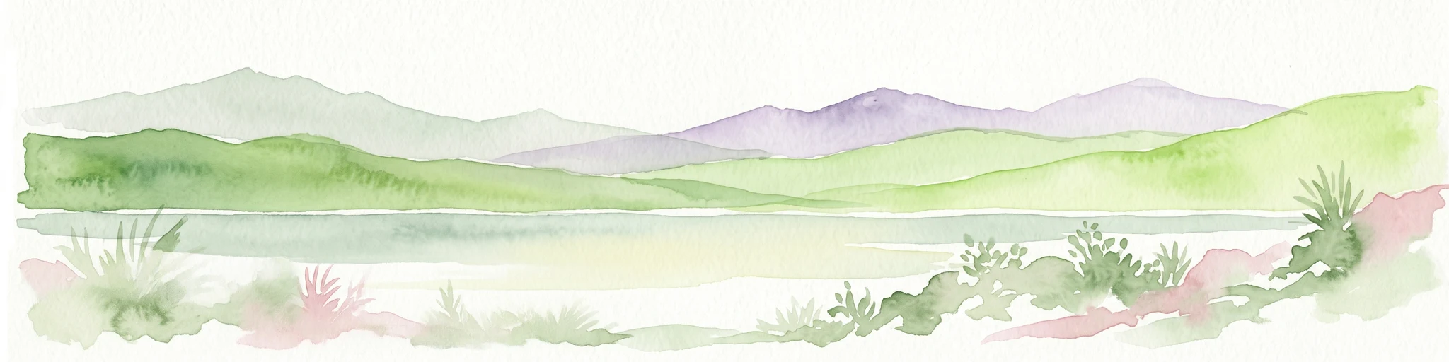
Watercolor painting showing green hills, purple mountains, and a calm water body with sparse vegetation
National parkRayong Province

Khao Laem Ya, Mu Ko Samet National Park: Marine National Park and Protected Island Geography

Coastal terrain and archipelago mapped within Rayong Province.

Delve into Khao Laem Ya, Mu Ko Samet National Park, a significant marine protected area located in Rayong Province, Thailand. This atlas entry highlights the park's archipelago of islands, including Ko Samet, its mainland coastal features like Khao Laem Ya, and the surrounding Gulf of Thailand waters. Understand the park's role in coastal conservation, its mapped marine environments, and its unique blend of terrestrial and aquatic protected landscapes for geographic discovery.

Area
131 km²
Established
1981
IUCN
II
Visitors
1.6M annual
National parkRayong Province

Khao Chamao, Khao Wong National Park: Protected Area Atlas and Mountain Landscape Context

Rayong Province's vital national park with mapped terrain and waterfalls.

Delve into the geography of Khao Chamao, Khao Wong National Park, a designated national park in Thailand's Rayong Province, forming a western extension of the Cardamom Mountains. This page provides detailed mapped context for its protected boundaries, forested hills, and prominent peaks, highlighting its importance as a habitat and an atlas entry for understanding regional landscapes. Explore the park's terrain and its role in conservation.

Area
84 km²
Established
1975
IUCN
II
Visitors
218.4K annual
National parkTanintharyi Region

Lampi Island Marine National Park National Park: Geographic Atlas and Protected Landscape Overview

Discover mapped boundaries and regional park geography.

Lampi Island Marine National Park is a designated national park offering a focused lens on protected landscapes and regional geography. Explore its precise mapped boundaries and understand its place within the Tanintharyi Region's natural terrain. This profile is designed for atlas-based discovery, providing essential geographic context for the park and its role as a conservation area.

Area
204.8 km²
Established
1996
IUCN
II
Relief
Mixed relief

Common questions about visiting, size, designation, and location context for Khao Sam Roi Yot National Park

Khao Sam Roi Yot National Park FAQs for park facts, access, geography, and protected area context
Find quick answers about Khao Sam Roi Yot National Park, including protected-area facts, park geography, trail and visitor context, and how the park fits into its surrounding country and regional landscape.
MoriAtlas Explorer

Continue Your Protected Areas Search Across the Global Atlas

Deepen your exploration by continuing the structured search for national parks and protected areas worldwide. Utilize the comprehensive filtering capabilities to compare different conservation landscapes and refine your understanding of global park geography. Discover more about the distribution and characteristics of protected natural areas.

Global natural geography