Mori Atlas logo
National parkKhaptad National Park

Understand the mapped boundaries and regional atlas context of this key protected area.

Khaptad National Park: A Protected National Park in Nepal's Geographic Landscape

Khaptad National Park stands as a vital protected landscape within Nepal's diverse geography. This national park offers a specific focus for atlas exploration, allowing users to understand its mapped boundaries and its place within the country's natural terrain. Investigate the geographic identity of Khaptad National Park and its contribution to the broader protected-area network across South Asia.

national parkprotected areaHimalayan ecosystemfar-western Nepalmountain forestsubalpine zone

Khaptad National Park

National park

Park overview

Structured park overview, official facts, and landscape profile for Khaptad National Park

Khaptad National Park park facts, protected area profile, and essential visitor context
Review the core facts for Khaptad National Park, including designation, size, terrain, visitor scale, habitats, and operating context in one park-focused overview.

About Khaptad National Park

Khaptad National Park occupies a distinctive position within Nepal's system of protected areas. Located in the Far-Western Region, it spans the mountainous terrain of four districts, protecting an elevation gradient from 1,400 to 3,300 meters. The park was established in 1984 following advocacy from Khaptad Baba, a spiritual figure whose presence in the area contributed to its recognition as a place worth preserving. A buffer zone of 216 square kilometers was added in 2006, expanding the conservation framework around the core protected area.

The park's landscape is characterized by steep slopes, ridgelines, and numerous streams that drain through its terrain. The vegetation reflects the transitional nature of this elevation zone, incorporating elements from both lower-elevation and higher-altitude Himalayan ecosystems. Chir pine and rhododendron form prominent forest communities on lower slopes, while oak forests occupy middle elevation bands. Higher still, Himalayan fir occurs in association with hemlock and oak, creating a distinctive subalpine character. River corridors support alder forest, adding to the diversity of plant communities. Open moorland areas also occur within the park, contributing to the heterogeneous landscape.

The relative remoteness of Khaptad from Nepal's major tourism corridors has shaped its character as a less-visited but ecologically significant protected area. While the Annapurna and Everest regions attract the majority of international visitors, Khaptad offers an alternative perspective on Nepal's Himalayan environment, one characterized by relative solitude and a sense of discovery that more frequented destinations cannot provide.

Quick facts and research context for Khaptad National Park

Khaptad National Park occupies 225 square kilometers in Nepal's Far-Western Region, spanning across Bajhang, Bajura, Achham, and Doti districts. Established in 1984, it protects elevations between 1,400 and 3,300 meters in a relatively isolated portion of the western Himalayas. The park features a buffer zone of 216 square kilometers declared in 2006. Its vegetation includes chir pine-rhododendron forest, oak forest, Himalayan fir-hemlock-oak forest, and alder forest along watercourses. The protected area supports 567 floral species, including 224 medicinal plant species, along with 23 mammal species and 287 recorded bird species.

Park context

Deeper park guide and search-rich context for Khaptad National Park

Khaptad National Park history, landscape, wildlife, and travel context
Explore Khaptad National Park through its history, landscape character, ecosystems, wildlife, conservation priorities, cultural context, and seasonal travel timing in a structured park guide built for atlas discovery and search intent.

Why Khaptad National Park stands out

Khaptad National Park is best known for its role as a sanctuary for Himalayan biodiversity in a remote corner of Nepal. The park protects significant populations of Indian leopard, Himalayan black bear, dhole, and Alpine musk deer among its mammalian residents. Its avifauna is particularly noteworthy, with 287 bird species including the Impeyan pheasant (Nepal's national bird), peregrine falcon, and white-rumped vulture. The park's mosaic of forest types, from chir pine-rhododendron at lower elevations to Himalayan fir and hemlock at higher altitudes, creates a vertically stratified ecosystem that supports this diversity. The area also holds cultural significance as the namesake and former home of Khaptad Baba, a respected spiritual figure whose advocacy helped establish the protected area.

Khaptad National Park history and protected-area timeline

Khaptad National Park was established in 1984, becoming one of Nepal's later additions to its national park system. The park's creation was significantly influenced by the presence of Khaptad Baba, a spiritual figure who lived in the area and advocated for its protection. This religious and cultural connection to the landscape contributed to the area's identification as deserving special conservation status.

Following its establishment, the park operated for over two decades as a core protected area without formal buffer zone designation. In 2006, the government declared a 216-square-kilometer buffer zone surrounding the core park area. This buffer zone provides additional protection for wildlife moving between the protected core and surrounding landscapes and helps integrate conservation with the needs of local communities. The establishment of the buffer zone reflected evolving approaches to protected area management in Nepal, which increasingly recognized the importance of community involvement and peripheral zones in maintaining ecological integrity.

Khaptad National Park landscape and geographic character

The landscape of Khaptad National Park is defined by its position in the western Himalayan foothills, characterized by steep and often rugged terrain. The elevation range from 1,400 to 3,300 meters encompasses a significant vertical span within the mountains, creating diverse local environments across relatively short distances. Ridges and valleys dissect the terrain, with numerous small streams feeding into larger watercourses that drain the protected area.

The park's topography supports a variety of vegetation zones that follow elevation and aspect patterns. Lower slopes feature chir pine, a species well-adapted to relatively drier conditions, often mixed with rhododendron that adds seasonal color during flowering periods. Oak forests occupy middle elevations where moisture conditions support broader-leaved deciduous species. Higher slopes and cooler aspects support Himalayan fir, an important conifer species of the subalpine zone, often growing in mixture with hemlock and oak. River valleys within the park feature alder forest, a community adapted to the greater moisture and disturbance regimes of watercourse margins. Intervening areas of open moorland add further variety to the landscape matrix.

Khaptad National Park ecosystems, habitats, and plant life

The ecological character of Khaptad National Park reflects its position in a transitional zone between the lower Himalayan foothills and the higher mountain environments. The park's 567 documented floral species represent a significant diversity for its area, distributed across distinct vegetation types that follow elevation and site conditions. Chir pine-rhododendron forest dominates lower elevations, while oak forest forms a distinct zone at middle altitudes. The Himalayan fir-hemlock-oak association represents the upper forest limit before the transition to more open terrain.

The diversity of forest types creates a structurally complex environment that supports varied ecological communities. The presence of 224 medicinal plant species within the park reflects both the floristic richness and the traditional knowledge associated with these forests. Riverine alder forests provide distinct habitats along watercourses, while open moorland areas offer different ecological conditions. This heterogeneity of habitats contributes to the park's significance as a biodiversity repository in the far-western Himalayas.

Khaptad National Park wildlife and species highlights

Khaptad National Park supports a notable mammalian community despite its relatively modest area. The park records 23 mammal species, including several of significant conservation concern. Indian leopard occurs throughout the park's elevation range, representing the apex predator in the terrestrial ecosystem. Himalayan black bear inhabits the forested areas, particularly during warmer months when vegetation provides foraging opportunities. Dhole, also known as the Asiatic wild dog, hunts in packs through the park's terrain, preying on available ungulate species. The Alpine musk deer occupies higher elevation areas, particularly in rocky terrain above the forest zone.

The avifauna of Khaptad is particularly diverse, with 287 bird species recorded within the park. The Impeyan pheasant, Nepal's national bird, inhabits the forested slopes and is among the most visually striking avian residents. The peregrine falcon occurs in the park, utilizing the cliff formations and open areas for hunting. The white-rumped vulture, a species that has faced severe population declines across South Asia, persists in the park's environment. Beyond mammals and birds, the park records 23 amphibians and reptiles, further contributing to its biodiversity profile.

Khaptad National Park conservation status and protection priorities

Khaptad National Park represents an important component of Nepal's protected area network, particularly for the conservation of western Himalayan ecosystems. The park protects a cross-section of habitats that would otherwise face pressures from logging, grazing, and agricultural expansion in this populated region of Nepal. Its buffer zone designation in 2006 extended protection into the surrounding landscape, acknowledging that effective conservation requires consideration of areas beyond strict protected boundaries.

The diversity of species recorded within the park, including several of conservation significance, demonstrates the ecological value of maintaining this protected area. The populations of Indian leopard, Himalayan black bear, and Alpine musk deer represent species that require large habitat areas and intact ecological communities. The presence of 287 bird species, including the white-rumped vulture, indicates the park's importance for avifauna conservation. The medicinal plant resources add another dimension to conservation significance, as these species represent both ecological and cultural value.

Khaptad National Park cultural meaning and human context

Khaptad National Park carries cultural significance beyond its ecological value, deriving from its association with Khaptad Baba, the spiritual figure for whom the area is named. The park was established in 1984 following advocacy from this figure, who lived in the area and recognized its special character. This connection between spiritual practice and environmental stewardship has shaped the park's identity and contributed to local support for its protection.

The park's location in the Far-Western Region places it within communities that have historical relationships with the mountainous landscape. The four districts that the park spans Bajhang, Bajura, Achham, and Doti each contain populations with traditional connections to the land. While the park itself is protected from most extractive uses, the surrounding landscape continues to support agricultural and pastoral activities that reflect the cultural traditions of the region.

Top sights and standout views in Khaptad National Park

Khaptad National Park offers a distinctive combination of Himalayan biodiversity, cultural significance, and relative remoteness within Nepal's protected area system. The park protects significant populations of Indian leopard, Himalayan black bear, and Alpine musk deer in its 225-square-kilometer extent. Its 287 bird species include the Impeyan pheasant, peregrine falcon, and white-rumped vulture, making it an important destination for avian conservation. The mosaic of vegetation types, from chir pine-rhododendron forest through oak to Himalayan fir-hemlock-oak communities, creates a vertically stratified ecosystem that reflects the park's elevation range. The spiritual legacy of Khaptad Baba adds cultural depth to the natural values, while the 2006 buffer zone expansion demonstrates evolving conservation approaches.

Best time to visit Khaptad National Park

The optimal season for visiting Khaptad National Park aligns with Nepal's general tourism patterns, with autumn from September through November offering the most reliable conditions. Clear skies and moderate temperatures characterize this period, providing favorable conditions for wildlife observation and landscape appreciation. The post-monsoon clarity reveals distant mountain views that may be obscured during the wet season.

Spring, from March through May, offers another favorable period when rhododendron flowers bloom across the forested slopes, adding vibrant color to the landscape. This flowering season attracts visitors interested in botanical displays and provides excellent photographic opportunities. Winter months bring colder temperatures, particularly at higher elevations, and some access limitations, though the park remains open for those prepared for winter conditions. The monsoon season from June through August brings heavy rainfall to the region, making travel more difficult and reducing visibility.

Park location guide

Geography guide, regional context, and park location map for Khaptad National Park

Khaptad National Park park geography, regions, and map view in Nepal
Understand where Khaptad National Park sits in Nepal through a broader geographic reading of the surrounding landscape, nearby location context, and its mapped position within the national park landscape.

How Khaptad National Park fits into Nepal

Nepal is a federal parliamentary republic in South Asia, landlocked between China and India. It spans the Himalayas and includes eight of the world's ten highest mountains. Kathmandu is the capital and largest city.

Wider geography shaping Khaptad National Park in Nepal

Nepal is located in South Asia, landlocked between China to the north and India to the south, east, and west. The country occupies the Himalayan region in the north and extends into the Indo-Gangetic Plain in the south. Terrain includes the Terai lowlands, subalpine hills, and the Himalayas with peaks including Mount Everest.

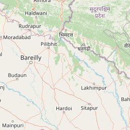
Map view of Khaptad National Park

Use this park location map to pinpoint Khaptad National Park in Nepal, understand its exact geographic position, and read its mapped placement within the surrounding landscape more clearly.

Pigeon | © OpenStreetMap contributors

Location context for Khaptad National Park

Far-Western Region
Park atlas

Explore the surrounding Himalayan landscapes and regional protected area geography after viewing Khaptad National Park.

Discover Other National Parks and Protected Areas Near Khaptad National Park
Broaden your geographic understanding of Nepal's protected areas by comparing national parks, wildlife reserves, and forest reserves near Khaptad National Park. Trace diverse mountain forests and subalpine zones across the western Himalayan foothills, expanding your atlas knowledge beyond a single location.
Watercolor scene of grassy fields and a winding river with distant hills and trees
National parkSudurpashchim Province

Shuklaphanta National Park: A National Park in Nepal's Sudurpashchim Province

Explore mapped protected areas and regional landscape context.

Shuklaphanta National Park is a key protected landscape within Sudurpashchim Province, Nepal. As a designated national park, its geographic identity is significant for understanding regional conservation and natural terrain. This entry focuses on its mapped boundaries and role as a protected area, providing foundational geographic context for atlas exploration and discovery of Nepal's natural landscapes.

Area
305 km²
Established
2017
IUCN
II
Relief
Lowland
National parkLakhimpur Kheri district

Dudhwa National Park: Terai Grasslands and Alluvial Plain Geography within Lakhimpur Kheri

Discover the mapped protected landscape of this vital Indian national park.

Dudhwa National Park in Lakhimpur Kheri district stands as a crucial example of the Terai grassland ecosystem, characterized by its expansive alluvial plains and marshy habitats. This page provides an atlas-style exploration of its protected landscape, detailing the unique terrain and geographic context essential for understanding its conservation significance.

Area
614 km²
Established
1977
IUCN
II
Visitors
26K annual
National parkNepal

Rara National Park: Nepal's National Park with Mapped Protected Landscape Context

Discover its geographic setting and park boundaries

Rara National Park is a key protected area within Nepal, offering a distinct focus for geographic exploration. This page details its identity as a national park, highlighting its mapped boundaries and its contribution to the country's atlas of natural landscapes. Understand the park's specific role and regional geographic context, providing a solid foundation for atlas-driven discovery of Nepal's protected areas.

Area
106 km²
Established
1976
IUCN
II
Relief
Mountain
National parkBardiya District

Bardiya National Park: Nepal's Expansive Terai Protected Landscape and Atlas

Mapped geography, tiger habitat, and rhino conservation in Bardiya District.

Bardiya National Park represents a significant protected area within Nepal's Terai lowlands, providing an exceptional resource for geographic discovery. Its diverse terrain, including vast grasslands and dense forests bisected by major river systems like the Karnali and Babai, creates unique ecosystems. As the largest national park in Nepal, it is instrumental in mapping wildlife corridors and understanding regional landscape dynamics, particularly for endangered species such as Bengal tigers and Indian rhinoceroses. This park offers a profound glimpse into the mapped natural heritage of the Bardiya District.

Area
968 km²
Established
1988
IUCN
II
Relief
Mixed relief
National parkNepal

Banke National Park: Nepal National Park with Distinct Protected Landscape Geography

Explore the mapped terrain and regional atlas context of Banke National Park.

Banke National Park represents a vital protected area within Nepal's diverse geography, offering a focused point for atlas and map-based discovery. As a national park, its designated status highlights its importance in conserving natural landscapes and understanding regional protected-area distribution across South Asia. This entry provides detailed geographic context, enabling users to explore the park's mapped boundaries and appreciate its role within Nepal's broader natural territory.

Area
550 km²
Established
2010
IUCN
II
Relief
Upland
National parkUttarakhand

Nanda Devi National Park: High-Altitude Protected Landscape and Himalayan Geography

Explore mapped glacial basins and alpine terrain in Uttarakhand.

Nanda Devi National Park is a prime example of a high-altitude protected area, nestled in the Garhwal Himalayas of Uttarakhand, India. Established in 1982, this national park protects a vast glacial sanctuary, renowned for its dramatic peaks, including Nanda Devi, India's second-highest mountain. The park's landscape is defined by rugged terrain, extensive glaciers like the Uttari Rishi and Dakshini Rishi, and a striking ring of mountains over 6,000 meters, providing critical context for understanding protected land geography and Himalayan atlas exploration.

Area
630.33 km²
Established
1982
IUCN
II
Relief
Mountain
National parkNepal

Shey Phoksundo National Park: Nepal's Largest Trans-Himalayan Protected Landscape with Phoksundo Lake

Explore alpine terrain and unique protected ecosystems.

Delve into the geographical distinctiveness of Shey Phoksundo National Park, Nepal's expansive protected area. This park is defined by its dramatic elevation changes and the striking Phoksundo Lake, a vivid turquoise alpine reservoir set against barren, mountainous terrain. Understanding its trans-Himalayan setting and protected landscape context reveals its importance within the broader atlas of global natural areas.

Area
3,555 km²
Established
1984
IUCN
II
Relief
Mountain
National parkUttarakhand

Jim Corbett National Park: Uttarakhand National Park and Protected Landscape Atlas

Mapped Boundaries and Regional Geographic Context

Jim Corbett National Park offers a specific entry point for understanding protected landscapes and their geographic significance. As a designated national park within Uttarakhand, India, it provides a distinct case study for exploring mapped boundaries and regional natural terrain. This detailed view allows for a deep dive into the park's identity as a protected area, highlighting its placement within the larger atlas of India's natural heritage and its contribution to the Himalayan geographic narrative.

Area
1,288.31 km²
Established
1936
IUCN
II
Visitors
365K annual

Common questions about visiting, size, designation, and location context for Khaptad National Park

Khaptad National Park FAQs for park facts, access, geography, and protected area context
Find quick answers about Khaptad National Park, including protected-area facts, park geography, trail and visitor context, and how the park fits into its surrounding country and regional landscape.
MoriAtlas Explorer

Continue Your Protected Areas Search Across the Global Atlas

Deepen your exploration by continuing the structured search for national parks and protected areas worldwide. Utilize the comprehensive filtering capabilities to compare different conservation landscapes and refine your understanding of global park geography. Discover more about the distribution and characteristics of protected natural areas.

Global natural geography