Mori Atlas logo
Nearby park discovery

Geographic analysis of surrounding conservation lands and regional park boundaries

Protected Areas and Natural Landscapes Situated Near the Łęgi Odrzańskie Protected Area

Examine the geographic distribution of protected areas adjacent to the Łęgi Odrzańskie riverine corridor in southwestern Poland. This view identifies nearby natural landscapes and conservation sites that share regional morphological characteristics across the Oder valley, facilitating a clearer understanding of local wilderness connectivity and protected land patterns.

A flat vector-style illustration of a river flowing through a lush valley with deciduous and coniferous trees, a small blue boat moored on the bank, and mountains in the distance.

A long Natura 2000 corridor of floodplain forests, meadows and peatlands along the Oder River in southwestern Poland.

Łęgi Odrzańskie

Łęgi Odrzańskie is a large Natura 2000 protected landscape in southwestern Poland, stretching more than one hundred kilometers along the middle course of the Oder River. The site combines a special protection area for birds (PLB020008) and a special area of habitat conservation (PLH020018), which were officially merged in 2019 and readjusted in 2022, and now cover roughly 21,350 hectares across Lower Silesian Voivodeship, with a small northern edge reaching into Lubusz Voivodeship. The protected area preserves the remains of a once vast and continuously marshy Oder valley. Today it takes the form of a mosaic of floodplain forests, wet meadows, peatlands, oxbow lakes, willow thickets, alder carrs and riverine oak-hornbeam woodland that follow the river's natural corridor through the Pradolina Wrocławska, Obniżenie Ścinawskie and Pradolina Głogowska mesoregions. Ecologically, the site is most notable as one of the most important riverine bird areas in Central Europe. It holds the region's largest populations of the middle spotted woodpecker and the whooper swan, more than a hundred breeding bird species, and it carries both European and Polish red-list species across plants, invertebrates, fish, amphibians and mammals. The site also qualifies as an Important Bird Area (IBA PLB089) of European rank.

Location
Poland
Park type
Protected area
Established
2007
Area
21,350.5 km²
Łęgi Odrzańskie Protected Area
Regional park map

See the ranked park cluster in its geographic setting

Nearby parks around Łęgi Odrzańskie

This regional map shows the same 20 nearby parks ranked below around Łęgi Odrzańskie. Select a ranked marker to highlight that park’s boundary where boundary data is available.
Reference park: Łęgi OdrzańskieRanked nearby parkSelected boundary: Łęgi Odrzańskie20 nearby parks shown
20 nearby parks

Distance ranked regional geography and surrounding protected landscapes

Parks and Protected Areas Geographically Near Łęgi Odrzańskie

Geographic proximity measurements establish a ranked sequence of protected areas surrounding Łęgi Odrzańskie across the regional valley corridor. Recorded environmental attributes and country context provide structured comparison signals for analyzing surrounding natural terrain.
Nature reservePoland
About 2.5 km away#1 closest

Southeast

Rezerwat przyrody Jodłowice: Nature Reserve Geography and Protected Forest Boundaries in Poland

Glacial valley forest landscapes and rare silver fir conservation

Located in the Lower Silesian Voivodeship, Rezerwat przyrody Jodłowice represents a vital pocket of protected woodland within the Pradolina Wrocławska. This reserve is recognized for maintaining rare forest communities and significant geological remnants, including a massive glacial erratic boulder. It stands as a prime example of localized conservation efforts focused on protecting fragile forest ecosystems and specialized wildlife habitats within the broader Polish landscape.

Area
0.094 km²
Established
1958
Relief
Lowland
Climate
Temperate
Protected areaLower Silesian Voivodeship
22 km away#2 closest

South

Przeplatki nad Bystrzycą Protected Area: Regional Geography and Riverine Habitat Mapping

Protected riparian corridors and floodplain landscapes in southwestern Poland

Trace the three enclaves of Przeplatki nad Bystrzycą across the Lower Silesian Voivodeship. This protected area offers insight into European lowland river systems, where alluvial forests, oxbow lakes, and traditionally managed grasslands form a vital ecological mosaic for rare meadow butterflies and freshwater species.

Area
8.437 km²
A watercolor painting showing a soft, stylized forest landscape with gentle rolling hills in the background, leafy trees in the midground, and ferns and grasses in the foreground.
Nature reserveGreater Poland Voivodeship
About 23 km away#3 closest

Northeast

Rezerwat przyrody Dębno: A Key Protected Nature Reserve in Greater Poland, Poland

Mapping lowland forest ecosystems and ancient oak habitats

Rezerwat przyrody Dębno provides a look into the lowland ecology of Greater Poland through its protected status and renaturation initiatives. This nature reserve, characterized by its ancient oaks and Magnocaricetum communities, highlights the importance of small-scale forest conservation and provides valuable insight into the regional geography of the Kotlina Żmigrodzka.

Area
0.08 km²
Established
1961
Relief
Lowland
Scope
Terrestrial
Nature reserveLubusz Voivodeship
About 28 km away#4 closest

Northwest

Rezerwat przyrody Mesze Nature Reserve: Geographic Analysis of Protected Polish Lands

Post-glacial lake and peatland geography in Lubusz Voivodeship.

Rezerwat przyrody Mesze preserves an essential slice of Polish lowlands geography, showcasing the interaction between post-glacial water-laid sands and lake-driven peat formation. Within this protected valley, the transition from open water to bog communities provides a significant example of natural succession, offering high value for those mapping the diverse terrain of the Sławskie Lakeland region.

Area
0.199 km²
Established
1983
Relief
Lowland
Climate
Temperate
Nature reservePoland
About 30 km away#5 closest

Northwest

Rezerwat przyrody Jezioro Święte: Protected Lake Ecosystems and Glacial Geography

A strictly protected nature reserve in western Poland

Located in the Lubuskie region, Rezerwat przyrody Jezioro Święte serves as a vital safeguard for rare aquatic plant assemblages within a glacial channel lake. The area features unique floating mats and stonewort stands set within a sandy outwash landscape, showcasing the complex environmental history of Polish water systems and long-term natural conservation.

Area
0.194 km²
Established
1983
Water
Water-dominated
Nature reserveGreater Poland Voivodeship
About 30 km away#6 closest

North

Rezerwat przyrody Dolinka: Protected Nature Reserve and Botanical Site in Greater Poland

A focused study of wet meadow conservation in western Poland

Rezerwat przyrody Dolinka is a key protected area in Greater Poland, dedicated to maintaining delicate molinia meadow habitats and native globeflower populations. This site highlights the importance of small-scale nature reserves in preserving botanical diversity within the post-glacial landscapes of the Krzywińskie Lakeland, offering a clear look at local environmental protection in action.

Area
0.018 km²
Established
1974
Relief
Lowland
Climate
Temperate
Protected landscapeLower Silesian Voivodeship
31 km away#7 closest

Southwest

Park Krajobrazowy Chełmy: Protected Landscape and Volcanic Geography in Southwestern Poland

Geological atlas of the Kaczawskie Foothills

Deep dive into the complex terrain of Park Krajobrazowy Chełmy, a protected area in Lower Silesia renowned for its layered volcanic history and unique floristic composition. This site showcases an intricate network of ravines and basalt-crowned hills that define the edge of the Sudetes, offering a comprehensive look at the region's ancient geological development and ecological heritage.

Area
159.91 km²
Established
1992
Relief
Mountain
Climate
Temperate
Nature reservePoland
About 32 km away#8 closest

North

Rezerwat przyrody Jezioro Trzebidzkie Nature Reserve: Geographic Map and Protected Habitat Study

Wetland and forest conservation within the Greater Poland moraine landscape

Investigate the protected boundaries of Rezerwat przyrody Jezioro Trzebidzkie. This faunistic reserve illustrates a transition between shallow lake basin, marshy reed beds, and deciduous forest stands, offering a clear view of postglacial terrain dynamics in the Przemęt commune of Poland.

Area
0.907 km²
Established
2000
Relief
Lowland
Scope
Terrestrial
Protected areaLubusz Voivodeship
33 km away#9 closest

Northwest

Otyń Special Area of Conservation: Natura 2000 Site Details and Habitat Geography

A vital bat maternity roost located in western Poland.

Otyń is a specialized protected area in Lubusz Voivodeship, Poland, designated under the Natura 2000 framework to safeguard a significant maternity colony of greater mouse-eared bats. The site demonstrates how historic church structures function as vital ecological reservoirs, providing a protected habitat that contributes to broader regional wildlife preservation and conservation efforts.

Area
0.002 km²
Relief
Lowland
Water
No major water
Nature reserveLower Silesian Voivodeship
About 37 km away#10 closest

Southwest

Rezerwat przyrody Mszana i Obłoga: Geological and Forest Protected Area Overview

Volcanic terrain in the Lower Silesian Voivodeship

This nature reserve preserves the natural maple-lime and oak-hornbeam forest communities found on the slopes of the Mszana and Obłoga hills. The area is defined by its striking basalt outcrops and volcanic rubble fields, providing a unique ecological character within the broader Kaczawskie foothills of southwestern Poland.

Area
0.999 km²
Established
2015
Relief
Mountain
Climate
Temperate
Protected areaGreater Poland Voivodeship
About 42 km away#11 closest

North

Wonieść Lake Protected Area: Geography, Wetland Habitats, and Regional Landscape Context

Postglacial water management and bird refuge in Greater Poland

Examine the geographic character of Wonieść Lake, a segmented retention reservoir reflecting the classic postglacial lowlands of western Poland. This protected area provides a significant wetland habitat within the Krzywińskie Lake District, blending historic hydraulic infrastructure with rich bird populations and forest-fringed shorelines that span across the rural Wielkopolska countryside.

Area
7.77 km²
Established
1974
Relief
Lowland
Climate
Temperate
A soft watercolor painting of a river flowing through a hilly, forested landscape with light green and pastel tones.
Nature reserveLower Silesian Voivodeship
50 km away#12 closest

Southwest

Ostoja nad Bobrem Nature Reserve and Bóbr River Valley Geographic Atlas

Protected Sudetes foothills landscape in Poland

Ostoja nad Bobrem represents a significant protected area within the Lower Silesian Voivodeship, characterized by its winding river corridor and hilly topography. The reserve supports a range of habitats including rare orchid-rich grasslands and dense slope forests. This atlas entry provides a detailed look at the geographic distribution and ecological importance of this essential Polish nature reserve.

Area
153.73 km²
Established
2009
Relief
Upland
Climate
Temperate
Protected areaLower Silesian Voivodeship
54 km away#13 closest

Southwest

Trzcińskie Mokradła Protected Area: Geographic Overview and Mapped Sudeten Wetland Landscape

Located in the Lower Silesian Voivodeship of Poland

Trzcińskie Mokradła stands as a significant mire complex in the Jelenia Góra Basin, providing a rare look at peat-forming habitats in the Sudetes. This protected area offers deep insight into regional wetland conservation and the environmental history of southwestern Poland, serving as an essential reference for researchers and landscape enthusiasts interested in intramontane basin geography.

Area
0.753 km²
Established
2011
Scope
Terrestrial
Water
Major water bodies
Protected areaLower Silesian Voivodeship
55 km away#14 closest

Southeast

Wzgórza Strzelińskie Protected Area: Geographic Atlas and Regional Landscape Mapping

A diverse Natura 2000 hill landscape in southwestern Poland.

Spanning over 3,800 hectares, Wzgórza Strzelińskie functions as a vital refuge for specialized European habitats. The area features a complex intersection of beech-dominated forests, rocky cliff communities, and traditional meadows that define the local Silesian topography. This record provides a detailed look at the park boundaries, ecosystem distribution, and the natural terrain that shapes this conservation site.

Area
38.362 km²
Relief
Upland
Water
Minor water
Watercolor painting of a calm pond with green trees on the banks, reeds in the foreground, and distant rolling hills.
Nature reservePoland
About 55 km away#15 closest

Northeast

Rezerwat przyrody Miranowo: Protected Peatland Ecosystem and Botanical Nature Reserve

A preserved wetland landscape in the Polish lake country

Located near the shores of Lake Dolskie Wielkie, Rezerwat przyrody Miranowo represents a significant protected area focused on the conservation of rare calcareous peatland habitats. The reserve sustains a dense collection of over 230 vascular plant species, offering a unique opportunity to study relict vegetation in a managed wetland environment within Poland.

Area
0.099 km²
Established
1972
Relief
Lowland
Climate
Temperate
A minimalist, flat-design vector illustration showing a tall waterfall flowing down a rocky canyon flanked by pine trees and layers of cliffs.
Protected landscapeLower Silesian Voivodeship
55 km away#16 closest

South

Park Krajobrazowy Sudetów Wałbrzyskich: Protected Mountain Landscape Map

Geographic overview of forested ridges and rock formations

Gain insight into the topography of Park Krajobrazowy Sudetów Wałbrzyskich, where elevations reach 936 meters. This atlas entry details the forested Central Sudetes landscape, highlighting protected geological monuments like Małpia Skała and the unique hydrology of the Rybna river capture.

Area
64.93 km²
Established
1998
Relief
Mountain
Climate
Temperate
Nature reserveLower Silesian Voivodeship
58 km away#17 closest

Southwest

Żerkowice-Skała Nature Reserve: Mapped Sandstone Cuestas and Forest Habitats in Lower Silesia

A study of Cretaceous geology and protected forest landscapes in Poland

Żerkowice-Skała offers a window into the geological complexity of the Pogórze Izerskie. This nature reserve protects a vital sandstone cuesta edge, creating a mosaic of cliff habitats and old-growth deciduous forest communities. As a key Natura 2000 site, it serves as a crucial reference point for understanding the distribution of rare species and the northernmost Cretaceous exposures linked to the broader Bohemian Massif region.

Area
0.849 km²
Established
2011
Relief
Upland
Climate
Temperate
A watercolor painting showing a soft landscape with trees, rolling hills, and a winding stream, rendered in light pastels.
Nature reserveGreater Poland Voivodeship
About 61 km away#18 closest

East

Rezerwat przyrody Mszar Bogdaniec: Geography and Protected Peatland Landscape Analysis

Explore wetland terrain within the Greater Poland Voivodeship.

Rezerwat przyrody Mszar Bogdaniec stands as a vital protected area in Greater Poland, featuring an elongated depression that supports transitional and raised bog elements. Enclosed by inland dunes, the reserve offers a compact study of Sphagnum-dominated micro-landscapes and wetland biodiversity that remains rare within the surrounding agricultural lowlands.

Area
0.22 km²
Established
1995
Scope
Terrestrial
Water
Major water bodies
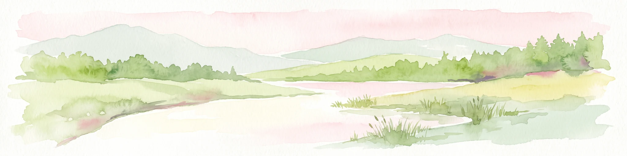
A horizontal watercolor painting depicting a wide river flowing through a lush landscape with distant rolling hills and a soft pink sky.
Nature reserveWielkopolska Voivodeship
62 km away#19 closest

Northeast

Ostoja Rogalińska: Protected Nature Reserve and Glacial Terrain in Wielkopolska Voivodeship

Mapped riparian corridors, moraine ridges, and bird habitats.

Ostoja Rogalińska offers a detailed look at lowland glacial morphology, featuring twelve mapped lakes, wandering inland dunes, and the extensive Warta River floodplain. This protected area within Wielkopolska Voivodeship preserves ancient pedunculate oaks alongside diverse wetland and forest ecosystems, providing a clear geographic view of one of the region's most important Natura 2000 bird sanctuaries.

Area
217.63 km²
Established
2007
Relief
Lowland
Climate
Temperate
Watercolor illustration of a mountain range with green hills, pink and yellow sky, and sparse vegetation
National parkPoland
66 km away#20 closest

Southwest

Karkonosze National Park: A Premier National Park in Poland's Giant Mountains

Discover alpine terrain and unique glacial landscapes.

Karkonosze National Park is a significant protected area in Poland, renowned for its dramatic alpine topography carved by ancient glaciers. As the highest range in the Polish Sudetes, it features striking U-shaped valleys, U-shaped glacial cirques, and diverse subalpine to alpine ecosystems. This national park provides a rich context for understanding Central European mountain geography and exploring its mapped protected boundaries.

IUCN
II
Relief
Mountain
Scope
Terrestrial
Distance methodology

Geographic measurements, not driving distances

How nearby park distances are calculated

Distances use park boundaries whenever the available geometry allows it. When one or both boundaries are missing, the mapped park locations provide a clearly labelled estimate. Every value represents straight-line geographic separation and does not use roads or routing.

Boundary distance

Calculated between the nearest points of both park boundaries.

Location-to-boundary estimate

Estimated from one mapped park location to the nearest boundary of the other park.

Mapped-location estimate

Estimated between the mapped locations of both parks.

MoriAtlas Explorer

Continue Exploring the Protected Landscapes of Łęgi Odrzańskie

Examine the detailed geographic boundaries and habitat distribution of Łęgi Odrzańskie within the MoriAtlas database. Gain a deeper understanding of this vital riverine corridor and its role as a cornerstone of ecological conservation in southwestern Poland.

Global natural geography