Why Matusadona National Park stands out
Matusadona National Park is best known for its remarkable population of black rhinoceros, which have been relocated to the park as part of intensive protection efforts. The park is also famous for its dramatic landscape where the flat expanse of the Zambezi Valley meets the rugged Matuzviadonha Escarpment, creating a visually striking contrast. The shoreline of Lake Kariba, with its fluctuating water levels and productive grasslands, supports exceptional concentrations of large mammals including elephant, Cape buffalo, and the predators that follow them. The park's history as an Intensive Protection Zone and its recent management by African Parks, which assumed control in 2019 due to challenges from poaching, have positioned it as a critical center for rhino conservation in Zimbabwe.
Matusadona National Park history and protected-area timeline
The conservation history of Matusadona stretches back to the late 1950s when the area was first protected as a non-hunting area on November 7, 1958. This initial protection reflected growing recognition of the area's wildlife values during the colonial period in what was then Rhodesia. In 1963, the status was elevated to that of a Game Reserve, providing stronger legal protection for the region's wildlife populations. The final transition to National Park status occurred in 1975 under the Parks and Wildlife Act of Rhodesia, establishing the formal protected area framework that continues to govern the park today. The creation of Lake Kariba itself, completed in 1959 with the construction of the Kariba Dam, profoundly reshaped the ecological character of the region. The flooded valley created new habitats and altered wildlife distributions, particularly benefiting large grazers that could exploit the productive shoreline grasslands. In November 2019, management of Matusadona was assumed by African Parks, a conservation organization that operates multiple national parks across Africa, in partnership with the Zimbabwe Parks and Wildlife Management Authority. This transition came in response to significant challenges facing the park, including the deteriorating condition resulting from rampant poaching that had depleted wildlife populations and degraded the protected area's integrity.
Matusadona National Park landscape and geographic character
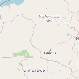
The physical landscape of Matusadona National Park is defined by a dramatic transition from the flat expanses of the Zambezi Valley floor to the rugged terrain of the Matuzviadonha Escarpment. The valley floor, lying at relatively low elevation, is characterized by broad plains and woodland vegetation dominated by mopane trees and thickets of Combretum celastroides. This terrain is interspersed with areas of thicker cover that provide habitat for browsers and the predators that pursue them. Rising from the valley floor, the escarpment climbs approximately 700 meters in elevation, presenting a stark contrast of steep ridges, rocky outcrops, and densely vegetated valleys. The escarpment country is extremely rugged, with deeply incised drainage lines and steep-sided hills that create a challenging environment for both wildlife and visitors. The southern shoreline of Lake Kariba forms the eastern boundary of the park, where the interplay between the lake's water levels and the adjacent land creates a dynamic interface of wetland, grassland, and woodland. The shoreline grasslands are particularly productive, supporting the grass species Panicum repens that thrives on the nutrients deposited during the lake's seasonal fluctuations.
Matusadona National Park ecosystems, habitats, and plant life
The ecological character of Matusadona National Park is distinguished by the presence of three clearly defined ecological zones, each supporting distinct communities of plants and animals. The Lake Kariba zone encompasses the reservoir itself along with the shoreline grasslands that fringe its southern edge, creating important wetland habitat that supports waterfowl and provides crucial grazing for large herbivores. The Zambezi Valley floor supports thick jesse woodlands, Combretum celastroides thickets, and extensive mopane woodland, a vegetation type characteristic of many lowland areas in southern Africa. These woodlands, while not particularly grass-rich, provide essential habitat for browsing species, most notably the black rhinoceros that has been the focus of intensive conservation efforts. The third zone, the Escarpment area, features Julbernardia and Brachystegia woodlands that represent a different forest type adapted to the higher elevations and more rugged terrain. The ecological relationships within these habitats are dynamic, with elephant browsing and fire regimes influencing vegetation structure and creating a mosaic of woodland and grassland that supports diverse wildlife communities.
Matusadona National Park wildlife and species highlights
Matusadona National Park supports impressive populations of large mammals that represent some of Africa's most iconic species. African elephants roam throughout the park, seeking shade under the canopy of jesse trees during the heat of the day and foraging across all three ecological zones. Cape buffalo form large herds that graze the shoreline grasslands and valley floor, their populations having benefited significantly from the grazing resources created by Lake Kariba's fluctuating levels. The park's designation as an Intensive Protection Zone reflects its importance for black rhinoceros, with several individuals having been relocated to the park as part of conservation programs to secure viable populations of this endangered species. Within a specific 450 square kilometer area of the park, research has documented populations of lions that historically fed heavily on the abundant Cape buffalo, though studies have shown lion numbers have declined as buffalo populations were affected by changing lake levels and habitat loss. Other mammals found in the park include leopard, warthog, greater kudu, bushbuck, waterbuck, common zebra, and impala, creating a diverse community of large mammals that supports viable predator populations.
Matusadona National Park conservation status and protection priorities
Matusadona National Park holds significant importance in the conservation landscape of Zimbabwe and broader southern Africa, serving as a critical refuge for several threatened species. The park's designation as an Intensive Protection Zone reflects its strategic role in conservation efforts for the black rhinoceros, a species that remains under serious threat from poaching for its horn. The relocation of rhinoceros to Matusadona represents a deliberate effort to establish secure populations in protected areas with active management and anti-poaching resources. The partnership between African Parks and the Zimbabwe Parks and Wildlife Management Authority, established in 2019, brought new management capacity to address the challenges of wildlife crime and habitat degradation that had weakened the park's conservation effectiveness. Management interventions have included population control measures for elephant, whose browsing pressure was transforming woodland habitats, and prescribed burning programs in the escarpment area designed to reduce the risk of destructive late-season fires that could damage the remaining woodland. These adaptive management approaches reflect the ongoing challenges of maintaining ecological balance in a protected area where multiple species interact across diverse habitats.
Matusadona National Park cultural meaning and human context
Matusadona National Park is situated in a region of Zimbabwe with deep cultural connections to the landscape, though the protected area itself was established through colonial-era conservation frameworks. The park takes its name from the Matuzviadonha Hills, a prominent geographical feature that carries significance in the local context and reflects the traditional relationship between communities and the land. The broader region around Lake Kariba has been inhabited by various ethnic groups whose histories are intertwined with the landscapes now protected within the park. The creation of Lake Kariba in the late 1950s fundamentally altered the human geography of the area, submerging previous settlements and transforming the relationship between local communities and the terrain. While the park itself is now managed primarily for wildlife conservation and tourism, the surrounding landscape continues to support rural communities whose lives are shaped by the rhythms of the environment. The management transition to African Parks in 2019 has emphasized community engagement as a component of conservation strategy, recognizing that the long-term viability of protected areas depends on the support and involvement of neighboring communities.
Top sights and standout views in Matusadona National Park
The dramatic elevation change from the Zambezi Valley floor to the Matuzviadonha Escarpment creates a landscape of exceptional visual diversity, with the 700-meter rise offering sweeping views across the park and the lake beyond. The shoreline of Lake Kariba provides a unique wildlife viewing experience where elephants, buffalo, and other large mammals can be observed against the backdrop of the reservoir, particularly during the dry season when animals congregate at the water's edge. The black rhinoceros population represents a conservation success story, with the park serving as a secure refuge for this endangered species within an Intensive Protection Zone. The three distinct ecological zones, from lakeshore wetland through valley woodland to escarpment forest, create remarkable biodiversity within a relatively compact protected area. The opportunity to access the park by boat from Kariba town or Bumi Hills offers a distinctive arrival experience that connects visitors directly to the aquatic dimension of this wilderness.
Best time to visit Matusadona National Park
The optimal time to visit Matusadona National Park aligns with the dry season, typically from April to October, when reduced rainfall concentrates wildlife around the remaining water sources along the lake shoreline and in the valley. During this period, the park's road network, which is notoriously challenging and often impassable during the rainy season, becomes more accessible for game viewing activities. The dry winter months from June to August offer comfortable temperatures for outdoor exploration, though morning and evening temperatures in the valley can be cool. The wet season from November to March brings green vegetation and newborn wildlife but also results in difficult road conditions and reduced visibility for game viewing. The lake itself remains a constant feature regardless of season, and boat-based activities can be enjoyed throughout the year, though the scenery and wildlife experience vary considerably between the dry and wet periods.