

Mori Atlas logo
National parkKafue National Park

Explore mapped boundaries and regional geographic context within Zambia's vast protected areas.

Kafue National Park: Zambia's Premier National Park for Protected Landscape Discovery

Kafue National Park stands as a significant protected area within Zambia, offering a unique lens for geographic discovery. This national park provides a detailed view of its mapped boundaries and contributes to understanding the broader landscape context of southern Africa. Users can delve into the protected area's identity and explore its regional geographic significance.

Miombo woodlandsLarge conservation areaBig game viewingBirdwatchingElephant populationsLion conservation

Kafue National Park

National park

Park overview

Structured park overview, official facts, and landscape profile for Kafue National Park

Kafue National Park park facts, protected area profile, and essential visitor context
Review the core facts for Kafue National Park, including designation, size, terrain, visitor scale, habitats, and operating context in one park-focused overview.

About Kafue National Park

Kafue National Park represents one of Africa's last great wilderness areas, spanning a vast expanse of terrain in central-southern Zambia that rivals some of the continent's most renowned protected areas. The park's size alone makes it remarkable, covering roughly 22,400 square kilometers, which places it among the largest national parks in the world and second only to Ruaha in Africa. This extensive territory encompasses remarkable ecological diversity, from the miombo woodlands that dominate most of the park's surface to the seasonal floodplains and wetlands that burst with life during the rainy season. The Kafue River serves as the lifeblood of the ecosystem, flowing through the park and providing critical habitat for hippos, crocodiles, and a rich diversity of aquatic species before emptying into the Itezhi-Tezhi Dam. The park's significance extends beyond its ecological richness to its role as a vital conservation corridor, buffered by nine Game Management Areas that help maintain connectivity with surrounding landscapes. Despite its size and importance, Kafue remains relatively less visited than Zambia's more famous South Luangwa National Park, offering a wilder and more remote experience for those who venture into its interiors.

Quick facts and research context for Kafue National Park

Kafue National Park covers 22,400 square kilometers, making it roughly the size of Wales or Massachusetts. It is Zambia's largest national park and the second largest on the African continent. The park contains 152 mammal species, 515 bird species, 70 reptile species, and 58 fish species. The area spans three provinces and features the Kafue River as its primary watercourse, with the Itezhi-Tezhi Dam creating a large reservoir within the park's boundaries. The park is buffered by nine Game Management Areas and has been managed since 2021 through a partnership with African Parks.

Park context

Deeper park guide and search-rich context for Kafue National Park

Kafue National Park history, landscape, wildlife, and travel context
Explore Kafue National Park through its history, landscape character, ecosystems, wildlife, conservation priorities, cultural context, and seasonal travel timing in a structured park guide built for atlas discovery and search intent.

Why Kafue National Park stands out

Kafue National Park is best known for its exceptional antelope diversity, with 21 species including rare populations of roan antelope and sable antelope. The park supports Zambia's largest cheetah population and serves as a stronghold for African wild dogs. The Busanga Plains in the far northwest represent seasonally flooded grasslands that support significant wildlife concentrations. The park is also notable for Zambia's only endemic bird, Chaplin's barbet, and holds Important Bird Area status from BirdLife International. Its vast miombo woodland ecosystem and the presence of the Kafue River corridor make it a critical conservation area in southern Africa.

Kafue National Park history and protected-area timeline

The protected area that would become Kafue National Park began as the Kafue Game Reserve in the early 1920s, established in response to growing concerns about wildlife depletion and the need to protect Zambia's natural resources from commercial exploitation. The formal establishment of the national park occurred in the 1950s under the guidance of Norman Carr, a pioneering British-Rhodesian conservationist whose work shaped much of Zambia's protected area network. A significant historical context surrounds the park's creation, as the Nkoya people, the traditional owners of the area, were relocated from their ancestral hunting grounds around Mwene Kabulwebulwe to the Mumbwa District in 1924 to make way for the reserve. In recent years, the park has undergone important management changes. In 2021, the Zambian government's Department of National Parks and Wildlife initiated a Priority Support Plan in partnership with African Parks, leading to a 20-year management agreement that has brought increased resources, infrastructure improvements, and employment opportunities to the area. Nkoya leaders have also advocated for the establishment of a new province in the area, citing dissatisfaction with development progress and limited benefits from tourism flowing to local communities.

Kafue National Park landscape and geographic character

The physical landscape of Kafue National Park presents a diverse terrain of gentle slopes, occasional granite hills, and extensive floodplains characteristic of the central African plateau. The geology features the Hook granite massif underlying the central portion of the park, with exposures of schist, gneiss, and granite-gneiss, while the edges of this massif contain sedimentary formations including slates, quartzites, and limestones from the Katanga sediments. Between Chonga and Ngoma, small but steep porphyritic granite hills rise from the generally flat terrain, reaching elevations around 120 meters above the surrounding landscape. The park is predominantly covered by the pale and orange Kalahari sands that characterize much of southern Africa's interior, with these well-drained but relatively infertile soils supporting the vast miombo woodlands. In the northern flood plain areas, heavier clay soils predominate, while dark grey alkaline clays occur in the drainage areas of the Nanzila, Nkala, Musa, and Lwansanza rivers. The Kafue River system, with tributaries including the Lufupa and Lunga rivers in the north and the Luansanza in the center, forms the primary drainage network bisecting the park.

Kafue National Park ecosystems, habitats, and plant life

The ecological character of Kafue National Park is defined by its extensive miombo woodlands, which cover the majority of the protected area and represent one of Africa's most widespread forest types. These open semi-deciduous forests are dominated by trees in the Brachystegia, Julbernardia, and Isoberlinia genera, adapted to the seasonal fire regimes that shape the landscape. Interspersed among the woodlands are numerous dambos, shallow seasonal wetlands that provide important dry-season grazing for wildlife. In the southern and central portions of the park, evergreen forests of teak and mopane create distinct habitat patches amid the broader miombo matrix. Large termite mounds, some hundreds or even thousands of years old, punctuate the woodland and grassland landscapes, hosting specialized vegetation including the candelabra tree and jackalberry. The Busanga Plains in the far northwest represent seasonally flooded grasslands along the Lufupa River, while the Kafue River corridor supports aquatic vegetation including the floating mats of Vossia cuspidata and, near Lake Itezhi-Tezhi, the invasive mimosa shrub that poses a threat to sensitive wetland areas.

Kafue National Park wildlife and species highlights

Kafue National Park supports an exceptional diversity of wildlife, with 152 mammal species, 515 bird species, 70 reptile species, and 36 amphibian species documented within its boundaries. The antelope diversity is particularly remarkable, with 21 species present including puku, sitatunga, red lechwe, blue duiker, yellow-backed duiker, Sharpe's grysbok, oribi, impala, roan antelope, sable antelope, and hartebeest. The park hosts around 4,800 African bush elephants, with herds commonly seen throughout the reserve, while other large mammals include African buffalo, warthog, and various smaller species. Kafue has been recognized as an important lion conservation unit since 2005, supporting over 200 lions, along with the largest cheetah population in Zambia and healthy leopard numbers. The African wild dog population represents a particularly significant conservation asset. The Kafue River supports pods of hippos and some of the largest Nile crocodiles in southern Africa. Birdlife is exceptional, with over 500 species including Chaplin's barbet (Zambia's only endemic bird), Pel's fishing owl, black-cheeked lovebird, African finfoot, and significant breeding populations of wattled cranes in the Busanga swamps.

Kafue National Park conservation status and protection priorities

Kafue National Park holds significant conservation importance as one of Africa's largest protected areas and a critical component of Zambia's wildlife estate. The park is buffered by nine Game Management Areas that provide additional protection and help maintain ecological connectivity with the broader landscape. Despite this protective framework, the park has faced significant challenges from poaching and bushmeat hunting, which have led to declines in some animal populations. In response, a coalition of NGOs has worked since 2018 to address these threats, and in 2021 African Parks joined this effort through a partnership with the Zambia Wildlife Authority. The Priority Support Plan and subsequent 20-year management agreement have brought substantial resources, including the creation of over 200 jobs, improved law enforcement capacity with doubled investment, new enforcement infrastructure, and road improvements. The park's designation as an Important Bird Area by BirdLife International underscores its significance for avian conservation, while its lion conservation unit status recognizes its role in protecting viable populations of this apex predator.

Kafue National Park cultural meaning and human context

The cultural landscape of Kafue National Park carries the imprint of human history, most notably through the presence of the Nkoya people whose traditional lands were incorporated into the protected area. The Nkoya were relocated from their ancestral hunting grounds around Mwene Kabulwebulwe to the Mumbwa District in 1924 during the colonial period, a displacement that enabled the establishment of the game reserve. This historical context remains relevant today, as Nkoya leaders continue to advocate for greater recognition and benefits from the park's resources. In 2021, they called for the establishment of a new province to be named Kafue Province, citing dissatisfaction with the pace of development in Central Province and the limited economic benefits that have flowed to local communities from tourism in the park. The settlement of Ngoma in the southern portion of the park represents the only permanent human habitation within the reserve, home to park management staff and their families.

Top sights and standout views in Kafue National Park

Kafue National Park offers exceptional wildlife viewing across its vast wilderness, with highlights including the Busanga Plains in the northwest where seasonal flooding creates productive grasslands supporting large concentrations of antelope, buffalo, and predators. The Kafue River corridor provides reliable hippo and crocodile sightings, while the miombo woodlands harbor diverse birdlife including the vulnerable Chaplin's barbet. The park's significant populations of roan antelope, sable antelope, cheetahs, and African wild dogs make it particularly important for conservation. The relatively low visitor numbers compared to Zambia's other parks create opportunities for more remote and exclusive safari experiences. The 2021 infrastructure improvements, including the completed spine road linking the north and south of the park, have improved access while maintaining the area's wild character.

Best time to visit Kafue National Park

The optimal time to visit Kafue National Park aligns with the dry season from June through October, when reduced water availability concentrates wildlife around the remaining water sources and the Kafue River. During this period, the landscape is more accessible and wildlife viewing is at its most productive, though the latter months toward October can become extremely hot. The wet season from November to May transforms the landscape with new growth and provides excellent birdwatching opportunities as migratory species arrive, but some areas become inaccessible due to flooding, particularly in the Busanga Plains region. The brief transition period in May and early June offers a compromise between accessibility and the dramatic transformation of the landscape as the rains end. Visitors seeking to see the Busanga Plains at their most spectacular should time their visit to coincide with the peak flooding period in the wet season, when waterbird populations are at their highest.
Park location guide

Geography guide, regional context, and park location map for Kafue National Park

Kafue National Park park geography, regions, and map view in Zambia
Understand where Kafue National Park sits in Zambia through a broader geographic reading of the surrounding landscape, nearby location context, and its mapped position within the national park landscape.

How Kafue National Park fits into Zambia

Zambia is a landlocked nation in Southern Africa with a population of approximately 20 million people. The country is bordered by eight countries and features diverse geography ranging from the Zambezi River to vast plateaus. Lusaka serves as the capital and largest city, while the Copperbelt Province in the north drives much of the economy through copper mining.

Wider geography shaping Kafue National Park in Zambia

Zambia is located in Southern Africa and is landlocked, bordered by eight countries: Democratic Republic of the Congo to the north, Tanzania to the northeast, Malawi to the east, Mozambique to the southeast, Zimbabwe and Botswana to the south, Namibia to the southwest, and Angola to the west. The country features varied terrain including the Zambezi River plain in the south, plateaus in the central and northern regions, and the Muchinga Mountains in the northeast. Lake Tanganyika forms part of the northern border.

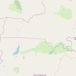
Map view of Kafue National Park

Use this park location map to pinpoint Kafue National Park in Zambia, understand its exact geographic position, and read its mapped placement within the surrounding landscape more clearly.

Pigeon | © OpenStreetMap contributors

Location context for Kafue National Park

Central ProvinceSouthern Province
Park atlas

Uncover the geographic spread of adjacent protected areas, comparing their conservation landscapes and regional context.

Discover Related National Parks and Protected Areas Surrounding Kafue National Park
Explore other national parks and protected areas near Kafue National Park, encompassing a wider array of Zambia's miombo woodlands, vast floodplains, and critical river ecosystems. Structured views enable comparison of diverse conservation landscapes, tracing geographic connections and understanding the regional distribution of protected natural areas.
National parkSouth Africa

Blue Lagoon National Park: National Park Atlas and Mapped Wetland Geography

Discover the protected landscape and fauna of Zambia's Kafue Flats.

Blue Lagoon National Park is a critical protected area recognized for its unique wetland and floodplain environment within South Africa's extensive Kafue Flats system. Established in 1976, this national park offers significant opportunities for atlas-driven exploration of its mapped geography and protected landscape. Visitors can learn about the park's ecological significance, its characteristic terrain of lagoons and marshes, and its importance as a sanctuary for endemic wildlife and diverse bird species, contributing valuable context to the broader regional atlas.

Area
500 km²
Established
1976
IUCN
II
Relief
Lowland
National parkSouthern Province

Mosi-oa-Tunya National Park: National Park Exploration and Geographic Atlas

Mapped boundaries and protected landscape context in Southern Province, Zambia.

Gain a comprehensive understanding of Mosi-oa-Tunya National Park, a designated national park in Zambia's Southern Province. This entry focuses on its protected area identity, mapped geographic scope, and its position within the regional atlas. Discover the essential landscape context and the structured geographic information that defines this important conservation area, providing a factual foundation for atlas-based exploration.

Area
66 km²
IUCN
II
Climate
Subtropical
Access
Easy access
National parkZimbabwe

Victoria Falls National Park: A Protected Landscape Within Zimbabwe's Geography

Atlas exploration of park boundaries and natural terrain.

Victoria Falls National Park is a key component of Zimbabwe's protected natural areas. This page provides structured information ideal for atlas-based exploration, detailing the park's geographic position and mapped landscape features. Understand its significance as a national park and its contribution to the region's conservation geography.

Area
23.4 km²
IUCN
II
Relief
Mixed relief
Climate
Tropical
National parkHwange District

Zambezi National Park: National Park within Hwange District's Geographic Landscape

Explore mapped boundaries and protected area context.

Delve into Zambezi National Park, a designated national park situated in Hwange District. This entry provides foundational geographic and landscape context, highlighting the park's protected status and its position within the regional terrain. Understand the atlas significance and mapped features of this conservation landscape for informed discovery.

Area
560 km²
Established
1979
Relief
Lowland
Climate
Subtropical
National parkLusaka Province

Lusaka National Park: Protected Woodland Habitat and Geographic Context in Lusaka Province

Zambia's smallest national park, mapping natural terrain near the capital.

Lusaka National Park, Zambia's newest national park, offers a contained yet representative example of the woodland ecosystems found on the Lusaka plateau. This protected landscape, covering 6,715 hectares, is entirely fenced, creating a distinct conservation area within Lusaka Province. Its establishment over a former forest reserve highlights a unique approach to upgrading protected lands. Explore the park's mapped terrain and understand its significance as an accessible natural enclave amid regional development, providing a focused view of central Zambian woodland environments.

Area
67.15 km²
Established
2011
IUCN
II
Climate
Tropical
National parkZimbabwe

Kazuma Pan National Park: Zimbabwe National Park Atlas and Protected Landscape Exploration

Unique plains landscape with reliable dry-season wildlife viewing.

Kazuma Pan National Park offers a rare glimpse into Zimbabwe's expansive grassy plains and vital pans, creating a unique protected landscape. This national park is critical for understanding regional wildlife migrations and the geographic context of conservation areas in northwestern Zimbabwe, providing an essential entry point for atlas-based exploration of its terrain and ecological significance.

Area
313 km²
Established
1975
IUCN
II
Relief
Lowland
National parkZambia

Sioma Ngwezi National Park: Zambia's National Park, Mapped Protected Landscape Explorer

Discover the geographic context and protected area boundaries of Sioma Ngwezi National Park.

Sioma Ngwezi National Park is a key protected area within Zambia, offering significant opportunities for geographic discovery. This national park's mapped boundaries define a significant natural landscape, providing crucial context for regional atlas exploration. Users can explore the park's specific identity as a conservation territory and understand its placement within Zambia's diverse terrain. The focus here is on the park's structured geographic data and its role in mapping protected lands across Southern Africa.

Area
5,000 km²
Relief
Lowland
Climate
Subtropical
Access
Remote access
National parkZimbabwe

Chizarira National Park: Zimbabwe's Remote Protected Landscape on the Zambezi Escarpment

Explore rugged mountains, deep gorges, and unique woodland ecosystems.

Chizarira National Park offers an unparalleled exploration of wilderness and dramatic geography within Zimbabwe. Situated along the imposing Zambezi Escarpment, its landscape is characterized by a 600-meter drop, rugged mountains, and deep river gorges carved by perennial streams. This protected area, known for its remote appeal and rich leopard populations, provides a distinct view of miombo and mopane woodlands, contributing to its unique ecological identity within the regional geography.

Area
2,000 km²
Established
1975
IUCN
II
Relief
Mountain

Common questions about visiting, size, designation, and location context for Kafue National Park

Kafue National Park FAQs for park facts, access, geography, and protected area context
Find quick answers about Kafue National Park, including protected-area facts, park geography, trail and visitor context, and how the park fits into its surrounding country and regional landscape.
MoriAtlas Explorer

Continue Your Protected Areas Search Across the Global Atlas

Deepen your exploration by continuing the structured search for national parks and protected areas worldwide. Utilize the comprehensive filtering capabilities to compare different conservation landscapes and refine your understanding of global park geography. Discover more about the distribution and characteristics of protected natural areas.

Global natural geography


