
Rivers
Park geography
Mapped boundaries, landscape classifications, and river system context for Mavinga
Structured Geographic Profile of Mavinga National Park in Cuando Province, Angola
Detailed analysis of Mavinga National Park, covering the recorded boundary extent across 46076 square kilometers of Angolan terrain. This profile maps the geographic position within Cuando Province and outlines the presence of key natural systems, including the Longa, Cuando, Cuito, and Lomba rivers, alongside regional woodland and grassland habitats.
Related tags
Miombo WoodlandTransfrontier ConservationTropical SavannaWildlife RecoveryPost-War Conservation
Vast miombo savanna reserve on the western edge of Africa's largest transfrontier conservation area
Mavinga National Park
Mavinga National Park is a sprawling protected area in southeastern Angola, established in 2011 as part of a major conservation initiative to protect the country's vanishing wilderness areas. The park covers approximately 46,000 square kilometers of tropical savanna landscape in Cuando Province, forming a contiguous management unit with the neighboring Luengue-Luiana National Park to the east. This vast protected area sits at the western boundary of the Kavango-Zambezi Trans-Frontier Conservation Area, Africa's largest cross-border conservation landscape, which spans portions of Angola, Botswana, Namibia, Zambia, and Zimbabwe. The region's ecology is characterized by a mosaic of habitats including open woodland, dense miombo forest, seasonal grasslands, and aquatic vegetation zones interspersed with watercourses and wetlands. The park's creation represents Angola's commitment to preserving areas of high biological value following the end of the devastating civil war that lasted from 1975 to 2002. Wildlife populations were drastically reduced during this conflict, and the park now serves as a critical corridor for ecological recovery and biodiversity conservation in southern Africa. Mavinga occupies a strategic position within the broader KaZa TFCA framework, connecting protected areas across international boundaries and enabling wildlife migration patterns that are essential for maintaining healthy ecosystems. The park's extensive road network, though partially degraded and complicated by remnants of conflict, provides access to a landscape that remains one of Angola's most significant conservation assets.
- Location
- Angola
- Park type
- National park
- Established
- 2011
- Area
- 46,076 km²
Location overview
Regional context and national placement within Cuando Province
Geographic Overview of Mavinga National Park in Angola
Mavinga National Park is situated in the Cuando Province of Angola, representing a key interior territory. Registered as an inland sanctuary, the park operates under national jurisdiction with no coastal or marine boundaries.
- Countries
- Angola
- Regions
- Cuando Province
- Primary location
- Angola
- Geographic setting
- Inland
Boundary and coordinates
Interactive protected-area geometry and calculated dimensional metrics
Mavinga National Park Boundary Map and Spatial Extent Analysis
Mapped park outlines establish spatial context across the protected landscape. Associated dimensional metrics supply calculated area measurements and geographic coordinate limits without implying legal survey precision.
- Boundary area
- 36,558.1 km²
- Boundary perimeter
- 1,991.6 km
- Northernmost point
- 14.6144° S
- Southernmost point
- 16.7746° S
- Easternmost point
- 22.4079° E
- Westernmost point
- 18.4744° E
- Geographic centre
- 16.0042° S, 20.279° E
- North–south span
- 239 km
- East–west span
- 421.6 km
Terrain and natural features
Lowland relief classification and recorded river systems
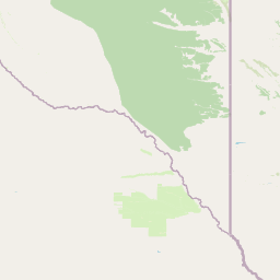
Mavinga National Park Terrain and Protected Rivers Map
Recorded terrain classifications indicate lowland relief across Mavinga National Park alongside multiple river channels situated within protected boundaries. Linked feature cards supply names, types, measurements, and spatial relationships for each recorded natural feature.
Selected named natural features
Rivers
Rio Lomba
Rivers
Cuando River
Rivers
Cuito River
Rivers
Rio Cuiriri
Rivers
Luancundo
Environmental setting
Tropical lowland terrain featuring woodland, grassland, and wetland habitats
Mavinga National Park Environmental Classification and Physical Setting Atlas
Recorded woodland, grassland, and wetland classifications provide complementary perspectives on the physical setting of Mavinga National Park. Structured environmental indicators connect these recorded categories to relevant protected area destinations.
- Relief
- Lowland
- Climate
- Tropical
- Water
- Minor water
- Forest cover
- Mostly forested
Landscape features
Woodland · Grassland · Wetland
Habitat types
Temperate broadleaf forest · Grassland · Wetland · Riverine habitat
Park atlas
Compare Angola's diverse protected areas, tracing the regional geography of parks connected to Mavinga National Park.
Discover Other Protected Landscapes and National Parks Near Mavinga National Park in Southeastern Angola
Discover additional national parks and key protected areas across Angola, following the geographic distribution of conservation landscapes near Mavinga National Park. Compare adjacent protected territories, explore their unique ecological roles, and map how these vital areas connect within the greater Southern African region.
National parkAngola
Mapped location lies within the park boundary#1 closest

Longa-Mavinga National Park: Detailed Atlas and Protected Landscape Context in Angola
Explore its mapped boundaries and regional geographic significance.
Longa-Mavinga National Park serves as a crucial point for understanding protected areas and natural landscapes within Angola. This page details its identity as a national park, focusing on its mapped geographic features and protected land status. Users can delve into the specific landscape context and regional distribution of this significant protected area, enhancing their grasp of Angola's natural geography.
- IUCN
- II
National parkAngola
Park boundaries overlap#2 closest
East
Luengue-Luiana National Park: Angola's Premier Protected Woodland and Floodplain Ecosystem
Mapping crucial habitats for large mammals and avian wildlife.
Luengue-Luiana National Park is a vital protected landscape in southeastern Angola, covering an immense area that transitions from open woodland ecosystems to vast, seasonal floodplain grasslands. As a cornerstone of the Kavango-Zambezi Transfrontier Conservation Area, it facilitates critical wildlife movements and supports significant populations of large mammals. Its geography provides essential habitat, particularly within the extensive wetland wilderness and riparian zones along the Cuando River, making it a significant site for regional biodiversity and atlas exploration.
- Area
- 42,000 km²
- Established
- 2011
- IUCN
- II
- Relief
- Lowland
National parkZambia
85 km away#3 closest
East

Sioma Ngwezi National Park: Zambia's National Park, Mapped Protected Landscape Explorer
Discover the geographic context and protected area boundaries of Sioma Ngwezi National Park.
Sioma Ngwezi National Park is a key protected area within Zambia, offering significant opportunities for geographic discovery. This national park's mapped boundaries define a significant natural landscape, providing crucial context for regional atlas exploration. Users can explore the park's specific identity as a conservation territory and understand its placement within Zambia's diverse terrain. The focus here is on the park's structured geographic data and its role in mapping protected lands across Southern Africa.
- Area
- 5,000 km²
- Relief
- Lowland
- Climate
- Subtropical
- Access
- Remote access
National parkZambezi Region
118 km away#4 closest
Southeast

Bwabwata National Park: National Park in the Zambezi Region, Namibia
Explore savanna ecosystem and riverine landscapes.
Bwabwata National Park represents a significant protected landscape in Namibia's Zambezi Region, notable for its integrated community conservation model and its function as a vital wildlife corridor. This national park spans the Caprivi Strip, featuring savanna woodlands and crucial riparian zones along the Okavango and Kwando rivers. As a key component of the Kavango-Zambezi Transfrontier Conservation Area, it facilitates significant elephant migrations, providing rich opportunities for atlas-based exploration of mapped protected areas and regional geography.
- Area
- 6,274 km²
- Established
- 2007
- IUCN
- II
- Relief
- Lowland
National parkWestern Province
145 km away#5 closest
Northeast
Liuwa Plain National Park National Park: Mapped Protected Landscape Explorer
Explore regional geography and protected park boundaries.
Liuwa Plain National Park, designated as a national park in Zambia's Western Province, serves as a crucial point for understanding protected land distribution and regional geography. This dedicated page provides detailed insights into its mapped protected landscape, allowing for focused atlas-style exploration. Discover the park's role within the larger geographic context of Western Province and its significance as a conservation area through structured mapping and landscape analysis.
- Area
- 3,369 km²
- Established
- 1972
- IUCN
- II
- Relief
- Lowland
National parkNamibia
191 km away#6 closest
South
Khaudum National Park: Namibia's Remote Kalahari Protected Landscape and Predatory Wildlife
Explore mapped boundaries and seasonal river ecosystems.
Khaudum National Park is a substantial protected landscape in northeastern Namibia, deep within the Kalahari Desert. This remote national park encompasses over 3,800 square kilometers of dry forest and acacia woodland, dissected by three major Omuramba dry river systems. It is globally recognized for its thriving populations of large predators like lions and spotted hyenas, alongside significant numbers of elephants and giraffes. The park's unique semi-arid terrain and biodiversity make it a key destination for understanding regional protected-area geography and landscape context.
- Area
- 3,842 km²
- IUCN
- II
- Relief
- Lowland
- Climate
- Arid
National parkCaprivi Region
About 196 km away#7 closest
Southeast
Mudumu National Park National Park: Discover its Protected Landscape and Geographic Boundaries
Mapping the protected area and regional landscape context in Caprivi Region.
Navigate the protected geography of Mudumu National Park, a designated national park situated within the Caprivi Region. This entry provides a structured atlas view of its mapped boundaries and landscape context. Gain a clear understanding of its protected status and its place within the regional geographic framework, offering essential detail for map-based exploration of natural areas in Namibia.
- Area
- 737 km²
- Established
- 1990
- Relief
- Lowland
- Climate
- Tropical
National parkNamibia
About 225 km away#8 closest
Southeast
Nkasa Rupara National Park: A Protected Landscape within Namibia's Geography
Explore the mapped protected area and its regional landscape context.
Nkasa Rupara National Park represents a distinct protected landscape within Namibia. This entry provides detailed geographic context, focusing on the park's mapped boundaries and its role as a national park. Understand how this protected area contributes to the broader regional geography, offering a focal point for atlas-based exploration of Namibia's natural lands.
- Area
- 320 km²
- Established
- 1990
- IUCN
- II
- Relief
- Lowland
MoriAtlas Explorer
Continue Your Exploration of Mavinga National Park's Geography and Landscape
Delve deeper into the protected area features and regional geographic context of Mavinga National Park. Understanding its mapped boundaries and landscape characteristics offers crucial insights into Angola's natural heritage and conservation atlas. Continue exploring to uncover the specific geographic elements that define this important national park and its surroundings.
Browse next
Global natural geography
Explore related park routes
Explore MoriAtlas Global ParksBrowse All MoriAtlas ParksGlobal Park Map DiscoveryMoriAtlas: Browse All CountriesBrowse All MoriAtlas ContinentsNational Park Environment AtlasGrand Canyon National Park AtlasYellowstone National Park AtlasYosemite National Park Atlas and GeographySerengeti National Park AtlasGalápagos National Park Protected LandscapeBanff National Park Geography and AtlasKruger National Park Atlas EntryUluṟu-Kata Tjuṯa National Park AtlasExplore Uluru-Kata Tjuta National Park GeographyPlitvice Lakes National Park AtlasFiordland National Park Protected LandscapeGreat Smoky Mountains National Park AtlasAfghanistan National Parks and Protected AreasAlbania National Parks and Protected AreasAlgeria National Parks and Protected AreasAmerican Samoa National Parks and Protected AreasAndorra National Parks and Protected AreasAngola National Parks and Protected AreasAntarctica National Parks and Protected AreasAntigua and Barbuda Park List