
Mori Atlas logo
Natural monumentMonumento Natural Formaciones de Tepuyes

Geographic analysis of the Guayana Shield and ancient table-top mountain formations in Venezuela

Monumento Natural Formaciones de Tepuyes: Protected Sandstone Plateaus and Highland Geography

Monumento Natural Formaciones de Tepuyes protects a vast expanse of Precambrian sandstone plateaus across the Amazonas and Bolivar states of southern Venezuela. This natural monument preserves a network of sheer-walled tepuys that rise abruptly from dense tropical forests and river basins. The area serves as a significant biological laboratory, where isolated mountain summits sustain unique endemic ecosystems within the broader landscape of the Guayana Shield.

tepuytable-top mountainsGuayana Shieldgeological monumentendemic speciessandstone plateaus
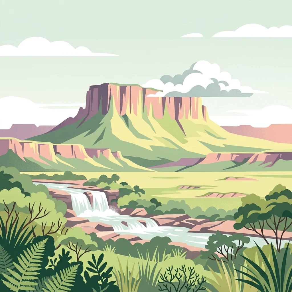
A stylized flat vector illustration of a massive, flat-topped tepuy mountain with steep vertical cliffs, overlooking a green savannah and a tiered waterfall in the foreground, with lush vegetation and clouds around the peaks.

Monumento Natural Formaciones de Tepuyes

Natural monument

Park overview

Structured park overview, official facts, and landscape profile for Monumento Natural Formaciones de Tepuyes

Monumento Natural Formaciones de Tepuyes park facts, protected area profile, and essential visitor context

Review the core facts for Monumento Natural Formaciones de Tepuyes, including designation, size, terrain, visitor scale, habitats, and operating context in one park-focused overview.

About Monumento Natural Formaciones de Tepuyes

Monumento Natural Formaciones de Tepuyes is one of the largest natural monument designations in Venezuela, established specifically to conserve a representative set of tepuy formations across southern Bolívar and Amazonas. Tepuys are among the oldest exposed surface formations on Earth, and their combination of sheer cliffs, flat summits, and isolated ecosystems makes them scientifically and scenically invaluable. The area lies within the broader Guayana Shield, one of the planet's oldest geological nuclei.

The protected landscape is dominated by continuous forested lowlands and savannas from which the tepuy plateaus emerge dramatically. These mountains are erosional remnants formed from layered Precambrian sandstones and quartzites resting on granitic basement rocks, with intrusions of diabase that further shape the cliff faces. Over hundreds of millions of years, weathering has stripped away the surrounding rock, leaving behind the iconic steep-sided mesas that today punctuate the skyline.

Ecologically, the monument matters as much for what lives on the summits as for the spectacle of the cliffs themselves. Because each tepuy is geologically and biologically isolated, their high plateaus host communities of plants, invertebrates, and other organisms that have evolved independently for immense stretches of time. This has made the tepuy region a focal point for studies of endemism, biogeography, and evolutionary isolation in tropical landscapes.

The monument's scale, spanning around a million hectares and encompassing roughly two dozen major tepuy formations, also makes it an unusually comprehensive conservation unit. Rather than protecting a single mountain, the designation preserves a network of these formations together with their surrounding forests and watersheds, helping maintain the ecological processes that link lowland and highland habitats throughout the region.

Quick facts and research context for Monumento Natural Formaciones de Tepuyes

Monumento Natural Formaciones de Tepuyes is a Venezuelan natural monument established in 1991, covering approximately 1,069,820 hectares across the states of Amazonas and Bolívar. The protected area encompasses more than two dozen individual tepuy formations set within the larger forested expanse of the Guayana Shield.

The monument is classified as a natural monument, a designation used in Venezuela for specific geological features of outstanding scientific or scenic value. The protected tepuys were selected for their striking configuration, landscape beauty, and exceptional biodiversity, particularly the endemic species associated with their isolated summit environments.

Protection and recognition

Documented terrestrial conservation scope and official designation records

Monumento Natural Formaciones de Tepuyes Protection Status and Recognition

Monumento Natural Formaciones de Tepuyes maintains a documented terrestrial protection scope without transboundary status or imported international recognition sources. Official conservation records provide verified administrative details for evaluating the established protected area designation.

Protection details

Protection scope
Terrestrial
Transboundary protection
No
Park context

Deeper park guide and search-rich context for Monumento Natural Formaciones de Tepuyes

Monumento Natural Formaciones de Tepuyes history, landscape, wildlife, and travel context

Explore Monumento Natural Formaciones de Tepuyes through its history, landscape character, ecosystems, wildlife, conservation priorities, cultural context, and seasonal travel timing in a structured park guide built for atlas discovery and search intent.

Why Monumento Natural Formaciones de Tepuyes stands out

The monument is best known for protecting a network of tepuys, the table-top mountains that are among the most recognizable geological landmarks of the Guayana Shield. These formations rise as flat plateaus with sheer vertical walls, sometimes reaching more than 2,500 meters in elevation. What sets these tepuys apart ecologically is their extreme age and isolation. Dating back to the Precambrian era, they are composed mainly of sandstone, quartzite, and granite intruded by diabase rocks, and their summits function like biological islands in the sky. Each plateau harbors specialized vegetation and fauna found nowhere else, giving the monument global importance for both geological heritage and the study of evolution in isolated habitats.
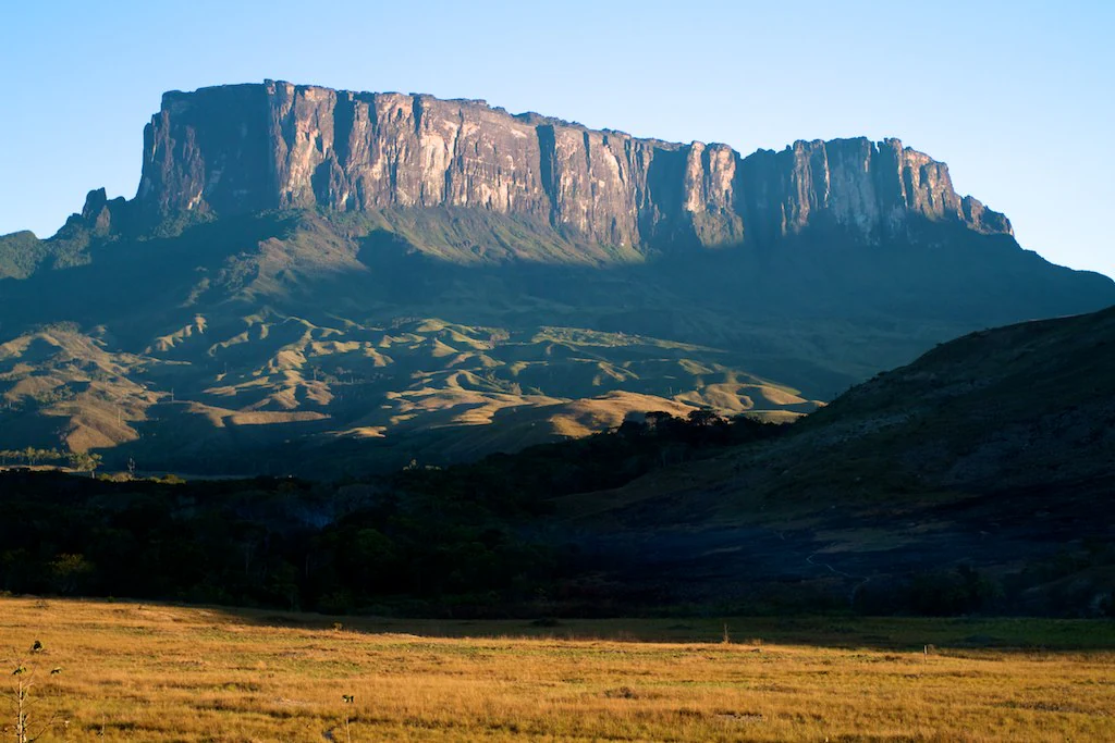
Wide view of a large, flat-topped tepui mountain rising above a grassy savanna at sunset.
The dramatic profile of Kukenan tepui, a characteristic table mountain in Venezuela.

Monumento Natural Formaciones de Tepuyes history and protected-area timeline

The Monumento Natural Formaciones de Tepuyes was formally designated as a protected area in 1991, becoming part of Venezuela's system of natural monuments managed for their geological and ecological significance. The designation specifically targeted a curated set of tepuy formations rather than a single mountain, reflecting recognition that the tepuy landscape as a whole constitutes a heritage feature of national and international importance.

The selection of the protected tepuys was guided by three main criteria: their physical configuration as tepuy landforms, their outstanding scenic beauty, and their biological richness, particularly their levels of endemism. Twelve formations were included from the state of Bolívar and thirteen from the state of Amazonas, providing a geographically balanced representation of the region's signature mountains.

Since its establishment, the monument has contributed to broader international recognition of the tepuy landscape as a key element of the Guayana Shield's natural heritage. While earlier references in encyclopedic sources, such as the Encarta entry cited in the original documentation, helped raise public awareness of Venezuela's natural monuments, the 1991 designation created an enduring legal framework for the protection of these specific formations and their associated ecosystems.

Monumento Natural Formaciones de Tepuyes landscape and geographic character

The landscape of the monument is defined by the contrast between dense, forested lowlands and the towering table-top mountains that rise abruptly above them. The tepuys present flat or slightly undulating summits bordered by near-vertical escarpments that can drop hundreds of meters to the base. This abrupt transition between plateau and jungle gives the region one of the most striking relief profiles in all of South America.

Among the most prominent protected formations in the state of Bolívar are the Uei Tepuy at roughly 2,150 meters, the Kukenan Tepuy reaching about 2,650 meters, the Yuruani Tepuy at around 2,400 meters, the Karaurín Tepuy at approximately 2,500 meters, and the Ilú Tepuy, which climbs to about 2,700 meters. Each of these formations displays the characteristic combination of broad, weather-shaped summits and sheer cliff walls.

In the state of Amazonas, the monument includes the Cerro Yaví at around 2,300 meters, the Parú Euaja massif at about 2,200 meters, and the Cerro Tamacuari at roughly 2,300 meters, among other protected formations. The surrounding terrain consists of tropical forest, gallery vegetation along rivers, and patches of savanna interspersed between the mountains, creating a mosaic of habitats that buffers and complements the highland ecosystems.
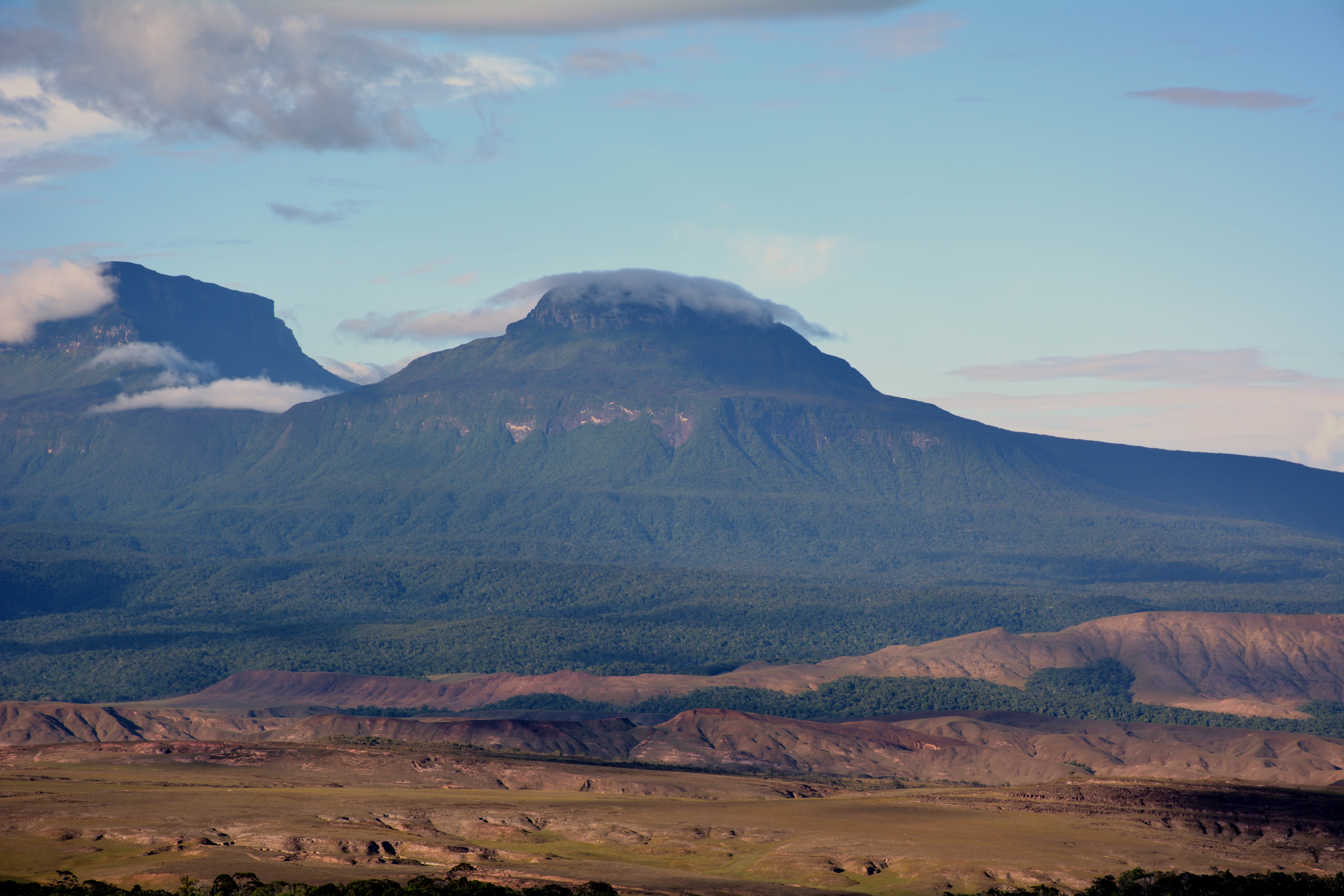
A wide shot showing the western face of the Karaurin-tepui table mountain, with a cap of clouds near the summit and a vast, arid, low-lying landscape in the foreground.
The western face of Karaurin-tepui, a distinctive table mountain formation located within the Gran Sabana region of Venezuela.

Monumento Natural Formaciones de Tepuyes ecosystems, habitats, and plant life

The natural heritage of the monument sits at the intersection of two very different worlds: the ancient Precambrian uplifts that formed the tepuys and the tropical forests that surround them. The summit environments function as ecological islands, with vegetation communities shaped by persistent cloud cover, high humidity, nutrient-poor sandstone substrates, and long-term isolation from neighboring ranges.

These conditions have produced ecosystems rich in endemic species. Plants adapted to the wet, exposed plateaus have diversified in isolation, while specialized habitats such as rocky outcrops, tepuy marshes, and shallow soils support distinct assemblages of flora and fauna not found at lower elevations. The continued protection of these summit environments is central to the monument's ecological purpose.

Surrounding the tepuys, the broader landscape includes extensive tracts of Guayana Shield forest and savanna. These lower elevation habitats help maintain watershed functions, support migratory and resident wildlife, and form the ecological context in which the highland communities have evolved. Together, the forests, savannas, rivers, and tepuy summits form an integrated ecological system rather than a collection of isolated features.
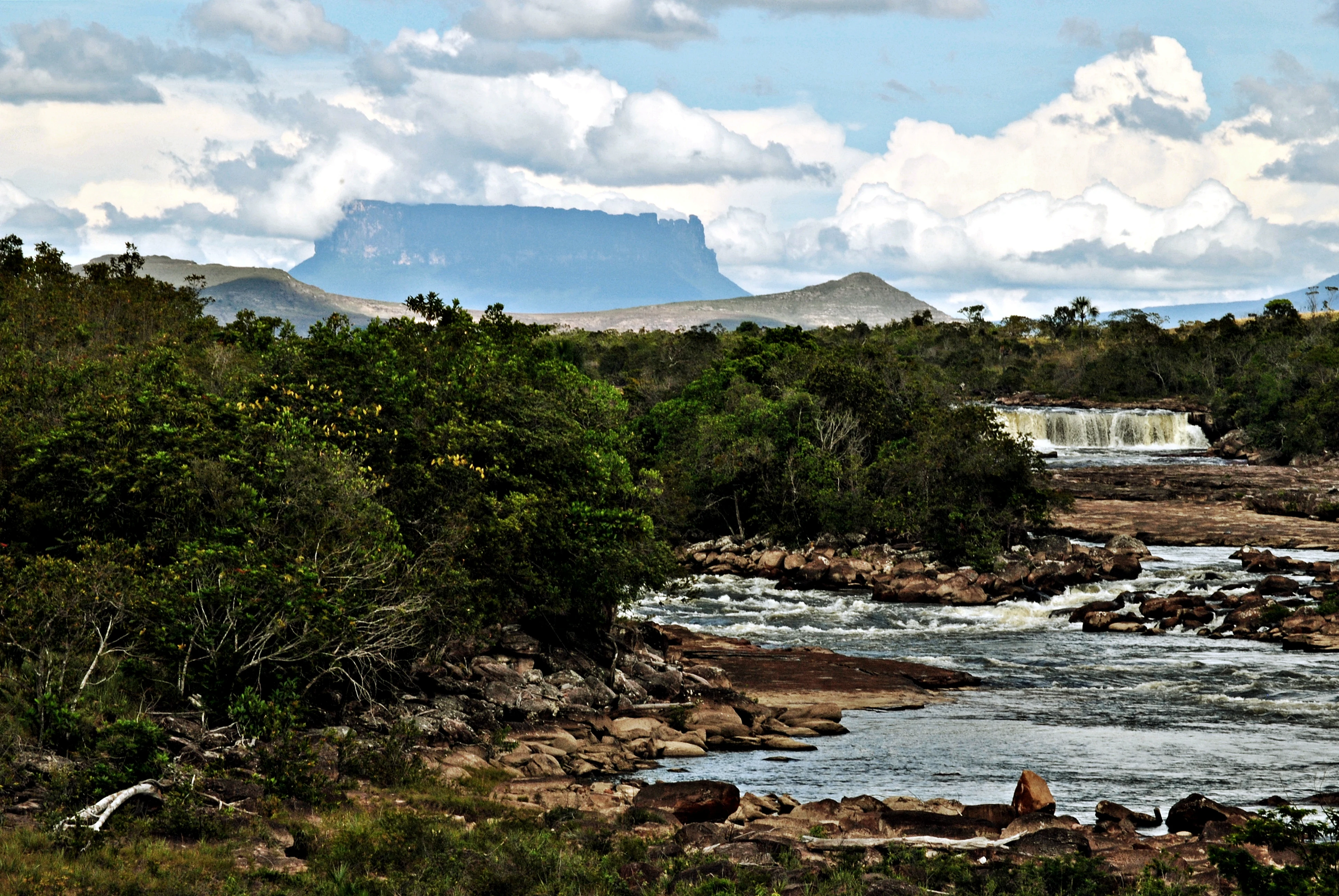
A wide landscape view of a river flowing over rocks toward a small waterfall, with a flat-topped tepuy mountain rising in the distant background under a cloudy sky.
The Yuruani Falls set against the backdrop of the iconic Yuruani Tepui in the Gran Sabana region of Venezuela.

Monumento Natural Formaciones de Tepuyes wildlife and species highlights

The wildlife profile of the monument is closely tied to the tepuy summit ecosystems, which support unusually high levels of endemism. Many of the species found on individual tepuys exist nowhere else, an outcome of the long geological isolation of each plateau and the distinct environmental conditions that develop on their summits.

The combination of forested slopes, rocky cliffs, savanna patches, and elevated plateaus creates a wide range of habitats for birdlife, amphibians, reptiles, and invertebrates. The cliffs and isolated summits in particular provide refuge for species that cannot survive in the surrounding lowland forests, while the forests below sustain a broader community of typical Guayana Shield wildlife.

The abundance and uniqueness of biodiversity was one of the principal reasons the tepuys were chosen for protection. The monument's protected network, spanning multiple tepuy formations across two states, helps ensure that endemic populations are not lost when individual mountains are isolated from conservation planning.
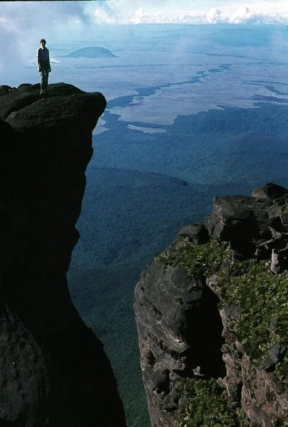
A person standing on the rocky edge of a high tepui cliff overlooking a vast landscape of forests and distant plains under a cloudy sky.
A climber standing on the summit edge of Ilu Tepui, one of the iconic tepuy formations in Venezuela.

Monumento Natural Formaciones de Tepuyes conservation status and protection priorities

The monument's conservation significance lies in its protection of some of the oldest and most biologically distinctive mountain ecosystems in South America. The tepuys are erosional remnants of the Precambrian Guayana Shield, a geological nucleus so ancient that the rocks forming them predate most complex life on Earth. Preserving these formations protects both a globally rare geological record and the evolutionary laboratories that their summits represent.

By designating roughly a million hectares as a natural monument in 1991, Venezuela created a legal protection framework for more than two dozen tepuy formations across Amazonas and Bolívar. This umbrella approach is ecologically important because the value of tepuys depends not just on individual mountains but on the wider landscape that connects them and sustains their watersheds and surrounding forests.

The monument also contributes to international understanding of the Guayana region's natural heritage. Its protected peaks are part of the broader tepuy landscape that includes neighboring formations in Canaima National Park, reinforcing the importance of coordinated conservation across administrative boundaries for the long-term protection of these fragile ecosystems.

Monumento Natural Formaciones de Tepuyes cultural meaning and human context

The tepuys hold a deep place in the regional identity of southern Venezuela, where indigenous peoples have lived among these mountains for millennia. Many of the formations carry names in Indigenous languages, including Pemón and other Amazonian linguistic traditions, reflecting long-standing familiarity with the landscape.

The dramatic profile of the tepuys has also become a powerful national symbol, representing the wild, ancient character of Venezuela's southern frontiers. References to the tepuy landscape appear in regional travel accounts, scientific literature, and broader discussions of South American natural heritage, linking the monument's protected formations to a wider cultural narrative about the Guayana region.

Top sights and standout views in Monumento Natural Formaciones de Tepuyes

The monument's standout qualities include its sheer concentration of tepuy formations, some of which reach more than 2,500 meters in elevation and display near-vertical cliff faces hundreds of meters high. These mountains are among the most visually distinctive landforms in all of tropical South America.

Equally important is the scientific value of the protected ecosystems. The summit habitats host numerous endemic species and provide natural laboratories for studying evolution in isolated environments, while the surrounding forests sustain the broader biodiversity of the Guayana Shield.

Best time to visit Monumento Natural Formaciones de Tepuyes

The tepuy region experiences a tropical climate with a relatively dry season and a wetter season that strongly affects access conditions and atmospheric character. During drier months, rivers are lower and trails are generally easier to traverse, while the rainy season brings more challenging conditions but also fuller waterfalls, mist-shrouded summits, and lusher vegetation.

Visitors interested in clearer views of the cliffs and plateaus often prefer periods when cloud cover is less persistent, while those drawn to lush landscapes and dramatic waterfalls may favor the wetter months. Because conditions vary considerably between the lowland forests and the elevated summits, the best experience depends on whether the focus is on exploring the surrounding jungle or on viewing and approaching the tepuy highlands.
Monthly climate preview

Long-term temperature ranges and monthly precipitation patterns across representative coordinate data

Monumento Natural Formaciones de Tepuyes Climate Normals and Weather by Month

Representative coordinates record distinct seasonal variations in monthly temperature averages and precipitation rates across the protected terrain. Analyzing twelve-month climatological normals provides deeper geographic insight into regional temperature fluctuations and precipitation totals.
Annual mean24 °C
23 °C26 °C
Jan24°
Feb25°
Mar26°
Apr25°
May24°
Jun23°
Jul23°
Aug23°
Sep24°
Oct24°
Nov24°
Dec24°
Warmest month
March

26.1 °C

Coolest month
July

22.9 °C

Wettest month
June

13.1 mm/day

Driest month
January

0.8 mm/day

Park location guide

Geography guide, regional context, and park location map for Monumento Natural Formaciones de Tepuyes

Monumento Natural Formaciones de Tepuyes park geography, regions, and map view in Venezuela

Understand where Monumento Natural Formaciones de Tepuyes sits in Venezuela through a broader geographic reading of the surrounding landscape, nearby location context, and its mapped position within the national park landscape.

How Monumento Natural Formaciones de Tepuyes fits into Venezuela

Venezuela is a country in northern South America with coastline along the Caribbean Sea and Atlantic Ocean. It borders Colombia, Brazil, Guyana, and Trinidad and Tobago. The country has an area of approximately 916,445 km² and a population of about 31.8 million. Caracas is the capital and largest city. Venezuela consists of 23 states and the Capital District.

Wider geography shaping Monumento Natural Formaciones de Tepuyes in Venezuela

Venezuela is located on the northern coast of South America. The continental territory is bordered by the Caribbean Sea and Atlantic Ocean to the north, Colombia to the west, Brazil to the south, and Guyana to the east. Trinidad and Tobago lies to the northeast. The country includes various islands and islets in the Caribbean Sea known as the Federal Dependencies.

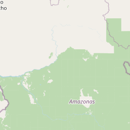
Map view of Monumento Natural Formaciones de Tepuyes

Use this park location map to pinpoint Monumento Natural Formaciones de Tepuyes in Venezuela, understand its exact geographic position, and read its mapped placement within the surrounding landscape more clearly.

Pigeon | © OpenStreetMap contributors

Location context for Monumento Natural Formaciones de Tepuyes

AmazonasBolívar

Visual reference guide to ancient sandstone plateaus and tropical jungle terrain

Monumento Natural Formaciones de Tepuyes Photos and Landscape Scenery

Visual documentation captures the dramatic contrast between sheer quartzite cliffs and dense lowland forests across the protected tepuy formations. Examining these landscape photographs reveals the unique geological relief and isolated summit habitats that define the Guayana Shield region.

Wide view of a large, flat-topped tepui mountain rising above a grassy savanna at sunset.

A wide, eye-level shot of the large, sheer-walled flat-topped Mount Kukenan tepuy rising above golden grassy savannahs and forested hills in Venezuela.

A wide shot showing the western face of the Karaurin-tepui table mountain, with a cap of clouds near the summit and a vast, arid, low-lying landscape in the foreground.

A wide landscape view of a river flowing over rocks toward a small waterfall, with a flat-topped tepuy mountain rising in the distant background under a cloudy sky.

A person standing on the rocky edge of a high tepui cliff overlooking a vast landscape of forests and distant plains under a cloudy sky.

Park atlas

Compare regional geography, sandstone plateaus, and adjacent protected natural areas.

Parks Near Monumento Natural Formaciones de Tepuyes and Surrounding Protected Landscapes

Browsing other protected areas near Monumento Natural Formaciones de Tepuyes reveals wider patterns of terrain, geology, and highland ecosystems across the region. Extending the comparison helps map related tropical forest reserves, table-top mountains, and biodiversity hotspots within the Guayana Shield.
National parkAmazonas
About 160 km away#1 closest

South

Yapacana National Park: Ancient Geology and Botanical Significance in Venezuela's Amazonas

Discover the dramatic plateau landscapes and unique flora of this protected national park.

Delve into the distinct geography and protected landscape identity of Yapacana National Park, a significant national park within Venezuela's Amazonas region. This page serves as a comprehensive atlas entry, detailing the park's core features, including its iconic Yapacana hill, a dramatic tepui formation representative of the ancient Guayana Shield. Understand the park's geological heritage and its exceptional botanical value, marked by unique floristic connections, all within the context of its Amazonian basin setting.

Area
3,200 km²
Established
1978
IUCN
II
Relief
Highland
Watercolor painting of rounded granitic hills or mountains rising above a low foreground of green vegetation against a white background.
Natural monumentAmazonas
About 172 km away#2 closest

West

Monumento natural Piedra la Tortuga: Granite Outcrops and Archaeological Landscapes

A vital protected monument in the Amazonas region of Venezuela

Discover the geological significance of Monumento natural Piedra la Tortuga, where ancient Precambrian granite formations rise above tropical savannas and gallery forests. This protected area preserves a unique concentration of indigenous history, including major petroglyphs and burial sites, while supporting diverse bird species and riparian ecosystems within the Amazonas region.

Area
5.03 km²
Established
1992
Relief
Upland
Climate
Tropical
A soft, painterly watercolor illustration showing layered hills and light green, yellow, and reddish vegetation across a rolling, abstract landscape.
National parkBolívar
About 174 km away#3 closest

Southeast

Parque nacional Jaua-Sarisariñama: Protected Tepui Landscapes in Bolívar

Mapping the sandstone mesas and remote wilderness of the Venezuelan Guiana Shield.

Parque nacional Jaua-Sarisariñama stands as one of the most secluded protected areas in Venezuela, defined by its massive tepuis and dramatic vertical sinkholes. This geography encompasses critical headwaters and ancient Precambrian rock formations that rise abruptly from surrounding lowland forests, providing a stable habitat for isolated species across the Guiana Shield.

Area
3,300 km²
Established
1978
IUCN
II
Relief
Highland
National parkAmazonas
About 181 km away#4 closest

South

Parque nacional Duida-Marahuaca: Geographic Overview of Protected Tepui Landscapes in Venezuela

Mapping the highland ecosystems and river systems of Amazonas

Parque nacional Duida-Marahuaca protects a vast expanse of remote wilderness, anchored by the prominent Cerro Duida, Cerro Huachamacari, and Cerro Marahuaca. This site offers deep insights into the park's sandstone topography and hydrological connectivity within the broader Guayana Shield, providing a clear geographic understanding of these isolated table-top mesas and their surrounding forest habitats.

Area
2,100 km²
Established
1978
IUCN
II
Relief
Mountain
National parkVichada Department
About 199 km away#5 closest

West

El Tuparro National Natural Park: Mapped Protected Landscape in Colombia's Vichada Department

Explore the geography and savanna terrain of this Orinoco basin national park.

El Tuparro National Natural Park stands as a significant protected area in the Vichada Department, embodying the ecological richness of Colombia's Llanos Orientales. Its landscape comprises extensive tropical savannas, striking gallery forests along major rivers like the Orinoco, and dramatic rapids. This page provides an atlas-focused view of El Tuparro National Natural Park, detailing its geographic boundaries and its importance as a conservation corridor within the region, crucial for understanding South American protected lands.

Area
5,480 km²
Established
1970
IUCN
II
Relief
Lowland
National parkAmazonas
About 214 km away#6 closest

Southeast

Parima Tapirapecó National Park: Venezuela's Largest Protected Area within the Guayanan Highlands

Explore its vast geographic extent and critical Orinoco River basin landscape.

Parima Tapirapecó National Park is an expansive protected territory in Venezuela's Amazonas region, holding the title of the country's largest national park and ranking among the world's most significant protected lands. Its geography is defined by the ancient Guayanan Highlands, protecting the vital headwaters of the Orinoco River and a mosaic of tropical forests and savannas. This park offers deep insights into landscape preservation on a grand scale, crucial for understanding regional geography and protected area distribution.

Area
38,290 km²
Established
1991
IUCN
II
Scope
Terrestrial
National parkApure State
About 216 km away#7 closest

Northwest

Santos Luzardo National Park: Exploring Venezuela's Protected Landscape Geography

National park mapped boundaries and regional natural terrain.

This detailed entry for Santos Luzardo National Park focuses on its role as a national park and its contribution to the geographic atlas of Venezuela. It highlights the park's protected landscape, mapped terrain, and its specific setting within Apure State. Engage with concrete details that illuminate the park's protected status and its natural geographic features, perfect for atlas-driven exploration and understanding protected areas.

Area
5,844 km²
Established
1988
IUCN
II
Relief
Lowland
National parkVenezuela
About 217 km away#8 closest

South

Duida, Marahuaca National Park: Venezuela's Remote Tepui National Park & Protected Landscape

Guiana Shield Geography and Cloud Forest Ecosystems

Duida, Marahuaca National Park in southern Venezuela is a protected national park defined by its spectacular tepui mountains and unique Guiana Shield geography. This park offers a glimpse into remote wilderness, characterized by dramatic sandstone formations and isolated cloud forest ecosystems that harbor endemic species. Understand the mapped extent and geographic context of this remarkable protected landscape, vital for comprehending regional natural heritage and evolutionary distinctiveness.

IUCN
II
Scope
Terrestrial

Common questions about visiting, size, designation, and location context for Monumento Natural Formaciones de Tepuyes

Monumento Natural Formaciones de Tepuyes FAQs for park facts, access, geography, and protected area context

Find quick answers about Monumento Natural Formaciones de Tepuyes, including protected-area facts, park geography, trail and visitor context, and how the park fits into its surrounding country and regional landscape.
MoriAtlas Explorer

Continue Your Protected Areas Search Across the Global Atlas

Deepen your exploration by continuing the structured search for national parks and protected areas worldwide. Utilize the comprehensive filtering capabilities to compare different conservation landscapes and refine your understanding of global park geography. Discover more about the distribution and characteristics of protected natural areas.

Global natural geography