
Mori Atlas logo
National parkNimrod Fortress

Trace the protected boundaries and regional geography of this important Israeli national park.

Nimrod Fortress National Park: A Mapped Protected Landscape in Israel's Geography

(Nimrod Fortress (Qal'at al-Subeiba))

Nimrod Fortress National Park represents a key protected area within the diverse geography of Israel. This detailed park page provides an atlas-style perspective on Nimrod Fortress, highlighting its mapped landscape context and its role as a distinct natural and historic site. Understand the park's geographic setting and the boundaries that define this significant protected territory.

Medieval FortressHistorical SiteAyyubid ArchitectureMamluk ArchitectureCrusader HistoryGolan Heights
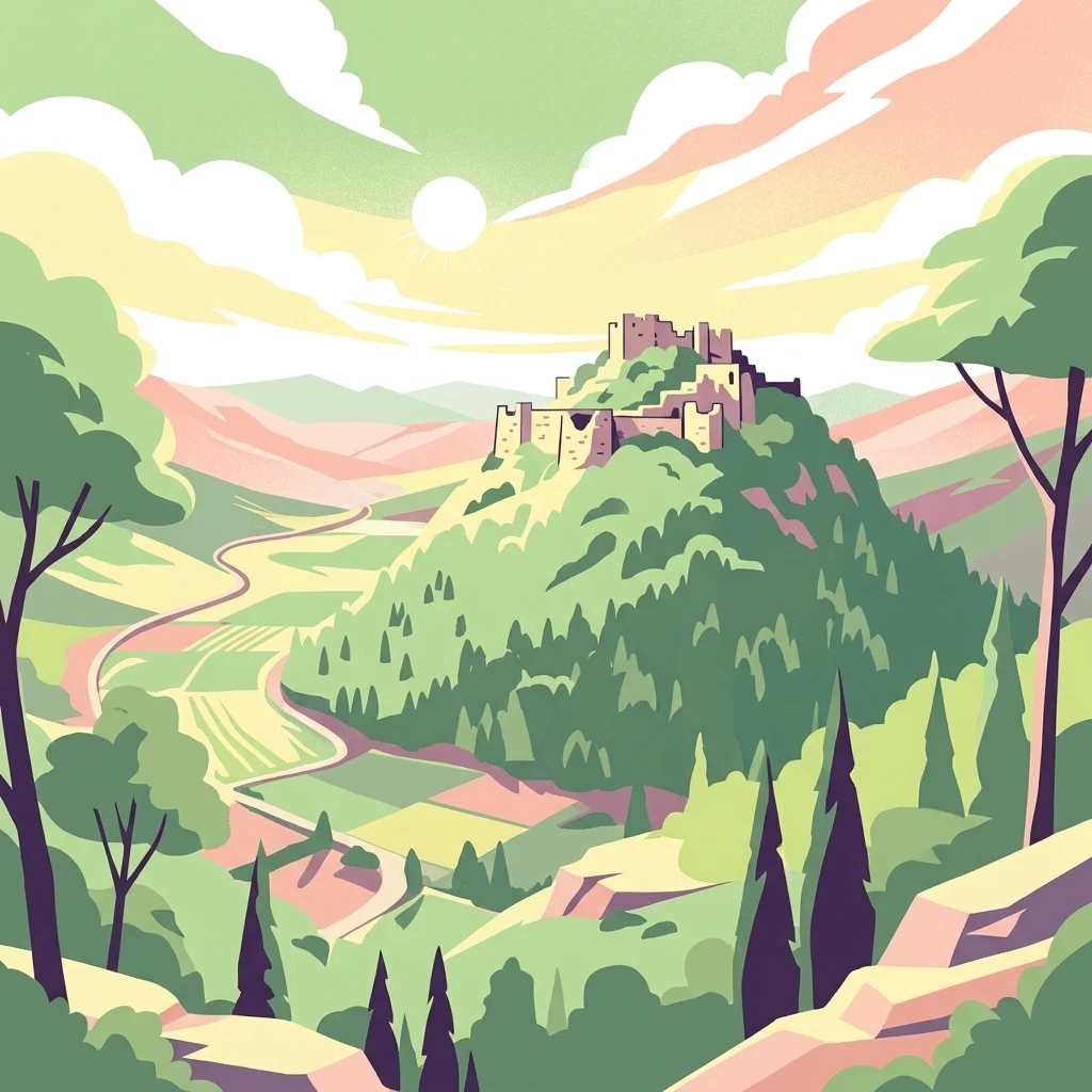
Illustration of a fortress on a hill with green fields and trees under a colorful sky

Nimrod Fortress

National park

Park overview

Structured park overview, official facts, and landscape profile for Nimrod Fortress

Nimrod Fortress park facts, protected area profile, and essential visitor context

Review the core facts for Nimrod Fortress, including designation, size, terrain, visitor scale, habitats, and operating context in one park-focused overview.

About Nimrod Fortress

Nimrod Fortress stands as a remarkable testament to medieval military architecture in the Levant, occupying a position of profound strategic importance throughout several centuries. The fortress was conceived not merely as a defensive structure but as a key element in the broader military and political architecture of the region, designed to protect the vital corridor that connected Damascus with the western territories. The structure's evolution reflects the complex tapestry of powers that controlled this crossroads of civilizations, from the early Hellenistic builders through the Crusader interventions to the significant Ayyubid and Mamluk expansions. The fortress's name evolved over time from its original Arabic designation Qal'at al-Subeiba, which referenced the imposing geological feature of the large cliff, to the later association with the biblical hunter Nimrod, a connection that emerged only in the 19th century through the Druze community that settled in the area. Today, the managed portions of the fortress allow visitors to explore the intricate network of corridors, chambers, and towers that once served as both residence and stronghold for regional governors.

Quick facts and research context for Nimrod Fortress

The fortress complex stretches 420 meters in length and 150 meters in width, constructed from large carefully squared stones. The prominent keep measures 65 by 45 meters and is protected by massive rectangular towers. The site features numerous rectangular and semi-circular towers, secret corridors with winding staircases, underground water cisterns with original plaster remnants, and defensive loopholes designed for archers. The fortress was significantly damaged by major regional earthquakes in 749, 1202, and 1759.

Protection and recognition

Documented terrestrial boundaries and transboundary protection frameworks for the reserve

Nimrod Fortress Terrestrial Protection Status and Transboundary Park Designation

Factual terrestrial protection status and transboundary management frameworks define the conservation profile of Nimrod Fortress. Researchers and park explorers can examine documented designation history alongside global database records to understand how regional geography shapes local preservation efforts.

Protection details

Protection scope
Terrestrial
Transboundary protection
Yes
Park context

Deeper park guide and search-rich context for Nimrod Fortress

Nimrod Fortress history, landscape, wildlife, and travel context

Explore Nimrod Fortress through its history, landscape character, ecosystems, wildlife, conservation priorities, cultural context, and seasonal travel timing in a structured park guide built for atlas discovery and search intent.

Why Nimrod Fortress stands out

Nimrod Fortress is best known as one of the largest and most impressive medieval fortifications in the Levant, with its strategic position controlling the ancient trade and military route between Damascus and Galilee. The fortress is notable for its complex architectural evolution spanning Hellenistic, Byzantine, Crusader, Ayyubid, and Mamluk periods, each layer contributing distinct construction styles and structural elements. The site is renowned for its sophisticated defensive features including loopholes, underground cisterns, and the well-preserved keep, as well as the panoramic views it offers over the Golan Heights and the surrounding landscape.
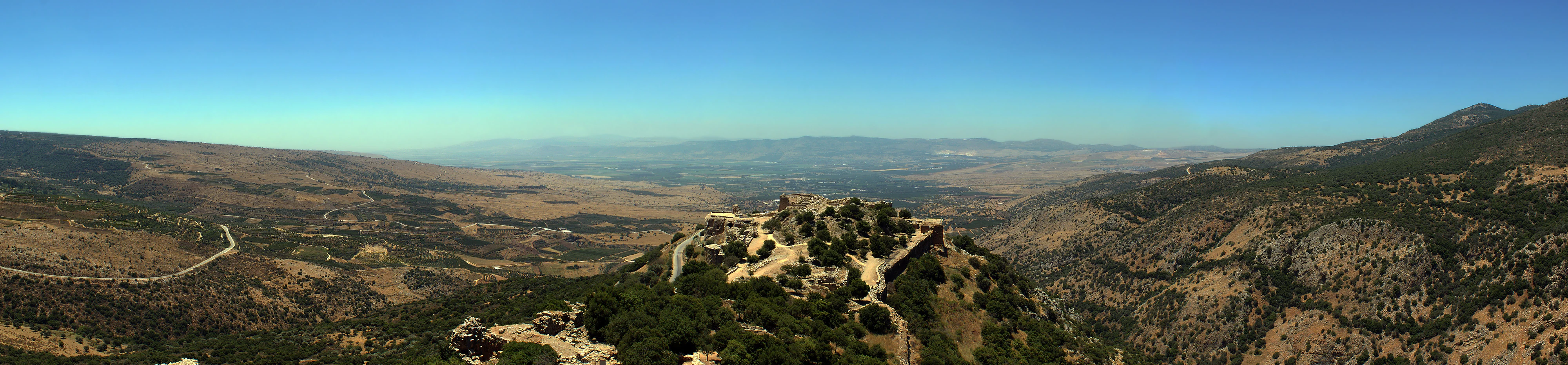
Nimrod Fortress on a hilltop with surrounding mountainous landscape under clear blue sky
Panoramic view of Nimrod Fortress from the upper portion looking west

Nimrod Fortress history and protected-area timeline

The earliest fortifications at the site likely date to the Hellenistic period, possibly constructed by Greco-Syrian builders after 332 BCE, though the precise origins remain subject to archaeological investigation. The catastrophic earthquake of 749 CE inflicted significant damage on these early structures. A subsequent Crusader building phase is evidenced by the distinctive cross-shaped rib vaults in the Eastern Hall, a construction technique never employed by Muslim builders. The fortress was rebuilt and greatly expanded around 1228 by Al-Aziz Uthman, son of Saladin's brother, in response to the approaches of the Sixth Crusade, and was further enlarged to encompass the entire ridge by 1230. In 1260, Mongol forces captured the fortress, dismantling some defenses before their defeat by the Mamluks at the Battle of Ain Jalut, after which Sultan Baibars strengthened the castle with larger towers and assigned it to his second-in-command Bilik, who undertook extensive construction activities memorialized in a 1275 inscription. Following the Muslim conquest of Acre and the end of Crusader rule in the Holy Land, the fortress lost its strategic significance and fell into disrepair. The Ottoman Turks used the site as a luxury prison for noble prisoners in the 16th century before its abandonment. The fortress was significantly damaged by the 1759 earthquake, and the Druze community that arrived during the 1860 Lebanon conflict began calling the site Qal'at Namrud, associating it with the biblical Nimrod.

Nimrod Fortress landscape and geographic character

Nimrod Fortress occupies a dramatic position on a ridge along the southern slopes of Mount Hermon, the highest peak in the Anti-Lebanon mountain range. The fortress commands views over a deep, narrow valley that physically separates Mount Hermon from the broader plateau of the Golan Heights. This elevated position at approximately 800 meters above sea level provides strategic visibility over the ancient road connecting the Galilee region with Damascus, as well as over the former Crusader settlement of Banias. The surrounding landscape is characterized by the rocky, semi-arid terrain typical of the northern Golan Heights, with the fortress built from large, carefully squared local stones that blend with the geological character of the ridge.
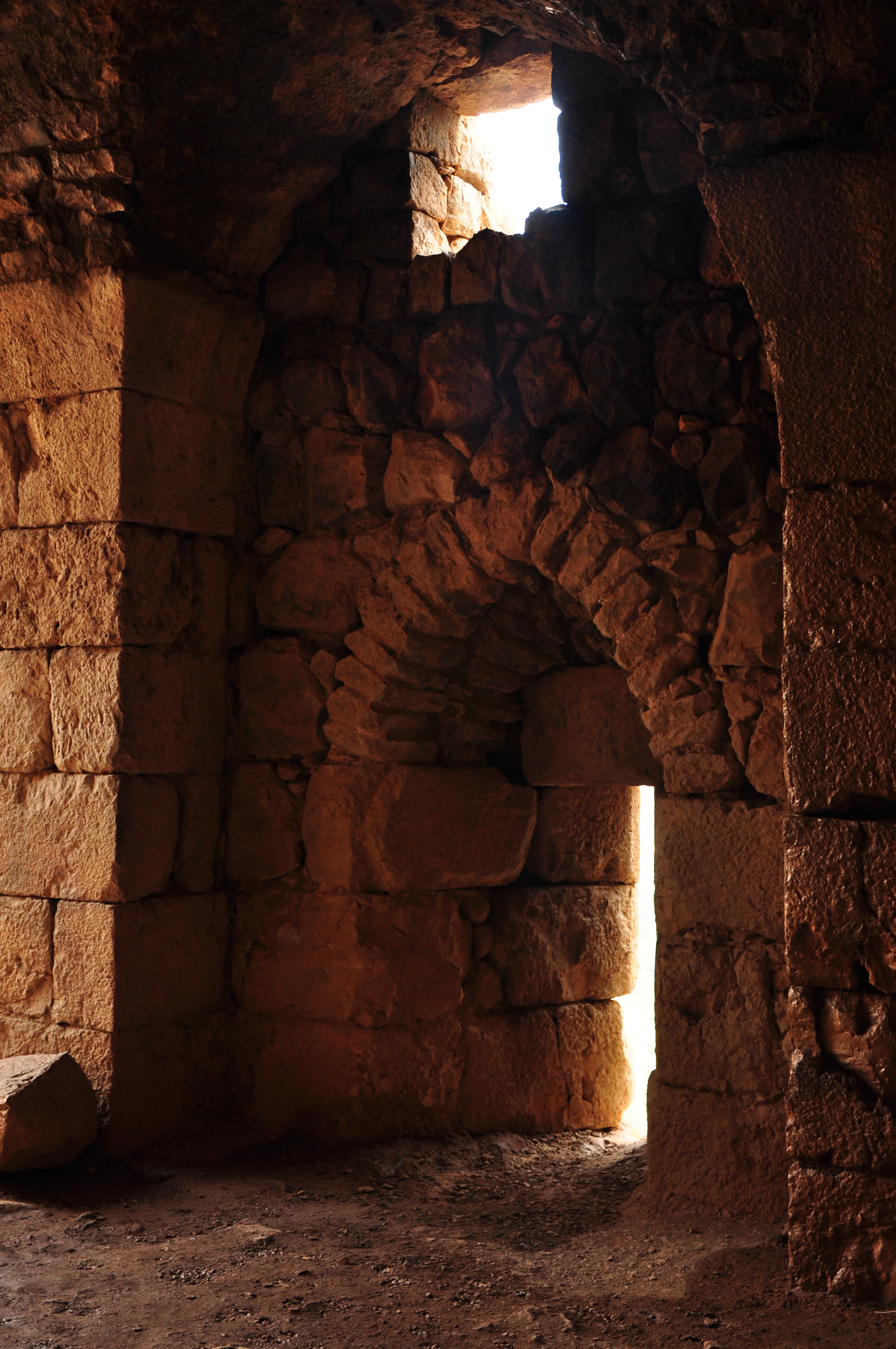
Stone archway with light streaming through an opening in a historic fortress interior
Interior view of Nimrod Fortress showing stone archway and light streaming through an opening

Nimrod Fortress ecosystems, habitats, and plant life

While Nimrod Fortress is primarily a historical and architectural site rather than a natural landscape, the Golan Heights region in which it is situated encompasses diverse Mediterranean and steppe ecosystems. The area around the fortress includes vegetation communities adapted to the semi-arid conditions at this elevation, with scrubland and grass covering the surrounding slopes. The strategic location along the slopes of Mount Hermon places the site within a transitional zone between the more lush upper elevations of the mountain and the drier Golan plateau.
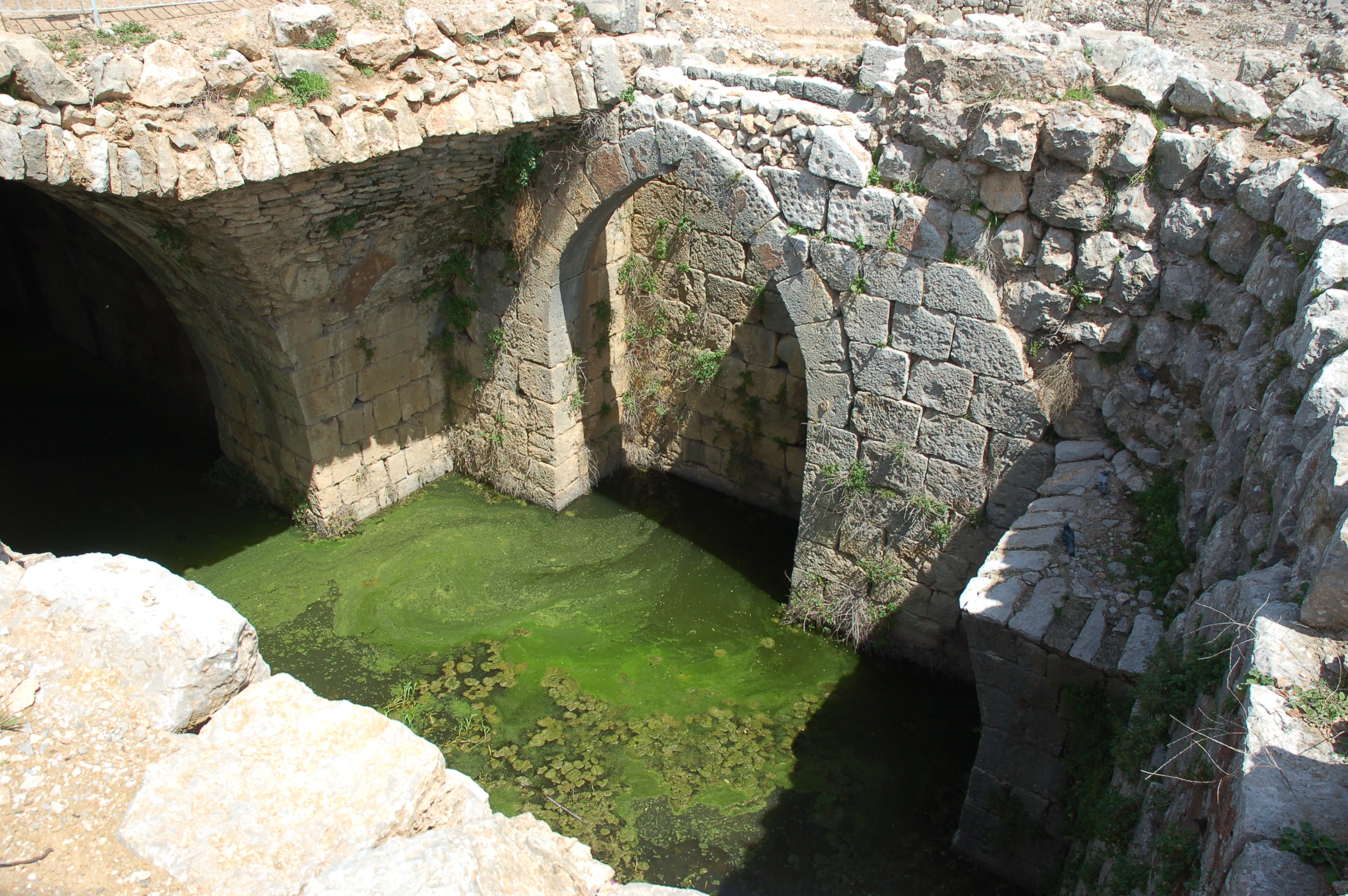
Stone arches of Nimrod Fortress with green water in a moat
Stone arches and green water-filled moat at Nimrod Fortress

Nimrod Fortress wildlife and species highlights

The Golan Heights region surrounding Nimrod Fortress supports various wildlife species adapted to the Mediterranean and steppe environments. The area is home to various bird species, small mammals, and reptiles typical of the rocky terrain and scrubland habitats. However, the fortress itself is primarily a historical site rather than a wildlife destination, and detailed wildlife records specific to the immediate fortress area are limited in the source material.
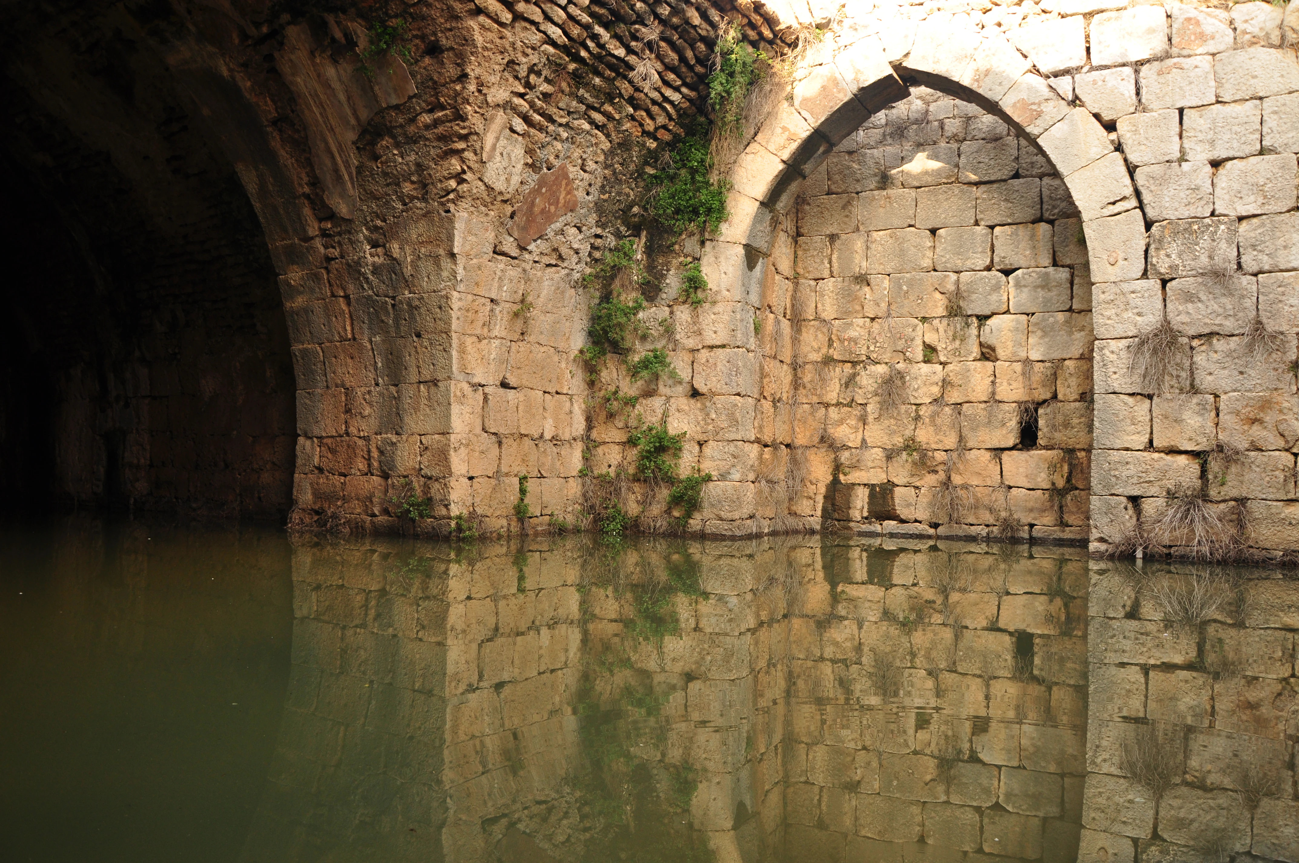
Stone arches and walls of a cistern filled with water, part of Nimrod Fortress
Main cistern of Nimrod Fortress with stone arches and water

Nimrod Fortress conservation status and protection priorities

The site is managed by the Israel Nature and Parks Authority, which maintains the excavated and restored portions of the fortress for public access and preservation. Conservation efforts have focused on stabilizing the ancient structures, particularly following earthquake damage sustained over the centuries. The designation as a managed historical site within the Golan Heights reflects the broader conservation framework applied to significant cultural heritage locations in the region.

Nimrod Fortress cultural meaning and human context

The cultural context of Nimrod Fortress is deeply intertwined with the complex historical layers of the Levant. The association with the biblical Nimrod, while historically inaccurate, emerged from the Druze community that settled in the area during the 1860 Lebanon conflict, adding a layer of local interpretive tradition to the site. The fortress's strategic position made it a prize for various powers seeking control over the Damascus-Galilee corridor, from Crusader lords to Mamluk sultans. The transition from a military stronghold to an Ottoman prison reflects the evolving functions of such structures as political circumstances changed. The nearby modern Israeli settlement of Nimrod carries the fortress's name into the present day.
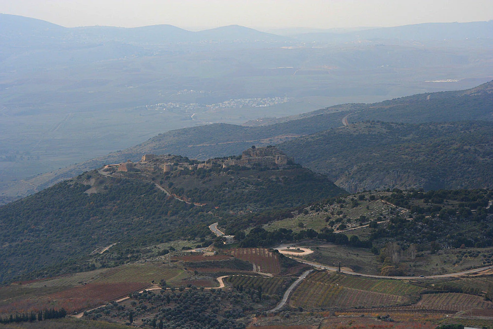
Wide landscape view of Nimrod Fortress on a hilltop with surrounding valleys and hills under overcast sky
Nimrod Fortress viewed from a high vantage point in the Golan Heights

Top sights and standout views in Nimrod Fortress

The fortress complex spans 420 meters in length and 150 meters in width, featuring numerous towers and defensive structures. The central keep, measuring 65 by 45 meters, represents the most imposing remaining structure. Visitors can explore secret corridors with winding staircases, underground water cisterns preserving original plaster, and numerous loopholes designed for archers to defend the walls while remaining protected. The western section contains what amounts to a fortress within a fortress, complete with the remnants of a moat and drawbridge, representing the oldest construction phase.
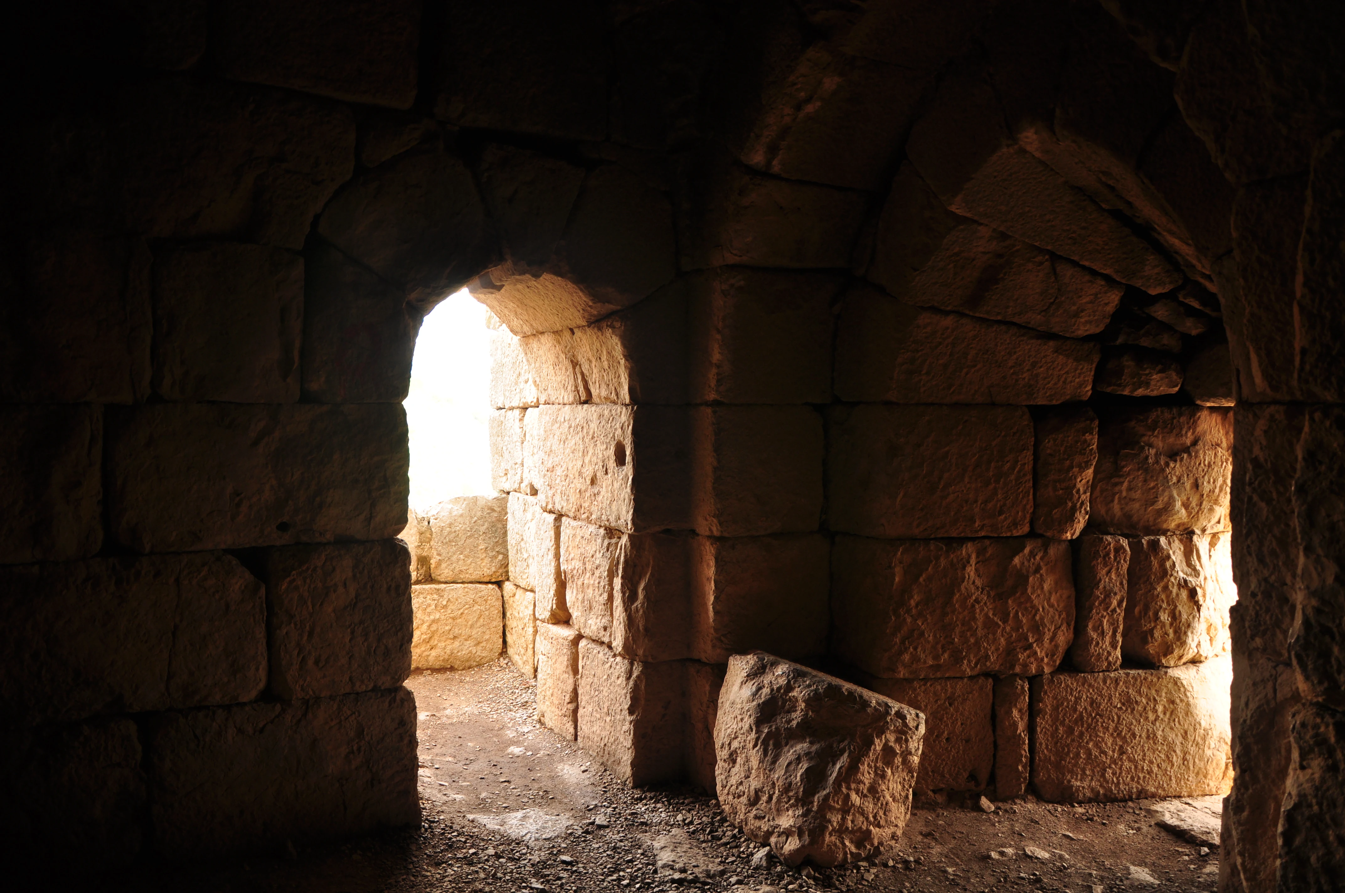
Stone interior room with arched openings showing light from an exterior space
Interior room of Nimrod Fortress showing stone walls and arched openings with light from exterior

Best time to visit Nimrod Fortress

The site is open to visitors from April through September from 8 a.m. to 5 p.m., and from October through March from 8 a.m. to 4 p.m. The spring and autumn months generally offer comfortable conditions for exploring the extensive ruins, while summer mornings provide good visibility for appreciating the strategic views over the surrounding landscape. Winter visits during the October to March season allow exploration of the site in quieter conditions, though the shorter opening hours should be considered.
Monthly climate preview

Long term representative measurements tracking twelve month weather patterns at elevation

Nimrod Fortress Climate Normals, Annual Temperature and Precipitation Rhythm

Representative coordinates record measured monthly temperature swings and precipitation rates across the historic terrain of Nimrod Fortress. Accessing the complete monthly profile provides detailed historical baseline data for analytical comparison.
Annual mean16 °C
7 °C25 °C
Jan
Feb
Mar10°
Apr14°
May19°
Jun23°
Jul25°
Aug25°
Sep23°
Oct19°
Nov13°
Dec
Warmest month
July

24.6 °C

Coolest month
January

6.8 °C

Wettest month
January

3.1 mm/day

Driest month
July

0 mm/day

Park location guide

Geography guide, regional context, and park location map for Nimrod Fortress

Nimrod Fortress park geography, regions, and map view in Israel

Understand where Nimrod Fortress sits in Israel through a broader geographic reading of the surrounding landscape, nearby location context, and its mapped position within the national park landscape.

How Nimrod Fortress fits into Israel

Israel is a parliamentary republic in the Southern Levant, established in 1948 as a Jewish homeland. It borders Lebanon, Syria, Jordan, and Egypt, with Mediterranean coastline and access to the Red Sea. Jerusalem is the capital, though its status is contested, while Tel Aviv is the largest urban area. The country has a high-income economy with strong technology and innovation sectors.

Wider geography shaping Nimrod Fortress in Israel

Israel occupies the Southern Levant region of West Asia. It is bordered by Lebanon to the north, Syria to the northeast, Jordan to the east, and Egypt to the southwest. The western coast lies on the Mediterranean Sea, while the southern tip reaches the Red Sea. The eastern border includes the Dead Sea, Earth's lowest point. The country occupies the West Bank, Gaza Strip, and Golan Heights.

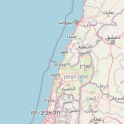
Map view of Nimrod Fortress

Use this park location map to pinpoint Nimrod Fortress in Israel, understand its exact geographic position, and read its mapped placement within the surrounding landscape more clearly.

Pigeon | © OpenStreetMap contributors

Explore the fortress's striking visual identity, from its commanding ridge position to the surrounding rocky terrain and panoramic Golan Heights views.

Nimrod Fortress: Visualizing the Medieval Castle's Dramatic Landscapes and Protected Area Scenery

Visually explore the impressive medieval architecture of Nimrod Fortress and understand its strategic placement on Mount Hermon's slopes, offering insight into its historical defense structures. The gallery showcases the dramatic rocky landscape of the Golan Heights and the fortress's commanding views, providing a clear picture of its unique protected-area environment.

Nimrod Fortress on a hilltop with surrounding mountainous landscape under clear blue sky

Stone walls and towers of Nimrod Fortress on a rocky hillside with vegetation and mountains in the background

Stone archway with light streaming through an opening in a historic fortress interior

Stone arches of Nimrod Fortress with green water in a moat

Stone arches and walls of a cistern filled with water, part of Nimrod Fortress

Stone ruins of Nimrod Fortress on a hillside with green vegetation and distant mountains

Wide landscape view of Nimrod Fortress on a hilltop with surrounding valleys and hills under overcast sky

Stone interior room with arched openings showing light from an exterior space

Park atlas

Explore the geographic spread and diverse protected landscapes surrounding this historic fortress in the Golan Heights

Discover Other National Parks and Protected Areas Near Nimrod Fortress

Browse national parks and protected areas geographically close to Nimrod Fortress, offering a comparative overview of the Golan Heights and Mount Hermon regions' diverse terrain. Continue your atlas exploration by tracing adjacent conservation landscapes and historical sites, revealing the interconnected regional geography of protected areas.
National parkGolan Heights
About 1.9 km away#1 closest

West

Hermon National Park: National Park with Distinct Protected Landscape in Golan Heights

Explore its mapped boundaries and regional geographic context.

Hermon National Park is a designated national park contributing to the rich tapestry of protected landscapes within the Golan Heights. This entity offers a focused entry into understanding its specific geographic setting, mapped terrain, and its significance as a protected area. Users can explore the natural features and regional context that define Hermon National Park, enhancing their atlas-based discovery of Israel's conservation lands.

IUCN
V
Watercolor painting with green, pink, yellow, and white areas depicting terrain and water
National parkIsrael
About 8.7 km away#2 closest

Southwest

Hurshat Tal National Park: Ancient Valonia Oak Forest and Protected Landscape Identity

Explore mapped boundaries and geographic context in Israel's Hula Valley.

Hurshat Tal National Park is a protected area in northern Israel’s Hula Valley, distinguished by its extraordinary grove of ancient Valonia oak trees, some dating back 350 to 400 years. This site offers a rare look at a living forest heritage, serving a dual role as a crucial nature conservation zone and a popular family recreational destination with facilities like accommodation and swimming areas, making it a unique feature on any park atlas.

Area
0.765 km²
Established
1968
IUCN
V
Relief
Lowland
Biosphere reserveLebanon
About 26 km away#3 closest

Northwest

Jabal Rihane Biosphere Reserve: Exploring Lebanon's Protected Mountainous Geography

Discover mapped boundaries and regional landscape context.

Jabal Rihane Biosphere Reserve is a protected natural area vital to Lebanon's conservation efforts. Situated in the mountainous north, it showcases the region's characteristic terrain and Mediterranean hillside environments. Understanding Jabal Rihane's geographic identity through its mapped boundaries and ecological role provides crucial context for exploring Lebanon's protected lands and natural heritage within the eastern Mediterranean.

Area
184.3 km²
Established
2007
IUCN
VI
Relief
Mountain
Nature reserveNabatieh District
About 26 km away#4 closest

West

Wadi al-Hujeir Nature Reserve: Protected Terrain and Mediterranean Woodland Geography

Highland valley landscape in the Nabatieh District of Southern Lebanon

Wadi al-Hujeir is a significant nature reserve characterized by its mature Valonia oak forests and ancient olive groves. This valley serves as a critical protected landscape, offering deep insight into the regional geography and Mediterranean woodland ecosystems of Southern Lebanon.

Area
26 km²
Established
2010
Relief
Upland
Climate
Mediterranean
National parkIsrael
About 30 km away#5 closest

Southwest

Tel Hazor National Park: Protected Landscape Details and Geographic Atlas Context

Explore the mapped boundaries and regional character of this Israeli national park.

Tel Hazor National Park is a protected national park entity situated within the geography of Israel. This page provides detailed information on its protected landscape, emphasizing its mapped boundaries and contribution to regional natural landscape context. Discover the geographic identity of Tel Hazor National Park and its significance for atlas exploration of protected areas in the Levant.

Relief
Upland
Scope
Mixed
Water
Minor water
National parkIsrael
About 36 km away#6 closest

Southwest

Bar'am National Park: Preserving Ancient Jewish Heritage and Galilee Landscape

Explore significant Talmudic-era synagogues and borderland geography.

Bar'am National Park is an important archaeological site in Israel's upper Galilee, renowned for its remarkably preserved ancient Jewish synagogues dating to the Talmudic period. These structures represent significant tangible evidence of Jewish religious life and architectural styles from late antiquity. Situated amidst the rolling hills of the Galilee countryside, the park's landscape offers a unique combination of historical reflection and scenic views towards the Lebanese border, making it a key destination for understanding regional heritage and geography.

Relief
Upland
Access
Moderate access
Scope
Terrestrial
Water
No major water
National parkNorthern District
About 41 km away#7 closest

South

Korazim National Park: Protected Landscape and Ancient Site Atlas in Northern District

Mapped basalt plateau and Galilean archaeological context.

Korazim National Park offers a unique exploration of protected landscape and ancient history on Israel's Korazim plateau. This national park preserves the archaeological site of Chorazin, a biblical-era town, set within an elevated volcanic terrain. The park's geography is defined by the basaltic geology characteristic of the eastern Galilee, providing wide views toward the Sea of Galilee and the surrounding regions. Understanding Korazim National Park involves appreciating its role as a protected area where natural terrain and historical preservation converge within the mapped geography of the Northern District.

Relief
Upland
Climate
Mediterranean
Scope
Terrestrial
Water
Major water bodies
Nature reserveLebanon
About 47 km away#8 closest

West

Tyre Coast Nature Reserve: Lebanon's Protected Nature Reserve Geography and Atlas Mapping

Discover the mapped natural landscape and regional context.

Tyre Coast Nature Reserve represents a distinct protected area within Lebanon, offering a unique focus for geographic exploration. This entry provides detailed insights into its mapped boundaries, situating it within the broader natural landscape and regional geography of the country. Engage with the structured atlas data to understand the specific protected land identity and geographic characteristics of this nature reserve.

Area
3.8 km²
Established
1998
Relief
Lowland
Climate
Mediterranean

Common questions about visiting, size, designation, and location context for Nimrod Fortress

Nimrod Fortress FAQs for park facts, access, geography, and protected area context

Find quick answers about Nimrod Fortress, including protected-area facts, park geography, trail and visitor context, and how the park fits into its surrounding country and regional landscape.
MoriAtlas Explorer

Continue Your Protected Areas Search Across the Global Atlas

Deepen your exploration by continuing the structured search for national parks and protected areas worldwide. Utilize the comprehensive filtering capabilities to compare different conservation landscapes and refine your understanding of global park geography. Discover more about the distribution and characteristics of protected natural areas.

Global natural geography