
Viewpoints
Park geography
A detailed look at the 2,578 square kilometer landscape, terrain, and recorded natural features.
Comprehensive Geographic Profile and Mapped Boundaries of Nxai Pan National Park, Botswana
Analyze the spatial data and environmental makeup of Nxai Pan National Park located in the north-eastern region of Botswana. This profile details the 2,578 square kilometer expanse, encompassing arid desert plains, sparse forests, and seasonally distinct wetland systems such as the Nxai Pan and Kudiakam Pan.
Related tags
Wilderness AreaBaobab ForestsSalt Pan LandscapeKAZA TFCASeasonal Wetlands
Baobab-studded wilderness on the edge of Botswana's ancient salt pans
Nxai Pan National Park
Nxai Pan National Park is a vast wilderness area in north-eastern Botswana, protecting a portion of the Makgadikgadi Pan system, one of the largest salt flat complexes in Africa. Established in 1992 and spanning approximately 2,578 square kilometres, the park encompasses the fossil lake bed of Nxai Pan, a remnant of the ancient Lake Makgadikgadi that once covered much of this region. The landscape is characterised by expansive salt-crusted pan surfaces, sparse grasslands, and distinctive baobab-adorned islands that rise like sentinels from the flat terrain. The park forms part of the Kavango-Zambezi Transfrontier Conservation Area, the world's second-largest nature conservation area, linking protected landscapes across five southern African nations. This remote wilderness offers visitors a distinctive safari experience centred on iconic African wildlife against a backdrop of otherworldly salt pan scenery.
- Location
- Botswana
- Park type
- National park
- Established
- 1992
- Area
- 2,578 km²
Location overview
Geographic placement within North-Eastern Botswana and national boundaries
Nxai Pan National Park: Geographic Location and National Setting
Nxai Pan National Park is situated within North-Eastern Botswana as an inland conservation territory. Atlas records detail its regional placement and status as a single-country protected landscape.
- Countries
- Botswana
- Regions
- North-Eastern Botswana
- Primary location
- Botswana
- Geographic setting
- Inland
Boundary and coordinates
Interactive boundary geometry and recorded spatial metrics
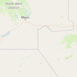
Nxai Pan National Park Boundary Map and Geographic Extent
Mapped park outlines provide clear spatial context for the protected territory. Accompanying boundary facts detail total area spans and coordinate limits without implying legal survey precision.
- Boundary area
- 2,507.2 km²
- Boundary perimeter
- 237.3 km
- Northernmost point
- 19.536° S
- Southernmost point
- 20.2774° S
- Easternmost point
- 24.9999° E
- Westernmost point
- 24.5578° E
- Geographic centre
- 19.9084° S, 24.827° E
- North–south span
- 82.1 km
- East–west span
- 46.3 km
Terrain and natural features
Lowland relief classifications and recorded natural features
Nxai Pan National Park Terrain and Named Natural Features
Nxai Pan National Park features a lowland relief classification alongside multiple recorded natural features located within its boundaries. Linked feature cards provide names, types, measurements, and spatial relationships where documented.
Selected named natural features
Viewpoints
Waterhole #3
Wetlands
Khama Khama Pan
Viewpoints
waterhole
Viewpoints
Waterhole #1
Wetlands
Kudiakam Pan
Environmental setting
Arid lowland relief, sparse forest cover, and strongly seasonal water features
Nxai Pan National Park Environmental Setting and Classification Profile
Recorded habitat types, landscape features, and climate zones combine to frame the physical setting of Nxai Pan National Park. Associated classifications connect stored categories to relevant atlas destinations across the region.
- Relief
- Lowland
- Climate
- Arid
- Water
- Minor water
- Forest cover
- Sparse forest
- Seasonality
- Strongly seasonal
Landscape features
Wetland · Forest · Grassland · Desert
Habitat types
Grassland · Wetland · Desert habitat
Park atlas
Trace the regional spread of diverse protected landscapes surrounding Nxai Pan National Park in Southern Africa
Explore Other National Parks and Protected Areas Near Nxai Pan National Park
Continue your exploration from Nxai Pan National Park to browse a curated list of national parks and protected areas across the surrounding Southern African region. Compare diverse landscapes and conservation zones, tracing their geographic spread and regional context, from vast salt pans to adjacent wilderness areas within the KAZA TFCA.
National parkBotswana
59 km away#1 closest
North

Chobe National Park: Botswana National Park Atlas and Mapped Landscape Explorer
Discover Botswana's diverse protected areas and unique savanna wetlands.
Chobe National Park represents a cornerstone of protected land discovery in Botswana, offering an unparalleled glimpse into a landscape shaped by dynamic water systems and iconic wildlife. This national park is not merely a destination; it is a vital ecosystem supporting vast elephant populations and showcasing a remarkable variety of terrain from riverine floodplains to savanna marshes. Understanding Chobe National Park through its mapped boundaries and regional geographic context reveals its significance as a protected natural area with diverse habitats supporting critical conservation efforts.
- Area
- 11,700 km²
- Established
- 1967
- IUCN
- II
- Relief
- Mixed relief
National parkBotswana
About 70 km away#2 closest
Southeast
Makgadikgadi Pans National Park: A Protected Landscape in Botswana's Geographic Atlas
Explore its mapped boundaries and regional natural terrain.
Makgadikgadi Pans National Park is a designated national park in Botswana, contributing significantly to the region's atlas of protected lands. This page details its geographic scope, emphasizing its role as a mapped natural landscape within Southern Africa. Explore the park's unique protected-area identity and understand its place within Botswana's diverse, largely Kalahari Desert-influenced terrain.
- Relief
- Lowland
- Climate
- Arid
- Scope
- Terrestrial
- Water
- Major water bodies
National parkMatabeleland North
112 km away#3 closest
Northeast

Hwange National Park: Explore its Mapped Boundaries and Protected Landscape in Matabeleland North
National Park with distinct geographic and landscape context.
Gain a structured understanding of Hwange National Park, a designated national park within the Matabeleland North region of Zimbabwe. This detailed entry focuses on its precise mapped boundaries and its contribution to the regional geography. Ideal for atlas-based discovery, it highlights Hwange National Park as a key protected landscape for understanding conservation and natural terrain distribution.
- Area
- 14,651 km²
- Established
- 1961
- IUCN
- II
- Relief
- Lowland
National parkZimbabwe
About 149 km away#4 closest
Northeast
Kazuma Pan National Park: Zimbabwe National Park Atlas and Protected Landscape Exploration
Unique plains landscape with reliable dry-season wildlife viewing.
Kazuma Pan National Park offers a rare glimpse into Zimbabwe's expansive grassy plains and vital pans, creating a unique protected landscape. This national park is critical for understanding regional wildlife migrations and the geographic context of conservation areas in northwestern Zimbabwe, providing an essential entry point for atlas-based exploration of its terrain and ecological significance.
- Area
- 313 km²
- Established
- 1975
- IUCN
- II
- Relief
- Lowland
National parkNamibia
About 176 km away#5 closest
Northwest

Nkasa Rupara National Park: A Protected Landscape within Namibia's Geography
Explore the mapped protected area and its regional landscape context.
Nkasa Rupara National Park represents a distinct protected landscape within Namibia. This entry provides detailed geographic context, focusing on the park's mapped boundaries and its role as a national park. Understand how this protected area contributes to the broader regional geography, offering a focal point for atlas-based exploration of Namibia's natural lands.
- Area
- 320 km²
- Established
- 1990
- IUCN
- II
- Relief
- Lowland
National parkHwange District
About 190 km away#6 closest
North
Zambezi National Park: National Park within Hwange District's Geographic Landscape
Explore mapped boundaries and protected area context.
Delve into Zambezi National Park, a designated national park situated in Hwange District. This entry provides foundational geographic and landscape context, highlighting the park's protected status and its position within the regional terrain. Understand the atlas significance and mapped features of this conservation landscape for informed discovery.
- Area
- 560 km²
- Established
- 1979
- Relief
- Lowland
- Climate
- Subtropical
National parkZimbabwe
193 km away#7 closest
North
Victoria Falls National Park: A Protected Landscape Within Zimbabwe's Geography
Atlas exploration of park boundaries and natural terrain.
Victoria Falls National Park is a key component of Zimbabwe's protected natural areas. This page provides structured information ideal for atlas-based exploration, detailing the park's geographic position and mapped landscape features. Understand its significance as a national park and its contribution to the region's conservation geography.
- Area
- 23.4 km²
- IUCN
- II
- Relief
- Mixed relief
- Climate
- Tropical
National parkCaprivi Region
About 204 km away#8 closest
Northwest
Mudumu National Park National Park: Discover its Protected Landscape and Geographic Boundaries
Mapping the protected area and regional landscape context in Caprivi Region.
Navigate the protected geography of Mudumu National Park, a designated national park situated within the Caprivi Region. This entry provides a structured atlas view of its mapped boundaries and landscape context. Gain a clear understanding of its protected status and its place within the regional geographic framework, offering essential detail for map-based exploration of natural areas in Namibia.
- Area
- 737 km²
- Established
- 1990
- Relief
- Lowland
- Climate
- Tropical
MoriAtlas Explorer
Continue Exploring Nxai Pan National Park's Geographic Identity and Atlas Context
Delve deeper into understanding Nxai Pan National Park's place within Botswana's protected landscapes. Learn more about its specific geography, the nature of its salt pan terrain, and how its mapped boundaries contribute to the regional conservation atlas. This exploration provides structured insight into the park's unique environmental characteristics and its significance as a mapped natural area.
Browse next
Global natural geography
Explore related park routes
Explore MoriAtlas Global ParksBrowse All MoriAtlas ParksGlobal Park Map DiscoveryMoriAtlas: Browse All CountriesBrowse All MoriAtlas ContinentsNational Park Environment AtlasGrand Canyon National Park AtlasYellowstone National Park AtlasYosemite National Park Atlas and GeographySerengeti National Park AtlasGalápagos National Park Protected LandscapeBanff National Park Geography and AtlasKruger National Park Atlas EntryUluṟu-Kata Tjuṯa National Park AtlasExplore Uluru-Kata Tjuta National Park GeographyPlitvice Lakes National Park AtlasFiordland National Park Protected LandscapeGreat Smoky Mountains National Park AtlasAfghanistan National Parks and Protected AreasAlbania National Parks and Protected AreasAlgeria National Parks and Protected AreasAmerican Samoa National Parks and Protected AreasAndorra National Parks and Protected AreasAngola National Parks and Protected AreasAntarctica National Parks and Protected AreasAntigua and Barbuda Park List