
Islands
Park geography
A detailed look at the island terrain, coastal span, and polar environmental context.
Geographic Profile of Qausuittuq National Park: Mapped Boundaries and Physical Features
This geographic profile tracks the physical extent and landscape characteristics of Qausuittuq National Park in Nunavut. Review structured data regarding the 11,000 square kilometer boundary, coastal geography, and regional upland terrain. Analyze the distribution of mapped capes and coastal features within this protected polar ecosystem.
Related tags
Arctic wildernessNational parkPeary caribou habitatHigh Arctic islandsProtected area
Arctic wilderness protecting critical Peary caribou habitat on Bathurst Island
Qausuittuq National Park
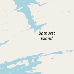
Qausuittuq National Park is a vast Arctic protected area located on northwest Bathurst Island in Nunavut, Canada. Established on September 1, 2015, it became Canada's 45th national park and was created to represent the Western High Arctic natural region, one of 39 distinct ecological regions identified by Parks Canada. The park encompasses more than 11,000 square kilometers of tundra, rolling hills, and coastal landscapes in one of Canada's most remote and sparsely populated regions. The name Qausuittuq, pronounced Qow-soo-ee-tooq, comes from Inuktitut and means place where the sun does not rise, capturing the extreme Arctic environment where winter darkness persists for months. This protected area safeguards critical habitat for the endangered Peary caribou and supports a fragile ecosystem adapted to extremely cold, dry conditions with minimal precipitation.
- Location
- Canada
- Park type
- National park
- Established
- 2015
- Area
- 11,000 km²
Location overview
Protected island and coastal environments within the Nunavut territory
Geographic Position of Qausuittuq National Park in Northern Canada
Qausuittuq National Park is situated within the Nunavut territory of Canada. The protected area features distinct coastal, island, and marine classifications that define its high-level geography.
- Countries
- Canada
- Regions
- Nunavut
- Primary location
- Nunavut
- Geographic setting
- Coastal · Island · Marine
Boundary and coordinates
Mapped protected area geometry and derived spatial measurements
Qausuittuq National Park Boundary Map and Spatial Extent
Spatial mapping outlines the protected perimeter and geographic limits for Qausuittuq National Park. Derived measurements provide area coverage and coordinate spans without survey precision.
- Boundary area
- 11,067.6 km²
- Boundary perimeter
- 1,581.6 km
- Northernmost point
- 76.7653° N
- Southernmost point
- 75.4993° N
- Easternmost point
- 98.498° W
- Westernmost point
- 104.4778° W
- Geographic centre
- 76.139° N, 100.9251° W
- North–south span
- 141.3 km
- East–west span
- 160 km
Terrain and natural features
Upland terrain classifications and recorded within park boundaries
Qausuittuq National Park Terrain and Named Natural Features
Upland relief classifications govern the regional landscape alongside recorded islands, bays, capes, and inlets contained within the protected area. Linked feature cards supply specific names, types, and spatial relationships for every registered natural feature.
Selected named natural features
Bays
Grinnell Ridge Basin
Islands
Helena Island
Capes
Cape Head
Islands
Phillipps Island
Peaks
Stokes Range
Environmental setting
Polar climate zones, upland relief, and tundra habitats across island terrain
Qausuittuq National Park Environmental Setting and Physical Geography
Recorded landscape features and habitat types provide complementary ways to read the physical setting of this polar region. Structured categories link directly to relevant atlas destinations for deeper geographic comparison.
- Relief
- Upland
- Climate
- Polar
- Water
- Major water bodies
- Forest cover
- No forest cover
- Seasonality
- Strongly seasonal
Landscape features
Islands · Glacier · Hills · Coast · Beach · Tundra
Habitat types
Tundra habitat · Coastal habitat · Marine habitat · Glacial habitat
Park atlas
Explore the geographic spread of protected areas and high Arctic landscapes throughout Nunavut, extending beyond Qausuittuq National Park
Explore Related Protected Areas and National Parks Near Qausuittuq National Park
Browse other national parks and protected areas located in the Canadian Arctic, including those across Nunavut and the Queen Elizabeth Islands, to discover diverse high Arctic environments. Compare their vast tundra ecosystems, unique geological features, and critical conservation efforts, providing essential context for regional protected landscape understanding and exploration.
National parkNorthwest Territories
436 km away#1 closest
West

Aulavik National Park: Northwest Territories National Park Protected Landscape and Geographic Context
Explore the mapped boundaries and regional park geography.
Gain a clear understanding of Aulavik National Park's protected status and its placement within the Northwest Territories. This detail page offers focused atlas exploration of the park's geographic identity, mapped features, and its significance as a National Park within Canada's northern geography. Discover the unique landscape context of this protected area for in-depth geographic study and discovery.
- Area
- 12,200 km²
- Established
- 1992
- IUCN
- II
- Visitors
- 34 annual
Wildlife reserveNorthwest Territories
476 km away#2 closest
West
Zugvogelschutzgebiet Banks Island No. 2: Protected Tundra and River Valley Geography
High Arctic wildlife reserve in the Northwest Territories
This wildlife reserve protects the Thomsen River valley and coastal estuary, serving as a primary moulting ground for Arctic waterfowl. Its geography defines a unique convergence of riverine and upland tundra habitats within the broader protected landscape of the Canadian Northwest Territories.
- Area
- 170 km²
- Established
- 1961
- IUCN
- Ia
- Relief
- Lowland
National parkNunavut
About 616 km away#3 closest
East
Sirmilik National Park: Nunavut National Park Atlas and Protected Landscape Map
Explore the geographic boundaries and regional context of Sirmilik National Park.
This entry provides detailed insights into Sirmilik National Park, a designated national park situated in Nunavut, Canada. It serves as a focal point for understanding the park's specific geography, its mapped protected landscape, and its role within the regional atlas. Users can explore the park's defined boundaries and its contribution to the broader landscape context of Nunavut, making it an essential destination for detailed geographic discovery.
- Area
- 22,200 km²
- Established
- 2001
- IUCN
- II
- Visitors
- 6 annual
National parkNunavut
672 km away#4 closest
Northeast
Quttinirpaaq National Park: A Detailed Look at its Protected Landscape and Nunavut Geography
Mapped boundaries and regional context for this significant Arctic national park.
Gain a comprehensive understanding of Quttinirpaaq National Park, a protected national park located in the expansive region of Nunavut, Canada. This resource delves into the park's geographic identity, its mapped contours, and its position within the broader arctic landscape context. It is designed to support atlas-based exploration and a detailed appreciation of this protected area's unique setting within Northern Canada's geography.
- Area
- 37,775 km²
- Established
- 1988
- IUCN
- II
- Visitors
- 7 annual
National parkNorthwest Territories
890 km away#5 closest
Southwest
Tuktut Nogait National Park: Northwest Territories Protected Landscape Atlas
Explore its mapped boundaries and regional geography.
Delve into Tuktut Nogait National Park, a protected national park situated within the vast geography of the Northwest Territories. This entry provides a focused view of the park's specific identity, its defined protected area boundaries, and its contribution to the regional landscape atlas. Understanding Tuktut Nogait National Park means grasping its geographic context and its role as a key natural landscape within the broader Canadian protected area network, ideal for detailed map-based study.
- Area
- 18,100 km²
- Established
- 1998
- IUCN
- II
- Visitors
- 12 annual
National parkGreenland
894 km away#6 closest
Northeast

Northeast Greenland National Park: Arctic Wilderness and Protected Landscape Atlas
Explore the world's largest national park and its mapped terrain.
Northeast Greenland National Park represents an extraordinary expanse of Arctic wilderness, renowned as the largest protected area globally. This national park protects a diverse landscape, from the interior Greenland Ice Sheet to dramatic glacial fjords and ice-free polar desert regions. Discover its extensive mapped boundaries and its significance as a sanctuary for vital Arctic megafauna, offering a profound case study in large-scale protected landscape geography.
- Area
- 972,000 km²
- Established
- 1974
- IUCN
- II
- Relief
- Mixed relief
National parkNunavut
1,063 km away#7 closest
Southeast
Ukkusiksalik National Park: Nunavut Protected Area Geography and Map Context
Explore the protected landscape and mapped terrain of this Canadian National Park.
Ukkusiksalik National Park serves as a protected national park within Nunavut, offering a distinct geographic identity. This entry provides structured insights into the park's mapped boundaries and its surrounding regional landscape, facilitating a deeper understanding of its place within the broader atlas of protected areas. Examine the geographic context and discover the unique attributes of Ukkusiksalik National Park's protected territory.
- Area
- 20,885 km²
- Established
- 2003
- IUCN
- II
- Relief
- Mixed relief
Wildlife reserveNunavut
1,192 km away#8 closest
East
Ninginganiq National Wildlife Area: Geographic Overview and Protected Landscape Mapping
A vital Arctic wildlife reserve on Baffin Island, Nunavut.
Ninginganiq National Wildlife Area stands as a cornerstone of Arctic conservation, encompassing the fog-defined shores of Isabella Bay. This protected area on Baffin Island serves as a critical seasonal feeding ground for bowhead whales and protects a vast expanse of tundra, marine inlets, and coastal ecosystems. Its establishment reflects a cooperative stewardship model between the federal government and Inuit communities, grounding this reserve in both ecological importance and cultural history.
- Area
- 3,362 km²
- Established
- 2010
- IUCN
- Ib
- Relief
- Lowland
MoriAtlas Explorer
Continue Exploring Qausuittuq National Park's Geographic and Landscape Context
Expand your understanding of Qausuittuq National Park by delving deeper into its mapped terrain and regional geographic significance. This focused exploration helps you appreciate its role as a protected national park and contributes to a broader atlas-based view of Canada's natural landscapes. Continue to discover the specifics of its protected boundaries and the unique geography that defines this significant area.
Browse next
Global natural geography
Explore related park routes
Explore MoriAtlas Global ParksBrowse All MoriAtlas ParksGlobal Park Map DiscoveryMoriAtlas: Browse All CountriesBrowse All MoriAtlas ContinentsNational Park Environment AtlasGrand Canyon National Park AtlasYellowstone National Park AtlasYosemite National Park Atlas and GeographySerengeti National Park AtlasGalápagos National Park Protected LandscapeBanff National Park Geography and AtlasKruger National Park Atlas EntryUluṟu-Kata Tjuṯa National Park AtlasExplore Uluru-Kata Tjuta National Park GeographyPlitvice Lakes National Park AtlasFiordland National Park Protected LandscapeGreat Smoky Mountains National Park AtlasAfghanistan National Parks and Protected AreasAlbania National Parks and Protected AreasAlgeria National Parks and Protected AreasAmerican Samoa National Parks and Protected AreasAndorra National Parks and Protected AreasAngola National Parks and Protected AreasAntarctica National Parks and Protected AreasAntigua and Barbuda Park List