Mori Atlas logo
National parkQausuittuq National Park

Discover the mapped geography and protected area boundaries of Qausuittuq National Park.

Qausuittuq National Park: Nunavut National Park Atlas and Protected Landscape Explorer

Qausuittuq National Park stands as a significant protected national park within Nunavut. This page serves as your dedicated entry point for understanding its distinct protected landscape identity and its place within the broader regional geography. Engage with detailed map-based context, explore its precisely defined park boundaries, and gain structured insights essential for atlas-driven discovery of this unique Canadian protected area.

Arctic wildernessNational parkPeary caribou habitatHigh Arctic islandsProtected areaCanadian Arctic

Qausuittuq National Park

National park

Park overview

Structured park overview, official facts, and landscape profile for Qausuittuq National Park

Qausuittuq National Park park facts, protected area profile, and essential visitor context
Review the core facts for Qausuittuq National Park, including designation, size, terrain, visitor scale, habitats, and operating context in one park-focused overview.

About Qausuittuq National Park

Qausuittuq National Park occupies the northwestern portion of Bathurst Island in the Canadian Arctic Archipelago, within the territory of Nunavut. This remote park represents the Western High Arctic natural region, one of 39 distinct ecological regions identified by Parks Canada for representation in the national park system. The park was established in 2015 as Canada's 45th national park, fulfilling a long-term conservation goal for this biologically significant yet vulnerable Arctic ecosystem. The creation of the park followed a feasibility study initiated in 1994, with lands first withdrawn in 1996 and Inuit Impact and Benefit Agreement negotiations beginning in 2009. The park protects rolling tundra hills, coastal areas, and the critical habitat that supports populations of Peary caribou, one of Canada's most endangered caribou subspecies. The extreme Arctic environment presents significant challenges for both wildlife and any visitors, with mean temperatures remaining below freezing for most of the year and annual precipitation measuring less than 130 millimeters. The park's isolation means that access is extremely limited, with Resolute on Cornwallis Island serving as the nearest community.

Quick facts and research context for Qausuittuq National Park

Qausuittuq National Park is situated on northwest Bathurst Island in Canada's Arctic Archipelago within the territory of Nunavut. The park was established in 2015 and covers over 11,000 square kilometers of high Arctic terrain. It represents the Western High Arctic natural region and protects important Peary caribou habitat. The nearest community is Resolute on Cornwallis Island to the southeast. The park features sedimentary geology including limestone, sandstone and dolomite, with glaciated landforms such as eskers, moraines and beach terraces. The climate is extremely cold with mean temperatures ranging from -35°C in January to 5°C in July and annual precipitation below 130 millimeters.

Park context

Deeper park guide and search-rich context for Qausuittuq National Park

Qausuittuq National Park history, landscape, wildlife, and travel context
Explore Qausuittuq National Park through its history, landscape character, ecosystems, wildlife, conservation priorities, cultural context, and seasonal travel timing in a structured park guide built for atlas discovery and search intent.

Why Qausuittuq National Park stands out

Qausuittuq National Park is best known for protecting one of the most significant remaining habitats for the Peary caribou, a endangered subspecies adapted to high Arctic conditions. The park represents the Western High Arctic natural region, encompassing the harsh yet ecologically important landscapes of Bathurst Island in the Queen Elizabeth Islands. Its extreme Arctic character, defined by cold temperatures, minimal precipitation, and extended periods of winter darkness, makes it one of Canada's most remote and pristine national parks. The park also contains evidence of thousands of years of human occupation by prehistoric Dorset and later Thule Inuit peoples.

Qausuittuq National Park history and protected-area timeline

The Bathurst Island area has supported human occupation for approximately 4,500 years, with archaeological evidence of both prehistoric and historic Dorset culture, followed by Thule Inuit settlement. Human presence in the region fluctuated over millennia in response to changing climate conditions, ice cover patterns, and the availability of wildlife for subsistence hunting. Most historical human activity was concentrated in the southern and eastern portions of Bathurst Island rather than within the proposed park area itself. The area was explored by British naval expeditions during the mid-nineteenth century, particularly those searching for the lost Franklin expedition, and several cairns remain on the north coast as evidence of this exploration period. Scientific and commercial studies of the area began during the 1960s. The community of Resolute, located on Cornwallis Island to the southeast of the park, was established in 1953 and serves as the nearest population center. Inuit from Resolute continue to use the land and waters of the Bathurst Island area for hunting and fishing. The park feasibility study was initiated in 1994, including a Mineral and Energy Resources Assessment completed in 1999, with the overall feasibility study concluding in 2000. The federal government introduced legislation to create the park in 2015, receiving approval on June 24 with the park legally established on September 1, 2015. The original proposed name was Tuktusiuqvialuk National Park, but the Qausuittuq name was selected through a local contest. The park received its first visitors in 2016.

Qausuittuq National Park landscape and geographic character

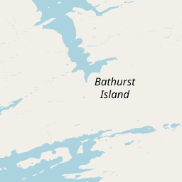
Qausuittuq National Park encompasses the northwestern portion of Bathurst Island, one of the larger islands in the Canadian Arctic Archipelago within the Queen Elizabeth Islands. The park's geology is composed primarily of sedimentary rocks including limestone, sandstone and dolomite, representing ancient marine deposits that have been exposed through millions of years of geological processes. The area shows clear evidence of past glaciation, with characteristic landforms including eskers, moraines and beach terraces scattered across the terrain. The landscape consists generally of rolling hills with tundra vegetation covering the terrain in the brief summer months. The island experiences a cold dry climate characteristic of the central Arctic, with almost unimpeded weather systems reaching the low-lying islands of the northwestern and north-central Queen Elizabeth Islands. The extreme climate, with temperatures remaining well below freezing for most of the year and minimal precipitation, shapes every aspect of the landscape and limits the development of soils and vegetation.

Qausuittuq National Park ecosystems, habitats, and plant life

The extreme Arctic climate of Qausuittuq severely limits soil and nutrient development, which in turn constrains the diversity and abundance of vegetation. This high Arctic region exhibits low vascular plant diversity, with vegetation dominated by herbaceous species adapted to harsh conditions. The plant community includes purple saxifrage, dwarf willow, various sedges and grasses, along with extensive coverage by lichens and mosses that carpet the tundra floor during the short growing season. These plants must survive extreme cold, minimal precipitation, permafrost conditions, and the challenges of a very short summer growing period. The terrestrial ecosystem supports wildlife species specifically adapted to this demanding environment, including Peary caribou, muskoxen, Arctic wolves and Arctic foxes. The marine environment surrounding Bathurst Island supports a range of species adapted to Arctic waters, including ringed seals, bearded seals, polar bears, walruses, and several whale species including bowhead whales, beluga whales and narwhals.

Qausuittuq National Park wildlife and species highlights

Qausuittuq National Park protects critical habitat for Peary caribou, one of the most endangered caribou subspecies in Canada and adapted exclusively to high Arctic conditions. These small, pale-colored caribou are found primarily on the islands of the Canadian Arctic Archipelago and have evolved to survive on the sparse vegetation of the tundra. The park also supports populations of muskoxen, large shaggy mammals that have survived in the Arctic since the Pleistocene era. Predators in the ecosystem include Arctic wolves and Arctic foxes, both specially adapted to hunt in the harsh Arctic environment. The bird population includes species such as snowy owls, snow geese, king eiders, jaegers, various gulls and shorebirds that migrate to the area during the brief summer breeding season. Marine mammals in the surrounding waters include ringed seals and bearded seals, important prey species for polar bears that also inhabit the area. The waters around Bathurst Island support several whale species including bowhead whales, beluga whales and narwhals, all of which have cultural and ecological significance in the Arctic.

Qausuittuq National Park conservation status and protection priorities

Qausuittuq National Park was established specifically to protect the Western High Arctic natural region, one of 39 distinct ecological regions identified by Parks Canada. The park plays a critical role in conserving habitat for the endangered Peary caribou, a subspecies that has suffered significant population declines and is considered at risk in Canada. By protecting this vast area of Bathurst Island, the park ensures that one of the most important remaining populations of this vulnerable subspecies has permanent conservation protection. The park also contributes to the broader conservation network of the Arctic Archipelago, sitting north of the Polar Bear Pass National Wildlife Area and contributing to a connected system of protected areas in the Queen Elizabeth Islands. The establishment of the park followed a comprehensive feasibility study including environmental and resource assessments, and was created in partnership with Inuit communities through an Inuit Impact and Benefit Agreement.

Qausuittuq National Park cultural meaning and human context

The Bathurst Island area has been inhabited by humans for approximately 4,500 years, with archaeological evidence of both prehistoric Dorset culture and later Thule Inuit peoples who are the ancestors of modern Inuit. These indigenous peoples adapted their lives to the extreme Arctic environment, relying on hunting and fishing for subsistence as climate and ice conditions allowed. Human presence in the region fluctuated over thousands of years in response to changing environmental conditions that affected the availability of wildlife for hunting. The nearby community of Resolute, established in 1953 on Cornwallis Island, maintains connections to the Bathurst Island area through traditional hunting and fishing activities. The park was created through negotiation with Inuit communities most closely connected to the proposed park, resulting in an Inuit Impact and Benefit Agreement. The name Qausuittuq was selected through a contest in the local area and reflects the Inuktitut language connection to this northern land.

Top sights and standout views in Qausuittuq National Park

Qausuittuq National Park represents one of Canada's most remote and least-visited national parks, offering access to a pristine high Arctic environment that few people will ever experience. The park protects critical Peary caribou habitat on Bathurst Island, one of the largest islands in the Queen Elizabeth Islands of the Canadian Arctic Archipelago. Visitors arriving in 2016 were among the first to experience this newly established protected area, which represents the Western High Arctic natural region in Canada's national park system. The park contains evidence of thousands of years of human history, from prehistoric Dorset sites to Thule Inuit occupation and nineteenth-century British exploration related to the search for the Franklin expedition. The extreme Arctic environment, with its cold temperatures, minimal precipitation, and extended periods of winter darkness, creates a landscape of stark beauty and ecological significance.

Best time to visit Qausuittuq National Park

Qausuittuq National Park can only be visited during the brief Arctic summer when temperatures rise above freezing and the landscape is accessible. The warmest period occurs in July when mean temperatures reach approximately 5°C, providing the only window for visitor activities. However, even during this peak period, conditions remain extremely cold by most standards and visitors must be prepared for harsh weather. The short summer season also corresponds with the midnight sun period, when the sun remains above the horizon for extended hours, and the brief burst of plant growth and wildlife activity that characterizes the Arctic summer. Winter visits are not practical due to the extreme cold, with mean January temperatures of -35°C and nearly complete darkness during the polar night period. Access to the park is extremely limited due to its remote location, requiring significant planning and resources.

Park location guide

Geography guide, regional context, and park location map for Qausuittuq National Park

Qausuittuq National Park park geography, regions, and map view in Canada
Understand where Qausuittuq National Park sits in Canada through a broader geographic reading of the surrounding landscape, nearby location context, and its mapped position within the national park landscape.

How Qausuittuq National Park fits into Canada

Canada is a federal parliamentary constitutional monarchy spanning North America from the Atlantic to the Pacific and Arctic Oceans. With a population of over 41 million, it is officially bilingual in English and French at the federal level. The country gained independence from the United Kingdom through a gradual process culminating in 1982.

Wider geography shaping Qausuittuq National Park in Canada

Canada occupies the northern portion of North America, sharing its longest international border with the United States. The country extends from the Atlantic Ocean to the Pacific Ocean and northward into the Arctic Ocean, giving it the longest coastline of any nation.

Map view of Qausuittuq National Park

Use this park location map to pinpoint Qausuittuq National Park in Canada, understand its exact geographic position, and read its mapped placement within the surrounding landscape more clearly.

Pigeon | © OpenStreetMap contributors

Location context for Qausuittuq National Park

Nunavut
Park atlas

Explore the geographic spread of protected areas and high Arctic landscapes throughout Nunavut, extending beyond Qausuittuq National Park

Explore Related Protected Areas and National Parks Near Qausuittuq National Park
Browse other national parks and protected areas located in the Canadian Arctic, including those across Nunavut and the Queen Elizabeth Islands, to discover diverse high Arctic environments. Compare their vast tundra ecosystems, unique geological features, and critical conservation efforts, providing essential context for regional protected landscape understanding and exploration.
National parkNorthwest Territories

Aulavik National Park: Northwest Territories National Park Protected Landscape and Geographic Context

Explore the mapped boundaries and regional park geography.

Gain a clear understanding of Aulavik National Park's protected status and its placement within the Northwest Territories. This detail page offers focused atlas exploration of the park's geographic identity, mapped features, and its significance as a National Park within Canada's northern geography. Discover the unique landscape context of this protected area for in-depth geographic study and discovery.

Area
12,200 km²
Established
1992
IUCN
II
Visitors
34 annual
National parkNunavut

Sirmilik National Park: Nunavut National Park Atlas and Protected Landscape Map

Explore the geographic boundaries and regional context of Sirmilik National Park.

This entry provides detailed insights into Sirmilik National Park, a designated national park situated in Nunavut, Canada. It serves as a focal point for understanding the park's specific geography, its mapped protected landscape, and its role within the regional atlas. Users can explore the park's defined boundaries and its contribution to the broader landscape context of Nunavut, making it an essential destination for detailed geographic discovery.

Area
22,200 km²
Established
2001
IUCN
II
Visitors
6 annual
National parkNunavut

Quttinirpaaq National Park: A Detailed Look at its Protected Landscape and Nunavut Geography

Mapped boundaries and regional context for this significant Arctic national park.

Gain a comprehensive understanding of Quttinirpaaq National Park, a protected national park located in the expansive region of Nunavut, Canada. This resource delves into the park's geographic identity, its mapped contours, and its position within the broader arctic landscape context. It is designed to support atlas-based exploration and a detailed appreciation of this protected area's unique setting within Northern Canada's geography.

Area
37,775 km²
Established
1988
IUCN
II
Visitors
7 annual
National parkNorthwest Territories

Tuktut Nogait National Park: Northwest Territories Protected Landscape Atlas

Explore its mapped boundaries and regional geography.

Delve into Tuktut Nogait National Park, a protected national park situated within the vast geography of the Northwest Territories. This entry provides a focused view of the park's specific identity, its defined protected area boundaries, and its contribution to the regional landscape atlas. Understanding Tuktut Nogait National Park means grasping its geographic context and its role as a key natural landscape within the broader Canadian protected area network, ideal for detailed map-based study.

Area
18,100 km²
Established
1998
IUCN
II
Visitors
12 annual
National parkNunavut

Ukkusiksalik National Park: Nunavut Protected Area Geography and Map Context

Explore the protected landscape and mapped terrain of this Canadian National Park.

Ukkusiksalik National Park serves as a protected national park within Nunavut, offering a distinct geographic identity. This entry provides structured insights into the park's mapped boundaries and its surrounding regional landscape, facilitating a deeper understanding of its place within the broader atlas of protected areas. Examine the geographic context and discover the unique attributes of Ukkusiksalik National Park's protected territory.

Area
20,885 km²
Established
2003
IUCN
II
Relief
Mixed relief
National parkYukon

Ivvavik National Park: Yukon National Park Protected Landscape and Geography

Explore mapped boundaries and regional context.

Ivvavik National Park is a designated national park within Yukon, representing a significant protected landscape. This page offers a focused exploration of its geographic identity, mapped boundaries, and its place within the broader atlas of Canada's natural areas. Understand Ivvavik National Park as a defined entity contributing to the regional geography and protected land distribution of Yukon.

Area
10,168 km²
Established
1984
IUCN
II
Visitors
179 annual
National parkNunavut

Auyuittuq National Park: Nunavut National Park and Protected Landscape Atlas

Explore Arctic protected area geography and mapped boundaries.

Auyuittuq National Park is a key protected area within Nunavut, Canada, serving as a vital component of the national park system. This entry provides the essential geographic and atlas context for understanding Auyuittuq National Park, highlighting its status as a mapped protected landscape. Examine its role within the regional geography of Nunavut and its contribution to the broader atlas of Canadian conservation lands.

Area
21,470 km²
Established
1972
IUCN
II
Visitors
256 annual
National parkNorthwest Territories

Thaidene Nëné National Park Reserve: Northwest Territories National Park Atlas Overview

Mapped geography and protected landscape context.

Investigate Thaidene Nëné National Park Reserve, a key national park within the Northwest Territories. This detailed entry focuses on its protected area status, mapped geographic boundaries, and regional landscape context, crucial for understanding its role in the broader atlas of conservation lands.

Area
14,070 km²
Established
2019
IUCN
II
Relief
Highland

Common questions about visiting, size, designation, and location context for Qausuittuq National Park

Qausuittuq National Park FAQs for park facts, access, geography, and protected area context
Find quick answers about Qausuittuq National Park, including protected-area facts, park geography, trail and visitor context, and how the park fits into its surrounding country and regional landscape.
MoriAtlas Explorer

Continue Your Protected Areas Search Across the Global Atlas

Deepen your exploration by continuing the structured search for national parks and protected areas worldwide. Utilize the comprehensive filtering capabilities to compare different conservation landscapes and refine your understanding of global park geography. Discover more about the distribution and characteristics of protected natural areas.

Global natural geography