Peaks
Vârful Nedeia
2,038 m

A structured examination of mountain topography, park elevation, and land distribution
Examine the physical geography of Retezat National Park located within Hunedoara County, Romania. This profile displays mapped boundary geometry, spanning 380.47 square kilometers with a maximum elevation reaching 2509 meters across diverse alpine terrain, forest ecosystems, and mountain peaks.
Romania's oldest national park protecting pristine alpine forests and glacier lakes in the Southern Carpathians
Retezat National Park is Romania's oldest national park, established in 1935 in the Retezat Mountains of Hunedoara County in southwestern Romania. The park covers approximately 38,000 hectares of rugged alpine terrain in the Southern Carpathians and is recognized as one of the most biodiverse protected areas in Europe. It contains over sixty peaks exceeding 2,300 meters and approximately eighty glacier lakes, with Peleaga (2,509 meters) standing as the highest summit within the park. Retezat is particularly notable for harboring some of the last remaining old-growth forests in Europe, including the strictly protected Gemenele scientific reserve. The park was designated a UNESCO Biosphere Reserve in 1979 and received the European Diploma of Protected Areas in 2008, reflecting its exceptional ecological significance.
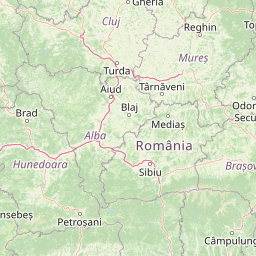
Administrative boundaries and regional placement within Romania
Retezat National Park’s mapped boundary encompasses 380.47 km²
Vertical range summary and recorded physical features within the protected mountain landscape.
Peaks
2,038 m
Peaks
2,158 m
Streams
Streams
Natural springs
Named stones
1,888 m
Alpine climate zones, extensive forest cover, and montane relief features
Mountains · Lakes · Forest
Temperate broadleaf forest · Temperate coniferous forest · Montane forest · Alpine meadow · Wetland
Compare the regional geography of other protected landscapes, tracing alpine peaks and glacial lakes near Retezat National Park.
Southwest

Explore its protected boundaries and regional geography.
Domogled-Valea Cernei National Park is recognized as a National Park, offering a distinct protected landscape for atlas-based discovery. This page provides focused insights into its mapped geographic extent and the character of its natural terrain. Understand the park's role within Romania's protected areas network and its unique geographic identity. Utilize this structured view to navigate the park's features and its surrounding landscape context for informed exploration.
North
Explore the protected landscape and regional atlas context.
Discover the Hațeg Country Dinosaur Geopark, a distinct protected area situated within the rich geography of Romania. This entry provides detailed information on its mapped boundaries and landscape characteristics, serving as a crucial anchor for understanding its place in the Southeast European region. Explore the structured geographic data and atlas context that define this significant protected landscape.
Northeast
Explore protected area geography and mapped boundaries.
Gain a structured understanding of Grădiștea Muncelului-Cioclovina Natural Park, a significant protected landscape located in Romania's Hunedoara County. This resource details its geographic position and mapped protected area extent, providing essential context for atlas exploration and regional landscape analysis. It serves as a focused entry point for understanding the park's unique geographic identity within its natural setting.
East
Explore maps, geography, and protected area context.
Defileul Jiului National Park is a vital protected natural area situated in Gorj County, Romania. This MoriAtlas page serves as a detailed entry point for understanding the park's specific geography, its mapped perimeters, and its significance within the regional landscape atlas. Discover the park's topographic features and its relationship to the surrounding terrain of the Southern Carpathians, providing essential context for geographic exploration.
West
National Park Geography and Mapped Boundaries
Delve into Semenic-Cheile Carașului National Park, a protected landscape in Romania, with a focus on its atlas and geographic context. This page details the park's identity as a national park, its specific mapped boundaries, and its contribution to regional geographic understanding. Utilize MoriAtlas to explore the structured data that defines this protected area and its surrounding natural terrain, enhancing your comprehension of Romania's conservation landscapes.
South
Explore Romania's unique limestone formations and karst landscapes.
The Mehedinți Plateau Geopark in Mehedinți County, Romania, is a significant protected landscape celebrated for its extensive karst features. This page offers detailed insights into the park's mapped boundaries, including its famous natural bridges like Podul lui Dumnezeu, vast limestone pavements, and cave systems. Understand its position within the broader regional geography of southwestern Romania, providing a solid foundation for atlas-driven exploration of this geologically rich area.
Southwest
Detailed atlas view of a protected landscape in Romania.
Uncover the geographic dimensions of Iron Gates Natural Park, a protected landscape situated in Romania. This detailed entry offers an atlas-centric exploration of its mapped boundaries and regional setting, facilitating a deeper understanding of its protected status and landscape features within the national geography. Discover the park's intrinsic value through structured geographic data and visual map context.
Southwest

Explore Serbia's largest national park along the Danube River.
Đerdap National Park is defined by the Iron Gate, Europe's longest and most dramatic river gorge, a geological marvel carved through the Carpathian Mountains. This protected area showcases a complex karst landscape with towering cliffs, deep river sections, and rich biodiversity, including vital Tertiary relict species. The park's vastness and unique terrain offer a profound geographic context for understanding regional natural landscapes and conservation efforts. Explore its mapped boundaries and ecological significance.
Delve deeper into the atlas representation of Retezat National Park. Understand how its protected landscape fits within the mapped geography of Hunedoara County and the Southern Carpathians. MoriAtlas helps you explore the specific park boundaries and the surrounding natural terrain for a comprehensive geographic overview.