Mori Atlas logo
National parkĐerdap National Park

Discover the mapped boundaries and protected landscape of Serbia's largest national park.

Đerdap National Park: Explore Europe's Dramatic Iron Gate Gorge on the Danube

(Nacionalni park Đerdap)

Đerdap National Park represents a monumental protected landscape along the Danube River in Serbia, carved by the colossal Iron Gate gorge. This park is a vital geographic feature, showcasing Europe's longest breakthrough valley with near-vertical limestone cliffs and extraordinary river depths. As Serbia's largest national park, it offers a unique atlas perspective on karst topography, vital wetlands, and a wealth of biodiversity including ancient relict species, making it a key destination for understanding regional geography and protected natural areas.

river gorgekarst landscapewetlandsbiodiversity hotspotTertiary relict speciesEurasian lynx

Đerdap National Park

National park

Park overview

Structured park overview, official facts, and landscape profile for Đerdap National Park

Đerdap National Park park facts, protected area profile, and essential visitor context
Review the core facts for Đerdap National Park, including designation, size, terrain, visitor scale, habitats, and operating context in one park-focused overview.

About Đerdap National Park

Đerdap National Park occupies a unique position in southeastern Europe as both a natural treasure and a crossroads of human civilization. The park's core identity revolves around the Iron Gate gorge—a spectacular 100-kilometer canyon where the Danube breaks through the Carpathian Mountains in a succession of four distinct gorges: Gornja klisura, Gospođin vir, Veliki kazan, and Mali kazan. These dramatic gorges alternate with narrow ravines, creating a landscape of extraordinary visual impact where limestone cliffs tower hundreds of meters above the river and ancient whirlpools once threatened navigators. The name Đerdap derives from the Turkish word 'girdap' meaning whirlpool, reflecting the river's dangerous character before damming transformed the waterway. Thepark's significance extends far beyond scenery—it protects exceptional biodiversity resulting from its location at the biogeographic crossroads of Central Europe and the Balkans. The terrain encompasses mountainous slopes, deep karstic depressions, numerous caves, and mineral springs, supporting forests that cover more than 64% of the area. The creation of Lake Đerdap in the 1970s added significant wetland habitat, transforming the ecological character of the river valley and establishing the park as both a mountain and river protected area. The combination of dramatic natural landscape, ecological significance, and deep human history makes Đerdap one of Serbia's most important and complex protected areas.

Quick facts and research context for Đerdap National Park

Đerdap National Park covers 63,786 hectares along the Danube in northeastern Serbia, making it the country's largest protected area. The park centers on the Iron Gate gorge, a 100-kilometer canyon carved through Carpathian limestone that represents Europe's longest breakthrough-type gorge. The landscape ranges from river level to 800 meters elevation, with over 64% of the area forested. The park includes Lake Đerdap, a 253-square-kilometer artificial reservoir created by the Iron Gate I hydroelectric station, completed in 1972 as a Yugoslav-Romanian collaborative project. The park also protects significant cultural heritage, including the 11,500-year-old Lepenski Vir archaeological site, Roman monuments, and medieval fortresses.

Park context

Deeper park guide and search-rich context for Đerdap National Park

Đerdap National Park history, landscape, wildlife, and travel context
Explore Đerdap National Park through its history, landscape character, ecosystems, wildlife, conservation priorities, cultural context, and seasonal travel timing in a structured park guide built for atlas discovery and search intent.

Why Đerdap National Park stands out

Đerdap National Park is best known for the Iron Gate (Đerdap Gorge), one of Europe's most impressive river canyons. This dramatic landscape features near-vertical limestone cliffs plunging to extraordinary river depths, with the gorge narrowing to just 150 meters in the Kazan section where cliffs soar 300 meters above the water. The park is also renowned for its extraordinary biodiversity, hosting over 1,100 plant species including numerous Tertiary relicts such as Turkish hazel, European yew, and Balkan beech that survived from ancient geological eras. The area is famous for significant wildlife including a stable population of 10-12 Eurasian lynx, rare bird species like Dalmatian pelicans that returned to nest after a century's absence, and diverse habitats supporting 150 bird species. The cultural layer is equally distinguished, with Lepenski Vir representing one of the oldest human settlement sites in the Balkans and Roman engineering marvels including Trajan's Bridge and Tabula Traiana.

Đerdap National Park history and protected-area timeline

Đerdap National Park was established in 1974 to protect the Iron Gate gorge and surrounding natural areas as a comprehensive spatial unit with exceptional cultural-historical values and significant ecosystems. The establishment came during a period of increased environmental awareness in Yugoslavia and reflected recognition that the Iron Gate area required coordinated protection of both natural and cultural heritage. The park management entity, originally founded as the Enterprise for Protection and Development of Đerdap National Park in 1989, was reorganized as the Public Enterprise 'National Park Đerdap' in 1993, with headquarters in Donji Milanovac. The park's borders were significantly expanded in 2020 when the broader Đerdap area was designated as Serbia's first UNESCO Global Geopark, now encompassing 1,330 square kilometers including portions of the Miroč and Kučaj mountain massifs alongside the Iron Gates Gorge. The same year, the entire national park area plus the Mala Vrbica wetland was declared Serbia's 11th Ramsar site, recognizing the international importance of the wetlands that developed after the creation of the reservoir. The Iron Gate dam itself represents a major historical intervention—the Iron Gate I hydroelectric station, completed in 1972 as a collaborative Yugoslav-Romanian project, was among the world's largest power facilities at the time and created the vast Lake Đerdap that now forms a central part of the park's character.

Đerdap National Park landscape and geographic character

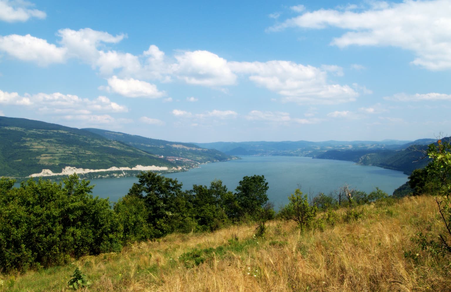
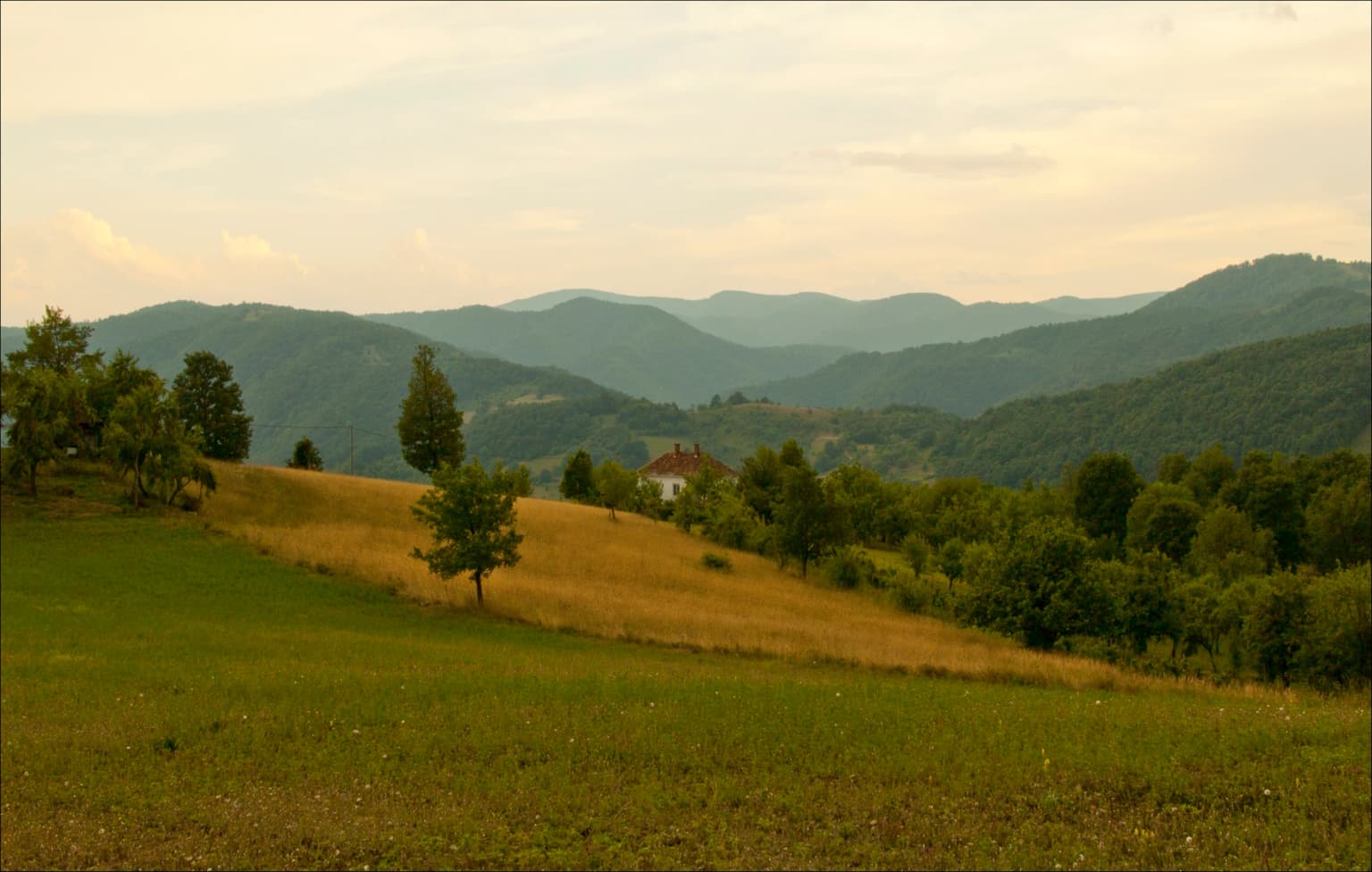
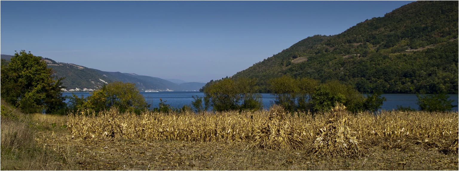
The landscape of Đerdap National Park is defined by the spectacular Iron Gate gorge, a complex river valley system carved through the limestone of the Carpathian Mountains. The gorge extends approximately 100 kilometers from Golubac to Tekija, comprising four distinct canyon sections separated by narrow ravines. The most dramatic section is the Kazan gorge, where the river is compressed to just 150 meters between cliffs reaching 300 meters in height, creating one of the most impressive river vistas in Europe. Along the gorge, river depths reach 82 meters in the Gospođin vir section—one of the deepest river measurements in the world. The park rises from the Danube bank through a forested mountain belt 2 to 8 kilometers wide, with elevations ranging from 50 meters along the river to over 800 meters on the surrounding peaks. The terrain is characterized by karstic topography with numerous caves, pits, sinkholes, and springs, including the significant Blederija spring on Miroč mountain. Several excellent scenic viewpoints offer panoramic views, most notably Veliki štrbac and Mali štrbac above the Kazan gorge, from which one can see the Deli Jovan and Veliki Krš mountains in Serbia and the Carpathians in Romania. The viewpoint Greben was famously described by geologist Jovan Žujović at the 1900 Budapest geology congress as 'the most beautiful hill in the Balkans.'

Đerdap National Park ecosystems, habitats, and plant life

The ecological character of Đerdap National Park is exceptionally rich, shaped by the park's position at the biogeographic crossroads between the Balkans and Central Europe and its diverse habitats ranging from riverine wetlands to mountainous forests. The park supports over 1,100 plant species, including a remarkable number of Tertiary relict species that survived from the ancient Tertiary period when this region supported subtropical forests. These relict species include Turkish hazel, common walnut, European yew, largeleaf linden, downy oak, and European holly—species that serve as living witnesses to the region's ancient climatic and ecological history. Of particular significance are the 57 forest communities found in the park, of which 40 are considered relict, including Balkan beech, Oriental beech, and Balkan maple communities. The park also protects several endemic Balkan species and Carpathian endemites. The creation of Lake Đerdap established important wetland habitats that support additional ecological communities, with the flooded underground water table creating new wetland complexes that have become crucial for waterfowl and other wetland species. The park's designation as an Important Plant Area reflects this extraordinary botanical significance.

Đerdap National Park wildlife and species highlights

Đerdap National Park supports remarkable wildlife diversity, with 150 bird species and significant mammal populations inhabiting its varied habitats. The park is particularly important for large predators, supporting a stable population of 10-12 Eurasian lynx, representing a significant portion of Serbia's estimated 40-60 lynx individuals. This lynx population represents an important conservation success story for the species in the region. The bird fauna is exceptionally diverse, with the return of Dalmatian pelicans in 2018-2019 representing a particularly notable event—these birds, whose closest habitat is the Danube Delta, had not been recorded in Đerdap since 1914. Their continued presence through nesting periods was confirmed in 2021, marking the first confirmed nesting in the area for over a century. Also significant was the discovery of white-winged tern nesting (previously extinct from central Serbia) and yellow-legged gull nesting (the only second nesting locality in Serbia, with no nests recorded since approximately 1900). Other notable species include European roller, woodchat shrike, booted eagle, common tern, and greylag goose. The river and lake support important fish populations, with catfish specimens exceeding 100 kilograms recorded. The Blederija valley and surrounding areas are known for deer and wild boar, with protected hunting grounds at Vratna and Ploče.

Đerdap National Park conservation status and protection priorities

Đerdap National Park holds multiple international protection designations reflecting its outstanding conservation significance. The park was designated a UNESCO Global Geopark in 2020, the first protected area in Serbia to achieve this status, recognizing the exceptional geological heritage of the Iron Gate gorge and surrounding Carpathian landscapes. In the same year, the park became Serbia's 11th Ramsar site, with the protected wetland area encompassing the entire national park plus the Mala Vrbica Important Bird Area outside the park boundaries. The Ramsar designation recognizes the international importance of the wetlands that developed following the creation of the artificial lake. The park also holds Important Bird Area and Important Plant Area designations, recognizing its significance for biodiversity conservation. The protection framework includes zoned management with different protection levels: approximately 8% at Level I (strict protection), 21.5% at Level II, and nearly 71% at Level III, balancing conservation with sustainable use. Thepark's geological significance centers on the Iron Gate as Europe's longest breakthrough-type gorge and the exposure of Carpathian geological formations.

Đerdap National Park cultural meaning and human context

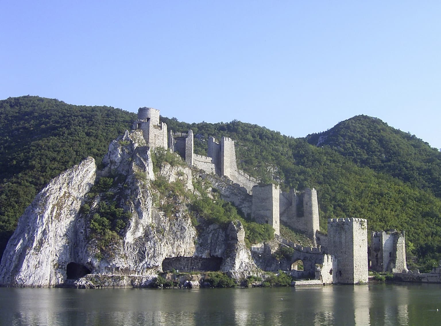
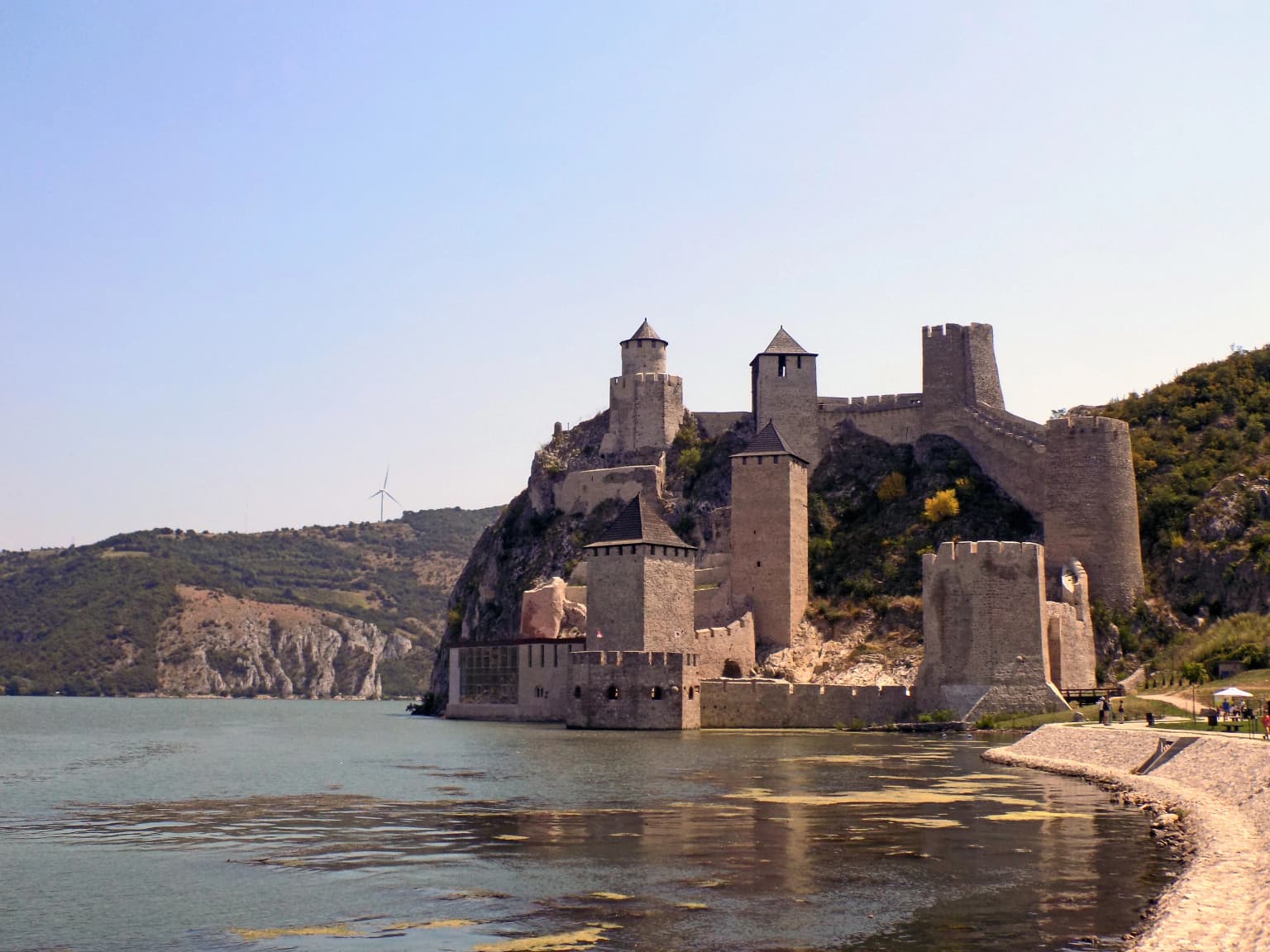
The Đerdap area represents one of Europe's most significant cultural landscapes, where human presence spans at least 11,500 years. The paramount archaeological treasure is Lepenski Vir, discovered in 1967, where excavations revealed exceptional traces of Mesolithic and later Neolithic settlements spanning from 1965 to 1971, with over 30 sites ranging from the Mesolithic to the Late Middle Ages. This site fundamentally shaped understanding of early human development in the Balkans. The region later became a major transit route for the Triballi, Dacians, and Autariates around 800 BC before Roman arrival in the first century BC. Romans established Đerdap as a border zone on the route of the western extension of Via Militaris, and Emperor Trajan built the famed Trajan's Bridge in 105 AD—pillars of which survive today alongside the Tabula Traiana inscription. The Roman fortress Diana stood at Kladovo. Medieval heritage is represented by the Golubac Fortress, a cultural monument containing numerous artifacts including pottery, iron tools, and weapons. The 27 settlements within the park are home to approximately 35,000 residents maintaining traditional connections to this landscape.

Top sights and standout views in Đerdap National Park

Đerdap National Park offers a compelling combination of Europe's most dramatic river gorge, exceptional biodiversity, and profound human history. The Iron Gate represents a geological wonder—the longest breakthrough gorge on the continent—with towering cliffs, extraordinary river depths, and panoramic viewpoints like Greben that geologists have called 'the most beautiful hill in the Balkans.' The ecological significance is extraordinary, with over 1,100 plant species including Tertiary relicts and 40 relict forest communities, plus a stable lynx population and confirmed nesting of rare Dalmatian pelicans after a century's absence. Cultural highlights include the 11,500-year-old Lepenski Vir archaeological site, Roman Trajan's Bridge and Tabula Traiana, and the medieval Golubac Fortress. The vast Lake Đerdap creates additional recreational and ecological value, while the park's 2020 designations as both a UNESCO Global Geopark and Ramsar site recognize its international significance.

Best time to visit Đerdap National Park

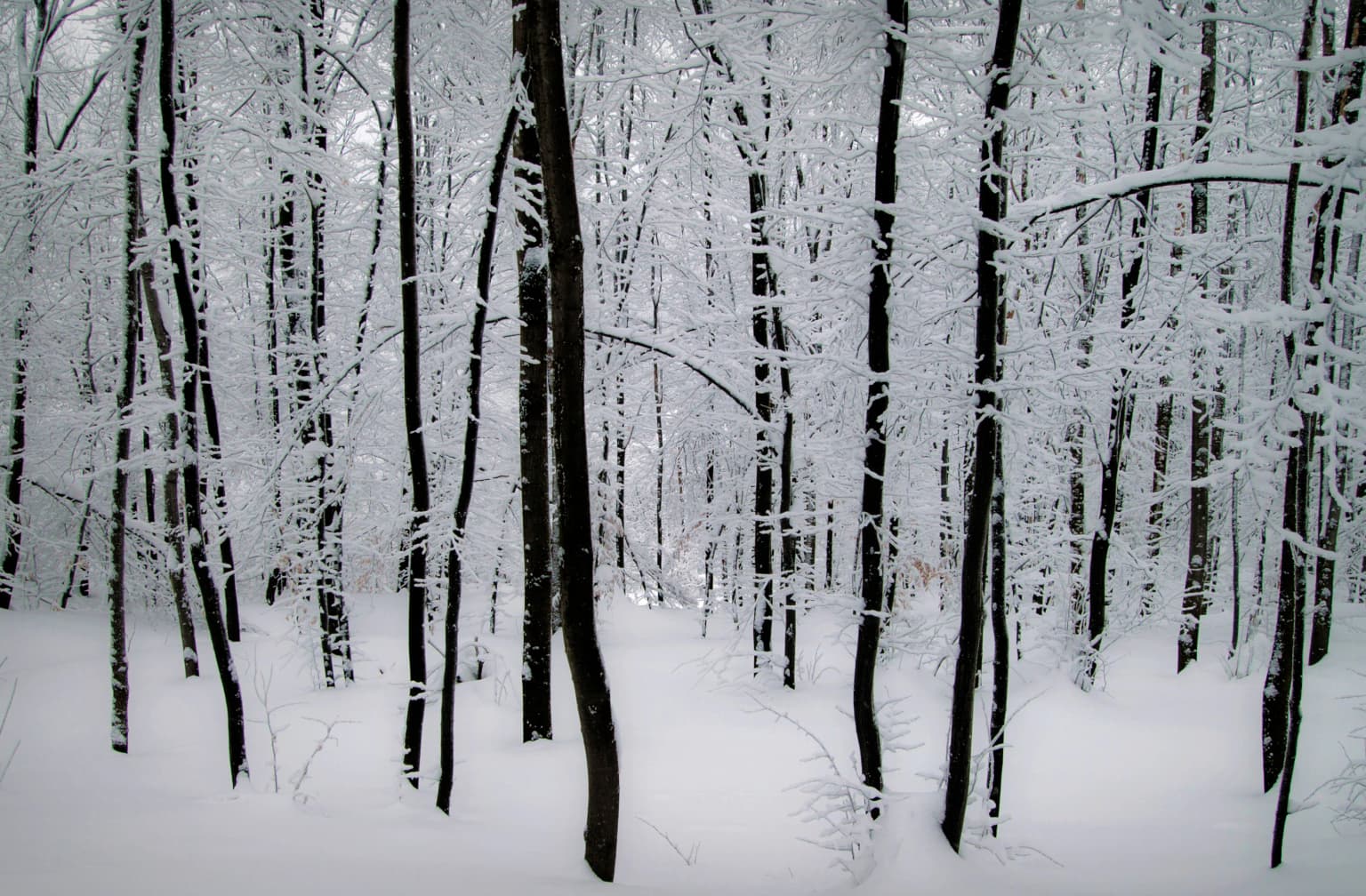
Đerdap National Park can be visited year-round, though each season offers distinct experiences. The spring and early summer months bring lush green landscapes, full water flow through the gorge, and excellent conditions for wildlife observation as species are active. Autumn offers particularly spectacular coloring as the diverse forests display vibrant hues, and the lower visitor numbers create a more contemplative experience. Summer brings the warmest conditions and highest water levels in the reservoir, suitable for boat tours and swimming at established tourist facilities. Winter reveals the gorge in its most dramatic light, with snow-dusted cliffs contrasting against the dark river, though some facilities may have reduced operations. The Danube valley generally experiences continental climate with moderate temperatures, though the gorge can create microclimate effects. For wildlife viewing, early morning visits to viewpoints offer the best chances to observe species, while the bird populations are most active during migration seasons.

Park location guide

Geography guide, regional context, and park location map for Đerdap National Park

Đerdap National Park park geography, regions, and map view in Serbia
Understand where Đerdap National Park sits in Serbia through a broader geographic reading of the surrounding landscape, nearby location context, and its mapped position within the national park landscape.

How Đerdap National Park fits into Serbia

Serbia is a landlocked country in Southeast and Central Europe, bordered by eight neighboring countries. With a population of approximately 6.6 million, it operates as a unitary parliamentary republic with Belgrade as its capital. The country has a rich history dating back to medieval statehood in the 7th century and has been independent since 2006 following the dissolution of Serbia and Montenegro.

Wider geography shaping Đerdap National Park in Serbia

Serbia is a landlocked country in the Balkans, spanning parts of Southeast and Central Europe. It occupies a strategic position in the heart of the Balkan Peninsula, bordered by Hungary to the north, Romania to the northeast, Bulgaria to the southeast, North Macedonia to the south, Croatia to the northwest, Bosnia and Herzegovina to the west, and Montenegro to the southwest. The terrain varies from rolling plains in the north to mountainous regions in the south and east.

Map view of Đerdap National Park

Use this park location map to pinpoint Đerdap National Park in Serbia, understand its exact geographic position, and read its mapped placement within the surrounding landscape more clearly.

Pigeon | © OpenStreetMap contributors
Park atlas

Trace the geography of the Iron Gate region and compare adjacent protected landscapes along the Danube River and surrounding Carpathian foothills.

Explore National Parks and Protected Areas Near Đerdap National Park, Serbia
Expand your discovery from Đerdap National Park by browsing other national parks and protected areas in the surrounding region, mapping their geographic spread across the Iron Gate gorge and Carpathian foothills. Compare diverse terrain, rich biodiversity, and significant cultural heritage within these conservation landscapes, gaining essential context for further atlas exploration.
Watercolor illustration of a river flowing through a valley with mountains in the background
Protected landscapeRomania

Iron Gates Natural Park: Explore Romania's Protected Landscape and Geographic Context

Detailed atlas view of a protected landscape in Romania.

Uncover the geographic dimensions of Iron Gates Natural Park, a protected landscape situated in Romania. This detailed entry offers an atlas-centric exploration of its mapped boundaries and regional setting, facilitating a deeper understanding of its protected status and landscape features within the national geography. Discover the park's intrinsic value through structured geographic data and visual map context.

Area
1,156.66 km²
Established
2000
Relief
Mixed relief
Climate
Mediterranean
Watercolor illustration showing rolling hills, scattered trees, and a soft pink sky
Protected landscapeMehedinți County

Mehedinți Plateau Geopark Protected Landscape: Karst Geography and Regional Context

Explore Romania's unique limestone formations and karst landscapes.

The Mehedinți Plateau Geopark in Mehedinți County, Romania, is a significant protected landscape celebrated for its extensive karst features. This page offers detailed insights into the park's mapped boundaries, including its famous natural bridges like Podul lui Dumnezeu, vast limestone pavements, and cave systems. Understand its position within the broader regional geography of southwestern Romania, providing a solid foundation for atlas-driven exploration of this geologically rich area.

Area
1,065 km²
Established
2005
IUCN
V
Relief
Upland
National park

Domogled-Valea Cernei National Park: National Park with Mapped Protected Landscape

Explore its protected boundaries and regional geography.

Domogled-Valea Cernei National Park is recognized as a National Park, offering a distinct protected landscape for atlas-based discovery. This page provides focused insights into its mapped geographic extent and the character of its natural terrain. Understand the park's role within Romania's protected areas network and its unique geographic identity. Utilize this structured view to navigate the park's features and its surrounding landscape context for informed exploration.

Area
612.11 km²
Established
2000
IUCN
II
Relief
Mountain
Watercolor illustration depicting a landscape with mountains, a winding river, and grassy fields
Protected landscape

Vršac Mountains Protected Landscape: A Unique Pannonian Island Mountain Range in Serbia

Explore distinct geological formations and rich avian habitats.

The Vršac Mountains Protected Landscape offers a unique geographic perspective as one of Serbia's Pannonian island mountains, emerging dramatically from the surrounding plains. This protected area is recognized for its striking gneiss and schist formations, its status as Vojvodina's highest elevation, and its exceptional importance for birdwatching, hosting over 120 species. Delve into the mapped terrain and geological character that distinguish this vital natural region.

Area
170 km²
Established
1982
Relief
Mountain
Climate
Temperate
Watercolor illustration of a mountain range with forests, a lake, and distant hills under a light sky
National parkHunedoara County

Retezat National Park National Park: Protected Landscape and Regional Geography

Mapped boundaries and landscape context in Hunedoara County.

Retezat National Park is a key protected area featured within MoriAtlas, offering structured geographic data and map-based insights. This national park's protected landscape is situated in Hunedoara County, Romania, contributing significantly to the regional topography and natural context of the Southern Carpathians. Explore its mapped boundaries and understand its role as a distinct natural entity.

Area
380.47 km²
Established
1935
IUCN
II
Relief
Mountain
Watercolor painting showing green forests, a river, and pink-hued mountains in the background
Protected landscape

Kosmaj Protected Landscape: Explore Serbia's Island Mountain Geography and Forests

Mapped terrain, historic monasteries, and biodiversity near Belgrade.

Kosmaj, a unique protected landscape and island mountain, presents a compelling study in regional geography and mapped terrain for atlas enthusiasts. Rising prominently near Belgrade, its landscape is characterized by dense deciduous forests of beech and oak blanketing its steeper slopes, along with distinct peaks like Mali Vis and Goli Vis. This area serves as a vital watershed source and boasts significant biodiversity, offering a rich context for understanding Serbia's natural and historic environments through structured geographic data and map exploration.

Area
0.035 km²
Established
2005
Relief
Lowland
Climate
Temperate
Protected landscape

Sićevo Gorge Protected Landscape: Explore Serbia's Dramatic Karst Geography

Mapping the unique limestone cliffs and river valley terrain.

Delve into the atlas details of Sićevo Gorge, a protected landscape in Serbia defined by its spectacular limestone cliffs and the Nišava River canyon. This page provides a structured overview of its dramatic topography, intricate karst formations, and the regional geographic context. Understand the mapped boundaries and the unique geological character that makes this gorge a standout feature in Serbia's natural landscape.

Scope
Terrestrial
Water
Minor water
Watercolor painting of a landscape featuring rolling hills, a lake, trees, and a sky with clouds
Natural monument

Avala Natural Monument: Iconic Protected Landscape and Regional Geography Near Belgrade

Explore Avala's mapped terrain and natural monument significance.

Avala Natural Monument offers a unique protected landscape and significant geographic context for the Belgrade metropolitan area. As one of Serbia's oldest protected natural sites, its distinct mountain terrain, geological composition, and panoramic views provide a rich subject for atlas-based discovery. Explore the mapped boundaries and natural features that define this prominent Serbian natural monument.

Area
5.01 km²
Established
1859
Relief
Mountain
Climate
Temperate

Common questions about visiting, size, designation, and location context for Đerdap National Park

Đerdap National Park FAQs for park facts, access, geography, and protected area context
Find quick answers about Đerdap National Park, including protected-area facts, park geography, trail and visitor context, and how the park fits into its surrounding country and regional landscape.
MoriAtlas Explorer

Continue Your Protected Areas Search Across the Global Atlas

Deepen your exploration by continuing the structured search for national parks and protected areas worldwide. Utilize the comprehensive filtering capabilities to compare different conservation landscapes and refine your understanding of global park geography. Discover more about the distribution and characteristics of protected natural areas.

Global natural geography