Mori Atlas logo
National parkRetezat National Park

Discover the mapped protected boundaries and regional terrain of Retezat National Park.

Retezat National Park: National Park Mapping and Protected Landscape Geography

(Parcul Național Retezat)

Retezat National Park represents a significant protected landscape within Hunedoara County, Romania. As a designated national park, it offers critical insight into the regional geography of the Southern Carpathians. MoriAtlas provides detailed mapping and structured data to understand Retezat National Park's place within the broader natural context of Transylvania.

Alpine MountainsOld-Growth ForestGlacial LakesBiodiversity HotspotUNESCO Biosphere ReserveNature Reserve
Stylized illustration of a mountain lake surrounded by coniferous trees and rocky terrain with a snow-capped mountain in the background.

Retezat National Park

National park

Park overview

Structured park overview, official facts, and landscape profile for Retezat National Park

Retezat National Park park facts, protected area profile, and essential visitor context
Review the core facts for Retezat National Park, including designation, size, terrain, visitor scale, habitats, and operating context in one park-focused overview.

About Retezat National Park

Retezat National Park occupies a prominent position in the Southern Carpathians of Romania, protecting the most complex and grand mountain massif in all geographic sectors of the Romanian Carpathians. The landscape bears the marks of two major glacial periods (Riss and Würm), resulting in spectacular alpine crests exceeding 2,000 meters and sculptural terrain featuring distinctive erosion platforms such as the Borăscu Alpine Erosion Platform. The park's territory encompasses portions of four administrative units: the communes of Pui, Râu de Mori, and Sălașu de Sus, along with the town of Uricani. The national road DN66A traverses the park area, connecting Petroșani with the DN67D route along the Cerna Valley. The park serves as a critical protected area for representative samples of Romania's biogeographic space, encompassing elements of outstanding physico-geographic, floristic, faunistic, hydrologic, geologic, paleontological, speleological, pedologic, and landscape value.

Quick facts and research context for Retezat National Park

Retezat National Park spans roughly 38,000 hectares in the Retezat Mountains of Hunedoara County, Romania. Founded in 1935, it is the country's oldest national park and a Category II IUCN protected area. The park features over sixty alpine peaks above 2,300 meters and about eighty glacial lakes, including Lacul Bucura, Romania's largest glacial lake. Its exceptional biodiversity includes approximately 1,190 plant species, 55 mammal species, and over 100 bird species. The park forms part of the Retezat-Godeanu mountain group in the Southern Carpathians and is adjacent to the Domogled-Valea Cernei National Park.

Park context

Deeper park guide and search-rich context for Retezat National Park

Retezat National Park history, landscape, wildlife, and travel context
Explore Retezat National Park through its history, landscape character, ecosystems, wildlife, conservation priorities, cultural context, and seasonal travel timing in a structured park guide built for atlas discovery and search intent.

Why Retezat National Park stands out

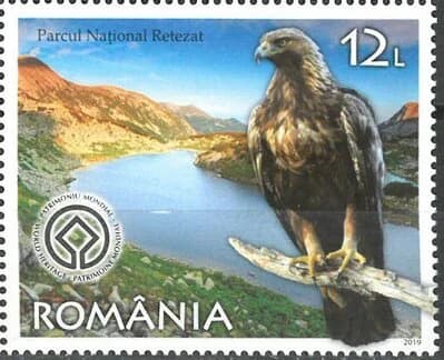
Retrizeat is best known for its exceptional old-growth forests, considered among the last intact forest landscapes in Europe. The Gemenele scientific reserve protects 1,800 hectares of pristine mixed forest, representing one of the largest continuous areas of untouched woodland on the continent. The park's biodiversity is extraordinary, with over 1,190 plant species (including 130 endangered or vulnerable species) representing more than a third of Romania's total flora. Its dramatic alpine scenery features glacial lakes, sharp peaks, and diverse habitats ranging from subalpine meadows to coniferous forests. The golden eagle, depicted on the park's logo, symbolizes its status as a crucial habitat for large raptors and other wildlife.

Grassy field leading to mountain peaks under a clear blue sky
Panoramic view of the Retezat mountains within Retezat National Park

Retezat National Park history and protected-area timeline

The Retezat region attracted scientific attention regarding its flora as early as the 19th century. During the 1930s, prominent Romanian scientists including Alexandru Borza (founder of the Cluj-Napoca Botanical Garden) and the renowned naturalist Emil Racoviță campaigned vigorously for the establishment of nature reserves in Romania. In 1935, the Tătărescu government set aside approximately 100 square kilometers of the Retezat Mountains, creating Romania's first national park. It required four additional years for legislation to finalize the park's status, thereby establishing the framework for all subsequent protected areas in Romania. In 1979, UNESCO included the park in the Man and the Biosphere Program, and in 1993 the International Union for Conservation of Nature recognized Retezat among its demonstration projects on sustainable rural development. The park received the European Diploma of Protected Areas in 2008. Since the 1990s, the park has faced increased pressure from sheep grazing and logging. A significant legal battle ensued after 2006 when the Romanian state decided to return 10,000 hectares to heirs of the Austro-Hungarian Kendeffy family; this restitution was deemed illegal by a 2022 court decision, restoring the land to state ownership.

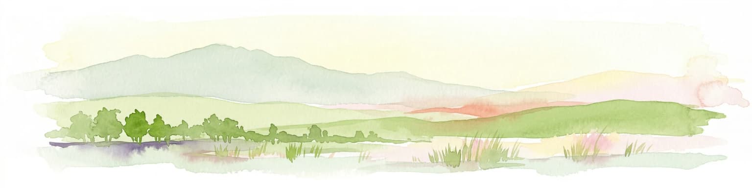
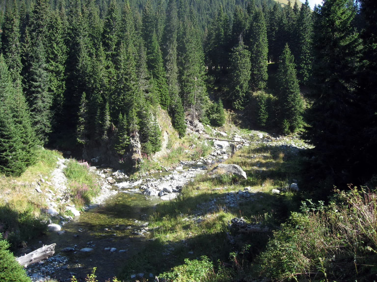
Retezat National Park landscape and geographic character

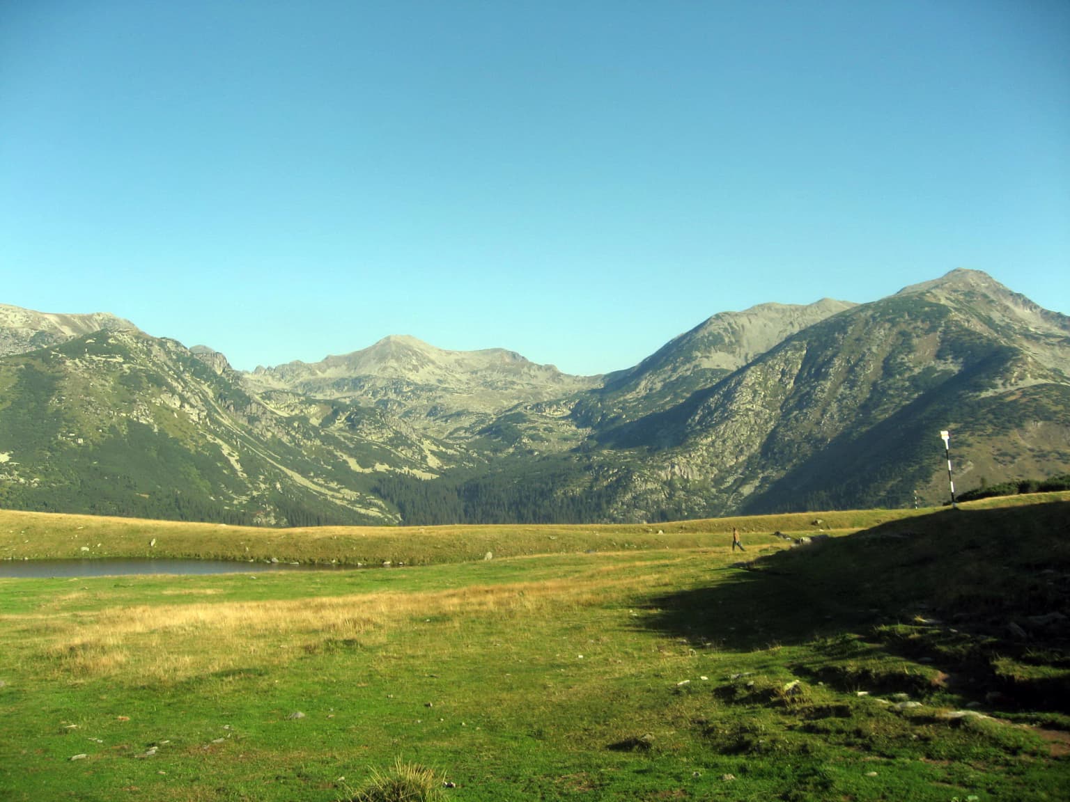
The Retezat landscape is defined by dramatic alpine terrain shaped by ancient glaciation. The mountains feature spectacular sculptural relief with spectacular crests rising above 2,000 meters, including the distinctive erosion platforms known as Borăscu. The terrain encompasses steep valleys, rocky ridges, and glacial cirques. More than sixty peaks exceed 2,300 meters, with Peleaga (2,509 meters) standing as the highest point in the range. The park contains approximately eighty glacier lakes, of which 54 are permanent. Lacul Bucura is the largest glacial lake in Romania. The landscape transitions through distinct altitudinal zones, from forested slopes to alpine meadows and bare rock above the treeline.

Wide view of Retezat National Park showing rocky mountain peaks, dense pine forests, and clear blue sky
Mountainous landscape of Retezat National Park with dense pine forests and rocky peaks under a clear sky

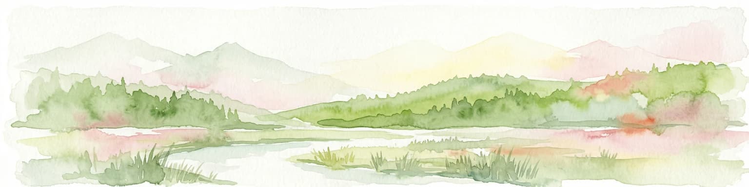
Retezat National Park ecosystems, habitats, and plant life

The park's ecological diversity is remarkable, with habitats ranging from subalpine coniferous forests through alpine meadows to glacial lakes and rock habitats. Mountain pine and juniper dominate the subalpine zone, with spruce forests and rhododendron thickets also common. The park protects extensive old-growth forest ecosystems that represent some of Europe's last intact woodlands. The Gemenele scientific reserve strictly protects nearly 1,800 hectares of primeval forest. The park contains over twenty distinct habitat types of community interest, including Daco-Beech forests, acidophilous spruce forests from the montane to alpine zone, alpine larch and Swiss stone pine forests, Nardus grasslands on siliceous substrates, alpine and subalpine calcareous grasslands, and montane streams with their associated vegetation.

A mountainous landscape with a lake reflecting a rocky peak, surrounded by grassy and rocky terrain
Mountain landscape near Camp Bucura with lake reflection

Retezat National Park wildlife and species highlights

Retezat hosts an exceptional diversity of wildlife, with 55 mammal species representing nearly a quarter of all mammal species found in Romania. The large carnivore community includes gray wolves, brown bears, and Eurasian lynx. Herbivores such as chamois (capra neagră), red deer, roe deer, and wild boar are well established. European wildcats and beech martens occupy the forested areas. The park serves as an important bat conservation center, hosting 13 species of Chiroptera including the greater horseshoe bat, parti-coloured bat, and soprano pipistrelle. Over 100 bird species have been recorded, many protected under Romanian law. The golden eagle appears on the park's logo, while other notable species include the western capercaillie, lesser spotted eagle, black grouse, peregrine falcon, and Eurasian eagle-owl. The park is recognized as an Important Bird Area by BirdLife International and contains two European Prime Butterfly Areas with over 1,000 butterfly species identified.

Romanian stamp showing Retezat National Park with a golden eagle perched on a branch, mountains and lake in background, and Romanian text
Romanian stamp featuring Retezat National Park with a golden eagle

Retezat National Park conservation status and protection priorities

Retezat holds exceptional conservation significance as Romania's oldest national park and one of Europe's most important protected areas. Its designation as a UNESCO Biosphere Reserve in 1979 reflects international recognition of its ecological value. The park received the European Diploma of Protected Areas in 2008, a distinction reserved for areas of outstanding European importance. It forms part of the Natura 2000 network, designated as both an SCI (Site of Community Importance) for habitats and species and an SPA (Special Protection Area) for birds. The Gemenele scientific reserve provides strict protection for old-growth forest ecosystems. However, the park faces ongoing conservation challenges including illegal logging, uncontrolled sheep grazing, poaching, and unregulated tourism that threatens sensitive habitats. The 2022 court decision rejecting the controversial land restitution to private heirs has helped secure the park's status as public property.

Retezat National Park cultural meaning and human context

The Retezat region contains a rich cultural landscape with numerous historical and architectural monuments in the villages surrounding the park. Medieval churches and noble courts dot the surrounding communes, including the 14th-century Church of the Cândea Knights in Suseni and noble courts from the 15th century in Râu de Mori and Sălașu de Sus. The area reflects centuries of traditional mountain village life with pastoral practices that have shaped the landscape. Archaeological sites at Ohaba-Ponor reveal Neolithic and Paleolithic occupation. These cultural elements complement the park's natural values, creating a heritage landscape where human history and alpine nature intertwine.

A stream running through a forested valley with tall evergreen trees and rocky terrain.
A stream flows through a forested valley in Retezat National Park.

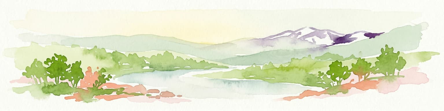
Top sights and standout views in Retezat National Park

Retezat National Park offers visitors exceptional alpine landscapes with dramatic peaks, crystal-clear glacial lakes, and extensive old-growth forests. The hiking route to Bucura Lake, the largest glacial lake in Romania, provides access to the heart of the park's alpine scenery. The Gemenele scientific reserve showcases pristine primeval forest inaccessible to general visitors but representing the park's ecological core. The network of over sixty peaks exceeding 2,300 meters attracts mountaineers and hikers seeking alpine challenges. The extraordinary plant diversity, with species including edelweiss, yellow gentian, and rhododendron, creates spectacular summer wildflower displays. Wildlife viewing opportunities include chamois on rocky ridges, golden eagles soaring above peaks, and bear tracks along forest trails.

Mountain slope with mixed green and brown vegetation leading down to Bucura Lake in the valley below
View of Bucura Lake from a mountain slope in Retezat National Park

Best time to visit Retezat National Park

The summer months from June through September offer the most favorable conditions for exploring Retezat, with warm days, accessible trails, and abundant alpine flora in bloom. July and August bring the peak wildflower season and warmest temperatures but also the highest visitor numbers. Early autumn in September and October provides cooler temperatures, fewer crowds, and the opportunity to witness autumn foliage in the forests. Winter access is limited and requires mountaineering experience due to heavy snowpack and harsh conditions. Spring brings snowmelt and rising streams, which can make some trails difficult. The shoulder seasons of late spring and early autumn generally offer the best balance of favorable weather and manageable visitor numbers for those seeking a more tranquil experience.

Park location guide

Geography guide, regional context, and park location map for Retezat National Park

Retezat National Park park geography, regions, and map view in Romania
Understand where Retezat National Park sits in Romania through a broader geographic reading of the surrounding landscape, nearby location context, and its mapped position within the national park landscape.

How Retezat National Park fits into Romania

Romania is a unitary semi-presidential republic located in Southeast and Central Europe. It borders Ukraine, Hungary, Serbia, Bulgaria, Moldova, and the Black Sea. The country has a population of approximately 19 million and covers an area of 238,397 km². Bucharest is the capital and largest city. Romania joined the European Union in 2007.

Wider geography shaping Retezat National Park in Romania

Romania lies on the lower course of the Danube River, north of the Balkan Peninsula, and on the northwestern shore of the Black Sea. The terrain is varied, featuring the Carpathian Mountains in the center, the Transylvanian Plateau, the Moldavian Plateau, and plains along the Danube and in the south. The country has a diverse landscape that includes forests, meadows, and wetland areas.

Map view of Retezat National Park

Use this park location map to pinpoint Retezat National Park in Romania, understand its exact geographic position, and read its mapped placement within the surrounding landscape more clearly.

Pigeon | © OpenStreetMap contributors

Location context for Retezat National Park

Hunedoara County

Discover the dramatic glacial lakes, rugged alpine terrain, and ancient forest habitats defining Retezat's protected environment.

Explore Retezat National Park Photos: Visual Guide to Romania's Alpine Landscapes and Old-Growth Forests
Browse an extensive collection of Retezat National Park photos to visually grasp its unique alpine landscapes, ancient forest ecosystems, and glacial formations. High-quality imagery provides essential context for comprehending the park's diverse terrain, rich biodiversity, and the visual character of this crucial European protected area.

Grassy field leading to mountain peaks under a clear blue sky

Panoramic view of Retezat National Park mountains with labeled peaks and valleys, rocky terrain, and a hiker silhouette in foreground

Wide view of Retezat National Park showing rocky mountain peaks, dense pine forests, and clear blue sky

A mountainous landscape with a lake reflecting a rocky peak, surrounded by grassy and rocky terrain

Romanian stamp showing Retezat National Park with a golden eagle perched on a branch, mountains and lake in background, and Romanian text

Pink rhododendron flowers with green leaves and rocky background in Retezat National Park

A stream running through a forested valley with tall evergreen trees and rocky terrain.

Mountain slope with mixed green and brown vegetation leading down to Bucura Lake in the valley below

Park atlas

Compare the regional geography of other protected landscapes, tracing alpine peaks and glacial lakes near Retezat National Park.

Explore Other National Parks Near Retezat National Park, Comparing Alpine Protected Areas
After exploring Retezat National Park's alpine peaks and ancient forests, continue your geographic discovery by browsing other protected areas within Romania and the wider Carpathian region. Compare these national parks to understand their unique conservation landscapes, glacial features, and biodiversity hotspots in a broader European context.
National park

Domogled-Valea Cernei National Park: National Park with Mapped Protected Landscape

Explore its protected boundaries and regional geography.

Domogled-Valea Cernei National Park is recognized as a National Park, offering a distinct protected landscape for atlas-based discovery. This page provides focused insights into its mapped geographic extent and the character of its natural terrain. Understand the park's role within Romania's protected areas network and its unique geographic identity. Utilize this structured view to navigate the park's features and its surrounding landscape context for informed exploration.

Area
612.11 km²
Established
2000
IUCN
II
Relief
Mountain
Protected landscapeHunedoara County

Grădiștea Muncelului-Cioclovina Natural Park: Protected Landscape in Hunedoara County Atlas

Explore protected area geography and mapped boundaries.

Gain a structured understanding of Grădiștea Muncelului-Cioclovina Natural Park, a significant protected landscape located in Romania's Hunedoara County. This resource details its geographic position and mapped protected area extent, providing essential context for atlas exploration and regional landscape analysis. It serves as a focused entry point for understanding the park's unique geographic identity within its natural setting.

Area
381.84 km²
Established
2000
IUCN
V
Relief
Mountain
National parkGorj County

Defileul Jiului National Park: Romania's Protected National Park Landscape in Gorj County

Explore maps, geography, and protected area context.

Defileul Jiului National Park is a vital protected natural area situated in Gorj County, Romania. This MoriAtlas page serves as a detailed entry point for understanding the park's specific geography, its mapped perimeters, and its significance within the regional landscape atlas. Discover the park's topographic features and its relationship to the surrounding terrain of the Southern Carpathians, providing essential context for geographic exploration.

Area
111.27 km²
Established
2005
IUCN
II
Relief
Mountain
Watercolor illustration showing rolling hills, scattered trees, and a soft pink sky
Protected landscapeMehedinți County

Mehedinți Plateau Geopark Protected Landscape: Karst Geography and Regional Context

Explore Romania's unique limestone formations and karst landscapes.

The Mehedinți Plateau Geopark in Mehedinți County, Romania, is a significant protected landscape celebrated for its extensive karst features. This page offers detailed insights into the park's mapped boundaries, including its famous natural bridges like Podul lui Dumnezeu, vast limestone pavements, and cave systems. Understand its position within the broader regional geography of southwestern Romania, providing a solid foundation for atlas-driven exploration of this geologically rich area.

Area
1,065 km²
Established
2005
IUCN
V
Relief
Upland
Watercolor illustration of a landscape with mountains, trees, and a river
Protected landscapeSibiu County

Cindrel Natural Park: Protected Landscape within Sibiu County's Regional Geography

Mapped natural landscapes and protected area context.

Delve into the protected landscape of Cindrel Natural Park, situated in Sibiu County, Romania. This page offers a detailed geographic perspective, highlighting the park's mapped boundaries and its role within the broader natural terrain of the Southern Carpathians. Understand the structured atlas data that defines Cindrel Natural Park and its regional significance for protected land discovery.

Area
98.73 km²
Established
2000
IUCN
V
Relief
Mountain
Watercolor illustration of a river flowing through a valley with mountains in the background
Protected landscapeRomania

Iron Gates Natural Park: Explore Romania's Protected Landscape and Geographic Context

Detailed atlas view of a protected landscape in Romania.

Uncover the geographic dimensions of Iron Gates Natural Park, a protected landscape situated in Romania. This detailed entry offers an atlas-centric exploration of its mapped boundaries and regional setting, facilitating a deeper understanding of its protected status and landscape features within the national geography. Discover the park's intrinsic value through structured geographic data and visual map context.

Area
1,156.66 km²
Established
2000
Relief
Mixed relief
Climate
Mediterranean
National parkVâlcea County

Buila-Vânturarița National Park: Romania's National Park in Vâlcea County Geography

Mapped protected landscape within Vâlcea County.

Delve into the specifics of Buila-Vânturarița National Park, a designated national park in Vâlcea County, Romania. This detailed entry focuses on its protected landscape identity and geographic placement, offering precise mapped boundary information relevant for atlas exploration. Understand how this national park contributes to the regional geography and protected area network, providing a foundational element for structured discovery of Romania's natural environments.

Area
41.86 km²
Established
2005
IUCN
II
Relief
Mountain
Protected landscapeSibiu County

Dumbrava Sibiului Natural Park: Protected Landscape Atlas and Geographic Discovery

Explore the mapped natural terrain and regional context.

Dumbrava Sibiului Natural Park is a designated protected landscape offering a unique lens into Romania's natural geography. This entry provides detailed atlas-level information on the park's protected boundaries and its setting within Sibiu County, part of the historic Transylvania region. Understand the park's landscape character and its role in the regional geography through structured map data.

Area
9.93 km²
Established
2000
IUCN
V
Relief
Lowland

Common questions about visiting, size, designation, and location context for Retezat National Park

Retezat National Park FAQs for park facts, access, geography, and protected area context
Find quick answers about Retezat National Park, including protected-area facts, park geography, trail and visitor context, and how the park fits into its surrounding country and regional landscape.
MoriAtlas Explorer

Continue Your Protected Areas Search Across the Global Atlas

Deepen your exploration by continuing the structured search for national parks and protected areas worldwide. Utilize the comprehensive filtering capabilities to compare different conservation landscapes and refine your understanding of global park geography. Discover more about the distribution and characteristics of protected natural areas.

Global natural geography