

Mori Atlas logo
National parkSwain Reefs National Park

Understand the mapped boundaries and regional geography of this Australian national park.

Swain Reefs National Park: Protected Landscape and Geographic Context in Queensland

Swain Reefs National Park represents a significant protected natural area within the diverse geography of Queensland, Australia. As a designated national park, its boundaries define a distinct conservation landscape contributing to the region's ecological richness. This page offers an atlas-driven perspective, helping you explore the park's geographic placement and understand its role as a protected natural entity within northeastern Australia.

coral reefsseabird coloniesmarine parkGreat Barrier ReefImportant Bird Arearoseate tern

Swain Reefs National Park

National park

Park overview

Structured park overview, official facts, and landscape profile for Swain Reefs National Park

Swain Reefs National Park park facts, protected area profile, and essential visitor context
Review the core facts for Swain Reefs National Park, including designation, size, terrain, visitor scale, habitats, and operating context in one park-focused overview.

About Swain Reefs National Park

Swain Reefs National Park represents a distinctive marine and terrestrial protected area in the Capricorn Group of the Coral Sea, forming part of the broader Great Barrier Reef World Heritage Area ecosystem. The park consists of nine small vegetated and unvegetated cays that provide critical nesting habitat for seabirds, surrounded by coral reef formations that support marine biodiversity. The isolation of these cays, far from the Queensland mainland, contributes to their ecological significance as relatively undisturbed breeding grounds. The park's management focuses on protecting both the terrestrial seabird colonies and the surrounding marine environment, recognizing the interconnected nature of these ecosystems. While the land area is modest at 0.58 square kilometres, the ecological value of the park extends well beyond its shoreline through the protection of surrounding reef systems and the marine species they support.

Quick facts and research context for Swain Reefs National Park

Swain Reefs National Park covers 0.58 square kilometres of protected land across nine discrete cays in the Capricorn Group, located in the Coral Sea off the Queensland coast. The park was established in 1995 under IUCN Category II protection. The cays include Gannet Cay, Bylund Cay, Thomas Cay, Bacchi Cay, Frigate Cay, Price Cay, Distant Cay, Riptide Cay, and Bell Cay, ranging in size from 0.25 to 2 hectares. The park is managed by the Queensland Parks and Wildlife Service and has been identified by BirdLife International as an Important Bird Area of global significance.

Park context

Deeper park guide and search-rich context for Swain Reefs National Park

Swain Reefs National Park history, landscape, wildlife, and travel context
Explore Swain Reefs National Park through its history, landscape character, ecosystems, wildlife, conservation priorities, cultural context, and seasonal travel timing in a structured park guide built for atlas discovery and search intent.

Why Swain Reefs National Park stands out

Swain Reefs National Park is distinguished primarily by its exceptional seabird colonies, particularly the roseate tern populations that nest on the small sandy cays. The park supports more than one percent of the world's breeding population of this species, alongside significant numbers of masked booby, brown booby, and various tern species. The surrounding coral reef environment provides important marine habitat, with the rockcod found at considerable depths representing a notable marine species presence. The combination of terrestrial seabird nesting habitat and surrounding coral reef ecosystems makes this park a unique dual ecosystem protected area.

Swain Reefs National Park history and protected-area timeline

Swain Reefs National Park was established in 1995 as part of Queensland's expanding network of marine protected areas. The park was designated to protect the significant seabird nesting colonies found on the small cays within the Swain Reefs area, recognizing the international importance of these sites for roseate tern populations. The Queensland Parks and Wildlife Service assumed management responsibility for the park, implementing protection measures for both the terrestrial nesting areas and the surrounding marine environment. The subsequent identification of the Swain Reefs as an Important Bird Area by BirdLife International further cemented the park's conservation significance at a global scale.

Swain Reefs National Park landscape and geographic character

The Swain Reefs landscape is characterised by a cluster of nine small sandy cays scattered across a remote section of the Coral Sea in the Capricorn Group. These cays range from tiny islets of 0.25 hectares to larger formations of approximately 2 hectares, with a combined terrestrial area of nine hectares. The cays are surrounded by coral reef platforms that extend into deeper oceanic waters, creating a complex marine environment where reef systems meet open sea. The physical setting is quintessential coral sea environment, with low-lying sandy formations, minimal elevation, and surrounding turquoise waters. The reefs around the cays support diverse benthic communities and fish populations in waters that range from shallow reef flats to deeper oceanic depths.

Swain Reefs National Park ecosystems, habitats, and plant life

The ecological character of Swain Reefs National Park centres on two interconnected systems: the terrestrial cay environments that support seabird nesting colonies, and the surrounding coral reef marine ecosystems. The cays provide essential habitat for breeding seabirds, with the sandy and vegetated surfaces offering suitable nesting sites for roseate terns and other colonial seabird species. The surrounding reef systems support typical coral sea biodiversity including hard and soft corals, reef fish, and invertebrates. The marine environment extends to considerable depths, with rockcod recorded at approximately 220 metres, indicating the ecological diversity present across the depth gradient. The combination of protected cays and reef systems creates a coherent ecological unit where marine and terrestrial values reinforce each other.

Swain Reefs National Park wildlife and species highlights

The wildlife of Swain Reefs National Park is most notable for its seabird populations, particularly the roseate tern colonies that represent over one percent of the global breeding population for this species. The cays support diverse seabird assemblages including masked booby and brown booby populations, silver gulls, black-naped terns, sooty terns, bridled terns, greater and lesser crested terns, little terns, black and common noddies, and lesser frigatebirds. The marine environment supports fish species including the rockcod, which occurs at the deeper reef edges around the cays. The ecological significance of the seabird colonies is reflected in the Important Bird Area designation, which recognises the site's global importance for breeding seabirds.

Swain Reefs National Park conservation status and protection priorities

Swain Reefs National Park holds significant conservation value through its designation as an Important Bird Area by BirdLife International, recognising the globally important seabird nesting colonies it supports. The protection of roseate tern breeding habitat is particularly significant, as this species depends on secure, relatively undisturbed island sites for successful reproduction. The park's marine component contributes to the broader conservation framework of the Great Barrier Reef region, protecting reef ecosystems and associated marine biodiversity. The dual protection of both terrestrial seabird habitat and surrounding coral reef environments ensures comprehensive conservation of the park's ecological values.

Swain Reefs National Park cultural meaning and human context

The Swain Reefs are located within the traditional sea country of Aboriginal and Torres Strait Islander peoples of the Capricorn Coast region. The cays and surrounding waters would have been part of the traditional Sea Country managed by Indigenous peoples who travelled and hunted throughout the Coral Sea region. While the Wikipedia source does not provide detailed cultural information, the broader Capricorn Group area has deep Indigenous heritage connections dating back thousands of years.

Top sights and standout views in Swain Reefs National Park

The most significant highlight of Swain Reefs National Park is its status as an Important Bird Area supporting over one percent of the world's breeding roseate tern population, with up to 25,000 non-breeding birds recorded at the site. The cluster of nine cays provides diverse seabird nesting habitat for at least thirteen bird species. The surrounding coral reef environment supports marine fish including rockcod at notable depths. The remote location in the Coral Sea, combined with the dual terrestrial and marine protected status, makes this park a distinctive conservation area within Queensland's protected estate.

Best time to visit Swain Reefs National Park

The optimal period to visit Swain Reefs National Park generally corresponds to the Australian cooler months from April through September, when conditions are more stable and wildlife activity around the cays is more predictable. The seabird breeding season typically occurs during these months, providing opportunities to observe roseate tern nesting behaviour. However, the park's remote location and limited access mean that visits are typically conducted through organised marine tourism operations rather than independent travel. Weather conditions in the Coral Sea can vary throughout the year, with the wet season bringing increased wind and storm activity.

Park location guide

Geography guide, regional context, and park location map for Swain Reefs National Park

Swain Reefs National Park park geography, regions, and map view in Australia
Understand where Swain Reefs National Park sits in Australia through a broader geographic reading of the surrounding landscape, nearby location context, and its mapped position within the national park landscape.

How Swain Reefs National Park fits into Australia

Australia is a constitutional monarchy and federal parliamentary democracy comprising six states and ten territories. With a population of nearly 28 million, it is one of the world's most urbanised countries, with most people concentrated on the eastern seaboard. The country has a high Human Development Index and is known for its cultural diversity, ancient Aboriginal heritage, and unique wildlife.

Wider geography shaping Swain Reefs National Park in Australia

Australia occupies the entire Australian continent, the island of Tasmania, and numerous smaller islands. It is the world's flattest and driest inhabited continent, featuring vast deserts in the interior (the Outback), tropical rainforests along the eastern coast, and a coastline bordering the Indian and Pacific Oceans.

Map view of Swain Reefs National Park

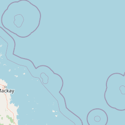
Use this park location map to pinpoint Swain Reefs National Park in Australia, understand its exact geographic position, and read its mapped placement within the surrounding landscape more clearly.

Pigeon | © OpenStreetMap contributors

Location context for Swain Reefs National Park

Queensland
Park atlas

Compare adjacent protected landscapes and trace the spread of marine conservation efforts across the wider Coral Sea region.

Explore Other National Parks and Protected Areas Around Swain Reefs National Park
Discover additional national parks and protected areas, including marine and island reserves, in the wider Queensland and Coral Sea region surrounding Swain Reefs National Park. A geographic overview reveals diverse protected landscapes, highlights regional conservation patterns, and maps the distribution of critical seabird habitats and coral reef systems.
National parkQueensland

Byfield National Park: Protected National Park with Coastal Dune Ecosystems in Queensland

Explore its mapped landscape and unique pandanus forests.

Byfield National Park presents a compelling case study in coastal protected-area geography, showcasing a diverse landscape where dune systems meet extensive pandanus forests across 12 kilometers of Queensland coastline. This national park, established in 1988, provides a unique glimpse into the ecological transition zone between tropical savanna and subtropical climates, offering a richly detailed environment for map-based exploration. Its relatively undeveloped terrain and distinct ecosystems make it a valuable entity for understanding regional Australian natural landscapes and conservation efforts.

Area
87 km²
Established
1988
IUCN
II
Relief
Lowland
National parkQueensland

Broad Sound Islands National Park: Queensland National Park Geographic Atlas

Mapped protected boundaries and landscape context in Queensland.

Broad Sound Islands National Park serves as a vital point of reference for exploring Queensland's protected natural areas. This canonical detail entry provides essential insights into the park's geographic positioning, its role as a national park, and its contribution to the regional atlas. Understand its mapped boundaries and unique landscape characteristics as part of a structured geographic discovery.

Area
16 km²
IUCN
II
Relief
Lowland
Climate
Subtropical
National parkQueensland

Capricornia Cays National Park: Queensland National Park Protected Landscape and Geographic Context

Explore mapped boundaries and regional atlas details for this national park.

Capricornia Cays National Park represents a significant protected area within Queensland, Australia, offering detailed insights into its geographic identity. This page provides a focused exploration of the park's mapped landscape features and its role within the broader regional atlas. Understand the park's specific protected-area context and its contribution to the natural geography of northeastern Australia.

Area
1.78 km²
Established
1994
IUCN
II
Relief
Lowland
National parkQueensland

Keppel Bay Islands National Park: Queensland's Coastal National Park and Archipelago Discovery

Explore protected islands, mapped coral reefs, and marine ecosystems.

Delve into the geographic identity of Keppel Bay Islands National Park, a significant protected area comprising thirteen islands off the coast of Queensland. This national park showcases a dynamic coastal landscape, featuring distinct island terrains, diverse marine life, and essential coral reef systems. Through its mapped boundaries and conservation focus, the park offers a unique lens for understanding island geography and the importance of marine protected areas within the broader Australian atlas.

Area
7.2 km²
Established
1994
IUCN
II
Relief
Lowland
National parkShire of Livingstone

Capricorn Coast National Park: Mapped Protected Area and Regional Geography

Explore its geographic setting within Shire of Livingstone.

Capricorn Coast National Park is a key protected landscape offering significant geographic detail for atlas exploration. Situated within the Shire of Livingstone, this national park's mapped boundaries and regional context are crucial for understanding its role as a protected natural area. Delve into the specific geography that shapes this Australian park and its contribution to conservation landscapes.

Area
1.14 km²
Established
1992
IUCN
II
Relief
Lowland
National parkQueensland

Mount O'Connell National Park: Queensland National Park, Protected Landscape, and Geographic Context

Discover the mapped terrain and regional boundaries within Queensland's natural geography.

Delve into Mount O'Connell National Park, a protected area offering critical insights into Queensland's regional geography and natural landscapes. This national park serves as a vital point for understanding mapped boundaries and the specific protected-area characteristics that define its identity. Users can explore its geographic context within Queensland, providing a solid foundation for atlas-driven discovery and detailed landscape analysis.

Area
7.57 km²
Established
1989
IUCN
II
Relief
Mixed relief
National parkQueensland

South Cumberland Islands National Park: Queensland's Dramatic Granite Island Protected Landscape

Explore its unique mapped geography and natural terrain.

South Cumberland Islands National Park, situated in Queensland, Australia, is a remarkable collection of islands characterized by dramatic granite landscapes, steep interior slopes cloaked in tropical rainforest, and surrounding coral fringing reefs. As the largest island, Scawfell Island rises to a prominent 397-metre peak, showcasing the island group's significant geological features and contributing to its distinct protected landscape identity within the Whitsunday region. Understanding this park offers insight into the mapped natural context of Australia's coastal protected areas.

Area
21.8 km²
IUCN
II
Relief
Mountain
Climate
Subtropical
National parkQueensland

West Hill National Park: Explore Queensland's National Park Geography and Mapped Protected Boundaries

Central Queensland Protected Landscape and Atlas Context

West Hill National Park represents a key protected area within Queensland's natural environment network. As a national park, it offers insights into the region's geography and landscape character, contributing to a structured understanding of protected lands. Explore the mapped boundaries and discover its specific place within the atlas of Australian parks, providing context for its conservation significance in central Queensland.

Area
10.8 km²
Established
1971
IUCN
II
Scope
Terrestrial

Common questions about visiting, size, designation, and location context for Swain Reefs National Park

Swain Reefs National Park FAQs for park facts, access, geography, and protected area context
Find quick answers about Swain Reefs National Park, including protected-area facts, park geography, trail and visitor context, and how the park fits into its surrounding country and regional landscape.
MoriAtlas Explorer

Continue Your Protected Areas Search Across the Global Atlas

Deepen your exploration by continuing the structured search for national parks and protected areas worldwide. Utilize the comprehensive filtering capabilities to compare different conservation landscapes and refine your understanding of global park geography. Discover more about the distribution and characteristics of protected natural areas.

Global natural geography