


Mori Atlas logo
Nature reserveTapiche Reserve

Examining the intersection of blackwater river systems, aguajal swamps, and terra firme topography

Tapiche Reserve: A Protected Mosaic of Amazonian Forest Ecosystems in the Loreto Region of Peru

Tapiche Reserve functions as a critical private conservation area situated in the Tapiche River basin of Peru. This protected landscape captures a rare convergence of three distinct forest types, igapo, varzea, and terra firme, across its alluvial plains and undulating terraces. The reserve serves as an important site for ecological study and habitat continuity within the Loreto Region, defined by its complex network of blackwater channels, oxbow lakes, and meandering waterways.

Amazon rainforestlowland Amazonian forestblackwater riverTapiche River basinprivate conservation areaLoreto Region
A flat-style digital illustration featuring a tall cliff with a waterfall in the distance, a meandering river in the foreground, and lush trees, rendered in soft pastel colors.

Tapiche Reserve

Nature reserve

Park overview

Structured park overview, official facts, and landscape profile for Tapiche Reserve

Tapiche Reserve park facts, protected area profile, and essential visitor context

Review the core facts for Tapiche Reserve, including designation, size, terrain, visitor scale, habitats, and operating context in one park-focused overview.

About Tapiche Reserve

Tapiche Reserve occupies a privileged position within the western Amazon, anchored on both banks of the Tapiche River in a remote stretch of Peru's Loreto Region. The reserve's geography places it firmly within the lowland Amazon basin, east of the Ucayali, yet with deep connections to the sub-Andean river systems. Because the area can only be reached by boat, it retains a strong sense of remoteness and ecological continuity, allowing the forests to function with relatively limited human pressure inside the protected boundary.

The landscape is shaped by both water and terrain. The Tapiche River itself is a blackwater system, its dark sepia color derived from humic and fulvic acids released by decomposing organic material. Its waters are acidic, with pH around 4.0, but rich in dissolved organic compounds, and they meander through alluvial plains, swampy lowlands, and rolling terraces. This combination of acidic blackwater and varied topography produces a network of microhabitats: oxbow lakes, meanders, restingas, channels, and flooded palm swamps dominated by the aguaje palm.

Ecologically, the reserve's importance lies in the way it concentrates multiple Amazonian forest formations within a relatively compact area. Igapo forests grow in the blackwater floodplains, varzea appears where sediment-rich waters influence soils, and terra firme forests dominate the higher, well-drained terraces and low hills. Together they support a wide range of plant families, including Moraceae, Fabaceae, Annonaceae, and Arecaceae, and many of the same families appear again in aguajal swamps, where the palm Mauritia flexuosa is a defining species. The richest botanical diversity is found among canopy and emergent trees such as Cedrela odorata and Swietenia macrophylla, alongside useful and culturally significant species like Hura crepitans, Eschweilera, Virola pavonis, Attalea phalerata, Socratea exorrhiza, Ficus trigona, and Oxandra espintana.

The reserve is also significant from a conservation science perspective. A 2011 land survey and rapid biological inventory recorded a detailed cross-section of the reserve's flora and fauna, producing one of the more thorough baselines for a private conservation area in the Peruvian Amazon. This inventory remains a useful reference point for researchers and conservationists working in the Tapiche River basin and across the broader region.

Quick facts and research context for Tapiche Reserve

Tapiche Reserve is a privately managed conservation property in the Loreto Region of northeastern Peru, located in the Tapiche District of Requena Province. It covers an area of approximately 18,803 hectares on both sides of the Tapiche River, around 340 kilometers upriver from the regional capital of Iquitos, and is reachable only by boat.

The reserve protects a convergence of three lowland Amazonian forest types: igapo (seasonally flooded blackwater swamp forest), varzea (whitewater floodplain forest), and terra firme (non-flooded upland forest). Its mix of alluvial plains, aguajal palm swamps, terraces, and low hills creates a landscape punctuated by rivers, channels, oxbows, and lakes, with the internal water body Quebrada Chambiria being the most significant.

Protection and recognition

Examine the terrestrial conservation framework and official designation history for Tapiche Reserve.

Tapiche Reserve Protection Status and International Recognition Details

Tapiche Reserve maintains a documented terrestrial protection scope across its managed landscape. Official records provide structural context regarding conservation boundaries and international recognition frameworks without assuming specific governance outcomes.

Protection details

Protection scope
Terrestrial
Transboundary protection
No
Park context

Deeper park guide and search-rich context for Tapiche Reserve

Tapiche Reserve history, landscape, wildlife, and travel context

Explore Tapiche Reserve through its history, landscape character, ecosystems, wildlife, conservation priorities, cultural context, and seasonal travel timing in a structured park guide built for atlas discovery and search intent.

Why Tapiche Reserve stands out

Tapiche Reserve is best known for protecting a rare side-by-side mosaic of igapo, varzea, and terra firme lowland Amazonian forests within a single contiguous block, combined with a distinctive blackwater river system. Few other places in the Amazon basin bring all three of these forest environments into such close proximity. The reserve is also recognized for the rich wildlife supported by that habitat mix, including jaguar, bald uakari, giant armadillo, Brazilian tapir, Amazonian manatee, and harpy eagle, as well as for its dense catalog of timber, palm, and culturally important plant species documented during a 2011 biological inventory.
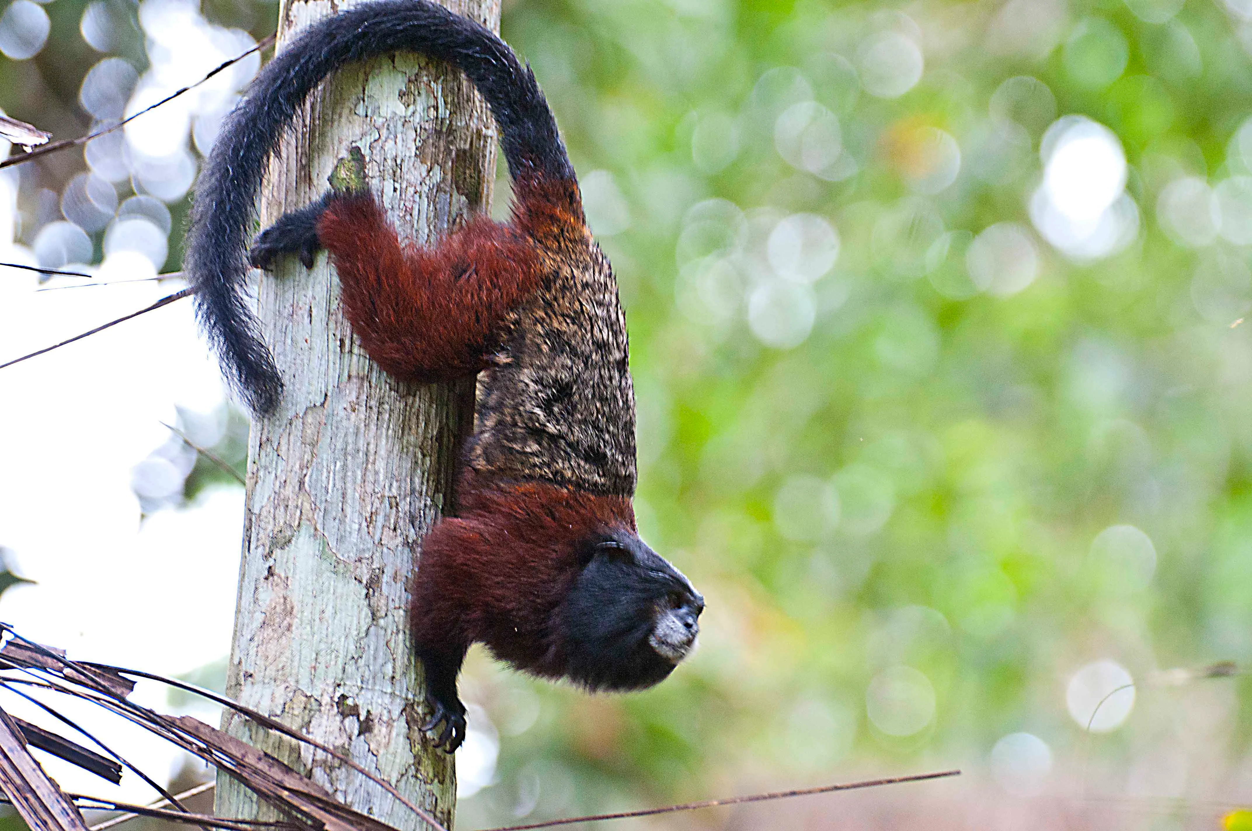
A saddle-back tamarin monkey with dark fur and reddish coloring, climbing vertically on a textured tree trunk.
A saddle-back tamarin climbing a tree trunk in the Amazonian rainforest.

Tapiche Reserve landscape and geographic character

The landscape of Tapiche Reserve is defined by a transition from river to forest, hydrology to topography. The Tapiche River runs through the center of the protected area, its blackwater character shaping both the chemistry and the visual feel of the surrounding forests. Its waters carry little suspended sediment but a heavy load of organic acids, giving them a dark, tea-like appearance that influences plant communities all along its banks.

Surrounding the river course, the terrain unfolds in several distinct layers. Alluvial plains and associated floodplains sit closest to the active channels, while aguajal palm swamps develop in the lowest, most waterlogged depressions, often over fibric histosol soils with pH values between 3.5 and 5. Slightly higher ground appears as undulating terraces that are not regularly flooded but still carry the imprint of the river's movement. Further from the active floodplain, the reserve rises into gently sloping low hills, providing long, well-drained slopes dominated by terra firme forest.

The reserve's hydrography adds a finer texture to this landscape. Internal lakes, oxbows, meanders, restingas, and narrow channels weave between the forest stands. Quebrada Chambiria, the largest internal body of water, has low flow and accumulates enough organic material to create a distinctive habitat corridor in its own right. During the rainy season, when floodwaters connect these channels, the entire lowland mosaic becomes navigable from a network of shortcuts and side passages instead of the main river course.
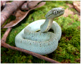
A pale green and speckled snake with a triangular head resting curled on a patch of bright green moss.
An Amazonian palm viper, Bothriopsis bilineata, resting on mossy ground.

Tapiche Reserve ecosystems, habitats, and plant life

The reserve's nature is ultimately a story of water chemistry, forest types, and the way they interlock. Igapo, varzea, and terra firme forests all occur within the protected boundaries, and this unusual convergence is core to its ecological identity. Igapo forests occupy the blackwater floodplains along the Tapiche itself; varzea appears in narrower bands where more sediment-rich inputs alter the soil; and terra firme forests dominate the higher terraces and gentle hills away from the active flood zone.

Aquatic ecosystems are equally important to the reserve's ecological fabric. Cochas and tahuampas (seasonally inundated forest pools and grass-lake wetlands) host distinctive plant communities built around aquatic grasses such as Paspalum fasciculatum and other grasses in the genera Paspalum and Echinochloa. These are accompanied by tall emergent reeds like caña brava (Gynerium sagittatum), water hyacinth (Eichhornia crassipes), and water lettuce (Pistia stratiotes), which together form floating and semi-aquatic habitats that shift with the seasonal flood cycle.

Botanically, the reserve is rich in palms, hardwoods, and culturally valued species. Arecaceae (palms) are particularly prominent, including Mauritia flexuosa in the swamps and species such as Astrocaryum, Attalea, Bactris, Euterpe, and Phytelephas in the broader forests. The Moraceae family contributes strangler figs and renaco, while Fabaceae offers nitrogen-fixing species and several valuable timber trees. Annonaceae completes the quartet of dominant families in the swamp environments, hinting at the structural and functional diversity packed into the area's wetlands.
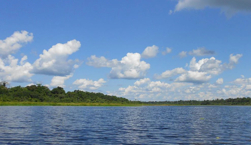
A wide, calm river flowing through a lush green Amazonian forest under a bright blue sky with scattered clouds.
The Tapiche River flowing through the Amazonian landscape of the Tapiche Reserve in Peru.

Tapiche Reserve wildlife and species highlights

Tapiche Reserve supports an exceptionally broad vertebrate fauna, anchored by several large, range-restricted species. The jaguar (Panthera onca) is present as an apex predator, while primates form one of the reserve's most distinctive features: red howler monkeys, white-fronted capuchin monkeys, squirrel monkeys, the bald uakari, and both white-bellied and black spider monkeys are all documented. The Brazilian tapir and the giant armadillo add further weight to the terrestrial mammal community, alongside the Amazonian manatee in the waterways.

Birds are abundant and varied, reflecting the diversity of forest types. Harpy eagles are among the most coveted species recorded, along with crested eagles, black hawk-eagles, and several other raptors including hook-billed kites, double-toothed kites, and swallow-tailed kites. Parrots and macaws are well represented: blue-and-yellow macaws, red macaws, red-bellied macaws, mealy parrots, orange-cheeked parrots, blue-headed parrots, and both tui and dusky-headed parakeets have been documented. Rates like the red-throated caracara, black caracara, and yellow-headed caracara round out the bird community.

The reserve also hosts a remarkable collection of reptiles, amphibians, and smaller mammals. Spectacled caimans and dwarf caimans live in the waters, while yellow-spotted river turtles nest along sandbanks. Frogs such as Hypsiboas punctatus, Rhinella marina, and Phyllomedusa tomopterna, and lizards like Plica plica, are tied closely to the reserve's pools, channels, and floodplain forests. Two-toed sloths, kinkajous, tayras, agoutis, Brazilian porcupines, and bush dogs add a further layer of mammalian diversity, and otters (Lutra longicaudis) and both pink and gray Amazonian river dolphins (Inia geoffrensis and Sotalia fluviatilis) inhabit the larger river channels. Some records also note the presence of the yellow-tailed woolly monkey (Lagothrix lagotricha), a species of significant conservation concern in the region.
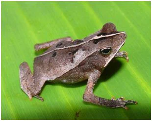
A small brown toad with a prominent ridge on its back resting on a large green leaf.
A small toad, belonging to the Bufonidae family, perched on a bright green leaf within the Tapiche Reserve.

Tapiche Reserve conservation status and protection priorities

As a designated Private Conservation Area (Área de Conservación Privada) under Peruvian law, Tapiche Reserve sits within the country's framework for privately held lands enrolled in the national protected-areas system. The forest types it protects, especially the convergence of igapo, varzea, and terra firme in a single block, carry conservation value well beyond the reserve's borders, because these three forest systems are typically fragmented across the broader Amazon basin.

The reserve's significance is further reinforced by the species it shelters. The jaguar, bald uakari, giant armadillo, Brazilian tapir, Amazonian manatee, and harpy eagle are all species of conservation concern, with the manatee in particular dependent on the quiet, floodplain-connected channels and lakes of the Tapiche basin for refuge. Maintaining functional populations of these animals requires very large, connected forest and river habitats, which the reserve helps sustain alongside neighboring areas.

The 2011 land survey and rapid biological inventory raised the reserve's profile as a scientific reference site. By systematically documenting flora and fauna across a relatively well-protected corridor of lowland Amazon, the inventory created a baseline that can be used for future monitoring of forest health, wildlife populations, and the impacts of broader regional pressures, including climate shifts, river-system changes, and external land-use pressures.

Tapiche Reserve cultural meaning and human context

Cultural context for Tapiche Reserve is most evident in the deep ethnobotanical relationships embedded in its forests. The 2011 flora inventory catalogs not only scientific species names but also local names and traditional uses, ranging from construction timber and food to medicine, dyes, thatching, and ritual plants. Species such as ayahuasca (Banisteriopsis caapi), uña de gato (Uncaria tomentosa), and a wide range of medicinal barks and resins speak to a long-standing local knowledge of how the forest is used.

Palms occupy a particularly rich cultural niche in the area. Arecaceae species such as Astrocaryum chambira (chambira), Mauritia flexuosa (aguaje), Attalea phalerata (shapaja), and Phytelephas macrocarpa (yarina) appear in substantial volume and are used for thatching, fiber, crafts, food, and tools. Trees such as Socratea exorrhiza (cashapona), Hura crepitans (catahua), and Eschweilera species (machimango) are similarly woven into everyday material culture. This breadth of ethnobotanical use suggests that the broader Tapiche basin has long supported communities whose daily life is tightly interwoven with the surrounding forest and river.
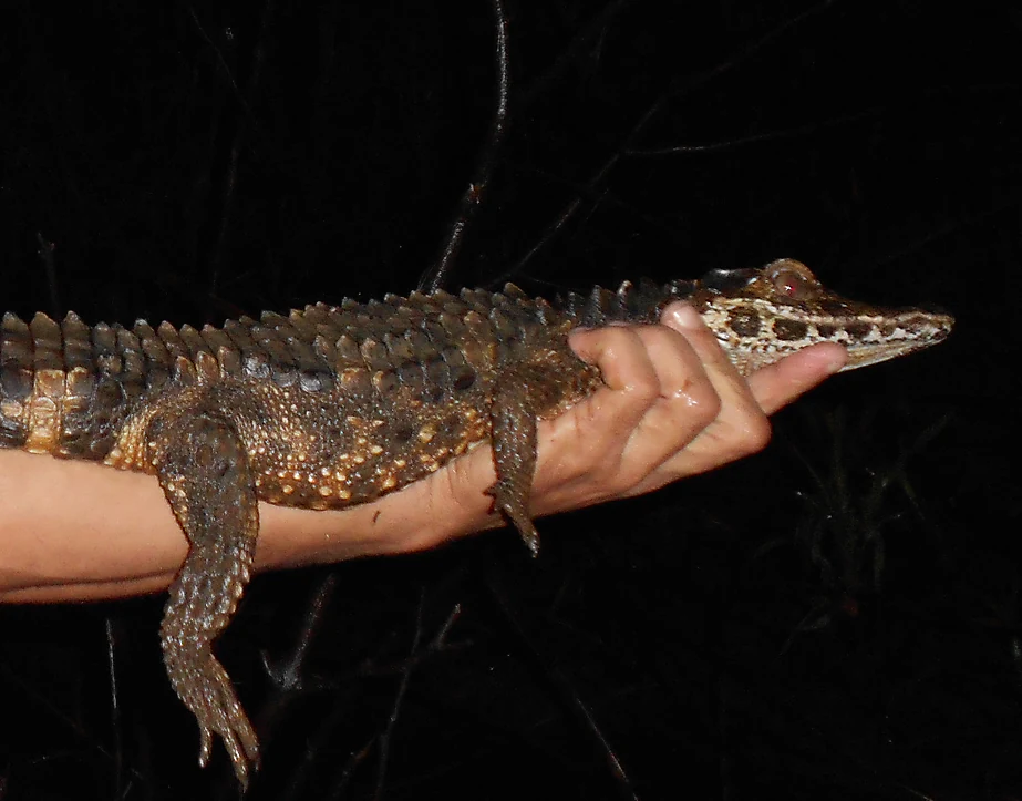
A close up shot of a person holding a small juvenile caiman in their hand against a dark, nocturnal background.
A small caiman being held for observation at night in the Tapiche Reserve.

Top sights and standout views in Tapiche Reserve

Tapiche Reserve's strongest points of distinction are ecological: it is one of the few protected areas in the Amazon basin where igapo, varzea, and terra firme forests all converge within a single continuous landscape. Layered on top of that forest mosaic is a network of aguajal palm swamps, a blackwater river system with acidic, humic-rich waters, and a labyrinth of oxbows, channels, and meanders that expand significantly in the rainy season.

Equally notable is the wildlife profile. The reserve provides habitat for an unusually complete set of Amazonian icon species: jaguar, harpy eagle, bald uakari, giant armadillo, Brazilian tapir, and Amazonian manatee, alongside a rich primate community that includes spider monkeys, howler monkeys, and the yellow-tailed woolly monkey. Add to this the documented presence of Amazonian river dolphins (both pink and gray), harpy and crested eagles, and a long list of parrot, macaw, and amphibian species, and the reserve emerges as a high-biodiversity refuge in the western Amazon.

Finally, the reserve's role as a private conservation area with a formal biological inventory elevates it beyond a generic protected landscape. The 2011 survey created a detailed baseline of plants and animals, giving Tapiche Reserve an enduring reference value for Amazon research, conservation planning, and regional biodiversity monitoring.
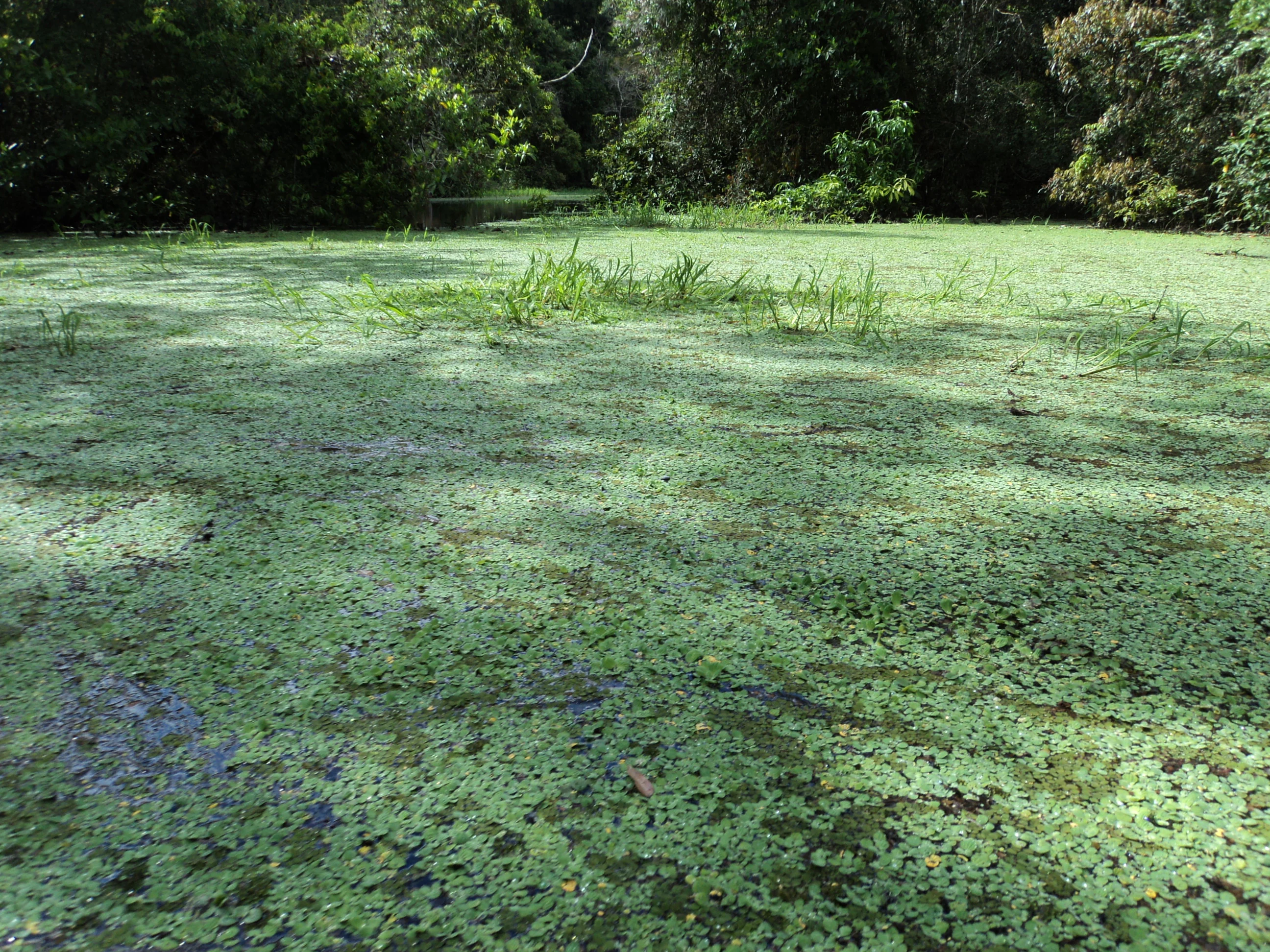
A calm, narrow waterway covered in thick green aquatic vegetation, surrounded by dense Amazonian forest.
The dense vegetation covering the Chambiria Channel in the Tapiche Reserve.

Best time to visit Tapiche Reserve

The climate of Tapiche Reserve is strongly seasonal, and timing a visit around those rhythms significantly shapes what one experiences. From October through May, the area enters its rainy season, with tropical rainfall that can total roughly three meters across the year. During this period, river channels and forest pools expand, lowland trails may be partially flooded, and the landscape takes on its most water-rich, dynamic character.

Between June and September, rainfall eases and the reserve typically experiences its most accessible conditions. Notably, in June or July a brief "cold spell" can occur, when polar air masses penetrate into the South American tropics and drop temperatures for two to four days, sometimes as low as around 13 degrees Celsius. This unusual chill can briefly alter the soundscape and behavior of wildlife, and signals the transitional character of the dry season. Year-round temperatures in the lowland Amazon remain warm: daily ranges typically sit between roughly 25 and 33 degrees Celsius, with high relative humidity.
Monthly climate preview

Long-term representative measurements outlining monthly weather variation across the reserve

Tapiche Reserve Climate Normals, Annual Temperature and Precipitation Rhythm

Representative coordinate records show sustained mean temperatures and shifting monthly precipitation rates across the landscape. Reviewing complete monthly climate normals provides deeper context for the long-term weather rhythm at Tapiche Reserve.
Annual mean25 °C
25 °C26 °C
Jan26°
Feb26°
Mar26°
Apr25°
May25°
Jun25°
Jul25°
Aug25°
Sep26°
Oct26°
Nov26°
Dec26°
Warmest month
October

26.1 °C

Coolest month
July

24.7 °C

Wettest month
March

8.6 mm/day

Driest month
August

2.9 mm/day

Park location guide

Geography guide, regional context, and park location map for Tapiche Reserve

Tapiche Reserve park geography, regions, and map view in Peru

Understand where Tapiche Reserve sits in Peru through a broader geographic reading of the surrounding landscape, nearby location context, and its mapped position within the national park landscape.

How Tapiche Reserve fits into Peru

Peru is a megadiverse country in western South America with a population of over 34 million. It spans three distinct geographic regions: the Pacific coastal desert in the west, the Andes mountains running north to south, and the Amazon rainforest in the east. The country has one of the longest histories of civilization in the world, tracing back to the Caral-Supe civilization of the 10th millennium BCE, and was home to the Inca Empire before Spanish colonization in the 16th century.

Wider geography shaping Tapiche Reserve in Peru

Peru is located in western South America along the Pacific coast. The country encompasses three major geographic regions: the coastal desert plains along the Pacific, the Andes mountain range extending from north to southeast, and the Amazon basin rainforest in the eastern interior. It shares borders with Ecuador and Colombia to the north, Brazil to the east, Bolivia to the southeast, and Chile to the south.

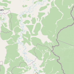
Map view of Tapiche Reserve

Use this park location map to pinpoint Tapiche Reserve in Peru, understand its exact geographic position, and read its mapped placement within the surrounding landscape more clearly.

Pigeon | © OpenStreetMap contributors

Location context for Tapiche Reserve

Loreto Region

Explore photographic records of blackwater rivers, floodplain swamps, and diverse forest terrain.

Tapiche Reserve Photos and Landscape Scenery: Visualizing Amazonian Protected Habitats

Visual documentation captures the complex transition from winding blackwater channels to dense terra firme forest across the lowland Amazon basin. Photographic evidence reveals the intricate mosaic of palm swamps and riverine habitats that define the ecological character of the protected landscape.

A saddle-back tamarin monkey with dark fur and reddish coloring, climbing vertically on a textured tree trunk.

A pale green and speckled snake with a triangular head resting curled on a patch of bright green moss.

A wide, calm river flowing through a lush green Amazonian forest under a bright blue sky with scattered clouds.

A small brown toad with a prominent ridge on its back resting on a large green leaf.

A small bird with a brown chest and iridescent blue-green head perched on a thin horizontal branch against a blurred green forest background.

A close up shot of a person holding a small juvenile caiman in their hand against a dark, nocturnal background.

A calm, narrow waterway covered in thick green aquatic vegetation, surrounded by dense Amazonian forest.

Park atlas

Compare regional forest reserves, blackwater river corridors, and lowland habitats.

Parks Near Tapiche Reserve And Other Protected Landscapes in the Amazon Basin

Browse protected areas and lowland forest reserves sharing geographic ties with Tapiche Reserve in the Peruvian Amazon. Comparing adjacent conservation units reveals broader patterns in floodplain hydrology, blackwater ecosystems, and regional biodiversity.
National parkPeru
About 86 km away#1 closest

South

Sierra del Divisor National Park: Peru's Sacred Amazonian Protected Landmark

Explore dramatic mountain terrain and protected lowland rainforest.

Sierra del Divisor National Park in Peru is a vital protected area conserving over 1.35 million hectares of Amazon rainforest. Characterized by the unique Sierra del Divisor mountain range and the sacred pyramid peak of Cerro El Cono, the park offers a distinct landscape within the broader Amazon basin. As one of Peru's newer national parks, it represents a significant commitment to preserving critical biodiversity corridors and understanding the geographic context of protected lands in a region facing environmental pressures.

Area
13,544.8 km²
Established
2015
IUCN
II
Relief
Mixed relief
National parkPeru
About 205 km away#2 closest

Southwest

Cordillera Azul National Park: A National Park for Geographic Discovery in Peru

Explore Peru's protected landscape and regional map context.

Cordillera Azul National Park serves as a dedicated entry point for understanding Peru's protected natural areas through a geographic lens. This park's identity is tied to its specific mapped boundaries and its contribution to the nation's diverse terrain. Focusing on Cordillera Azul National Park allows for detailed atlas exploration of its unique landscape context within western South America, providing factual data for geographic understanding.

Area
13,531.9 km²
Established
2001
IUCN
II
Relief
Mountain
A soft watercolor illustration showing rolling green hills and distant mountain peaks in pale yellow and green tones, with a minimalist white background.
Wildlife reservePeru
About 351 km away#3 closest

South

El Sira Communal Reserve: Geographic Profile and Protected Landscape Context in Peru

Analyzing the Sira Mountain range and regional watershed boundaries

El Sira Communal Reserve sits at the intersection of the Andes and the Amazon, protecting a vast mosaic of habitats across Huánuco, Pasco, and Ucayali. Its geography is defined by deep river valleys, mountain ridges, and a significant altitudinal range that supports diverse wildlife communities. This resource provides a detailed look at the boundaries, terrain, and ecological importance of this major Peruvian protected area.

Area
6,164.13 km²
Established
2001
IUCN
VI
Relief
Mountain
A watercolor illustration of layered green hills and distant mountain ridgelines, depicted in soft pastel tones against a white background.
Nature reserveSan Martin
About 361 km away#4 closest

West

Alto Mayo Protection Forest: Geographic Boundaries and Andean Slope Landscape Mapping

Protected watershed and cloud forest in San Martin, Peru

Spanning the eastern Andes, Alto Mayo Protection Forest functions as a foundational watershed for the Mayo River basin. This reserve preserves significant cloud forest habitats and high-gradient terrain, serving as an important link between Andean highlands and the Amazonian lowlands. Study the topographic features, hydrological network, and protected boundaries that define this crucial Peruvian wilderness.

Area
1,820 km²
Established
1987
IUCN
VI
Relief
Mountain
National parkLoreto Region
About 376 km away#5 closest

Northeast

Yaguas National Park: A Vast Protected Amazonian Landscape in Peru's Loreto Region

Mapping unique transboundary conservation and tropical biodiversity.

Yaguas National Park represents a monumental addition to Peru's protected lands, safeguarding an immense area of Amazonian rainforest within the Loreto Region. Its designation as a national park underscores its ecological importance as part of a critical international conservation corridor. This page provides detailed geographic context, showcasing the park's mapped boundaries, its characteristic lowland tropical forest terrain, and its role in preserving the rich biodiversity of the Amazon basin.

Area
8,689 km²
Established
2018
IUCN
II
Relief
Lowland
National parkSan Martín Region
About 381 km away#6 closest

Southwest

Rio Abiseo National Park: Peru's Protected Landscape Identity and Geographic Context

Discover the mapped boundaries and regional atlas information.

Investigate Rio Abiseo National Park, a designated national park situated within the San Martín Region of Peru. This detailed entry focuses on its protected landscape characteristics and its specific geographic placement. Understand the park's mapped boundaries and its role in the broader atlas of protected areas, offering a structured approach to geographic discovery.

Area
2,745.2 km²
Established
1983
IUCN
II
Relief
Mountain
National parkColombia
About 455 km away#7 closest

Northeast

Amacayacu National Natural Park: Amazonian Flooded Forest and Protected Geography

Explore mapped park boundaries and biodiversity within the Amazon River ecosystem.

Amacayacu National Natural Park is a premier protected area in Colombia, defined by its expansive Amazonian rainforest along the Amazon River. This national park safeguards a complex geography of seasonally flooded forests, river islands, and intact jungle, supporting exceptional biodiversity. Users can explore the mapped extent of Amacayacu National Natural Park, understand its role as a crucial habitat for Amazon river dolphins and primates, and appreciate the dynamic landscape shaped by the river's pulse, all within a comprehensive atlas context.

Area
2,935 km²
Established
1975
IUCN
II
Relief
Lowland
Wildlife reserveAmazonas Region
About 463 km away#8 closest

West

Chayu Nain Communal Reserve: Mapped Protected Landscapes and Regional Geography in Peru

Andes to Amazon ecological transition zone in the Amazonas region

Chayu Nain Communal Reserve functions as a critical stronghold for endemic wildlife and represents a major achievement in communal conservation. Its sandstone geology and elevational gradients create a distinct terrain that sustains rare primate populations, lowland tapirs, and complex forest mosaic habitats in northern Peru.

Area
235.98 km²
Established
2009
IUCN
VI
Relief
Upland

Common questions about visiting, size, designation, and location context for Tapiche Reserve

Tapiche Reserve FAQs for park facts, access, geography, and protected area context

Find quick answers about Tapiche Reserve, including protected-area facts, park geography, trail and visitor context, and how the park fits into its surrounding country and regional landscape.
MoriAtlas Explorer

Continue Your Protected Areas Search Across the Global Atlas

Deepen your exploration by continuing the structured search for national parks and protected areas worldwide. Utilize the comprehensive filtering capabilities to compare different conservation landscapes and refine your understanding of global park geography. Discover more about the distribution and characteristics of protected natural areas.

Global natural geography

