Why Tirgua National Park stands out
Tirgua National Park is best known as a hydrological protection unit. Its primary purpose is preserving the water sources that feed the Tirgua River and surrounding drainage systems, which makes the park especially valuable within the regional watershed. Beyond its water role, the park stands out for its foothill geography, mixing rugged terrain with deciduous and semi-deciduous forests that support primates, large mammals, and a notably rich bird community of more than three hundred recorded species.
Tirgua National Park history and protected-area timeline
Tirgua National Park was officially established on June 5, 1992, as part of Venezuela's national system of protected areas. From the outset, its designation was tied to the conservation of water resources, particularly the headwaters of the Tirgua River that flow through the region.
Since its creation, the park has been administered by INPARQUES, the Venezuelan agency responsible for managing national parks and other protected natural areas. Its designation under IUCN Category II reflects its status as a national park focused on ecosystem and watershed conservation.
The park carries the official name Parque Nacional Tirgua, General Manuel Manrique, honoring a figure connected to its institutional identity, though the source material does not detail the specific biographical background behind the dedication.
Tirgua National Park landscape and geographic character
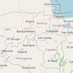
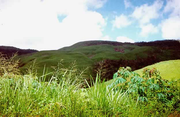
The landscape of Tirgua National Park is defined by piedmont topography along the transition between the central Venezuelan llanos and the foothills of the northern ranges. The terrain is uneven and broken, with irregular relief that creates a varied surface of slopes, valleys, and drainage lines.
This foothill setting shapes how water moves through the park, concentrating runoff into the streams and rivers that rise within its boundaries. The Tirgua River, the park's namesake, traces its origins to this system of slopes and seasonal forest cover, which together regulate the flow and quality of water in the broader region.
The park does not feature extreme elevations or dramatic high-mountain scenery. Instead, it offers a more rolling but accidented landscape, typical of Venezuelan piedmont environments, where changes in elevation, soil, and drainage create distinct microhabitats across a relatively compact geographic area.
Tirgua National Park ecosystems, habitats, and plant life
Ecologically, Tirgua National Park lies in a transitional zone between the dry interior landscapes of central Venezuela and the more humid northern foothills. This position gives it a vegetation mosaic shaped by seasonal rainfall patterns, with deciduous and semi-deciduous forests forming the dominant plant cover.
The tree canopy includes clusiaceous, mimosaceous, myrtaceous, and tiliaceous species, while the understory is occupied in large areas by palms. This mix of seasonal broadleaf forest and palm-dominated understory layers is characteristic of the region's piedmont forests, which shed leaves during the dry season and regain density with the rains.
The combination of varied topography, seasonal forest, and consistent water availability creates a habitat structure that supports a wide range of animals, making the park ecologically richer than its relatively modest size might suggest.
Tirgua National Park wildlife and species highlights
Tirgua National Park supports a diverse mammal community for an area of its size. Among the notable species are howler monkeys and capuchin monkeys, the cunaguaro (a wild cat of the region), the lapa (agouti), and the danta (tapir), a large herbivore of particular conservation interest.
Reptiles are also well represented, including snakes such as the boa constrictor (known locally as tragavenado), the mapanare, and several coral snake species. These reptiles occupy the forest understory and the edges of clearings and watercourses that cross the park.
The park is especially notable for its birdlife, with more than three hundred recorded species. Among them are the maracaná macaw (Ara severus), various parakeets and parrots, herons, two species of toucans, and many additional resident and migratory birds. This diversity makes the area meaningful for birdwatching and for regional avian conservation.
Tirgua National Park conservation status and protection priorities
Tirgua National Park's conservation value is rooted primarily in its hydrological function. By protecting the headwaters of the Tirgua River and the surrounding drainage basins, the park safeguards water supply, flow regulation, and watershed integrity for downstream communities and ecosystems.
Designated under IUCN Category II and managed by INPARQUES, the park forms part of Venezuela's national strategy for conserving representative ecosystems and critical water-producing landscapes. Its forested slopes act as natural regulators of rainfall capture and runoff, reducing erosion and maintaining water quality.
Beyond water, the park contributes to biodiversity conservation in north-central Venezuela by preserving seasonal piedmont forests and the fauna they support. The presence of species such as the tapir, several primate species, and a rich avifauna underscores the importance of maintaining habitat continuity in this transitional landscape between the llanos and the northern ranges.
Top sights and standout views in Tirgua National Park
Tirgua National Park's strongest defining feature is its role as a protected watershed surrounding the headwaters of the Tirgua River. This hydrological identity, more than any single landmark, gives the park its character and importance within the regional landscape.
Its varied foothill terrain, dominated by deciduous and semi-deciduous forests, supports an unusually rich fauna for the area, including primates, large cats, tapirs, snakes, and more than three hundred bird species. Together, these qualities make Tirgua a quiet but ecologically meaningful part of Venezuela's protected-area network.
Best time to visit Tirgua National Park
Tirgua National Park lies in a region with a pronounced seasonal climate, where the alternation between wet and dry periods strongly shapes the experience of the landscape. The dry season tends to bring more open forest conditions, easier visibility along forest edges and watercourses, and more concentrated wildlife activity around remaining water sources.
The wet season restores dense foliage and stream flow, which can make birdwatching and forest exploration more immersive, though tracks and trails may be more difficult to traverse. Because the park's appeal is strongly tied to its water systems and seasonal forests, understanding the local climate rhythm is more useful than focusing on a single calendar window.