Mori Atlas logo
National parkTuart Forest National Park

Discover the unique limestone terrain and towering eucalyptus landscape of this significant protected area.

Tuart Forest National Park: A Mapped National Park Preserving World's Largest Pure Tuart Woodland

Tuart Forest National Park in Western Australia represents a globally significant protected area, safeguarding the largest remaining pure stand of the rare tuart forest ecosystem. Situated on the coastal limestone soils of the Swan Coastal Plain, this national park showcases some of the tallest and most massive Eucalyptus gomphocephala trees on Earth. Its distinctive landscape supports critical habitat for endangered species, making it an essential destination for understanding Australia's unique protected woodlands and their geographic context.

tuart forestlimestone woodlandWestern Australiaendangered species habitatWestern Ringtail PossumEucalyptus woodland

Tuart Forest National Park

National park

Park overview

Structured park overview, official facts, and landscape profile for Tuart Forest National Park

Tuart Forest National Park park facts, protected area profile, and essential visitor context
Review the core facts for Tuart Forest National Park, including designation, size, terrain, visitor scale, habitats, and operating context in one park-focused overview.

About Tuart Forest National Park

Tuart Forest National Park represents one of the most botanically significant protected areas in Western Australia, preserving a forest type that has been drastically reduced by agricultural development and urban expansion across the Swan Coastal Plain. The tuart tree is a distinctive eucalypt species uniquely adapted to the shallow, alkaline soils derived from coastal limestone formations. Unlike many eucalypt species that tolerate a range of conditions, tuart grows almost exclusively on this specific geological substrate, making its distribution naturally restricted. The park encompasses the finest remaining examples of this woodland, with the trees here representing the genetic legacy of a forest type that once covered much of the coastal plain between Perth and Bunbury. The establishment of the park in 1987 marked formal recognition of both the botanical significance and the conservation vulnerability of this ecosystem. Visitors to the park can appreciate the towering trees along a network of walking tracks, with the Tuart Drive road providing access through the heart of the forest. The park's management focuses on maintaining the ecological integrity of the tuart woodland while providing sustainable visitor opportunities that do not compromise the sensitive possum populations or the forest ecosystem.

Quick facts and research context for Tuart Forest National Park

Tuart Forest National Park covers approximately 20.5 square kilometres along the coastal limestone belt of Western Australia's Swan Coastal Plain. The park was established in 1987 and is located between the towns of Capel and Busselton, near the Ludlow settlement. The tuart tree (Eucalyptus gomphocephala) is endemic to this specific limestone region and the park contains the world's largest remaining stand of this species. The forest is home to the largest wild population of the Western Ringtail Possum, a marsupial of significant conservation concern. A 2-kilometre night trail called the Possum Spotlighting Trail allows visitors to observe both Western Ringtail and Brushtail Possums in their natural habitat.

Park context

Deeper park guide and search-rich context for Tuart Forest National Park

Tuart Forest National Park history, landscape, wildlife, and travel context
Explore Tuart Forest National Park through its history, landscape character, ecosystems, wildlife, conservation priorities, cultural context, and seasonal travel timing in a structured park guide built for atlas discovery and search intent.

Why Tuart Forest National Park stands out

Tuart Forest National Park is best known for protecting the world's largest remaining pure tuart forest, an ecosystem that exists only on the coastal limestone soils of south-western Australia. The park contains the tallest and most impressive specimens of Eucalyptus gomphocephala remaining anywhere, with individual trees reaching over 33 metres in height. It is also renowned as the stronghold population for the Western Ringtail Possum, an endangered marsupial that depends on the dense canopy and hollows of mature tuart trees. The Possum Spotlighting Trail offers one of the few opportunities in Australia to observe these nocturnal marsupials in the wild.

Wooden sign reading 'LUDLOW TUART FOREST' surrounded by tall trees and greenery in a forest setting
Sign for Ludlow Tuart Forest entrance within the national park

Tuart Forest National Park history and protected-area timeline

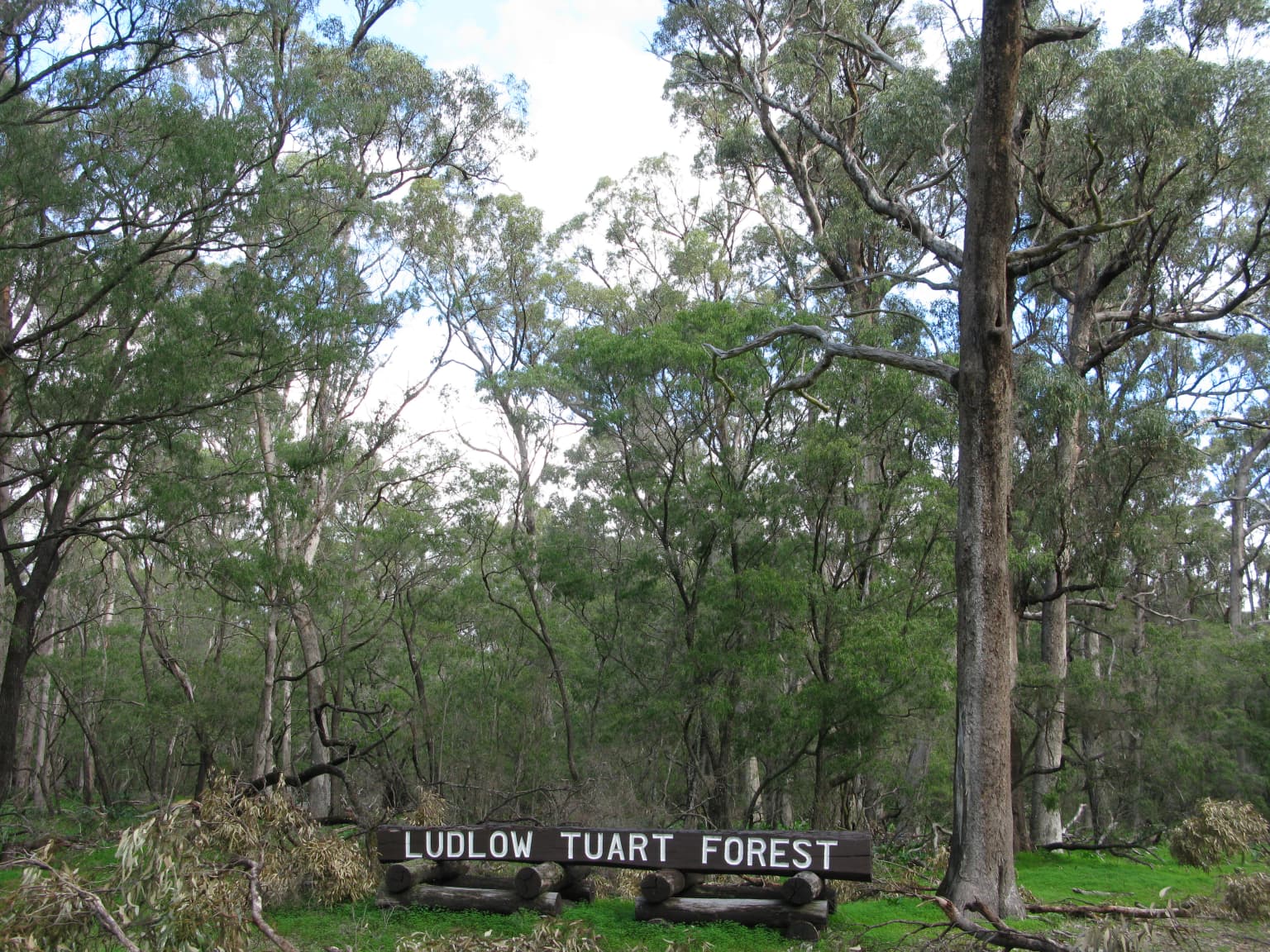
Tuart Forest National Park was officially established in 1987, formalizing protection for an area of forest that had long been recognized for its botanical significance. The tuart woodland in this area was historically part of the Ludlow State Forest, a name derived from the nearby settlement and honoring Frederick Ludlow, an early settler in the region. For decades before formal national park status, the area served as a state forest where timber harvesting and other extractive uses were permitted, though the unique nature of the pure tuart stand was increasingly understood by foresters and botanists. The transition to national park status reflected a growing recognition that this forest represented an irreplaceable natural asset that warranted protection rather than exploitation. The road known as Tuart Drive, approximately 15 kilometres in length, was originally part of the Bussell Highway but was diverted around the park in 1995, reducing traffic impacts on the forest ecosystem. The creation of the Possum Spotlighting Trail represents a more recent visitor management initiative, designed to allow nocturnal wildlife observation while minimizing disturbance to the sensitive possum populations.

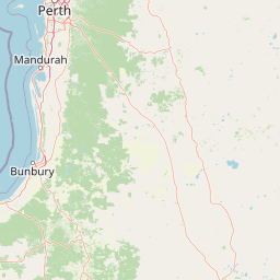
Tuart Forest National Park landscape and geographic character

The landscape of Tuart Forest National Park is defined by a narrow belt of coastal limestone that underlies the southern Swan Coastal Plain. The terrain is gently undulating, with the limestone bedrock lying close to the surface and influencing both soil chemistry and drainage patterns. The tuart trees dominate the canopy, forming a relatively open woodland with a scattered understory of shrubs and grasses adapted to the alkaline soils. The forest creates a distinctive visual character, with the massive, gnarled trunks and spreading canopies of the mature tuart trees creating a park-like environment. The limestone influence extends to the substrate, with many areas showing exposed limestone outcrops or shallow soils over the bedrock. The park occupies a transitional position between the more arid interior of the coastal plain and the higher rainfall zones closer to the coast, giving it intermediate environmental characteristics that support the tuart ecosystem.

Tuart Forest National Park ecosystems, habitats, and plant life

The tuart forest represents a highly restricted ecological community with remarkable botanical significance. Eucalyptus gomphocephala is endemic to the coastal limestone soils of south-western Australia, and the Tuart Forest National Park contains the largest and most genetically diverse remaining population of this species. The forest structure features tall, mature trees with a relatively open canopy that allows sunlight to reach the forest floor, supporting a diverse ground layer of shrubs and grasses. The limestone-derived soils are alkaline and relatively nutrient-poor, selecting for plant species adapted to these specific conditions. The ecological significance of the forest extends beyond the trees themselves, with the complex structure of mature tuart providing critical habitat for hollow-dependent wildlife. The forest exists at the western edge of the tuart's range and represents a transition between the more extensive woodlands of the interior and the specific coastal limestone environment that this species requires.

Tuart Forest National Park wildlife and species highlights

Tuart Forest National Park is home to a remarkable concentration of wildlife, particularly marsupials that depend on the mature forest for survival. The park supports the largest remaining wild population of the Western Ringtail Possum (Pseudocheirus occidentalis), an endangered species that has suffered significant range contraction across its former distribution on the Swan Coastal Plain. These possums rely on tree hollows in mature tuart trees for shelter during daylight hours and emerge at night to feed on leaves, flowers, and nectar. The Western Ringtail Possum is specifically adapted to the tuart woodland ecosystem and is rarely found in other forest types. The park also supports populations of the more widespread Brushtail Possum, which can be observed along the same nighttime viewing areas. Birdlife includes various parrots, honeyeaters, and woodland species that utilize the forest canopy and understory. The combination of hollow-bearing trees, dense canopy cover, and the presence of flowering plants throughout the year makes this forest particularly valuable for wildlife conservation.

Tuart Forest National Park conservation status and protection priorities

Tuart Forest National Park serves as a critical refuge for one of Western Australia's most restricted and threatened forest ecosystems. The tuart woodland represents a community that has been reduced to remnant patches across much of its former range, with agricultural conversion, urban development, and historical logging eliminating the vast majority of the original forest cover. The establishment of the park formalized protection for the largest and most intact remaining example of pure tuart forest, preserving both the forest ecosystem and the wildlife populations it supports. The Western Ringtail Possum population in the park is of particular conservation significance, representing a stronghold for this endangered species that has declined dramatically outside protected areas. Management of the park focuses on maintaining forest health, protecting wildlife populations from disturbance, and providing visitor experiences that are compatible with conservation objectives. The park contributes to regional biodiversity conservation by preserving a functioning example of an ecosystem type that has largely disappeared from the surrounding landscape.

Tuart Forest National Park cultural meaning and human context

The tuart forest area has been part of the cultural landscape of the Noongar people, the Traditional Custodians of the south-west of Western Australia, though detailed historical documentation of indigenous use of this specific area is limited in available sources. The forest would have provided resources including food, materials, and shelter for local Aboriginal groups. The post-colonial history of the area is tied to European settlement, with the Ludlow area named after Frederick Ludlow, an early settler in the region. The forest was subsequently managed as State Forest before its protection as a national park. The tension between conservation values and historical land use practices, including the partial loss of the forest to logging and agricultural conversion, reflects broader patterns across the Swan Coastal Plain.

Top sights and standout views in Tuart Forest National Park

The towering tuart trees, some exceeding 33 metres in height and 10 metres in girth, represent the tallest and largest surviving specimens of this species anywhere in the world. The Possum Spotlighting Trail offers a rare opportunity to observe Western Ringtail Possums and Brushtail Possums in their natural nocturnal habitat. The forest exists on a unique coastal limestone substrate that determines the distribution of this restricted ecosystem. The park preserves the largest wild population of an endangered marsupial that depends entirely on mature tuart woodland. The combination of botanical significance, wildlife importance, and accessibility makes this park a unique conservation asset in the Western Australian landscape.

Best time to visit Tuart Forest National Park

The park can be visited year-round, though autumn and spring offer particularly comfortable conditions for walking and wildlife observation. The cooler months from April to September provide ideal temperatures for exploring the forest trails, including the Possum Spotlighting Trail which is specifically designed for evening visits when possums are active. Summer months can be warm but early morning walks offer the chance to observe birds and other diurnal wildlife. The nighttime possum viewing is most productive on moonless nights when the animals are more likely to venture into the open. The park is accessible from Busselton, making it a convenient destination for visitors exploring the South West region of Western Australia.

Park location guide

Geography guide, regional context, and park location map for Tuart Forest National Park

Tuart Forest National Park park geography, regions, and map view in Australia
Understand where Tuart Forest National Park sits in Australia through a broader geographic reading of the surrounding landscape, nearby location context, and its mapped position within the national park landscape.

How Tuart Forest National Park fits into Australia

Australia is a constitutional monarchy and federal parliamentary democracy comprising six states and ten territories. With a population of nearly 28 million, it is one of the world's most urbanised countries, with most people concentrated on the eastern seaboard. The country has a high Human Development Index and is known for its cultural diversity, ancient Aboriginal heritage, and unique wildlife.

Wider geography shaping Tuart Forest National Park in Australia

Australia occupies the entire Australian continent, the island of Tasmania, and numerous smaller islands. It is the world's flattest and driest inhabited continent, featuring vast deserts in the interior (the Outback), tropical rainforests along the eastern coast, and a coastline bordering the Indian and Pacific Oceans.

Map view of Tuart Forest National Park

Use this park location map to pinpoint Tuart Forest National Park in Australia, understand its exact geographic position, and read its mapped placement within the surrounding landscape more clearly.

Pigeon | © OpenStreetMap contributors

Location context for Tuart Forest National Park

Western Australia

Visually understand the unique coastal limestone woodland, the towering tuart trees, and the vital protected habitats of this Western Australian national park.

Tuart Forest National Park Photos: Explore Landscapes and Protected Forest Scenery
The gallery provides a visual overview of Tuart Forest National Park, capturing its distinctive landscapes, towering tuart trees, and the unique coastal limestone environment. Browse these protected-area photos to understand the park's specific habitats, its ecological significance, and the visual character of this globally rare Western Australian forest ecosystem.

Wooden sign reading 'LUDLOW TUART FOREST' surrounded by tall trees and greenery in a forest setting

Park atlas

Trace the Regional Geography and Protected Landscapes Surrounding Tuart Forest National Park in Western Australia

Discover Other National Parks and Protected Areas Near Tuart Forest National Park
After exploring Tuart Forest National Park's unique tuart forest ecosystem, browse other national parks and protected areas across Western Australia to continue your geographic discovery. Compare diverse landscapes and conservation efforts in the surrounding region, deepening your understanding of protected-area geography.
National parkWestern Australia

Whicher National Park: Exploring Western Australia's Protected Landscape Geography

A national park with distinct mapped boundaries and natural terrain.

Delve into the geographic profile of Whicher National Park, a designated national park situated within the vast landscapes of Western Australia. This entry provides an atlas-focused view of the park's protected land identity, its position within the regional geography, and the characteristics of its mapped natural terrain. Understand the park's specific role as a protected area and its contribution to the broader natural landscape context of Western Australia.

Established
2019
IUCN
II
Relief
Upland
Climate
Mediterranean
National park

Yelverton National Park National Park: Mapped Protected Area & Biodiversity Refuge

Focusing on rare species and diverse vegetation communities.

Yelverton National Park, situated in the South West region of Western Australia, serves as a vital protected area dedicated to preserving ecological significance. Established from former timber reserves, its 729 hectares capture diverse vegetation types crucial for rare and priority species. This park's landscape identity lies in its role as a biodiversity refuge, distinct from nearby tourism hubs, offering a unique insight into conservation-driven land management and the mapped protected geography of the region.

Area
7.29 km²
Established
2004
IUCN
II
Scope
Terrestrial
National parkWestern Australia

Wellington National Park: Protected Jarrah Forest & Collie River Landscape

Explore the mapped boundaries and regional geography.

Wellington National Park offers a deep dive into Western Australia's protected landscapes, characterized by extensive old-growth jarrah forests and the scenic Collie River valley. This national park provides a vital study of the region's unique geography, mapped terrain, and ecological significance within the Yilgarn craton. Understand the park's protected area identity and its place in the wider natural context of Western Australia through its detailed landscape features.

Area
170 km²
Established
2000
IUCN
II
Visitors
212K annual
National park

Wiltshire-Butler National Park: Mapped Jarrah Forest Landscape in Western Australia

Explore protected boundaries and regional geographic context

Wiltshire-Butler National Park stands as a protected natural area celebrated for its representation of Western Australia's iconic jarrah forest ecosystems. This National Park, created in 2004, offers rich opportunities for atlas-based discovery, focusing on its distinct landscape character, mapped park boundaries, and its geographical placement within the broader South West region. Understanding its terrain and conservation significance provides valuable insight into the protected lands of the Jarrah Forest bioregion.

Area
116.45 km²
Established
2004
IUCN
II
Relief
Highland
National parkWestern Australia

Wooditjup National Park: Protected Forest Landscape and Regional Geographic Context

Explore mapped boundaries of this Western Australia national park.

Wooditjup National Park stands as a testament to Western Australia's unique forest ecosystems, specifically within the Jarrah Forest bioregion. This protected area offers a distinct natural landscape contrasting with the nearby coastal attractions of Margaret River. Delve into the park's mapped geography, understand its role as a national park, and appreciate its position within the broader South West Australian landscape and its traditional Wardandi Country heritage.

Area
38.92 km²
Established
2004
IUCN
II
Relief
Lowland
National parkWestern Australia

Blackwood River National Park: Protected Area in Western Australia's Geography

Explore mapped boundaries and natural terrain.

Blackwood River National Park is a key protected area within the vast geographic expanse of Western Australia. This park's designation as a national park underscores its importance for conservation and landscape preservation. Users can explore its precisely mapped boundaries to understand its footprint and its contribution to the regional natural landscape context, offering a grounded perspective on protected lands within Australia.

Area
204.75 km²
Established
2004
IUCN
II
Relief
Upland
National park

Dalgarup National Park: Protected Forest Landscape and Regional Geographic Context in Western Australia

Mapped boundaries of protected areas within the Jarrah Forest bioregion.

Dalgarup National Park serves as a crucial protected area, safeguarding the characteristic jarrah-marri forest ecosystems of southwestern Australia. Located within the Jarrah Forest and Warren bioregions, its terrain reflects the undulating topography and Mediterranean climate prevalent in the South West land division. This national park offers a unique opportunity to explore mapped natural landscapes and understand the conservation efforts within a region historically shaped by forest ecology and development.

Area
23.77 km²
Established
2004
Scope
Terrestrial
Water
Minor water
National parkAustralia

Milyeannup National Park: Explore its Protected Landscape and Geographic Atlas Context

Discover the mapped terrain and boundaries of this Australian national park.

Milyeannup National Park offers a unique focus for atlas-based geographic exploration. This entry details the park's identity as a protected area, highlighting its landscape context and mapped geographic features within Australia. Use this resource to understand its role in the national park system and its specific place within the broader landscape.

Area
186.92 km²
Established
2004
Scope
Terrestrial
Forest
Mostly forested

Common questions about visiting, size, designation, and location context for Tuart Forest National Park

Tuart Forest National Park FAQs for park facts, access, geography, and protected area context
Find quick answers about Tuart Forest National Park, including protected-area facts, park geography, trail and visitor context, and how the park fits into its surrounding country and regional landscape.
MoriAtlas Explorer

Continue Your Protected Areas Search Across the Global Atlas

Deepen your exploration by continuing the structured search for national parks and protected areas worldwide. Utilize the comprehensive filtering capabilities to compare different conservation landscapes and refine your understanding of global park geography. Discover more about the distribution and characteristics of protected natural areas.

Global natural geography