Mori Atlas logo
National parkUssangoda National Park

Trace the mapped boundaries and regional geographic context of this significant natural area.

Ussangoda National Park: Sri Lanka's Protected Landscape and National Park Geography

Ussangoda National Park stands as a distinct protected landscape within Sri Lanka, offering an essential focal point for understanding the island's conservation geography. This dedicated page serves as an atlas entry for Ussangoda National Park, detailing its presence as a national park and providing context for its mapped protected boundaries. Delve into the geographic setting of this natural area to appreciate its place within the broader landscape of Sri Lanka.

coastal plateaured soil ecosystemsea turtle nesting sitearchaeological sitedry zone parkgrassland landscape
Stylized illustration of coastal cliffs, waterfall, sandy beach, and lush vegetation in Ussangoda National Park

Ussangoda National Park

National park

Park overview

Structured park overview, official facts, and landscape profile for Ussangoda National Park

Ussangoda National Park park facts, protected area profile, and essential visitor context
Review the core facts for Ussangoda National Park, including designation, size, terrain, visitor scale, habitats, and operating context in one park-focused overview.

About Ussangoda National Park

Ussangoda National Park represents a unique intersection of geological rarity, ecological significance, and cultural importance within Sri Lanka's protected area network. Located along the Colombo-Kataragama road near the Ambalantota-Nonagama Junction in Hambantota District, the park occupies a distinctive patch of elevated ground that rises from the southern coastal plain. The defining characteristic of Ussangoda is its unusual red soil, a brick-like, hard terrain with a reddish coloration that local communities have long observed and speculated about. This soil quality, combined with the area's location near the sea in a zone known for sea turtle breeding, creates a landscape of uncommon ecological and geological value. The plateau nature of the summit area, extending for a significant length, provides panoramic views of the surrounding coastal terrain. The vegetation pattern differs notably from the surrounding landscape, with grassland dominating and only pockets of pygmy forest surviving, creating an ecosystem of restricted but distinctive character. The park was established in 2010 with the explicit purpose of providing long-term protection for the area's biological, archaeological, and geographical values, reflecting the multiple dimensions of significance this site holds.

Quick facts and research context for Ussangoda National Park

Ussangoda National Park covers 349 hectares in the Hambantota District of Sri Lanka's Southern Province, established in 2010 under the management of the Department of Wildlife Conservation. The park sits on a coastal plateau of elevated ground near the sea, distinguished by its unusual red soils containing high iron concentration. This location places the park within Sri Lanka's southern sea turtle breeding zones. The area is designated both as a national park under IUCN category II and as a significant archaeological site. The park borders the Kalametiya Wildlife Sanctuary to the east, creating a contiguous protected area corridor in this region of the island.

Park context

Deeper park guide and search-rich context for Ussangoda National Park

Ussangoda National Park history, landscape, wildlife, and travel context
Explore Ussangoda National Park through its history, landscape character, ecosystems, wildlife, conservation priorities, cultural context, and seasonal travel timing in a structured park guide built for atlas discovery and search intent.

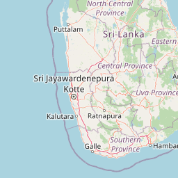
Why Ussangoda National Park stands out

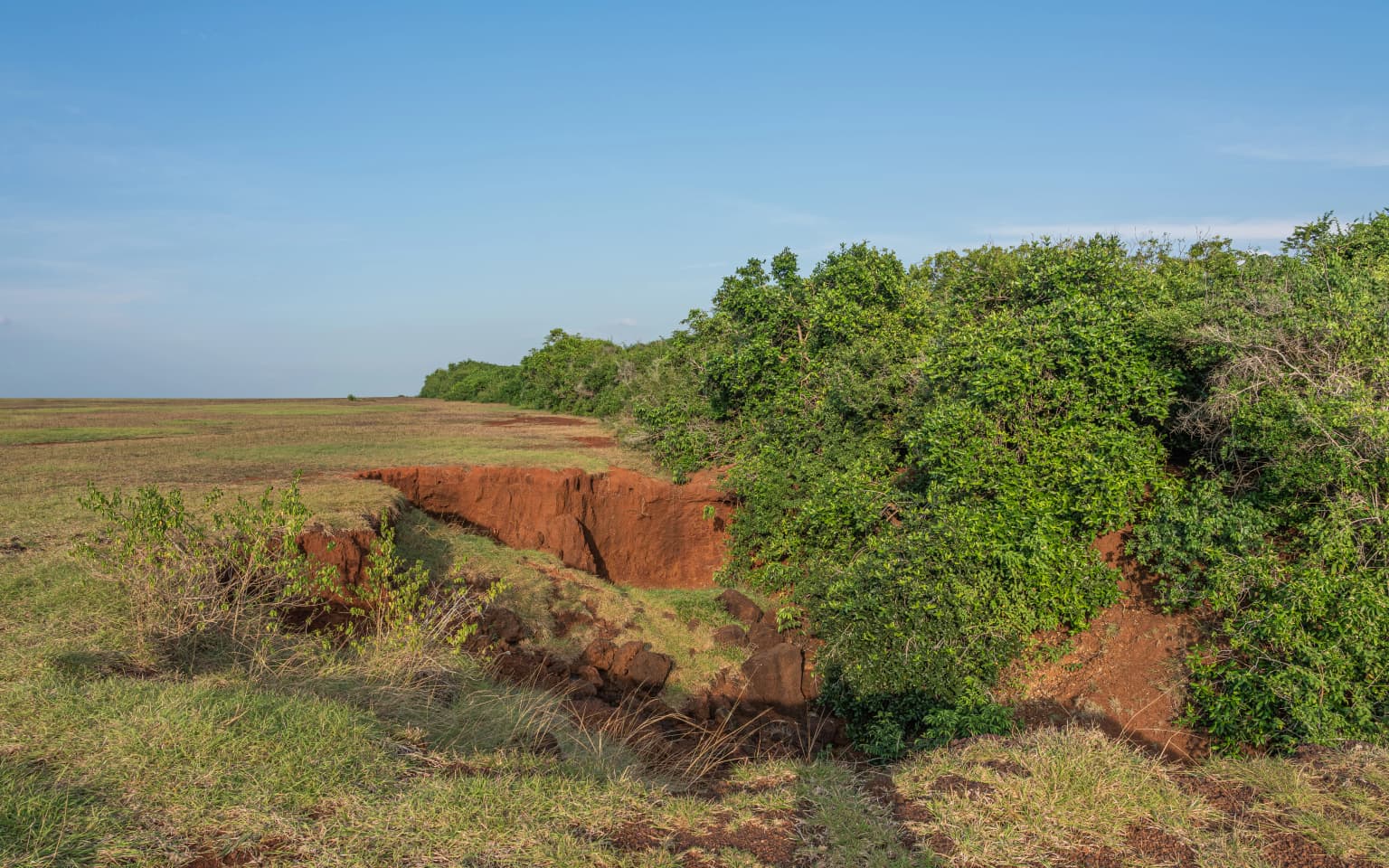
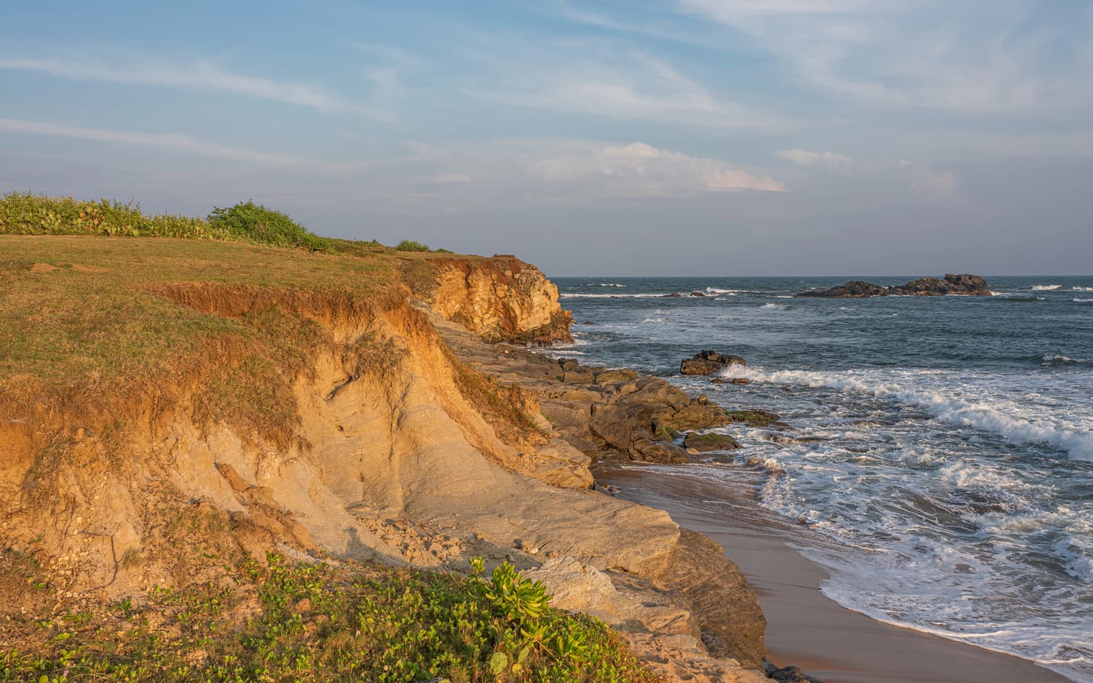
Ussangoda is best known for its extraordinary red soils and unusual geological character, which distinguish it sharply from the surrounding landscape. The iron-rich, brick-like soil and magnetically attracted rock debris create a landscape unlike any other in Sri Lanka. The park is also recognized as an important sea turtle nesting area along the southern coast, supporting breeding populations of endangered marine turtles. The plateau summit, which pans across a significant length, provides sweeping coastal views and a unique vantage point. Archaeological significance adds to the park's identity, with local legends connecting the site to mythical narratives and historical beliefs about meteor impacts or ancient landing grounds.

Grassy plain with red clay erosion features and dense green trees under clear blue sky
Grassy plain with red clay erosion features in Ussangoda National Park

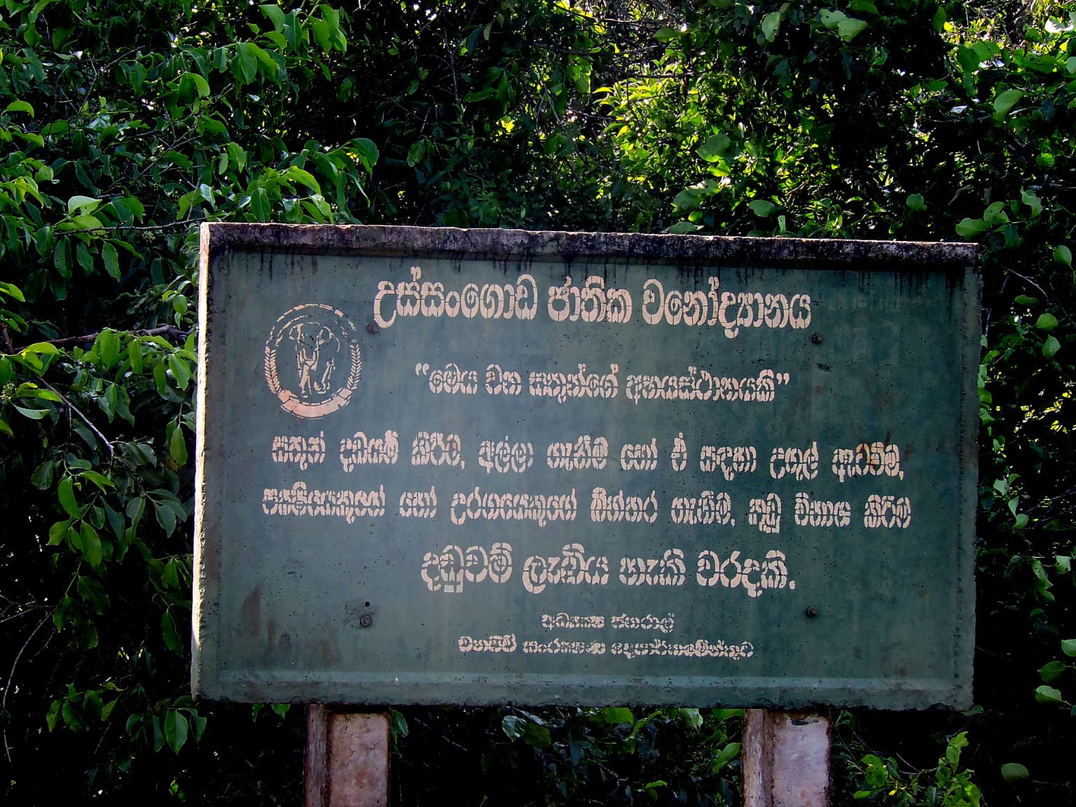
Ussangoda National Park history and protected-area timeline

Ussangoda National Park was formally established in 2010 by the Department of Wildlife Conservation, marking its addition to Sri Lanka's national park system. The creation of the park responded to the need to protect the area's multifaceted values, which extend beyond typical biodiversity conservation to include geological and archaeological significance. Prior to national park designation, the area existed as a notable geological and cultural site with local recognition of its unusual characteristics. The establishment of the park formalized protections that had not previously existed under national legislation, bringing the area under the governance structure of Sri Lanka's Department of Wildlife Conservation. The park borders the Kalametiya Wildlife Sanctuary to the east, creating a connected protected area that enhances conservation effectiveness in this portion of the southern region. The objectives articulated at the park's founding emphasized long-term protection for biological resources, archaeological heritage, and geological features, acknowledging the layered significance of this coastal plateau.

Ussangoda National Park landscape and geographic character

The landscape of Ussangoda National Park is defined by its position as a patch of elevated ground rising from the coastal plain near the sea. Unlike much of the surrounding terrain in the Hambantota District, which consists of typical lowland characteristics, Ussangoda stands as a notabletopographic feature with its plateau-like summit that extends for a considerable length. The most visually striking element of the landscape is the red soil, a brick-like, hard terrain with a distinctive reddish coloration that immediately distinguishes this area from its surroundings. The soil's unusual quality has attracted local attention and speculation, with the hard, compact nature of the earth contrasting sharply with typical soil in the region. Rock formations throughout the park, particularly along sea-facing areas, display multi-layered structures with distinct coloration. These rocks contain high iron concentration, a property that makes them attracted to magnets. The vegetation cover consists primarily of grassland, with only scattered pockets of pygmy forest breaking the openness of the terrain. A beach area fronts the park, adding a coastal dimension to the landscape. The combination of elevated plateau, red soils, coastal position, and sparse vegetation creates a landscape of uncommon visual and geological character.

Coastal cliffs with sandy beach and ocean waves under partly cloudy sky
Coastal cliffs and ocean view at Ussangoda National Park

Ussangoda National Park ecosystems, habitats, and plant life

The nature of Ussangoda National Park reflects a distinctive ecological character shaped by the park's unusual soil conditions, coastal position, and limited vegetation cover. The grassland-dominated landscape supports an ecosystem quite different from the surrounding areas, with pockets of pygmy forest representing rare enclaves of woody vegetation in an otherwise open terrain. The coastal location places the park within one of Sri Lanka's primary sea turtle breeding zones, giving the area significant ecological importance for marine turtle conservation. The red soil conditions create a habitat niche supporting vegetation adapted to this unusual substrate, contributing to the park's botanical distinctiveness. The boundary with Kalametiya Wildlife Sanctuary to the east creates ecological connectivity, allowing for wildlife movement between protected areas. The ecosystem represents a fragile coastal environment where specialized species have adapted to the challenging conditions of sparse vegetation and unusual soil chemistry.

Green signboard with Sinhala text and circular emblem mounted on wooden posts surrounded by dense green foliage
Entrance sign for Ussangoda National Park with Sinhala text

Ussangoda National Park wildlife and species highlights

Ussangoda National Park holds particular significance for sea turtle conservation as one of the breeding zones along Sri Lanka's southern coast. Endangered sea turtle species utilize the park's beach areas for nesting, making this coastline important for the survival of these protected marine reptiles. The grassland and pygmy forest habitats support terrestrial wildlife adapted to the coastal dry zone environment. While the Wikipedia source does not provide detailed species inventories, the park's location within a designated sea turtle breeding zone indicates that marine turtle activity represents the most notable wildlife presence. The connectivity with the adjacent Kalametiya Wildlife Sanctuary suggests that terrestrial wildlife may move between these protected areas, benefiting from the combined habitat protection.

Ussangoda National Park conservation status and protection priorities

Ussangoda National Park was established specifically to provide long-term protection for an area of compound significance, recognizing that biological, archaeological, and geological values warranted formal conservation status. The park's designation as IUCN category II reflects its primary function as a national park focused on ecosystem conservation, while its additional designation as an archaeological site acknowledges the cultural heritage dimension. The unusual geological features, particularly the red soils with their unique mineral composition, represent conservation priorities that extend beyond typical biodiversity focus. Protection of the sea turtle breeding grounds ensures that this coastal zone remains available for endangered marine turtles to nest without disturbance. The bordering relationship with Kalametiya Wildlife Sanctuary creates a contiguous conservation corridor that enhances overall protection effectiveness for wildlife in this region of Sri Lanka's southern coast.

Ussangoda National Park cultural meaning and human context

Ussangoda carries deep cultural significance in local tradition, with the area considered sacred and historically forbidden for general affairs according to local lore. Several legends associate the site with supernatural or legendary origins, contributing to its mythological reputation in the region. One prominent belief holds that Ussangoda was the ground of the local demi-god Mangara, connecting the landscape to traditional spiritual narratives. Other beliefs connect the site to the legendary figure Ravana from the Ramayana, with Hindu puranas describing Ussangoda as one of the landing strips of Ravana's Pushpaka vimana, the mythical flying chariot. These legends have contributed to the site's reputation as a place of historical and cultural importance beyond its ecological and geological features. The archaeological significance, including proximity to Miniha Gal Kanda where evidence of prehistoric human existence has been found, further reinforces the site's historical importance in the region.

Top sights and standout views in Ussangoda National Park

Ussangoda National Park stands out for its rare red soils with high iron concentration and magnetically attracted rock debris, a geological characteristic found nowhere else in the surrounding region. The coastal plateau setting provides sweeping views across the southern landscape from an elevated vantage point. Sea turtle nesting activity along the beach areas establishes the park's importance for marine turtle conservation in Sri Lanka. The archaeological and legendary heritage, including associations with mythical figures and ancient landing narratives, adds layers of cultural significance that distinguish this park from typical protected areas. The combination of geological rarity, ecological value, and cultural depth creates a multidimensional protected area that serves diverse conservation and heritage objectives.

Best time to visit Ussangoda National Park

The best time to visit Ussangoda National Park would generally align with Sri Lanka's dry season, which runs from December through March, when conditions are more comfortable for outdoor exploration. The sea turtle breeding activity follows seasonal patterns typical of marine turtles in the region, with nesting occurring during specific times of year that visitors may wish to observe responsibly. The open grassland terrain and coastal exposure mean that visiting during cooler parts of the day provides the most comfortable experience, particularly given the southern region's warm climate. The park's compact size allows for relatively efficient exploration, though visitors should check current access arrangements with the Department of Wildlife Conservation.

Park location guide

Geography guide, regional context, and park location map for Ussangoda National Park

Ussangoda National Park park geography, regions, and map view in Sri Lanka
Understand where Ussangoda National Park sits in Sri Lanka through a broader geographic reading of the surrounding landscape, nearby location context, and its mapped position within the national park landscape.

How Ussangoda National Park fits into Sri Lanka

Sri Lanka is a tropical island nation in South Asia with a recorded history spanning over 3,000 years. Formerly known as Ceylon, it became independent in 1948 and adopted its current constitutional name in 1972. The country features diverse geography ranging from coastal plains to mountainous highlands and maintains a population exceeding 22 million.

Wider geography shaping Ussangoda National Park in Sri Lanka

Sri Lanka is an island nation in the Indian Ocean, positioned southwest of the Bay of Bengal. It is separated from India by the Gulf of Mannar and Palk Strait to the northwest. The island has a pear-like shape with diverse terrain including coastal plains, central highlands, and river valleys.

Map view of Ussangoda National Park

Use this park location map to pinpoint Ussangoda National Park in Sri Lanka, understand its exact geographic position, and read its mapped placement within the surrounding landscape more clearly.

Pigeon | © OpenStreetMap contributors

Location context for Ussangoda National Park

Southern Province

Explore imagery revealing Ussangoda's distinct red soil terrain, coastal habitats, and unusual geological character within this protected area.

Ussangoda National Park Photos: Visual Guide to Sri Lanka's Unique Red Soil Coastal Landscape
Visually explore Ussangoda National Park's extraordinary red soils, elevated coastal plateau, and unique grassland landscapes through an in-depth image gallery. The collection provides essential insight into the park's geological rarity, distinctive habitats, and the overall character of this significant protected area in Sri Lanka, aiding visual research.

Grassy plain with red clay erosion features and dense green trees under clear blue sky

Sandy beach with waves, rocky cliffs covered in vegetation, and ocean under a partly cloudy sky.

Coastal cliffs with sandy beach and ocean waves under partly cloudy sky

Green signboard with Sinhala text and circular emblem mounted on wooden posts surrounded by dense green foliage

Park atlas

Compare protected landscapes, coastal regions, and dry zone parks across the wider geography of Southern Sri Lanka.

Explore Nearby National Parks and Protected Areas Beyond Ussangoda National Park, Southern Sri Lanka
Continue your exploration from Ussangoda National Park by browsing other national parks and protected areas situated across Sri Lanka's diverse southern region. Compare different coastal plateaus, dry zone ecosystems, and unique geological sites to understand the full spread of conservation landscapes in the Hambantota District.
National parkSri Lanka

Udawalawe National Park: National Park Protected Landscape and Geographic Atlas

Explore Sri Lanka's mapped natural terrain and park boundaries.

Gain a comprehensive atlas-level understanding of Udawalawe National Park, a key protected landscape in Sri Lanka. This entry focuses on the park's distinct geographic identity, its mapped boundaries, and its significance as a protected area within the island's diverse natural terrain. Explore how this national park contributes to the regional geography and provides structured insights for landscape discovery.

Area
308.21 km²
Established
1972
IUCN
II
Visitors
188.4K annual
National parkSri Lanka

Lunugamvehera National Park: Sri Lanka's Protected Area Mapping and Geographic Identity

Mapped terrain and national park boundaries in Sri Lanka.

Lunugamvehera National Park is a dedicated national park situated in Sri Lanka. This entry facilitates a focused exploration of its protected landscape, offering insight into its mapped geography and position within the country's conservation network. Understand the park's role and its physical characteristics through detailed geographic and atlas-oriented information.

Area
234.988 km²
Established
1995
IUCN
II
Relief
Lowland
National parkSouthern Province

Yala National Park: National Park Protected Landscape and Geographic Exploration

Mapped boundaries and regional context in Southern Province

Investigate Yala National Park, a protected national park situated in the Southern Province of Sri Lanka. This entry focuses on its geographic identity, detailing mapped boundaries and the surrounding landscape context crucial for atlas-based exploration and understanding protected area distributions. Gain insight into the park's role as a significant natural landmark.

Area
978.807 km²
Established
1938
IUCN
II
Visitors
400K annual
National parkCentral Province

Horton Plains National Park: A Protected Landscape within Sri Lanka's Central Province

Explore its mapped geographic boundaries and park identity.

Delve into the geographic specifics of Horton Plains National Park, a designated national park located in the Central Province of Sri Lanka. This entry provides detailed insights into its protected area status, mapped landscape features, and regional geographic context. Understand how this park contributes to the atlas of protected lands and offers a distinct point for landscape exploration.

Area
31.6 km²
Established
1988
IUCN
II
Relief
Mountain
National parkEastern Province

Kumana National Park: Detailed Geographic and Protected Landscape Exploration

Mapped boundaries and regional context for this national park.

Delve into the protected landscape of Kumana National Park, a designated national park situated in Sri Lanka's Eastern Province. This dedicated exploration surface provides detailed geographic information, helping you understand the park's mapped boundaries, surrounding terrain, and its significance within the regional context. It is designed for users seeking a structured understanding of protected areas and their place in the broader atlas.

Area
356.64 km²
Established
1970
IUCN
II
Relief
Lowland
National parkCentral Province

Galways Land National Park: A Protected Landscape within Central Province, Sri Lanka

Explore the mapped geography and protected area context of this national park.

Galways Land National Park is a designated national park within the Central Province of Sri Lanka, offering a distinct focus for geographic exploration. This entry provides specific details on its protected landscape characteristics and its place within the regional atlas. Users can examine the mapped boundaries and understand the natural terrain that defines this conservation area. Discover the unique geographic identity of Galways Land National Park and its contribution to the protected areas network.

Area
0.27 km²
Established
2006
IUCN
II
Relief
Mountain
National parkSouthern Province

Hikkaduwa National Park: Protected Area Identity and Geographic Context in Southern Province

Explore mapped boundaries and regional landscape features.

Hikkaduwa National Park stands as a vital national park, offering rich geographic details for atlas exploration. This page focuses on its protected landscape identity within Sri Lanka's Southern Province, providing insights into its mapped terrain and regional context. Understand the park's specific place in the landscape, ideal for users seeking structured geographic data and detailed map-based insights into protected natural areas.

Area
1.016 km²
Established
2002
IUCN
II
Climate
Tropical
National parkEastern Province

Lahugala Kitulana National Park: Eastern Province National Park Protected Landscape Discovery

Explore mapped boundaries and regional geography.

Lahugala Kitulana National Park is a key protected area, designated as a national park within Sri Lanka's Eastern Province. This content focuses on its geographic identity, including mapped park boundaries and its regional landscape context. Gain a structured understanding of this protected natural land for atlas-based exploration, highlighting its geographical significance and protected status.

Area
15.54 km²
Established
1980
IUCN
II
Relief
Lowland

Common questions about visiting, size, designation, and location context for Ussangoda National Park

Ussangoda National Park FAQs for park facts, access, geography, and protected area context
Find quick answers about Ussangoda National Park, including protected-area facts, park geography, trail and visitor context, and how the park fits into its surrounding country and regional landscape.
MoriAtlas Explorer

Continue Your Protected Areas Search Across the Global Atlas

Deepen your exploration by continuing the structured search for national parks and protected areas worldwide. Utilize the comprehensive filtering capabilities to compare different conservation landscapes and refine your understanding of global park geography. Discover more about the distribution and characteristics of protected natural areas.

Global natural geography