Why Valley of Flowers National Park stands out
The park is internationally celebrated for its spectacular displays of alpine flowers that transform the valley into a vivid tapestry of color each summer. The meadows feature diverse flora including orchids, poppies, primulas, marigolds, daisies, and anemones, with the blue Himalayan poppy and brahmakamal among the most iconic species. The valley's botanical significance is underscored by its designation as a Centre of Plant Diversity and the presence of numerous threatened medicinal plant species. Beyond its floral fame, the park protects critical habitat for endangered Himalayan wildlife including snow leopards, Asiatic black bears, brown bears, Himalayan musk deer, and blue sheep, making it one of India's most ecologically significant high-altitude protected areas.
Valley of Flowers National Park history and protected-area timeline
The valley remained largely unknown to the outside world until 1931 when British mountaineers Frank S. Smythe, Eric Shipton, and R.L. Holdsworth stumbled upon the area while returning from an expedition to Mount Kamet. Enchanted by the extraordinary displays of flowers, Smythe named the location the Valley of Flowers and later authored a book of the same name that brought international attention to the area. In 1939, Lady Joan Margaret Legge, a botanist from the Royal Botanic Gardens, Kew, arrived to study the flora and tragically died while collecting specimens on rocky slopes, with her sister later erecting a memorial at the site. The area was officially protected in 1939 when it was established as the Nanda Devi Game Sanctuary, though border disputes in 1962 temporarily disrupted access. Following periods of mountaineering activity that caused environmental degradation, the sanctuary was closed and in 1980 the valley was declared a national park under the Wildlife Protection Act of 1972. The park became part of the Nanda Devi Biosphere Reserve in 1988 when it was inscribed as a UNESCO World Heritage Site, and was expanded to include the Valley of Flowers as a second core zone in 2000 when the biosphere reserve was further extended.
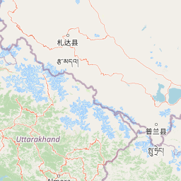
Valley of Flowers National Park landscape and geographic character
The park occupies a distinctive hanging valley positioned at the head of the Bhyundar valley, oriented roughly east-west across approximately 15 kilometers in length with an average width of 6 kilometers. The valley floor sits at elevations between 3,352 and 3,658 meters above sea level, nestled between mountain ridges whose highest peak within the park reaches 6,719 meters at Gauri Parbat. The landscape is characterized by gentle topography that contrasts sharply with the rugged wilderness of adjacent Nanda Devi National Park. A small tributary of the Pushpawati River originates from the Tipra glacier on Gauri Parbat and flows through the valley, cutting trails and creating characteristic streams that visitors encounter during treks. The surrounding hills are thickly forested in the buffer zone, while the valley itself contains a mosaic of meadows, river beds, and alpine terrain. The geoclimatic setting creates a distinctive microclimate typical of enclosed inner Himalayan valleys, shielded from the full impact of the southwest monsoon by the Greater Himalayan range to the south.
Valley of Flowers National Park ecosystems, habitats, and plant life
The Valley of Flowers represents one of the most botanically significant protected areas in the Western Himalayas, recognized internationally for its exceptional diversity of alpine flora. The park contains three distinct sub-alpine zones: foothills alpine between 3,200 and 3,500 meters representing the upper tree line, lower alpine between 3,500 and 3,700 meters, and higher alpine above 3,700 meters. Botanical surveys have documented over 520 species of higher plants including 498 flowering plants, with the Asteraceae family dominating with 62 species. The valley supports significant populations of medicinal plants including Dactylorhiza hatagirea, Picrorhiza kurrooa, Aconitum violaceum, and Podophyllum hexandrum, several of which are globally threatened. Sub-alpine forests of Himalayan maple, west Himalayan fir, Himalayan white birch, and rhododendron cover portions of the park, while the valley floor hosts meadows that become carpeted with colorful blooms during the summer months. The park's location within a transition zone between Eastern and Western Himalayan flora contributes to its exceptional species diversity.
Valley of Flowers National Park wildlife and species highlights
Despite relatively low animal density, the park harbors rare and endangered wildlife species characteristic of high-altitude Himalayan ecosystems. Mammals documented in the park include the snow leopard, Asiatic black bear, brown bear, Himalayan musk deer, red fox, Himalayan weasel, yellow-throated marten, Himalayan goral, blue sheep, Himalayan tahr, and serow, with tahr being common while serow, goral, musk deer, and blue sheep are considered rare. The presence of snow leopard was confirmed through a 2004 faunal survey, while local reports also indicate brown bear sightings. The park lies within the Western Himalayan Endemic Bird Area and supports populations of Himalayan monal pheasant, koklass pheasant, lammergeier, Himalayan vulture, red-billed chough, yellow-billed chough, and various other high-altitude bird species. Reptiles including the high-altitude lizard and Himalayan pit viper have been recorded, while numerous butterfly species including the common yellow swallowtail and common blue apollo inhabit the meadows during summer.
Valley of Flowers National Park conservation status and protection priorities
The park forms a critical component of the Nanda Devi Biosphere Reserve, a larger protected landscape that encompasses both Nanda Devi National Park and Valley of Flowers National Park as core zones surrounded by an extensive buffer area. As a UNESCO World Heritage Site designated in 1988 and expanded in 2005, the valley benefits from international recognition and protection frameworks. Conservation management focuses on preserving the unique alpine ecosystem through prohibition of grazing, restrictions on visitor access, and seasonal closures during the winter months when the park is snow-bound. A research nursery and seed bank has been established at Musadhar near the park entrance to propagate rare and endangered medicinal plants including several globally threatened species. Research programs address conservation challenges including control of invasive Himalayan knotweed while protecting native flora, and annual monitoring surveys track ecological changes within the park.
Valley of Flowers National Park cultural meaning and human context
The Valley of Flowers holds significance in Hindu religious tradition and has been referenced in ancient texts, with local people visiting the valley for centuries. Indian yogis are traditionally known to have visited the area for meditation, and the valley is associated with the goddesses Nanda Devi and Sunanda Devi to whom certain flowers like brahmakamal are offered as religious offerings. The nearby settlement of Ghangaria serves as the base for visitors accessing the park and also provides access to the Sikh pilgrimage site of Hemkund Sahib, creating a cultural landscape where Himalayan nature and religious pilgrimage intersect. The Pushpawati river valley was first documented by Colonel Edmund Smyth in 1862, though the area remained relatively inaccessible to outsiders until the 1931 expedition that brought the valley to international attention.
Top sights and standout views in Valley of Flowers National Park
The park's defining highlight is the spectacular summer bloom when meadows explode with color from July through early September, featuring orchids, poppies, primulas, and the iconic blue Himalayan poppy against the backdrop of snow-capped peaks. The combination of gentle alpine meadows with the rugged Himalayan wilderness of the surrounding Nanda Devi Biosphere Reserve creates a unique landscape contrast. Wildlife viewing opportunities include encounters with endangered species such as snow leopard, Himalayan musk deer, and blue sheep in their natural high-altitude habitat. The trekking approach through the Pushpawati valley from Govindghat to Ghangaria, passing through fields of wildflowers, adds to the overall experience of discovering this remote Himalayan sanctuary.
Best time to visit Valley of Flowers National Park
The optimal visiting window spans from July through early September when the monsoon brings heavy rainfall that sustains the lush vegetation and triggers the peak flowering season. During this period the valley displays its famous carpet of colorful blooms, though visitors should be prepared for frequent fog and rain typical of the late summer monsoon. The park is closed from November through May when heavy snowfall renders the area inaccessible, with temperatures dropping significantly during the winter months. From mid-April to June, conditions are moderate with maximum temperatures around 19 degrees Celsius, offering an alternative window before the monsoon arrives, though the famous flower displays are less spectacular during this pre-monsoon period.