
Lakes
Park geography
A comprehensive analysis of island terrain, marine zones, and coastal landscape characteristics
Vilsandi National Park Geographic Profile, Mapped Boundaries, and Regional Coastal Landscape Features
Analyze the structured physical geography of Vilsandi National Park, located in Estonia within Saare County. The protected area encompasses diverse coastal and island landscapes, featuring intricate capes and bays across its 241 square kilometer recorded extent. This profile documents the environmental classifications and specific natural landmarks within this marine-focused region.
Estonia's coastal bird paradise with over 100 islands
Vilsandi National Park
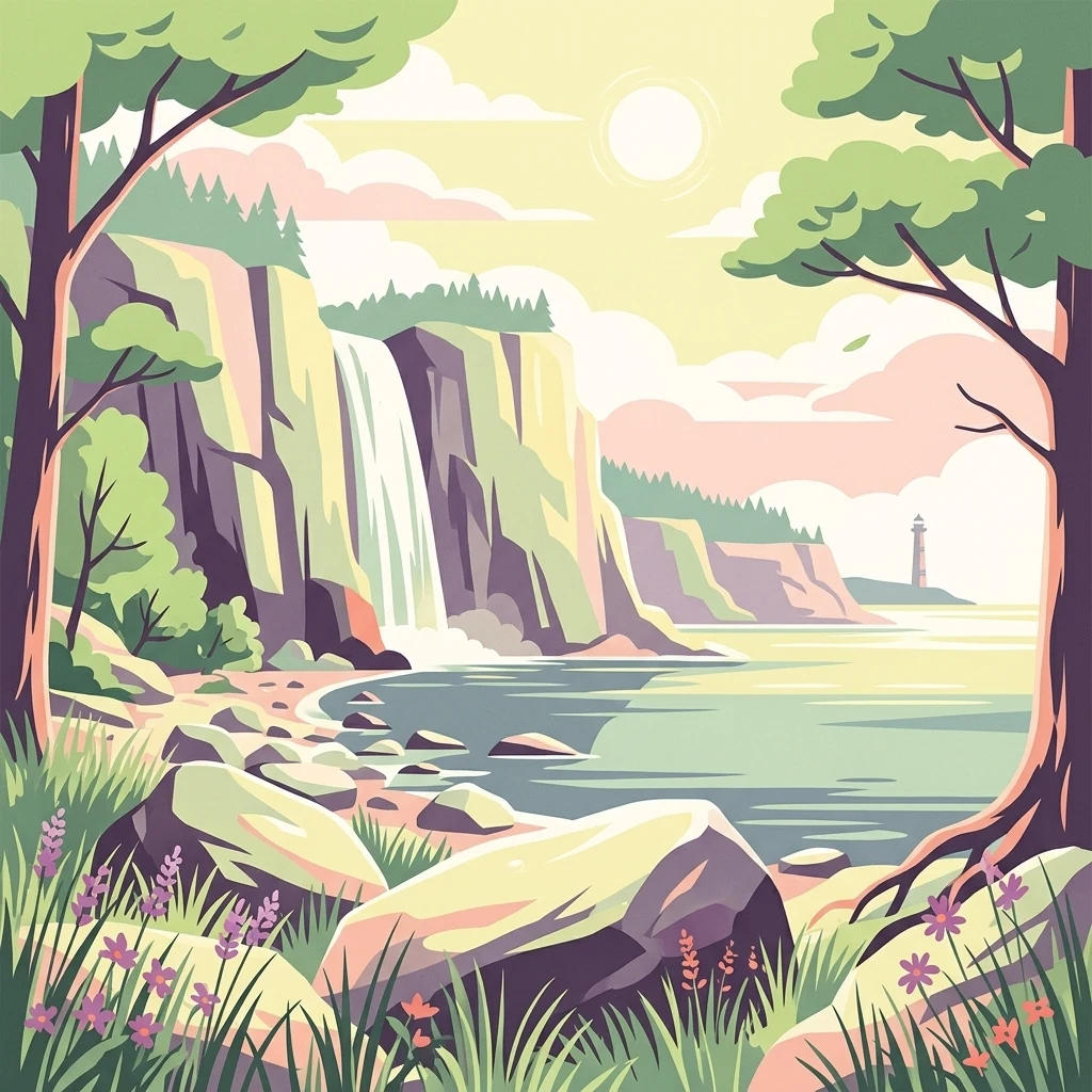
Vilsandi National Park is a marine protected area located in Saare County on the island of Saaremaa in western Estonia. Established in its current form in 1993, the park encompasses Vilsandi island along with approximately 100 smaller islands, islets, and the surrounding coastal waters and western coastline of Saaremaa. The protected area represents one of the Baltic region's most significant coastal and marine ecosystems, characterized by diverse archipelago landscapes, shallow bays, and rich biodiversity. The park grew from a bird reserve founded in 1910, making it one of the oldest protected areas in the Baltic states. It serves as a critical stop-over site for migratory waterfowl traveling between northern breeding grounds and southern wintering areas, as well as an important breeding ground for numerous seabird species.
- Location
- Estonia
- Park type
- Marine protected area
- Established
- 1957
- Area
- 241 km²
Location overview
Coastal and marine protected area status in Saare County
Geographic Profile of Vilsandi National Park in Estonia
Vilsandi National Park is positioned within Saare County in Estonia. As a coastal, island, and marine protected area, its geographic status represents a defined national territory without transboundary borders.
- Countries
- Estonia
- Regions
- Saare County
- Primary location
- Saare County
- Geographic setting
- Coastal · Island · Marine
Boundary and coordinates
Mapped spatial geometry and derived boundary measurements
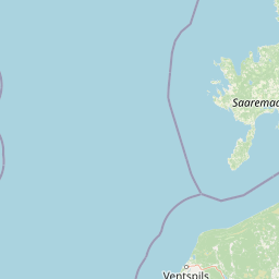
Vilsandi National Park Boundary Map and Geographic Extent
Visual boundary mapping establishes clear spatial context for the protected territory. Accompanying measurements detail total area spans, coordinate limits, and central reference points.
- Boundary area
- 238.8 km²
- Boundary perimeter
- 110.6 km
- Northernmost point
- 58.5367° N
- Southernmost point
- 58.2344° N
- Easternmost point
- 22.0333° E
- Westernmost point
- 21.7619° E
- Geographic centre
- 58.3789° N, 21.8773° E
- North–south span
- 33.7 km
- East–west span
- 15.9 km
Terrain and natural features
Twenty islands, bays, capes, beaches, and waters within
Vilsandi National Park lowland terrain and coastal features
Vilsandi National Park has lowland relief and twenty displayed features, each recorded within the park. Bays and islands lead the set, alongside capes, beaches, lakes, peninsulas, and a stream, with each supplied name retained for the feature cards.
Selected named natural features
Lakes
Abajaloik
Islands
Piskumadal
Islands
Aamarahu
Islands
Oju rahu
Islands
Ussirahu
Environmental setting
Temperate lowland coastal terrain, marine waters, and island wetlands
Vilsandi National Park Environmental Classifications and Physical Setting
Recorded landscape features and habitat types structure the physical setting into temperate coastal environments, marine waters, and lowland wetlands. Associated atlas records link these classifications directly to corresponding protected areas across the region.
- Relief
- Lowland
- Climate
- Temperate
- Water
- Major water bodies
Landscape features
Coast · Beach · Islands · Cliffs · Wetland
Habitat types
Coastal habitat · Wetland · Marine habitat
Park atlas
Compare coastal protected landscapes and marine ecosystems, tracing the regional spread of Estonia's conservation geography.
Discover Other National Parks and Protected Areas Near Vilsandi National Park
After exploring Vilsandi National Park, continue your geographic discovery by browsing other protected areas, national parks, and coastal landscapes in Estonia and the wider Baltic Sea region. Compare diverse marine ecosystems, island geography, and important bird habitats, gaining a broader understanding of conservation efforts across similar regional terrain.
National parkLatvia
65 km away#1 closest
South

Slītere National Park: Latvia's Protected Coastal Landscape with Blue Hills and Bird Flyways
Explore the unique terrain and protected geography of this Baltic national park.
Slītere National Park represents a distinctive protected landscape on Latvia's Courland Peninsula, celebrated for its ancient geological formations like the Blue Hills (Zilie Kalni) and its role as a crucial bird migration corridor. The park's geography encompasses varied dune systems, wetland habitats, and rich broadleaf forests, offering a unique mapped environment. Discover the park's protected area boundaries and its significance within the regional Baltic geography, highlighting its unique ecosystem features and landscape context.
- Area
- 164.14 km²
- Established
- 2000
- IUCN
- II
- Relief
- Mixed relief
National parkLääne County
84 km away#2 closest
Northeast

Matsalu National Park: Explore Estonia's Premier Wetland National Park Geography and Protected Area
Discover mapped landscapes and bird migration routes in Lääne County.
Matsalu National Park, located in Lääne County, Estonia, is a prime example of a protected wetland ecosystem of international significance. This page delves into the park's unique geographic features, including the shallow brackish Matsalu Bay, the expansive Kasari River delta, and the numerous islands that form its coastal mosaic. Users can explore the park's protected boundaries and understand its critical function as a major staging area for migratory birds, offering a detailed atlas-level view of this important natural landscape.
- Area
- 486.1 km²
- Established
- 1957
- IUCN
- II
- Relief
- Lowland
National parkFinland
127 km away#3 closest
North

Archipelago National Park: Mapped Protected Landscape and Geographic Context in Finland
Explore protected area boundaries and natural terrain.
Archipelago National Park represents a vital component of Finland's protected lands. This page serves as an atlas-focused entry point, detailing the park's specific geographic context, its mapped protected area boundaries, and the nature of its landscape. Understand how this national park contributes to the broader regional geography of Finland and the Nordic region, aiding structured discovery through maps and geographic data.
- Area
- 500 km²
- Established
- 1983
- IUCN
- II
- Visitors
- 78.8K annual
National parkSweden
143 km away#4 closest
West

Gotska Sandön National Park: Unique Baltic Island Protected Landscape & Dune Atlas
Mapped geography and ancient pine forests on a Swedish island.
Delve into Gotska Sandön National Park, a distinct national park encompassing an entire Baltic island renowned for its significant sand dune systems and ancient pine forests. This protected area showcases a rare sandy island ecosystem and a unique landscape shaped by coastal influences. MoriAtlas provides structured geographic context to understand the mapped boundaries and natural terrain of Gotska Sandön, highlighting its role as a vital protected natural landscape in the Scandinavian region.
- Established
- 1963
- IUCN
- II
- Scope
- Terrestrial
- Water
- Minor water
National parkLatvia
157 km away#5 closest
Southeast
Ķemeri National Park: Discover Latvia's Iconic Protected Bog and Wetland Geography
Explore a unique protected landscape with mapped bog ecosystems and regional natural terrain.
Ķemeri National Park in Latvia is a remarkable protected area, celebrated for its expansive and ecologically significant raised bog systems, particularly the Great Ķemeri Bog. This national park showcases a unique geographical character, featuring natural sulfur springs, therapeutic muds, and a series of ancient lagoon lakes that support rich birdlife. Its diverse wetland habitats and distinct peatland landscapes offer a compelling focus for atlas-based discovery and understanding the regional geography of the Latvian coast.
- Area
- 381.65 km²
- Established
- 1997
- IUCN
- II
- Relief
- Lowland
National parkViljandi County
167 km away#6 closest
East
Soomaa National Park: Estonia's Wilderness Wetland Landscape Atlas
Explore mapped protected peat bogs and dynamic floodplains in Viljandi County.
Soomaa National Park is a protected wilderness area in Estonia renowned for its extensive peat bog systems and unique floodplains. This national park, located primarily in Viljandi County, showcases some of Europe's largest intact wetland landscapes, characterized by seasonal floods that transform the terrain into vast aquatic environments. MoriAtlas provides detailed geographic context for Soomaa, allowing for exploration of its protected boundaries and landscape features within the broader atlas of European natural areas.
- Area
- 359 km²
- Established
- 1993
- IUCN
- II
- Relief
- Lowland
National parkUusimaa
About 172 km away#7 closest
Northeast
Ekenäs Archipelago National Park: Mapped Baltic Sea Archipelago Landscape
Protected marine area with island geography in Uusimaa, Finland.
Delve into the unique protected landscape of Ekenäs Archipelago National Park, a premier example of a Baltic Sea marine protected area. Located in the Uusimaa region, this national park encompasses a vast expanse of coastal waters dotted with hundreds of rocky islets and skerries. MoriAtlas provides detailed geographic context, allowing for exploration of its mapped boundaries, island formations, and critical role as a sanctuary for breeding aquatic birds. Understand its place within Finland's protected areas atlas and appreciate its distinctive marine archipelago character.
- Area
- 52 km²
- Established
- 1989
- IUCN
- II
- Visitors
- 53.6K annual
National parkSouthwest Finland
About 200 km away#8 closest
North
Teijo National Park: Mapped Boundaries of a Protected National Park in Southwest Finland
Explore the geographic context and protected landscape of Teijo National Park.
Teijo National Park is a designated national park within Southwest Finland, offering a distinct protected landscape for atlas exploration. This entry focuses on its geographic identity, mapped park boundaries, and its place within the broader regional geography. Discover the structured details of Teijo National Park as a key protected area, providing valuable context for understanding natural landscapes and conservation efforts in Finland.
- Area
- 34 km²
- Established
- 2015
- IUCN
- II
- Visitors
- 92.1K annual
MoriAtlas Explorer
Continue Exploring Vilsandi National Park's Protected Marine Landscape
Delve deeper into the protected geography of Vilsandi National Park. Understand its unique island and coastal formations, mapped protected boundaries, and its significance as a key Baltic Sea marine protected area. MoriAtlas provides the structured geographic context to navigate and comprehend this vital Estonian landscape and its surrounding marine environment.
Browse next
Global natural geography
Explore related park routes
Explore MoriAtlas Global ParksBrowse All MoriAtlas ParksGlobal Park Map DiscoveryMoriAtlas: Browse All CountriesBrowse All MoriAtlas ContinentsNational Park Environment AtlasGrand Canyon National Park AtlasYellowstone National Park AtlasYosemite National Park Atlas and GeographySerengeti National Park AtlasGalápagos National Park Protected LandscapeBanff National Park Geography and AtlasKruger National Park Atlas EntryUluṟu-Kata Tjuṯa National Park AtlasExplore Uluru-Kata Tjuta National Park GeographyPlitvice Lakes National Park AtlasFiordland National Park Protected LandscapeGreat Smoky Mountains National Park AtlasAfghanistan National Parks and Protected AreasAlbania National Parks and Protected AreasAlgeria National Parks and Protected AreasAmerican Samoa National Parks and Protected AreasAndorra National Parks and Protected AreasAngola National Parks and Protected AreasAntarctica National Parks and Protected AreasAntigua and Barbuda Park List