Mori Atlas logo
Marine protected areaVilsandi National Park

Discover the mapped boundaries and geographic context of Vilsandi National Park in Saare County.

Vilsandi National Park: Estonia's Marine Protected Area and Archipelago Landscape

Vilsandi National Park represents a vital marine protected area situated off the western coast of Saaremaa island in Saare County, Estonia. This extensive protected landscape encompasses Vilsandi island, numerous smaller islets, and the surrounding Baltic Sea waters, forming a complex archipelago. Established as one of the Baltic region's oldest protected areas, it is renowned for its critical role in supporting diverse birdlife, especially migratory waterfowl and seabirds, and showcases unique coastal terrain including rocky shores, shallow bays, and prominent cliff formations.

Baltic Seacoastal protected areabird migrationislandsmarine protected areaarchipelago

Vilsandi National Park

Marine protected area

Park overview

Structured park overview, official facts, and landscape profile for Vilsandi National Park

Vilsandi National Park park facts, protected area profile, and essential visitor context
Review the core facts for Vilsandi National Park, including designation, size, terrain, visitor scale, habitats, and operating context in one park-focused overview.

About Vilsandi National Park

Vilsandi National Park occupies the western coastal region of Saaremaa, Estonia's largest island, extending across a complex archipelago of islands, islets, and surrounding marine waters. The protected area represents Estonia's premier coastal and marine conservation zone, established to safeguard the unique Baltic Sea ecosystems that characterize this stretch of the Gulf of Riga. The park's landscape is defined by its archipelago character, with approximately 100 islands of varying sizes scattered along the western coast, interspersed with shallow bays, lagoons, and peninsula features such as the prominent Harilaid peninsula. The coastal cliffs at Soeginina provide dramatic seascapes, while the park's numerous islands range from bare rocky skerries to larger islands supporting vegetation and, in the case of Vilsandi itself, human settlement. The park's marine component is substantial, with waters covering about 394 km² of the total protected area, reflecting the park's primary focus on coastal ecosystem preservation. The presence of the Vilsandi biological station on the main island supports ongoing research and monitoring of the park's ecological values.

Quick facts and research context for Vilsandi National Park

Vilsandi National Park covers approximately 486 km² including surrounding waters, making it one of Estonia's larger protected marine areas. The park includes nearly 100 islands and islets, with Vilsandi being the only inhabited island. Over 250 bird species have been recorded in the park, with about 112 species breeding there. The area supports one of the largest eider duck populations in the Baltic region, with more than 4,000 breeding pairs. The park holds Ramsar Convention status since 1997 and is designated an Important Bird Area by BirdLife International. One third of all protected plant species in Estonia are found within the park boundaries.

Park context

Deeper park guide and search-rich context for Vilsandi National Park

Vilsandi National Park history, landscape, wildlife, and travel context
Explore Vilsandi National Park through its history, landscape character, ecosystems, wildlife, conservation priorities, cultural context, and seasonal travel timing in a structured park guide built for atlas discovery and search intent.

Why Vilsandi National Park stands out

Vilsandi National Park is best known for its extraordinary birdlife and coastal marine ecosystems. The park serves as a major migratory bird corridor, hosting tens of thousands of staging waterfowl including barnacle geese and Steller's eider during spring and autumn migrations. The diverse archipelago supports over 247 bird species, with the common eider being particularly abundant. The park's extensive wetlands, islands, and coastal waters create ideal conditions for nesting seabirds and waterfowl. The landscape features dramatic cliff formations along the Soeginina coast, the distinctive Kiipsaare lighthouse on the Harilaid peninsula, and numerous shallow bays and inlets that define the western Saaremaa coastline.

Vilsandi National Park history and protected-area timeline

The protected area that would become Vilsandi National Park traces its origins to 1910, when a bird reserve was established in the region, making it one of the oldest nature protection initiatives in the Baltic states. This early designation reflected the exceptional ornithological significance of the coastal islands and waters. In 1971, the Vaika nature reserve was expanded to encompass 10,689 hectares and renamed the Vilsandi State Nature Reserve through a decree of the Estonian SSR Council of Ministers. This expansion brought under protection a diverse collection of islands totaling 1,289 hectares in land area. On 8 December 1993, the Vilsandi National Park was formally established by the Estonian government, combining the former Vilsandi State Nature Reserve with the Harilaid botanical-zoological reserve. In May 1996, the protection regulations and boundaries of the national park were confirmed, establishing the park's current extent. The year 1997 marked a significant milestone when the park received Ramsar Convention status as a wetland of international importance, and the visitor center opened at Loona manor. The park joined the Junior Ranger program in 2012, aligning with similar programs across Estonian national parks.

Vilsandi National Park landscape and geographic character

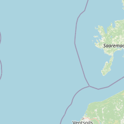
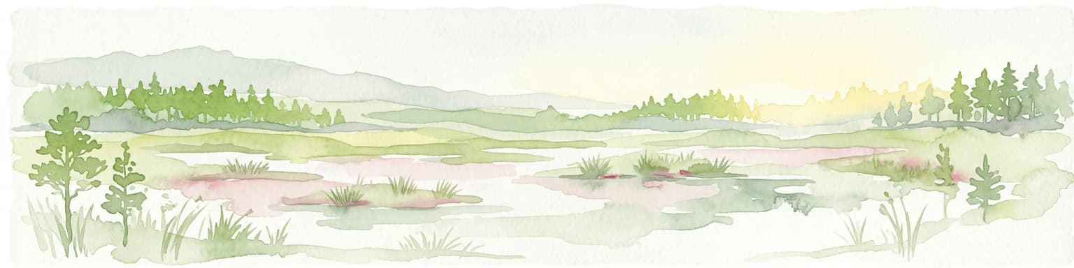
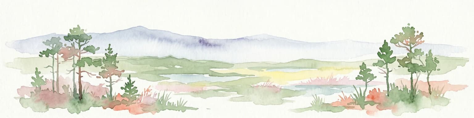
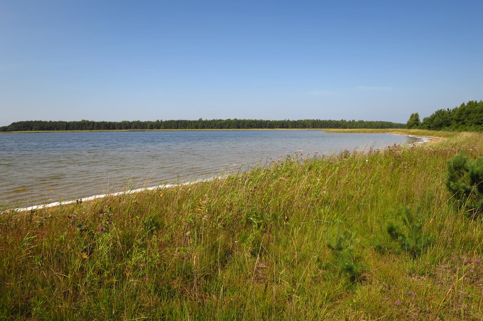
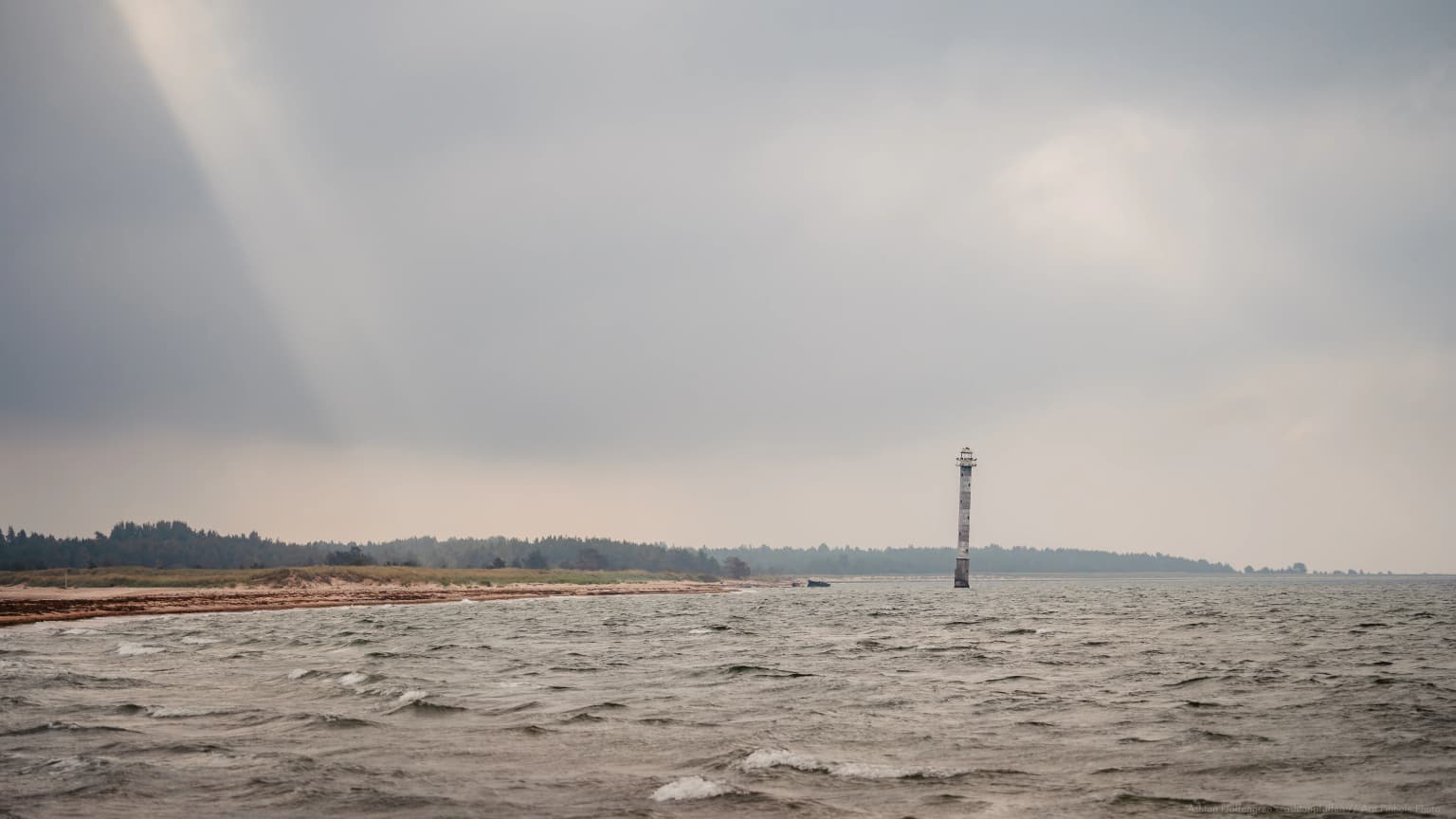
The landscape of Vilsandi National Park is characterized by its archipelago setting along the western coast of Saaremaa. The park encompasses a remarkable variety of coastal landforms including rocky islands, sandy beaches, dramatic cliff faces, peninsulas, and shallow marine waters. The Soeginina coastline features impressive cliff formations that illustrate the geological character of the Baltic Sea coast. The Harilaid peninsula extends prominently into the Gulf of Riga, with its terminal point marked by the Kiipsaare lighthouse, a distinctive coastal landmark. The park includes numerous bays such as Atla, Kihelkonna, and Kuusnõmme, each contributing to the complex indented coastline. The island landscape ranges from the larger Vilsandi island with its human settlement and vegetation cover to countless small rocky islets and sandbanks barely above the waterline. The marine environment includes both deeper channels between islands and extensive shallow areas that provide important habitat for waterfowl and marine organisms.

Vilsandi National Park ecosystems, habitats, and plant life

Vilsandi National Park protects some of Estonia's most ecologically significant coastal and marine habitats. The park's wetland ecosystems support extraordinary biodiversity, with approximately one-third of all protected plant species in Estonia found within its boundaries. The shallow coastal waters, bays, and island environments create diverse habitat types ranging from rocky shores to sandy beaches and marshy areas. The park's islands provide crucial nesting habitat for colonial seabirds, while the surrounding waters support wintering populations of waterfowl. The migration corridor function of the area is particularly important, with the park serving as a major staging area where thousands of waterfowl pause during their twice-yearly journeys between northern breeding grounds and southern wintering areas. The marine ecosystem includes important fish spawning grounds and supports a complex food web characteristic of Baltic Sea coastal waters.

Vilsandi National Park wildlife and species highlights

The avifauna of Vilsandi National Park is its most celebrated ecological asset. Over 250 bird species have been recorded in the park, of which approximately 112 species nest within its boundaries. The common eider dominates the breeding bird population with more than 4,000 breeding pairs, one of the highest concentrations in the Baltic region. The park serves as a critical staging area for migratory waterfowl, with barnacle geese stopping in tens of thousands during migration, along with various duck species and other waterfowl. Steller's eider, a species of particular conservation concern, uses the park as a stop-over area. The park also supports breeding populations of the common crane during passage. The marine environment supports fish species important to both the ecosystem and traditional local fishing, while the islands provide habitat for colonial nesting seabirds. The protected status of the area has enabled populations of multiple bird species to thrive with minimal disturbance.

Vilsandi National Park conservation status and protection priorities

Vilsandi National Park represents a cornerstone of Estonian coastal and marine conservation. The protected area was established primarily to safeguard coastal marine ecosystems and regulate use through protection measures that balance ecological preservation with sustainable traditional uses. The park's designation as a Ramsar Wetland of International Importance in 1997 acknowledges its exceptional value as a wetland habitat supporting migratory waterfowl populations. Its recognition as an Important Bird Area by BirdLife International further confirms the site\'s significance for bird conservation at the European scale. The prohibition of hunting within the park provides essential protection for wildlife populations, while specific fishing restrictions in designated zones during breeding and migration periods help maintain ecological integrity. The park\'s conservation goals include restoring and showcasing the biological diversity and landscapes characteristic of western Estonian coastal areas, preserving maritime cultural heritage, and maintaining the traditional coastal lifestyle of the region.

Vilsandi National Park cultural meaning and human context

The cultural landscape of Vilsandi National Park reflects centuries of human interaction with the coastal environment of western Saaremaa. Vilsandi island remains the only inhabited island within the park, carrying forward the tradition of maritime settlement that has characterized this coast. The park encompasses areas of traditional fishing activity, with local communities maintaining connections to the sea that extend back generations. The Loona manor, which now houses the park\'s visitor center, represents the historic estate culture of the region. The distinctive Kiipsaare lighthouse on the Harilaid peninsula has served as a navigation aid and has also become a cultural landmark, having served as a filming location for the Estonian film \

Top sights and standout views in Vilsandi National Park

Vilsandi National Park stands as Estonia\'s premier birdwatching destination, with its extraordinary concentration of waterfowl during migration and significant breeding populations of seabirds. The park\'s archipelago landscape offers a distinctive Baltic coastal experience, with nearly 100 islands creating a unique maze of waterways, bays, and rocky shores. The dramatic cliffs of Soeginina provide iconic coastal scenery, while the Kiipsaare lighthouse on the Harilaid peninsula serves as a memorable landmark. The park\'s status as one of the Baltic region\'s oldest protected areas, dating from 1910, reflects its enduring ecological significance. The combination of marine protected status, Ramsar wetland designation, and Important Bird Area recognition makes Vilsandi one of Estonia\'s most comprehensively protected landscapes.

Best time to visit Vilsandi National Park

The park can be explored throughout the year, though spring and autumn offer the most dramatic wildlife viewing opportunities when migratory waterfowl pass through in large numbers. The breeding season in late spring brings active seabird colonies, while summer provides the most accessible weather for island hopping and coastal exploration. Winter offers a different character, with frozen bays and a quieter atmosphere, though access to some areas may be limited. The visitor center at Loona manor provides orientation and information year-round.

Park location guide

Geography guide, regional context, and park location map for Vilsandi National Park

Vilsandi National Park park geography, regions, and map view in Estonia
Understand where Vilsandi National Park sits in Estonia through a broader geographic reading of the surrounding landscape, nearby location context, and its mapped position within the national park landscape.

How Vilsandi National Park fits into Estonia

Estonia is a parliamentary republic and member of the European Union and NATO. With a population of about 1.4 million, it is one of the least populous EU member states. The official language is Estonian, and the currency is the Euro.

Wider geography shaping Vilsandi National Park in Estonia

Estonia is situated on the eastern coast of the Baltic Sea in Northern Europe. It borders the Gulf of Finland to the north, Latvia to the south, and Russia to the east. The territory includes the mainland, the islands of Saaremaa and Hiiumaa, and over 2,300 smaller islands and islets.

Map view of Vilsandi National Park

Use this park location map to pinpoint Vilsandi National Park in Estonia, understand its exact geographic position, and read its mapped placement within the surrounding landscape more clearly.

Pigeon | © OpenStreetMap contributors

Location context for Vilsandi National Park

Saare County
Park atlas

Compare coastal protected landscapes and marine ecosystems, tracing the regional spread of Estonia's conservation geography.

Discover Other National Parks and Protected Areas Near Vilsandi National Park
After exploring Vilsandi National Park, continue your geographic discovery by browsing other protected areas, national parks, and coastal landscapes in Estonia and the wider Baltic Sea region. Compare diverse marine ecosystems, island geography, and important bird habitats, gaining a broader understanding of conservation efforts across similar regional terrain.
Watercolor illustration of a river flowing through a forested landscape with mountains in the background
National park

Slītere National Park: Latvia's Protected Coastal Landscape with Blue Hills and Bird Flyways

Explore the unique terrain and protected geography of this Baltic national park.

Slītere National Park represents a distinctive protected landscape on Latvia's Courland Peninsula, celebrated for its ancient geological formations like the Blue Hills (Zilie Kalni) and its role as a crucial bird migration corridor. The park's geography encompasses varied dune systems, wetland habitats, and rich broadleaf forests, offering a unique mapped environment. Discover the park's protected area boundaries and its significance within the regional Baltic geography, highlighting its unique ecosystem features and landscape context.

Area
164.14 km²
Established
2000
IUCN
II
Relief
Mixed relief
Watercolor illustration showing a wetland landscape with grassy fields, a river, and trees in the background
National parkLääne County

Matsalu National Park: Explore Estonia's Premier Wetland National Park Geography and Protected Area

Discover mapped landscapes and bird migration routes in Lääne County.

Matsalu National Park, located in Lääne County, Estonia, is a prime example of a protected wetland ecosystem of international significance. This page delves into the park's unique geographic features, including the shallow brackish Matsalu Bay, the expansive Kasari River delta, and the numerous islands that form its coastal mosaic. Users can explore the park's protected boundaries and understand its critical function as a major staging area for migratory birds, offering a detailed atlas-level view of this important natural landscape.

Area
486.1 km²
Established
1957
Relief
Lowland
Climate
Temperate
National parkFinland

Archipelago National Park: Mapped Protected Landscape and Geographic Context in Finland

Explore protected area boundaries and natural terrain.

Archipelago National Park represents a vital component of Finland's protected lands. This page serves as an atlas-focused entry point, detailing the park's specific geographic context, its mapped protected area boundaries, and the nature of its landscape. Understand how this national park contributes to the broader regional geography of Finland and the Nordic region, aiding structured discovery through maps and geographic data.

Area
500 km²
Established
1983
IUCN
II
Visitors
78.8K annual
National parkUusimaa

Ekenäs Archipelago National Park: Mapped Baltic Sea Archipelago Landscape

Protected marine area with island geography in Uusimaa, Finland.

Delve into the unique protected landscape of Ekenäs Archipelago National Park, a premier example of a Baltic Sea marine protected area. Located in the Uusimaa region, this national park encompasses a vast expanse of coastal waters dotted with hundreds of rocky islets and skerries. MoriAtlas provides detailed geographic context, allowing for exploration of its mapped boundaries, island formations, and critical role as a sanctuary for breeding aquatic birds. Understand its place within Finland's protected areas atlas and appreciate its distinctive marine archipelago character.

Area
52 km²
Established
1989
IUCN
II
Visitors
53.6K annual
National park

Ķemeri National Park: Discover Latvia's Iconic Protected Bog and Wetland Geography

Explore a unique protected landscape with mapped bog ecosystems and regional natural terrain.

Ķemeri National Park in Latvia is a remarkable protected area, celebrated for its expansive and ecologically significant raised bog systems, particularly the Great Ķemeri Bog. This national park showcases a unique geographical character, featuring natural sulfur springs, therapeutic muds, and a series of ancient lagoon lakes that support rich birdlife. Its diverse wetland habitats and distinct peatland landscapes offer a compelling focus for atlas-based discovery and understanding the regional geography of the Latvian coast.

Area
381.65 km²
Established
1997
IUCN
II
Relief
Lowland
Watercolor painting showing a wetland landscape with scattered trees, marshy areas, and distant mountains under a muted sky
National parkViljandi County

Soomaa National Park: Estonia's Wilderness Wetland Landscape Atlas

Explore mapped protected peat bogs and dynamic floodplains in Viljandi County.

Soomaa National Park is a protected wilderness area in Estonia renowned for its extensive peat bog systems and unique floodplains. This national park, located primarily in Viljandi County, showcases some of Europe's largest intact wetland landscapes, characterized by seasonal floods that transform the terrain into vast aquatic environments. MoriAtlas provides detailed geographic context for Soomaa, allowing for exploration of its protected boundaries and landscape features within the broader atlas of European natural areas.

Area
359 km²
Established
1993
Relief
Lowland
Climate
Boreal
National parkSouthwest Finland

Teijo National Park: Mapped Boundaries of a Protected National Park in Southwest Finland

Explore the geographic context and protected landscape of Teijo National Park.

Teijo National Park is a designated national park within Southwest Finland, offering a distinct protected landscape for atlas exploration. This entry focuses on its geographic identity, mapped park boundaries, and its place within the broader regional geography. Discover the structured details of Teijo National Park as a key protected area, providing valuable context for understanding natural landscapes and conservation efforts in Finland.

Area
34 km²
Established
2015
IUCN
II
Visitors
92.1K annual
National parkStockholm County

Tyresta National Park: Explore Protected Old-Growth Forest and Rift Valley Landscape

Stockholm County National Park, Sweden

Tyresta National Park stands as a crucial protected area, showcasing one of southern Sweden's largest expanses of old-growth coniferous forest, featuring trees up to 400 years old. Its distinctive rift valley terrain, lakes, and post-fire recovery zones offer a rich geographic profile for atlas exploration. Within Stockholm County, this national park provides essential context for understanding the preservation of ancient forest ecosystems and unique geological formations.

Area
20 km²
Established
1993
IUCN
II
Relief
Mixed relief

Common questions about visiting, size, designation, and location context for Vilsandi National Park

Vilsandi National Park FAQs for park facts, access, geography, and protected area context
Find quick answers about Vilsandi National Park, including protected-area facts, park geography, trail and visitor context, and how the park fits into its surrounding country and regional landscape.
MoriAtlas Explorer

Continue Your Protected Areas Search Across the Global Atlas

Deepen your exploration by continuing the structured search for national parks and protected areas worldwide. Utilize the comprehensive filtering capabilities to compare different conservation landscapes and refine your understanding of global park geography. Discover more about the distribution and characteristics of protected natural areas.

Global natural geography