
Mori Atlas logo
National parkVodlozersky National Park

Detailed mapping and atlas exploration of this significant national park in Northwest Russia.

Vodlozersky National Park: Protected Landscape and Geographic Context in Arkhangelsk Oblast

Vodlozersky National Park represents a distinct protected area within the vast geography of Arkhangelsk Oblast. As a designated national park, it offers a unique focal point for understanding regional natural landscapes and mapped terrain. MoriAtlas facilitates structured discovery of its boundaries and its place within the broader Russian protected areas atlas, providing a foundation for detailed geographic exploration.

Taiga ForestNational ParkUNESCO Biosphere ReserveBoreal EcosystemLake DistrictNorthern Russia
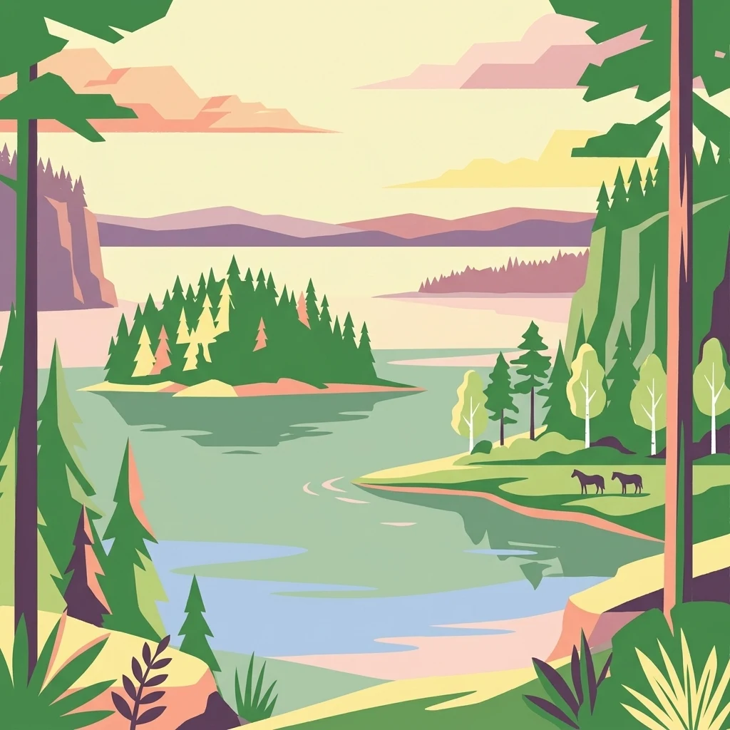
Stylized illustration showing a lake with a forested island, coniferous trees, two horses on the shore, and distant mountains.

Vodlozersky National Park

National park

Park overview

Structured park overview, official facts, and landscape profile for Vodlozersky National Park

Vodlozersky National Park park facts, protected area profile, and essential visitor context

Review the core facts for Vodlozersky National Park, including designation, size, terrain, visitor scale, habitats, and operating context in one park-focused overview.

About Vodlozersky National Park

Vodlozersky National Park represents one of Russia's most significant protected wilderness areas, established in April 1991 as part of the country's early national park system. The park covers an extensive territory of 4,280 square kilometers spanning the northern Russian landscape where the boreal forest zone meets the subarctic environment. Its strategic location encompasses portions of two administrative regions: Onezhsky District of Arkhangelsk Oblast and Pudozhsky District in the Republic of Karelia. The protected area was created specifically to preserve the outstanding coniferous forest ecosystems that characterize Northern Russia, representing a vital refuge for taiga biodiversity in a region where such intact wilderness has become increasingly rare. The park's significance extends beyond its ecological value to encompass cultural landscapes shaped by centuries of human habitation around Lake Vodlozero, where traces of prehistoric settlement dating back six to eight thousand years have been discovered. The park was the second-largest national park in Europe at the time of its creation, surpassed only by Yugyd Va National Park, and continues to rank among the continent's most extensive protected wilderness areas.

Quick facts and research context for Vodlozersky National Park

Vodlozersky National Park occupies approximately 4,280 square kilometers in northwestern Russia, making it the second-largest national park in Europe. The protected area straddles the boundary between Onezhsky District in Arkhangelsk Oblast and Pudozhsky District in the Republic of Karelia. The park's landscape is dominated by coniferous taiga forest, with spruce forests comprising 53.5% of the woodland and pine forests covering 44.1%. Lake Vodlozero serves as the park's central geographic feature, while extensive wetland systems cover roughly 40% of the total area. The region experiences a harsh northern climate with winter temperatures dropping to minus 45 degrees Celsius in the northern sector.

Protection and recognition

Tracking terrestrial conservation boundaries and international biosphere designations

Vodlozersky National Park Protection Status and UNESCO Recognition

Geographic records detail the terrestrial protection status and international conservation framework established for Vodlozersky National Park. Analyzing official UNESCO Biosphere Reserve designations and management boundaries offers a structured geographic baseline for regional conservation research.

International recognition

Protection details

Protection scope
Terrestrial
Designated year
2001
Transboundary protection
No
Core area
994.53 km²
Buffer area
3,156.57 km²
Park context

Deeper park guide and search-rich context for Vodlozersky National Park

Vodlozersky National Park history, landscape, wildlife, and travel context

Explore Vodlozersky National Park through its history, landscape character, ecosystems, wildlife, conservation priorities, cultural context, and seasonal travel timing in a structured park guide built for atlas discovery and search intent.

Why Vodlozersky National Park stands out

Vodlozersky National Park is best known for its vast tracts of undisturbed northern taiga forest, one of the largest remaining in Europe. The park protects theLake Vodlozero basin and surrounding landscapes featuring the Vetreny Poyas Ridge in the north. It is distinguished by its dual UNESCO recognition as both a national park and a Biosphere Reserve, and its remarkable collection of wooden architectural monuments dating from the 18th and 19th centuries. The park also stands out for its extensive wetland systems covering nearly half the territory, creating a unique complex of forests, lakes, and marshes that define the boreal landscape character.
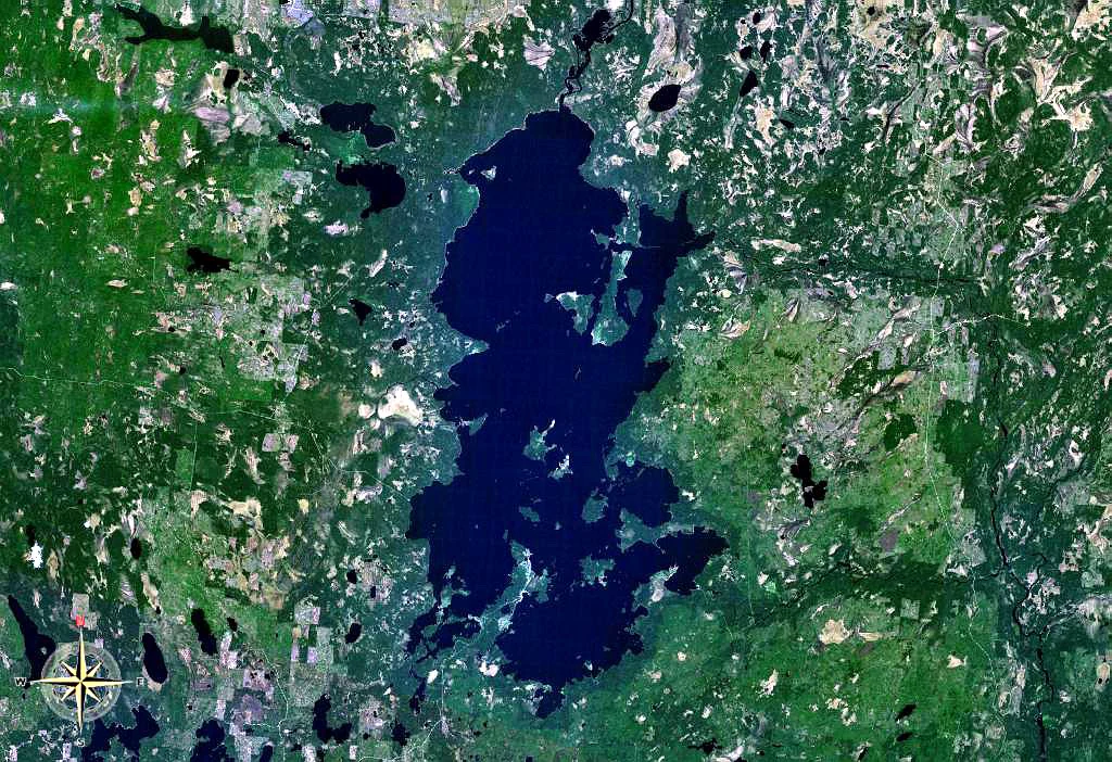
Satellite image showing Lake Vodlozero surrounded by forested land and smaller lakes
Satellite view of Lake Vodlozero within Vodlozersky National Park

Vodlozersky National Park history and protected-area timeline

The Lake Vodlozero region has a rich human history extending back to prehistoric times, with archaeological evidence indicating human settlement in the area between six and eight thousand years before the present era. Russian colonization of the territory began during the period when Novgorodians sought trade routes leading to the White Sea, with Lake Vodlozero serving as an important waypoint along routes extending to the Onega River. Colonization intensified during the 14th and 15th centuries, establishing a pattern of human presence that would shape the landscape for centuries to follow. By the beginning of the 20th century, approximately 40 villages surrounded Lake Vodlozero, though most have since been abandoned. The park contains several dozen monuments of wooden architecture from the 18th and 19th centuries, with the Ilyinsky Pogost ensemble representing the most significant surviving example. This historic religious complex features a wooden church surrounded by a defensive wall, situated on an island within Lake Vodlozero. Vodlozersky National Park was created in 1991, becoming one of the first national parks established in post-Soviet Russia. In 1996, the site was considered for UNESCO World Heritage status but was rejected on the grounds that it did not qualify as a purely natural site. The park has since been resubmitted for consideration under the cultural landscape criteria, reflecting its unique combination of natural and cultural values.

Vodlozersky National Park landscape and geographic character

The terrain of Vodlozersky National Park exhibits notable variation between its northern and southern sectors. The northern portion, encompassing the Ileksa River valley, features rolling hills reaching heights of up to 20 meters and includes the Vetreny Poyas Ridge, literally translated as the Windy Belt, which provides the most prominent topographic relief within the park. The southern sector, centered around Lake Vodlozero, presents an almost completely flat landscape characteristic of lacustrine plains. The park contains numerous lakes beyond its central feature of Lake Vodlozero, including Lake Monastyrskoye, Lake Nelmozero, and Lake Luzskoye within the Ileksa river basin. Extensive wetlands dominate the terrain, with swamps and marshes covering approximately 40 percent of the park's total area. The vegetation is overwhelmingly dominated by coniferous forest, with spruce forests comprising 53.5 percent of the woodland cover and pine forests accounting for 44.1 percent, while birch and aspen forests make up roughly 2 percent of the forested area.
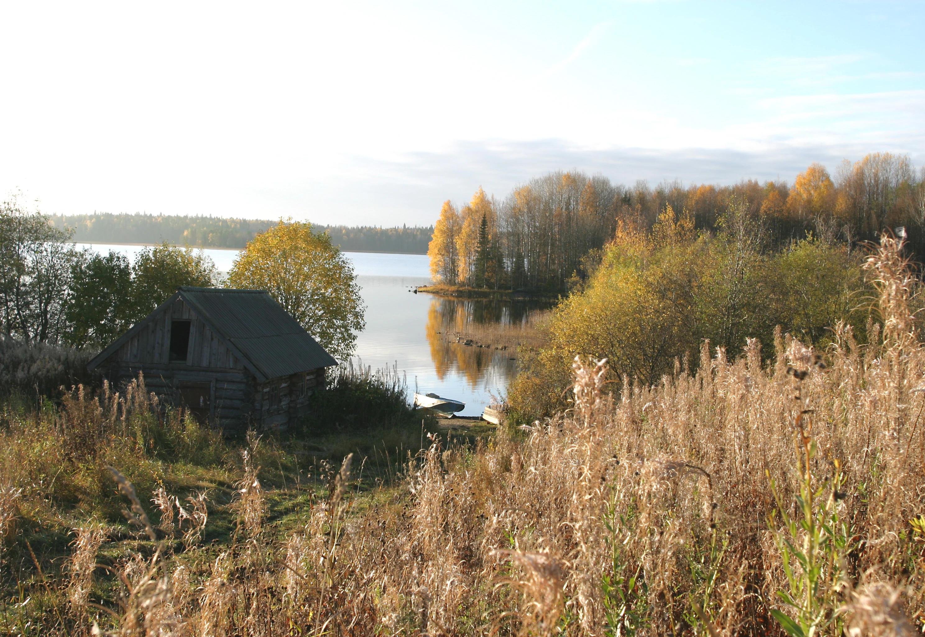
Wooden cabin on a grassy hillside overlooking a lake with autumn-colored trees and tall grasses in the foreground
Autumn landscape at Pilmas Ozero showing a wooden cabin by the lake in Vodlozersky National Park

Vodlozersky National Park ecosystems, habitats, and plant life

The ecological character of Vodlozersky National Park is defined by its position within the northern taiga biome, representing one of the most extensive and intact examples of this boreal forest ecosystem in Europe. The park's location at the boundary between the more harsh northern taiga climate and the milder southern conditions creates a transition zone supporting diverse ecological communities. The combination of extensive forest cover, numerous lakes, and vast wetland systems creates a complex mosaic of habitats supporting characteristic boreal species. The coniferous forest matrix of spruce and pine provides the structural foundation for the park's ecosystems, while the significant proportion of wetland areas adds ecological diversity and supports specialized species adapted to riparian and palustrine environments. The lake systems, particularly Lake Vodlozero with its extensive basin, serve as important ecological features within the broader forest matrix.

Vodlozersky National Park wildlife and species highlights

Vodlozersky National Park supports populations of wildlife characteristic of the northern taiga biome, with the extensive forest and wetland ecosystems providing suitable habitat for species adapted to boreal conditions. The park's location in northwestern Russia positions it within a zone where European and Siberian faunal elements overlap, supporting a diverse assemblage of forest-dwelling species. The lakes and wetlands provide important habitat for waterfowl and other bird species associated with freshwater environments, while the mixed forest matrix supports populations of game species and their predators. The remote and relatively undisturbed nature of the park contributes to its value as a wildlife refuge in a region where extensive human activity has modified much of the surrounding landscape.

Vodlozersky National Park conservation status and protection priorities

Vodlozersky National Park was established with the primary purpose of protecting the coniferous taiga forests of Northern Russia, representing one of the earliest and most ambitious conservation initiatives in post-Soviet Russia. The park received additional international recognition in 2001 when it was designated a UNESCO Biosphere Reserve under the Man and the Biosphere Programme, acknowledging its significance both as a protected natural area and as a model for sustainable interaction between human communities and the environment. The dual status of national park and biosphere reserve reflects the park's unique character, combining strict nature protection with recognition of the cultural landscapes shaped by long-term human habitation. The park's extensive size and relatively intact ecosystems make it significant for biodiversity conservation at the European scale, particularly for maintaining viable populations of species dependent on large, undisturbed forest habitats.

Vodlozersky National Park cultural meaning and human context

The human heritage of Vodlozersky National Park is deeply intertwined with the landscape, as evidenced by millennia of settlement extending back to prehistoric times and the continued presence of significant architectural monuments. The region was colonized by Russian populations from Novgorod during the 14th and 15th centuries as part of the expansion of trade networks toward the White Sea, with Lake Vodlozero serving as an important waypoint on these routes. The wooden architectural heritage preserved within the park, including the Ilyinsky Pogost ensemble on Lake Vodlozero, represents outstanding examples of traditional Russian wooden construction techniques and ecclesiastical architecture. The abandonment of most villages surrounding the lake during the 20th century has created a cultural landscape where the historic human presence remains visible in the form of monuments and the relationship between settlement patterns and the natural environment. This cultural dimension was a key factor in the UNESCO rejection of the 1996 World Heritage bid and is now central to the resubmission under cultural landscape criteria.

Top sights and standout views in Vodlozersky National Park

Vodlozersky National Park offers visitors access to one of Europe's largest and most remote wilderness areas, with the opportunity to experience pristine taiga forests, expansive wetlands, and significant cultural heritage sites. The park's Lake Vodlozero, one of the largest lakes in northwestern Russia, provides a striking central feature for exploration and recreation. The Ileksa and Vodla rivers offer whitewater rafting opportunities through remote forest landscapes. The Ilyinsky Pogost wooden church complex represents a unique cultural attraction, accessible by boat to its island site on Lake Vodlozero. The park's designation as a UNESCO Biosphere Reserve since 2001 confirms its international significance for both natural and cultural conservation.

Best time to visit Vodlozersky National Park

The optimal time to experience Vodlozersky National Park depends on the type of visit desired. Summer months offer the warmest conditions for exploring the park's forests, lakes, and walking trails, though the northern location means temperatures remain moderate. The brief summer season provides the best opportunity for wildlife observation and participation in activities such as fishing and birdwatching. Winter visitors can experience the park's harsh taiga character, with the landscape transformed by snow and the opportunity to observe species adapted to extreme cold. The shoulder seasons of spring and autumn offer unique opportunities to witness the dramatic seasonal transitions that define the boreal environment, though visitor facilities may have limited availability during these periods. The park's northern climate means that warm clothing is advisable regardless of the season.

Monthly climate preview

Baseline monthly temperature and precipitation trends from a representative park coordinate

Long-Term Climate Normals and Average Weather for Vodlozersky National Park

Historical measurements at the representative park coordinate show winter minimum averages dipping below negative twenty-nine degrees Celsius alongside mild summers reaching average maximums above twenty-six degrees Celsius. Accessing the full climatology profile reveals the complete twelve-month cycle of average temperatures and daily precipitation rates to help analyze annual trends.
Annual mean1 °C
-13 °C17 °C
Jan-13°
Feb-12°
Mar-7°
Apr-1°
May
Jun13°
Jul17°
Aug14°
Sep
Oct
Nov-6°
Dec-11°
Warmest month
July

16.5 °C

Coolest month
January

-13.3 °C

Wettest month
July

3.5 mm/day

Driest month
February

1.5 mm/day

Park location guide

Geography guide, regional context, and park location map for Vodlozersky National Park

Vodlozersky National Park park geography, regions, and map view in Russia

Understand where Vodlozersky National Park sits in Russia through a broader geographic reading of the surrounding landscape, nearby location context, and its mapped position within the national park landscape.

How Vodlozersky National Park fits into Russia

Russia is a transcontinental nation spanning eleven time zones, bordered by fourteen countries. It is the world's largest country by area, covering 17,098,246 km². Moscow is the capital and largest city, while Saint Petersburg is the second-largest and a major cultural centre.

Wider geography shaping Vodlozersky National Park in Russia

Russia spans Eastern Europe and North Asia, covering 17,098,246 km². It shares land borders with fourteen countries, more than any other nation, and spans eleven time zones. The landscape includes vast plains, mountain ranges such as the Urals and Caucasus, and extensive coastlines along the Arctic Ocean, Pacific Ocean, Baltic Sea, Black Sea, and Caspian Sea.

Map view of Vodlozersky National Park

Use this park location map to pinpoint Vodlozersky National Park in Russia, understand its exact geographic position, and read its mapped placement within the surrounding landscape more clearly.

Pigeon | © OpenStreetMap contributors

Location context for Vodlozersky National Park

Arkhangelsk OblastRepublic of Karelia

Visualizing Northern Russia's Vast Protected Area, Scenery, and Unique Boreal Ecosystems

Vodlozersky National Park Photos: Explore Pristine Taiga Forest and Boreal Wetland Landscapes

Explore the varied landscapes of Vodlozersky National Park through detailed imagery, offering visual insights into its pristine taiga forests, vast Lake Vodlozero, and distinctive wetland ecosystems. Gain a deeper understanding of this northern Russian protected area's unique boreal character and geographic features, from rolling hills to flat lacustrine plains.

Satellite image showing Lake Vodlozero surrounded by forested land and smaller lakes

Calm lake with forested island in the distance and trees on the shore under clear sky

Wooden cabin on a grassy hillside overlooking a lake with autumn-colored trees and tall grasses in the foreground

Park atlas

Trace the geographic spread of protected taiga forests and wetland ecosystems surrounding Vodlozersky National Park.

Discover Other National Parks and Protected Areas Near Vodlozersky National Park

After exploring Vodlozersky National Park, continue your discovery by browsing other national parks and protected areas across the surrounding northern Russian region. Comparing these protected landscapes provides valuable geographic context for understanding the distribution of taiga forests, expansive wetlands, and boreal ecosystems across Karelia and Arkhangelsk Oblast.
National parkRepublic of Karelia
Mapped location lies within the park boundary#1 closest

Southwest

Vodlozero National Park: Geographic Profile of Russia's Pristine Taiga and Wetland Landscapes

Protected boreal ecosystems in the Republic of Karelia

Vodlozero National Park protects a significant expanse of pristine boreal forest, lake systems, and river basins in the Russian North. This entry provides a structured look at the park geography, covering its status as a biosphere reserve, its sprawling taiga terrain, and the cultural landscape that defines its remote northern boundaries.

Area
4,683 km²
Established
1991
IUCN
II
Relief
Lowland
Watercolor painting showing a lake surrounded by forests with mountains in the background
National parkRussia
About 13 km away#2 closest

Southeast

Kenozersky National Park: Geography, Glacial Landscapes, and Protected Taiga Forests in Russia

Exploring the lake-studded terrain of the Arkhangelsk Oblast

Kenozersky National Park offers a profound look at the glacial geology of northern Russia. The area encompasses an integrated network of streams, wetlands, and spruce-dominated forests, providing essential habitat and reflecting centuries of human interaction with the natural terrain.

IUCN
II
Watercolor painting of a lake landscape with islands, rolling green hills, and light atmospheric washes, featuring soft green and pale tones on a white background.
National parkArkhangelsk Oblast
About 13 km away#3 closest

Southeast

Kenozersky National Park: Geography and Protected Heritage in Arkhangelsk Oblast

A UNESCO-listed cultural and natural landscape.

Located in the Arkhangelsk Oblast, Kenozersky National Park protects a distinctive middle taiga environment defined by ancient crustal fracture basins and significant watershed features like the Maselga esker. The area serves as a primary example of a cultural-natural landscape, merging intact boreal wilderness with the preserved architectural history of the Russian North, including traditional churches, villages, and sacred groves that have persisted for centuries.

Area
1,413.54 km²
Established
1991
IUCN
II
Relief
Upland
Watercolor painting showing a river flowing through a grassy field with trees and hills in the background
National parkArkhangelsk Oblast
About 122 km away#4 closest

North

Onezhskoye Pomorye National Park: A Geographic Profile of Northern Russian Protected Lands

Tracing the coastal and boreal landscape boundaries in Arkhangelsk Oblast

Onezhskoye Pomorye National Park preserves an isolated wilderness of immense ecological importance. The territory encompasses ancient taiga forests that descend directly into the White Sea, showcasing a rare transition zone between inland boreal ecosystems and marine coastal environments. This protected area offers a look into northern Russian geography, characterized by its glaciated terrain and historic maritime heritage sites.

Area
2,016.68 km²
Established
2013
IUCN
II
Relief
Lowland
Watercolor painting of a lake with pine-covered islands and rolling hills in the background.
National parkArkhangelsk Oblast
About 144 km away#5 closest

North

Onezhskoye Pomorye National Park: An Atlas of Protected Northern Taiga and Coastal Terrains

Exploring the glacial landscapes of Arkhangelsk Oblast

Onezhskoye Pomorye National Park serves as a significant protected corridor where large tracts of old-growth spruce and pine forest extend directly to the White Sea shoreline. The mapped terrain transitions from elevated glacial plains and moraine ridges to low-lying glacio-marine terraces, dunes, and migratory wetlands. This geographic record highlights the park's role in conserving boreal wilderness, salmon-rich rivers, and the historic cultural legacy of the Pomor people along the northern coast.

Area
2,016.68 km²
Established
2013
IUCN
II
Relief
Mixed relief
A stylized vector illustration featuring a large, balanced boulder perched on a cliff edge, surrounded by evergreen trees and a distant mountain waterfall.
Natural monumentRepublic of Karelia
About 183 km away#6 closest

West

Vottovaara National Park and Natural Monument: Mapping the West Karelian Upland

Protected quartzite massifs and glacial boulder fields in Russia

Vottovaara stands as a significant natural landmark in the Republic of Karelia, defined by its quartzite bedrock and plateau covered in glacial erratics. As a protected national park and natural monument, it represents the high-relief landscape of the West Karelian Upland, providing mapped access to a unique convergence of taiga forest and exposed geological formations.

Area
140.59 km²
Established
2023
IUCN
III
Relief
Mountain
Natural monumentRepublic of Karelia
About 183 km away#7 closest

West

Mount Vottovaara Natural Monument: Explore Protected Landscape and Geographic Context in Karelia

Mapped protected area boundaries and regional terrain in the Republic of Karelia.

Mount Vottovaara represents a significant natural monument within the Republic of Karelia, offering a focal point for structured geographic exploration. This protected landscape's mapped boundaries and its setting within the region's broader geography are key to understanding its atlas value. MoriAtlas provides the framework to examine the specific identity of Mount Vottovaara as a protected area, encouraging detailed study of its natural features and regional context.

Area
15 km²
Established
2011
IUCN
III
Relief
Mixed relief
Watercolor illustration of a landscape with trees, hills, and water
National parkVologda Oblast
About 234 km away#8 closest

South

Russky Sever National Park: Glacial Landscapes and Historical Protected Areas

Regional geography in the Vologda Oblast of Russia

Situated in the Vologda Oblast, Russky Sever National Park encompasses extensive forests, glacial hills, and riverine ecosystems. This protected area stands out for its deep connection to medieval Russian architecture, featuring preserved monasteries within a landscape shaped by long-standing agricultural and religious traditions.

Area
1,664 km²
Established
1992
IUCN
II
Relief
Highland

Common questions about visiting, size, designation, and location context for Vodlozersky National Park

Vodlozersky National Park FAQs for park facts, access, geography, and protected area context

Find quick answers about Vodlozersky National Park, including protected-area facts, park geography, trail and visitor context, and how the park fits into its surrounding country and regional landscape.
MoriAtlas Explorer

Continue Your Protected Areas Search Across the Global Atlas

Deepen your exploration by continuing the structured search for national parks and protected areas worldwide. Utilize the comprehensive filtering capabilities to compare different conservation landscapes and refine your understanding of global park geography. Discover more about the distribution and characteristics of protected natural areas.

Global natural geography