
Rivers
Park geography
Detailed spatial analysis covering mapped boundaries, terrain features, and elevation ranges
Comprehensive Geographic and Environmental Profile of Wasgamuwa National Park in Sri Lanka
This geographic profile details the physical scope of Wasgamuwa National Park, covering its 393.22 square kilometer area within the Central and North Central provinces of Sri Lanka. The documentation includes recorded boundary metrics, forest and grassland habitat classifications, and key riverine associations such as the Mahaweli and Amban Ganga river systems.
Related tags
Dry Zone ForestsElephant HabitatImportant Bird AreaSri Lankan EndemicsAncient Irrigation Heritage
Sri Lankan dry-zone wilderness protecting herds of Asian elephants and ancient irrigation heritage
Wasgamuwa National Park
Wasgamuwa National Park is a protected natural area in central Sri Lanka, spanning the Matale and Polonnaruwa Districts within the Central and North Central provinces. Established in 1984 as part of the Mahaweli Development Project, the park covers approximately 39,322 hectares of dry-zone terrain and was created to provide refuge for wildlife displaced by the massive hydroelectric and irrigation development scheme. The park sits about 225 kilometers northeast of Colombo and occupies a landscape characterized by dry evergreen forests, riverine woodlands, and grasslands surrounding ancient irrigation reservoirs. Wasgamuwa holds particular significance as one of the few remaining strongholds where Sri Lankan elephants congregate in substantial herds, and it has been recognized as an Important Bird Area due to its rich avifauna diversity.
- Location
- Sri Lanka
- Park type
- National park
- Established
- 1984
- Area
- 393.2 km²
- Highest point
- 470 m
Location overview
Mapped regional boundaries within Central and North Central Provinces
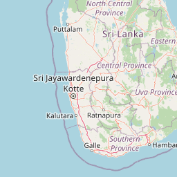
Geographic Location of Wasgamuwa National Park in Sri Lanka
Wasgamuwa National Park is situated within Sri Lanka, spanning parts of both the Central Province and the North Central Province. Map data confirms its status as a single-country protected area with localized provincial administration.
- Countries
- Sri Lanka, Zambia
- Regions
- Central Province, North Central Province
- Primary location
- Central Province
Boundary and coordinates
Interactive protected-area geometry and calculated spatial metrics
Wasgamuwa National Park Boundary Map and Spatial Extent
Mapped park outlines provide visual spatial context for the protected territory. Accompanying boundary facts detail recorded area measurements, coordinate limits, and geographic spans.
- Boundary area
- 395.9 km²
- Boundary perimeter
- 104.4 km
- Northernmost point
- 7.8789° N
- Southernmost point
- 7.6083° N
- Easternmost point
- 81.0653° E
- Westernmost point
- 80.8411° E
- Geographic centre
- 7.7436° N, 80.932° E
- North–south span
- 29.9 km
- East–west span
- 24.7 km
Elevation and terrain
Upland topography with recorded rivers and physical features
Wasgamuwa National Park Terrain and Elevation Profile
Recorded elevation records indicate an upland terrain profile reaching 470 meters at its highest point. Associated feature records document specific river systems and islands located within the protected boundary.
- Maximum elevation
- 470 m
- Highest point
- 470 m
Selected named natural features
Rivers
Mahaweli River
Islands
Kalinga Nuwara
Rivers
Mahaweli River
Environmental setting
Interpreting upland relief, forest cover, and seasonal water systems
Wasgamuwa National Park Environmental Settings and Habitat Classifications
Recorded classifications frame the physical setting through interconnected habitat types, forest cover, and regional climate zones. Linked categories connect specific environmental properties directly to related protected area records.
- Relief
- Upland
- Climate
- Arid
- Water
- Major water bodies
- Forest cover
- Mostly forested
- Seasonality
- Seasonal
Landscape features
Hills · Forest · Grassland · Lakes · Rivers
Habitat types
Tropical forest · Grassland · Riverine habitat · Lacustrine habitat
Park atlas
Trace the regional park geography of central Sri Lanka, comparing protected areas adjacent to Wasgamuwa National Park.
Discover Nearby National Parks and Protected Areas Beyond Wasgamuwa National Park
After exploring Wasgamuwa National Park, browse other national parks and protected areas situated in the broader region of central Sri Lanka. Compare their unique landscapes, key protected species, and geographic characteristics to deepen your understanding of Sri Lanka's conservation efforts.
National parkNorth Central Province
Park boundaries overlap#1 closest
Northeast

Flood Plains National Park: Sri Lanka's Vital Wetland and Elephant Corridor
Mapping the geography of its unique villus system and Mahaweli River flood plain.
Flood Plains National Park stands as a paramount protected wetland ecosystem in Sri Lanka's North Central Province, critically important as an elephant corridor along the Mahaweli River. The park's landscape is defined by its unique villus system, shallow swampy depressions that support extraordinary biodiversity and serve as vital feeding grounds for Asian elephants and migratory waterfowl. Understanding the mapped park boundaries and its regional geographic context reveals its significance in landscape-level conservation efforts within the Mahaweli basin.
- Area
- 173.5 km²
- Established
- 1984
- IUCN
- II
- Relief
- Lowland
National parkNorth Central Province
0.1 km away#2 closest
North
Angammedilla National Park: Protecting the Watershed for Parakrama Samudra in North Central Province
Mapped dry evergreen forests and mountainous terrain boundaries.
Angammedilla National Park is a national park in Sri Lanka's North Central Province renowned for its pivotal role in safeguarding the drainage basin for the large Parakrama Samudra reservoir. This protected landscape features significant dry evergreen forest ecosystems and mountainous terrain, contributing to the region's ecological stability and wildlife habitats. Its establishment highlights a commitment to preserving vital natural resources and understanding the complex interplay between protected areas and regional geography.
- Area
- 75.29 km²
- Established
- 2006
- IUCN
- II
- Relief
- Mountain
National parkEastern Province
11 km away#3 closest
Southeast
Maduru Oya National Park: Sri Lanka National Park Landscape and Geographic Context
Mapped protected area boundaries within Eastern Province.
Maduru Oya National Park represents a distinct protected area within the Eastern Province of Sri Lanka, offering valuable geographic context for atlas-based exploration. This national park's mapped boundaries and its placement within the regional landscape provide critical data points for understanding conservation geography. Discover the park's identity as a protected natural landscape and its role in the broader geographic atlas of Sri Lanka.
- Area
- 588.5 km²
- Established
- 1983
- IUCN
- II
- Relief
- Mountain
National parkNorth Central Province
14 km away#4 closest
North
Minneriya National Park: A Protected National Park in North Central Province
Explore mapped boundaries and regional landscape context.
Minneriya National Park is a designated national park offering unique protected landscape exploration within Sri Lanka's North Central Province. This entry provides structured data crucial for understanding the park's geographic features, its defined boundaries, and its significance as a protected area. Dive into the atlas context that illuminates the natural terrain and regional setting of Minneriya National Park.
- Area
- 88.894 km²
- Established
- 1997
- IUCN
- II
- Relief
- Mixed relief
National parkSri Lanka
21 km away#5 closest
Northeast
Somawathiya National Park: A Sri Lankan National Park Protected Landscape
Explore its mapped boundaries and regional geography.
Delve into the geographic identity of Somawathiya National Park, a designated national park within Sri Lanka. This entry provides atlas-level insights into its protected landscape, mapped terrain, and the specific natural area context it offers. Understand Somawathiya National Park's place in the Sri Lankan geography for structured discovery, focusing on its protected status and mapped features without travel logistics.
- Area
- 376.455 km²
- Established
- 1986
- IUCN
- II
- Relief
- Lowland
National parkNorth Central Province
26 km away#6 closest
North
Kaudulla National Park: Sri Lanka's Protected National Park Geography
Mapped landscape and regional context for Kaudulla National Park.
Kaudulla National Park stands as a protected national park offering valuable geographic insights for atlas explorers. This page details the park's location within the North Central Province, providing context on its mapped terrain and protected area status. Users can delve into the structured geographic data associated with Kaudulla National Park, enhancing their understanding of Sri Lanka's conservation landscapes.
- Area
- 69 km²
- Established
- 2002
- IUCN
- II
- Visitors
- 10K annual
National parkUva Province
58 km away#7 closest
Southeast
Gal Oya National Park: Protected Landscape and Reservoir Geography in Uva Province
Explore savannah grasslands, elephant populations, and mapped terrain.
Gal Oya National Park presents a unique protected landscape within Uva Province, Sri Lanka. This national park is defined by its broad savannah grasslands, known as thalawa, interspersed with forested hills and the vast Senanayake Samudraya reservoir. Its varied topography, from lowlands to mountain peaks, offers a rich canvas for geographic exploration and understanding protected-area dynamics. The park's consistent visibility of elephant populations across these diverse terrains makes it a key site for wildlife observation within Sri Lanka's atlas of natural heritage.
- Area
- 259 km²
- Established
- 1954
- IUCN
- II
- Relief
- Mountain
National parkCentral Province
About 73 km away#8 closest
South
Galways Land National Park: A Protected Landscape within Central Province, Sri Lanka
Explore the mapped geography and protected area context of this national park.
Galways Land National Park is a designated national park within the Central Province of Sri Lanka, offering a distinct focus for geographic exploration. This entry provides specific details on its protected landscape characteristics and its place within the regional atlas. Users can examine the mapped boundaries and understand the natural terrain that defines this conservation area. Discover the unique geographic identity of Galways Land National Park and its contribution to the protected areas network.
- Area
- 0.27 km²
- Established
- 2006
- IUCN
- II
- Relief
- Mountain
MoriAtlas Explorer
Continue your Atlas Exploration of Wasgamuwa National Park's Geography
Deepen your understanding of Wasgamuwa National Park by examining its protected landscape and its position within Central Province's geography. This detailed view supports structured exploration of national park boundaries and regional natural terrain. Engage with the mapped context of this protected area to build a comprehensive picture for your atlas-based discovery of Sri Lanka's conservation areas.
Browse next
Global natural geography
Explore related park routes
Explore MoriAtlas Global ParksBrowse All MoriAtlas ParksGlobal Park Map DiscoveryMoriAtlas: Browse All CountriesBrowse All MoriAtlas ContinentsNational Park Environment AtlasGrand Canyon National Park AtlasYellowstone National Park AtlasYosemite National Park Atlas and GeographySerengeti National Park AtlasGalápagos National Park Protected LandscapeBanff National Park Geography and AtlasKruger National Park Atlas EntryUluṟu-Kata Tjuṯa National Park AtlasExplore Uluru-Kata Tjuta National Park GeographyPlitvice Lakes National Park AtlasFiordland National Park Protected LandscapeGreat Smoky Mountains National Park AtlasAfghanistan National Parks and Protected AreasAlbania National Parks and Protected AreasAlgeria National Parks and Protected AreasAmerican Samoa National Parks and Protected AreasAndorra National Parks and Protected AreasAngola National Parks and Protected AreasAntarctica National Parks and Protected AreasAntigua and Barbuda Park List