

Mori Atlas logo
National parkWillandra National Park

Explore mapped park boundaries and regional landscape context within this Australian national park.

Willandra National Park: A Protected Landscape in New South Wales for Geographic Exploration

Willandra National Park stands as a significant protected area within New South Wales, Australia, offering a distinct national park experience for geographic discovery. This canonical page serves as an atlas-like entry point, detailing the park's mapped boundaries and its place within the regional geography. Users can explore the landscape context that defines Willandra National Park, understanding its role as a protected natural area for detailed map-based exploration and structured geographic learning.

Semi-arid landscapeGrassland ecosystemsHeritage accommodationRemote national parksBirdwatchingAboriginal heritage

Willandra National Park

National park

Park overview

Structured park overview, official facts, and landscape profile for Willandra National Park

Willandra National Park park facts, protected area profile, and essential visitor context
Review the core facts for Willandra National Park, including designation, size, terrain, visitor scale, habitats, and operating context in one park-focused overview.

About Willandra National Park

Willandra National Park occupies a distinctive position in New South Wales' protected area network as a conservation enclave within a predominantly pastoral landscape. The park's flat terrain and semi-arid setting present a stark yet ecologically significant environment where specialized species have adapted to survive in conditions of limited moisture and extreme temperature ranges. The park was created in 1972 following the expiration of pastoral leases that had seen the property operate as a successful sheep station for over a century, with the land resuming under Crown ownership and being gazetted for national park status. The transition from productive pastoral land to protected conservation area reflects broader shifts in Australian land management priorities during the mid-20th century, when recognition of the ecological value of remnant native landscapes led to the establishment of reserves in regions previously considered primarily for agricultural use. Today, the park offers visitors a glimpse into both the natural and cultural history of the far western plains, with heritage buildings providing tangible connections to the pastoral era while the surrounding landscapes support native species that have persisted despite decades of land use change.

Quick facts and research context for Willandra National Park

Willandra National Park covers 19,386 hectares in the Far West region of New South Wales, situated about 150 kilometres northwest of Griffith and 64 kilometres from Hillston. The park was established in May 1972 after the expiration of pastoral leases, previously operating as a renowned Merino sheep station that won numerous prizes for flock quality during the early to mid-20th century. The landscape consists primarily of flat grassland with low woodland along watercourses, dominated by black box and River Cooba trees. The region experiences a semi-arid climate with extreme temperature variations between summer and winter. Access roads are largely unsealed and can become impassable after rainfall.

Park context

Deeper park guide and search-rich context for Willandra National Park

Willandra National Park history, landscape, wildlife, and travel context
Explore Willandra National Park through its history, landscape character, ecosystems, wildlife, conservation priorities, cultural context, and seasonal travel timing in a structured park guide built for atlas discovery and search intent.

Why Willandra National Park stands out

Willandra National Park is best known for its role as a conservation refuge in a semi-arid pastoral landscape, protecting remnant grassland habitats and vital wildlife corridors in far western New South Wales. The park provides critical habitat for the Plains-wanderer, a threatened ground-dwelling bird species that relies on native grassland environments. The historic Willandra Homestead, built in 1918 and now available for visitor accommodation, represents a remarkable oasis in the typically dry and dusty outback landscape. The park also preserves evidence of Aboriginal occupation dating back at least 15,000 years, with Willandra Creek serving as a traditional boundary between the Wiradjuri and Wongaibon peoples.

Willandra National Park history and protected-area timeline

The history of Willandra spans both Aboriginal and European occupation periods. Aboriginal people are believed to have occupied the area for at least 15,000 years, with Willandra Creek serving as a rough boundary between the Wiradjuri people to the south and the Wongaibon people to the north. European settlement began in the 1830s as low-key pastoral activity that initially allowed Aboriginal traditional practices to continue largely unimpeded. The first phase of permanent European settlement occurred during the 1870s and early 1880s, marked by extensive fencing, building construction, and dam creation. In 1894, following the collapse of the Whittingham Brothers' entrepreneurial empire during the 1890s depression, Willandra passed to the London Bank of Melbourne. Under subsequent owners Arthur and Frank Laird, the property became renowned for its high-quality Merino sheep, winning many prizes. After further ownership changes including the Vickery Partnership in 1912, the property reached its peak as a stud property in the 1920s and 1930s, with shearing numbers reaching nearly 97,000 sheep in 1931. A new homestead constructed in 1918 remains standing today and offers visitor accommodation. Following decline as a prominent pastoral holding exacerbated by prolonged drought after World War II, the property was purchased by Dalgety plc in 1969. When pastoral leases expired in 1971, the NSW Government resumed the Crown Land and gazetted Willandra National Park in 1972. The NSW National Parks and Wildlife Service has managed the reserve since that time, with a major restoration program in the late 1990s returning heritage buildings to their former condition.

Willandra National Park landscape and geographic character

The physical landscape of Willandra National Park is characterized by extreme flatness, with few elevated features breaking the otherwise uniform terrain of the Riverina Plain. The park comprises flat grassy plains that extend across the majority of the reserve, with vegetation becoming more dense only along watercourses and around the margins of normally dry lakes and depressions. Willandra Creek, which forms the park's northern boundary, represents the primary drainage feature, flowing as a tributary of the Lachlan River. The surrounding district consists of semi-arid rangeland used primarily for extensive sheep and cattle grazing, with the landscape transitioning from the more productive plains to increasingly arid terrain. The region's geology supports this flat landscape, forming part of the Murray Basin lowlands system. The overall visual character is one of open space and distant horizons, with the sky dominating the view across the treeless grasslands that define much of the park's appearance.

Willandra National Park ecosystems, habitats, and plant life

The ecological character of Willandra National Park reflects the semi-arid conditions of far western New South Wales, with vegetation adapted to low rainfall and high temperature variability. The park's vegetation communities consist primarily of grassland across the open plains, transitioning to low woodland along watercourses and around depressions. The low woodland is dominated by black box (Eucalyptus largiflorens) and River Cooba (Acacia stenophylla), species well-suited to the periodic flooding and drying cycles of the region. Prior to European settlement, the plains would have supported saltbush, cotton bush, and native grasses as the primary plant cover. However, more than a century of grazing pressure and pasture improvement has modified these native communities, and the current vegetation does not fully represent pre-European conditions. Despite this modification, the park retains significant ecological value as a refuge for native species in a landscape largely converted to pastoral use, providing connectivity between remnant habitat areas and serving as a sanctuary for species adapted to grassland environments.

Willandra National Park wildlife and species highlights

Willandra National Park provides important habitat for a range of native wildlife species, particularly those adapted to semi-arid grassland environments. The park supports populations of emus, the large flightless birds that move across the landscape in search of feeding opportunities. Kangaroos are common, with both red and grey kangaroos present throughout the reserve. Echidnas, the spiny anteaters that forage in the leaf litter and soil, are also found in the park. The reptile community includes species such as Gould's Sand Goanna and the Mulga Brown Snake, both characteristic of arid and semi-arid environments in eastern Australia. Of particular conservation significance is the Plains-wanderer, a threatened ground-dwelling bird species that depends on native grassland habitats for survival. This species has declined significantly across its former range due to habitat loss and fragmentation, making reserves like Willandra increasingly important for its continued survival. The park's importance as wildlife habitat stems from its function as a relatively intact remnant of native grassland in a landscape otherwise heavily modified by pastoral activities.

Willandra National Park conservation status and protection priorities

Willandra National Park contributes to conservation outcomes in far western New South Wales by protecting remnant grassland habitats in a region where agricultural conversion has dramatically altered the landscape. The park serves as an important refuge for native species, particularly the threatened Plains-wanderer, whose survival depends on the preservation of native grass environments. While the park's vegetation and animal communities have been modified by more than a century of grazing and pastoral management, the reserve still supports native species assemblages that would otherwise be absent from this heavily modified region. The transition from active pastoral use to protected area status in 1972 reflects a growing recognition of the ecological value of remnant native landscapes, even in semi-arid regions not typically associated with high biodiversity. Management by the NSW National Parks and Wildlife Service focuses on maintaining and enhancing biodiversity values while preserving the park's cultural heritage features.

Willandra National Park cultural meaning and human context

The cultural context of Willandra National Park encompasses both Aboriginal heritage and European pastoral history. Aboriginal occupation of the area dates back at least 15,000 years, with traditional boundaries defined by natural features such as Willandra Creek, which separated the Wiradjuri people to the south from the Wongaibon people to the north. The park preserves physical evidence of European pastoral development through its heritage-listed structures, most notably the Willandra Homestead complex. This collection of buildings, including the 1918 homestead and associated outbuildings, represents a remarkable example of rural architecture in the outback. The homestead complex included facilities such as a tennis court, croquet lawn, and orchards, creating an oasis in the typically dry landscape. Restoration work in the late 1990s preserved these structures and enabled their use for visitor accommodation, providing a tangible connection to the pastoral era and the people who lived and worked on the property through successive generations of ownership.

Top sights and standout views in Willandra National Park

Willandra National Park offers distinctive outback experiences centered on its heritage buildings and semi-arid landscapes. The restored Willandra Homestead provides unique accommodation options, allowing visitors to stay in a historic property that once operated as the center of a prosperous sheep station. The park's wildlife viewing opportunities include encounters with emus, kangaroos, and echidnas moving across the open grasslands, while birdwatchers may spot the threatened Plains-wanderer in suitable habitat. The flat terrain and distant horizons create a sense of isolation and space characteristic of the Far West region. Access to the park requires travel on unsealed roads, adding to the sense of remoteness and adventure. The park serves as a base for understanding both the natural and cultural history of the region, with Aboriginal heritage spanning thousands of years juxtaposed against the more recent pastoral development that preceded the area's protection.

Best time to visit Willandra National Park

The best time to visit Willandra National Park depends on seasonal conditions and desired activities. The semi-arid climate produces very hot summer temperatures, which can make outdoor exploration uncomfortable and limit daytime activities. Winter months bring cold conditions but generally clear, stable weather suitable for bushwalking and wildlife observation. The park's grassland landscapes are most characteristic during spring when occasional rainfall promotes green growth across the plains, though this is also when roads may become impassable after precipitation. Visitors planning trips should check road conditions before travel, as unsealed access routes can become slippery and closed following rain. The heritage accommodations at Willandra Homestead are available year-round, providing a base for exploring the park regardless of season.
Park location guide

Geography guide, regional context, and park location map for Willandra National Park

Willandra National Park park geography, regions, and map view in Australia
Understand where Willandra National Park sits in Australia through a broader geographic reading of the surrounding landscape, nearby location context, and its mapped position within the national park landscape.

How Willandra National Park fits into Australia

Australia is a constitutional monarchy and federal parliamentary democracy comprising six states and ten territories. With a population of nearly 28 million, it is one of the world's most urbanised countries, with most people concentrated on the eastern seaboard. The country has a high Human Development Index and is known for its cultural diversity, ancient Aboriginal heritage, and unique wildlife.

Wider geography shaping Willandra National Park in Australia

Australia occupies the entire Australian continent, the island of Tasmania, and numerous smaller islands. It is the world's flattest and driest inhabited continent, featuring vast deserts in the interior (the Outback), tropical rainforests along the eastern coast, and a coastline bordering the Indian and Pacific Oceans.

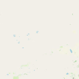
Map view of Willandra National Park

Use this park location map to pinpoint Willandra National Park in Australia, understand its exact geographic position, and read its mapped placement within the surrounding landscape more clearly.

Pigeon | © OpenStreetMap contributors

Location context for Willandra National Park

Far WestNew South Wales
Park atlas

Compare adjacent protected areas and map similar semi-arid landscapes across the Far West region of New South Wales.

Discover Other National Parks Near Willandra National Park and its Semi-Arid New South Wales Region
Explore national parks and other protected areas found near Willandra National Park, tracing similar semi-arid landscapes and grassland ecosystems across the Far West region of New South Wales. Compare these mapped conservation landscapes to understand the regional spread of protected habitats and the unique geographic context of the Murray Basin lowlands.
National parkRiverina

Cocoparra National Park: Semi-Arid Hill Country and Protected Landscape in Riverina

Explore mapped geography and key natural features of this Australian national park.

Cocoparra National Park is an essential protected natural area within Australia's Riverina region, noted for its striking semi-arid landscape. The park features a prominent range of low hills, including Bingar Mountain, rising from the predominantly flat terrain. This distinctive geography, characterized by rocky sandstone ridges and characteristic woodland communities, offers valuable insights into the region's natural heritage. As an Important Bird Area, Cocoparra National Park also holds significant conservation value for its avian populations and their unique inland habitat.

Area
83.57 km²
Established
1969
IUCN
II
Relief
Mixed relief
National parkNew South Wales

Oolambeyan National Park National Park: Discover its Mapped Geography and Protected Landscape

Explore the protected area and regional context of New South Wales.

Delve into Oolambeyan National Park, a key national park within New South Wales, Australia. This entry provides essential geographic context, detailing the park's mapped boundaries and its identity as a protected landscape. It serves as a foundation for understanding the park's contribution to the regional atlas and offers a distinct perspective on the natural geography of the area.

Area
222.31 km²
Established
2001
IUCN
II
Access
Moderate access
National parkNew South Wales

Yanga National Park National Park: Mapped Boundaries and Regional Geographic Context in New South Wales

Protected landscape atlas entry for New South Wales.

Examine Yanga National Park, a dedicated national park situated in New South Wales, Australia. This entry provides essential details for atlas-based discovery, focusing on its mapped boundaries, protected area status, and integration into the regional geography. Understanding Yanga National Park contributes to a broader comprehension of protected lands and their distribution, offering a clear geographic perspective on conservation efforts within New South Wales for users seeking structured landscape data.

Area
667.34 km²
Established
2007
IUCN
II
Relief
Lowland
National parkNew South Wales

Murrumbidgee Valley National Park: National Park with Mapped Protected Boundaries in New South Wales

Regional geography and landscape context for this protected area.

Murrumbidgee Valley National Park is recognized as a national park, offering critical insights into protected land distribution within New South Wales. This destination facilitates an atlas-style exploration of its geographic identity, mapped boundaries, and its role as a defined natural landscape within the broader region. Understanding this park's protected status and geographic placement is key for detailed map-based discovery.

Area
477.03 km²
Established
2010
IUCN
II
Relief
Lowland
National parkAustralia

Paroo-Darling National Park: Mapped Boundaries and Protected Landscape Geography

Explore the geographic context of this Australian national park.

Paroo-Darling National Park is a protected national park offering insights into Australia's natural geography. This section provides details on its mapped protected area, highlighting the landscape and regional context. Understand the park's geographic footprint and its importance as a conservation landscape within the Australian continent.

Area
1,780.53 km²
Established
2000
IUCN
II
Relief
Upland
National parkNew South Wales

Mallee Cliffs National Park: Protected Landscape and Geographic Atlas Entry

Explore its mapped boundaries and regional New South Wales context.

Mallee Cliffs National Park is presented here as a distinct protected landscape, offering specific insights for atlas and geographic discovery. This entry details the park's national park designation and its position within New South Wales, highlighting its mapped boundaries and the surrounding regional geography. It provides the foundational geographic context needed to understand Mallee Cliffs National Park's presence within the broader landscape of protected areas, inviting detailed exploration for those interested in mapped natural terrain.

Area
579.69 km²
Established
1977
IUCN
II
Relief
Lowland
National parkNew South Wales

Kinchega National Park: National Park Protected Area in New South Wales

Explore the mapped Darling River terrain and outback landscapes.

Kinchega National Park stands as a protected national park entity within New South Wales, Australia. Its geographic significance is deeply tied to the Darling River, which shapes its unique riparian ecosystems and contrasts with the surrounding semi-arid outback terrain. This park offers a valuable point for atlas-based discovery, allowing exploration of its mapped boundaries, landscape context, and the conservation of its distinct natural and cultural heritage within the regional geography.

Area
442.59 km²
Established
1967
IUCN
II
Climate
Arid
National park

Hattah-Kulkyne National Park: Victoria's Ramsar Wetland National Park & Mallee Landscape

Explore its mapped protected area and semi-arid regional geography.

Delve into Hattah-Kulkyne National Park, a substantial protected area in northwestern Victoria, Australia, defined by its striking red-earth terrain and sprawling mallee woodlands. This national park is renowned for its dynamic seasonal lake system, a key component of the Murray River basin's wetland geography. The park's status as a Ramsar-designated wetland highlights its ecological importance, providing critical habitat within a distinct semi-arid environment. Discover the unique atlas-scale landscape character and protected land context of this significant Australian natural area.

Area
480 km²
Established
1960
IUCN
II
Relief
Lowland

Common questions about visiting, size, designation, and location context for Willandra National Park

Willandra National Park FAQs for park facts, access, geography, and protected area context
Find quick answers about Willandra National Park, including protected-area facts, park geography, trail and visitor context, and how the park fits into its surrounding country and regional landscape.
MoriAtlas Explorer

Continue Your Protected Areas Search Across the Global Atlas

Deepen your exploration by continuing the structured search for national parks and protected areas worldwide. Utilize the comprehensive filtering capabilities to compare different conservation landscapes and refine your understanding of global park geography. Discover more about the distribution and characteristics of protected natural areas.

Global natural geography