Mori Atlas logo
National parkAbel Tasman National Park

Discover New Zealand's smallest national park situated in the Tasman District's stunning geography.

Abel Tasman National Park: Mapped Protected Landscape and Coastal Geography

Abel Tasman National Park represents a critical protected landscape at the northern tip of New Zealand's South Island, within the Tasman District. This atlas entry details its unique coastal geography, characterized by golden sand beaches, forested headlands, and offshore islands. Understanding its mapped boundaries and ecological context is key to appreciating its significance as a national park and its role in conservation and historical discovery.

Coastal National ParkIsland EcosystemsMāori Heritage SiteNew Zealand Great WalksRestoration EcologyScenic Beaches

Abel Tasman National Park

National park

Park overview

Structured park overview, official facts, and landscape profile for Abel Tasman National Park

Abel Tasman National Park park facts, protected area profile, and essential visitor context

Review the core facts for Abel Tasman National Park, including designation, size, terrain, visitor scale, habitats, and operating context in one park-focused overview.

About Abel Tasman National Park

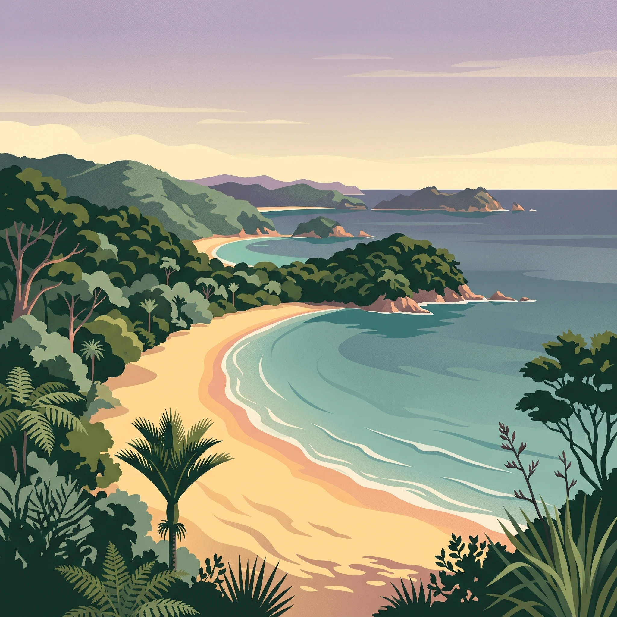
Abel Tasman National Park occupies a remarkable position at the northern end of New Zealand's South Island, where the waters of Golden Bay and Tasman Bay converge to create a distinctive coastal environment of sheltered inlets, offshore islands, and forested hills rising from the shoreline. At just 237.1 square kilometres, it stands as the smallest of New Zealand's national parks, yet its accessibility and scenic quality make it one of the most frequently visited. The park's landscape tells a complex story of natural beauty and human modification. Forested ridges descend through mixed woodland to meet a coastline of sweeping beaches, tidal creeks, and dramatic rock platforms. The Tata Islands shelter in Golden Bay while Tonga Island, Motuareronui/Adele Island, and Fisherman Island dot the waters of Tasman Bay. These islands have remained free of introduced mammalian predators and support wildlife populations that have vanished from the mainland, making them critical conservation areas within the broader park ecosystem. The park's coastal fringe below mean high water is designated as a scenic reserve, while the adjoining Tonga Island Marine Reserve extends protection into the marine environment. Visitors arrive primarily through the small settlements of Mārahau or Kaiteriteri, gaining access to the legendary walking tracks that follow the coastline through some of New Zealand's most picturesque terrain.

Quick facts and research context for Abel Tasman National Park

Abel Tasman National Park spans 237.1 km² along the northern coast of New Zealand's South Island in Tasman District. It is the smallest of New Zealand's 14 national parks yet ranks among the most visited, largely due to the popularity of its renowned coastal track. The park was established in 1942 through the advocacy of ornithologist Pérrine Moncrieff, making it one of the more recent additions to New Zealand's national park system. The park encompasses mainland areas between Golden Bay and Tasman Bay, along with several islands including Tonga Island, Motuareronui/Adele Island, and the Tata Islands. A 7.74 km² scenic reserve covers the intertidal beaches between high and low water marks. The park is administered by New Zealand's Department of Conservation with adjacent coastal waters managed by the Tasman District Council.

Protection and recognition

Tracing the terrestrial boundary scope and historical designation records since 1942

Official Protection Status and Land Designation of Abel Tasman National Park

Browse the verified terrestrial protection status and established historical boundaries of Abel Tasman National Park, which was formally designated in 1942. Structured atlas records provide factual database alignment for regional conservation tracking, mapping coordinates, and official boundary information.

Protection details

Protection scope
Terrestrial
Designated year
1942
Transboundary protection
No
Park context

Deeper park guide and search-rich context for Abel Tasman National Park

Abel Tasman National Park history, landscape, wildlife, and travel context

Explore Abel Tasman National Park through its history, landscape character, ecosystems, wildlife, conservation priorities, cultural context, and seasonal travel timing in a structured park guide built for atlas discovery and search intent.

Why Abel Tasman National Park stands out

Abel Tasman National Park is best known for its exceptional coastal hiking through the Abel Tasman Coast Track, one of New Zealand's premier Great Walks. The park's golden sand beaches, sheltered anchorages, and distinctive granite headlands create one of the country's most recognizable coastal landscapes. The park preserves islands that serve as crucial refuges for native wildlife, including species absent from the mainland due to introduced predators. Its ecological restoration story is equally notable, as Project Janszoon works to return the modified landscape to its pre-colonial state. The park also holds historical significance as the location where Dutch navigator Abel Tasman first anchored and made contact with Māori in 1642.

Abel Tasman National Park history and protected-area timeline

The land now comprising Abel Tasman National Park has been shaped by human presence for approximately 700 years, with archaeological evidence pointing to seasonal and permanent Māori occupation well before European arrival. The coastal area was home to iwi including Waitaha, Rapuwai, Muaūpoko (formerly known as Ngāi Tara), and later Ngāti Tūmatakōkiri, who were present when Dutch explorer Abel Tasman arrived in Golden Bay in 1642, becoming the first European to sight New Zealand. Historical records indicate a pā was established at Auckland Point by Pohea around 1450, and local Māori harvested food from forests, estuaries, and waters while cultivating crops including kūmara. Following Pākehā arrival in the 19th century, the region experienced widespread deforestation, farming, and quarrying that dramatically altered the landscape, leaving it among the most modified of New Zealand's national parks. The park itself was established in 1942 to mark the 300th anniversary of Tasman's visit, largely through the efforts of ornithologist Pérrine Moncrieff, who served on the park board from 1943 to 1974. The Crown set aside over 15,000 hectares, with the Golden Bay Cement Company donating land for the Abel Tasman Monument. The park opened on 18 December 1942 with Queen Wilhelmina of the Netherlands as patron. Subsequent expansion occurred through land purchases, with around 6,100 hectares added over time, including 7.9 km² in 2008 and 7 hectares at Awaroa Inlet in 2016 through a crowdfunding campaign that enabled New Zealanders to purchase and gift the land to the nation.

Abel Tasman National Park landscape and geographic character

The physical landscape of Abel Tasman National Park reflects the intersection of tectonic activity, marine erosion, and ongoing ecological processes that have shaped this coastal region of the South Island. The park consists of forested, hilly country rising north of the Tākaka River and Riwaka River valleys, with the terrain descending gradually to meet the waters of Golden Bay to the north and Tasman Bay to the east. Granite headlands project into the sea, sheltering coves and sandy beaches that have become iconic features of the New Zealand coast. The park contains a chain of islands including the Tata Islands in Golden Bay, and Tonga Island, Motuareronui/Adele Island, and Fisherman Island in Tasman Bay. These islands rise from productive marine waters and support distinctive terrestrial ecosystems. The intertidal zone between mean high water and mean low water springs encompasses 7.74 km² of beaches designated as scenic reserve, creating a continuum of protection from the terrestrial park into the coastal margin. The landscape includes coastal forests clothing the lower slopes, sub-alpine bogs in higher terrain, and sand dunes at several beach locations, representing a diversity of habitats within the park's relatively small area.

Abel Tasman National Park ecosystems, habitats, and plant life

The ecological character of Abel Tasman National Park is defined by the interplay between historical modification and ongoing restoration that distinguishes it from most other New Zealand protected areas. Early European settlers burned and cleared much of the forest, only to discover that the thin soils were unsuitable for sustained agriculture, a misadventure that destroyed native shrubland while simultaneously introducing invasive plant species that persist today. Despite this degradation, substantial regeneration has occurred, with native forest returning in valley areas where rātā, mataī, miro, and hinau form the canopy. The park's habitat diversity encompasses coastal forests, sub-alpine bogs, and sand dunes, each supporting different communities of plants and animals. The offshore islands represent the most intact ecosystems within the park, as their isolation has prevented the establishment of introduced mammals that have devastated mainland wildlife. These islands support species absent from the mainland and receive more restricted visitor access to protect their ecological integrity. The park's coastal waters, including the adjacent Tonga Island Marine Reserve, extend protection into the marine environment where rocky reefs and sandy bottoms support different communities than those found on land.

Abel Tasman National Park wildlife and species highlights

The wildlife of Abel Tasman National Park reflects both the challenges of introduced species and the success of protection efforts, particularly on the predator-free islands. Over 70 species of birds have been recorded within the park, with common sightings including petrels that nest in burrows on coastal slopes, shags that fish along the shoreline, and penguins that breed in sheltered coastal areas. Gulls, terns, and herons frequent the beaches and coastal waters, while forest-dwelling species inhabit the remaining native woodland. The islands support bird populations that have been eliminated from the mainland by introduced predators, making them critically important for conservation. Mammalian wildlife includes several introduced species that inhabit the park: possums, wild pigs, deer, and goats all occur, though their presence represents a management challenge for conservation staff working to protect native species. The marine environment around the offshore islands supports different wildlife communities, with the Tonga Island Marine Reserve protecting underwater ecosystems including seals that haul out on rocky shores.

Abel Tasman National Park conservation status and protection priorities

The conservation landscape of Abel Tasman National Park is notable for its focus on restoration and the prominent role of private initiative in complementing government management. The park is administered by the Department of Conservation, which divides management into three zones: the Coast along the coastal margin where restoration priorities include wetlands, dune areas, and threatened plant protection; the Interior covering areas further inland where ecological surveys, pest control, and heritage protection proceed; and the Islands where keeping areas free of invasive pests and reintroducing native species are key objectives. Project Janszoon, established in 2012 as a privately funded trust, represents an ambitious initiative to restore the park's ecosystems, taking its name from Tasman's middle name. The project aims to complete restoration work by 2042, the 400th anniversary of Tasman's visit and the park's 100th anniversary. The trust has worked alongside the Department of Conservation to develop a virtual visitor centre application and has funded extensive pest control and native species reintroduction programs. This public-private partnership model has become a significant approach to accelerating conservation outcomes in a park where historical modification makes restoration particularly challenging.

Abel Tasman National Park cultural meaning and human context

The cultural context of Abel Tasman National Park is deeply rooted in both Māori heritage and the colonial history of New Zealand's South Island. The park preserves evidence of approximately 700 years of Māori occupation, with the coastal areas serving as sites for permanent and seasonal habitation where iwi including Waitaha, Rapuwai, Muaūpoko, and Ngāti Tūmatakōkiri lived, harvested food resources from the land and sea, and cultivated crops. The arrival of Abel Tasman in 1642 marked a pivotal moment, as this was the first European contact with New Zealand, and the anchoring in what is now called Golden Bay represents a foundational event in the nation's colonial history. The Abel Tasman Monument, though located outside the park proper, commemorates this historic encounter between Dutch explorers and Māori. The park's Māori name, Te Pātaka a Māui, reflects traditional associations with the demigod Māui and the region's cultural significance. The 1942 establishment of the park specifically to commemorate the 300th anniversary of Tasman's visit created a deliberately bicultural site that honors both Māori history and European exploration.

Top sights and standout views in Abel Tasman National Park

The Abel Tasman Coast Track stands as the park's signature attraction, a 60-kilometre Great Walk that follows the coastline through some of New Zealand's most scenic terrain, connecting a series of golden sand beaches, tidal inlets, and forested headlands that define the park's character. Tōtaranui Beach, spanning roughly one kilometre, offers a large campsite and serves as a popular destination for hikers and kayakkers accessing the park from the water. The islands, particularly Tonga Island and Motuareronui/Adele Island, provide wildlife experiences unmatched on the mainland, with seabird colonies and seal populations drawing visitors on water-based excursions. Wainui Falls at the end of a short walk from Wainui Bay offers a refreshing destination for those seeking waterfall views without undertaking the full coast track. The park's restoration story, embodied in Project Janszoon's work, provides visitors with a narrative of environmental recovery that adds depth to the landscape beyond its scenic qualities. The blend of historical significance, natural beauty, and active conservation makes this small park a disproportionately important destination in New Zealand's protected area network.

Best time to visit Abel Tasman National Park

The Abel Tasman Coast Track is accessible year-round, though the park's mild climate makes it a compelling destination across seasons. Summer months from December through February bring the warmest conditions, with daytime temperatures regularly reaching the low twenties Celsius, making beach stops along the track particularly pleasant and encouraging water-based activities like kayaking. Spring and autumn offer comfortable temperatures with fewer visitors, though conditions can be more variable with occasional rain. Winter brings cooler weather but still maintains temperatures well above freezing, and the park sees its lowest visitation during these months, offering a more solitary experience on the tracks. The park's location at the northern tip of the South Island means it experiences less of the harsh weather that can affect higher-altitude parks, though coastal conditions can change rapidly. The islands and more exposed sections of track may experience stronger wind effects, particularly during spring when northerly winds are common. For wildlife viewing, the breeding season for seabirds from October through March offers the best opportunities, while the absence of breeding penguins in winter means fewer land-based bird sightings.
Monthly climate preview

Analyzing long term average temperatures and daily precipitation trends over three decades

Abel Tasman National Park Climate Normals and Monthly Weather Patterns

Long term climate measurements at a representative elevation of 156 meters reveal average temperatures peaking near 17.8 degrees Celsius and dropping to 8.85 degrees Celsius. Analyzing the complete twelve month cycle provides valuable baseline context for comparing seasonal temperature ranges and precipitation trends within the park.
Annual mean13 °C
9 °C18 °C
Jan17°
Feb18°
Mar16°
Apr14°
May12°
Jun10°
Jul
Aug
Sep10°
Oct12°
Nov14°
Dec16°
Warmest month
February

17.8 °C

Coolest month
July

8.9 °C

Wettest month
June

3.8 mm/day

Driest month
February

2.4 mm/day

Park location guide

Geography guide, regional context, and park location map for Abel Tasman National Park

Abel Tasman National Park park geography, regions, and map view in New Zealand

Understand where Abel Tasman National Park sits in New Zealand through a broader geographic reading of the surrounding landscape, nearby location context, and its mapped position within the national park landscape.

How Abel Tasman National Park fits into New Zealand

New Zealand is an island nation in the southwestern Pacific Ocean comprising two main islands and numerous smaller islands. Located east of Australia across the Tasman Sea, it features varied topography with the Southern Alps running along the South Island and volcanic terrain on the North Island. The country was settled by Maori people between 1280 and 1350, followed by European exploration beginning in 1642, and became a Dominion in 1907 before gaining full independence in 1947.

Wider geography shaping Abel Tasman National Park in New Zealand

New Zealand lies in the southwestern Pacific Ocean, east of Australia across the Tasman Sea. The country consists of two main islands, the North Island and South Island, plus over 600 smaller islands. The North Island features volcanic plateaus and hills while the South Island is dominated by the Southern Alps mountain range. The country has a long coastline and is surrounded by the Pacific Ocean.

Map view of Abel Tasman National Park

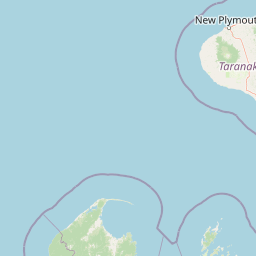
Use this park location map to pinpoint Abel Tasman National Park in New Zealand, understand its exact geographic position, and read its mapped placement within the surrounding landscape more clearly.

Pigeon | © OpenStreetMap contributors

Location context for Abel Tasman National Park

Tasman District
Natural feature types

Explore the Full Collection of Natural Features in Abel Tasman National Park

Examine the specific landforms and coastal features that define the geography of Abel Tasman National Park. MoriAtlas provides a structured view of these elements, allowing for a detailed understanding of the park's diverse natural terrain and spatial character.
Recorded earthquake history

Explore the Abel Tasman National Park Seismic and Earthquake History Database

Visit the dedicated catalogue to browse recorded earthquakes associated with the geography of Abel Tasman National Park. This structured index allows you to review historical event details, including magnitude and proximity, for a clearer understanding of regional seismic documentation across the coastal landscape.

Abel Tasman National Park Earthquake History

Catalogued events

101 events

Strongest magnitude

Magnitude 5.3

Most recent event

Apr 30, 2026

This history includes earthquakes recorded inside the park or within 50 km of its borders

Park atlas

Compare New Zealand's diverse coastal and terrestrial protected areas, mapping their unique geography and conservation focus.

Explore National Parks and Protected Areas Near Abel Tasman National Park, New Zealand

Browse a curated selection of national parks and protected areas that share geographic features or conservation goals with Abel Tasman National Park, extending your exploration across New Zealand's South Island. Compare mapped coastal landscapes, island ecosystems, and terrestrial reserves to deepen your understanding of the country's interconnected protected-area network and regional park geography.
Watercolor painting of mountains, green valleys, and a winding river under a soft sky
National parkWest Coast Region
2.9 km away#1 closest

Southwest

Kahurangi National Park: A National Park of Ancient Geology and Diverse Protected Landscapes in New Zealand

Explore the mapped natural terrain and regional geographic context.

Kahurangi National Park is distinguished by its extraordinary geological diversity, representing New Zealand's finest Paleozoic rock sequence and expansive karst features. Covering a vast area in the West Coast Region, it protects a remarkable array of natural landscapes, from coastal cliffs and nikau palm forests to alpine tussock basins and deep gorges. This national park is crucial for understanding New Zealand's natural heritage, offering a rich tapestry of mapped terrain and protected biodiversity for dedicated geographic exploration.

Area
5,193 km²
Established
1996
IUCN
II
Relief
Mixed relief
Protected landscapeNew Zealand
About 38 km away#2 closest

West

North-west Nelson Forest Park: Exploring the Tasman Region Protected Landscape Boundaries

A mapped overview of scattered conservation blocks in South Island, New Zealand.

North-west Nelson Forest Park provides an atlas-style perspective on the evolution of public conservation land in the Tasman region. Once a continuous wilderness, the remaining forest park is characterized by a series of excluded parcels that now border the Kahurangi National Park. This site documents the terrain and geographic distribution of these disparate forest blocks, offering insight into the legacy of land management and protected area formation within the northern South Island.

Established
1970
Protected landscapeMarlborough Region
40 km away#3 closest

Southeast

Mount Richmond Forest Park: Geography and Protected Landscapes in the Marlborough Region

Expansive native bush and mountain peak terrain

Mount Richmond Forest Park stands as one of the largest protected forest areas on the South Island of New Zealand. Dominated by dense native bush and rugged subalpine ridges, the park offers a complex topography of river valleys and high-altitude peaks, including its namesake Mount Richmond. It serves as a vital conservation landscape and a core segment of the regional geography between Nelson and the Marlborough district.

Area
1,659 km²
Established
1977
Relief
Mountain
Scope
Terrestrial
Marine protected areaWest Coast Region
61 km away#4 closest

West

Kahurangi Marine Reserve: Protected Marine Landscapes and West Coast Geography

Mapped coastal reefs, nīkau forest margins, and subtidal habitats

Located in New Zealand's West Coast Region, Kahurangi Marine Reserve protects 16 kilometres of coastline and extends five kilometres offshore. The reserve is defined by its layered marine profile, ranging from boulder-strewn beaches to complex rocky reefs and expansive mud and sand seabeds. It serves as a vital protected counterpart to Kahurangi National Park, fostering habitats for Hector's dolphins and diverse reef communities within its remote and rugged geography.

Area
84.19 km²
Established
2014
Relief
Lowland
Climate
Temperate
Nature reserveNew Zealand
About 69 km away#5 closest

East

Maud Island Nature Reserve: Geographic Overview and Protected Coastal Landscape

A pivotal conservation sanctuary in the Marlborough Sounds region

Maud Island represents a critical protected area in the Pelorus Sound of New Zealand. Defined by 320 hectares of forested, hilly terrain and a unique narrow isthmus, the island serves as a foundational refuge for species recovery. Its sheltered maritime setting makes it a key feature of the Marlborough Sounds geography and an essential location for scientific ecological research.

Area
3.2 km²
Established
1971
Relief
Upland
Climate
Temperate
Nature reserveMarlborough Region
About 82 km away#6 closest

East

Stephens Island (New Zealand) Nature Reserve: Geography and Protected Land Overview

Maritime sanctuary and ecological refuge in Marlborough Region

Stephens Island (New Zealand) acts as a rugged, compact island refuge in the Cook Strait, defined by steep terrain rising to 283 metres. As a critical nature reserve managed by Ngāti Koata and the Department of Conservation, this site offers profound insights into isolated island ecosystems, evolutionary endemic species, and the geological processes of the Maitai Group.

Area
1.5 km²
Established
1966
Relief
Upland
Climate
Temperate
National parkNew Zealand
87 km away#7 closest

South

Nelson Lakes National Park: Alpine Geography and Glacial Lakes Atlas

Explore New Zealand's protected mountain terrain and natural landscapes.

Nelson Lakes National Park provides a deep dive into a dramatic alpine environment situated at the northern edge of New Zealand's Southern Alps. This national park is characterized by its striking glacial lakes, Rotoiti and Rotoroa, and the extensive mountain ranges that surround them, offering a rich context for understanding protected land distribution. Explore the park's mapped geography, its distinct beech forest ecosystems, and the rugged natural terrain that makes it a significant feature within the broader South Island landscape.

Area
1,018.8 km²
Established
1956
IUCN
II
Relief
Mountain
Marine protected areaMarlborough Region
102 km away#8 closest

East

Long Island-Kokomohua Marine Reserve: Mapped Geography and Protected Reef Systems

Explore marine boundaries in the Marlborough Region

Located at the entrance to Queen Charlotte Sound, Long Island-Kokomohua Marine Reserve encompasses significant island and submerged reef features. This protected area serves as an essential site for understanding coastal ecosystem restoration, featuring varied terrain from shallow near-shore reefs to deeper rocky pinnacles that support diverse marine populations.

Area
6.19 km²
Established
1993
Relief
Lowland
Climate
Temperate

Common questions about visiting, size, designation, and location context for Abel Tasman National Park

Abel Tasman National Park FAQs for park facts, access, geography, and protected area context

Find quick answers about Abel Tasman National Park, including protected-area facts, park geography, trail and visitor context, and how the park fits into its surrounding country and regional landscape.
MoriAtlas Explorer

Continue Your Protected Areas Search Across the Global Atlas

Deepen your exploration by continuing the structured search for national parks and protected areas worldwide. Utilize the comprehensive filtering capabilities to compare different conservation landscapes and refine your understanding of global park geography. Discover more about the distribution and characteristics of protected natural areas.

Global natural geography