Mori Atlas logo
National parkAbisko National Park

Subarctic landscapes and natural phenomena mapped in Lapland

Abisko National Park Protected Area

Abisko National Park is a protected national park in northern Swedish Lapland, situated north of the Arctic Circle. Explore its dramatic subarctic terrain, including mountain birch forests, alpine tundra, and the significant Abiskojåkka river canyon.

National ParkSwedenArctic CircleSubarcticLaplandMountain Birch Forest
Stylized illustration of a mountain landscape with a lake, forest, and colorful sky patterns

Abisko National Park

National park

Park overview

Structured park overview, official facts, and landscape profile for Abisko National Park

Abisko National Park park facts, protected area profile, and essential visitor context
Review the core facts for Abisko National Park, including designation, size, terrain, visitor scale, habitats, and operating context in one park-focused overview.

About Abisko National Park

Abisko National Park represents one of Sweden's most significant protected wilderness areas, established in 1909 as part of the nation's pioneering nature conservation movement. The park was created with the dual purpose of preserving northern Nordic fell landscape in its natural state and providing a memorial for scientific research, reflecting Sweden's early commitment to protecting unique natural environments. The protected area spans approximately 7,700 hectares encompassing a diverse landscape that transitions from lake shoreline through dense mountain birch forest to open alpine terrain above the tree line.

The park's geography centers on a fundamental valley that sits in the rain shadow of the Scandinavian mountain range, creating unusual climate conditions for this latitude. Despite its northern position, Abisko receives remarkably little precipitation—only about 300 millimeters annually—making it one of Sweden's driest regions. This dryness, combined with extended periods of clear skies, contributes to the area's fame as an exceptional location for observing both the midnight sun of summer and the northern lights of winter.

The landscape is defined by Mount Nuolja, which rises prominently above the valley, and the Abiskojåkka river, which flows through a dramatic canyon with steep walls exposing the geological layers of the region. The canyon reveals the area's complex geological history, with rocks that were lifted from an ancient Atlantic ocean and displaced eastward during the formation of the Caledonian mountain range approximately 400 million years ago. The underlying bedrock is notably calcareous, supporting a rich and diverse flora with many rare species.

Abisko serves as a gateway to Swedish Lapland for many visitors, with the Abisko Turiststation operated by the Swedish Tourist Association providing accommodations and amenities. The park's accessibility via the Iron Ore Line railway, which connects Stockholm with Narvik in Norway, makes it one of Sweden's most easily reachable northern wilderness areas.

Quick facts and research context for Abisko National Park

Abisko National Park lies in northern Swedish Lapland, approximately 37 kilometers from the Norwegian border and about 195 kilometers north of the Arctic Circle. The 77-square-kilometer protected area spans from the shores of Lake Torneträsk into a valley surrounded by mountain massifs. The landscape transitions from mountain birch forest at lower elevations to open alpine tundra above the tree line, which sits at roughly 650 to 800 meters depending on aspect. The park is drained by the Abiskojåkka river, which flows through a notable canyon before reaching Torneträsk. The region experiences a distinctive microclimate due to its rain shadow position, making it one of Sweden's sunniest and driest areas with only about 300 millimeters of annual precipitation. The park is part of Sweden's Natura 2000 network and contains significant cultural and scientific heritage dating back to its establishment alongside Sweden's first nature conservation laws in 1909.

Park context

Deeper park guide and search-rich context for Abisko National Park

Abisko National Park history, landscape, wildlife, and travel context
Explore Abisko National Park through its history, landscape character, ecosystems, wildlife, conservation priorities, cultural context, and seasonal travel timing in a structured park guide built for atlas discovery and search intent.

Why Abisko National Park stands out

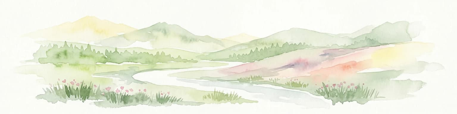
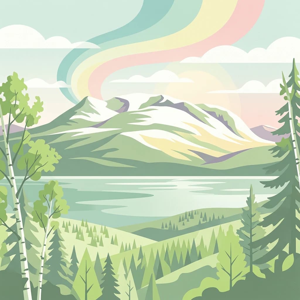
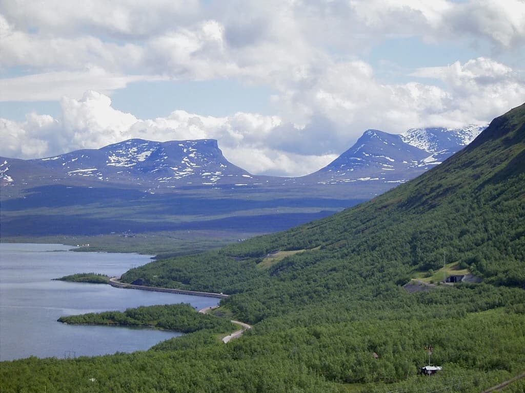
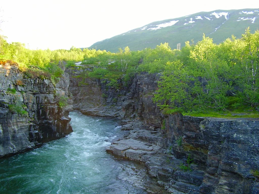
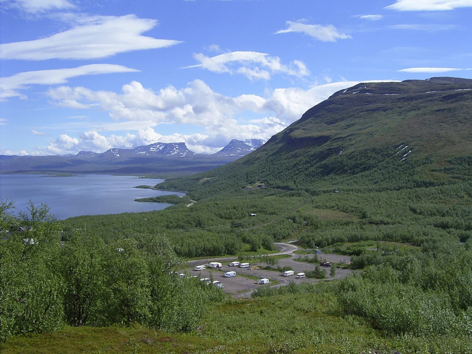
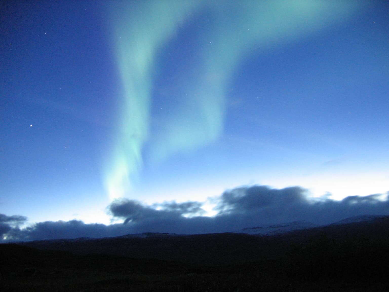
Abisko National Park is renowned for its exceptional Arctic light phenomena. During summer, the park experiences the midnight sun for over eight weeks around the summer solstice, when the sun remains above the horizon throughout the night. In winter, the dark season offers optimal conditions for viewing the aurora borealis, as Abisko lies in one of the world's best locations for this phenomenon due to its northerly latitude, minimal light pollution, and typically clear skies. The park is also famous as the starting or ending point of the Kungsleden, the famous 440-kilometer hiking trail that follows the Scandinavian mountain range. The distinctive Lapporten gateway, a U-shaped valley formed by surrounding mountains, provides one of the most photographed landscapes in northern Sweden. The Abiskojåkka canyon with its 20-meter deep gorge and the panoramic view from Mount Nuolja are additional standout natural features.

A Northern Hawk Owl with mottled gray and white plumage perched on a branch with green foliage in background
Northern Hawk Owl perched on branch in Abisko National Park forest

Abisko National Park history and protected-area timeline

Abisko National Park was established in 1909 alongside eight other national parks, making it one of the first protected areas created in Europe and the oldest in Sweden's current national park system. The park's creation coincided with Sweden's first nature conservation laws, reflecting a growing scientific and societal recognition of the need to preserve unique natural landscapes. The initiative came from a group of prominent Swedish scientists, with geologist Fredrik Svenonius playing a leading role in proposing the protected area.

The founding purpose was explicitly twofold: to preserve an area of northern Nordic fell landscape in its original condition and to create a memorial area for scientific research. This scientific emphasis was soon reflected in the establishment of the Abisko Scientific Research Station, which had originally been founded in 1903 approximately 31 kilometers west of Abisko in Vassijaure. After a fire destroyed the original facility in 1910, a new station was constructed in its present location in Abisko village and opened in 1913. The research station was incorporated into the Royal Swedish Academy of Sciences in 1935 and has since become a significant center for biological, climate, ecological, and geological research in the Arctic region.

The Swedish Tourist Association had already established a tourist station at Abisko in 1902, before the national park was formally created, recognizing the area's potential as a destination for nature tourism. This early infrastructure helped establish Abisko as a gateway to Swedish Lapland and contributed to its ongoing status as the most visited national park in Norrbotten County.

Abisko National Park landscape and geographic character

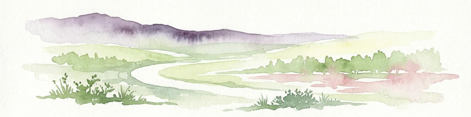
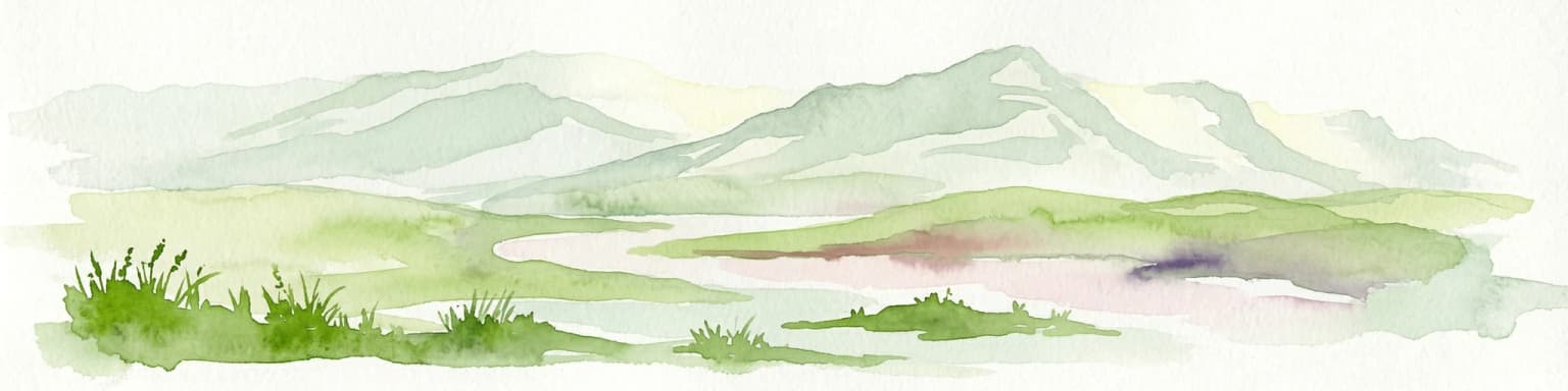
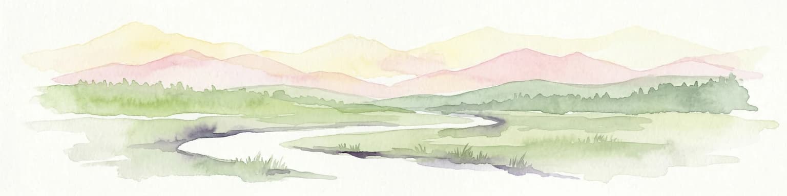
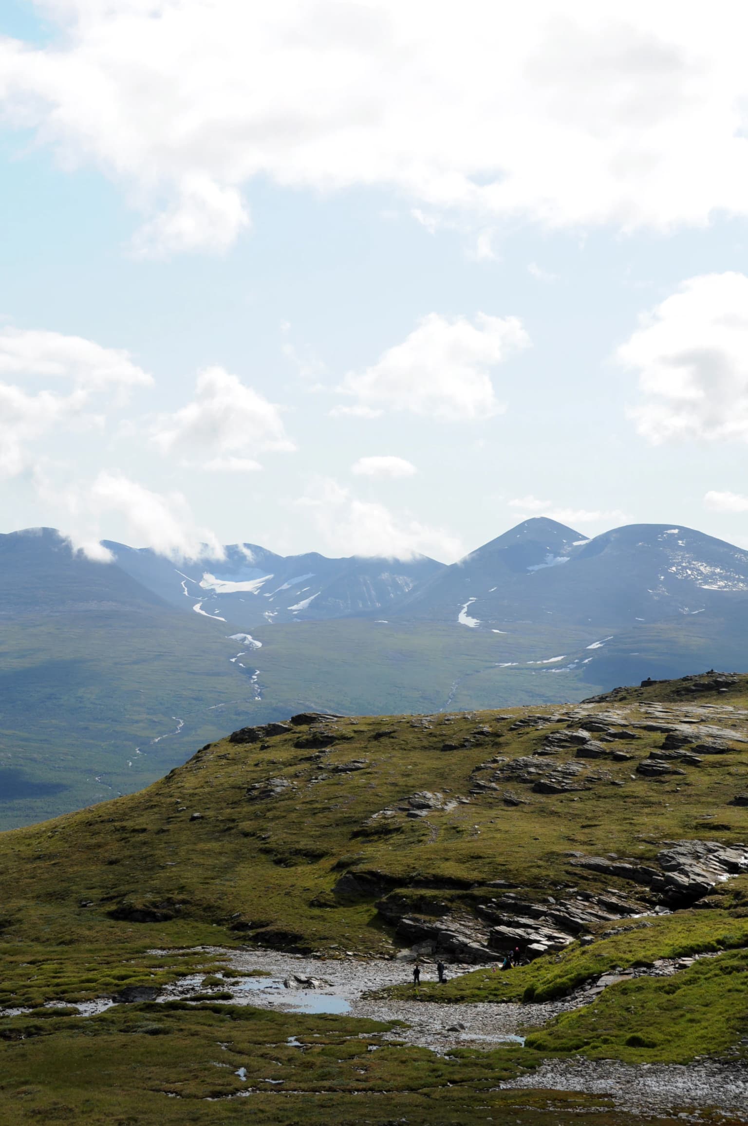
The physical landscape of Abisko National Park is characterized by a fundamental valley flanked by substantial mountain massifs to the south and west, with Lake Torneträsk forming the northeastern boundary. The terrain descends from alpine heights through mountain birch forest to the lake shore, creating a pronounced ecological gradient within a relatively compact area. The most prominent topographic feature is Mount Nuolja, which rises steeply above the valley floor and provides panoramic views of the surrounding landscape.

The Abiskojåkka river is a defining hydrological feature, flowing from Lake Abiskojaure in the southern part of the park through the valley before entering a dramatic 20-meter deep canyon with near-vertical walls just before its mouth at Torneträsk. This canyon provides a spectacular cross-section of the region's geology, exposing the layered structure of the bedrock. The river also forms a delta area at its confluence with Torneträsk, which functions as an important bird habitat.

The underlying geology consists primarily of hard schist and metamorphic rocks, with notable limestone and dolomite formations. The dolomite found in the canyon has been locally called "abisko marble" and was historically extracted on a small scale. The geological history is tied to the Caledonian orogeny, when rock masses were transported eastward from what was once an ancient ocean. The calcareous nature of the bedrock has significantly influenced the park's vegetation, supporting species-rich plant communities including many rare and northern-distributed species.

Above the tree line at approximately 650 to 800 meters elevation, the landscape opens into alpine heath and bare rock terrain, with the higher peaks providing exposed summits above the subalpine zone.

Grassy hillside with rocky outcrops, small stream, and distant snow-capped mountains under a partly cloudy sky
View from Nuolja mountain showing grassy hills, rocky outcrops, and distant snow-capped peaks

Abisko National Park ecosystems, habitats, and plant life

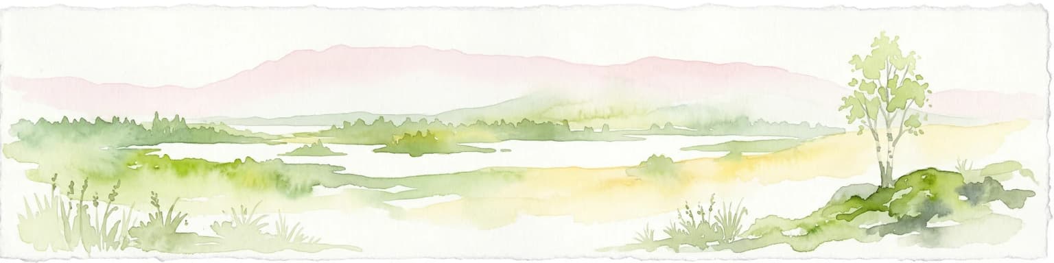
The ecological character of Abisko National Park is defined by the transition from subarctic birch forest to alpine tundra, creating a landscape of significant biodiversity and ecological interest. The mountain birch forest covers approximately 3,900 hectares of the park and exists in two distinct forms: heath birch forest on drier, poorer soils and meadow birch forest in wetter, more nutrient-rich locations. The heath birch forest dominates, characterized by birch trees growing in scattered groups with an understory of lingon, bearberry, and limited herbaceous vegetation.

The meadow birch forest occurs in more sheltered and fertile locations, particularly on the slopes of Nuolja and Slåttatjåkka, where taller birches support a richer ground flora including alpine herbs such as天山devil's-bit and woolly willow. The transition zone between forest and alpine terrain supports subalpine heath communities.

The park's location in a rain shadow creates unusual ecological conditions, with the dry climate supporting plant species more typical of continental rather than maritime Arctic environments. The calcareous bedrock further influences vegetation patterns, supporting species-rich communities in the canyon area where rare plants including Lapland rosebay, mountain avens, and purple saxifrage thrive. The canyon harbors particularly significant botanical diversity, including the only Swedish population of the protected orchid known as lapfela.

The Abiskojåkka delta provides important wetland habitat for breeding birds, though the area is protected from visitor disturbance during the early summer breeding season. The open alpine heaths above the tree line support characteristic tundra vegetation dominated by dwarf shrubs including Arctic bearberry and Arctic willow.

Landscape view of Lapporten valley with Torneträsk lake, snow-capped mountains, and dense green forest under a partly cloudy sky
View of Lapporten valley from Björkliden in Abisko National Park

Abisko National Park wildlife and species highlights

The wildlife of Abisko National Park reflects the subarctic location and the variety of habitats from lake shore through birch forest to alpine tundra. Bird diversity is particularly notable, with the park supporting both northern species adapted to harsh conditions and more southern species that reach the northern limit of their range here. Typical birch forest birds include redpoll, brambling, and bluethroat, while southern species such as dunnock, garden warbler, and robin also occur. The rare northern warbler has been recorded in the area.

Wetland areas support waders including greenshank, whimbrel, and spotted redshank, while small lakes harbor diving ducks such as tufted duck, goldeneye, and scaup. The delta area provides habitat for breeding waterfowl, though it is not exceptionally rich in seabirds. Alpine areas above the tree line support species including snow bunting, ptarmigan, and dotterel. Birds of prey include the common kestrel as the most frequently observed raptor, with golden eagle occurring less commonly.

Large mammals have been reduced in population but remain present. Moose are common throughout the park, with tracks and droppings found widely in the forest. Reindeer, both wild and semi-domesticated, pass through the area. Smaller mammals including pine marten, stoat, red squirrel, and mountain hare are regularly observed. The Norway lemming population fluctuates dramatically in cycles typical of this species. Predators including wolverine, Arctic fox, lynx, and brown bear occur but are seen only sporadically, as these wide-ranging species pass through the park intermittently rather than maintaining permanent populations.

A river flowing through a rocky canyon with steep cliffs, green trees, and snow-capped mountains in the background
Abiskojåkka river flowing through a rocky canyon in Abisko National Park

Abisko National Park conservation status and protection priorities

Abisko National Park holds significant conservation importance as one of Sweden's oldest protected areas and a key site within the European Natura 2000 network. The park was established in 1909 with the explicit purpose of preserving northern Nordic fell landscape in its natural state, making it part of Sweden's pioneering conservation legacy. The inclusion in Natura 2000 reflects the European-level recognition of the park's importance for maintaining biodiversity and ecological processes.

The conservation significance stems from multiple factors: the intact ecological gradients from lake through birch forest to alpine terrain, the presence of rare and northern-distributed species, the calcareous bedrock supporting unusual plant communities, and the long-term scientific research that has documented environmental change in the region. The Abisko Scientific Research Station, operational since 1903, provides one of the longest continuous records of climate and ecological observations in the Arctic, offering crucial baseline data for understanding environmental change.

The park faces conservation challenges related to climate change, with evidence of warming temperatures affecting permafrost in lowland areas, changes in vegetation distribution including the upward movement of the birch tree line, and alterations to precipitation patterns. The mountain birch forests have also experienced significant historical disturbance from outbreaks of the autumnal moth, with massive defoliation events in the 1950s causing extensive forest death that is still visible in areas of sparse, regenerating woodland.

Abisko National Park cultural meaning and human context

The cultural context of Abisko National Park is deeply connected to the Sami people and the history of northern Sweden. The park's name derives from the Northern Sami word "Ábeskovvu," meaning "the forest by the big water," referencing the proximity to Torneträsk. This linguistic heritage reflects the long-standing presence of the Sami in the region, though the protected area was formally established without explicit recognition of Sami land use rights that would be more commonly incorporated in modern Swedish protected area management.

The establishment of the Swedish Tourist Association's station in 1902 and the subsequent creation of the national park in 1909 reflect the broader development of northern Sweden during the railway era. The Iron Ore Line connecting Kiruna with Narvik transformed the region's accessibility and supported the growth of tourism and scientific interest in Arctic landscapes. The Abisko Scientific Research Station further reinforced the area's role as a destination for scientific exploration and research.

Traditional land use in the surrounding region includes reindeer husbandry, with both wild and semi-domesticated herds moving through the landscape. The park's designation as a protected area has influenced but not eliminated these traditional practices in the broader region.

Panoramic landscape view showing a U-shaped valley, lake, mountainous terrain with green vegetation, and a parking area with vehicles under a partly cloudy sky
Panoramic view of Lapporten valley and surrounding mountains from Bjorkliden in Abisko National Park

Top sights and standout views in Abisko National Park

Abisko National Park offers an exceptional combination of Arctic natural phenomena and outdoor activities within a relatively accessible wilderness setting. The midnight sun of summer, when the sun remains above the horizon for weeks, creates extraordinary opportunities for extended hiking and skiing under持续 daylight. Winter brings the complementary experience of the aurora borealis, with the park's northerly position, minimal light pollution, and clear skies creating optimal viewing conditions for this spectacular natural phenomenon.

The starting point of the Kungsleden trail makes Abisko a gateway for hikers exploring the Swedish mountain range, with the well-equipped Abisko Turiststation providing logistical support. The spectacular Lapporten gateway valley provides one of northern Sweden's most iconic landscapes. Mount Nuolja offers accessible panoramic views via chair lift, while the Abiskojåkka canyon provides a dramatic natural feature with geological and botanical significance.

The combination of scientific heritage, with the long-running research station, and nature-based tourism infrastructure makes Abisko distinctive among Swedish national parks. The park successfully balances accessibility with wilderness character, allowing visitors to experience subarctic nature while providing comfortable facilities and well-maintained trails.

Northern lights displaying green and blue hues against a dark night sky with distant clouds and mountain silhouettes
Aurora borealis illuminating the night sky over Abisko National Park

Best time to visit Abisko National Park

The visiting season at Abisko National Park is fundamentally divided by the Arctic light conditions, with each half of the year offering dramatically different experiences. Summer, from approximately late May through late July, brings the midnight sun with its extended daylight hours, creating ideal conditions for hiking, wildlife observation, and landscape photography. The warmest month is June with average temperatures around 11°C, though conditions can vary significantly with elevation and exposure. This period sees the highest visitor numbers and offers the most reliable access to trails and facilities.

Winter, from roughly late November through February, provides the optimal season for northern lights viewing as the darkness returns and the sky remains dark enough to observe the aurora borealis. January is the coldest month with average temperatures around -12°C, but the dry climate and relatively low snowfall in the valley compared to surrounding mountains create more comfortable conditions than might be expected. Cross-country skiing and winter hiking are popular activities, with the aurora watching being the primary draw for many visitors.

The shoulder seasons of spring and autumn offer quieter conditions with fewer visitors, though facilities may have more limited operating hours. The rapid transitions between seasons characterize the local experience, with the birch forest leafing out quickly in late spring and displaying autumn colors in early September. The choice of visiting season depends on whether travelers prioritize midnight sun experiences or northern lights viewing, as these two phenomena define the park's most distinctive seasonal character.

Park location guide

Geography guide, regional context, and park location map for Abisko National Park

Abisko National Park park geography, regions, and map view in Sweden
Understand where Abisko National Park sits in Sweden through a broader geographic reading of the surrounding landscape, nearby location context, and its mapped position within the national park landscape.

How Abisko National Park fits into Sweden

Sweden, formally the Kingdom of Sweden, is a highly developed Nordic country on the Scandinavian Peninsula in Northern Europe. With a population of 10.6 million and an area of 450,295 km², it is the largest Nordic country by both area and population. Sweden is a constitutional monarchy with Stockholm as its capital and largest city, known for its advanced economy, social welfare system, and membership in the European Union and NATO.

Wider geography shaping Abisko National Park in Sweden

Sweden occupies the eastern portion of the Scandinavian Peninsula in Northern Europe. It borders Norway to the west and north, Finland to the east, and shares a maritime border with Denmark to the southwest across the Øresund. The country has an extensive coastline along the Baltic Sea and Gulf of Bothnia, dotted with thousands of islands. The terrain varies from mountainous regions in the northwest to low-lying coastal areas and inland lakes in the south and central parts.

Map view of Abisko National Park

Use this park location map to pinpoint Abisko National Park in Sweden, understand its exact geographic position, and read its mapped placement within the surrounding landscape more clearly.

Pigeon | © OpenStreetMap contributors

Location context for Abisko National Park

Norrbotten County

Explore compelling images illustrating Abisko's alpine tundra, mountain birch forests, and Arctic light phenomena.

Abisko National Park Photos: Exploring Subarctic Landscapes, Scenery, and Protected Terrain
Browse an image gallery showcasing Abisko National Park photos, revealing its dramatic subarctic landscapes, mountain massifs, and unique environmental features. Visual content contextualizes the park's alpine tundra, dense birch forests, and striking Abiskojåkka canyon. These views provide a deeper understanding of Abisko's distinct protected-area character, Arctic light phenomena, and diverse terrain.

A Northern Hawk Owl with mottled gray and white plumage perched on a branch with green foliage in background

Snow-covered mountain range under a blue sky with scattered clouds

Grassy hillside with rocky outcrops, small stream, and distant snow-capped mountains under a partly cloudy sky

Landscape view of Lapporten valley with Torneträsk lake, snow-capped mountains, and dense green forest under a partly cloudy sky

A river flowing through a rocky canyon with steep cliffs, green trees, and snow-capped mountains in the background

Wide landscape view of Nissånjokkens Canyon featuring a river flowing through rocky cliffs, surrounded by autumn-colored trees and distant mountains under a partly cloudy sky

Panoramic landscape view showing a U-shaped valley, lake, mountainous terrain with green vegetation, and a parking area with vehicles under a partly cloudy sky

Northern lights displaying green and blue hues against a dark night sky with distant clouds and mountain silhouettes

Hiking trail through a tundra landscape with grassy hills, trail markers, and distant mountains under an overcast sky

Grassy tundra landscape with a small lake and distant mountains with snow patches under a clear sky

Park atlas

Trace the broader regional geography of protected areas surrounding Abisko, essential for park comparison.

Compare National Parks and Protected Areas Near Abisko National Park, Norrbotten County
Expand your discovery of subarctic protected areas by browsing other national parks and natural reserves throughout Norrbotten County and Swedish Lapland, offering geographic context around Abisko National Park. Explore varied conservation landscapes, map their regional distribution, and compare the diverse wilderness found across this Arctic destination.
National parkNorrbotten County

Vadvetjåkka National Park: Arctic Mountain Landscape and Karst Terrain

Northernmost National Park in Norrbotten County, Sweden

Vadvetjåkka National Park offers a unique atlas perspective on Sweden's northernmost protected mountain landscape. Explore its remote Arctic terrain, characterized by glaciers existing at unusual low altitudes and significant karst cave systems carved into limestone bedrock. This is a vital point for understanding the mapped geography and protected natural features of Norrbotten County and Swedish Lapland.

Area
26.3 km²
Established
1920
IUCN
II
Relief
Mountain
National parkTroms

Rohkunborri National Park: Northern Norway's Dramatic Protected Landscape

Explore its mapped terrain, canyon, and alpine ecosystems.

Rohkunborri National Park offers a profound encounter with northern Norway's wild geography. As a designated national park in Troms county, it features the iconic Sørdalen canyon, a dominant geological feature that shapes its diverse terrain. The park's landscape encompasses a rich ecological gradient, from boreal forests to alpine tundra, supporting a variety of wildlife. This protected area is crucial for understanding Scandinavian mountain ecosystems and transboundary conservation efforts, providing rich content for atlas-based exploration of its mapped boundaries and natural context.

Area
571 km²
Established
2011
IUCN
II
Relief
Mountain
National parkTroms

Øvre Dividal National Park: Arctic Alpine Protected Landscape in Troms, Norway

Mapped boundaries and unique ecological terrain of a pristine wilderness.

Øvre Dividal National Park stands as a premier example of Arctic alpine wilderness, meticulously preserved as a national park in Norway's Troms region. This entry facilitates a detailed exploration of its mapped protected boundaries and the distinct elevational ecological zones, from boreal forests to high-altitude tundra. Gain geographic context for this vital landscape, which supports diverse habitats and contributes to Scandinavia's largest contiguous wilderness areas.

Area
750 km²
Established
1971
IUCN
II
Relief
Mountain
Watercolor painting of a landscape featuring a body of water, green fields, a single tree, and distant mountains under a light sky
National parkNorrbotten County

Stora Sjöfallet National Park: Protected Arctic Landscape in Norrbotten County

Explore mapped terrain and regional geography.

Stora Sjöfallet National Park stands as a significant protected landscape within Norrbotten County, Sweden, renowned for its striking Arctic mountain scenery centered on the Áhkká massif. As a key component of the Laponian Area UNESCO World Heritage Site, its vast expanse of over 1,278 square kilometers offers critical insights into subarctic ecosystems, glacial terrain, and the mapped boundaries of a protected natural territory. Discover the unique geographic features and ecological value of this expansive national park.

Area
1,278 km²
Established
1909
IUCN
II
Relief
Mountain
National parkSenja

Ånderdalen National Park: Ancient Coastal Pine Forest and Glacial Valley Landscape

Norway's protected area within the Senja region.

Delve into the detailed protected landscape of Ånderdalen National Park, a national park located on Norway's Senja island. This entry offers a focused atlas exploration of its unique geographic features, including its celebrated ancient coastal pine forest, dramatic glacial valleys carved from granite, and its significance as a representative example of the northern Norwegian coastal mountain terrain. Understand the mapped boundaries and the natural context of this vital conservation area.

Area
134 km²
Established
1970
IUCN
II
Relief
Mixed relief
Watercolor illustration of a mountainous landscape with a river, grass, and distant hills
National parkNorrbotten County

Sarek National Park: Mapping Sweden's Rugged Alpine Wilderness and Glacial Terrain

Explore the mapped geography of Norrbotten County's largest alpine national park.

Sarek National Park represents the heart of Sweden's alpine wilderness, a protected landscape defined by its towering mountain peaks, expansive glaciers, and deeply carved glacial valleys. Situated in Norrbotten County, the park's geography is characterized by a remote and rugged terrain, making it a prime destination for understanding high-altitude natural environments through mapped context. Discover the unique contours of this iconic national park and its place within the broader regional geography of Swedish Lapland.

Area
1,970 km²
Established
1909
IUCN
II
Relief
Mountain
Watercolor illustration of a winding river through a green landscape with distant mountains
National parkNorrbotten County

Padjelanta National Park: Sweden's Largest National Park Protected Plateau Landscape

Explore subarctic terrain, large lakes, and Laponia World Heritage Site geography.

Padjelanta National Park, situated in Norrbotten County, is Sweden's largest national park. It features a distinctive subarctic plateau ecosystem centered around two vast lakes, offering a starkly open landscape compared to adjacent alpine areas. This protected area is renowned for its exceptional botanical and lichen diversity, a vital part of the Laponia World Heritage Site. Users can explore its mapped geography, unique terrain, and the cultural significance of this expansive arctic wilderness.

Area
1,984 km²
Established
1963
IUCN
II
Relief
Highland
Watercolor illustration showing mountains, a lake, and rolling hills
National parkNordland

Møysalen National Park: Coastal Alpine Protected Landscape in Nordland, Norway

Mapped boundaries, dramatic terrain, and coastal ecosystems.

Møysalen National Park offers a compelling study in coastal alpine geography, situated within Nordland county, Norway. This protected area is renowned for its dramatic mountain scenery where peaks plunge directly into the sea and deep fjords. The park's 51 square kilometres encompass a unique ecological transition from alpine summits to sea level, featuring jagged peaks, sheltered valleys with birch forests, and coastal wetlands. Explore the mapped landscape of this distinctive Norwegian national park and understand its place in regional geography and protected land networks.

Area
51 km²
Established
2003
IUCN
II
Relief
Mountain

Common questions about visiting, size, designation, and location context for Abisko National Park

Abisko National Park FAQs for park facts, access, geography, and protected area context
Find quick answers about Abisko National Park, including protected-area facts, park geography, trail and visitor context, and how the park fits into its surrounding country and regional landscape.
MoriAtlas Explorer

Continue Your Protected Areas Search Across the Global Atlas

Deepen your exploration by continuing the structured search for national parks and protected areas worldwide. Utilize the comprehensive filtering capabilities to compare different conservation landscapes and refine your understanding of global park geography. Discover more about the distribution and characteristics of protected natural areas.

Global natural geography