Mori Atlas logo
Protected areaAirag Lake

Understanding the mapped hydrology and thermal landscape of the Great Lakes Depression basin

Airag Lake Protected Area in Uvs Province: A Geographic Atlas of Mongolia's Steppe Wetlands

Airag Lake represents a distinct freshwater ecosystem situated in the broad, flat expanses of Mongolia's Great Lakes Depression. This protected landscape is defined by its unusual thermal behavior and its vital role as a hydrological link within an interconnected chain of lakes and river systems. Through its status as a designated wetland of importance, the area offers a unique view into the arid steppe geography and tectonic basin processes that shape the Uvs Province region.

freshwater lakeGreat Lakes DepressionRamsar Wetlandsteppe wetlandshallow lakeinterconnected lake system

Airag Lake

Protected area

Park overview

Structured park overview, official facts, and landscape profile for Airag Lake

Airag Lake park facts, protected area profile, and essential visitor context

Review the core facts for Airag Lake, including designation, size, terrain, visitor scale, habitats, and operating context in one park-focused overview.

About Airag Lake

Airag Lake is a freshwater steppe lake in the Zavkhan sum of Uvs Province, Mongolia, occupying part of the country's far western Great Lakes Depression. The Great Lakes Depression is one of the most distinctive physiographic regions of Mongolia, a deep, sediment-filled basin that holds an interconnected series of large lakes separated by stretches of dry steppe and semi-desert. Airag sits within this larger system, receiving inflow from the Zavkhan and Khüngüin rivers and passing its water on to Khyargas Lake through a short connecting canal. Although small compared to nearby Khyargas and Khar-Us, Airag is an integral link in this regional hydrological chain.

Hydrologically, the lake is shallow and gentle in character, with average depths around five meters and a maximum of roughly ten meters, covering a surface of approximately 143 square kilometers. Its size and depth track closely with the flow of its inflowing rivers, so the lake visibly swells and shrinks with the seasonal and annual rhythms of central Asian runoff. Compared to many other Mongolian lakes, its water is described as relatively turbid, owing to the fine sediments delivered by the rivers that feed it and to the shallowness of the basin.

What truly distinguishes Airag Lake from other lakes in the region is its thermal behavior. Because the lake is shallow and well-mixed, summer sun warms the entire water column from surface to bottom. During winter, instead of freezing solid like many comparable steppe lakes, the water remains relatively warm, and the outflow canal to Khyargas Lake stays open year-round. This anomaly is more than a curiosity; it shapes the local ecology, supports unfrozen habitat through the coldest months, and contributes to the wetland values that led to the lake's international recognition.

Beyond its hydrology, Airag Lake is part of the broader Uvs Lake basin, a transboundary watershed that extends into Russia and supports a wide range of steppe, wetland, and migratory bird habitats. The lake itself, officially listed as the Ramsar site "Ayrag Nuur" since 1999, is valued for the wetland environments it sustains in a region where surface freshwater is otherwise scarce. Together, its position in the Great Lakes Depression, its connection to the Khyargas system, and its unusually warm winter waters give Airag Lake a distinctive place in Mongolia's network of great inland waters.

Quick facts and research context for Airag Lake

Airag Lake sits at about 1,030 meters above sea level in the Zavkhan sum of Uvs Province, within Mongolia's Great Lakes Depression. It is a freshwater lake that receives inflow from the Zavkhan and Khüngüin rivers and drains southward through a canal into Khyargas Lake. The maximum recorded dimensions are about 18 kilometers long by 13 kilometers wide, with average depths of only a few meters. The site is officially listed as the Ramsar Wetland "Ayrag Nuur," designated on 13 April 1999.

Park context

Deeper park guide and search-rich context for Airag Lake

Airag Lake history, landscape, wildlife, and travel context

Explore Airag Lake through its history, landscape character, ecosystems, wildlife, conservation priorities, cultural context, and seasonal travel timing in a structured park guide built for atlas discovery and search intent.

Why Airag Lake stands out

Airag Lake is best known for its unusual thermal profile in the Mongolian steppe: in summer the shallow lake warms nearly to the bottom, and in winter its water stays relatively warm, keeping the outflow canal to Khyargas Lake ice-free. It is also recognized for its role in the Great Lakes Depression hydrological chain and for its Ramsar status as an important wetland habitat in an otherwise arid region.

Airag Lake history and protected-area timeline

Airag Lake has long functioned as part of the same drainage basin as Khyargas Lake. In ancient times, before the gradual infilling and separation of basins that shaped the modern Great Lakes Depression, the two water bodies were part of one continuous lake system. Over time, sediment accumulation and changes in the regional hydrology broke this single basin into the series of distinct lakes seen today, with Airag connected to Khyargas by only a narrow canal.

In the modern era, the lake gained formal international recognition on 13 April 1999, when it was designated as the Ramsar Wetland of Importance under the official name Ayrag Nuur. This designation acknowledged the lake's wetland values within the broader Uvs Lake basin, a transboundary watershed shared with Russia.

Airag Lake landscape and geographic character

Airag Lake occupies a shallow basin within Mongolia's Great Lakes Depression, a vast inland trough that holds some of the country's largest lakes amid wide stretches of steppe and semi-desert. The lake's shoreline is low and gently contoured, reflecting the surrounding flat to rolling terrain and the absence of steep mountainous shores along its immediate margins.

The broader scenery around Airag is shaped by the characteristic Mongolian transition zone between arid steppe and the lusher rim of the Altai and Khangai ranges to the north and west. Vast open plains, seasonal river channels, and patches of marshland fringe the lake, and the horizon is dominated by the broad, sky-filled openness typical of the Great Lakes Depression. The lake itself is roughly 18 kilometers long and 13 kilometers wide at its maximum, sitting at an elevation of around 1,030 meters above sea level.

Geologically and geomorphologically, the lake is a product of the tectonic basin that defines the entire region and of the long-term interplay between river inflow, evaporation, and sediment deposition. Today the lake's concrete link to the landscape is its outflow canal, a 5-kilometer-long, 200 to 300-meter-wide channel that runs southward into Khyargas Lake and serves as a visible reminder of the interconnected nature of the region's hydrology.

Airag Lake ecosystems, habitats, and plant life

The lake's hydrology supports a variety of wetland and aquatic habitats, even though the surrounding region is largely arid steppe. The shallow, well-mixed water column and the year-round unfrozen outflow canal create conditions that differ from those of deeper, fully freezing lakes in the area, allowing for sustained aquatic activity through the cold season.

The lake's designation as the Ramsar site Ayrag Nuur reflects these habitat qualities. Wetlands along the shoreline, river-mouth zones where the Zavkhan and Khüngüin rivers enter the lake, and the productive shallow waters of the lake bed together support waterbird populations and other wetland-dependent species typical of the Uvs Lake basin, one of the most important wetland complexes in central Asia.

Airag Lake conservation status and protection priorities

Airag Lake's principal conservation significance lies in its role as an internationally recognized Ramsar Wetland of Importance, formally designated on 13 April 1999 under the name Ayrag Nuur. The designation highlights the lake's value as a representative wetland habitat within the much larger Uvs Lake basin, a transboundary watershed that extends into Russia and is widely recognized for its biodiversity importance.

The conservation value of the lake is closely tied to its hydrology rather than to spectacular scenery. Its warm winter waters and ice-free outflow canal sustain wetland conditions through seasons when most comparable steppe lakes are frozen solid, supporting wintering waterbirds and other aquatic life. The lake's connection to the broader Mongolian and Russian portions of the basin amplifies its importance, as protection of the larger watershed helps safeguard the ecological processes that maintain Airag itself.

Top sights and standout views in Airag Lake

Airag Lake stands out as a Ramsar-listed freshwater lake in the heart of Mongolia's Great Lakes Depression, connected through a short canal to the much larger Khyargas Lake. Its defining feature is its unusually warm winter water column and an outflow channel that resists freezing, a pattern driven by the lake's unusual summer heating behavior and its role as a hydrological link in the regional lake chain.

Best time to visit Airag Lake

Airag Lake sits in a region of extreme continental climate, with cold winters and short, relatively warm summers. The lake's thermal behavior, with warmed surface-to-bottom water in summer and relatively warm, ice-free outflow waters in winter, means that even in cold months the canal area can retain open water while the lake itself and broader steppe landscape experience harsh winter conditions. For visitors interested in wetland habitats and birdlife, late spring and early autumn often offer a balance between milder weather and active wildlife movement, while summer exposes the lake's full shallow warmth and expansive open-water character.
Monthly climate preview

Long term temperature and precipitation records for Uvs Province

Airag Lake Climate Normals and Monthly Weather Patterns

Historical data records wide swings in average monthly temperatures alongside low daily precipitation across the representative coordinate. Exploring the complete twelve month profile reveals detailed seasonal variations in long term climate normals.
Annual mean3 °C
-18 °C22 °C
Jan-18°
Feb-14°
Mar-4°
Apr
May13°
Jun20°
Jul22°
Aug19°
Sep12°
Oct
Nov-7°
Dec-16°
Warmest month
July

21.9 °C

Coolest month
January

-18.4 °C

Wettest month
July

1.3 mm/day

Driest month
January

0.1 mm/day

Park location guide

Geography guide, regional context, and park location map for Airag Lake

Airag Lake park geography, regions, and map view in Mongolia

Understand where Airag Lake sits in Mongolia through a broader geographic reading of the surrounding landscape, nearby location context, and its mapped position within the national park landscape.

How Airag Lake fits into Mongolia

Mongolia is a landlocked sovereign state in East Asia, known for its vast steppe landscapes, nomadic culture, and historical significance as the heartland of the Mongol Empire founded by Genghis Khan in 1206. The country has a population of approximately 3.5 million people and is the world's most sparsely populated sovereign state. Ulaanbaatar is the capital and largest city, home to roughly half the population.

Wider geography shaping Airag Lake in Mongolia

Mongolia is located in East Asia, landlocked between Russia to the north and China to the south. The country occupies the Mongolian Plateau and features diverse terrain including grassy steppe, mountains in the north and west, and the Gobi Desert in the south. It covers 1,564,116 km2, making it the second largest landlocked country in the world.

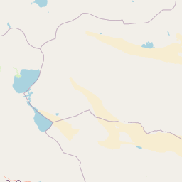
Map view of Airag Lake

Use this park location map to pinpoint Airag Lake in Mongolia, understand its exact geographic position, and read its mapped placement within the surrounding landscape more clearly.

Pigeon | © OpenStreetMap contributors

Location context for Airag Lake

Uvs Province
Park atlas

Compare adjacent steppe wetlands and interconnected regional lake basins

Parks Near Airag Lake and Surrounding Protected Areas in Western Mongolia

Browsing other parks near Airag Lake reveals the wider hydrological network and vast semi-desert terrain of the Great Lakes Depression. Extending the geographic review helps trace connected protected landscapes across western Mongolia.
A watercolor painting of a serene lakeshore with soft green grass in the foreground, a still lake reflecting soft pink and beige tones, and light green hills in the distance.
National parkUvs Province
About 28 km away#1 closest

North

Khyargas Lake National Park: Geography and Protected Area Mapping in Western Mongolia

A comprehensive look at saline and freshwater steppe ecosystems.

Khyargas Lake National Park, situated in Uvs Province, offers a rare glimpse into the saline and freshwater lake systems of the Mongolian steppe. This protected area encompasses an endorheic basin characterized by its wide, open shoreline and unique ecological contrast. Use our atlas to analyze the mapped terrain and the expansive, undisturbed wetlands that define this notable region of western Mongolia.

Area
3,328 km²
Established
2000
Relief
Lowland
Climate
Arid
Watercolor illustration of a lake with mountains in the background, surrounded by trees and grass
National parkMongolia
About 82 km away#2 closest

Southwest

Har Us Nuur National Park: A Mapped Protected Landscape in Mongolia's Vast Geography

Explore the geography and atlas context of this national park.

Har Us Nuur National Park is a designated national park offering a unique protected landscape within Mongolia. This page provides context for exploring its geographic features, mapped boundaries, and its significance within the broader atlas of protected areas in East Asia. Understanding Har Us Nuur National Park contributes to a structured appreciation of Mongolia's natural terrains and regional conservation landscapes.

Area
8,503 km²
Established
1997
Relief
Mixed relief
Climate
Arid
A soft watercolor illustration featuring marsh grasses in the foreground, calm water, and layered mountain ranges in the background under a pale sky.
National parkKhovd Province
About 82 km away#3 closest

Southwest

Khar Us Nuur National Park: Geographic and Protected Area Map of Western Mongolia

Wetland habitats and mountain-fed basins in Khovd Province

Khar Us Nuur National Park offers a comprehensive view of the Great Lakes Basin ecology, where freshwater delta inflows meet saline lakes and high mountain catchments. The park is defined by its diverse terrain, ranging from the extensive Agbash island and reed-fringed shorelines to the prominent southern slopes of the Altai Mountains. This protected area is essential for understanding the hydrological and ecological connectivity of the region.

Area
8,503 km²
Established
1997
IUCN
II
Relief
Mixed relief
National parkUvs Province
About 117 km away#4 closest

Northeast

Khan-Khokhi Khyargas Mountain National Park: Mapped Boundaries and Protected Landscape

Uvs Province National Park Geography

Khan-Khokhi Khyargas Mountain National Park is a designated national park offering critical insights into Mongolia's protected natural landscapes. This entry supports structured geographic discovery, detailing the park's mapped boundaries and its environmental context within Uvs Province. Engage with the park's identity as a protected area, uncovering its role in the regional atlas and its unique contribution to the mapped terrain.

Area
3,413 km²
Established
2000
IUCN
II
Relief
Mountain
National parkZavkhan Province
About 172 km away#5 closest

East

Ulaagchinii Khar Nuur National Park: Protected National Park in Zavkhan Province

Mapped landscape context and regional geographic setting.

As a dedicated national park, Ulaagchinii Khar Nuur National Park serves as a key protected area within Zavkhan Province. This detail page provides an atlas-oriented view of its mapped boundaries and its role in the regional geography of western Mongolia. Understand the park's specific protected landscape characteristics and its contribution to the mapped natural terrain of the Khangai Mountain region.

Area
2,594 km²
Established
2010
IUCN
II
Relief
Mixed relief
National parkBayan-Ölgii Province
About 182 km away#6 closest

West

Tsambagarav Uul National Park: Mapped Protected Landscape in Bayan-Ölgii

Explore its geographic context and park boundaries.

Tsambagarav Uul National Park offers a detailed look at a significant protected landscape situated in Mongolia's western Bayan-Ölgii Province. This national park's boundaries are mapped to provide context within the broader Altai Mountains region. Users can explore the park's geographic setting, understanding its contribution to the protected natural areas of western Mongolia and its significance for regional landscape studies.

Area
1,110 km²
Established
2000
IUCN
II
Relief
Mountain
National parkBayan-Ölgii Province
About 220 km away#7 closest

South

Munkhkhairkhan National Park: Alpine Glacial Landscape & Protected Area

Explore the mapped geography of western Mongolia's high peaks.

Munkhkhairkhan National Park protects the dramatic alpine environment surrounding Mönkhkhairkhan Mountain, Mongolia's second-highest peak. This national park showcases spectacular glacial valleys and steep, rock-strewn slopes characteristic of the Mongol-Altai Mountains. As a key protected landscape in Bayan-Ölgii Province, it offers a distinct view into Mongolia's high-elevation ecosystems and their unique mapped boundaries for atlas exploration.

Area
5,061 km²
Established
2011
IUCN
II
Relief
Mountain
National parkBayan-Ölgii Province
About 300 km away#8 closest

West

Altai Tavan Bogd National Park: Protected Mountainous Landscape in Bayan-Ölgii

Explore mapped geography and protected terrain.

Altai Tavan Bogd National Park, situated in Mongolia's Bayan-Ölgii Province, offers a detailed view of a significant protected natural area. This park is defined by its mountainous geography, forming a key part of the Altai range. Users can explore its mapped boundaries and understand its role as a protected landscape within the western Mongolian atlas.

Area
6,362 km²
Established
1996
IUCN
II
Relief
Mountain

Common questions about visiting, size, designation, and location context for Airag Lake

Airag Lake FAQs for park facts, access, geography, and protected area context

Find quick answers about Airag Lake, including protected-area facts, park geography, trail and visitor context, and how the park fits into its surrounding country and regional landscape.
MoriAtlas Explorer

Continue Your Protected Areas Search Across the Global Atlas

Deepen your exploration by continuing the structured search for national parks and protected areas worldwide. Utilize the comprehensive filtering capabilities to compare different conservation landscapes and refine your understanding of global park geography. Discover more about the distribution and characteristics of protected natural areas.

Global natural geography