
Mori Atlas logo
Nature reserveAletschwald

A protected landscape featuring centuries-old Arolla pine forests and evolving moraine terrain.

Aletschwald Nature Reserve: Mapping the Alpine Forest and Glacial Succession in the Swiss Valais

Aletschwald serves as a vital ecological record located on the northern slopes of Moosfluh and Hohfluh in the Swiss canton of Valais. This nature reserve provides a unique vantage point for observing subalpine plant succession, where forest boundaries shift alongside the retreating Great Aletsch Glacier. The area contains a rare combination of mature larch woodlands, pioneer plant communities on lateral moraines, and high-elevation bogs carved into the rugged Alpine terrain.

alpine forestsubalpine woodlandArolla pine forestglacial landscapeprimval forestlateral moraines
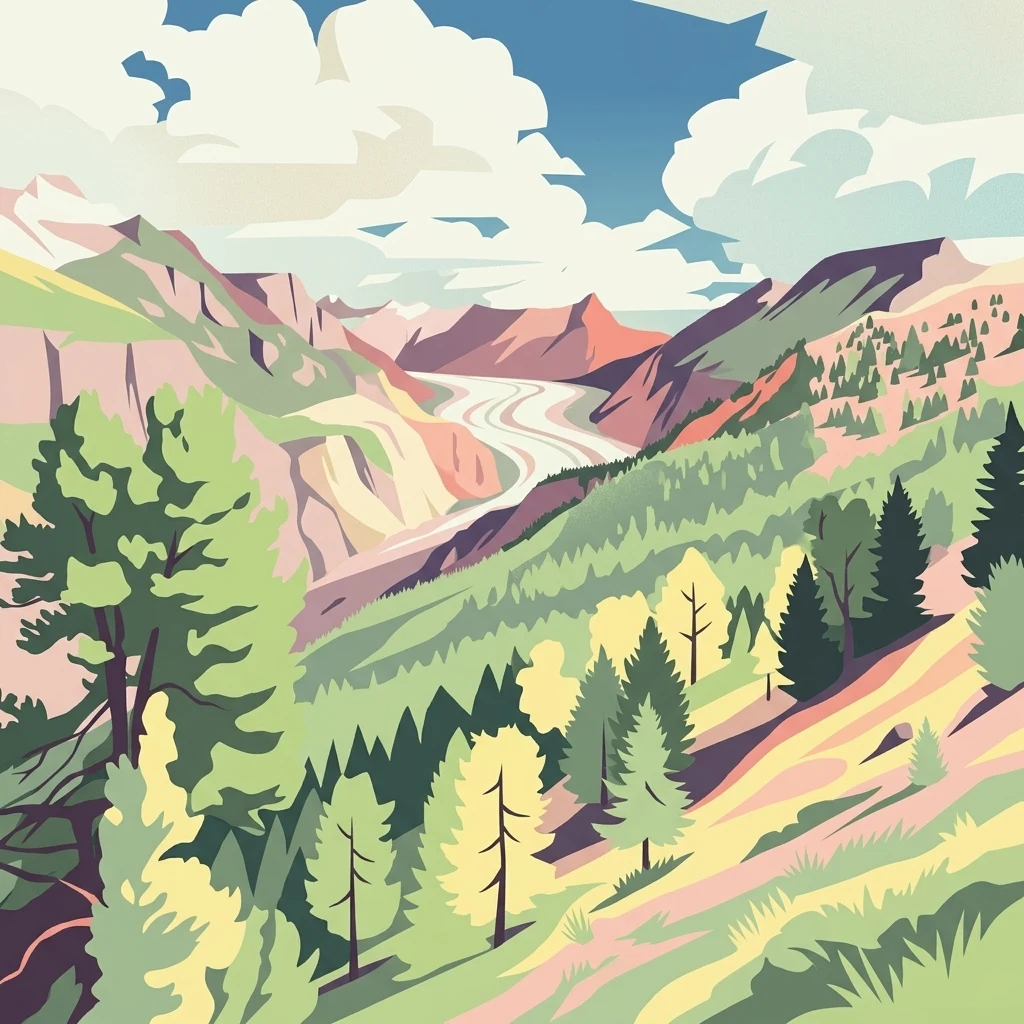
A stylized, flat-design illustration showing a coniferous forest in the foreground with a winding glacier valley and rugged mountain peaks in the background under a cloudy sky.

Aletschwald

Nature reserve

Park overview

Structured park overview, official facts, and landscape profile for Aletschwald

Aletschwald park facts, protected area profile, and essential visitor context

Review the core facts for Aletschwald, including designation, size, terrain, visitor scale, habitats, and operating context in one park-focused overview.

About Aletschwald

The Aletschwald is a protected subalpine forest ecosystem in the southern Swiss Alps, perched above the Great Aletsch Glacier, the largest and longest glacier in the Alps. The reserve sits across the slopes of Moosfluh and Hohfluh on the territory of the Riederalp municipality in the canton of Valais, making it part of the broader Upper Rhone valley landscape. Its elevation range of roughly 1,600 to 2,200 meters places it firmly within the subalpine zone, where conditions are cold and snowy for much of the year but still allow for the growth of hardy conifers.

The defining character of the Aletschwald is its primval forest structure. The dominant trees are Arolla pines (Pinus cembra), a five-needle pine sometimes called the Swiss stone pine, and European larches (Larix decidua), which together form the characteristic Arven-Lärchenwald community of the Central Alps. Because the forest has been categorically excluded from forestry use since 1933, deadwood accumulates naturally, canopy gaps open through the fall of individual old trees, and a wider range of microhabitats develop than in actively managed Alpine woodlands. This has produced a forest with the visual and structural complexity usually associated with untouched forest landscapes.

Ecologically, the site is more than a scenic Alpine forest. Its position directly above the retreating tongue of the Great Aletsch Glacier has made it one of the most studied examples of plant succession on freshly deglaciated terrain in Europe. The glacier's lateral moraines, freed from ice over decades and centuries, are progressively invaded by alpine vegetation, and visitors can trace this transition on foot. The forest is also embedded in a network of higher-level Swiss conservation designations and forms the terrestrial heart of the UNESCO Jungfrau-Aletsch-Bietschhorn World Heritage area.

For visitors, the Aletschwald is approachable on foot from the surrounding Alpine villages, and several marked hiking trails cross the reserve as part of the public Swiss hiking network. A suspension bridge installed in 2008 across the Massa Gorge allows hikers to continue from the forest across to Belalp on the opposite side of the valley. Above the forest on the Riederfurka stands Villa Cassel, home since 1976 to the Pro Natura Centre Aletsch, which provides multimedia interpretation of the reserve and is surrounded by an Alpine botanical garden with more than 300 plant species.

Quick facts and research context for Aletschwald

The Aletschwald lies in the Swiss canton of Valais, on the communal territory of Riederalp, above the tongue of the Great Aletsch Glacier. It occupies an elevation band of roughly 1,600 to 2,200 meters in the subalpine zone on the slopes of Moosfluh and Hohfluh.

It was placed under protection in 1933 covering an area of approximately 400 hectares, and has not been logged since that designation. The forest is listed in the Federal Inventory of Landscapes and Natural Monuments of Switzerland (BLN), forms part of a designated hunting ban area, and since 2001 has been included in the Jungfrau-Aletsch-Bietschhorn UNESCO World Natural Heritage Site alongside the Great Aletsch Glacier. The Pro Natura Centre at Villa Cassel, above the forest, has operated on the site since 1976.

Protection and recognition

Terrestrial protected area designation and institutional recognition records

Aletschwald Protection Status and Designated Conservation History

Aletschwald maintains a documented terrestrial protection status established in the year 2001. Records compile official designation history and management scope without supplementary international recognition sources.

Protection details

Protection scope
Terrestrial
Designated year
2001
Transboundary protection
No
Park context

Deeper park guide and search-rich context for Aletschwald

Aletschwald history, landscape, wildlife, and travel context

Explore Aletschwald through its history, landscape character, ecosystems, wildlife, conservation priorities, cultural context, and seasonal travel timing in a structured park guide built for atlas discovery and search intent.

Why Aletschwald stands out

The Aletschwald is best known for being a living laboratory of glacial landscape succession. Because the Great Aletsch Glacier has retreated over centuries, it has left behind freshly exposed lateral moraines that the forest is gradually colonizing. Within the reserve, one can observe every stage of high-elevation forest development, from bare rock and the first moss and saxifrage pioneers, through heath and shrub communities, up to centuries-old Arolla pines. It is also recognized as one of the most important surviving Arven-Lärchen forests in Switzerland. The decision in 1933 to remove it from active forestry management gave it a near-primval character that is exceptionally rare in the densely settled Alps, and it has been the subject of extensive ecological research ever since.
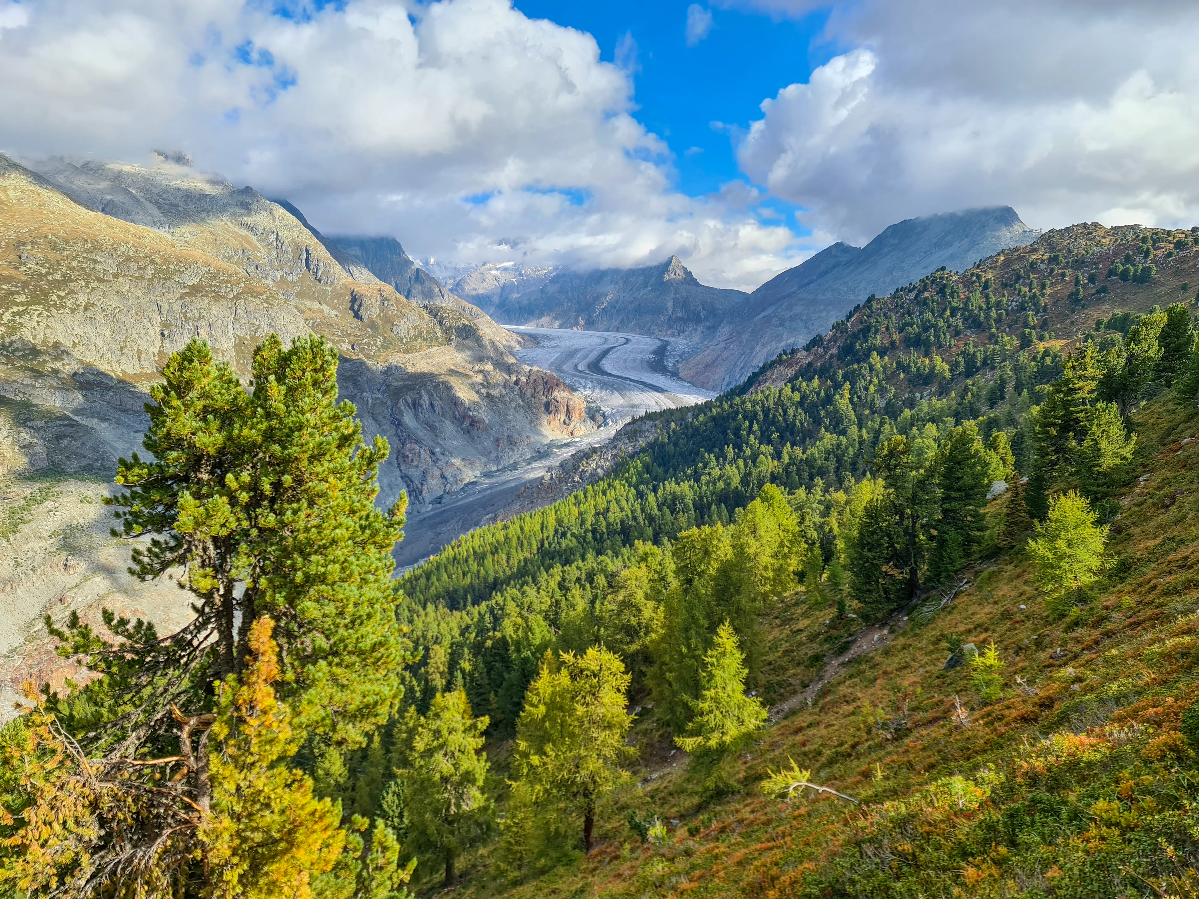
A wide mountain landscape showing a dense pine and larch forest in the foreground, with the Aletsch Glacier winding through a deep valley in the background under a partly cloudy blue sky.
The Aletschwald forest slopes meeting the massive Aletsch Glacier in the Swiss Alps during autumn.

Aletschwald history and protected-area timeline

The legal foundation of the Aletschwald as a protected site dates to 1933, when approximately 400 hectares of forest above the Great Aletsch Glacier were placed under protection. From that point onward, the area was withdrawn from commercial forestry use, allowing the existing Arven-Lärchenwald to develop without human intervention. This was an early and significant act of Alpine forest conservation in Switzerland and gave researchers and visitors a rare opportunity to study a Central Alpine forest evolving under near-natural conditions.

In the following decades, the Aletschwald became a frequently cited reference site in Swiss forest ecology, particularly for studies of subalpine succession and the relationship between glacier retreat and forest advance. Its recognition grew steadily, and it was eventually included in the Federal Inventory of Landscapes and Natural Monuments of Switzerland (BLN) and designated as a hunting ban area, giving it protection against both timber exploitation and hunting pressure.

A major milestone came in December 2001, when the area, together with the Great Aletsch Glacier, was inscribed as part of the UNESCO World Natural Heritage Site Jungfrau-Aletsch-Bietschhorn. This international designation placed the forest in a global context and reinforced its importance as a natural heritage of humanity. The Pro Natura Centre at the Villa Cassel on the Riederfurka, established in 1976, further cemented the site's role in environmental education. More recently, the construction of a suspension bridge in 2008 across the Massa Gorge linked the Aletschwald to Belalp and completed a key hiking connection through the landscape.

Aletschwald landscape and geographic character

The Aletschwald occupies a steep but well-defined slice of Alpine terrain on the northern and northwestern flanks of Moosfluh and Hohfluh, two prominent ridges above the lower reaches of the Great Aletsch Glacier. The reserve lies between approximately 1,600 and 2,200 meters of elevation, which situates it at the transition between the montane and true subalpine zones of the Alps. Below the forest, the white tongue of the Aletsch Glacier descends dramatically toward the Massa valley, providing the constant cold-air drainage and high humidity that shape the forest microclimate.

Because the glacier has retreated significantly over the past centuries, the landscape immediately below the mature forest is a mosaic of bare moraines, boulder fields, and newly exposed rock surfaces. Lateral moraines of varying ages run diagonally across the slope, and their age determines the vegetation they carry. The oldest moraines are fully forested with mature Arolla pines and larches, intermediate moraines are in thicket or shrub phases, and the youngest moraines near the current ice margin are still largely barren or carry only pioneer mosses and lichens.

Within the forest itself, the terrain is uneven and broken by small streams, springs, seepage zones, and the occasional high bog. Some sections contain small raised bogs (Hochmoore), an unusual feature for a forest at this elevation and a hint of the local peculiarities of soil and water distribution. The Massa Gorge, a deep cut carved by the meltwater of the Aletsch Glacier, forms a dramatic boundary on one side of the forest and is crossed today by the 2008 suspension bridge linking the forest to Belalp.
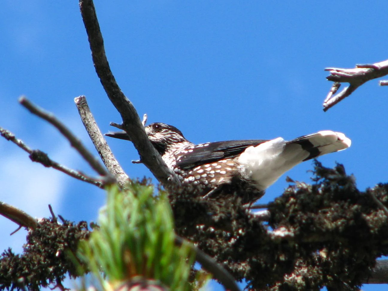
A spotted nutcracker bird with speckled brown and white feathers perched on a mossy pine branch against a clear blue sky.
A spotted nutcracker perched in an Arolla pine within the Aletschwald.

Aletschwald ecosystems, habitats, and plant life

The vegetation of the Aletschwald shows a clear vertical zonation, even across its relatively narrow elevation band of a few hundred meters. In the upper, more open sections, the canopy is dominated by widely spaced Arolla pines (Pinus cembra) and larches (Larix decidua). Between these scattered tall trees grow dense layers of dwarf shrubs, especially alpine rose (Rhododendron), common heather (Erica), and blueberry (Vaccinium myrtillus), which produce vivid seasonal displays of color and form a continuous low cover across the forest floor.

In the lower, denser and more western parts of the forest, the species mix shifts. European spruce (Picea abies) becomes an important additional component, and as the canopy closes, light availability drops and the understory becomes darker and more uniform. The presence of spruce gives those areas a character quite different from the open, parklike upper forest.

A particularly striking ecological feature of the Aletschwald is its mosaic of small high-elevation raised bogs. These bogs, unusual at this altitude in the Alps, support moisture-loving plants and contribute to the hydrological complexity of the site. Together, the combination of open Arolla-larch stands, denser spruce-augmented stands, heath layers, and bog pockets produces a rare heterogeneity of habitats for a Central Alpine forest of this size.

Beyond the closed forest, the most ecologically dynamic zone is the freshly deglaciated terrain at the lower boundary. Here, the succession from bare ground to closed canopy can be observed directly. Pioneer mosses and saxifrages colonize newly exposed rock, followed by grasses, low shrubs, and eventually the same Arolla pines that dominate the older forest. This makes the entire reserve a compressed example of long-term subalpine forest development.
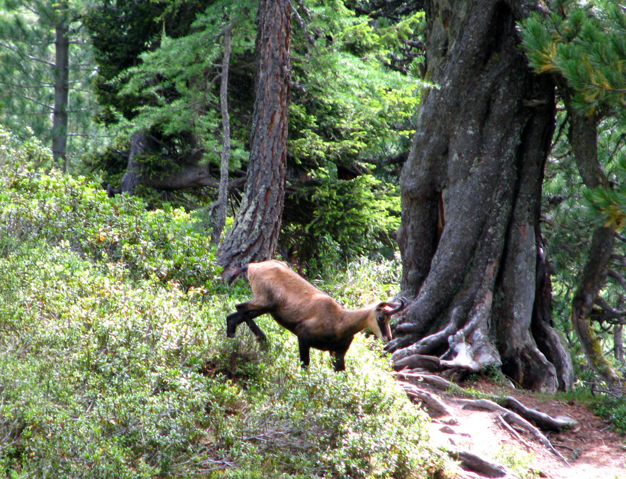
A chamois stands on a forested slope next to a large, gnarled conifer tree in the Aletschwald.
A chamois stands near an ancient larch tree in the Aletschwald forest.

Aletschwald wildlife and species highlights

The Aletschwald supports a community of typical Central Alpine forest and edge species, shaped by the mix of open subalpine woodland, rocky moraines, and cliffs above the glacier. Chamois (Gämse) move through the forest and onto the open slopes and are among the most characteristic large mammals of the area. Alpine marmots inhabit the more open moraine terrain, where their burrows can be found in the boulder fields.

Among birds, the woodland is home to black grouse, which find cover in the denser forest sections and on the open slopes above, and especially the spotted nutcracker, which is closely tied to the Arolla pine. The nutcrackers feed almost exclusively on the seeds of Arolla pines, the so-called Zirbelnüsse or pine nuts, and play a key role in their dispersal; by caching seeds in the ground and forgetting many of them, the birds effectively plant the next generation of trees. Red deer pass through parts of the forest only in summer, when they wander up from lower elevations; the area's status as part of a designated hunting ban area gives these populations an important refuge.

Aletschwald conservation status and protection priorities

The Aletschwald occupies a prominent place in Swiss nature conservation as one of the earliest formally protected Arolla-larch forests in the country. The 1933 protection decision removed roughly 400 hectares from active forestry, allowing the forest to develop with minimal human interference. This early protection has given the site decades of accumulated deadwood, undisturbed soils, and a near-natural stand structure that is now very difficult to recreate elsewhere in the Alps, where most forest has been shaped by centuries of use.

At the national level, the reserve is listed in the Federal Inventory of Landscapes and Natural Monuments of Switzerland, the BLN, which identifies landscapes of national significance. It is also part of a designated hunting ban area, limiting wildlife disturbance and helping conserve resident populations of chamois, marmot, and grouse, among others.

Internationally, the Aletschwald has been part of the UNESCO World Natural Heritage Site Jungfrau-Aletsch-Bietschhorn since December 2001, sharing its status with the neighboring Great Aletsch Glacier. The site is recognized for the combined value of an outstanding Alpine landscape and a functioning subalpine ecosystem. The Pro Natura Centre at Villa Cassel, in operation since 1976, adds a long-running educational and monitoring dimension, making the reserve both a conservation stronghold and a center for ecological research and public outreach about Alpine ecosystems.

Aletschwald cultural meaning and human context

The Aletschwald is bound up with the long-standing Alpine cultural landscape of the Upper Valais. The local communities around Riederalp and Belalp have historically lived in close relationship with the Great Aletsch Glacier and its surrounding slopes, where seasonal livestock grazing, forestry, and tourism have shaped the local economy for generations. The decision in 1933 to withdraw the forest from forestry use marked a shift in this relationship, revaluing the forest as a natural and scientific heritage rather than a timber resource.

The construction of the Villa Cassel on the Riederfurka above the forest and its transformation in 1976 into the Pro Natura Centre gave the site an enduring cultural role as a place of environmental education in the Alps. Today, the reserve is part of an Alpine cultural geography that combines traditional Swiss hiking culture, research infrastructure, and high-level international heritage status, with hikers, scientists, and school groups all using the network of trails crossing the forest.

Top sights and standout views in Aletschwald

Among the standout features of the Aletschwald is the visible, walk-through sequence of subalpine plant succession on the glacier's lateral moraines, from pioneer mosses and saxifrages on freshly deglaciated ground to centuries-old Arolla pines in the mature forest. Few protected areas in the Alps compress this ecological story so legibly into a single short hike.

Equally distinctive is the primval character of the Arolla-larch forest itself, preserved since 1933 from forestry use and now rare in Central Europe for its density of old trees, deadwood, and natural regeneration. The combination of this living forest, the Great Aletsch Glacier below it, the small high-elevation bogs scattered through its terrain, and the Massa Gorge with its 2008 suspension bridge makes the reserve an unusually rich compact landscape.

Best time to visit Aletschwald

The Aletschwald is most accessible in the summer and early autumn months, when the higher trails are free of heavy snow and the subalpine flora is most visible. Late June through early October is the period when the Pro Natura Centre at Villa Cassel is open to the public, and the same window generally coincides with the most comfortable hiking conditions.

In summer, visitors are rewarded with green canopies, flowering alpine rose and blueberry patches, and active wildlife including marmots and chamois on the surrounding slopes. By early autumn, the larches begin to turn golden, creating a striking contrast against the evergreen Arolla pines and the white tongue of the glacier below. Winter brings heavy snowfall and typically closes most of the hiking routes into the reserve.

Monthly climate preview

Long-term monthly temperature ranges and precipitation patterns across representative high-elevation terrain

Aletschwald Climate Normals: Annual Temperature and Precipitation Rhythm

Representative coordinate records show significant annual temperature variation alongside steady monthly precipitation distribution throughout the year. Examining the full twelve-month profile provides complete historical averages for detailed climate comparison.
Annual mean2 °C
-8 °C12 °C
Jan-8°
Feb-8°
Mar-4°
Apr
May
Jun10°
Jul12°
Aug12°
Sep
Oct
Nov-3°
Dec-7°
Warmest month
July

11.8 °C

Coolest month
January

-8 °C

Wettest month
June

5 mm/day

Driest month
February

2.5 mm/day

Park location guide

Geography guide, regional context, and park location map for Aletschwald

Aletschwald park geography, regions, and map view in Switzerland

Understand where Aletschwald sits in Switzerland through a broader geographic reading of the surrounding landscape, nearby location context, and its mapped position within the national park landscape.

How Aletschwald fits into Switzerland

Switzerland is a landlocked federal republic in Central Europe comprising 26 cantons, with Bern as the federal city and Zurich as the largest city. The country features the Swiss Alps, Swiss Plateau, and Jura Mountains, with German, French, Italian, and Romansh as official languages. It is noted for its political neutrality, direct democracy traditions, and strong economy.

Wider geography shaping Aletschwald in Switzerland

Switzerland is located in Central Europe at the intersection of Western and Southern Europe. It is bordered by Germany to the north, France to the west, Austria and Liechtenstein to the east, and Italy to the south. The country is geographically divided among the Swiss Alps (covering most of the territory), the Swiss Plateau (where most of the population resides), and the Jura Mountains. Switzerland is landlocked.

Map view of Aletschwald

Use this park location map to pinpoint Aletschwald in Switzerland, understand its exact geographic position, and read its mapped placement within the surrounding landscape more clearly.

Pigeon | © OpenStreetMap contributors

Location context for Aletschwald

Valais

Explore high-elevation old-growth forests, moraines, and glacial valley terrain.

Aletschwald Photos and Landscape Scenery: Visualizing Alpine Glacier Habitats

Visual documentation captures the unique subalpine woodland communities and retreating glacial boundaries defining Aletschwald. Detailed imagery reveals ancient pine stands, lateral moraines, and complex ecological succession across protected alpine terrain.

A wide mountain landscape showing a dense pine and larch forest in the foreground, with the Aletsch Glacier winding through a deep valley in the background under a partly cloudy blue sky.

A large, ancient Arolla pine tree with thick, gnarled bark and heavy branches dominates the frame, set within a forest environment with hints of mountainous terrain in the background.

A spotted nutcracker bird with speckled brown and white feathers perched on a mossy pine branch against a clear blue sky.

A chamois stands on a forested slope next to a large, gnarled conifer tree in the Aletschwald.

Park atlas

Compare surrounding subalpine terrain and glacial reserves across Valais

Parks Near Aletschwald and Related Protected Landscapes in the Swiss Alps

Browsing other parks near Aletschwald reveals a wider network of high-elevation protected areas shaped by similar glacial dynamics. Comparing these connected mountain reserves provides essential geographic context for understanding subalpine woodland succession throughout the region.
A watercolor illustration of a soft, rolling alpine landscape with a winding path and distant mountain peaks against a pale yellow sky.
Regional parkValais
About 13 km away#1 closest

East

Landschaftspark Binntal: Alpine Geography and Regional Protected Area in Valais, Switzerland

Mapping deep mountain valleys and glacial alpine terrain

Landschaftspark Binntal serves as a vital protected area in the Valais Alps, showcasing a vertical sequence of ecosystems from river gorges to 3000 meter peaks. The park preserves a living cultural landscape alongside significant mineralogical heritage, offering a detailed view into the high-altitude geography and remote valleys that define this distinctive corner of the Swiss mountain landscape.

Area
180 km²
Established
2008
Relief
Mountain
Climate
Alpine
A soft watercolor painting of a green landscape featuring rolling hills and a winding river with distant mountains in the background.
Nature reserveBern
About 28 km away#2 closest

Northeast

Naturschutzgebiet Gauligletscher: Glacial Landscape and Nature Reserve in Bern

A high-alpine protected area in the Bernese Oberland

Discover the unique geography of Naturschutzgebiet Gauligletscher, a protected area in Bern featuring a wide amphitheater of moraines, glacial lakes, and retreating ice. This site functions as an active laboratory for river dynamics and alpine vegetation colonization across an expansive, mineral-dominated valley floor.

Area
5.7 km²
Established
2001
IUCN
IV
Relief
Mountain
Watercolor painting of soft, rolling alpine terrain, green vegetation, and distant purple-toned mountains under a pale sky.
Nature reserveBern
About 29 km away#3 closest

Northeast

Naturschutzgebiet Mederlouwenen: Alpine Moor and Protected Glacial Terrain in the Bernese Oberland

A high-elevation nature reserve featuring rare flat-moor vegetation and peat-forming bogs.

Naturschutzgebiet Mederlouwenen occupies a distinctive series of glacial granite terraces in the Bernese Oberland, where high-altitude slope bogs and relict conifer forests create a vital refuge for rare alpine flora. This protected area stands as a primary example of Swiss mountain ecology, blending ancient geological history with the fragile, moisture-dependent ecosystems found at the head of the Aare valley.

Area
0.053 km²
Established
2004
IUCN
IV
Relief
Mountain
A soft watercolor painting of a panoramic landscape featuring a marshy fen area in the foreground with distant mountain ranges in the background, rendered in pastel greens, purples, and yellows.
Nature reserveBern
About 32 km away#4 closest

Northeast

Chessibidmer Nature Reserve: Glacial Granite and Protected Alpine Moorland Landscapes

Protected alpine bog and granite terrace in the Bernese Oberland

Chessibidmer offers a detailed look at a nationally significant flat bog and moorland landscape situated above the upper Aare valley in the Bernese Oberland. The area provides an exceptional map of glacial geomorphology, featuring granite domes, rock-bound tarns, and successional peatlands that sit as a protected mosaic within the surrounding high-alpine terrain of the Swiss Alps.

Area
0.5 km²
Established
1998
IUCN
IV
Relief
Mountain
Watercolor painting of a green landscape with rolling hills, meadows, and a water body in the foreground against a light background.
Protected areaSwitzerland
About 33 km away#5 closest

Northeast

Rhonegletschervorfeld Protected Area: Alpine Glacier Geography and Mapping

Proglacial landscape and glacial history in the Swiss Alps.

The Rhonegletschervorfeld provides an unparalleled view into the geomorphology of the Swiss Alps, showcasing a continuous record of ice loss through moraines, exposed bedrock, and emerging meltwater systems. Situated near the Furka Pass, this protected area serves as an essential reference for glaciology, offering a clear visual timeline of glacier retreat that has shaped modern alpine tourism and climate science. Explore the mapped terrain where the Rhone River headwaters emerge from the retreating ice.

Area
13.58 km²
Relief
Mountain
Climate
Alpine
Access
Easy access
Watercolor illustration showing green mountains, forests, a river, and snow-capped peaks in the distance
National parkPiedmont
About 43 km away#6 closest

Southeast

Val Grande National Park: National Park Protected Landscape in Piedmont

Explore its mapped boundaries and regional geographic context.

Val Grande National Park represents a key protected landscape within the Piedmont region of northwest Italy. This canonical page offers detailed insights into the park's designated status as a national park, its specific geographic placement, and its mapped protected boundaries. Users can navigate its atlas-level details to understand its role in the regional geography and conservation landscape, providing a structured foundation for further discovery of Italy's natural protected areas.

Area
170.21 km²
Established
1992
IUCN
II
Relief
Mountain
A soft watercolor painting of rolling hills and distant mountains in light green and muted tones.
Biosphere reserveLucerne
About 46 km away#7 closest

North

Entlebuch Biosphere Reserve: Mapped Protected Landscapes in the Canton of Lucerne

Exploring karst formations and alpine wetland ecosystems

Entlebuch stands as a pioneering example of community-driven conservation in the Swiss Alps. This protected landscape encompasses extensive peatlands, forested slopes, and the iconic Schrattenfluh karst massif. Use this geographic entry to understand the regional topography and the spatial distribution of protected habitats throughout this central Swiss valley.

Area
397 km²
Established
2001
Relief
Mountain
Climate
Alpine
Nature reserveKanton Luzern
About 46 km away#8 closest

North

Naturschutzgebiet Laubersmad - Salwidili: Exploring a Vast Swiss Moorland and Alpine Reserve

A critical moorland complex in the heart of Kanton Luzern

Spanning over 1,300 hectares, this protected nature reserve in Kanton Luzern constitutes the largest contiguous moorland landscape in Switzerland. The area is defined by a unique geological flysch trough that supports a rich diversity of peatland types, including raised bogs and fens, alongside spruce forest and alpine pasture. As an IUCN Category IV area, it provides essential habitat for endangered mire flora and high-altitude wildlife in a remarkably intact hydrological setting.

Area
13.76 km²
IUCN
IV
Relief
Mountain
Scope
Terrestrial

Common questions about visiting, size, designation, and location context for Aletschwald

Aletschwald FAQs for park facts, access, geography, and protected area context

Find quick answers about Aletschwald, including protected-area facts, park geography, trail and visitor context, and how the park fits into its surrounding country and regional landscape.
MoriAtlas Explorer

Continue Your Protected Areas Search Across the Global Atlas

Deepen your exploration by continuing the structured search for national parks and protected areas worldwide. Utilize the comprehensive filtering capabilities to compare different conservation landscapes and refine your understanding of global park geography. Discover more about the distribution and characteristics of protected natural areas.

Global natural geography