
Mori Atlas logo
National parkAlkhanay National Park

Mapping the geographic transition from mid-mountain taiga terrain to Daurian steppe ecosystems

Alkhanay National Park: A Protected Synthesis of Siberian Boreal Forests and Buddhist Sacred Landscapes

Alkhanay National Park occupies a unique ecological position in the Duldurginsky District of Zabaykalsky Krai, where Eurasian boreal forests intersect with the open grasslands of the Daurian steppes. This protected area features mid-mountain denudation relief dominated by ancient granite and volcanic formations, including a Jurassic-era paleovolcanic caldera and natural arches. Beyond its geological significance, the park protects a major spiritual heritage site for the Buryat people, integrating more than 20 sacred cult locations directly into the natural mountain geography.

Siberian taigaMountain landscapesBuddhist sacred sitesBuryat cultural heritageForest-steppe transitionVolcanic geology

Alkhanay National Park

National park

Park overview

Structured park overview, official facts, and landscape profile for Alkhanay National Park

Alkhanay National Park park facts, protected area profile, and essential visitor context

Review the core facts for Alkhanay National Park, including designation, size, terrain, visitor scale, habitats, and operating context in one park-focused overview.

About Alkhanay National Park

Alkhanay National Park lies in the southeastern part of Zabaykalsky Krai, in the Duldurginsky District, with its administrative center in the village of Duldurga and the nearest major city being Chita. The park threads through parts of the Daurian and Mogoytuysky mountain ranges and is shaped according to the boundaries of the watershed of the upper and middle Ilya River, placing it in the upper reaches of the Amur basin.

The defining characteristic of Alkhanay is the way its natural and cultural dimensions are woven together. Ecologically, it sits on the contact zone between the vast boreal forests of northern Eurasia and the open steppes of Dauria. Within a single park, one can find taiga forests, alpine meadows, rocky mountain slopes, steppe margins, rivers and waterfalls, and a series of lakes. This landscape variety is intensified by the underlying geology, which includes a Jurassic-era paleovolcanic complex with ancient lavas, tuffs, ignimbrites, a caldera collapse feature, and remnants of volcanic lake deposits. The terrain is predominantly mid-mountain, with elevations typically reaching between 1,000 and 1,200 meters.

Layered on top of this natural setting is a major spiritual landscape. Mount Alkhanay and its associated rocks have been a place of worship for the Buryat people since the early nineteenth century, when Buddhist activity was established here under the Namnanay Lama, a teacher of the prominent Buryat Buddhist Agvan Dorzhiev. The park now protects more than 20 cult objects, including Buddhist temples, stone steles inscribed with Tibetan mantras, stupas, sacred springs, and dramatic natural rock features such as the Alkhanay Gate, which is both a geological monument and a pilgrimage focus. The park is therefore understood as a place where ecological conservation, scientific research, environmental education, and pilgrimage coexist.

Quick facts and research context for Alkhanay National Park

Alkhanay National Park is located in the Duldurginsky District of Zabaykalsky Krai in southeastern Siberia, covering roughly 1,382 square kilometers of mountain taiga, valleys, and steppe margins. It was established on May 15, 1999 by a resolution of the Government of the Russian Federation to protect the mountain taiga landscapes of the Transbaikal region and to preserve the sacred sites of the Buryat people.

The park sits at the junction of the Daurian and Mogoytuysky mountain ranges and includes the watershed of the upper and middle Ilya River, part of the larger Amur basin. Its landscape combines mid-mountain denudation relief, ancient volcanic features, taiga forests, meadows, steppes, and rivers with waterfalls, while its cultural layer is defined by a major Northern Buddhist sacred complex of more than 20 cult objects centered on Mount Alkhanay.

Protection and recognition

Examine terrestrial protection scope, designation history, and recognized conservation frameworks for Alkhanay National Park.

Alkhanay National Park Protection Status and Conservation Records

Alkhanay National Park maintains a documented terrestrial protection scope and structured conservation framework within regional boundaries. Detailed records compile official management context, designation history, and international recognition data for comparative environmental analysis.

Protection details

Protection scope
Terrestrial
Transboundary protection
No
Buffer area
104 km²
Park context

Deeper park guide and search-rich context for Alkhanay National Park

Alkhanay National Park history, landscape, wildlife, and travel context

Explore Alkhanay National Park through its history, landscape character, ecosystems, wildlife, conservation priorities, cultural context, and seasonal travel timing in a structured park guide built for atlas discovery and search intent.

Why Alkhanay National Park stands out

Alkhanay is best known as the only Russian national park that protects both a large mountain taiga ecosystem and an important Northern Buddhist sacred landscape. The park straddles the ecological boundary between Eurasian boreal forests and the Daurian steppes, which produces exceptional biodiversity and landscape variety within a relatively compact territory. The park's cultural identity is equally distinctive. Mount Alkhanay is a pilgrimage destination for Buryat Buddhists, and the surrounding terrain contains more than 20 cult objects, including the natural rock arch called the Alkhanay Gate, stone steles with Tibetan mantras, Buddhist stupas, and sacred springs considered to have healing properties. Visitors come for both nature and pilgrimage, and the park is organized as a working example of how spiritual, ecological, and recreational values can coexist.
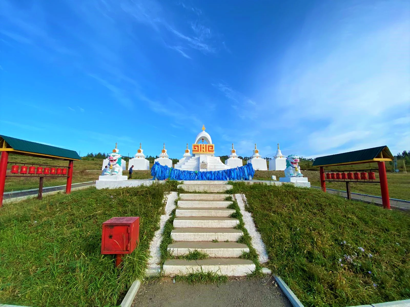
Alkhanay National Park history and protected-area timeline

Alkhanay National Park was established by Resolution No. 533 of the Government of the Russian Federation on May 15, 1999. The decision came after several years of scientific groundwork. In 1996, the non-governmental organization known as the Transbaikal Center for Biodiversity Conservation carried out a comprehensive ecological, natural, historical, cultural, and recreational expedition to Mount Alkhanay and its surrounding ridges. Based on the findings of that expedition, two major institutions, the Russian State Institute for the Design of Forestry Enterprises and Nature Conservation Objects and the Institute of Natural Resources, Ecology and Cryology of the Siberian Branch of the Russian Academy of Sciences, conducted project and survey work over a broader area, including the entire upper and middle watershed of the Ilya River.

A key argument for protecting the landscape was the discovery that gold mining using heap leaching was being planned on the Dybyksa River, a tributary of the Ilya. The project would have threatened both the unique natural complexes of the area and the culturally sacred sites that depend on them. Protection as a national park was conceived as a way to safeguard the integrity of this combined natural and cultural system.

Culturally, the area's Buddhist significance dates to the early nineteenth century and is associated with the work of Namnanay Lama, a teacher of the Buryat Buddhist leader Agvan Dorzhiev. In the summer of 1991, the Fourteenth Dalai Lama visited the site, and a stupa was erected in his honor. The park now preserves these traditions alongside the natural landscape that has supported them.

Alkhanay National Park landscape and geographic character

The landscape of Alkhanay National Park is dominated by mid-mountain terrain. Absolute elevations generally reach 1,000 to 1,200 meters, and the majority of the park, around 80 percent of its territory, is covered by medium to strongly dissected mid-mountain denudation relief developed on Riphean, Proterozoic, and Jurassic granites. A smaller share of the park consists of level accumulative relief formed on lake and alluvial sands.

The park's boundaries are defined by the watershed of the upper and middle Ilya River and extend along portions of both the Daurian and Mogoytuysky mountain ranges. Within this frame, the terrain transitions from forested ridges through rocky slopes, boulder fields known locally as kurums, river valleys, and lakes. Rivers in the park feature small waterfalls, and the hydrological system is shaped by the broader geography of the upper Amur basin. Around the core protected area, a buffer zone approximately half a kilometer wide has been designated, totaling about 10,400 hectares.

Geologically, Alkhanay is one of the more distinctive landscapes in the Transbaikal region. It is recognized as a cluster of local geological heritage monuments, with a Jurassic-era paleovolcanic area that includes ancient lava flows of intermediate to basic composition, volcanic conduits, a collapse caldera in the upper reaches of the Ubzhogoye valley, and erosional remnants of lavas and tuffs that have themselves become subjects of religious veneration. Ignimbrites, sometimes called "burning cloud" tuffs, are widespread. Layers of tuffites preserving the imprints of organisms from ancient volcanic lakes have been documented. The Onon-Turin deep fault contributes additional geological complexity with associated fracturing, sulfide mineralization, quartz veining, and tourmaline occurrences, while the Ilinskie Lakes area is known for small-scale mud volcanism fed by interpermafrost water.
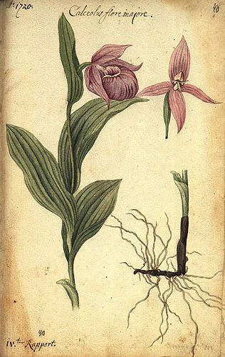
Alkhanay National Park ecosystems, habitats, and plant life

Alkhanay National Park occupies a zone of unusually high ecological contrast. Its position at the boundary between the boreal forests of Eurasia and the great Daurian steppes produces a striking diversity of habitats within a relatively compact area, as forests, steppes, meadows, rocky slopes, and river valleys all occur in close proximity.

The park's flora is correspondingly rich. More than 600 species of vascular plants have been recorded, together with around 130 species of mosses. The vegetation reflects the altitudinal zonation of the terrain, with soils, plant communities, and microclimates shifting as elevation changes. Roughly 180 plant species are recognized as useful in official medicine or in folk and Tibetan medicine, including noteworthy species such as Rhodiola rosea, Astragalus membranaceus, Scutellaria baicalensis, compact rhubarb, Chinese lofant, and Siberian Phlojodicarpus. The park's flora also includes a substantial number of rare or protected species, such as the large-flowered lady's slipper orchid and Altai onion, which are listed in the Russian Red Data Book.

On the animal side, more than 120 vertebrate species have been documented, representing amphibians, reptiles, birds, and mammals. Around 160 insect species have been described. Within the park's waters, 18 species of fish from 9 families have been identified, including taimen, lenok, and grayling. The combination of forest, steppe, mountain, and riparian habitats supports a wide range of species and gives the park its characteristically rich biodiversity.
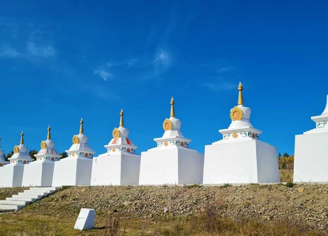
Alkhanay National Park wildlife and species highlights

The wildlife of Alkhanay reflects the same dual forest-steppe character that defines its vegetation. In the taiga and mountain habitats, larger mammals such as brown bears, moose, Siberian wapiti known as izyubr, Siberian musk deer, and Siberian roe deer are present, alongside smaller carnivores and fur-bearers like sable, stoat, kolonok, lynx, wolf, red fox, and hares.

The park's birdlife is similarly varied. Forest species such as jays and nutcrackers are typical in the wooded areas around rock formations like the Alkhanay Gate, while larger birds of conservation interest, including the golden eagle, the demoiselle crane, and the black stork, are recorded in the wider park. Waterfowl such as the whooper swan and the bean goose are noted along the park's rivers and lakes. Several of these bird species, including the golden eagle, the great bustard, and the black stork, are listed in the Russian Red Data Book and highlight the park's importance for protected avifauna.

In the rivers of the wider park area, including the Ubzhogoye, Duldurga, and Ilya rivers, as well as in lakes such as Balzino and the Alkhanay lakes, a diverse fish community has been documented. Species such as taimen, lenok, and grayling belong to salmonid groups that are particularly sensitive to water quality, making them useful indicators of the park's riverine ecological health.
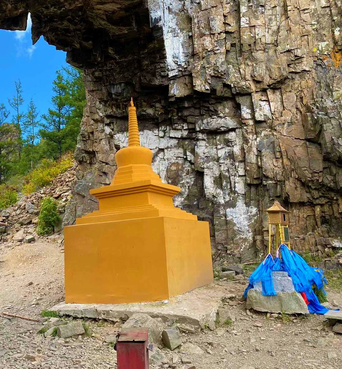
Alkhanay National Park conservation status and protection priorities

Alkhanay National Park was created with an explicit conservation mission, balancing ecosystem protection with regulated public use. The park was established to preserve the mountain taiga landscapes of the Transbaikal, study their natural processes, and provide for recreational and educational use, while also protecting the sacred places that depend on the integrity of those landscapes. The park's establishment in 1999 followed scientific surveys that identified both the ecological importance of the area and the immediate threat of gold mining by heap leaching on the Dybyksa River.

The park's biodiversity value is rooted in its transitional geography. It lies at the limit of the boreal forest belt of Eurasia, where it meets the great Daurian steppes, and the resulting overlap of forest and steppe floras and faunas produces high species richness and ecological significance. The park's IUCN management category is II, corresponding to national park status. To balance these values, the territory is organized into distinct functional zones, including strictly protected areas, recreational zones with marked tourist routes, and zones set aside for scientific research.

The conservation profile of the park is reinforced by its geological heritage. The Jurassic paleovolcanic area, the collapse caldera, the ignimbrite formations, the mud volcanic activity around the Ilinskie Lakes, and the natural arch of the Alkhanay Gate together make the park a recognized cluster of geological monuments of local significance. The combination of geological, ecological, and cultural conservation priorities, and the explicit use of zoning to reconcile them, gives Alkhanay a notably integrated conservation approach.

Alkhanay National Park cultural meaning and human context

Alkhanay is distinctive among Russian national parks for the depth and continuity of its cultural layer. Mount Alkhanay and its associated rock formations, springs, and ritual sites have been part of the traditional sacred geography of the Transbaikal Buryats since well before the modern park existed. The Buddhist presence at the site was established in the early nineteenth century and is associated with the activities of Namnanay Lama, a teacher of the prominent Buryat Buddhist figure Agvan Dorzhiev.

In 1991, the park area drew international attention when the Fourteenth Dalai Lama visited the site, and a Buddhist stupa was erected in his honor. More than 20 cult objects are now recognized within the park, including the stone stele Maanin Shuluun inscribed with a Tibetan mantra, the Dimchig Sume temple to the lord of the mountain, the Nara Khazhad shrine to a celestial musician, the Uuden Sume, sometimes called the Temple of the Gate, the Dorje Pagmin Sume temple of the Diamond Queen, the Sins' Crack, the Ekhyn Umay Mother Womb, the main oboo, the summit oboo, the Zurkhyn Shuluun stone heart, and the Khoreo Shuluun stone fence. The natural rock arch known as the Alkhanay Gate also holds both spiritual and geological significance, and the inner surface of the arch contains ancient petroglyphs from the first millennium BC, first documented in 1977 by the archaeologist A. P. Okladnikov.

Each year, both a small and a large goroo, a circumambulation of the sacred sites, are performed. The small goroo follows a route within the complex, while the larger ritual takes four days and circles Mount Alkhanay. The annually recurring Buddhist prayer ceremonies at the main oboo and at Uuden Sume are widely attended. Sacred springs known as arshans are considered to have healing properties and are visited by both pilgrims and tourists. The park thus functions as a living cultural landscape where religious practice, traditional ecology, and contemporary conservation coexist.
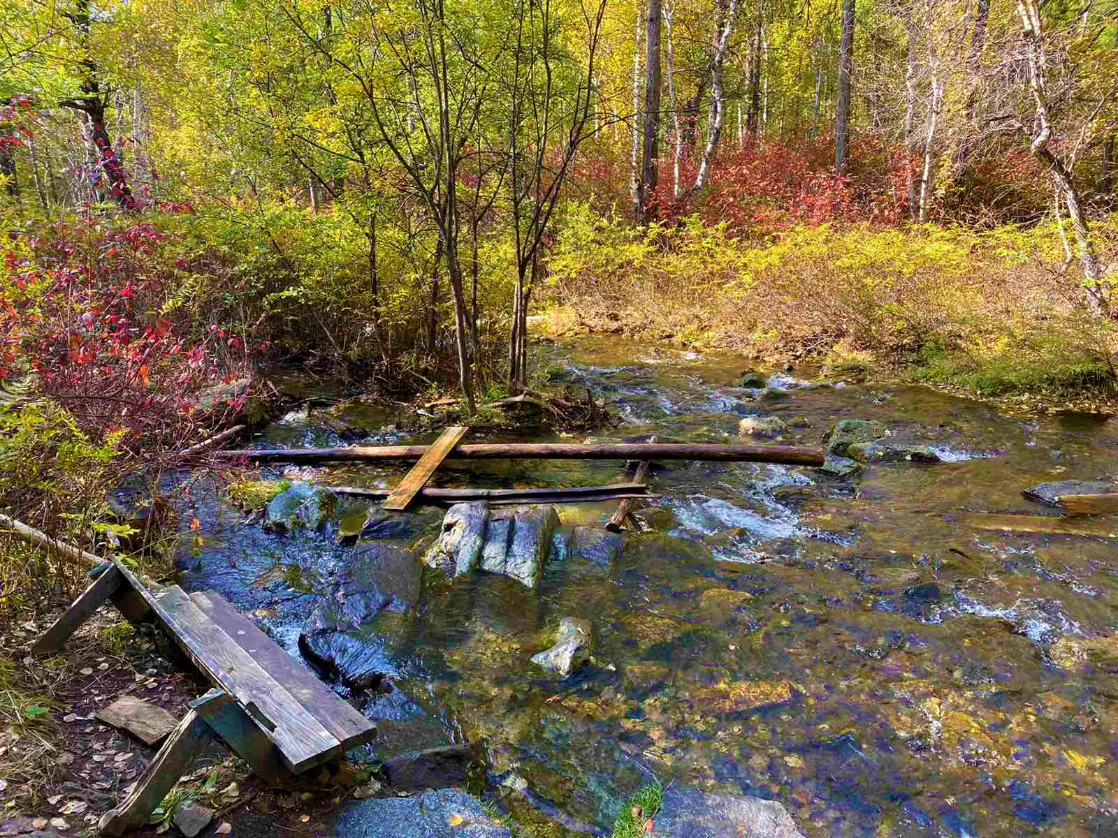
Top sights and standout views in Alkhanay National Park

The standout features of Alkhanay National Park span the natural, geological, and cultural domains, which is precisely what makes it unusual. Ecologically, the park sits at the meeting point of the Eurasian boreal forest and the great Daurian steppes, producing one of the more biodiverse national park territories in Siberia.

Geologically, it is recognized as a cluster of local geological heritage monuments, anchored by the Alkhanay paleovolcanic area with its Jurassic-age lavas, tuffs, ignimbrites, and collapse caldera, and by the striking natural arch of the Alkhanay Gate. Culturally, the park protects more than 20 Buddhist cult sites centered on Mount Alkhanay, along with ancient petroglyphs and sacred springs. Together, these features make Alkhanay a place of integrated natural and spiritual heritage in southeastern Siberia.
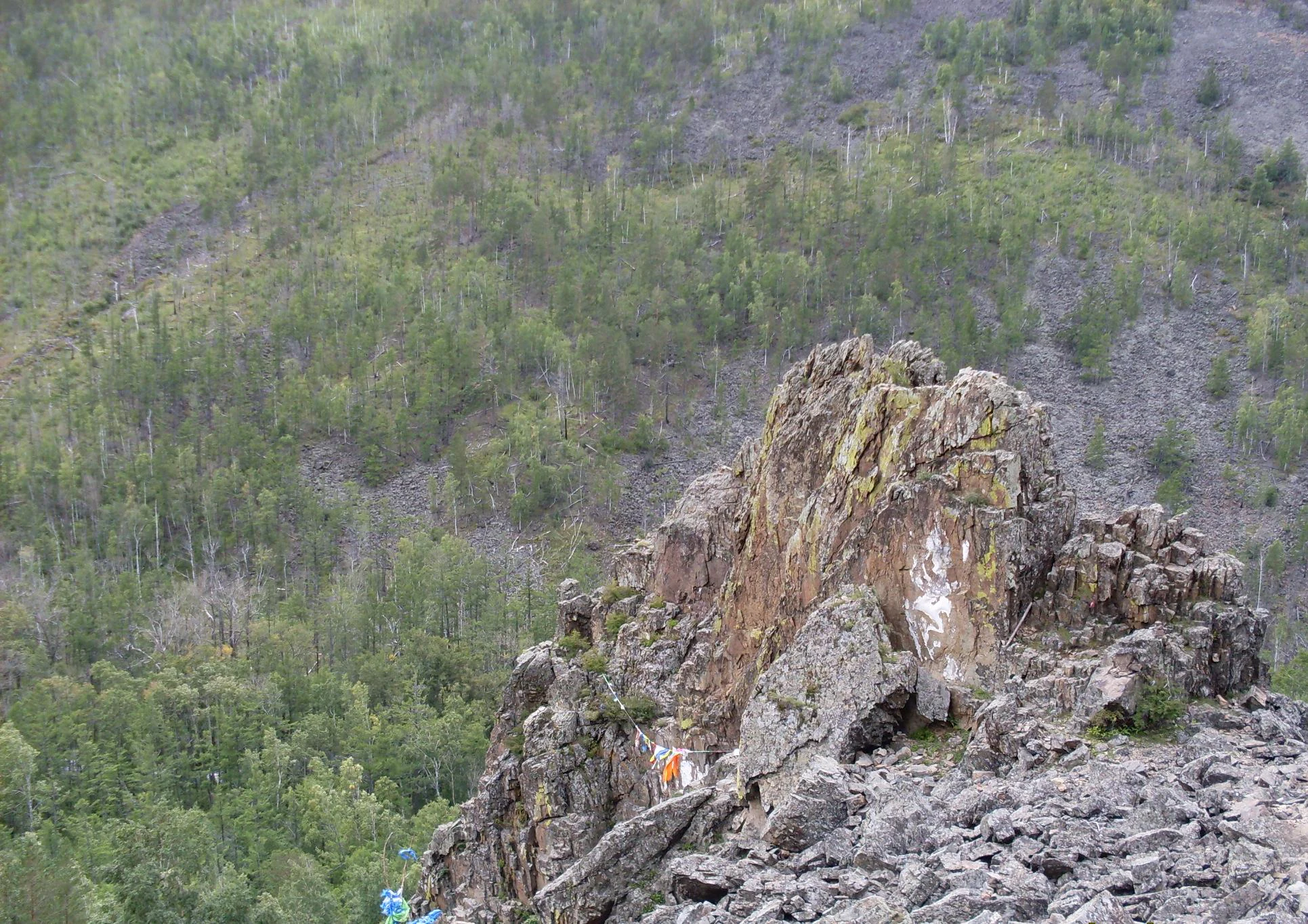
Best time to visit Alkhanay National Park

Alkhanay's climate and visitor rhythm are strongly seasonal. Summer is the period of greatest accessibility and the time when the park is most active. Peak visitation occurs in July and August, when warm weather opens access to the high-elevation trails, the sacred springs are most easily approached, and the major Buddhist gatherings at the main oboo and the Uuden Sume temple take place. The broader summer visitor window from June through mid-September is when the park's infrastructure, including the recreational zone in the valley of the Sukhoe Ubzhogoye stream, is most fully in use.

Outside the summer months, access becomes more restricted due to the harsh continental climate of the Transbaikal, with long cold winters and short transitional seasons. Visitors interested in witnessing the annual Buddhist ceremonies, the goroo circumambulations, and the natural green phase of the taiga and steppe vegetation will find the warmest months of summer the most rewarding time to visit.
Monthly climate preview

Long-term temperature ranges and monthly precipitation averages for Zabaykalsky Krai

Alkhanay National Park Climate Normals and Annual Weather Patterns

Alkhanay National Park records long-term average temperatures spanning deep winter lows to warm summer highs alongside a distinct annual precipitation rhythm. Examining the complete twelve-month climatology profile reveals precise monthly variations across the representative coordinate elevation.
Annual mean-1 °C
-21 °C18 °C
Jan-21°
Feb-17°
Mar-10°
Apr
May
Jun15°
Jul18°
Aug15°
Sep
Oct-1°
Nov-11°
Dec-18°
Warmest month
July

18.1 °C

Coolest month
January

-20.9 °C

Wettest month
July

3.1 mm/day

Driest month
January

0.2 mm/day

Park location guide

Geography guide, regional context, and park location map for Alkhanay National Park

Alkhanay National Park park geography, regions, and map view in Russia

Understand where Alkhanay National Park sits in Russia through a broader geographic reading of the surrounding landscape, nearby location context, and its mapped position within the national park landscape.

How Alkhanay National Park fits into Russia

Russia is a transcontinental nation spanning eleven time zones, bordered by fourteen countries. It is the world's largest country by area, covering 17,098,246 km². Moscow is the capital and largest city, while Saint Petersburg is the second-largest and a major cultural centre.

Wider geography shaping Alkhanay National Park in Russia

Russia spans Eastern Europe and North Asia, covering 17,098,246 km². It shares land borders with fourteen countries, more than any other nation, and spans eleven time zones. The landscape includes vast plains, mountain ranges such as the Urals and Caucasus, and extensive coastlines along the Arctic Ocean, Pacific Ocean, Baltic Sea, Black Sea, and Caspian Sea.

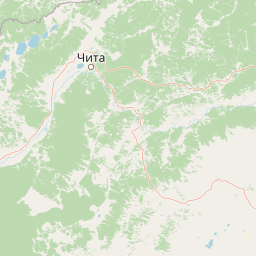
Map view of Alkhanay National Park

Use this park location map to pinpoint Alkhanay National Park in Russia, understand its exact geographic position, and read its mapped placement within the surrounding landscape more clearly.

Pigeon | © OpenStreetMap contributors

Location context for Alkhanay National Park

Zabaykalsky Krai
Park atlas

Compare adjacent mountain taiga reserves and regional forest steppe landscapes

Explore Protected Areas and Parks Near Alkhanay National Park in Zabaykalsky Krai

Browsing other protected areas near Alkhanay National Park reveals the broader ecological transition where Siberian boreal forests meet Daurian steppes. Extending geographical comparison beyond a single park clarifies regional terrain patterns, watershed boundaries, and protected landscapes across southeastern Siberia.
Watercolor illustration depicting layered mountains, green hills, and forested areas with purple and pink tones
National parkZabaykalsky Krai
About 0 km away#1 closest

Southeast

Alkhanay National Park: A Study of Sacred Peaks and Daurian Forest Steppe Geography

Protected mountain landscapes in Russia's Zabaykalsky Krai

Alkhanay National Park preserves a unique transitional landscape where rugged mountain terrain meets the expansive Siberian steppe. Focused on the sacred Mount Alkhanai, the area features dramatic rock landforms, pine-covered canyons, and mineral springs. This protected zone provides a deep look into the geological and ecological history of the Mogotuyskogo Range and surrounding border regions.

Area
1,382 km²
Established
1999
IUCN
II
Relief
Mountain
Nature reserveDornod Province
About 174 km away#2 closest

Southeast

Mongol Daguur Nature Reserve: Steppe and Wetland Geography in Eastern Mongolia

Protected landscape boundaries within Dornod Province

An authoritative overview of the Mongol Daguur protected area, focusing on its role as a core element of the Daurian landscape. Discover the spatial distribution of its steppe habitats, wetland systems, and mountain-grassland terrain that define this eastern Mongolian region.

Area
156 km²
Established
1998
IUCN
Ib
Relief
Lowland
Watercolor painting of a river winding through hills with trees and vegetation
National parkZabaykalsky Krai
About 252 km away#3 closest

Southwest

Chikoy National Park: Protected National Park with Highland Landscape and River Basin Geography

Explore its protected boundaries and unique taiga-steppe transition in Zabaykalsky Krai.

Chikoy National Park, a protected area in Russia's Zabaykalsky Krai, showcases the rugged geography of the Khentei-Daur Highlands. As a national park, it preserves the upper Chikoy River basin and represents a significant ecological borderland, marking the transition from Siberian taiga to Mongolian steppe. This page facilitates a structured understanding of the park's mapped landscape, its prominent natural monument Bystrinsky Golets, and its role within the broader atlas of protected natural areas.

Area
6,665 km²
Established
2014
IUCN
II
Relief
Mountain
Watercolor illustration showing a mountainous landscape with green valleys and a river, rendered in soft pink and green hues
National parkKhentii Province
About 265 km away#4 closest

Southwest

Onon-Balj National Park: A Protected River Valley in Mongolia's Khentii Province

Explore unique geography and diverse ecosystems at a steppe-forest transition.

Onon-Balj National Park safeguards a critical river valley area in Khentii Province, Mongolia, marking an important ecological transition zone between Siberian forests and the Daurian steppe. Discover the park's mapped landscape, characterized by mid-sized mountains and riparian habitats along the Onon and Balj rivers. This protected area offers insights into regional geography, biodiversity, and the unique natural heritage of northern Mongolia.

Area
4,158 km²
Established
2000
IUCN
II
Relief
Mountain
Wildlife reserveKhentii Province
About 407 km away#5 closest

Southwest

Khan Khentii Strictly Protected Area: Geographic Overview and Protected Landscape Mapping

Eastern Mongolia wilderness and Khentii mountain terrain

Explore the expansive reaches of Khan Khentii Strictly Protected Area, a cornerstone of Mongolian conservation. This reserve shields intact taiga forests, river valley habitats, and the historic Burkhan Khaldun mountain from industrial activity, preserving one of the most significant mountain wilderness regions in the province of Khentii.

Area
12,270 km²
Established
1992
IUCN
Ib
Relief
Mountain
National parkBuryatia
About 430 km away#6 closest

Northwest

Zabaykalsky National Park: Geographic and Protected Area Mapping for the Eastern Baikal Shore

Mountain taiga, islands, and protected peninsula landscapes.

Zabaykalsky National Park comprises an extensive area of the eastern Baikal shoreline, characterized by the Barguzin Range, the prominent Sviatoy Nos peninsula, and a dense network of mountain taiga forests. Its protected boundaries include diverse mineral springs, karst features, and crucial marine habitats, providing a comprehensive look at the unique geomorphology and biodiversity of this Siberian wilderness.

Area
2,690 km²
Established
1986
IUCN
II
Relief
Mountain
Watercolor painting depicting a lake with mountain ranges, green hills, and scattered trees.
National parkBuryatia
About 430 km away#7 closest

Northwest

Zaybaykalsky National Park: Geographic Atlas of Lake Baikal Protected Terrain

Mapping the Svyatoy Nos peninsula and Barguzin mountain landscapes

Spanning over 269,000 hectares, Zaybaykalsky National Park protects a dramatic transition from the shores of Lake Baikal to high-altitude mountain complexes. This atlas resource details the park's steep topography, characterized by ancient taiga forests and geological features like the Academician Ridge and marble-limestone islands, offering a structured view of this significant Siberian protected area.

Area
2,690 km²
Established
1986
IUCN
II
Relief
Mountain
Protected areaDornod Province
About 458 km away#8 closest

Southeast

Buir Lake Protected Area: Geographic Overview and Steppe Landscape Context

Mapping the transboundary freshwater wetlands of Dornod Province

Buir Lake occupies a expansive depression in the eastern Mongolian steppe, characterized by its shallow seasonal hydrology and fringing marshlands. This protected area serves as a primary geographic feature within Dornod Province, linking regional steppe systems and migratory bird corridors. The site offers a clear look at the interplay between water and grassland in a unique transboundary setting.

Established
2004
Relief
Lowland
Scope
Terrestrial
Water
Water-dominated

Common questions about visiting, size, designation, and location context for Alkhanay National Park

Alkhanay National Park FAQs for park facts, access, geography, and protected area context

Find quick answers about Alkhanay National Park, including protected-area facts, park geography, trail and visitor context, and how the park fits into its surrounding country and regional landscape.
MoriAtlas Explorer

Continue Your Protected Areas Search Across the Global Atlas

Deepen your exploration by continuing the structured search for national parks and protected areas worldwide. Utilize the comprehensive filtering capabilities to compare different conservation landscapes and refine your understanding of global park geography. Discover more about the distribution and characteristics of protected natural areas.

Global natural geography