
Why Angat Watershed Forest Reserve stands out
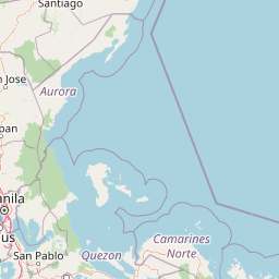
The Angat Watershed Forest Reserve is best known as the source of nearly all of Metro Manila's drinking water, channeled through the Angat, Novaliches system, while simultaneously functioning as a major biodiversity refuge in a heavily populated region. It supports the Ipo Dam and the Angat Dam, anchors a substantial share of the Luzon grid's hydroelectric capacity, and shelters one of the largest remaining blocks of closed-canopy forest in Central Luzon. Its birdlife adds another dimension to its identity: as a BirdLife International Important Bird Area, it draws observers seeking endemic species such as the Luzon hornbill and Rufous hornbill, alongside a roster of restricted-range and threatened forest birds found nowhere else. The combination of watershed utility, hydropower significance, and endemic biodiversity makes Angat stand out among Philippine protected areas.
Angat Watershed Forest Reserve history and protected-area timeline
The Angat Watershed's protection history extends back to the early American colonial period. In 1904, Civil Governor Luke Edward Wright signed Executive Order No. 33 establishing the Angat River Reserve, setting aside the Angat River in Norzagaray, the surrounding slopes of Mounts Salacot, Balugan, and Sulip, and important tributaries such as the Bulagao and Bitbit creeks for purposes of water power development.
In 1927, Governor-General Leonard Wood issued Proclamation No. 71 establishing the 62,309-hectare Angat Watershed Forest Reserve across municipalities in Rizal, Bulacan, Nueva Ecija, and Tayabas (today's Quezon) provinces, placing administration and control with the Department of Agriculture and Natural Resources. Around the same period, the Metropolitan Water District initiated the construction of the Angat–Novaliches Water System, including the Ipo Dam within the reserve, completed in 1939 and inaugurated in 1940.
Two later milestones reshaped its administration: in 1965, President Diosdado Macapagal signed Proclamation No. 505 transferring administration of the whole reserve to the National Power Corporation following the construction of the Angat Hydroelectric Dam, while in 1968 President Ferdinand Marcos issued Proclamation No. 391 declaring 6,600 hectares around the Ipo Dam as a separate watershed management pilot project reserve under joint administration of the forestry director and the Metropolitan Waterworks and Sewerage System. The Angat Hydropower Corporation, a joint venture between San Miguel Corporation and K-water, took over ownership of the hydroelectric plant from the National Power Corporation in 2014, and the Angat Rainforest and Ecological Park was inaugurated in the reserve in December of that year.
Angat Watershed Forest Reserve landscape and geographic character
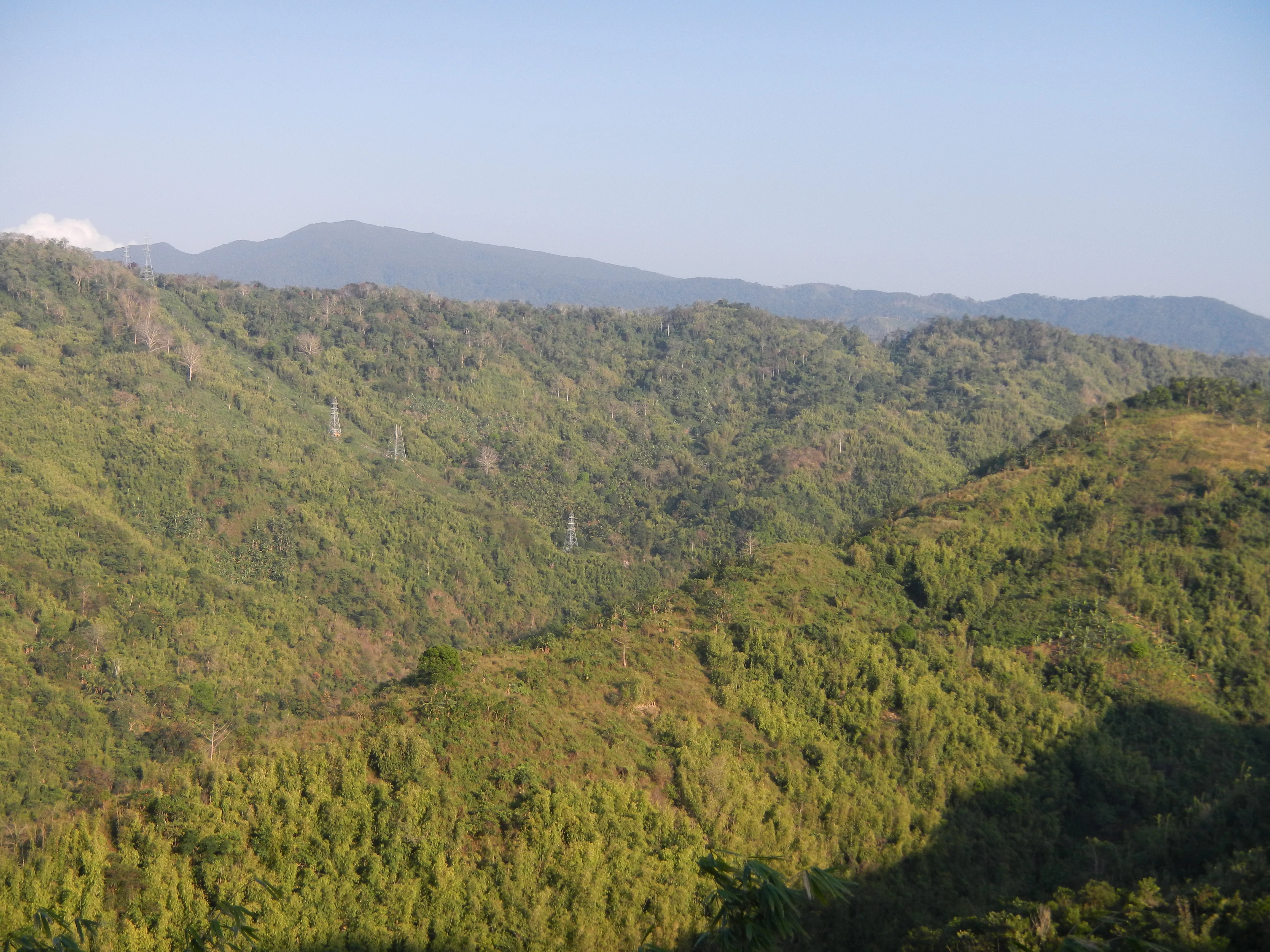
The Angat Watershed Forest Reserve is shaped by the rugged southern Sierra Madre range, with terrain that rises from roughly 490 meters at lower elevations to peaks exceeding 1,200 meters. The landscape is defined by steep ridges, forested slopes, intersecting valleys, and a series of rivers that drain toward the Angat Reservoir and beyond. This combination produces a continuous gradient of environments, from lowland valleys to high-elevation forest, with relatively little fragmentation in the protected core.
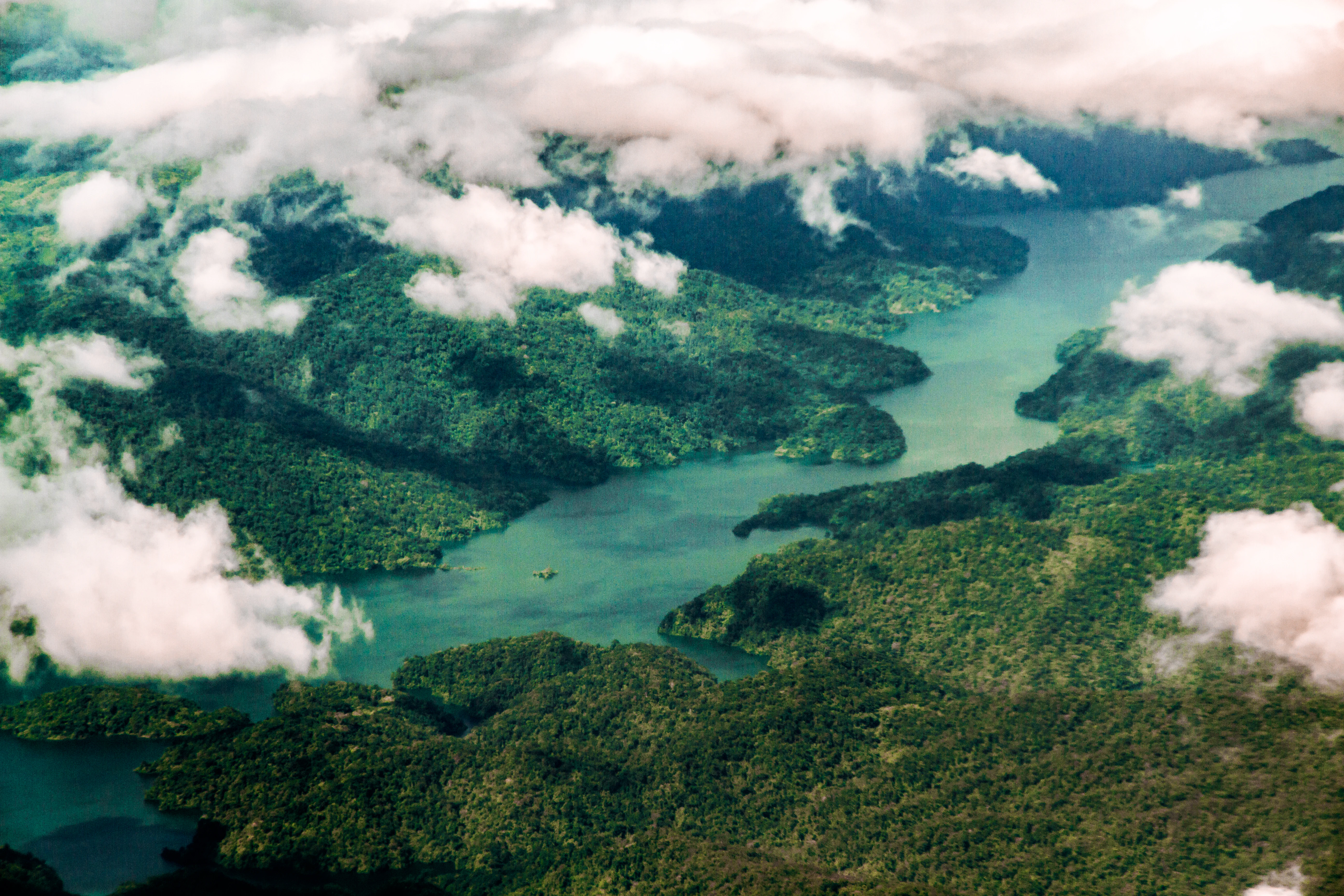
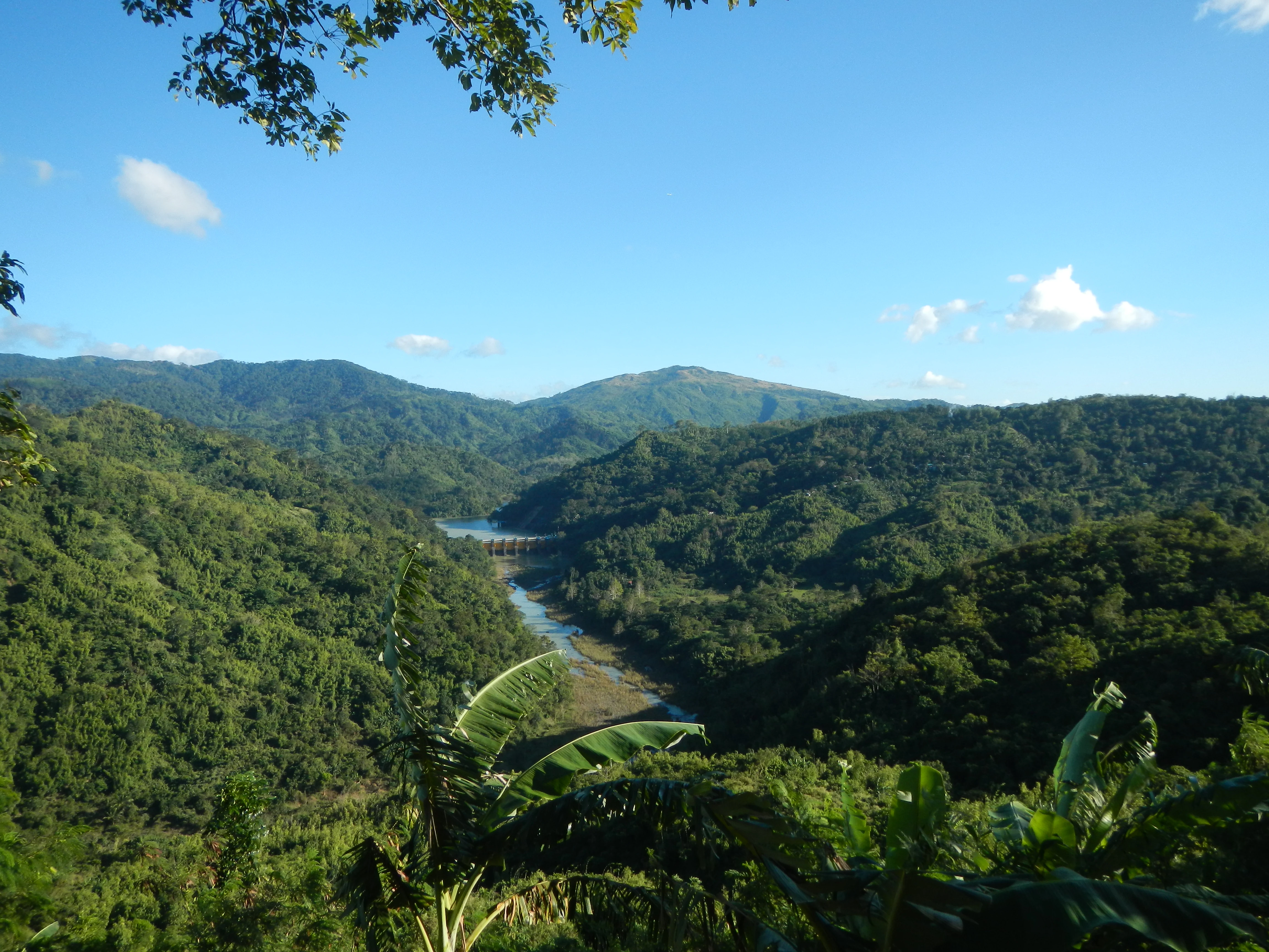
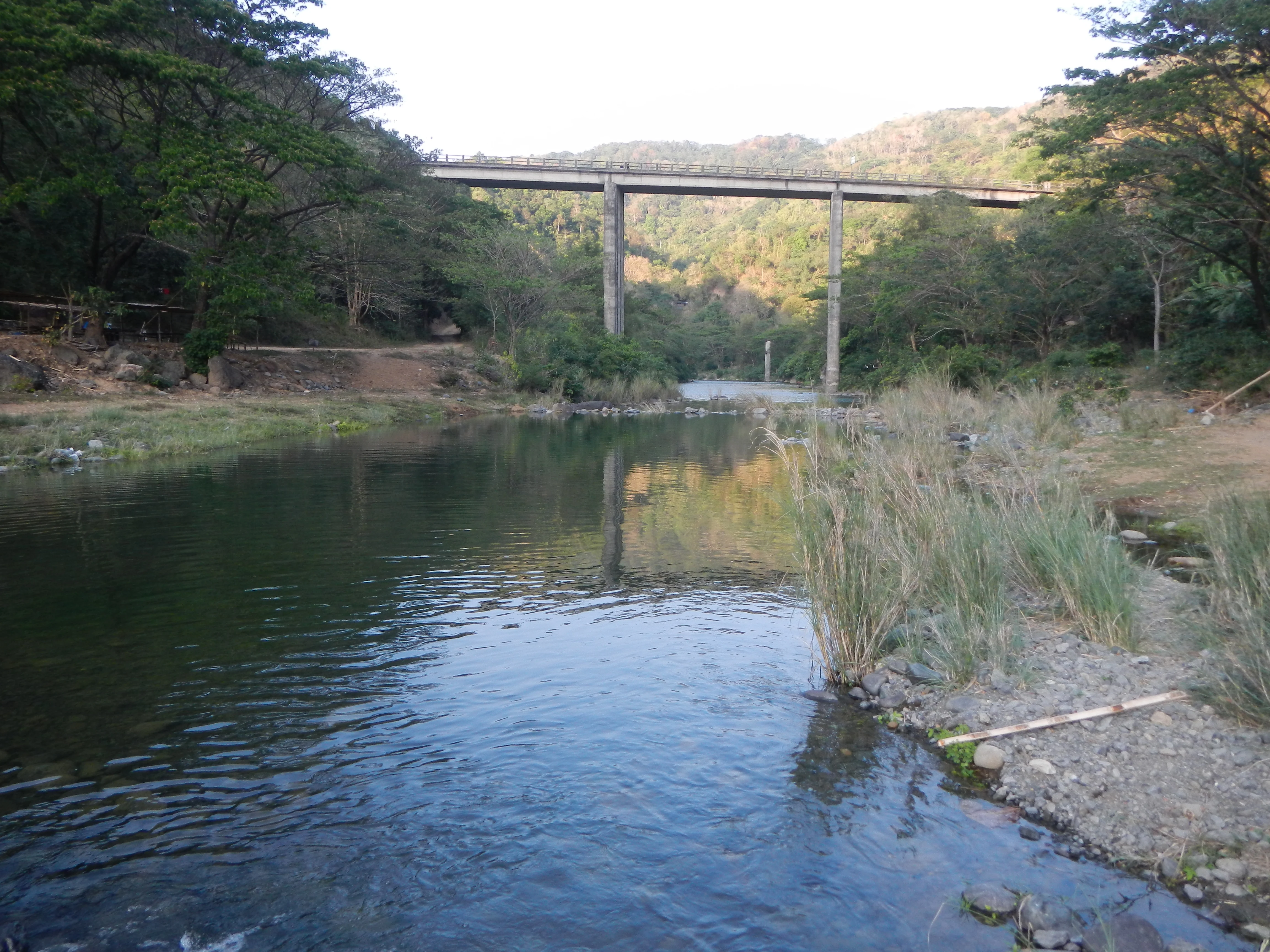
At the watershed's heart lies the Angat Reservoir, the artificial lake behind the Angat Hydroelectric Dam, which dominates much of the lower sub-catchment's scenery. Upstream, the Ipo Dam regulates a smaller but strategically important basin that feeds directly into the metropolitan water system. Between the two dams, tributaries such as the Talaguio, Catmon, and Matulid rivers carve narrow valleys through the forest, contributing both water and visual variety to the reserve. The water system is augmented by the Angat–Umiray trans-basin tunnel, which diverts additional flow from the Umiray River on the eastern face of the Sierra Madre.
Mountain features shape the reserve's identity above all. Mount Oriod, at 1,206 meters and located in Norzagaray at the boundary between the two sub-catchments, is the highest point in Bulacan province and a defining landmark of the watershed. Mount Maranat, another notable peak, draws hikers and visitors interested in the reserve's waterfalls and forested ridges. The result is a landscape where water bodies, river valleys, and forested peaks together create one of the better-preserved mountain watershed scenes in Central Luzon.
Angat Watershed Forest Reserve ecosystems, habitats, and plant life
The Angat Watershed Forest Reserve belongs to a bioclimatic zone that supports a layered vegetation pattern typical of southern Sierra Madre ecosystems. Closed-canopy lowland dipterocarp forests form much of the core, while submontane forests extend up the slopes into cooler, moister conditions. Interspersed among these forests are open grasslands, secondary bamboo stands, and scrublands, which together create a mosaic of habitats that accommodate different wildlife communities.
The reserve's flora is unusually rich for an area so close to Metro Manila, with approximately 290 endemic species of woody and non-woody plants recorded. Among the characteristic trees are white lauan, locally known as bagtikan, along with tanguile, yakal, acacia, and narra, several of which are valued hardwoods that indicate the presence of relatively mature dipterocarp forest. The combination of endemic plant richness and habitat variety is what allows Angat to retain most of the remaining closed-canopy forest in Central Luzon.
Aquatic and wetland environments add another ecological layer. The Angat Reservoir and the smaller Ipo basin, together with the network of tributaries, support freshwater fauna including large tilapia and eel populations, while moist forest floors harbor amphibians such as the endemic Japanese bullet frog and reptiles such as the marbled water monitor. This blend of forest, river, and reservoir habitats gives Angat a varied ecological profile rarely matched by other protected areas in the region.
Angat Watershed Forest Reserve wildlife and species highlights
The Angat Watershed's wildlife profile is shaped by its position along the Sierra Madre, its forested cover, and the protection its watershed status has provided over more than a century. Mammals of conservation concern include the crab-eating macaque and the Philippine warty pig, both currently classified as near-threatened, with the Philippine deer also roaming sections of the forest. Smaller and less-studied species such as the blazed Luzon shrew rat add to the watershed's significance for mammal conservation within Central Luzon.
Birdlife is the reserve's most celebrated faunal feature. Its designation as an Important Bird Area by BirdLife International reflects the presence of significant populations of species that are either globally restricted, threatened, or both. More than 40 bird species have been recorded, many of them endemic to the Philippines. The two most conspicuous species are the Luzon hornbill and the Rufous hornbill, joined by large flocks of spotted imperial pigeons and a suite of forest-dependent endemics such as the scale-feathered malkoha, rough-crested malkoha, grey-backed tailorbird, Philippine eagle owl, whiskered pitta, celestial monarch, ashy thrush, ashy-breasted flycatcher, flame-breasted fruit dove, and green-faced parrotfinch. The data-deficient Worcester's buttonquail has also been documented here, alongside raptors such as the Philippine hawk-eagle and striking smaller birds like the Philippine dwarf kingfisher and green racket-tail.
Reptiles and amphibians further diversify the reserve's fauna. Endemic amphibians like the Japanese bullet frog inhabit the moist forest floor, while the marbled water monitor occupies the waterways and reservoir margins. Together, these groups confirm that Angat supports not only birdwatching opportunities but also a broader faunal assemblage of considerable conservation value.
Angat Watershed Forest Reserve conservation status and protection priorities
Angat Watershed Forest Reserve holds an unusual and important place in Philippine conservation because its protection is rooted as much in water security and power generation as in biodiversity. Designated initially to safeguard water power and later expanded for metropolitan water supply, the reserve's protected status has historically shielded it from the agricultural conversion and settlement that have eliminated most of the original forest cover elsewhere in Central Luzon.
Its conservation value is international as well as national: recognition as a BirdLife International Important Bird Area acknowledges the reserve's role in sustaining populations of endemic and threatened bird species of the Philippines, while the presence of 290 endemic plant species and a stable population of mammals such as the Philippine warty pig and crab-eating macaque confirms its biodiversity significance. The reserve's mixed governance, with the Department of Environment and Natural Resources, the Metropolitan Waterworks and Sewerage System, and the Angat Hydropower Corporation sharing responsibilities, reflects an approach that integrates ecological protection with hydropower and water management.
Connectivity adds another conservation dimension. Angat is contiguous with the Doña Remedios–General Tinio Watershed Forest Reserve and borders the Upper Marikina River Basin Protected Landscape, Biak-na-Bato National Park, and Minalungao National Park. This network of adjacent protected areas enables wildlife movement across the Sierra Madre corridor and strengthens the long-term viability of its forest-dependent species. The inauguration of the Angat Rainforest and Ecological Park in 2014 marked a step toward combining infrastructure function, biodiversity conservation, public engagement, and indigenous Dumagat heritage within the same protected landscape.
Angat Watershed Forest Reserve cultural meaning and human context
Cultural context in the Angat Watershed is closely tied to the Dumagat indigenous communities, who inhabit sitios in the villages of San Mateo, San Lorenzo, and San Isidro in Norzagaray, as well as Kabayunan in Doña Remedios Trinidad. Their long-standing presence along the rivers and forested ridges of the reserve means that cultural heritage is woven into the watershed's landscape, rather than being separated from it.
The development of the Angat Rainforest and Ecological Park reflects an effort to acknowledge this context formally. Plans for the park include a Dumagat cultural heritage site, along with a natural history museum, ecological center, hilltop view deck, seedling propagation area, rattan gene bank, and bambusetum. Together, these features intend to make the reserve not only a water-supply and biodiversity site but also a place where the indigenous identity of the watershed is recognized and preserved.
Top sights and standout views in Angat Watershed Forest Reserve
The Angat Watershed Forest Reserve pairs metropolitan-scale infrastructure responsibility with the conservation of one of Central Luzon's last extensive forest blocks. Its watershed output underpins nearly all of Metro Manila's domestic water supply while the Angat Hydroelectric Dam contributes major capacity to the Luzon grid, illustrating how a single protected landscape can hold national-level utility.
Ecologically, Angat stands out for its BirdLife International Important Bird Area status, its 290 endemic plant species, and the presence of globally near-threatened and endemic mammals, birds, reptiles, and amphibians. Set against a backdrop of peaks such as Mount Oriod and Mount Maranat, the reserve offers one of the most accessible windows into the southern Sierra Madre's closed-canopy forests and endemic wildlife.
Best time to visit Angat Watershed Forest Reserve
Conditions in the Angat Watershed vary with the regional climate of Luzon, where a distinct dry season generally runs from roughly November through May and a wetter rainy season prevails from June through October. The dry months typically offer more comfortable conditions for hiking destinations such as Mount Maranat, clearer views from elevated points like Mount Oriod, and easier access to forest trails and the Angat Rainforest and Ecological Park facilities in Sitio Bitbit, San Lorenzo.
The wetter months bring heavier rainfall, more humid forest conditions, and occasionally limited access to steep trails, though they also coincide with the watershed's highest water levels and lusher vegetation. Birdwatching interest persists throughout the year, as several endemic species are resident rather than migratory, but cooler and drier periods often make long observation sessions and ridge-top exploration more pleasant. Visitors generally find that late dry-season months offer a balance of stable weather, high water displays, and active wildlife observation.