
Mori Atlas logo
Wildlife reserveAshtamudi Lake

A detailed geographic look at the wetland boundaries, tidal channels, and island topography

Ashtamudi Lake Wildlife Reserve: Mapping the Palm-Shaped Estuary Landscapes of Kerala India

Ashtamudi Lake serves as a critical brackish water ecosystem on the Malabar Coast, characterized by its eight distinct arms that branch inland from the Arabian Sea. This wildlife reserve provides a deep look at the intricate network of tidal channels, mangrove-fringed shorelines, and estuarine mudflats that define the region. By examining the mapped boundaries and natural terrain of this Ramsar-designated site, researchers and observers can better understand the hydrological connectivity and complex island clusters inherent to the Kerala backwaters.

estuarybrackish wetlandRamsar siteKerala backwatersmangrovesmigratory birds
A vibrant graphic art illustration showing a calm river flowing past a large cliff with a waterfall, surrounded by lush palm trees under a bright sky, with a small houseboat in the water.

Ashtamudi Lake

Wildlife reserve

Park overview

Structured park overview, official facts, and landscape profile for Ashtamudi Lake

Ashtamudi Lake park facts, protected area profile, and essential visitor context

Review the core facts for Ashtamudi Lake, including designation, size, terrain, visitor scale, habitats, and operating context in one park-focused overview.

About Ashtamudi Lake

Ashtamudi Lake is a broad, branching estuary in the Kollam District of Kerala, forming one of the defining water landscapes of southwestern India. From the air, the lake resembles the palm of a hand, with eight arms spreading eastward from the open mouth at Neendakara, where the estuary meets the Arabian Sea. The Malayalam name itself, Ashtamudi, means 'eight peaks' or 'eight branches', and this branching structure shapes both the hydrology and the human geography of the region, with towns, villages, islands, canals, and coconut groves strung along each arm.

The lake occupies a central place in the Kerala backwater network. Kollam, the historic port city once known as Quilon, sits on its eastern bank and serves as the main hub for boat traffic. From here, houseboats and ferries travel westward through the canals of the estuary toward the sea at Neendakara, or southward to the Paravur backwaters, or northward along the National Waterway toward Alappuzha. This connectivity has made Ashtamudi the functional gateway to the Kerala backwater experience, even though the larger Vembanad system to its north is more famous.

Ecologically, Ashtamudi is a brackish estuary with salinity that changes with the monsoons, tides, and freshwater releases from the Kallada River. Its shores host extensive mangrove patches, sandbanks, and clusters of small islands, several of which remain inhabited and retain traditional ways of life tied to coconut cultivation, coir production, and small-scale fishing. The Ramsar designation in 2002 confirmed the lake's status as a wetland of international importance, drawing attention to the birdlife, fish spawning grounds, and mangrove habitat that the estuary continues to support alongside intense human activity.

Quick facts and research context for Ashtamudi Lake

Ashtamudi Lake lies in the Kollam District of Kerala, on the southwestern coast of India, and is the state's second-largest estuarine system after Vembanad. Designated a Ramsar Wetland of International Importance in 2002, it functions as a brackish, year-round tidal estuary that remains open to the sea. The lake stretches across a surface area roughly six thousand hectares, with eight principal arms branching eastward from the Arabian Sea. It is fed primarily by the Kallada River, supports extensive mangrove habitat, and serves as the entry point to the Kerala backwaters used by houseboats between Kollam and Alappuzha.

Protection and recognition

Examine official designation records and management frameworks for Ashtamudi Lake.

Ashtamudi Lake Protection Status and Designated Conservation History

Ashtamudi Lake holds a mixed protection status established in 2002 alongside documented management history. Review complete designation records and official conservation frameworks tied to this protected wetland environment.

Protection details

Protection scope
Mixed
Designated year
2002
Transboundary protection
No
Park context

Deeper park guide and search-rich context for Ashtamudi Lake

Ashtamudi Lake history, landscape, wildlife, and travel context

Explore Ashtamudi Lake through its history, landscape character, ecosystems, wildlife, conservation priorities, cultural context, and seasonal travel timing in a structured park guide built for atlas discovery and search intent.

Why Ashtamudi Lake stands out

Ashtamudi is best known as the gateway to the Kerala backwaters and for its distinctive palm-shaped or octopus-shaped outline with eight arms extending inland from the Neendakara inlet. It is also recognized for being the deepest estuary in Kerala, for the mangrove-lined channels threaded with traditional Chinese fishing nets, and for the houseboat cruises that connect Kollam with Alappuzha. Its identity combines high conservation value as a Ramsar site with a long-standing cultural and economic role as a fishing, coir-retting, and inland-navigation hub.
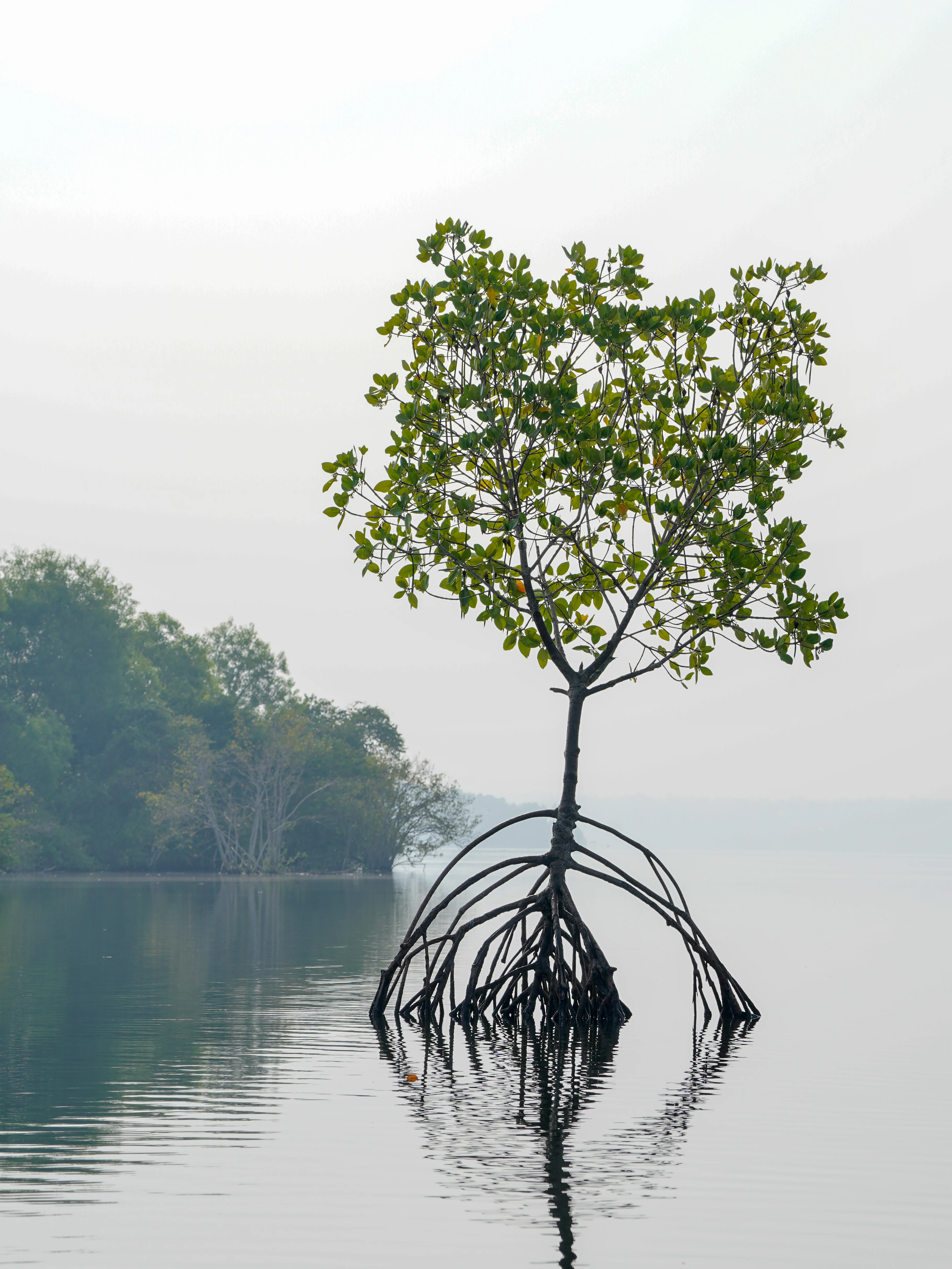
A lone mangrove tree with arched prop roots growing directly out of calm, reflective water, with a blurred shoreline in the background.
A solitary mangrove tree with characteristic prop roots reflecting in the calm waters of Ashtamudi Lake.

Ashtamudi Lake history and protected-area timeline

The history of Ashtamudi Lake stretches back thousands of years. Quaternary geological studies suggest that during the early Holocene period, the original Ashtamudi system once had a larger set of tidal creeks, and what is now Sasthamkotta Lake, Kerala's largest natural freshwater lake and another Ramsar site, was once connected to Ashtamudi before being cut off around seven thousand years ago. Other former creek portions, including Chittumala and Cherupola lakes, were similarly separated in the same period, each taking a thousand years or more to lose their estuary salinity.

Kollam, on the eastern shore of Ashtamudi, has been a trading port since ancient times, with historical links to Roman, Phoenician, Persian, and Chinese merchants. Ibn Battuta mentioned Quilon in his 14th-century travels as one of the key ports on Chinese trade routes, and Portuguese, Dutch, and British colonial interests followed in later centuries. Velu Thampi, a notable figure in Kerala's resistance history, is associated with organizing early resistance against British power from this region. During the colonial era, Dutch commander De Lanoy ordered reclamation of marshland on the southern flanks for coconut and fruit plantations, while the British expanded the city with a military garrison and railway links in the late nineteenth and early twentieth centuries.

The modern identity of the lake took shape with the construction of the Thenmala Dam across the Kallada River and with the road and rail link between Kollam and Ernakulam via Munroe Island in 1958. While the dam improved irrigation, it also reduced freshwater inflows and contributed to salinity ingress, foreshadowing later conservation concerns. The estuary received its Ramsar designation in 2002, marking formal recognition of its international ecological value at a time when pollution, encroachment, and microplastic contamination were already emerging as serious issues.

Ashtamudi Lake landscape and geographic character

Ashtamudi Lake's defining feature is its eight eastward-spreading arms: Thevally, Kureepuzha, Kandachira, Thekkumbhagam, Perumon, Kanjirottu, Kallada, and Kumbalathu. These arms enclose four major islands and numerous smaller islets, locally known as 'thuruths', which sit among mangrove patches, sandbanks, and shallow mudflats. The estuary has an average depth that is shallow overall but reaches a maximum of about 6.4 meters at the confluence zone near Neendakara, making it the deepest estuary in Kerala.

At its mouth, the estuary opens into the Arabian Sea through the Neendakara inlet, which has been reinforced with breakwaters to shelter a busy fishing harbour. Long tidal channels fan inland through the arms, fringed by coconut palms, marshy shoreline vegetation, and discontinuous mangrove forests. The lake is connected in the south to the Paravur backwater system via the Kollam Thodu canal and in the north to the Kayamkulam backwaters, so that its landscape forms part of a continuous chain of brackish coastal waterways that define the Kerala coast.
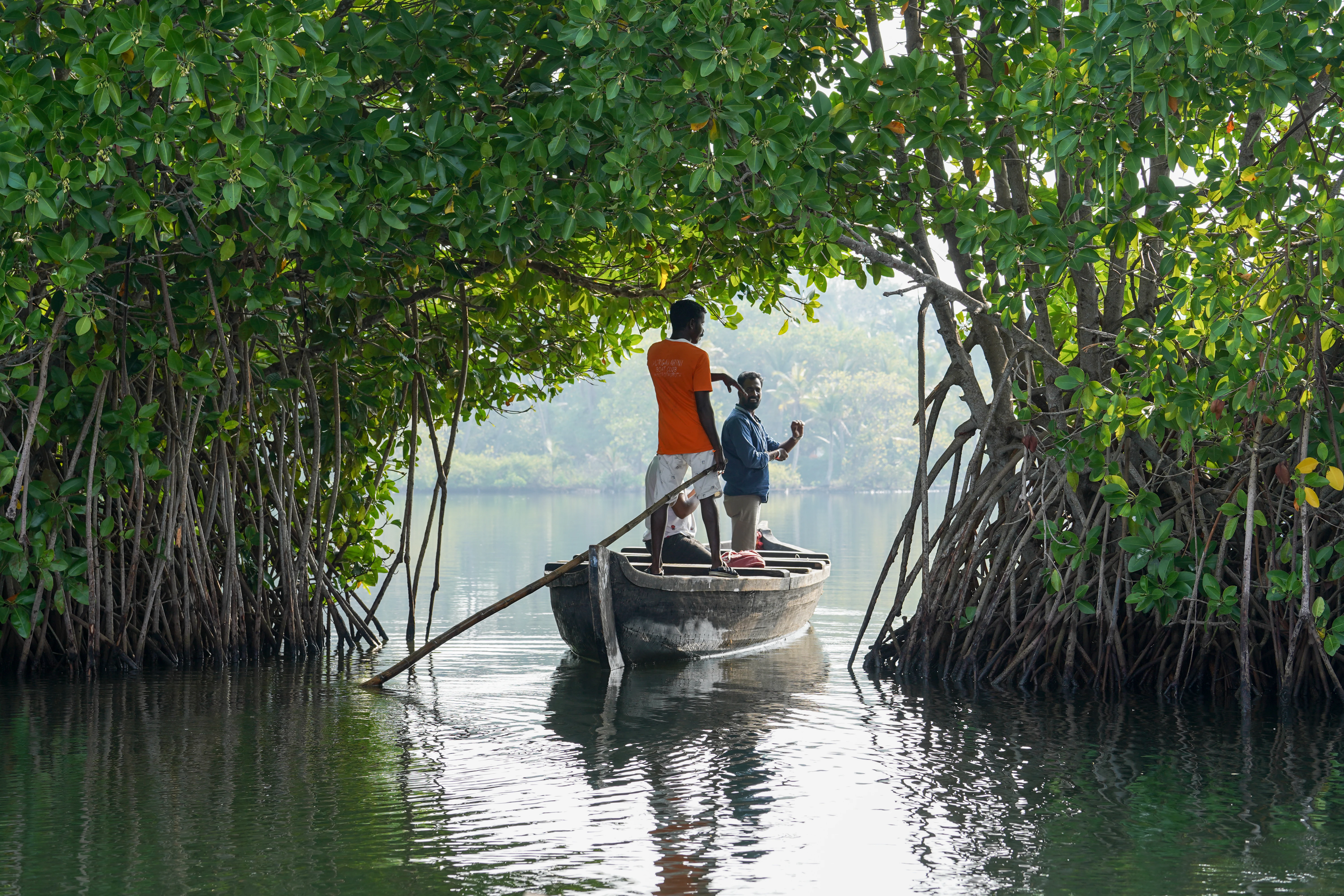
Two men standing in a wooden rowboat passing through a natural arch formed by overhanging mangrove tree branches on the calm waters of Ashtamudi Lake.
A small boat navigates through a dense mangrove arch on the backwaters of Ashtamudi Lake.

Ashtamudi Lake ecosystems, habitats, and plant life

Ashtamudi supports a layered estuarine ecosystem that blends marine, brackish, and freshwater influences. True mangrove species such as Avicennia officinalis, Avicennia marina, Bruguiera gymnorhiza, Sonneratia caseolaris, Rhizophora apiculata, Excoecaria agallocha, and Acanthus ilicifolius line the channel edges, alongside mangrove associates including Cerbera odollam, Hibiscus tiliaceus, Thespesia populnea, and Pandanus fascicularis. The terrestrial edges include endangered or rare species such as Syzygium travancoricum, listed in India's Red Data Book, and the rattan palm Calamus rotang.

Salinity in the estuary ranges widely between about 13 and 33.5 parts per thousand, with freshwater conditions dominating the inner creeks during and shortly after the monsoon months. Phytoplankton diversity is high, with documented species representing dozens of families across multiple classes, and the lake acts as a nursery for commercially important shrimp and crab species harvested off the Kollam coast. The combination of mangrove cover, mudflats, brackish water, and adjacent paddy and coconut landscapes creates a mosaic of habitats that supports a diverse community of fish, invertebrates, and birds.
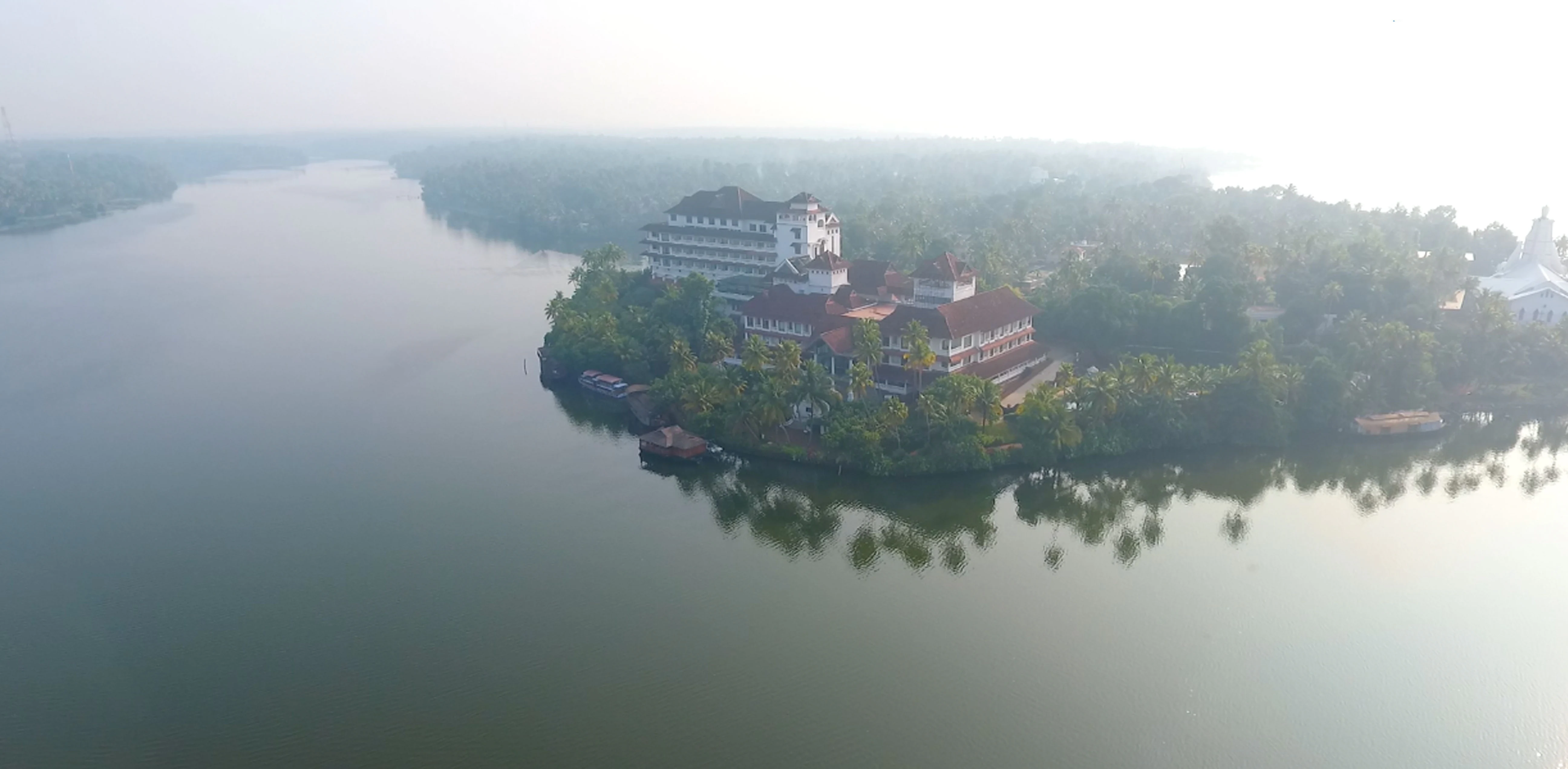
An aerial perspective of a large hotel complex situated on a lush, palm-covered peninsula surrounded by the calm, hazy waters of Ashtamudi Lake.
An aerial view of the resort and palm-fringed backwaters of Ashtamudi Lake in Kerala.

Ashtamudi Lake wildlife and species highlights

Ashtamudi Lake hosts an exceptionally rich estuarine fauna. Bird surveys record 57 species of avifauna, including 51 resident species and 6 migratory species, with around 40 wetland-dependent bird species documented overall, nearly half of which are long-distance migrants. Terns, plovers, cormorants, and herons are the most abundant groups, and the estuary receives more than twenty thousand waterfowl visits each year. Insects are also well represented, including 26 butterfly species, dragonflies, hymenopterans, and other insect groups catalogued in local studies.

The lake's fish fauna is similarly diverse, with documented records of around 87 fish species across 64 genera and 38 families, dominated by Perciformes and including Clupeiformes, Mugiliformes, Cypriniformes, and Siluriformes among others. Commercially important finfish such as pearl spot, mullet, and gobies, as well as shellfish including penaeid and palaemonid prawns, mud crabs, and the commercially critical clam Paphia malabarica, all depend on the estuary. The lake also hosts copepods, fish larvae, and a variety of zooplankton that underpin the food web and support both capture fisheries and clam collection in the lower estuary.
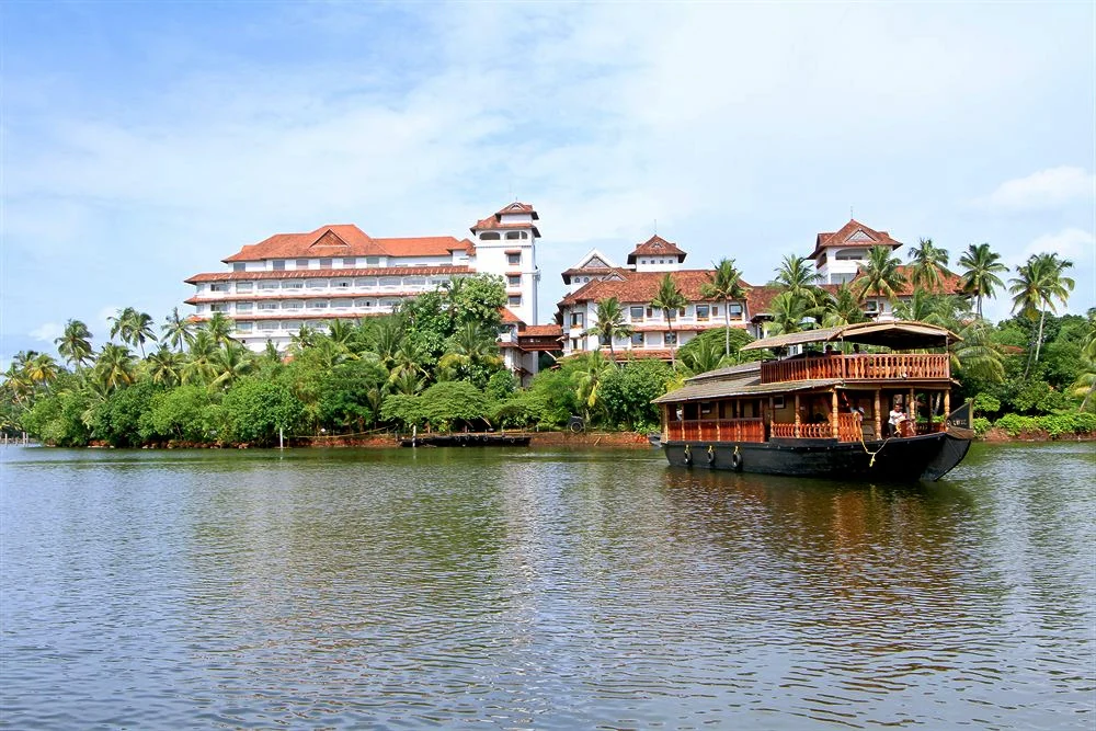
A traditional wooden houseboat floating on the calm waters of Ashtamudi Lake with a large resort building and dense palm trees on the shoreline.
A traditional houseboat cruising on the backwaters of Ashtamudi Lake, Kerala.

Ashtamudi Lake conservation status and protection priorities

Ashtamudi Lake's listing as a Ramsar Wetland of International Importance in 2002 reflects its high-profile conservation status. Its mangroves, mudflats, and brackish waters support migratory bird populations, endangered plant species, and nursery grounds for commercially valuable fish and shellfish, and the lake also functions as a flood storage system that protects the densely populated city of Kollam.

Despite this recognition, the estuary is under significant environmental pressure. Pollution from untreated sewage, solid waste dumping, oil spills from fishing boats, industrial discharges from paper mills and ceramics factories, and coconut husk retting has degraded water quality, with coliform readings in some parts of the lake indicating serious contamination. Reports document that the original lake area has shrunk due to encroachment and reclamation, and the construction of laterite and granite walls along much of the shoreline has eliminated fish spawning areas. A government-supported study assisted by New Zealand development funds has outlined a management plan focusing on pollution control, fish stock recovery, mangrove restoration, and eco-tourism, with partial success in replanting mangroves. Microplastic pollution, heavy metal contamination, and habitat alteration remain ongoing concerns that complicate the lake's long-term resilience.

Ashtamudi Lake cultural meaning and human context

Ashtamudi Lake is deeply embedded in the cultural and literary landscape of Kerala. Kollam, on its banks, has been a major port city for centuries, and historical records connect it to Roman, Phoenician, Persian, Chinese, Portuguese, Dutch, and British trade networks. The renowned Malayalam poet Thirunalloor Karunakaran, born near the lake, drew on its imagery in his works, and the first major epic poetry in Malayalam, Ramachandravilasam, was composed by the poet Azhakath Padmanabha Kurup at Thekkumbhagom on the lake's shore, where an ancient temple and a centuries-old church still stand together.

The lake also features prominently in local festivals and in Kerala's film and literary traditions, including the 1978 Malayalam film Ashtamudikkaayal. Traditional livelihoods such as coir retting, inland navigation, and Chinese fishing net fishing have shaped a distinctive lakeshore community identity, while modern houseboat tourism has woven the lake into the wider experience of the Kerala backwaters as a symbol of the state's coastal culture.
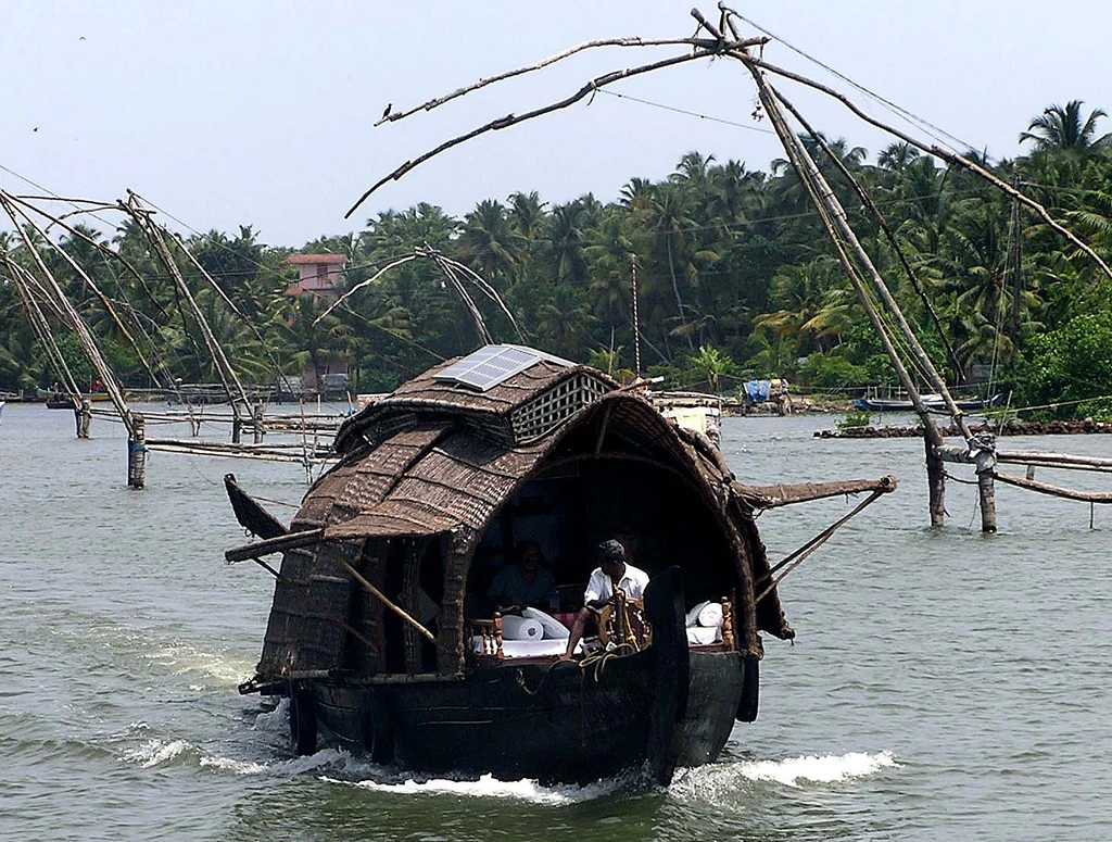
A traditional houseboat with a thatched roof cruising on the calm waters of Ashtamudi Lake in Kerala, with several large Chinese fishing nets visible in the background against a backdrop of palm trees.
A traditional houseboat navigating Ashtamudi Lake past Chinese fishing nets.

Top sights and standout views in Ashtamudi Lake

Ashtamudi Lake is a palm-shaped brackish estuary with eight defined arms, a Ramsar-designated wetland, and the deepest estuary in Kerala. Its mangrove-fringed channels, traditional Chinese fishing nets, and historic Kollam port setting create the classic Kerala backwater atmosphere. The estuary's role as the gateway to the Kerala backwater houseboat network, its importance for migratory and resident birds, and its longstanding cultural and economic role for fishing and coir communities make it one of the most emblematic wetlands of southwestern India.
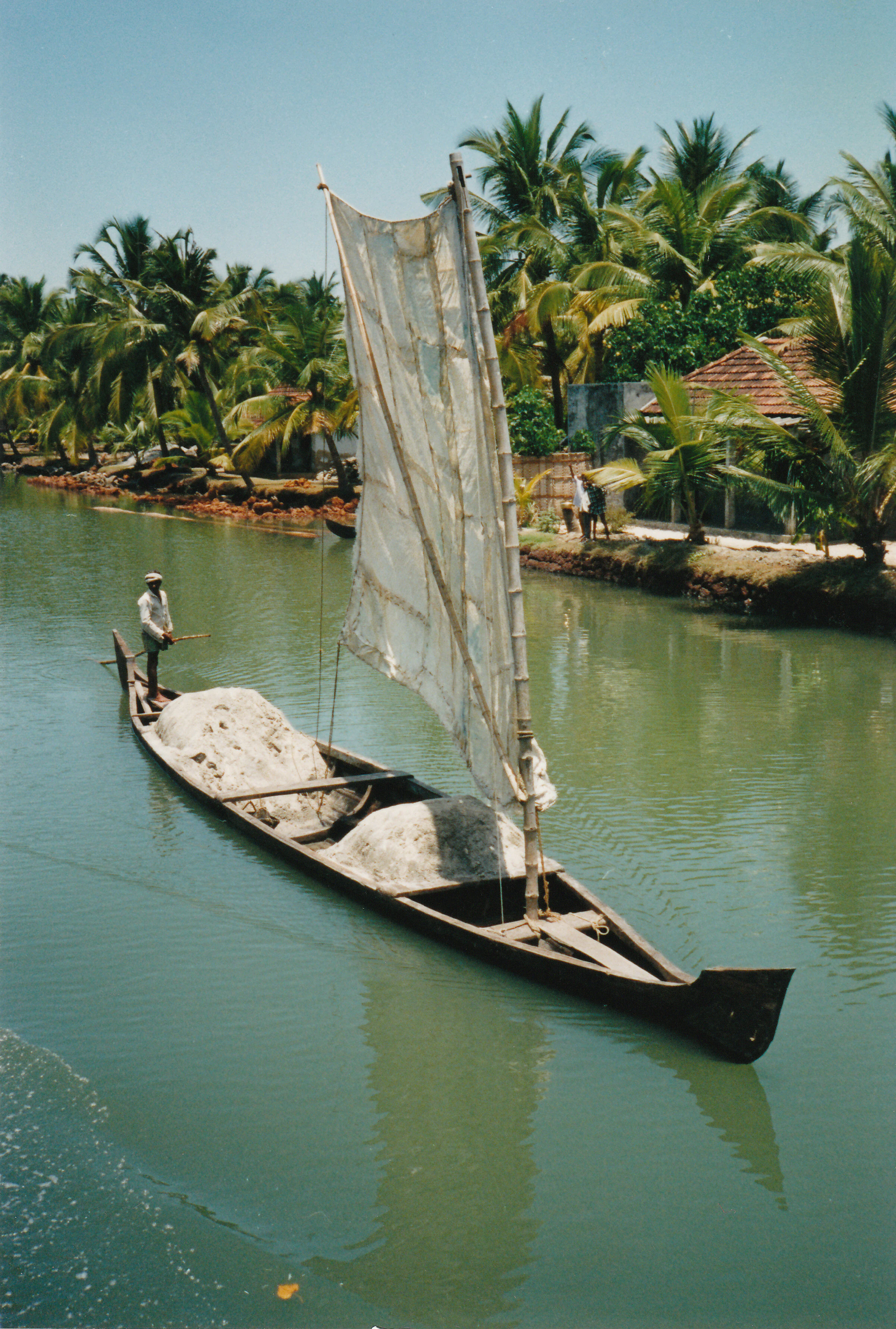
A traditional narrow wooden boat with a white sail carrying piles of goods navigates a calm, narrow waterway lined with coconut palm trees in Kerala, India.
A traditional merchant boat carrying cargo through the backwaters of Kerala.

Best time to visit Ashtamudi Lake

Ashtamudi Lake has a warm, humid tropical climate, with most of the rain arriving during the southwest and northeast monsoons. The post-monsoon months generally offer calmer waters, clearer skies, and more favorable conditions for houseboat cruises and birdwatching, when migratory waterfowl are present in larger numbers and salinity has not yet risen as sharply as in the drier pre-monsoon period. Visiting during the cooler, drier months tends to produce more pleasant conditions on the water, while monsoon visits are marked by higher freshwater inflow, greener surroundings, and distinctly fresher creek water even though weather can be unsettled.

Monthly climate preview

Long term representative measurements tracking twelve month temperature and precipitation trends

Ashtamudi Lake Climate Normals and Annual Temperature Patterns

Representative coordinates record measured monthly averages spanning from 1991 to 2020, capturing shifting temperature ranges and precipitation rates across the year. Examining the full twelve month profile provides deeper insight into long term climate rhythms at Ashtamudi Lake.
Annual mean26 °C
24 °C29 °C
Jan25°
Feb27°
Mar29°
Apr28°
May27°
Jun26°
Jul25°
Aug25°
Sep25°
Oct25°
Nov25°
Dec24°
Warmest month
March

28.5 °C

Coolest month
December

24.1 °C

Wettest month
June

11.6 mm/day

Driest month
January

0.5 mm/day

Park location guide

Geography guide, regional context, and park location map for Ashtamudi Lake

Ashtamudi Lake park geography, regions, and map view in India

Understand where Ashtamudi Lake sits in India through a broader geographic reading of the surrounding landscape, nearby location context, and its mapped position within the national park landscape.

How Ashtamudi Lake fits into India

India is a South Asian country bordered by the Indian Ocean, Arabian Sea, and Bay of Bengal. It shares land borders with Pakistan, China, Nepal, Bhutan, Bangladesh, and Myanmar. The country has a population of over 1.4 billion people and operates as a federal parliamentary republic with its capital in New Delhi.

Wider geography shaping Ashtamudi Lake in India

India occupies the Indian subcontinent in South Asia, bordered by the Arabian Sea to the southwest, the Bay of Bengal to the southeast, and the Indian Ocean to the south. It shares land borders with Pakistan to the west, China, Nepal, and Bhutan to the north, and Bangladesh and Myanmar to the east. The territory also includes the Andaman and Nicobar Islands in the Indian Ocean.

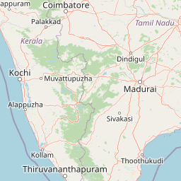
Map view of Ashtamudi Lake

Use this park location map to pinpoint Ashtamudi Lake in India, understand its exact geographic position, and read its mapped placement within the surrounding landscape more clearly.

Pigeon | © OpenStreetMap contributors

Location context for Ashtamudi Lake

Kerala

Explore photographic documentation of the eight branching arms, tidal channels, and coastal wetlands.

Visualizing Ashtamudi Lake: Landscape Scenery, Mangrove Habitats, and Estuary Photography

Visual records capture the distinctive palm-shaped topography and brackish ecosystems defining Ashtamudi Lake across its branching tidal arms. Photographic exploration reveals the protected wetland habitats, mangrove fringes, and coastal scenery shaping this significant Ramsar sanctuary.

A lone mangrove tree with arched prop roots growing directly out of calm, reflective water, with a blurred shoreline in the background.

A traditional wooden houseboat cruises under a concrete bridge spanning a wide lake, surrounded by lush green trees.

Two men standing in a wooden rowboat passing through a natural arch formed by overhanging mangrove tree branches on the calm waters of Ashtamudi Lake.

An aerial perspective of a large hotel complex situated on a lush, palm-covered peninsula surrounded by the calm, hazy waters of Ashtamudi Lake.

A traditional wooden houseboat floating on the calm waters of Ashtamudi Lake with a large resort building and dense palm trees on the shoreline.

A wide panoramic view of a calm, expansive lake with paved embankments, lush green vegetation on both sides, and a small boat moored near the water edge under a bright sky with scattered clouds.

A traditional houseboat with a thatched roof cruising on the calm waters of Ashtamudi Lake in Kerala, with several large Chinese fishing nets visible in the background against a backdrop of palm trees.

A traditional narrow wooden boat with a white sail carrying piles of goods navigates a calm, narrow waterway lined with coconut palm trees in Kerala, India.

A wide view of the calm waters of Ashtamudi Lake with dark palm fronds hanging from the top of the frame and a lush treeline visible across the horizon.

A sunset scene over calm water featuring traditional large wooden Chinese fishing nets, with a small boat nearby and palm trees on the distant shore.

A peaceful sunset view of Ashtamudi Lake in Kerala with a line of palm trees silhouetted against a golden sky and reflected in the calm water.

An elevated view of a wide lake in Kerala, India, featuring a traditional houseboat cruising through the center; palm trees line the shores.

A wide shot of Ashtamudi Lake in Kerala featuring calm dark water reflecting a multi-story building and surrounding palm trees under a pale blue sky.

A concrete road bridge supported by several pillars crossing a wide, calm river surrounded by dense green vegetation and forested hills.

A view from a moving train looking across a railway bridge that spans the calm waters of Ashtamudi Lake, with lush green palm trees along the distant shoreline under a cloudy sky.

A long, traditional houseboat with a thatched roof floating in a narrow canal filled with water hyacinths, framed by palm trees.

Park atlas

Compare adjacent coastal wetlands, tidal channels, and regional protected landscapes

Parks Near Ashtamudi Lake And Related Regional Protected Areas To Explore

Compare protected areas near Ashtamudi Lake to understand the broader network of coastal wetlands and tidal ecosystems across the region. Regional park exploration connects unique estuarine geography with adjacent wildlife habitats and protected natural landscapes.
A minimalist, stylized vector art illustration of a mountain lake with a waterfall cascading down a cliff, surrounded by a coniferous forest under a soft sun.
Protected areaKerala
About 9.6 km away#1 closest

Northeast

Sasthamkotta Lake Protected Area: Geography and Wetland Map Profile

Kerala's largest freshwater wetland and basin landscape

Investigate the territorial profile of Sasthamkotta Lake, an important Ramsar site in Kerala. This resource maps the lake's sheltered basin, shoreline hill contours, and connection to the alluvial plains of the Kallada River, highlighting its critical role in the regional hydrologic network.

Area
3.73 km²
Relief
Lowland
Climate
Tropical
Access
Easy access
National parkKerala
About 94 km away#2 closest

Northeast

Periyar National Park: National Park Protected Area Atlas and Geographic Context

Mapped protected lands and regional landscape exploration in Kerala.

Discover Periyar National Park as a distinct protected landscape offering rich geographic context for atlas exploration. This entry details its mapped boundaries and its significance within the broader regional geography of Kerala. Understand the natural terrain and protected-area distribution that makes Periyar National Park a key element in India's conservation mapping.

Area
350.54 km²
Established
1982
IUCN
II
Visitors
754.3K annual
Protected areaIndia
About 101 km away#3 closest

North

Vembanad Protected Area: Mapping India's Iconic Kerala Backwaters and Wetland Landscape

An extensive inland lake system featuring tidal lagoons, islets, and below-sea-level agricultural plains.

Spanning over 96 kilometers, Vembanad forms a sprawling wetland environment that acts as the primary drainage basin for much of Kerala. Analyze the geography of its intricate shorelines, mangrove patches, and historic islets like Pathiramanal. This protected zone provides a critical habitat for thousands of waterbirds while illustrating the complex relationship between coastal estuaries and human-managed landscapes.

Area
2,033.02 km²
Relief
Lowland
Climate
Tropical
Access
Easy access
National parkIdukki
About 132 km away#4 closest

Northeast

Mathikettan Shola National Park: National Park Exploration and Geographic Mapping

Discover its protected landscape and regional context.

Mathikettan Shola National Park, a designated national park in the Idukki region, offers a focal point for understanding protected landscapes and their geographic distribution. This entry details the park's mapped boundaries and its specific setting within the regional geography, providing an atlas-level view of its conservation value. Users can explore the structured geographic identity of this protected natural area, enriching their understanding of India's park network.

Area
12.82 km²
Established
2003
IUCN
II
Relief
Mountain
National parkKerala
About 139 km away#5 closest

North

Eravikulam National Park: National Park with Mapped Protected Boundaries in Kerala

Understanding its geographic setting and landscape identity.

Delve into the protected landscape of Eravikulam National Park, a significant national park located in Kerala. This detailed entry focuses on its geographic coordinates, mapped boundaries, and its role as a distinct protected area within the regional geography. It serves as a valuable resource for exploring the park's natural terrain and its importance in conservation landscapes.

Area
97 km²
Established
1978
IUCN
II
Visitors
148.4K annual
National parkKerala
About 148 km away#6 closest

Northeast

Anamudi Shola National Park: Protected Montane Forest and Wildlife Corridor in Kerala

Explore unique high-altitude ecosystems and regional landscape context.

Anamudi Shola National Park is a compact yet ecologically significant protected area situated in the Western Ghats of Kerala, India. Covering around 7.5 square kilometers, the park preserves rare montane shola forests at elevations exceeding 2,100 meters. Its identity as a critical wildlife corridor, connecting contiguous protected zones, is fundamental to its conservation value. The park's landscape, defined by its unique ecosystems and regional geographic position, offers valuable insights for atlas-driven exploration of protected natural areas.

Area
7.5 km²
Established
2003
IUCN
II
Relief
Mountain
National parkIndia
About 150 km away#7 closest

Northeast

Pampadum Shola National Park: India's Protected Area Landscape Details

Explore mapped terrain and geographic context for this national park.

Gain insight into Pampadum Shola National Park, a key protected area within India's geography. This park detail provides essential information on its designation as a national park, its mapped boundaries, and its contribution to the regional landscape. It serves as a vital point for understanding the distribution and character of protected lands across India, offering a foundation for structured geographic research and atlas-based discovery of natural environments.

Wildlife reserveIndia
About 169 km away#8 closest

North

Anaimalai Tiger Reserve: Wildlife Reserve Park Atlas and Geographic Context in India

Mapping protected landscapes and natural terrain of this Indian wildlife reserve.

Anaimalai Tiger Reserve is a significant wildlife reserve located in India, offering rich opportunities for geographic and atlas-based discovery. This page provides detailed information on its protected area status, mapped boundaries, and the surrounding natural landscape context. Delve into the park's specific geography to understand its role as a conservation area within the broader Indian subcontinent.

Common questions about visiting, size, designation, and location context for Ashtamudi Lake

Ashtamudi Lake FAQs for park facts, access, geography, and protected area context

Find quick answers about Ashtamudi Lake, including protected-area facts, park geography, trail and visitor context, and how the park fits into its surrounding country and regional landscape.
MoriAtlas Explorer

Continue Your Protected Areas Search Across the Global Atlas

Deepen your exploration by continuing the structured search for national parks and protected areas worldwide. Utilize the comprehensive filtering capabilities to compare different conservation landscapes and refine your understanding of global park geography. Discover more about the distribution and characteristics of protected natural areas.

Global natural geography