

Mori Atlas logo
National parkAuyuittuq National Park

Trace the mapped boundaries and geographic context of this Arctic protected area.

Auyuittuq National Park: Nunavut's Arctic National Park and Protected Landscape

Auyuittuq National Park stands as a significant protected landscape within Canada's vast Nunavut territory. As a designated National Park, it represents a unique segment of the Arctic region, offering a distinct geographic identity for atlas exploration. Understanding Auyuittuq National Park means delving into its role as a mapped protected area, contributing to the broader geographic understanding of Canadian conservation landscapes and their regional context.

Arctic wildernessNational parkBaffin IslandIce caps and glaciersFjordsMountain landscapes

Auyuittuq National Park

National park

Park overview

Structured park overview, official facts, and landscape profile for Auyuittuq National Park

Auyuittuq National Park park facts, protected area profile, and essential visitor context

Review the core facts for Auyuittuq National Park, including designation, size, terrain, visitor scale, habitats, and operating context in one park-focused overview.

About Auyuittuq National Park

Auyuittuq National Park protects a spectacular cross-section of Arctic terrain on Canada's eastern Arctic coast. The park occupies the Cumberland Peninsula of Baffin Island, extending from the coastal fjords of the Davis Strait coastline inland to the polar plateau of the Penny Ice Cap. This diversity of landscape provides protection for an exceptional range of Arctic environments, from sea-level coastal marshes to alpine tundra zones and permanent ice fields. The geological foundation consists of ancient Precambrian granite formations that have been carved by glacial processes over millennia, creating the dramatic vertical cliffs and deep valleys that characterize the region. The park lies entirely within the Arctic Circle, placing it in a region of extreme seasonal variation where summer brings continuous daylight while winter brings prolonged darkness. This harsh Arctic environment supports sparse but ecologically significant plant and animal communities that have adapted to survive in one of Earth's most challenging ecosystems.

Quick facts and research context for Auyuittuq National Park

Auyuittuq National Park is located on Baffin Island within the Arctic Circle in Canada's Nunavut territory. The park covers 21,470 square kilometres and contains the Penny Ice Cap, a major glacial system spanning about 6,000 square kilometres. Notable peaks include Mount Asgard with its distinctive 800-metre granite face and Mount Thor with a 1,250-metre vertical wall. The park lies within the Qikiqtaaluk Region, the largest political subdivision in Canada. The nearest communities are Pangnirtung and Qikiqtarjuaq, where visitors must register with Parks Canada before entering the park. The park is classified as IUCN Category II (national park) and receives a limited number of visitors each year due to its remote location and challenging Arctic conditions.

Protection and recognition

Documenting the formal designation history and management scope of the Arctic wilderness

Auyuittuq National Park Protection Status and Official Designation History

Establishment records for Auyuittuq National Park mark its transition to formal protection in the year 2000 with a mixed conservation scope. Analyzing the documented designation framework provides critical geographic context for evaluating the legal footprint of the Arctic territory.

Protection details

Protection scope
Mixed
Designated year
2000
Park context

Deeper park guide and search-rich context for Auyuittuq National Park

Auyuittuq National Park history, landscape, wildlife, and travel context

Explore Auyuittuq National Park through its history, landscape character, ecosystems, wildlife, conservation priorities, cultural context, and seasonal travel timing in a structured park guide built for atlas discovery and search intent.

Why Auyuittuq National Park stands out

Auyuittuq National Park is best known for its extraordinary Arctic mountain landscape and the iconic Akshayuk Pass, a renowned backpacking corridor that threads through dramatic glacial valleys between the Weasel and Owl rivers. The park contains some of the most impressive granite peaks in the Arctic, including Mount Asgard and Mount Thor, which have become legendary among mountaineers and adventure travelers. The Penny Ice Cap dominates the park's interior, feeding numerous glaciers including the Coronation Glacier. The combination of massive granite walls rising from glacial valleys, extensive ice fields, and deep fjords creates one of the most visually striking Arctic landscapes in North America. Despite the harsh environment, the park supports a resilient ecosystem including polar bears, beluga whales, narwhals, and migratory bird populations.

Auyuittuq National Park history and protected-area timeline

The establishment of Auyuittuq National Park represents a significant chapter in Canada's protected areas history. The park was first designated in 1972 under the name Baffin Island National Park, making it one of the earlier national park establishments in the Canadian Arctic. In 1975, Parks Canada initiated a process to rename the park to better reflect the local Inuit cultural context and the distinctive character of the landscape. After careful consideration of various proposals, the name Auyuittuq was selected, derived from the Inuktitut language and translating to "the land that never melts." This name captures the essence of the region's persistent ice and snow cover even during the brief summer season. The park operated as a national park reserve from 1972 until 2000, when it was upgraded to full national park status, reflecting Canada's commitment to permanent conservation protection for this Arctic wilderness area.

Auyuittuq National Park landscape and geographic character

The landscape of Auyuittuq National Park is defined by its dramatic mountainous terrain and extensive glacial features. The Baffin Mountains rise sharply from the surrounding terrain, with peaks reaching elevations that create stunning vertical relief. Mount Asgard is particularly notable for its twin granite domes and massive 800-metre face, while Mount Thor presents an impressive 1,250-metre vertical wall that ranks among the tallest cliff faces in the world. Between these peaks, deep glacial valleys have been carved over successive ice ages, now occupied by rivers such as the Weasel River and Owl River that flow through the Akshayuk Pass. The Penny Ice Cap covers approximately 6,000 square kilometres of the park's interior, a remnant of the continental ice sheets that once covered much of North America. This ice cap sits atop Precambrian granite bedrock and feeds numerous glaciers that descend toward the coast. Along the shoreline, deep narrow fjords cut into the land, providing dramatic transitions between mountain terrain and marine environments. The Akshayuk Pass corridor is famous for its consistently high winds, which can exceed 175 kilometres per hour, shaping the vegetation and creating a distinctive character for this穿越区域的通道.

Auyuittuq National Park ecosystems, habitats, and plant life

The Arctic ecosystem of Auyuittuq National Park is characterized by extreme environmental conditions that limit biological productivity but support specialized species adapted to polar conditions. Vegetation is sparse and low-growing, consisting primarily of tundra plants that hug the ground to avoid harsh winds. Species such as mountain avens, various saxifrages, Arctic willow, dwarf birch, and heather form intricate communities in sheltered locations. Many plants grow in dense clumps that create warmer microclimates around themselves, allowing them to survive the prolonged cold temperatures. The plant communities transition from coastal salt-tolerant species near the fjords to alpine tundra communities at higher elevations near the ice cap. Marine environments along the coastline support significantly more life than the terrestrial portions of the park, with the productive waters of the Davis Strait and adjacent fjords providing habitat for various marine mammals and fish species.

Auyuittuq National Park wildlife and species highlights

Despite the seemingly inhospitable Arctic environment, Auyuittuq National Park supports a diverse array of wildlife species adapted to polar conditions. The park's location along migration routes for marine mammals makes the coastal waters particularly important, with beluga whales, narwhals, and occasional bowhead whales appearing seasonally. Polar bears are resident in the coastal areas, where they hunt seals and scavenge along the ice edge. On land, Arctic foxes and red foxes are the primary mammalian predators, preying on the small rodent populations including lemmings and voles. Arctic hares are common throughout the tundra areas. The bird population includes both resident and migratory species, with snowy owls, peregrine falcons, rough-legged hawks, and gyrfalcons hunting over the terrain. Waterfowl including snow geese and Canada geese use the park during migration seasons. Barren-ground caribou herds occasionally traverse the area, though they are not permanent residents. The park's marine margins provide critical habitat for seals and walruses that haul out on coastal ice and rocky shorelines.

Auyuittuq National Park conservation status and protection priorities

Auyuittuq National Park represents Canada's commitment to preserving representative samples of Arctic ecosystems for future generations. The park protects a landscape that exemplifies the polar terrain of eastern Arctic Canada, including unique geological features, glacial systems, and the ecological communities that have adapted to these extreme conditions. The designation of this area as a national park ensures long-term protection for the cultural and natural values of the Cumberland Peninsula, including the traditional Inuit relationship with the land. Parks Canada manages the park with recognition of its ecological sensitivity, requiring visitors to register and attend orientation sessions before entering the backcountry. The limited visitor numbers reflect both the logistical challenges of accessing this remote location and the management approach that prioritizes wilderness preservation over high-volume tourism. Research and monitoring programs within the park contribute to understanding climate change impacts on Arctic ecosystems.

Auyuittuq National Park cultural meaning and human context

The lands within Auyuittuq National Park have been inhabited by Inuit peoples for thousands of years, with the cultural landscape reflecting millennia of human activity in this Arctic environment. The selection of the Inuktitut name Auyuittuq for the park in 1976 acknowledged the deep cultural connections between the Inuit of the Cumberland Peninsula and this northern landscape. Traditional place names, travel routes, and seasonal hunting and fishing areas are embedded throughout the park's geography, representing Indigenous knowledge systems that have evolved over generations of living in close relationship with the Arctic environment. The contemporary communities of Pangnirtung and Qikiqtarjuaq maintain strong connections to the park lands, with residents continuing traditional activities in the surrounding areas. These communities serve as gateways for park visitors and play essential roles in the park's management through collaborative planning processes. The cultural context emphasizes that national parks in Canada's North are managed with recognition of Indigenous rights and the ongoing presence of Inuit communities in these landscapes.

Top sights and standout views in Auyuittuq National Park

The Akshayuk Pass remains the park's signature backcountry experience, offering hikers the opportunity to traverse a dramatic valley corridor flanked by towering granite peaks and glacial features. Mount Asgard and Mount Thor are internationally recognized among climbing and hiking enthusiasts for their exceptional granite formations. The Penny Ice Cap provides access to glacial environments that offer insight into Arctic glaciology and landscape formation. Coastal fjords such as Pangnirtung Fiord showcase the dramatic meeting point of mountain and sea that characterizes this Arctic coastline. Wildlife viewing opportunities, particularly for marine mammals along the coast and migratory birds during appropriate seasons, add biological richness to the landscape-focused attractions. The experience of traveling through a landscape that remains genuinely remote and wild, far from the development and infrastructure common in more accessible parks, represents a distinctive highlight for those who make the journey to this northern preserve.

Best time to visit Auyuittuq National Park

The optimal visiting window for Auyuittuq National Park occurs during the brief Arctic summer, typically from mid-June through late August, when temperatures rise above freezing and continuous daylight transforms the landscape. July and August offer the warmest conditions and the most accessible hiking routes, though weather remains highly variable and conditions can change rapidly. During this period, temperatures may reach comfortable levels in the valleys but can remain cool and windy, particularly in exposed areas like the Akshayuk Pass. The midnight sun provides extended daylight hours for hiking and exploration. Late summer may bring the first autumn conditions, including snow at higher elevations and the return of colder temperatures. Winter visits are possible but require specialized equipment and expertise for the extreme cold, darkness, and challenging travel conditions that characterize the Arctic winter. Spring and fall transitions are generally considered poor seasons for visitation due to variable weather, limited services, and challenging trail conditions.
Monthly climate preview

Track long-term temperature patterns and precipitation trends across the year

Climate Normals and Average Temperature for Auyuittuq National Park

Long-term measurements at a representative low-elevation coordinate show a severe Arctic temperature cycle where monthly averages stay below freezing for most of the year and daily precipitation remains low. Exploring the detailed monthly weather patterns reveals critical shifts in sub-zero minimums, brief summer melt windows, and year-round precipitation averages.
Annual mean-10 °C
-25 °C4 °C
Jan-24°
Feb-25°
Mar-22°
Apr-15°
May-6°
Jun
Jul
Aug
Sep
Oct-4°
Nov-12°
Dec-20°
Warmest month
July

3.9 °C

Coolest month
February

-25.1 °C

Wettest month
August

2.1 mm/day

Driest month
February

0.6 mm/day

Park location guide

Geography guide, regional context, and park location map for Auyuittuq National Park

Auyuittuq National Park park geography, regions, and map view in Canada

Understand where Auyuittuq National Park sits in Canada through a broader geographic reading of the surrounding landscape, nearby location context, and its mapped position within the national park landscape.

How Auyuittuq National Park fits into Canada

Canada is a federal parliamentary constitutional monarchy spanning North America from the Atlantic to the Pacific and Arctic Oceans. With a population of over 41 million, it is officially bilingual in English and French at the federal level. The country gained independence from the United Kingdom through a gradual process culminating in 1982.

Wider geography shaping Auyuittuq National Park in Canada

Canada occupies the northern portion of North America, sharing its longest international border with the United States. The country extends from the Atlantic Ocean to the Pacific Ocean and northward into the Arctic Ocean, giving it the longest coastline of any nation.

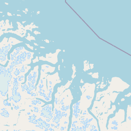
Map view of Auyuittuq National Park

Use this park location map to pinpoint Auyuittuq National Park in Canada, understand its exact geographic position, and read its mapped placement within the surrounding landscape more clearly.

Pigeon | © OpenStreetMap contributors

Location context for Auyuittuq National Park

NunavutQikiqtaaluk Region
Natural feature types

Explore the Full Collection of Natural Features in Auyuittuq National Park

Continue your geographic exploration of Auyuittuq National Park by browsing this structured index of natural features. MoriAtlas provides detailed context on the peaks, glaciers, and fjords that define the landscape, mapping the diverse physical elements of this remote Arctic territory.
Recorded earthquake history

Browse the Historical Earthquake Catalogue for Auyuittuq National Park

Consult the repository of recorded seismic events associated with the geography of Auyuittuq National Park. This archive offers a detailed look at past activity through documented magnitude and epicentre data, providing a clear reference for those examining the seismic history of this Arctic region.

Auyuittuq National Park Earthquake History

Catalogued events

5 events

Strongest magnitude

Magnitude 5.1

Most recent event

Oct 29, 2021

This history includes earthquakes recorded inside the park or within 50 km of its borders

Park atlas

Trace the regional spread of protected Arctic wilderness and compare diverse Canadian park geography.

Discover Nearby National Parks and Protected Areas Beyond Auyuittuq National Park

Expand your exploration from Auyuittuq National Park to browse other national parks and protected areas featuring comparable Arctic wilderness, glaciated terrain, or remote mountain landscapes in Canada. Compare distinct conservation areas and diverse geographic characteristics, providing a deeper atlas view of protected natural environments within the broader northern region.
Wildlife reserveQikiqtaaluk
47 km away#1 closest

Southeast

Qaqulluit National Wildlife Area: Protected Marine Geography and Arctic Cliff Landscapes

A remote wildlife reserve along the eastern Arctic coastline.

Qaqulluit National Wildlife Area is a strictly protected reserve in Nunavut, recognized for its concentration of seabird nesting cliffs at Cape Nuvuttiq. The geography is defined by the sharp transition between towering rock walls and cold marine waters, creating a unique coastal environment that supports significant Arctic breeding colonies and marine mammals.

Area
398.21 km²
Established
2010
IUCN
Ib
Wildlife reserveNunavut
107 km away#2 closest

Northwest

Ninginganiq National Wildlife Area: Geographic Overview and Protected Landscape Mapping

A vital Arctic wildlife reserve on Baffin Island, Nunavut.

Ninginganiq National Wildlife Area stands as a cornerstone of Arctic conservation, encompassing the fog-defined shores of Isabella Bay. This protected area on Baffin Island serves as a critical seasonal feeding ground for bowhead whales and protects a vast expanse of tundra, marine inlets, and coastal ecosystems. Its establishment reflects a cooperative stewardship model between the federal government and Inuit communities, grounding this reserve in both ecological importance and cultural history.

Area
3,362 km²
Established
2010
IUCN
Ib
Relief
Lowland
National parkNewfoundland and Labrador
671 km away#3 closest

South

Torngat Mountains National Park: National Park Atlas and Protected Landscape Exploration

Explore the mapped geography and protected status of this Canadian national park.

Gain a structured understanding of Torngat Mountains National Park, a protected national park in Newfoundland and Labrador. This destination focuses on its geographic identity, mapped boundaries, and place within the broader regional landscape of the Canadian Arctic. Discover the park's terrain and conservation context, essential for anyone exploring Canada's protected areas and natural geography.

Area
9,700 km²
Established
2008
IUCN
II
Visitors
599 annual
Wildlife reserveNunavut
719 km away#4 closest

West

Refuge d'oiseaux de la baie Est: Protected Coastal Landscapes on Southampton Island

Wildlife reserve in the Nunavut territory of Canada

Refuge d'oiseaux de la baie Est functions as a federally protected sanctuary within the Hudson Strait ecosystem. The terrain is characterized by broad intertidal flats, coastal saltmarshes, and low-lying tundra that supports migratory birds at the edge of their Arctic breeding range. This site maps as a cornerstone of conservation in the Kivalliq region, safeguarding seasonal habitats from the coast to the inland wetlands.

Area
1,128.11 km²
Established
1959
IUCN
Ib
Relief
Lowland
National parkNunavut
About 726 km away#5 closest

Northwest

Sirmilik National Park: Nunavut National Park Atlas and Protected Landscape Map

Explore the geographic boundaries and regional context of Sirmilik National Park.

This entry provides detailed insights into Sirmilik National Park, a designated national park situated in Nunavut, Canada. It serves as a focal point for understanding the park's specific geography, its mapped protected landscape, and its role within the regional atlas. Users can explore the park's defined boundaries and its contribution to the broader landscape context of Nunavut, making it an essential destination for detailed geographic discovery.

Area
22,200 km²
Established
2001
IUCN
II
Visitors
6 annual
National parkNunavut
871 km away#6 closest

West

Ukkusiksalik National Park: Nunavut Protected Area Geography and Map Context

Explore the protected landscape and mapped terrain of this Canadian National Park.

Ukkusiksalik National Park serves as a protected national park within Nunavut, offering a distinct geographic identity. This entry provides structured insights into the park's mapped boundaries and its surrounding regional landscape, facilitating a deeper understanding of its place within the broader atlas of protected areas. Examine the geographic context and discover the unique attributes of Ukkusiksalik National Park's protected territory.

Area
20,885 km²
Established
2003
IUCN
II
Relief
Mixed relief
Watercolor illustration of green rolling hills and a body of water under a pale sky
National parkGreenland
888 km away#7 closest

Northeast

Northeast Greenland National Park: Arctic Wilderness and Protected Landscape Atlas

Explore the world's largest national park and its mapped terrain.

Northeast Greenland National Park represents an extraordinary expanse of Arctic wilderness, renowned as the largest protected area globally. This national park protects a diverse landscape, from the interior Greenland Ice Sheet to dramatic glacial fjords and ice-free polar desert regions. Discover its extensive mapped boundaries and its significance as a sanctuary for vital Arctic megafauna, offering a profound case study in large-scale protected landscape geography.

Area
972,000 km²
Established
1974
IUCN
II
Relief
Mixed relief
National parkNunavut
1,342 km away#8 closest

Northwest

Qausuittuq National Park: Explore Nunavut's Protected National Park Landscape and Geography

Mapped protected area boundaries and regional geographic context.

Delve into Qausuittuq National Park, a key protected area in Nunavut offering rich opportunities for geographic exploration. This destination provides detailed mapping of its protected boundaries and a comprehensive overview of its landscape context within the Arctic region. Discover how Qausuittuq National Park contributes to the mapped protected lands of Canada, ideal for users seeking structured geographic data and atlas-style discovery.

Area
11,000 km²
Established
2015
IUCN
II
Relief
Upland

Common questions about visiting, size, designation, and location context for Auyuittuq National Park

Auyuittuq National Park FAQs for park facts, access, geography, and protected area context

Find quick answers about Auyuittuq National Park, including protected-area facts, park geography, trail and visitor context, and how the park fits into its surrounding country and regional landscape.
MoriAtlas Explorer

Continue Your Protected Areas Search Across the Global Atlas

Deepen your exploration by continuing the structured search for national parks and protected areas worldwide. Utilize the comprehensive filtering capabilities to compare different conservation landscapes and refine your understanding of global park geography. Discover more about the distribution and characteristics of protected natural areas.

Global natural geography
