

Mori Atlas logo
Biosphere reserveBarkindji Biosphere Reserve

A vital transition zone of riverine wetlands, sand plains, and semi-arid woodland ecosystems

Barkindji Biosphere Reserve: Mapped Protected Landscapes along the Murray River in New South Wales

Barkindji Biosphere Reserve encompasses a diverse protected landscape where riverine environments meet the semi-arid terrain of the Murray-Darling Basin. This expanse features a mosaic of wetlands, floodplains, dunes, and mallee-style woodland, reflecting the ecological complexity of southeastern Australia. Its designated boundaries integrate various land tenures to conserve the natural intersection of arid inland geography and significant river corridors.

biosphere reserveMurray Riverfloodplainwetlandsdunessand plains

Barkindji Biosphere Reserve

Biosphere reserve

Park overview

Structured park overview, official facts, and landscape profile for Barkindji Biosphere Reserve

Barkindji Biosphere Reserve park facts, protected area profile, and essential visitor context

Review the core facts for Barkindji Biosphere Reserve, including designation, size, terrain, visitor scale, habitats, and operating context in one park-focused overview.

About Barkindji Biosphere Reserve

The Barkindji Biosphere Reserve occupies a strategic position along the lower Murray River, where the river forms the border between New South Wales and Victoria. The reserve sits near Mildura, an important regional hub in the Sunraysia area, and stretches across nearly 1,900 square kilometers of land adjacent to one of Australia's most significant waterways.

Landscape within the reserve is unusually varied for a semi-arid region. Eleven distinct land systems cross the area, producing a mosaic that includes red-earth dunes, sand plains, grey and brown clay soils, calcareous sands and siliceous sands. The wetlands along the Murray River contrast sharply with shrublands and semi-arid forest patches further from the watercourse. Subdued mountain ranges frame much of the reserve, while the southwestern portion opens into broader lowland country.

The reserve's profile is shaped by its position within the Murray-Darling Basin, the largest river basin in Australia. This positioning gives Barkindji both ecological and hydrological importance, since wetland and floodplain habitats here are directly influenced by the flow regime of the Murray River. The reserve's composition of dunes, floodplains and forest patches reflects the broader patterns of inland southeast Australia, where ancient landscapes, river action and semi-arid climate have together produced a patchwork of habitats.

Beyond its ecological value, the reserve is significant for cultural reasons. Its name reflects the Barkindji (also spelled Barka) people, the Traditional Owners of the country along the lower Murray River. The bioregional identity, the mix of conservation reserves, pastoral land and Aboriginal-acknowledged areas help distinguish Barkindji from neighboring parks and reserves in the Murray-Darling system.

Quick facts and research context for Barkindji Biosphere Reserve

Barkindji Biosphere Reserve sits within the Murray-Darling Basin in southeast Australia and straddles the New South Wales and Victoria border along the Murray River, close to Mildura. Established in 2005 and recognized by UNESCO in 2016, it covers a substantial area of dune country, floodplain, wetland and semi-arid woodland. The reserve combines government conservation land, such as Neds Corner Station and Culpra forest, with privately owned properties, and is managed jointly by state agencies, conservation organizations and Traditional Owners.

Protection and recognition

Examine the terrestrial protection scope and documented designation year for Barkindji Biosphere Reserve.

Barkindji Biosphere Reserve Protection Status and Designation History

Barkindji Biosphere Reserve features a terrestrial protection scope established in the year 2016 for long-term environmental oversight. Review the structured conservation records and designation history associated with this protected natural landscape.

Protection details

Protection scope
Terrestrial
Designated year
2016
Transboundary protection
No
Park context

Deeper park guide and search-rich context for Barkindji Biosphere Reserve

Barkindji Biosphere Reserve history, landscape, wildlife, and travel context

Explore Barkindji Biosphere Reserve through its history, landscape character, ecosystems, wildlife, conservation priorities, cultural context, and seasonal travel timing in a structured park guide built for atlas discovery and search intent.

Why Barkindji Biosphere Reserve stands out

Barkindji Biosphere Reserve is best known for its role as a meeting point between the Murray River corridor and the surrounding semi-arid Australian landscape. It captures a transition zone where floodplain wetlands give way to dunes, sand plains, shrublands and mallee-style woodland, all within one of the country's most important river basins. The reserve is also recognized for bringing together diverse land tenures: pastoral properties, state-owned reserves and Aboriginal-acknowledged country under a single biosphere framework. Its recognition by UNESCO highlights both its ecological variability and its integration of conservation with cultural recognition of the Barkindji people.

Barkindji Biosphere Reserve history and protected-area timeline

The Barkindji Biosphere Reserve was formally established in July 2005 as a coordinated conservation area along the Murray River. Its creation brought together a diverse set of landholdings, including Neds Corner Station on the south side of the river west of Mildura, Culpra Forest and the Kamendoc Nature Reserve north of the river southeast of Mildura, and a range of properties surrounding and to the north of Mildura, including the Australian Inland Botanic Gardens.

The reserve was structured as a partnership between government agencies, private organizations and individual landholders. Private-sector involvement came through Barkindji Biosphere Ltd and the Australian Inland Botanic Gardens, while government participation included the New South Wales Department of Infrastructure, Planning and Natural Resources, the Victorian Department of Sustainability and Environment, the Trust for Nature (Victoria) and Lower Murray Water. Individual landholders, including Terry Hill and Dudley Marrows, also played a direct role in the reserve's management arrangements.

The reserve's profile grew significantly in 2016 when UNESCO described Barkindji within its biosphere reserve network, recognizing the area's ecological diversity and its place within the Murray-Darling Basin. This international recognition highlighted the reserve's mixture of dune systems, floodplains, wetlands and semi-arid forest, along with the cultural significance of its name, which acknowledges the Barkindji people as the Traditional Owners of the region.

Barkindji Biosphere Reserve landscape and geographic character

The landscape of the Barkindji Biosphere Reserve is defined by the transition between river country and inland semi-arid terrain. The Murray River runs through the reserve, forming part of the border between New South Wales and Victoria, and its floodplain contributes extensive wetland and floodplain land systems to the broader area.

Away from the river, the topography shifts into a mosaic of dunes and sand plains. Eleven different land systems are recognized across the reserve, producing a varied terrain of red earths, grey and brown clays, calcareous sands and siliceous sands. This abrupt soil variability is mirrored by abrupt habitat variability, with sudden shifts between wetland vegetation and shrubland or semi-arid forest.

Subdued mountain ranges rise around much of the reserve, particularly to the north, east and southeast, while the southwestern portion of the reserve opens into broader lowland country. The combination of running water, floodplain, dune systems and ranges gives Barkindji a layered landscape that is unusual for a single protected area in inland southeast Australia.

Barkindji Biosphere Reserve ecosystems, habitats, and plant life

The park protects an ecological gradient that runs from the River Red Gum-dominated wetlands of the Murray River floodplain to the dry shrublands and semi-arid forests of the surrounding dunes and plains. Wetland areas follow the river closely, while sand-plain and dune systems further from the watercourse support hardier, drought-adapted plant communities.

One of the reserve's most distinctive ecological characteristics is the close proximity of very different habitat types. Wetlands, shrublands and semi-arid forests occur within short distances of one another, often separated by sharp soil transitions rather than gradual climatic shifts. This ecological patchwork is a defining feature of the reserve and contributes to its biodiversity value.

The reserve also sits within the larger Murray-Darling Basin, which links its local ecosystems to continent-scale patterns of water flow, floodplain inundation and drought. As a result, Barkindji captures both the micro-scale variability of sandstone-derived, dune and floodplain soils and the broader ecological dynamics of Australia's largest river system.

Barkindji Biosphere Reserve wildlife and species highlights

Wildlife within the Barkindji Biosphere Reserve reflects the reserve's placement at the meeting point of riverine and arid environments. Wetland corridors along the Murray River support waterbirds and other species dependent on the river's flow regime, while the surrounding sand-plain and shrubland habitats support fauna adapted to semi-arid conditions.

The contrast between wetland and dry-country habitats within a single reserve creates opportunities for a wide range of birdlife, including species that rely on floodplain wetlands alongside those characteristic of mallee and shrubland environments. Smaller mammals, reptiles and invertebrates typical of inland southeast Australia are also present across the reserve's drier land systems.

The presence of large tracts of connected habitat, particularly through Neds Corner Station, Culpra Forest and the Kamendoc Nature Reserve, supports ecological processes that would not be sustained in smaller, fragmented protected areas. This connectivity strengthens the reserve's value for wildlife conservation in the Murray-Darling system.

Barkindji Biosphere Reserve conservation status and protection priorities

Barkindji Biosphere Reserve provides an important conservation framework for the lower Murray River region, combining multiple land tenures into a coordinated protected-area system. The reserve's recognition by UNESCO reflects its significance within the Murray-Darling Basin, Australia's largest river basin, and the broader international effort to protect examples of semi-arid riverine landscapes.

The reserve's conservation value lies in its combination of habitat diversity and scale. By including pastoral land, state reserves and private properties under a biosphere framework, Barkindji extends protection beyond the boundaries of formal reserves and allows for ecologically sensitive management across the broader landscape.

Its position within the Murray-Darling Basin also gives the reserve a role in capturing the ecological dynamics of one of Australia's most hydrologically altered systems. The mix of wetland, floodplain, dune and semi-arid forest habitats means that Barkindji contributes to conservation goals across multiple bioregions, rather than representing a single habitat type.

Barkindji Biosphere Reserve cultural meaning and human context

The reserve carries the name of the Barkindji (also known as Barka) people, the Aboriginal Traditional Owners of the country along the lower Murray River near Mildura. Naming the biosphere reserve after this group acknowledges the long-standing Aboriginal connection to the landscape and reflects contemporary Australian approaches to pairing conservation recognition with cultural recognition.

The reserve's land mosaic, including pastoral properties such as Neds Corner Station, state reserves like Culpra Forest and the Kamendoc Nature Reserve, and the Australian Inland Botanic Gardens, reflects the layered human history of the region. The area combines traditional Aboriginal land, historical pastoral use, state-led conservation and private stewardship, giving the reserve a complex cultural as well as ecological identity.

Top sights and standout views in Barkindji Biosphere Reserve

Barkindji Biosphere Reserve stands out for the unusual closeness of wetland, floodplain, dune and semi-arid forest habitats within a single protected area. Its position along the Murray River, near Mildura and within the Murray-Darling Basin, gives it both ecological and geographic significance.

Other highlights include its recognition by UNESCO in 2016, its management partnership between state agencies, conservation organizations and individual landholders, and its acknowledgment of the Barkindji people as the Traditional Owners of the country it protects.

Best time to visit Barkindji Biosphere Reserve

The climate of the Barkindji Biosphere Reserve is semi-arid, with hot, dry summers and cooler winters. Spring and autumn typically offer the most comfortable conditions for experiencing the landscape, when temperatures are milder and the contrast between green floodplain vegetation and dry surrounding country is most visible. Winter brings cooler weather and is often a productive time for observing waterbirds along the Murray River wetlands, while summer conditions can be harsh in exposed dune and sand-plain country.
Monthly climate preview

Long-term monthly averages for temperature and precipitation patterns

Barkindji Biosphere Reserve Climate Normals and Temperature Rhythms

Representative coordinates record measured monthly temperature swings and precipitation averages across the protected area from 1991 to 2020. Reviewing the complete twelve-month climatology data provides deeper insight into annual environmental rhythms.
Annual mean18 °C
10 °C27 °C
Jan27°
Feb26°
Mar23°
Apr18°
May14°
Jun11°
Jul10°
Aug11°
Sep15°
Oct18°
Nov22°
Dec25°
Warmest month
January

27 °C

Coolest month
July

9.9 °C

Wettest month
February

1.1 mm/day

Driest month
March

0.5 mm/day

Park location guide

Geography guide, regional context, and park location map for Barkindji Biosphere Reserve

Barkindji Biosphere Reserve park geography, regions, and map view in Australia

Understand where Barkindji Biosphere Reserve sits in Australia through a broader geographic reading of the surrounding landscape, nearby location context, and its mapped position within the national park landscape.

How Barkindji Biosphere Reserve fits into Australia

Australia is a constitutional monarchy and federal parliamentary democracy comprising six states and ten territories. With a population of nearly 28 million, it is one of the world's most urbanised countries, with most people concentrated on the eastern seaboard. The country has a high Human Development Index and is known for its cultural diversity, ancient Aboriginal heritage, and unique wildlife.

Wider geography shaping Barkindji Biosphere Reserve in Australia

Australia occupies the entire Australian continent, the island of Tasmania, and numerous smaller islands. It is the world's flattest and driest inhabited continent, featuring vast deserts in the interior (the Outback), tropical rainforests along the eastern coast, and a coastline bordering the Indian and Pacific Oceans.

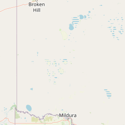
Map view of Barkindji Biosphere Reserve

Use this park location map to pinpoint Barkindji Biosphere Reserve in Australia, understand its exact geographic position, and read its mapped placement within the surrounding landscape more clearly.

Pigeon | © OpenStreetMap contributors

Location context for Barkindji Biosphere Reserve

New South WalesVictoria
Park atlas

Compare regional riverine ecosystems, arid terrain, and connected conservation landscapes.

Explore Parks Near Barkindji Biosphere Reserve and Surrounding Protected Areas

Browse other parks near Barkindji Biosphere Reserve to examine how river corridors transition into semi-arid woodland and sand plains across the wider region. Comparing adjacent protected areas reveals the complex environmental gradients that shape southeast Australian river basins.
National parkAustralia
About 21 km away#1 closest

Southwest

Murray-Sunset National Park: Iconic Pink Lakes and Mallee Wilderness in Victoria's Semi-Arid Interior

Explore its unique landscape, mapped boundaries, and regional geography.

Murray-Sunset National Park offers a compelling glimpse into Australia's semi-arid heart, featuring a dramatic landscape of salt lakes, gypsum plains, extensive sand dunes, and dense mallee woodlands. This vast protected area is renowned for the vibrant pink hue of its salt lakes, a phenomenon created by microscopic algae that flourishes in the hypersaline conditions during warmer months. The park's rich biodiversity and unique ecosystem make it a significant conservation asset, providing crucial habitat for numerous species adapted to this challenging yet beautiful environment.

Area
6,330 km²
Established
1991
IUCN
II
Relief
Lowland
Biosphere reserveVictoria
About 25 km away#2 closest

Southeast

Hattah-Kulkyne and Murray-Kulkyne Biosphere Reserve: Protected Geography and Mapped Landforms

An inland mosaic of river corridors and semi-arid mallee habitats.

Located in northwestern Victoria, this biosphere reserve encompasses a distinct ecological assembly of Hattah lakes, seasonal floodplains, and sand-ridge terrains. Understand the interplay between the Murray River system and the surrounding dryland vegetation through detailed geographic context.

Area
515 km²
Established
1981
Visitors
99K annual
Relief
Lowland
National parkNew South Wales
About 38 km away#3 closest

East

Mallee Cliffs National Park: Protected Landscape and Geographic Atlas Entry

Explore its mapped boundaries and regional New South Wales context.

Mallee Cliffs National Park is presented here as a distinct protected landscape, offering specific insights for atlas and geographic discovery. This entry details the park's national park designation and its position within New South Wales, highlighting its mapped boundaries and the surrounding regional geography. It provides the foundational geographic context needed to understand Mallee Cliffs National Park's presence within the broader landscape of protected areas, inviting detailed exploration for those interested in mapped natural terrain.

Area
579.69 km²
Established
1977
IUCN
II
Relief
Lowland
National parkAustralia
About 45 km away#4 closest

South

Hattah-Kulkyne National Park: Victoria's Ramsar Wetland National Park & Mallee Landscape

Explore its mapped protected area and semi-arid regional geography.

Delve into Hattah-Kulkyne National Park, a substantial protected area in northwestern Victoria, Australia, defined by its striking red-earth terrain and sprawling mallee woodlands. This national park is renowned for its dynamic seasonal lake system, a key component of the Murray River basin's wetland geography. The park's status as a Ramsar-designated wetland highlights its ecological importance, providing critical habitat within a distinct semi-arid environment. Discover the unique atlas-scale landscape character and protected land context of this significant Australian natural area.

Area
480 km²
Established
1960
IUCN
II
Relief
Lowland
National parkNew South Wales
About 84 km away#5 closest

Northeast

Mungo National Park: Protected Landscape Atlas and Geographic Context

Explore mapped boundaries and regional terrain within New South Wales.

Mungo National Park offers a distinct focus for atlas exploration, presenting itself as a key protected landscape within the state of New South Wales, Australia. This entry details the park's geographic positioning and mapped boundaries, allowing for a clear understanding of its terrain and regional context. Engage with the park's identity as a protected area, uncovering the specifics of its natural landscape for a richer geographic discovery experience.

Area
1,109.67 km²
Established
1979
IUCN
II
Relief
Lowland
Nature reserveNew South Wales
About 114 km away#6 closest

Northwest

Scotia Sanctuary: Protected Nature Reserve and Mallee Landscape Geography in New South Wales

Arid zone conservation and dune-swale mapping.

Scotia Sanctuary serves as a primary example of arid-zone conservation in south-western New South Wales. This reserve protects vast tracts of intact eucalypt mallee shrubland and sheoak woodland, set across a distinctive landscape of parallel sand dunes and calcareous swales. Its geographic position within the Murray-Darling Depression makes it a critical site for understanding the intersection of land management, habitat restoration, and regional ecological patterns.

Area
650 km²
Established
1994
Relief
Lowland
Climate
Arid
National parkAustralia
About 122 km away#7 closest

South

Wyperfeld National Park: Mapping Victoria's Vast Mallee Semi-Arid Wilderness and Sandhill Landscapes

Discover the unique geography and protected terrain of this significant Australian national park.

Wyperfeld National Park in Victoria, Australia, is a prime example of a vast semi-arid wilderness landscape. It is best known for its extensive sandhill formations, referred to as 'snowdrifts,' which punctuate the otherwise flat terrain. The park also protects a significant ephemeral lake system and is a stronghold for the mallee ecosystem, offering a unique context for understanding dryland conservation and mapped natural areas. Its protected status highlights its importance within the broader geographic context of Australia's protected landscapes.

Area
3,570 km²
Established
1921
IUCN
II
Relief
Lowland
National parkSouth Australia
About 127 km away#8 closest

West

Murray River National Park: Protected Wetland Ecosystems in South Australia

Explore South Australia's unique river red gum floodplains.

Murray River National Park is a significant protected area in South Australia, renowned for its expansive wetland and floodplain environments situated along the Murray River. This national park preserves crucial habitats within the Murray-Darling Basin, characterized by river red gum woodlands, permanent water bodies, and dynamic seasonal floodplains. Its detailed maps and geographic context offer deep insights into one of Australia's most important riverine conservation landscapes.

Area
148.79 km²
Established
1991
IUCN
VI
Relief
Lowland

Common questions about visiting, size, designation, and location context for Barkindji Biosphere Reserve

Barkindji Biosphere Reserve FAQs for park facts, access, geography, and protected area context

Find quick answers about Barkindji Biosphere Reserve, including protected-area facts, park geography, trail and visitor context, and how the park fits into its surrounding country and regional landscape.
MoriAtlas Explorer

Continue Your Protected Areas Search Across the Global Atlas

Deepen your exploration by continuing the structured search for national parks and protected areas worldwide. Utilize the comprehensive filtering capabilities to compare different conservation landscapes and refine your understanding of global park geography. Discover more about the distribution and characteristics of protected natural areas.

Global natural geography