
Mori Atlas logo
National parkBarmah National Park

Discover the mapped boundaries and unique protected landscape of this vital Murray River floodplain.

Barmah National Park: Australia's Vast River Red Gum Forest and Ramsar Wetland

Barmah National Park protects the planet's largest contiguous river red gum woodland, a nationally significant protected area situated within the Murray River floodplain in Victoria, Australia. This expansive landscape is characterized by towering red gums interspersed with freshwater marshes, forming a critical Ramsar-listed wetland ecosystem of global ecological importance. Users can explore the park's unique geography, mapped terrain, and its role as a vital protected natural area through its detailed atlas representation.

River Red Gum ForestWetlandRamsar SiteMurray RiverFloodplainVictoria
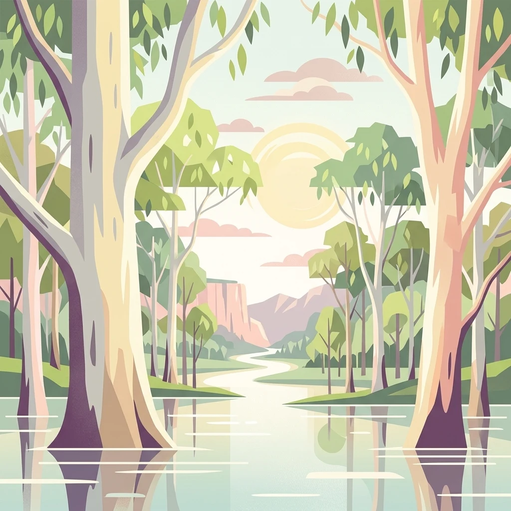
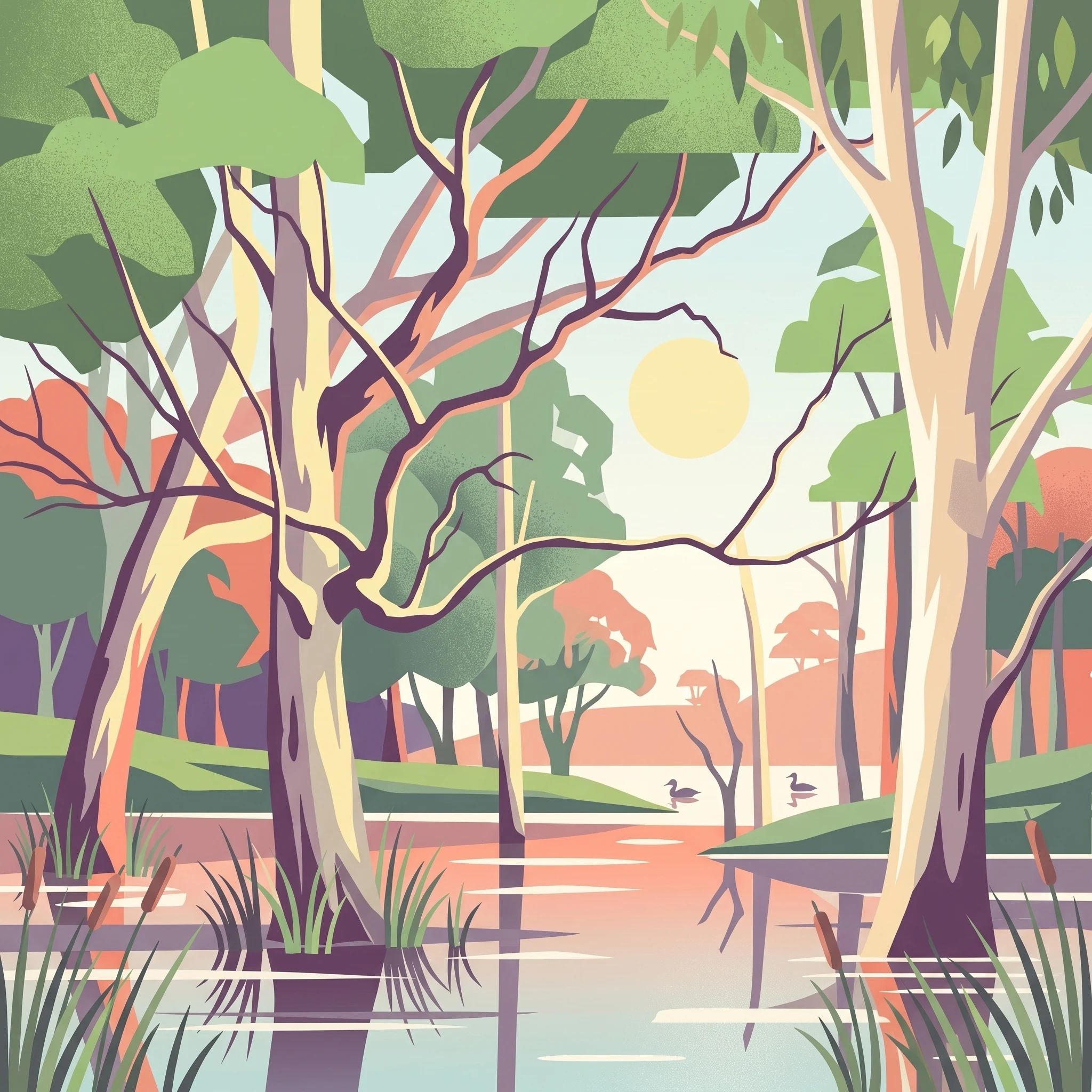
Illustration showing a river flowing through a forest with tall trees and reflections in the water, hills in the background

Barmah National Park

National park

Park overview

Structured park overview, official facts, and landscape profile for Barmah National Park

Barmah National Park park facts, protected area profile, and essential visitor context
Review the core facts for Barmah National Park, including designation, size, terrain, visitor scale, habitats, and operating context in one park-focused overview.

About Barmah National Park

Barmah National Park represents one of Victoria's most ecologically significant protected areas, preserving a remarkable floodplain ecosystem that has shaped both the natural and cultural history of the Murray River region. The park's landscape is dominated by river red gum (Eucalyptus camaldulensis) forest forming an open woodland with a distinctive upper canopy and sparse understory of native grasses, sedges, and rushes. This forest type is interspersed with expansive treeless freshwater marshes that transform dramatically with seasonal flooding cycles. The park forms part of the broader Barmah-Millewa Forest, which at 60,000 hectares spans across the border into New South Wales and constitutes the largest continuous river red gum forest anywhere on Earth. The ecological importance of this landscape is underscored by its designation as a Ramsar wetland of international importance, recognizing the critical role it plays in supporting waterbird populations and maintaining floodplain processes. Visitors are drawn to Barmah for camping, walking, fishing, boating, canoeing, and swimming opportunities that allow them to experience this unique environment firsthand. The park's proximity to the Murray River provides additional recreational possibilities while connecting visitors to the broader river system that has defined the region's identity for millennia.

Quick facts and research context for Barmah National Park

Barmah National Park covers 285.21 square kilometres in Victoria's Hume region, situated along the Murray River near Barmah. The park protects the world's largest river red gum forest, a floodplain ecosystem characterized by towering eucalyptus canopy, native grasses, sedges, and seasonal wetlands. The area holds Ramsar international wetland designation and participates in Japan-Australia and China-Australia migratory bird agreements. Established in 2010 from the former Barmah State Park, the park is managed by Parks Victoria with Yorta Yorta traditional owner involvement. The region experiences a temperate semi-arid climate with average rainfall of 400 millimetres annually.

Park context

Deeper park guide and search-rich context for Barmah National Park

Barmah National Park history, landscape, wildlife, and travel context
Explore Barmah National Park through its history, landscape character, ecosystems, wildlife, conservation priorities, cultural context, and seasonal travel timing in a structured park guide built for atlas discovery and search intent.

Why Barmah National Park stands out

Barmah National Park is best known for protecting the largest river red gum floodplain forest in the world, a distinctive ecosystem shaped by the seasonal flooding regimes of the Murray River. The park's towering river red gums towering above wetlands and marshes create a uniquely Australian landscape of outstanding natural beauty. The area is internationally significant as a Ramsar-listed wetland and serves as crucial habitat for migratory birds traveling between Australia and East Asia. The park also contains a notable population of wild horses (brumbies) that have inhabited the forest since the mid-1800s, adding to its cultural landscape.
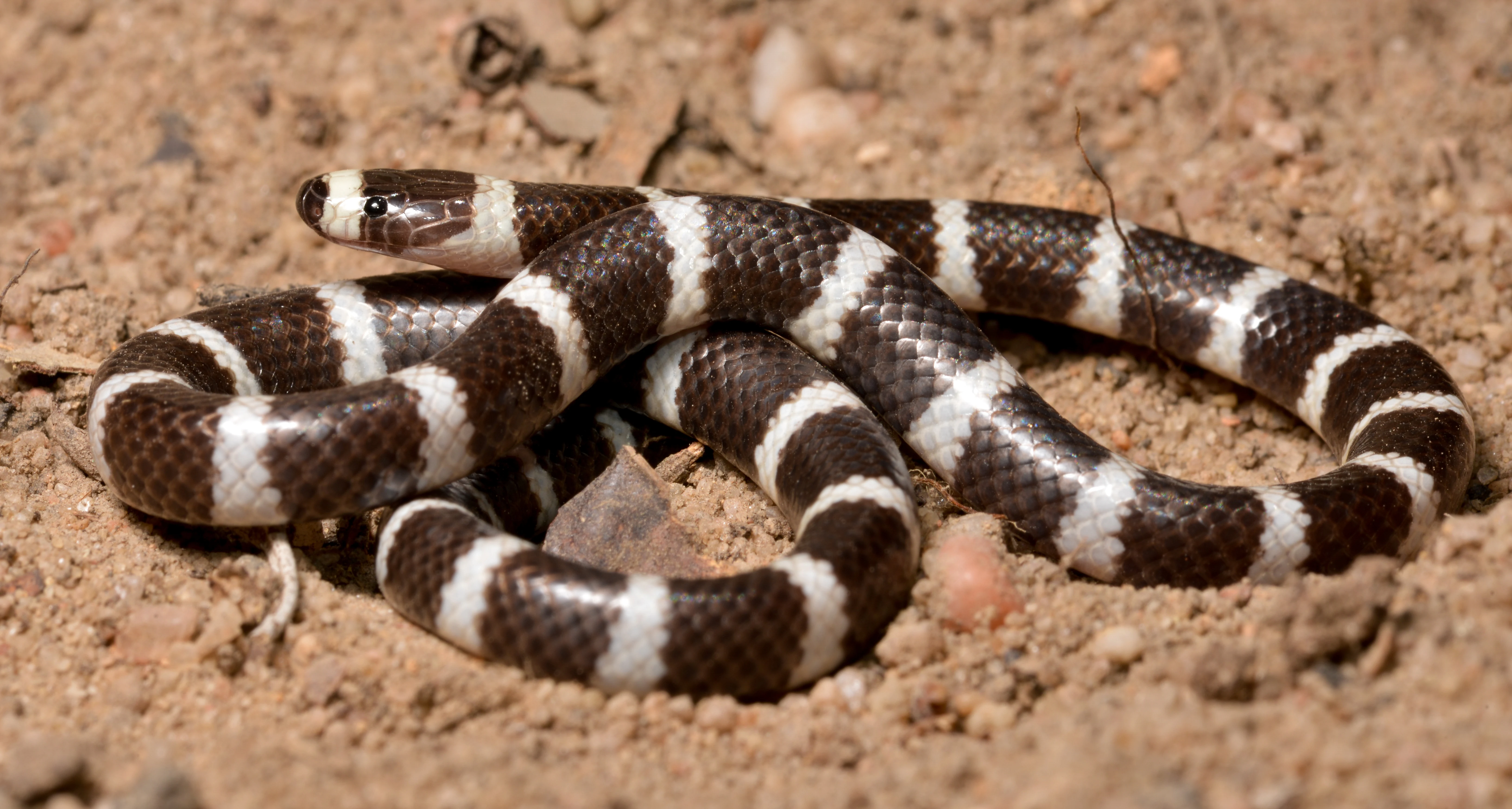
A black and white banded snake coiled on sandy soil with small rocks and dry leaves
Eastern Bandy-bandy snake (Vermicella annulata) coiled on sandy ground

Barmah National Park history and protected-area timeline

The Barmah region has been home to Indigenous Australians for thousands of years, with the Yorta Yorta and Bangerang peoples historically utilizing the forest for food, shelter, and materials. Following European settlement in the 1800s, the area became an important fishing and logging region, with surrounding lands progressively cleared for agriculture and grazing. Hardwood timber extraction from river red gums commenced around 1870 and continued as a significant local industry until the park's creation. The introduction of rabbits, foxes, sheep, cattle, and horses profoundly altered the ecosystem's dynamics. Barmah State Park was established in 1987, and following decades of advocacy for stronger protection, was redesignated as Barmah National Park in 2010 as part of a Victorian Government initiative to protect remnant river red gum forests. The other river red gum national parks created during this period include Gunbower, Hattah-Kulkyne, Lower Goulburn, Murray-Sunset, and Warby-Ovens. In July 2010, New South Wales declared the adjacent Millewa Forest as Murray Valley National Park, creating a 70,000-hectare cross-border reserve. The Barmah muster yards in the park's southern end, used for cattle management in the river red gum forests, were heritage listed in 2009, and cattle grazing was banned in all Victorian river red gum national parks in 2015.

Barmah National Park landscape and geographic character

The landscape of Barmah National Park is defined by the floodplain of the Murray River, characterized by expansive river red gum forest dominating the terrain with scattered freshwater marshes creating a mosaic of open woodland and wetland. The river red gums form a distinctive upper canopy without a significant shrub or middle storey, allowing light to penetrate to a ground layer of native grasses, sedges, and rushes. The forest edges transition into eucalypt-box woodland, adding diversity to the landscape. The floodplain's topography is flat, with subtle variations in elevation determining which areas flood and which remain as forest during high water periods. Ulupna Island extends into the park's northeastern portion, adding riverine character to the landscape. The Murray River itself forms the park's boundary, with its flow patterns historically driving the ecological processes that shaped this forest ecosystem.
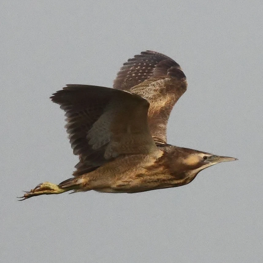
Brown and white bird in flight with outstretched wings and long beak
Australasian Bittern in flight against a gray sky

Barmah National Park ecosystems, habitats, and plant life

Barmah National Park supports a complex floodplain ecosystem where the river red gum forest depends upon periodic flooding for its health and regeneration. The park's wetlands represent a dynamic environment where flooding patterns determine vegetation communities, with marshes dominated by Moira grass historically covering extensive areas that were seasonally flooded for five to nine months annually. However, flow regulation of the Murray River has dramatically altered these natural cycles, with winter and spring floods now reduced in duration while unseasonal summer and autumn flooding has increased. These changes have caused a catastrophic 96 percent decline in Moira grass plains over the past 80 years, threatening a once-widespread habitat community. The park contains numerous threatened plant species including buloke, various joyweeds, swamp wallaby-grass, and many others listed under Victorian and Commonwealth legislation. The floodplain also supports aquatic vegetation communities and the intricate ecological connections between wetland and forest that sustain the broader ecosystem.
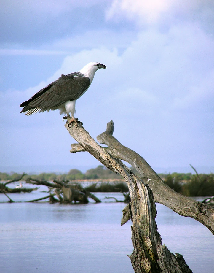
A white-bellied sea eagle with dark gray wings, white head, and tail perched on a dead tree branch near a body of water.
White-bellied Sea Eagle perched on a weathered tree branch overlooking a river.

Barmah National Park wildlife and species highlights

The wildlife of Barmah National Park is exceptionally diverse, with the park providing critical habitat for numerous threatened species. Waterbirds are particularly well represented, with the Australasian bittern (endangered in Australia), royal spoonbill, brolga, white-bellied sea-eagle, and various egret species among the notable residents. The park supports birds part of both the Japan-Australia and China-Australia Migratory Bird Agreements, highlighting its international significance for migratory species. Native fish are well represented with Murray cod, trout cod, silver perch, golden perch, Macquarie perch, Murray rainbowfish, southern pygmy perch, and freshwater catfish all occurring in the park's waters. Mammals include the squirrel glider, brush-tailed phascogale, and large-footed myotis, while reptiles such as the carpet python and lace monitor inhabit the forest. The park also contains amphibians including the critically endangered giant banjo frog. However, several marsupial species have been lost from the park, including the rufous bettong, bridled nailtail wallaby, western barred bandicoot, and lesser stick-nest rat, with their absence attributed to the introduction of rabbits and foxes.
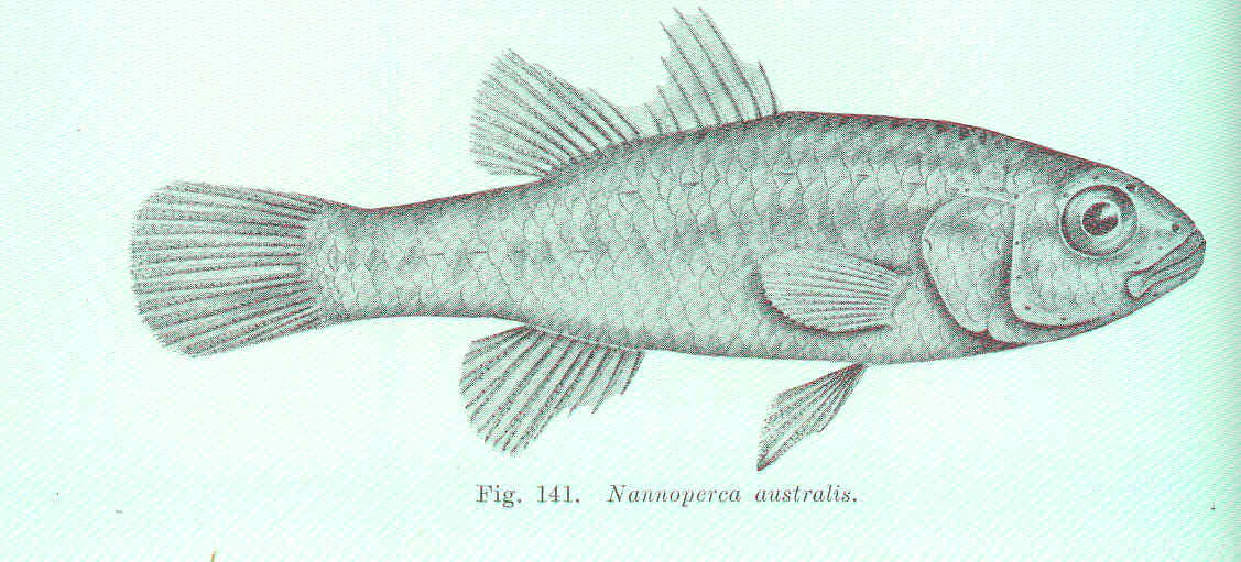
Black-and-white illustration of a Southern Pygmy Perch fish with detailed fins, scales, and tail.
Illustration of Southern Pygmy Perch (Nannoperca australis) from Barmah National Park.

Barmah National Park conservation status and protection priorities

Barmah National Park represents a critical conservation asset for Victoria and Australia, protecting the world's largest river red gum forest and internationally recognized Ramsar wetlands. The park's biodiversity significance is reflected in the numerous threatened species listed under Victorian and Commonwealth legislation, spanning flora, fauna, birds, fish, reptiles, and amphibians. However, the ecosystem faces significant challenges from altered flood regimes caused by upstream dam construction beginning in the 1930s, which has disrupted the natural flooding cycles essential for forest health and wetland vegetation communities. Invasive species including feral horses, rabbits, foxes, and various introduced plants pose ongoing threats to native biodiversity. Environmental water management through the Murray-Darling Basin Authority now seeks to partially restore natural flow patterns, with targeted environmental flows aimed at supporting river red gum health, waterbird breeding, and native fish populations. Management priorities include controlling invasive species, restoring floodplain marsh communities particularly Moira grass plains, and removing feral horses to prevent continued environmental degradation.

Barmah National Park cultural meaning and human context

The Barmah region holds deep cultural significance for the Yorta Yorta and Bangerang peoples, who have inhabited and managed this landscape for thousands of years. Traditional Indigenous land management practices including periodic burning shaped the forest and maintained ecological balance prior to European settlement. The park's management now involves collaboration between Parks Victoria and traditional owners, recognizing the importance of Indigenous knowledge and connection to Country. The Barmah muster yards, heritage listed in 2009, represent the later historical layer of European pastoralism, when cattle were grazed in the surrounding river red gum forests. The presence of wild horses (brumbies) that trace back to horses escaped or released in the mid-1800s adds another dimension to the cultural landscape, though their population has become environmentally unsustainable. The park forms part of the cross-border Murray Valley National Park managed jointly by Victorian and New South Wales governments with traditional owners.
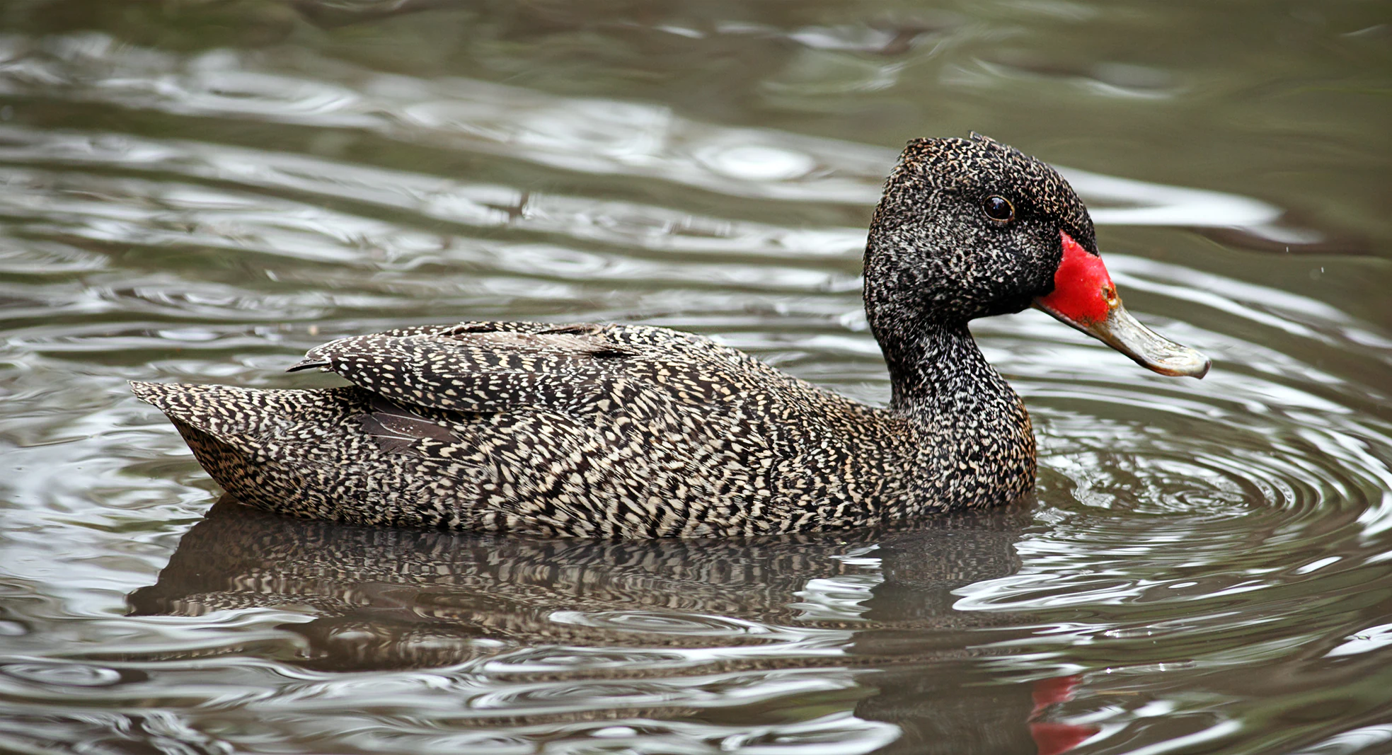
Male Freckled Duck with speckled feathers and bright red beak swimming in water
Male Freckled Duck swimming in water

Top sights and standout views in Barmah National Park

Barmah National Park offers visitors the opportunity to experience the world's largest river red gum forest, a landscape of towering eucalypts bordering wetlands that support exceptional birdlife. The park's Ramsar-listed wetlands attract migratory birds and provide outstanding wildlife viewing opportunities, particularly for waterbirds and raptors. Camping beneath the ancient river red gums, bushwalking through the forest, and paddling the waterways reveal the park's ecological character and seasonal transformations. The presence of wild horses adds a distinctive element to the landscape, though their management remains controversial. The park's connection to the broader Murray River system provides fishing and boating opportunities while connecting visitors to one of Australia's most significant river ecosystems. The collaboration between Parks Victoria and Yorta Yorta traditional owners exemplifies contemporary approaches to park management that integrate Indigenous knowledge and values.
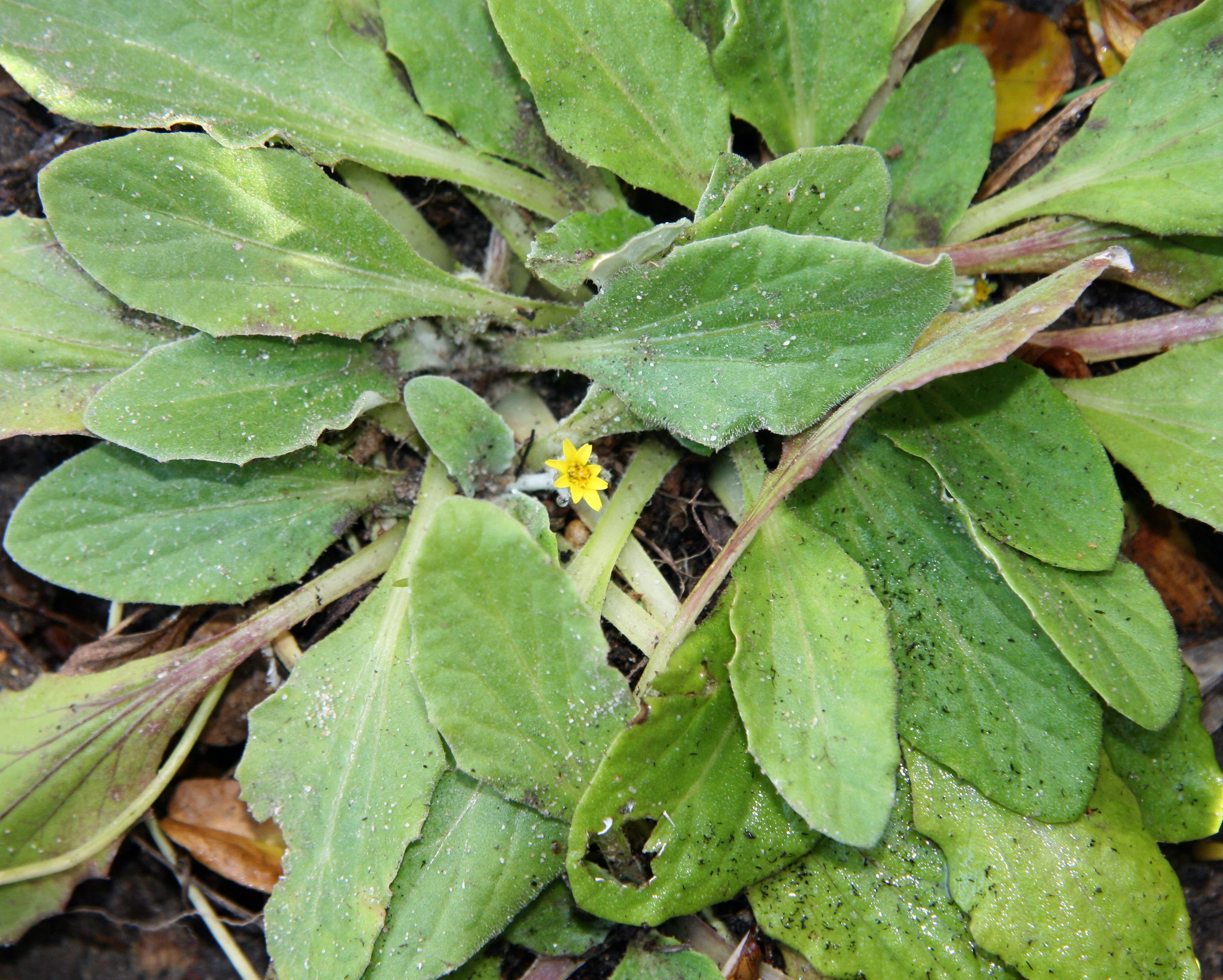
Close-up of green leaves with a small yellow flower and water droplets
Cymbonotus lawsonianus, a plant species found in Barmah National Park

Best time to visit Barmah National Park

Barmah National Park can be visited throughout the year, with each season offering different experiences shaped by the region's temperate semi-arid climate. Summer months from December to February bring average maximum temperatures around 30 degrees Celsius, making early morning or late afternoon activities more comfortable. Winter from June to August sees average minimum temperatures drop to 4 degrees Celsius, with the coldest months requiring warmer clothing for outdoor exploration. The park receives approximately 400 millimetres of rainfall annually, with most precipitation falling during winter. The seasonal flooding patterns that define the park's ecology have been altered by river regulation, but environmental water releases continue to influence wetland conditions. Visitors interested in waterbird viewing may find different experiences depending on flooding conditions, while those seeking to explore the forest on foot will find the landscape accessible in most seasons. The spring wildflower display adds botanical interest to visits during the warmer months.
Park location guide

Geography guide, regional context, and park location map for Barmah National Park

Barmah National Park park geography, regions, and map view in Australia
Understand where Barmah National Park sits in Australia through a broader geographic reading of the surrounding landscape, nearby location context, and its mapped position within the national park landscape.

How Barmah National Park fits into Australia

Australia is a constitutional monarchy and federal parliamentary democracy comprising six states and ten territories. With a population of nearly 28 million, it is one of the world's most urbanised countries, with most people concentrated on the eastern seaboard. The country has a high Human Development Index and is known for its cultural diversity, ancient Aboriginal heritage, and unique wildlife.

Wider geography shaping Barmah National Park in Australia

Australia occupies the entire Australian continent, the island of Tasmania, and numerous smaller islands. It is the world's flattest and driest inhabited continent, featuring vast deserts in the interior (the Outback), tropical rainforests along the eastern coast, and a coastline bordering the Indian and Pacific Oceans.

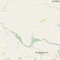
Map view of Barmah National Park

Use this park location map to pinpoint Barmah National Park in Australia, understand its exact geographic position, and read its mapped placement within the surrounding landscape more clearly.

Pigeon | © OpenStreetMap contributors

Location context for Barmah National Park

Hume

Explore the towering eucalypt forests, freshwater marshes, and unique floodplain terrain through essential Barmah National Park imagery.

Barmah National Park Photos: Visual Guide to the River Red Gum Forest Landscape and Wetland Scenery
Browse a curated collection of Barmah National Park photos to visually explore its distinctive river red gum floodplain forest, expansive wetlands, and unique Murray River terrain. These protected area images offer critical insight into the park's diverse habitats and the unparalleled character of its internationally significant Ramsar site environment.

A black and white banded snake coiled on sandy soil with small rocks and dry leaves

River red gum trees partially submerged in floodwater, with calm water reflecting the trees and surrounding forest

Brown and white bird in flight with outstretched wings and long beak

A white-bellied sea eagle with dark gray wings, white head, and tail perched on a dead tree branch near a body of water.

Black-and-white illustration of a Southern Pygmy Perch fish with detailed fins, scales, and tail.

Black falcon perched on a gnarled tree branch with clear blue sky background

Male Freckled Duck with speckled feathers and bright red beak swimming in water

Close-up of green leaves with a small yellow flower and water droplets

White bird with long black spoon-shaped beak standing in shallow water

Lace monitor lizard with black and yellow patterned scales on the ground, surrounded by leaves and twigs

A Major Mitchell's Cockatoo with pink and white plumage and a red crest perched on a tree branch against a backdrop of green foliage and sky

Eastern Bearded Dragon perched on a weathered tree branch with green vegetation in the background

Detailed scientific illustration of a fish with multiple anatomical views including side profile, head, and jaw structures

Two birds with brown and white plumage perched on a tree branch

Bird in flight with outstretched wings over water with blurred reeds and water lilies in background

Person holding a Macquarie perch fish with fishing rod over water

Park atlas

Browse the extensive network of protected areas across Victoria and the Murray River floodplain.

Discover Nearby National Parks and Protected Areas Beyond Barmah National Park
Continue your exploration from Barmah National Park to discover additional protected areas throughout the Murray River floodplain and surrounding Victorian landscapes. Map their distribution, compare distinct river red gum forests and wetlands, and trace the regional spread of conservation efforts in southeastern Australia.
National park

Lower Goulburn National Park: Australia's River Red Gum Woodland Protected Landscape

Explore mapped boundaries and riparian geography.

Lower Goulburn National Park in Victoria, Australia, safeguards a critical segment of the Goulburn River, celebrated for its magnificent river red gum woodlands. This protected area offers a linear exploration of a rare riparian ecosystem, providing essential habitat and scenic beauty. Understand its geographic layout, mapped extent, and the distinctive landscape formed by these iconic Australian trees, offering a vital natural contrast to the surrounding agricultural areas.

Area
93.1 km²
Established
2010
IUCN
II
Relief
Lowland
National park

Terrick Terrick National Park: National Park Geography and Protected Land Exploration

Semi-arid woodland and grassland ecosystems in northern Victoria.

Terrick Terrick National Park represents a crucial protected area showcasing the characteristic Box-Ironbark forest and native grassland ecosystems of northern Victoria. This park is defined by its gently undulating terrain and semi-arid woodland character, offering a distinct natural landscape for geographic study and atlas exploration. Its mapped extent clearly delineates an environment vital for conservation, providing a valuable point of reference for understanding regional protected land distribution and ecological significance within Australia.

Area
38.8 km²
Established
1988
IUCN
II
Relief
Lowland
Watercolor painting of green trees, rolling hills, and a pastel sky.
National park

Heathcote-Graytown National Park: Protected Box-Ironbark Forests and Swift Parrot Habitat

Mapping the landscape and geography of this Australian National Park.

Heathcote-Graytown National Park is a significant protected area safeguarding one of Victoria's remaining box-ironbark forest ecosystems. Its landscape, nestled within the Great Dividing Range, provides essential habitat for migratory swift parrots and supports diverse woodland bird species recognized by BirdLife International. Explore the park's mapped terrain and understand its role within the Central Highlands' regional geography as a vital conservation landscape.

Area
128.33 km²
Established
2002
IUCN
II
Relief
Mountain
National park

Warby-Ovens National Park: Protected Landscape and Geographic Atlas Entry

Discover its Box-Ironbark forests and mapped regional terrain.

Warby-Ovens National Park is a protected national park situated in northeastern Victoria, Australia, covering 14,655 hectares of distinctive landscape. It is internationally recognized as an Important Bird Area, primarily for its significant Box-Ironbark forest ecosystem that supports numerous threatened woodland bird species. The park's geography features low granite hills and rolling terrain, with the Ovens River flowing through its northern section. This detail page provides structured information on its protected boundaries, natural landscape characteristics, and its place within regional geography.

Area
146.55 km²
Established
2010
IUCN
II
Relief
Upland
National park

Greater Bendigo National Park: Essential Protected Landscape and Regional Geography Details

Map exploration of its box-ironbark forest and woodland ecosystems.

Delve into Greater Bendigo National Park, a protected area in Victoria renowned for its extensive box-ironbark forests. This national park is crucial for maintaining the distinct woodland ecosystems that support rich bird populations and provide essential habitat for the endangered swift parrot. Users can explore its mapped geographic extent, understand its landscape character, and appreciate its significance within Australia's protected natural areas.

Area
170 km²
Established
2002
IUCN
II
Relief
Lowland
National parkNew South Wales

Oolambeyan National Park National Park: Discover its Mapped Geography and Protected Landscape

Explore the protected area and regional context of New South Wales.

Delve into Oolambeyan National Park, a key national park within New South Wales, Australia. This entry provides essential geographic context, detailing the park's mapped boundaries and its identity as a protected landscape. It serves as a foundation for understanding the park's contribution to the regional atlas and offers a distinct perspective on the natural geography of the area.

Area
222.31 km²
Established
2001
IUCN
II
Access
Moderate access
National parkNew South Wales

Murrumbidgee Valley National Park: National Park with Mapped Protected Boundaries in New South Wales

Regional geography and landscape context for this protected area.

Murrumbidgee Valley National Park is recognized as a national park, offering critical insights into protected land distribution within New South Wales. This destination facilitates an atlas-style exploration of its geographic identity, mapped boundaries, and its role as a defined natural landscape within the broader region. Understanding this park's protected status and geographic placement is key for detailed map-based discovery.

Area
477.03 km²
Established
2010
IUCN
II
Relief
Lowland
Watercolor illustration showing a lake surrounded by green hills and vegetation
National park

Lake Eildon National Park: Protected Landscape with Ancient Volcanic and Gold Mining Heritage

Explore mapped terrain and diverse eucalypt forests.

Lake Eildon National Park in Victoria's Central Highlands offers a unique protected landscape shaped by ancient volcanic activity and the region's gold rush era. This national park, centered around the large Lake Eildon reservoir, provides critical habitat within its diverse eucalypt forests. Discover its geological significance, historical mining sites, and mapped boundaries, offering a comprehensive view of its protected-area identity and regional geographic context.

Area
277.5 km²
Established
1997
IUCN
II
Relief
Mountain

Common questions about visiting, size, designation, and location context for Barmah National Park

Barmah National Park FAQs for park facts, access, geography, and protected area context
Find quick answers about Barmah National Park, including protected-area facts, park geography, trail and visitor context, and how the park fits into its surrounding country and regional landscape.
MoriAtlas Explorer

Continue Your Protected Areas Search Across the Global Atlas

Deepen your exploration by continuing the structured search for national parks and protected areas worldwide. Utilize the comprehensive filtering capabilities to compare different conservation landscapes and refine your understanding of global park geography. Discover more about the distribution and characteristics of protected natural areas.

Global natural geography