

Mori Atlas logo
National parkBen Lomond National Park

Discover its unique dolerite geology, extensive plateau, and high peaks within Australia's geographic context.

Ben Lomond National Park: A Dramatic Alpine Protected Landscape in Australia

Ben Lomond National Park represents a significant protected landscape within Australia, centered on a dramatic central dolerite massif and an extensive alpine plateau. This national park showcases distinctive geological formations, including the high outlier peaks and the imposing cliff face of Stacks Bluff, offering a unique vista of Tasmania's alpine terrain. Users exploring Ben Lomond National Park can uncover its mapped boundaries, understand its regional geographic setting, and appreciate the scale of its protected natural landscape through detailed atlas-style data.

alpine environmentsvolcanic landscapesprotected forestmountain parksskiingendemic species
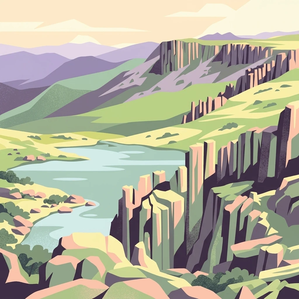
Stylized illustration of a mountainous landscape featuring a lake, cliffs, and rolling hills

Ben Lomond National Park

National park

Park overview

Structured park overview, official facts, and landscape profile for Ben Lomond National Park

Ben Lomond National Park park facts, protected area profile, and essential visitor context

Review the core facts for Ben Lomond National Park, including designation, size, terrain, visitor scale, habitats, and operating context in one park-focused overview.

About Ben Lomond National Park

Ben Lomond National Park occupies a commanding position in Tasmania's north-eastern highlands, protecting a mountain landscape of exceptional geological and ecological significance. The park's central feature is a massive dolerite plateau rising dramatically above the surrounding foothills, with Legges Tor at 1,572 metres representing Tasmania's highest peak outside the Western Mountains. The southern plateau is dominated by Stacks Bluff, an imposing 1,527-metre feature whose cliffline drops 600 metres to the foothills below. Surrounding the plateau are prominent outlier peaks including Ragged Jack, Mensa Moor, and Tower Hill, creating a distinctive mountain silhouette visible across the northern Tasmanian landscape.

The mountain holds deep significance for the palawa kani people, whose traditional name for the area is turapina. The original inhabitants were the clans of the Ben Lomond Nation, who seasonally occupied the plateau and surrounding valleys. European colonial activity began in the early 1800s, with the mountain named by Colonel Paterson in 1804 after the Scottish Ben Lomond. The area was prospected for minerals including gold, coal, tin, and tungsten, with mining settlements developing in the foothills. Proposals for the area to be protected as a scenic reserve emerged in 1910, and Ben Lomond was declared a National Park and Scenic Reserve in July 1947, encompassing nearly 40,000 acres of former fauna reserve and other lands.

Quick facts and research context for Ben Lomond National Park

Ben Lomond National Park is located approximately 60 kilometres east of Launceston in Tasmania's north-east. The park protects 182.6 square kilometres of mountainous terrain centred on a Jurassic dolerite massif with a high alpine plateau. The mountain was the only plateau in Tasmania's north-east to experience glaciation during the Pleistocene Ice Age, leaving distinctive periglacial features including blockfields covering over a quarter of the plateau. The park is home to 222 plant species and supports populations of Bennett's wallabies, wombats, pademelons, eastern quolls, and numerous bird species including the endemic green rosella and black currawong.

Protection and recognition

Official conservation framework and terrestrial management scope of the highland park

Documented Protection Status and Terrestrial Designation of Ben Lomond National Park

National park profiles provide verified data regarding the formal terrestrial protection status and established boundaries of Ben Lomond National Park. Geographic records clarify the official conservation framework to help researchers evaluate how the land is classified within global environmental networks.

Protection details

Protection scope
Terrestrial
Transboundary protection
No
Park context

Deeper park guide and search-rich context for Ben Lomond National Park

Ben Lomond National Park history, landscape, wildlife, and travel context

Explore Ben Lomond National Park through its history, landscape character, ecosystems, wildlife, conservation priorities, cultural context, and seasonal travel timing in a structured park guide built for atlas discovery and search intent.

Why Ben Lomond National Park stands out

Ben Lomond is Tasmania's premier alpine skiing destination, with facilities at the state's highest ski village at 1,460 metres elevation. The mountain is notable for its dramatic dolerite geology, including the imposing Stacks Bluff and extensive plateau scenery. The park protects significant alpine ecosystems and endemic species including the northern snow skink. Its historical significance includes both the traditional country of the Ben Lomond Nation and later colonial exploration and mining activity.
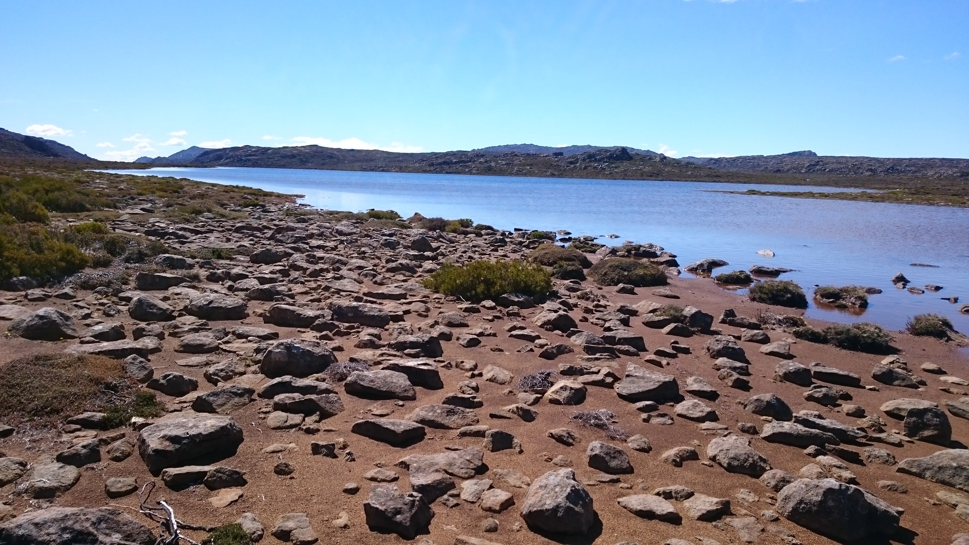
A lake surrounded by rocky terrain with sparse vegetation under a clear blue sky
Lake Youl viewed from the rocky shore under a clear blue sky

Ben Lomond National Park history and protected-area timeline

The establishment of Ben Lomond National Park followed decades of growing recognition of the mountain's natural and scenic values. Proposals to protect the area as a scenic reserve were made as early as 1910, emerging in response to frequent fires on the plateau that damaged the unique alpine vegetation. The formal declaration of the national park in July 1947 marked the culmination of these保护 efforts, creating a protected area encompassing nearly 40,000 acres of land that had previously been declared a fauna reserve, though land set aside for the Forestry Commission was excluded from the park boundaries.

Prior to national park status, the mountain had already become a destination for recreation and tourism. Walking tracks onto the plateau were established from the 1830s, with the principal routes ascending from Avoca through the Ben Lomond Marshes or from Mangana on the eastern side. The development of skiing facilities began in the 1920s, with the Northern Tasmanian Alpine Club formed in 1929 and early ski huts constructed from 1932. The accessibility of the mountain from Launceston, combined with the existence of a ski village on the plateau, has made Ben Lomond a year-round destination for tourists and hikers. Access to the village and summit can be made via walking tracks or via the distinctive Jacobs Ladder road that ascends the steep northern face.

Ben Lomond National Park landscape and geographic character

The landscape of Ben Lomond National Park is defined by its distinctive dolerite geology and glacial history. The mountain is composed of a central massif with an extensive plateau above 1,200 metres, while high outlier peaks project from the main body of the mountain. The plateau surface is largely stony and covered with blockfields, periglacial depositional features that cover over a quarter of the plateau area and represent the legacy of Pleistocene glaciation. This was the only plateau in Tasmania's north-east to experience glaciation, and the resulting landforms create a landscape markedly different from other mountains in the region.

The highest feature on the plateau is Legges Tor, an unimposing summit at 1,572 metres on the northern aspect. The southern end of the plateau is dominated by Stacks Bluff, a dramatic feature that drops away via a cliffline 600 metres above the surrounding foothills. The prominent outlier peaks of Ragged Jack at 1,369 metres, Mensa Moor at 1,358 metres, and Tower Hill at 1,122 metres surround the plateau, creating a distinctive mountain complex. The western escarpment features exposed Jurassic dolerite, while the surrounding foothills are characterized by slopes leading down to the South Esk River, which encircles the plateau on three sides.
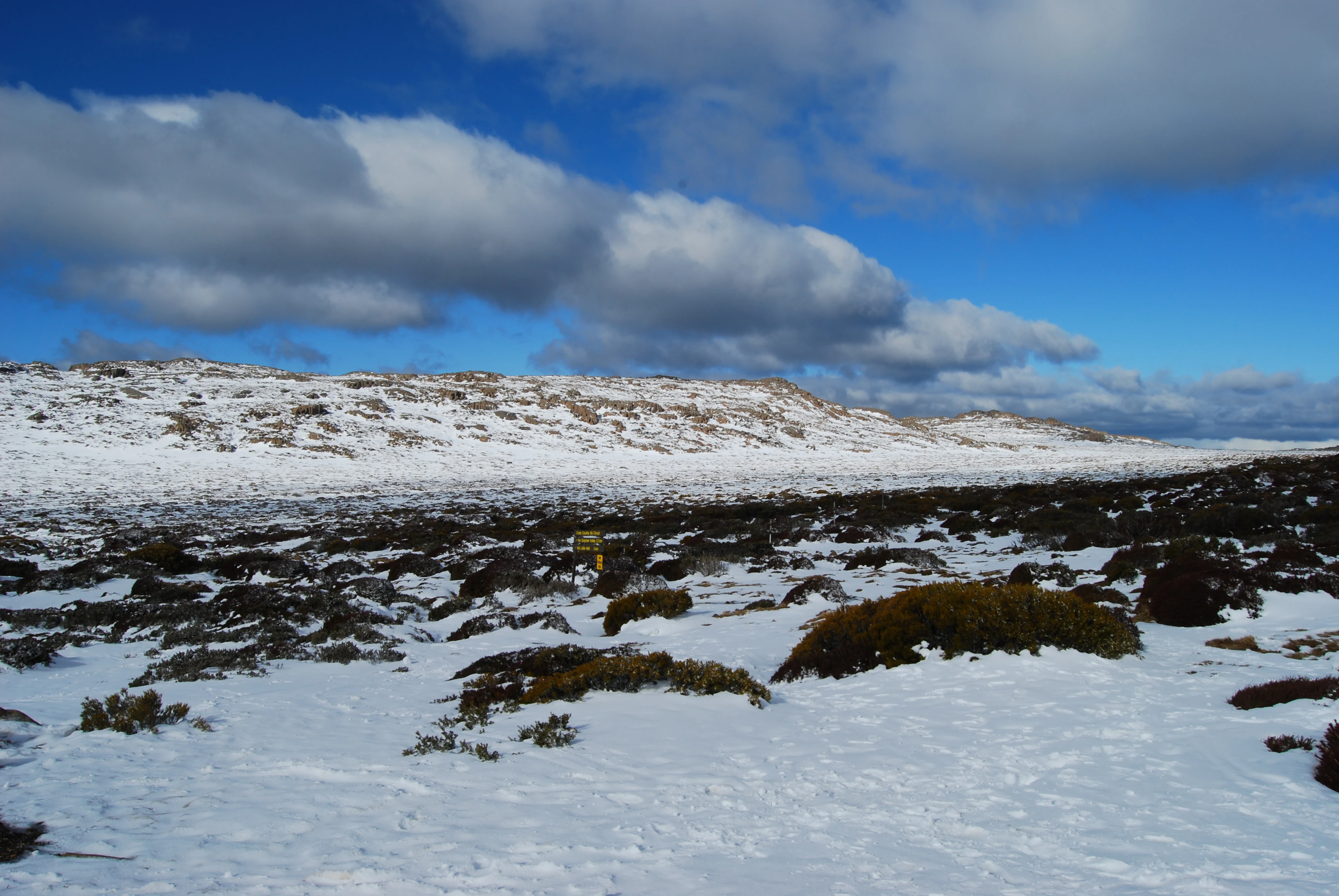
Snow-covered landscape with patches of exposed vegetation under a partly cloudy sky, featuring a single hiker in the midground.
Snow-covered fields on Ben Lomond National Park, Tasmania, Australia.

Ben Lomond National Park ecosystems, habitats, and plant life

Ben Lomond National Park protects a representative cross-section of Tasmania's north-east alpine plant communities, supporting 222 plant species across diverse habitats. Although much of the plateau is stony with areas of low and often stunted vegetation, the remainder of the mountain contains a wide variety of habitats ranging from alpine moorland to dense forest. The five most common plant families recorded are Asteraceae, Poaceae, Epacridaceae, Cyperaceae, and Proteaceae, which together account for about half of all species documented on the plateau.

Cushion plants are abundant throughout the plateau, and several rare or endemic species occur within the park. The rock cushion plant Chionohebe ciliolata is known only from a small localized area within the park. Other significant species include the rare endemic Oreomyrrhis sessiliflora and the endangered Colobanthus curtisiae. The most common native species include tussock grass (Poa gunnii), gentian (Gentianella diemensis), and various shrubs including Richea scoparia, Orites acicularis, and Baeckea gunniana. The plateau soils are largely thin or absent, with organic peats most extensively developed on the western side of Rodway Valley.
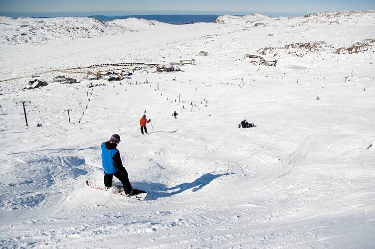
A skier in a blue jacket skiing on a snow-covered slope with a ski village and mountainous landscape in the background.
A skier in a blue jacket navigating a snowy slope with the ski village of Ben Lomond National Park visible in the background.

Ben Lomond National Park wildlife and species highlights

The park supports a diverse fauna typical of Tasmanian alpine and forest environments. Among the larger mammals, Bennett's wallabies and wombats are common and are regularly seen in the ski village even during winter blizzard conditions. Pademelons are abundant in wet gullies and areas with thick undergrowth, while Forester kangaroos have been recorded along the south-western edge of the park. Eastern quolls inhabit the ski village during winter, occasionally sighted during daylight hours, and various other marsupials including long-nosed potoroo, Tasmanian bettong, brushtail possum, ringtail possum, and sugar glider have all been recorded.

The bird fauna includes wedge-tailed eagles and noisy yellow-tailed black cockatoos which are regularly reported. Among the endemic Tasmanian species recorded are the green rosella, scrubtit, brown thornbill, yellow wattlebird, yellow-throated honeyeater, black-headed honeyeater, strong-billed honeyeater, and the black currawong. Of particular conservation interest is the endemic northern snow skink (Niveoscincus greeni), an alpine species restricted to several mountain top areas in Tasmania. Amphibians recorded include the brown tree frog, common eastern froglet, and the endemic Tasmanian froglet.
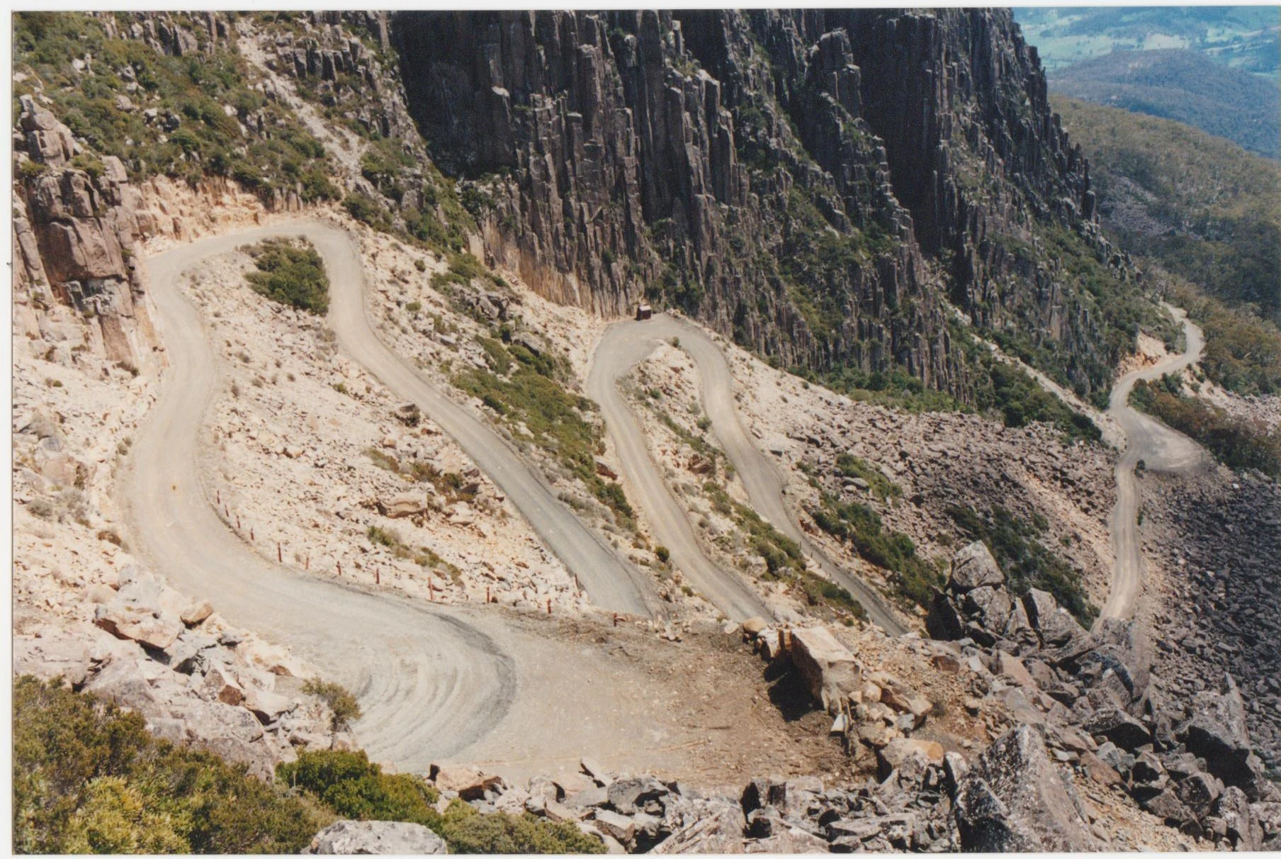
A winding dirt road curves along a rocky mountainside with steep cliffs and sparse vegetation
Winding dirt road known as Jacob's Ladder on Mount Ben Lomond

Ben Lomond National Park conservation status and protection priorities

Ben Lomond National Park plays an important role in protecting Tasmania's alpine ecosystems and endemic species. The park protects representative examples of north-east alpine plant communities that would otherwise face pressures from development, tourism infrastructure, and changing fire regimes. The declaration of the national park in 1947 was partly motivated by concerns about frequent fires on the plateau that threatened the unique alpine vegetation communities.

The protection of endemic species such as the northern snow skink and rare plants including Chionohebe ciliolata and Colobanthus curtisiae represents an important conservation outcome. The blockfield landscapes and glacial features of the plateau are of scientific interest as examples of periglacial processes in the Australian Alps region. The park also protects habitat for species of conservation concern including various marsupials and endemic birds, contributing to the broader conservation network across Tasmania's highlands.

Ben Lomond National Park cultural meaning and human context

The mountain holds deep cultural significance as the traditional country of the Ben Lomond Nation, comprising at least three clans (Plangermaireener, Plindermairhemener, and Tonenerweenerlarmenne) whose total population numbered 150-200 people. The palawa kani name for Ben Lomond is turapina, with the suffix likely denoting tableland or plateau and linguistic research suggesting the stem refers to bluff or precipitous cliffs. The clans seasonally occupied the plateau in summer and hunted along the valleys of the South Esk and North Esk rivers and their tributaries.

The colonial period saw violent conflict as settlers expanded into the Ben Lomond frontier during the 1820s. The remnants of the Ben Lomond Nation were eventually removed during the Black War, with survivors relocated to Wybalenna on Flinders Island. Descendants of palawa women taken by sealers continue to live on Flinders and Cape Barren Islands and maintain cultural and genetic connections to the Ben Lomond Nation. The mountain also contains evidence of Aboriginal quarry works at Coalmine Crag, indicating sustained use of the plateau for stone tool production.

Top sights and standout views in Ben Lomond National Park

Ben Lomond National Park offers Tasmania's highest and most accessible alpine experience. The ski resort at 1,460 metres provides the state's premier alpine skiing facilities, while the extensive plateau and peak summits reward hikers with sweeping views across eastern Tasmania. The mountain's dolerite geology creates distinctive landscapes including the dramatic Stacks Bluff cliff face and the blockfield-covered plateau. Wildlife viewing opportunities include encounters with wallabies, wombats, and eastern quolls in the ski village area. The mountain's historical layers range from Aboriginal heritage through colonial exploration and mining to modern recreation development.

Best time to visit Ben Lomond National Park

Ben Lomond can be visited year-round, with each season offering different experiences. Summer (December to February) provides the most accessible hiking conditions on the plateau, with warm temperatures and long daylight hours ideal for walking and summit attempts. The alpine wildflower season occurs during this period. Winter (June to August) transforms the mountain into Tasmania's primary ski destination, with snow cover and ski facilities operational. The shoulder seasons of autumn and spring offer quieter conditions but may bring variable weather. The alpine weather can change rapidly, and visitors should be prepared for conditions at any time of year.
Monthly climate preview

Monthly weather patterns and representative station averages across the protected terrain

Ben Lomond National Park Climate Normals, Long-Term Temperature and Precipitation Rhythms

Representative coordinates record distinct seasonal temperature ranges and consistent monthly precipitation rhythms across the protected terrain. Reviewing the complete twelve-month climatology provides deeper analytical context for long-term regional environmental patterns.
Annual mean10 °C
5 °C16 °C
Jan16°
Feb16°
Mar14°
Apr10°
May
Jun
Jul
Aug
Sep
Oct
Nov12°
Dec14°
Warmest month
January

16 °C

Coolest month
July

5.4 °C

Wettest month
August

2.7 mm/day

Driest month
February

1.6 mm/day

Park location guide

Geography guide, regional context, and park location map for Ben Lomond National Park

Ben Lomond National Park park geography, regions, and map view in Australia

Understand where Ben Lomond National Park sits in Australia through a broader geographic reading of the surrounding landscape, nearby location context, and its mapped position within the national park landscape.

How Ben Lomond National Park fits into Australia

Australia is a constitutional monarchy and federal parliamentary democracy comprising six states and ten territories. With a population of nearly 28 million, it is one of the world's most urbanised countries, with most people concentrated on the eastern seaboard. The country has a high Human Development Index and is known for its cultural diversity, ancient Aboriginal heritage, and unique wildlife.

Wider geography shaping Ben Lomond National Park in Australia

Australia occupies the entire Australian continent, the island of Tasmania, and numerous smaller islands. It is the world's flattest and driest inhabited continent, featuring vast deserts in the interior (the Outback), tropical rainforests along the eastern coast, and a coastline bordering the Indian and Pacific Oceans.

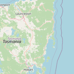
Map view of Ben Lomond National Park

Use this park location map to pinpoint Ben Lomond National Park in Australia, understand its exact geographic position, and read its mapped placement within the surrounding landscape more clearly.

Pigeon | © OpenStreetMap contributors

Location context for Ben Lomond National Park

Tasmania

Visual Atlas of Ben Lomond National Park's Dolerite Geology, Alpine Habitats, and Sweeping Plateau Terrain

Ben Lomond National Park Photos: Explore Tasmania's Dramatic Alpine Landscapes and Protected Mountain Scenery

Browse Ben Lomond National Park photos to visually explore its dramatic dolerite geology, expansive alpine plateau, and rugged mountain scenery. This imagery provides essential context for understanding the park's unique protected landscapes, from its high-elevation blockfields and prominent Stacks Bluff cliffs to diverse alpine habitats and the overall conservation environment.

A lake surrounded by rocky terrain with sparse vegetation under a clear blue sky

Rocky escarpment with steep cliffs and valley view under clear blue sky

Snow-covered landscape with patches of exposed vegetation under a partly cloudy sky, featuring a single hiker in the midground.

A skier in a blue jacket skiing on a snow-covered slope with a ski village and mountainous landscape in the background.

A winding dirt road curves along a rocky mountainside with steep cliffs and sparse vegetation

Rocky, snow-dusted terrain with scattered boulders and sparse vegetation under overcast sky. A ski lift tower and fence are visible on the right with distant mountains in the background.

Park atlas

Trace the regional geography of other protected areas, mapping their spread across Tasmania's diverse alpine and forested landscapes.

Explore Nearby National Parks and Protected Landscapes Beyond Ben Lomond National Park

Explore national parks and protected areas near Ben Lomond National Park, focusing on regions with similar alpine environments, dramatic dolerite geology, or diverse forest landscapes. Comparing these protected landforms reveals broader regional conservation patterns and the unique geographic spread of parks throughout Tasmania's varied terrain.
Watercolor illustration of a landscape featuring hills, trees, and a winding river
National parkTasmania
33 km away#1 closest

Southeast

Douglas-Apsley National Park: Discover its Protected Landscape and Geographic Context in Tasmania

Mapped boundaries and regional terrain of a key Tasmanian national park.

Delve into the geographic details of Douglas-Apsley National Park, a designated national park situated in Tasmania, Australia. This entry provides insight into the park's protected landscape identity, its mapped boundaries, and its contribution to the rich regional geography of Tasmania. Understanding its place within the island's natural terrain is crucial for comprehensive atlas-driven exploration and appreciating Australia's protected areas.

Area
160.8 km²
Established
1989
IUCN
II
Relief
Upland
National parkTasmania
52 km away#2 closest

Southeast

Freycinet National Park: Iconic Granite Peaks and Protected Coastal Landscape in Tasmania

Mapped geography and distinct terrain of Tasmania's historic national park.

Freycinet National Park on Tasmania's east coast is a remarkable protected landscape defined by its dramatic granite mountains, including The Hazards, and the pristine Wineglass Bay. Established as one of Tasmania's first national parks, it showcases unique geological formations and coastal ecosystems across its rugged terrain. This detailed view provides an atlas-style exploration of its mapped boundaries and geographic significance within the regional context.

Area
169 km²
Established
1916
IUCN
II
Visitors
200K annual
Marine protected areaTasmania
57 km away#3 closest

East

Freycinet Commonwealth Marine Reserve: Protected Marine Landscapes and Bathymetry in the Tasman Sea

Offshore Australian marine geography and deep-sea protected areas

Freycinet Commonwealth Marine Reserve serves as a monumental example of marine conservation in the Tasman Sea. Stretching far from the Tasmanian coast, this reserve protects substantial offshore seamounts and pelagic waters. Its submarine landscape is shaped by ancient volcanic activity, creating varied seafloor environments that support deep-sea biodiversity and wide-ranging marine species.

Area
57,942 km²
Established
2007
IUCN
II
Climate
Temperate
National parkTasmania
61 km away#4 closest

Northeast

Mount William National Park: Protected Landscape and National Park Atlas Details

Discover mapped geography and protected area context within Tasmania.

Mount William National Park stands as a vital protected area within Tasmania's vast network of natural landscapes. This detailed entry focuses on its identity as a national park, providing essential geographic context and mapped boundaries for atlas exploration. Understanding Mount William National Park's place in Tasmania's regional geography allows for a richer appreciation of Australia's protected lands.

Area
184.39 km²
Established
1973
IUCN
II
Relief
Lowland
Nature reserveTasmania
About 63 km away#5 closest

West

Liffey Valley Reserve: Geographic Overview of a Tasmania Nature Reserve and Landscape

Protected sclerophyll forest and temperate rainforest sequences

Liffey Valley Reserve in Tasmania provides a focused look at how protected land boundaries align with natural elevation gradients. Its four component parcels protect a complete sequence of Tasmanian vegetation, spanning from ridge-top alpine heath to mossy rainforest depressions. This site acts as a key reference for understanding private conservation geography and the rugged terrain characterizing the eastern edge of the central highlands.

Area
2.75 km²
Established
1991
Water
Major water bodies
Season
Year-round
National parkTasmania
85 km away#6 closest

Northwest

Narawntapu National Park: Tasmania's Coastal Protected Landscape and Wildlife Atlas

Explore mapped boundaries, heathland, woodland, and intertidal bird habitats.

Narawntapu National Park showcases a remarkable protected coastal landscape on Tasmania's north coast, renowned for its exceptional density of marsupial wildlife and significant intertidal bird populations. Its diverse terrain, including heathland, woodland, and extensive mudflats, offers unique opportunities for geographic discovery and understanding the park's ecological importance. Examine its mapped natural features and protected status within the broader atlas of Australian reserves.

Area
43.49 km²
Established
1976
IUCN
II
Visitors
10.1K annual
National parkTasmania
94 km away#7 closest

West

Mole Creek Karst National Park: Mapped Protected Area and Tasmanian Landscape Atlas

Explore the geography and park boundaries within Tasmania's protected lands.

Mole Creek Karst National Park stands as a key protected area within Tasmania, offering a unique glimpse into the island state's natural geography. This resource facilitates an atlas-style discovery of the park's mapped landscape, its protected boundaries, and its significance within the broader context of Australian protected lands. Understand the park's terrain and its role in the region's conservation heritage.

Area
13.45 km²
Established
1996
IUCN
II
Relief
Mountain
National parkTasmania
100 km away#8 closest

West

Walls of Jerusalem National Park: A Mapped Alpine Wilderness in Tasmania

Explore protected landscapes with biblical place names.

Walls of Jerusalem National Park in Tasmania is a distinguished national park characterized by its rugged alpine terrain and dramatic quartzite formations, most notably King Davids Peak. The park's landscape is further distinguished by a unique series of features named after biblical locations, offering an evocative exploration for those interested in geographic discovery. As a protected wilderness area within the Tasmanian Wilderness World Heritage Area, it provides valuable insight into Australia's significant natural landscapes and their mapped representation.

Area
518 km²
Established
1978
IUCN
II
Relief
Mountain

Common questions about visiting, size, designation, and location context for Ben Lomond National Park

Ben Lomond National Park FAQs for park facts, access, geography, and protected area context

Find quick answers about Ben Lomond National Park, including protected-area facts, park geography, trail and visitor context, and how the park fits into its surrounding country and regional landscape.
MoriAtlas Explorer

Continue Your Protected Areas Search Across the Global Atlas

Deepen your exploration by continuing the structured search for national parks and protected areas worldwide. Utilize the comprehensive filtering capabilities to compare different conservation landscapes and refine your understanding of global park geography. Discover more about the distribution and characteristics of protected natural areas.

Global natural geography