
Mori Atlas logo
National parkBlack River Gorges National Park

Discover mapped boundaries and vital endemic wildlife habitats within the island's southwest highlands.

Black River Gorges National Park: Mauritius's Essential Protected Landscape and National Park

Black River Gorges National Park represents the largest protected area in Mauritius, safeguarding approximately 67.54 square kilometers of diverse ecosystems in the island's rugged southwestern highlands. Established to preserve the nation's dwindling native rainforest, this park is a critical stronghold for endemic species, particularly its eight unique bird species. Its landscape is defined by deep gorges, steep slopes, and elevated plateaus, offering a complex mosaic of natural terrain and microhabitats crucial for conservation efforts.

rainforestendemic wildlifeImportant Bird Areanational parkisland conservationmountain forest
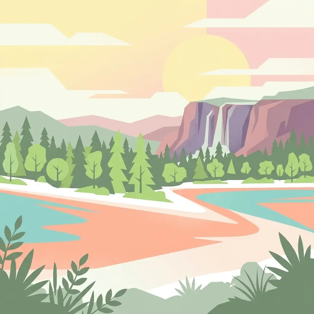
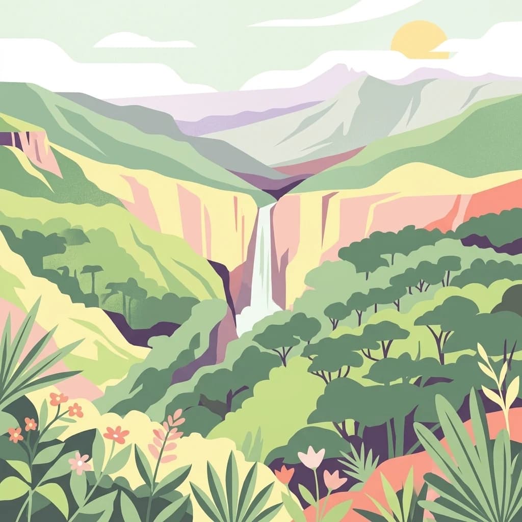
Illustration of a waterfall surrounded by green mountains and vegetation

Black River Gorges National Park

National park

Park overview

Structured park overview, official facts, and landscape profile for Black River Gorges National Park

Black River Gorges National Park park facts, protected area profile, and essential visitor context

Review the core facts for Black River Gorges National Park, including designation, size, terrain, visitor scale, habitats, and operating context in one park-focused overview.

About Black River Gorges National Park

Black River Gorges National Park stands as the centrepiece of Mauritius's conservation estate, protecting the island's most significant remaining tracts of native forest in the south-western highlands. The park's establishment in 1994 represented a critical step in preserving what little original vegetation survived centuries of agricultural expansion and development. The terrain is characterised by rugged gorges, steep ridges, and plateaus that create diverse microclimates across the protected area, supporting everything from humid cloud forest in the higher elevations to drier forest types at lower altitudes. The park's infrastructure includes visitor information centres, picnic areas, and an extensive trail network that allows people to experience the landscape while minimising impact on sensitive ecosystems. Four field stations within the park support the research operations of the National Parks and Conservation Service and the Mauritian Wildlife Foundation, making the area a hub for conservation science in the Indian Ocean region. The park's location in the mountainous south-west provides stunning scenic value while serving as a living laboratory for ecological restoration and species recovery programmes.

Quick facts and research context for Black River Gorges National Park

Black River Gorges National Park occupies the south-western highlands of Mauritius, with access from nearby communities including Chamouny, Chamarel, and La Preneuse. The protected area serves as the island's largest national park and its primary reservoir of native forest ecosystem. Visitors can explore roughly 60 kilometres of walking trails, with two information centres providing orientation and educational resources. The park contains four field stations that support ongoing ecological research and conservation initiatives targeting the island's most threatened species.

Protection and recognition

Official establishment history and conservation status of the terrestrial park landscape

Black River Gorges National Park Protected Area Status and Terrestrial Designation

Establishment of Black River Gorges National Park as a terrestrial protected area dates back to 1994, marking a crucial step in formalizing regional landscape management. Reviewing the documented conservation status provides essential geographic insights into the official boundaries and protection history of the area.

Protection details

Protection scope
Terrestrial
Designated year
1994
Transboundary protection
No
Park context

Deeper park guide and search-rich context for Black River Gorges National Park

Black River Gorges National Park history, landscape, wildlife, and travel context

Explore Black River Gorges National Park through its history, landscape character, ecosystems, wildlife, conservation priorities, cultural context, and seasonal travel timing in a structured park guide built for atlas discovery and search intent.

Why Black River Gorges National Park stands out

The park is renowned as the last refuge of Mauritius's endemic bird species, protecting all eight of the island's endemic birds including the critically endangered Mauritius kestrel, the pink pigeon, and the Mauritius parakeet. It contains the majority of Mauritius's remaining rainforest, despite substantial degradation from invasive plants such as Chinese guava and privet, and introduced animals including rusa deer and wild pigs. The park has been designated an Important Bird Area by BirdLife International, recognizing its global significance for the conservation of threatened avian species.
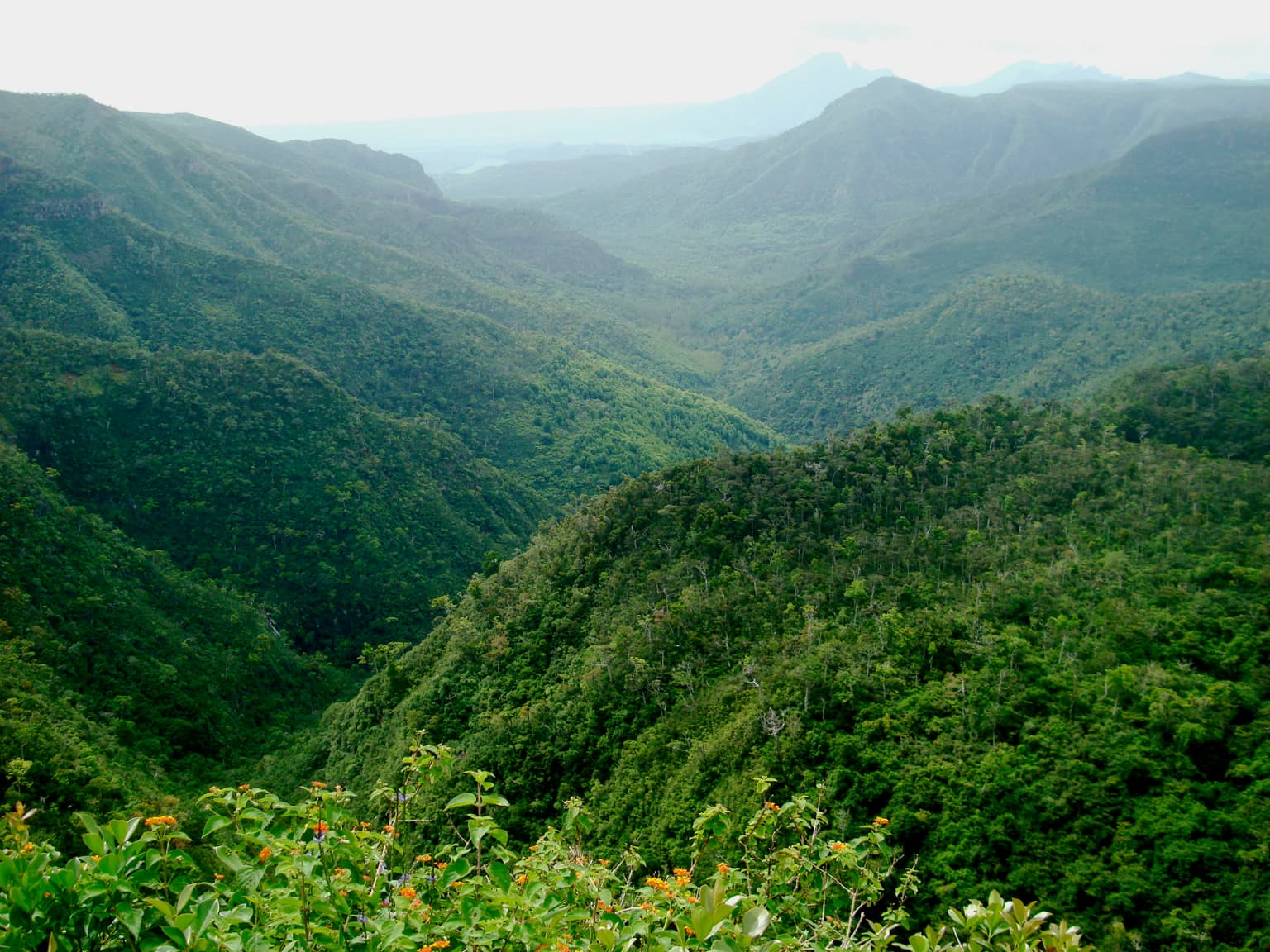
Wide landscape view of dense green forests covering rolling mountains and deep valleys in Black River Gorges National Park, Mauritius.
A lush green mountainous valley within Black River Gorges National Park, Mauritius.

Black River Gorges National Park history and protected-area timeline

The national park was formally proclaimed on June 15, 1994, following years of growing recognition that Mauritius's native ecosystems required formal protection. The creation of the park reflected increasing concern about the fate of the island's endemic species, many of which had been driven to the brink of extinction by habitat loss, introduced predators, and invasive species. Prior to national park status, the area had already been recognised for its ecological importance and had been the focus of conservation efforts by the Mauritian Wildlife Foundation and government agencies. The establishment of the park provided a framework for coordinated management of the remaining forest, implementation of invasive species control programmes, and expansion of research activities. The park's creation also acknowledged the cultural and historical significance of the Black River Gorges area, which had long been recognised as a distinctive landscape within Mauritius.

Black River Gorges National Park landscape and geographic character

The physical landscape of Black River Gorges National Park is defined by the rugged topography of Mauritius's south-western highlands, featuring deep gorges carved by water flow, steep forested slopes, and elevated plateaus that rise from the surrounding coastal plain. The terrain creates a complex mosaic of microhabitats, with north-facing slopes retaining moisture and supporting more humid forest types while south-facing areas tend towards drier conditions. Throughout the park, rocky outcrops and cliff faces add visual complexity and provide specialised habitats for certain plant and animal species. The Black River itself, while not directly traversing the park, has carved the dramatic gorge system that gives the protected area its name and contributes to the region's distinctive character. Elevation changes within the park create visual and ecological transitions from the lowland margins up to the higher ridge systems.

Black River Gorges National Park ecosystems, habitats, and plant life

The ecological character of Black River Gorges National Park centres on the island's remaining rainforest ecosystems, which represent the last substantial fragments of Mauritius's original vegetation. The park contains three primary habitat types: humid upland forest in the higher elevations where moisture is highest, drier lowland forest in the lower areas, and marshy heathland in poorly drained sections. Despite the park's protected status, these forests have suffered significant degradation from invasive species, particularly Chinese guava and privet which have spread extensively through the canopy layer. Introduced mammals including rusa deer and wild pigs have also caused substantial damage to understory vegetation and soil structure. Conservation teams have implemented fencing programmes in several areas to exclude invasive animals and allow native vegetation to recover, creating refugia where endangered species can persist. The park forms part of a broader network of protected areas that together represent Mauritius's attempt to maintain functional ecosystems in a highly modified island environment.

Black River Gorges National Park wildlife and species highlights

The wildlife of Black River Gorges National Park is remarkable for the extraordinary concentration of endemic species, many of which survive nowhere else on Earth. All eight of Mauritius's endemic bird species occur within the park, making it globally significant for avian conservation. The Mauritius kestrel, once reduced to just four individuals, has been saved from extinction through intensive captive breeding and is now one of the rarest birds in the world. The pink pigeon, Mauritius parakeet, Mauritius cuckooshrike, Mauritius bulbul, Mauritius olive white-eye, Mauritius grey white-eye, and Mauritius fody all rely on the park's forest habitats for their survival. The park also protects the Mauritian flying fox, the island's only remaining native mammal, which plays important roles in pollination and seed dispersal. Invasive species remain a major threat, with introduced deer and pigs damaging habitat and competing with native wildlife for resources.

Black River Gorges National Park conservation status and protection priorities

Black River Gorges National Park represents Mauritius's primary tool for conserving its terrestrial biodiversity and protecting the island's remaining native ecosystems. The park's designation as an Important Bird Area by BirdLife International acknowledges its global significance for threatened bird species, several of which are found nowhere else on the planet. Conservation programmes within the park focus on invasive species control, habitat restoration, and species recovery for the most endangered inhabitants. Fenced exclusion areas have been established to protect key habitat patches from introduced mammals, and ongoing efforts to remove invasive plants aim to restore native forest composition. The collaboration between the National Parks and Conservation Service and the Mauritian Wildlife Foundation provides a model for integrated conservation management, combining government authority with NGO expertise and resources. The park also serves as a baseline for understanding what remains of Mauritius's original ecology and as a reference for restoration efforts across the island.

Black River Gorges National Park cultural meaning and human context

The Black River Gorges area holds significance beyond its ecological value as the traditional landscape of Mauritius's southern highlands. The communities of Chamouny, Chamarel, and La Preneuse lie near the park boundaries and have historical connections to the land now protected. The area's name reflects the presence of the Black River system that carved the dramatic gorges, and this hydrological feature has shaped both the physical landscape and human settlement patterns in the region. The park's establishment has created opportunities for local employment and community involvement in conservation activities, linking rural communities in the south-west to the broader effort to preserve Mauritius's natural heritage.

Top sights and standout views in Black River Gorges National Park

Black River Gorges National Park protects the majority of Mauritius's remaining rainforest and all eight of the island's endemic bird species, making it one of the most significant conservation areas in the Indian Ocean. The recovery of the Mauritius kestrel from near extinction stands as one of the great success stories in modern conservation, with the species now breeding within the park's protected boundaries. Visitors can explore over 60 kilometres of trails through varied terrain, with information centres providing context for understanding the park's ecological importance. The combination of rugged scenery, unique wildlife, and conservation significance makes this the essential destination for anyone seeking to understand Mauritius's natural heritage.

Best time to visit Black River Gorges National Park

The park can be visited throughout the year, though the warmer summer months from October to April generally offer more comfortable conditions for walking the trail network. The winter months from June to September tend to be cooler and drier, which can be pleasant for exploring the forests but may bring reduced visibility in the higher terrain due to mist. The wetter summer season brings lush vegetation and active birdlife, while the drier winter period may offer clearer views from the ridge tops. Wildlife viewing is rewarding year-round, though early morning visits typically provide the best chances to see active birds and the Mauritian flying fox.
Monthly climate preview

Long-term monthly temperature averages and precipitation records for Mauritius

Black River Gorges National Park Climate Normals and Annual Weather Patterns

Representative coordinate measurements reveal the annual temperature and precipitation rhythm across Black River Gorges National Park from 1991 to 2020. Examining the full twelve-month climate profile provides detailed historical normals for monthly temperature ranges and daily rainfall volumes.
Annual mean25 °C
22 °C27 °C
Jan27°
Feb27°
Mar27°
Apr26°
May25°
Jun23°
Jul22°
Aug22°
Sep22°
Oct23°
Nov25°
Dec26°
Warmest month
February

27.1 °C

Coolest month
August

21.9 °C

Wettest month
February

4.2 mm/day

Driest month
July

1 mm/day

Park location guide

Geography guide, regional context, and park location map for Black River Gorges National Park

Black River Gorges National Park park geography, regions, and map view in Mauritius

Understand where Black River Gorges National Park sits in Mauritius through a broader geographic reading of the surrounding landscape, nearby location context, and its mapped position within the national park landscape.

How Black River Gorges National Park fits into Mauritius

Mauritius is an island nation in the Indian Ocean and part of the Mascarene Islands. The country gained independence from Britain in 1968 and became a republic in 1992. It is characterized by a diverse population of primarily Indian and Creole descent, with English and French as official languages and Mauritian Creole as the dominant spoken language.

Wider geography shaping Black River Gorges National Park in Mauritius

Mauritius is located in the Indian Ocean approximately 2,000 km east of Africa and east of Madagascar. The main island is volcanic in origin, and the country also includes the islands of Rodrigues, Agaléga, and St. Brandon (Cargados Carajos shoals). The territory is part of the Mascarene Islands, with nearby Réunion being a French overseas department.

Map view of Black River Gorges National Park

Use this park location map to pinpoint Black River Gorges National Park in Mauritius, understand its exact geographic position, and read its mapped placement within the surrounding landscape more clearly.

Pigeon | © OpenStreetMap contributors

Discover the Rugged Terrain, Deep Gorges, and Diverse Forest Scenery within Mauritius's Premier Protected Area

Black River Gorges National Park Photos: Explore Mauritius's Unique Rainforest Landscapes and Endemic Habitats

Visually explore Black River Gorges National Park through an extensive photo gallery showcasing its unique topography, lush rainforests, and critical conservation landscapes. Understanding the distinct terrain, from deep gorges to elevated plateaus, provides essential context for appreciating the park's endemic wildlife and vital Mauritian ecosystems.

Wide landscape view of dense green forests covering rolling mountains and deep valleys in Black River Gorges National Park, Mauritius.

Park atlas

Discover the broader geographic context of protected landscapes and island ecosystems surrounding Black River Gorges.

Discover Other National Parks and Protected Areas Near Black River Gorges National Park

After exploring Black River Gorges National Park, continue your geographic discovery by browsing other protected areas and national parks across Mauritius and its regional context. Compare diverse island ecosystems, mountain forests, and coastal conservation zones to deepen your understanding of the Indian Ocean's natural heritage.
Nature reserveChamarel
Mapped location lies within the park boundary#1 closest

Southwest

Ebony Forest Nature Reserve: A Detailed Atlas of Chamarel's Restored Protected Landscapes

Indigenous forest restoration in southwest Mauritius

Ebony Forest stands as a primary nature reserve in the Chamarel hills of Mauritius, where extensive restoration efforts have reclaimed native semi-dry forest and upland ecosystems. This site offers an essential look at the island's endemic biodiversity through its protected ebony stands and rehabilitated slopes, making it a key component of the broader southwestern Mauritian conservation network.

Established
2017
Relief
Upland
Climate
Tropical
Access
Easy access
Nature reserveMauritius
About 5.5 km away#2 closest

Northeast

Monvert Nature Park: Exploring Protected Indigenous Landscapes in Mauritius

Regenerated highland forest and endemic flora reserve

Located in the central highlands of Mauritius near Curepipe, Monvert Nature Park protects a significant portion of recovering indigenous woodland. The park functions as a major botanical conservation site, featuring an arboretum with over 150 endemic species and a network of nature trails that traverse its unique highland terrain. This reserve offers a grounded look at the island's botanical diversity and ongoing forest restoration efforts.

Relief
Upland
Climate
Subtropical
Access
Easy access
Scope
Terrestrial
Nature reserveMoka District
About 17 km away#3 closest

Northeast

Le Pouce Nature Reserve: Volcanic Geography and Protected Upland Habitat in Mauritius

A rugged basalt peak in the Moka District mountain range.

Le Pouce Nature Reserve guards a critical 0.69 square kilometer patch of upland forest on the slopes of the third highest mountain in Mauritius. This protected area is recognized for its dramatic volcanic terrain and as the rare surviving home for the critically endangered Le Pouce Mountain Screwpine, providing an essential window into the island's unique ecological and geological history within the Moka Range.

Area
0.69 km²
Established
1951
Relief
Mountain
Climate
Tropical
Nature reserveGrand Port District
About 25 km away#4 closest

East

Vallée de Ferney Nature Reserve: Protected Mountain Landscapes in the Grand Port District

Indigenous rainforest, volcanic terrain, and conservation refuge

Located in the Bambou mountains of southeastern Mauritius, Vallée de Ferney is a 200-hectare nature reserve known for its protected indigenous rainforest and ongoing rewilding projects. As a key conservation site in the Grand Port District, the reserve offers a look at rare endemic species and the unique moisture-loving vegetation of the island's eastern volcanic series. Explore the mapped boundaries and natural terrain of this significant protected landscape.

Area
2 km²
Established
2006
Relief
Mountain
Climate
Tropical
Nature reserveMauritius
About 27 km away#5 closest

East

Ile aux Aigrettes: Exploring the Protected Coral Coastal Landscape of Mauritius

A critical nature reserve and rewilding site in the Grand Port bay

Ile aux Aigrettes represents a unique geographic outpost off the south-east coast of Mauritius, defined by its flat coral limestone terrain. As a protected nature reserve, it offers insights into the recovery of rare dry coastal forest ecosystems and the ongoing scientific efforts to maintain endemic biodiversity on a small maritime scale.

Area
0.27 km²
Established
1965
Relief
Lowland
Access
Easy access
National parkMauritius
About 32 km away#6 closest

East

Île aux Fouquets National Park: Coral Islet Geography and Lighthouse Heritage in Mauritius

Protected maritime landscape and offshore reef terrain

This compact coral island represents a critical piece of the national park system in Mauritius. Known for its distinct limestone geology and nineteenth-century lighthouse ruins, it provides a unique window into the maritime history and offshore reef ecosystems of the Indian Ocean, contrasting with the volcanic landforms of the mainland.

Area
0.025 km²
Established
2004
Relief
Lowland
Access
Remote access
Watercolor illustration of a forest scene with trees, ferns, and distant mountains
National parkMauritius
About 34 km away#7 closest

Northeast

Bras d'Eau National Park: Mauritius National Park Protected Landscape Discovery

Explore coastal terrain, endemic species habitats, and wetland geography.

Bras d'Eau National Park, situated on Mauritius, offers an in-depth look at a protected coastal lowland landscape vital for conservation. This national park showcases remnant forest patches critical for endemic flora and fauna, complemented by a unique system of four mares, including the mangrove-rich Mare sarcelle. Its mapped geography provides context for island ecosystems and serves as a key location for understanding Mauritius's protected natural areas.

Area
4.97 km²
Established
2011
Relief
Lowland
Climate
Tropical
Protected areaRivière du Rempart District
About 55 km away#8 closest

Northeast

Île Plate: Protected Area Geography and Natural Features in Rivière du Rempart District

Island biodiversity and volcanic landscapes in northern Mauritius

Île Plate is a compact island covering approximately 2.5 square kilometres, notable for its basalt geology and status as a protected area. It anchors a wider system of islets, offering a rich study of indigenous vegetation, seabird habitats, and tangible maritime history in the Indian Ocean.

Area
2.53 km²
Relief
Lowland
Access
Moderate access
Scope
Mixed

Common questions about visiting, size, designation, and location context for Black River Gorges National Park

Black River Gorges National Park FAQs for park facts, access, geography, and protected area context

Find quick answers about Black River Gorges National Park, including protected-area facts, park geography, trail and visitor context, and how the park fits into its surrounding country and regional landscape.
MoriAtlas Explorer

Continue Your Protected Areas Search Across the Global Atlas

Deepen your exploration by continuing the structured search for national parks and protected areas worldwide. Utilize the comprehensive filtering capabilities to compare different conservation landscapes and refine your understanding of global park geography. Discover more about the distribution and characteristics of protected natural areas.

Global natural geography