

Mori Atlas logo
National parkBlackwood National Park

Discover the protected landscape identity and regional geography of this Australian national park.

Blackwood National Park: Mapped Boundaries of a Queensland National Park

Blackwood National Park stands as a significant protected area within the diverse geographic expanse of Queensland, Australia. As a designated national park, its mapped boundaries define a unique natural landscape offering rich context for atlas-driven discovery. Users exploring this entry gain insight into the park's specific protected-area status and its placement within the broader regional geography of northeastern Australia, contributing to a deeper understanding of Queensland's natural landforms and conservation efforts.

Brigalow BeltQueensland national parkssemi-arid wildernessbirdwatchingdryland ecosystemsprotected woodland

Blackwood National Park

National park

Park overview

Structured park overview, official facts, and landscape profile for Blackwood National Park

Blackwood National Park park facts, protected area profile, and essential visitor context
Review the core facts for Blackwood National Park, including designation, size, terrain, visitor scale, habitats, and operating context in one park-focused overview.

About Blackwood National Park

Blackwood National Park protects a significant area of the Brigalow Belt, a biogeographic region that stretches across much of inland Queensland and northern New South Wales. The Brigalow Belt is characterized by a mix of woodland, shrubland, and grassland communities adapted to the region's subtropical climate with distinct wet and dry seasons. The park's terrain is varied and includes steep-sided hills and gorges that provide sheltered microhabitats, rocky stony ridges that support sparse but distinctive vegetation, and alluvial flats along drainage lines where more moisture-dependent species occur. This topographic diversity means the park contains multiple habitat types within its relatively modest 16 square kilometre area, supporting a corresponding diversity of plant and animal species. The park's establishment in 1991 reflected growing recognition of the conservation value of inland Queensland's semi-natural landscapes, many of which had been extensively cleared for grazing and agriculture. Queensland Parks and Wildlife Service manages the area with a focus on maintaining ecological integrity while providing appropriate opportunities for public appreciation of the landscape.

Quick facts and research context for Blackwood National Park

Blackwood National Park occupies 16 square kilometres in the Brigalow Belt bioregion of inland Queensland. The park protects a complex landscape of rugged hills, steep gorges, stony ridgelines, and fertile alluvial flats along watercourses. Located in the Charters Towers Region, the park lies west of Mount Coolon and is accessible via the Gregory Developmental Road. Approximately 80 bird species have been recorded within the park, making it notable for avian diversity in a semi-arid setting. The area is managed by Queensland Parks and Wildlife Service and was officially established as a national park in 1991.

Park context

Deeper park guide and search-rich context for Blackwood National Park

Blackwood National Park history, landscape, wildlife, and travel context
Explore Blackwood National Park through its history, landscape character, ecosystems, wildlife, conservation priorities, cultural context, and seasonal travel timing in a structured park guide built for atlas discovery and search intent.

Why Blackwood National Park stands out

Blackwood National Park is best known for protecting representative Brigalow Belt plant communities in Queensland's semi-arid interior. The park's rugged landscape of hills, gorges, and stony ridges provides habitat for diverse birdlife, with around 80 species documented within its boundaries. The combination of rocky terrain, alluvial drainage systems, and subtropical climate creates conditions for plant and animal species adapted to Australia's dry inland environments. While not as visually dramatic as coastal or mountain parks, Blackwood serves an important conservation function as a protected example of inland Queensland's woodland and shrubland ecosystems.

Blackwood National Park history and protected-area timeline

Blackwood National Park was established in 1991 through the formal proclamation of land previously held under other tenures. The creation of the park represented part of Queensland's broader program to protect representative examples of the state's diverse bioregions. The Brigalow Belt, while extensive, had suffered significant land clearing for pastoral use throughout the twentieth century, and protected areas like Blackwood were identified to preserve remaining stands of native vegetation and the biodiversity they support. The park was named after the Australian Blackwood (Acacia melanoxylon), a widespread tree species in eastern Australia, though the specific connection to this particular area likely reflects naming conventions rather than the species being dominant in the park's vegetation. Management responsibility rests with Queensland Parks and Wildlife Service, which oversees visitor services, fire management, and ongoing conservation programs for the reserve.

Blackwood National Park landscape and geographic character

The physical landscape of Blackwood National Park consists of rugged hills and steep-sided gorges interspersed with stony ridgelines and more level alluvial flats. The terrain is characteristic of the eastern edge of the Mount Isa Inlier, a geological region that produces hills and ranges of metamorphic and igneous rocks. The park sits at the interface between the drier inland plains and the more humid coastal plains, creating a transitional landscape with elements of both. Drainage lines crossing the park flow outward from the hills, depositing alluvial sediments in flatter areas and creating corridors of more lush vegetation. The combination of rocky outcrops, gentle slopes, and creek flats produces an intricate mosaic of landforms typical of Queensland's semi-arid interior. Vegetation varies accordingly, with more open woodlands on the slopes and denser shrubland in drainage areas.

Blackwood National Park ecosystems, habitats, and plant life

The ecological character of Blackwood National Park is defined by its position within the Brigalow Belt, a transitional bioregion between Australia's tropical and temperate zones. The park's vegetation communities include woodland formations dominated by various eucalypt and Acacia species, with the understorey varying from open grasslands to denser shrub thickets depending on soil type and moisture availability. The alluvial flats support different plant assemblages than the rocky hillsides, with species better adapted to periodic flooding and higher soil moisture. This habitat heterogeneity supports the recorded bird species diversity, as different avian communities utilize different parts of the landscape. The semi-arid climate means that the park experiences pronounced seasonal variation, with a generally dry winter period followed by a warmer, more variable wet season that brings the majority of rainfall and triggers growth across the ecosystem.

Blackwood National Park wildlife and species highlights

Approximately 80 bird species have been recorded in Blackwood National Park, making avian life the park's most documented wildlife feature. The varied terrain and vegetation communities create multiple bird habitats, from woodland species that favor the tree cover to ground-dwelling birds that inhabit the more open grassy areas. The rocky outcrops and gorges provide nesting and shelter opportunities for species that require cliff or boulder habitat. While the Wikipedia source focuses on birds, the mammal, reptile, and invertebrate fauna of the Brigalow Belt is also diverse, though less systematically documented for this specific protected area. The alluvial drainage areas likely attract species seeking water and more verdant vegetation, particularly during the dry season when water becomes scarce in the surrounding landscape.

Blackwood National Park conservation status and protection priorities

Blackwood National Park serves an important conservation function as a protected example of Brigalow Belt ecosystems that have been extensively modified across their former range. The Brigalow Belt was once one of Queensland's most heavily cleared bioregions, with vast areas converted to grazing land and agriculture. Remaining protected areas like Blackwood preserve critical habitat for native species, many of which have declined due to habitat loss outside protected boundaries. The park protects vegetation communities that would otherwise continue to face pressures from land clearing, changed fire regimes, and introduced species. Queensland Parks and Wildlife Service manages the park with conservation as a primary objective, maintaining the natural values while providing controlled public access.

Blackwood National Park cultural meaning and human context

The cultural context for Blackwood National Park relates to the broader history of European settlement and pastoral development in inland Queensland. The Charters Towers Region has a history of mining and grazing that dates to the nineteenth century, and the establishment of the national park in 1991 represented a shift toward recognizing the conservation value of remaining native landscapes. The traditional Indigenous heritage of the area is not detailed in the available source material, though the broader Brigalow Belt region has Indigenous associations spanning thousands of years. The park is named using the common English name for a widespread tree species rather than any Indigenous terminology.

Top sights and standout views in Blackwood National Park

Blackwood National Park's highlights include its representative Brigalow Belt landscapes of rugged hills and gorges, diverse birdlife with around 80 species recorded, protected alluvial flats supporting specialized vegetation, and its role in conserving inland Queensland's diminished native ecosystems. The park offers a distinctive semi-arid wilderness experience different from Australia's more famous coastal and mountain parks, with opportunities to observe woodland bird communities and explore terrain characteristic of Queensland's interior.

Best time to visit Blackwood National Park

The best time to visit Blackwood National Park is during the cooler months from April to September, when temperatures are more comfortable for outdoor exploration. The semi-arid climate means summers can be very hot, limiting visitor comfort and increasing sun exposure risks. The wet season typically runs from November to March, bringing higher temperatures and potential for rain that may affect road access and trail conditions. The dry winter period generally offers more reliable access and more pleasant daytime temperatures for walking and wildlife observation. Bird activity may be higher during the drier months as species concentrate around remaining water sources.
Park location guide

Geography guide, regional context, and park location map for Blackwood National Park

Blackwood National Park park geography, regions, and map view in Australia
Understand where Blackwood National Park sits in Australia through a broader geographic reading of the surrounding landscape, nearby location context, and its mapped position within the national park landscape.

How Blackwood National Park fits into Australia

Australia is a constitutional monarchy and federal parliamentary democracy comprising six states and ten territories. With a population of nearly 28 million, it is one of the world's most urbanised countries, with most people concentrated on the eastern seaboard. The country has a high Human Development Index and is known for its cultural diversity, ancient Aboriginal heritage, and unique wildlife.

Wider geography shaping Blackwood National Park in Australia

Australia occupies the entire Australian continent, the island of Tasmania, and numerous smaller islands. It is the world's flattest and driest inhabited continent, featuring vast deserts in the interior (the Outback), tropical rainforests along the eastern coast, and a coastline bordering the Indian and Pacific Oceans.

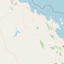
Map view of Blackwood National Park

Use this park location map to pinpoint Blackwood National Park in Australia, understand its exact geographic position, and read its mapped placement within the surrounding landscape more clearly.

Pigeon | © OpenStreetMap contributors

Location context for Blackwood National Park

Queensland
Park atlas

Browse other protected landscapes in Queensland's semi-arid interior and compare park geography

Explore Nearby National Parks and Protected Areas Beyond Blackwood National Park
Continue your discovery of Blackwood National Park by browsing other national parks and protected areas situated across Queensland's Brigalow Belt and dryland ecosystems. Compare their unique semi-arid terrain, conservation priorities, and regional geographic context to deepen your atlas exploration of Australia's interior protected landscapes.
National parkQueensland

Epping Forest National Park: Queensland National Park Protected Landscape Identity

Explore its mapped boundaries and regional geography.

Delve into the protected landscape of Epping Forest National Park, a designated national park situated in Queensland, Australia. This entry provides critical atlas-level information, focusing on the park's geographic setting and its role within the regional landscape. Understand its precise location, mapped protected area boundaries, and its contribution to the natural geography of northeastern Australia, offering a factual basis for geographic discovery.

Area
31.6 km²
Established
1971
IUCN
Ia
Relief
Lowland
National parkQueensland

Mazeppa National Park: Queensland's Semi-Arid Gidgee Scrub Protected Landscape

Explore mapped boundaries of this Central Queensland national park.

Mazeppa National Park preserves critical examples of semi-arid gidgee scrub, a vegetation type significantly reduced across inland Queensland. This protected woodland ecosystem, situated in Central Queensland, offers a glimpse into the region's natural heritage with its characteristic terrain of gently undulating plains and dense gidgee tree stands. Discover its mapped geographic context and the unique outback landscape identity that makes it a noteworthy conservation area among Australia's national parks.

Area
41.3 km²
Established
1972
IUCN
II
Scope
Terrestrial
National parkQueensland

Narrien Range National Park: Queensland's Protected Landscape for Geographic Exploration

Understand its mapped terrain and regional park context.

Narrien Range National Park represents a vital protected landscape within Queensland, Australia, offering a deep dive into regional geography and conservation lands. As a designated national park, it serves as a crucial point for atlas-based exploration, detailing its specific mapped boundaries and ecological context. Understanding Narrien Range National Park means appreciating its contribution to the diverse natural geography of northeastern Australia, providing a concrete example of protected land within the Sunshine State.

Area
40.2 km²
IUCN
II
Access
Access unknown
Scope
Terrestrial
National parkQueensland

Peak Range National Park: Mapped Protected Landscape and Regional Geography in Queensland

Explore Queensland's protected areas and natural terrain context.

Peak Range National Park is presented here as a key protected landscape within the diverse geography of Queensland, Australia. Users can explore its specific mapped boundaries and understand its regional setting, contributing to a structured overview of natural areas. This provides essential geographic context and supports deeper atlas-based discovery of Queensland's protected lands and varied terrain.

Area
25 km²
Established
1983
IUCN
II
Relief
Mountain
National parkQueensland

Cudmore National Park: Mapped Protected Area in Queensland's Geography

Explore the unique landscape and regional context.

Cudmore National Park represents a distinct protected landscape within the vast geographic expanse of Queensland, Australia. This national park offers a valuable point of entry for understanding regional conservation efforts and the mapped distribution of protected lands. Examine its specific location within Queensland's natural terrain and appreciate its role in the broader atlas of Australian protected areas, focusing on its geographic identity and landscape features.

Area
204 km²
Established
1998
IUCN
II
Climate
Arid
National parkQueensland

Forest Den National Park: Queensland's Protected Landscape and Geographic Atlas

Explore mapped boundaries and regional park geography.

Forest Den National Park stands as a distinct protected landscape within Queensland, Australia. This MoriAtlas entry provides detailed geographic context, focusing on the park's mapped boundaries and its position within the regional atlas. Discover the specific terrain and landscape characteristics that define this national park, aiding in structured geographic exploration and understanding its protected status within northeastern Australia.

Area
58.9 km²
Established
1991
IUCN
II
Relief
Upland
National parkQueensland

Moorrinya National Park: Queensland Protected Landscape Exploration

Mapped boundaries and regional park geography.

Moorrinya National Park represents a distinct protected landscape within Queensland, Australia, offering valuable insights into the region's natural terrain and geographic distribution of conservation areas. This national park serves as a focal point for understanding local environmental context and the broader atlas of Australian protected lands. Delve into the mapped outlines and regional setting to grasp its unique ecological position.

Area
326.07 km²
Established
1993
IUCN
II
Scope
Terrestrial
National parkIsaac Region

Homevale National Park: Central Queensland's Protected Sandstone and Fossil Landscape

Explore dramatic cliffs, peaks, and ancient Permian fossil sites.

Homevale National Park in Australia's Isaac Region is a testament to geological time and conservation. Its landscape is defined by striking sandstone formations, including dramatic cliffs, rugged peaks, and distinctive spires. Beyond its visual appeal, the park is scientifically vital for its Permian-period fossil discoveries, dating back 280 to 225 million years. This protected area offers a unique glimpse into ancient marine environments and the geological evolution of Central Queensland, making it a key destination for atlas-driven landscape discovery.

Area
218 km²
Established
1995
IUCN
II
Relief
Mountain

Common questions about visiting, size, designation, and location context for Blackwood National Park

Blackwood National Park FAQs for park facts, access, geography, and protected area context
Find quick answers about Blackwood National Park, including protected-area facts, park geography, trail and visitor context, and how the park fits into its surrounding country and regional landscape.
MoriAtlas Explorer

Continue Your Protected Areas Search Across the Global Atlas

Deepen your exploration by continuing the structured search for national parks and protected areas worldwide. Utilize the comprehensive filtering capabilities to compare different conservation landscapes and refine your understanding of global park geography. Discover more about the distribution and characteristics of protected natural areas.

Global natural geography