
Mori Atlas logo
Protected areaBogovë Nature Park

Examining the karst terrain, limestone ravines, and ecological character of this Balkan nature reserve

Bogovë Nature Park: A Protected Mediterranean Forest and Waterfall Landscape in Southern Albania

Bogovë Nature Park represents a vital protected area within the Pindus Mountains mixed forests ecoregion of southern Albania. This compact reserve showcases rugged limestone hills, dense deciduous woodland, and the prominent waterfall systems that define its valley geography. Understanding the park landscape provides clear insight into the ecological transition zones between the high Balkan interior and the coastal lowlands of the region.

nature parkwaterfallslimestone landscapemixed forestMediterranean forest ecoregionsouthern Albania
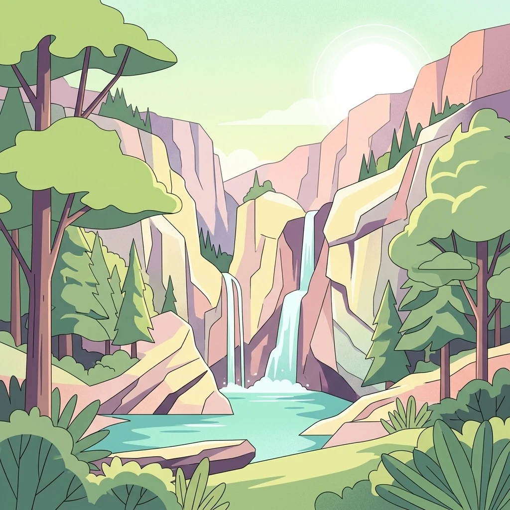
An illustrative vector style drawing of a double waterfall flowing into a blue pool, surrounded by cliffs, pine trees, and lush green vegetation under a bright sky.

Bogovë Nature Park

Protected area

Park overview

Structured park overview, official facts, and landscape profile for Bogovë Nature Park

Bogovë Nature Park park facts, protected area profile, and essential visitor context

Review the core facts for Bogovë Nature Park, including designation, size, terrain, visitor scale, habitats, and operating context in one park-focused overview.

About Bogovë Nature Park

Bogovë Nature Park is a small but ecologically meaningful protected area in southern Albania, formally established in 1977 as part of the country's early efforts to safeguard nationally important biodiversity and ecosystems. Covering roughly 330 hectares, the park belongs to a generation of Albanian nature reserves designated during the late twentieth century, when the state began formalizing a network of areas aimed at preserving characteristic landscapes and species. Administration falls under Albania's Ministry of Environment, and the site carries an IUCN Category IV designation, meaning it is managed primarily for the conservation of habitats and species rather than for strict wilderness preservation.

Geographically and ecologically, the park sits within the Pindus Mountains mixed forests terrestrial ecoregion of the Palearctic realm, classified as part of the broader Mediterranean forests, woodlands, and scrub biome. This places Bogovë within one of the most extensive and ecologically significant ecoregions of the western Balkans, where Balkan mixed deciduous forests meet the drier Mediterranean-influenced vegetation patterns of southern Albania. The park's relatively compact footprint nonetheless captures a representative cross-section of these habitats, supporting forests, woodland transition zones, rocky limestone outcrops, and the streams and gullies associated with its drainage system.

The landscape of the park is shaped heavily by limestone geology, producing karst-influenced terrain, scenic rocky hills, and the conditions that feed the Bogovë Waterfalls. These waterfalls are the central natural attraction and have shaped the park's public identity for decades, drawing day visitors from Berat and surrounding communities. Beyond the waterfalls, visitors encounter mixed woodlands, traditional rural landscapes at the edges of the protected area, and a peaceful forested environment that contrasts with the more dramatic mountain parks elsewhere in Albania.

Because of its position in southern Albania, Bogovë functions as both a local recreational resource and a conservation site, anchoring biodiversity protection in a region where agricultural land use and rural settlement are widespread. While the park is modest in size relative to Albania's large alpine and coastal national parks, its combination of waterfalls, broadleaf and mixed forest cover, limestone terrain, and accessible location gives it an outsized cultural and ecological significance at the regional level.

Quick facts and research context for Bogovë Nature Park

Bogovë Nature Park is located in southern Albania, with the city of Berat serving as the nearest urban reference point and main visitor gateway. It was formally established in 1977 as one of Albania's earlier nature protection areas and falls within the Pindus Mountains mixed forests terrestrial ecoregion, part of the wider Palearctic Mediterranean forests, woodlands, and scrub biome. Covering about 330 hectares, the park is classified under IUCN Category IV as a habitat and species management area, and it is administered by Albania's Ministry of Environment.

Protection and recognition

Explore terrestrial protection metrics and official designation data.

Bogovë Nature Park Protection Status and Conservation Records

Bogovë Nature Park maintains a documented terrestrial protection status with structured conservation records. Designated management scopes and international recognition metrics remain available for detailed verification.

Protection details

Protection scope
Terrestrial
Transboundary protection
No
Park context

Deeper park guide and search-rich context for Bogovë Nature Park

Bogovë Nature Park history, landscape, wildlife, and travel context

Explore Bogovë Nature Park through its history, landscape character, ecosystems, wildlife, conservation priorities, cultural context, and seasonal travel timing in a structured park guide built for atlas discovery and search intent.

Why Bogovë Nature Park stands out

Bogovë Nature Park is best known for the Bogovë Waterfalls, a series of cascades set within a wooded ravine in the limestone hills of southern Albania. The park's reputation also rests on its representation of the Pindus Mountains mixed forests ecoregion, which extends across much of the western Balkans, and on its role as an accessible forest and waterfall retreat for visitors traveling from Berat. Together, the waterfalls, the surrounding mixed deciduous forest, and the underlying limestone terrain define the park's most recognizable identity.
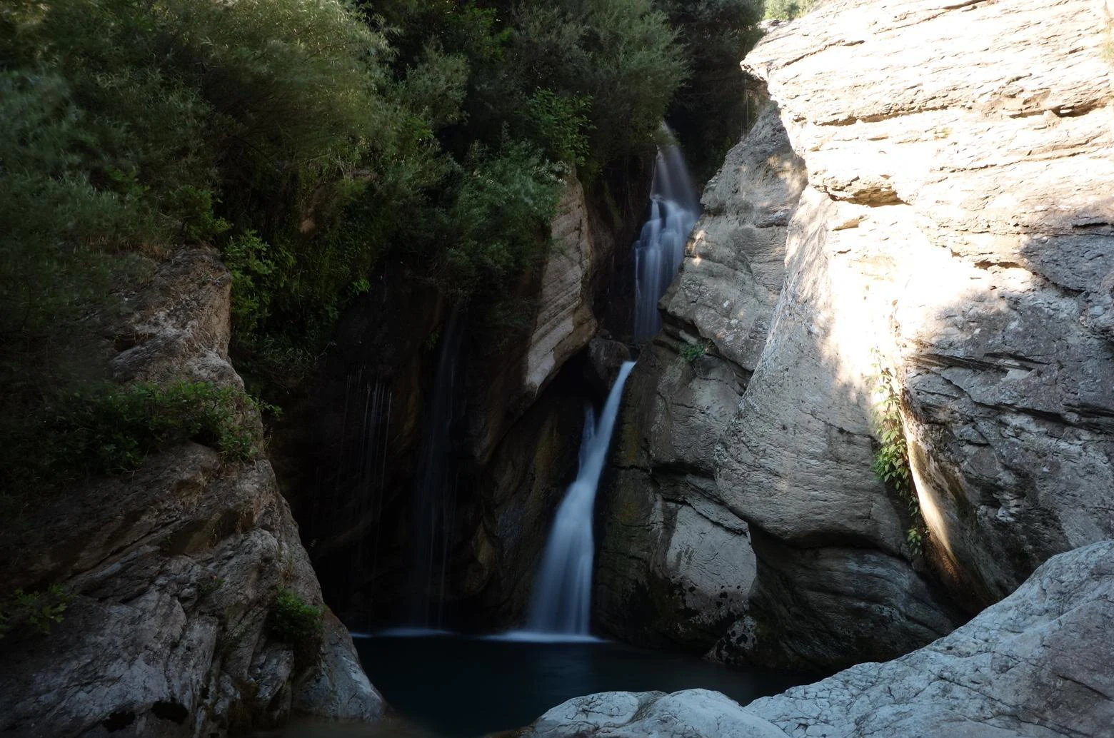
A multi-tiered waterfall flows down a rocky cliffside into a pool, framed by trees on one side and light-colored rock walls on the other.
The cascading waters of Bogovë Waterfall nestled within a rocky canyon.

Bogovë Nature Park history and protected-area timeline

Bogovë Nature Park was established in 1977 as one of the earlier formally designated nature protection areas of Albania. Its creation was part of a broader effort during that period to identify and protect ecosystems and biodiversity of national importance, including forest, freshwater, and karst-related habitats in the country's southern regions.

From its establishment onward, the park has been administered under national environmental authorities, currently the Ministry of Environment of Albania. Its IUCN Category IV status reflects a management orientation focused on habitat and species conservation alongside compatible human uses such as recreation, research, and traditional land management near the park's edges.

Over the decades, Bogovë has come to occupy a stable position in Albania's network of protected areas, recognized primarily for its waterfalls and its representation of Pindus Mountains mixed forest habitats rather than for dramatic landscape scale. While the surrounding region has experienced changes in land use and rural demographics since the late twentieth century, the park has remained a persistent local conservation landmark near Berat.

Bogovë Nature Park landscape and geographic character

The landscape of Bogovë Nature Park is defined by limestone hills and forested ravines typical of southern Albania's transition zone between mountainous interior terrain and the lower country toward the Adriatic. Karst-influenced geology shapes the terrain, producing rocky outcrops, irregular hill profiles, and the conditions that channel seasonal and perennial water through narrow valleys.

The park's most prominent landscape feature is the Bogovë Waterfalls, a multi-tiered cascade system that occupies a central forested glen. The waterfalls and the surrounding rock formations have become the visual signature of the park, and the contrast between the white water, dark limestone, and mixed green forest canopy creates the scenes most associated with Bogovë in regional imagery.

Surrounding the waterfall corridor, the protected area extends across gently to moderately sloped terrain with mixed broadleaf woodland, scattered clearings, and rocky ridge lines. Limestone exposures and small cave-like formations appear throughout the hills, contributing to the rugged character of the area. Streams and minor drainage channels link the higher slopes to the waterfall system, supporting both the visual and ecological coherence of the park's landscape.
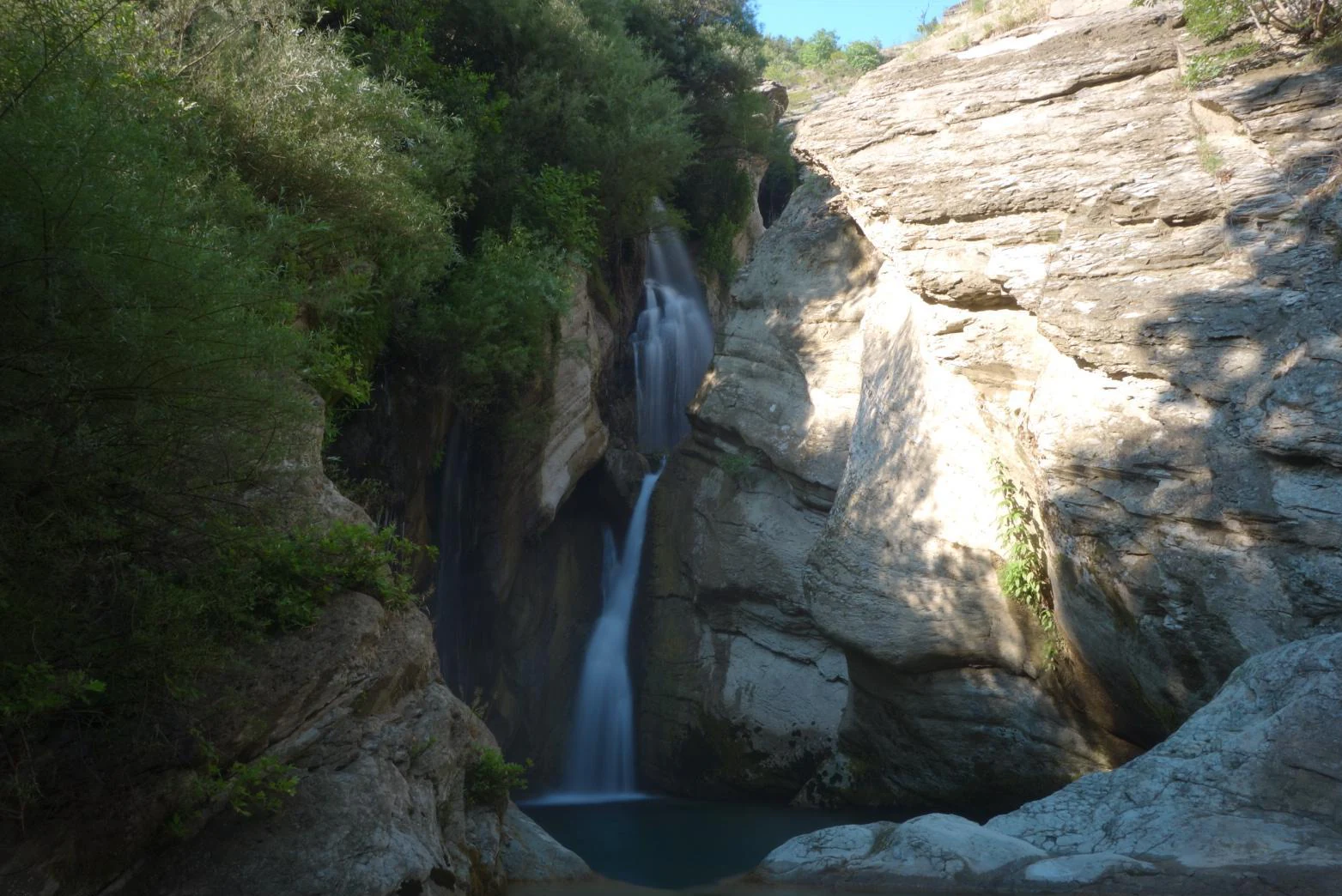
A waterfall cascades down a rocky canyon wall surrounded by lush greenery and shaded cliffs.
The Bogovë Waterfall, a prominent natural feature within Bogovë Nature Park.

Bogovë Nature Park ecosystems, habitats, and plant life

Ecologically, Bogovë Nature Park sits within the Pindus Mountains mixed forests terrestrial ecoregion, a globally recognized classification of the Palearctic realm that falls under the broader Mediterranean forests, woodlands, and scrub biome. This ecoregion is characteristic of much of the western Balkans and supports a mixture of broadleaf deciduous species, pines, and transitional woodland species adapted to a Mediterranean-influenced climate with mountain modification.

Within its modest footprint, the park protects a representative sample of these mixed forest communities, including wooded slopes, karstic rocky habitats, freshwater stream and waterfall environments, and edge habitats where forest meets traditional rural land use. This mosaic of small-scale habitats supports the ecological processes and species interactions typical of the wider Pindus region, even though the park's size limits the absolute scale of biodiversity it can host.

The protected area's value lies in part in its contribution to ecological connectivity at the ecoregional scale, anchoring a protected forest and karst landscape near Berat amid a region where natural and semi-natural habitat is increasingly interspersed with human land use. The presence of functioning woodland cover, fresh water, and karst substrates gives the park ecological significance beyond its compact area.
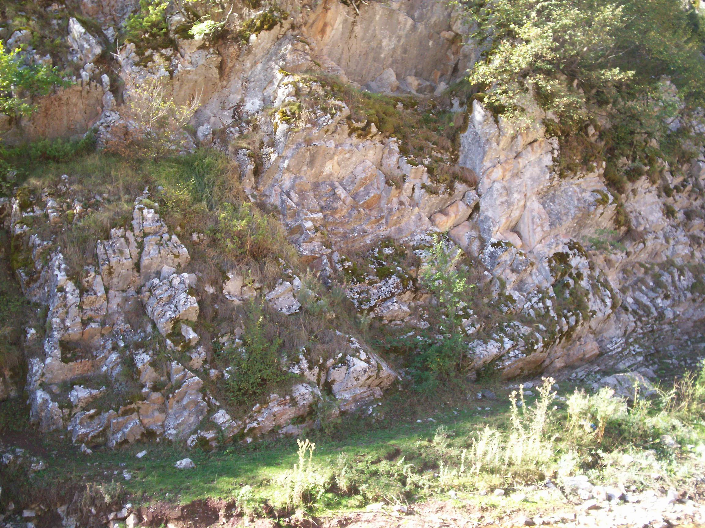
A close-up view of a rugged, light-colored rocky cliff face covered in patches of moss and small green shrubs, with a small patch of grass visible at the base.
A rocky cliff face and surrounding vegetation within Bogovë Nature Park.

Bogovë Nature Park wildlife and species highlights

Wildlife in Bogovë Nature Park reflects the broader species assemblages typical of the Pindus Mountains mixed forests ecoregion. The park's mixed deciduous and Mediterranean-influenced forests provide habitat for a variety of forest-dwelling birds, small and medium-sized mammals, and insects associated with both woodland and karst environments.

The waterfall and stream habitats further support freshwater and riparian wildlife, including invertebrates, amphibians, and bird species drawn to the moist microclimates along the watercourse corridors. Rocky limestone areas provide shelter for reptiles and small mammals adapted to crevice-rich terrain, while the surrounding woodland offers foraging and nesting habitat for typical Balkan forest bird communities.

While the park is not a flagship destination for charismatic megafauna, its combination of forest, water, and rock habitats supports the kind of species diversity associated with the wider Pindus ecological region. Its protected status contributes to the continuity of these wildlife communities in a region where habitat fragmentation from agriculture and rural development is an ongoing concern.

Bogovë Nature Park conservation status and protection priorities

Bogovë Nature Park carries clear conservation value as a formally protected area of Albania, anchored in its designation as an IUCN Category IV habitat and species management area. The park's establishment in 1977 reflects early recognition of its forests, freshwater habitats, and karstic terrain as resources of national importance, and it has since contributed to a regional network of protected sites in southern Albania.

The protected area safeguards a representative sample of the Pindus Mountains mixed forests ecoregion, helping maintain forest cover, freshwater systems, and limestone-associated habitats in a landscape where rural land use is prevalent. By protecting the watershed and forest mosaic that feeds the Bogovë Waterfalls, the park also helps preserve the ecological processes that sustain the area's distinctive scenery.

At a broader scale, Bogovë contributes to the conservation of Palearctic Mediterranean forest biodiversity within Albania, supporting habitat continuity for forest, stream, and karst-dependent species. Even as a smaller park, it plays a role in the country's efforts to maintain ecological representation across its varied ecoregions.

Bogovë Nature Park cultural meaning and human context

The park sits within a region of southern Albania where rural communities have long interacted with forested and karst landscapes, shaping traditional land use, grazing patterns, and small-scale resource harvesting at the edges of the protected area. The village of Bogovë and nearby settlements contribute to the cultural setting of the park, and the falls themselves have long been part of local identity and tourism memory.

Berat, the nearest city and a UNESCO-recognized cultural site, anchors the broader cultural context. Visitors approaching Bogovë typically pass through or near Berat's historical urban landscape, linking the park to one of Albania's most important heritage cities and reinforcing its role as a natural complement to regional cultural tourism.

Despite its modest size, the park carries a recognizable local cultural footprint, often featured in regional images of Albania's natural heritage as an accessible natural attraction connected to the Berat area.

Top sights and standout views in Bogovë Nature Park

The Bogovë Waterfalls stand at the heart of the park's identity, drawing visitors into a narrow limestone ravine where forested slopes frame cascading water. These falls, together with the surrounding karst terrain and mixed deciduous woodland, define the most photogenic and visited portions of the protected area.

Equally important to the park's character is its position within the Pindus Mountains mixed forests ecoregion, giving Bogovë tangible ecological significance as a protected representative of this broader Balkan forest system. The combination of forest, water, and limestone terrain, paired with straightforward access from Berat, makes the park a compact but distinctive destination within Albania's network of natural areas.

Best time to visit Bogovë Nature Park

The best time to experience Bogovë Nature Park generally aligns with the milder seasons of southern Albania, when the forest canopy, waterfalls, and surrounding limestone scenery are most comfortable to explore. Spring brings fresh green growth, active stream flow, and a lively atmosphere through the waterfall corridor, making it especially appealing for nature-focused visitors.

Autumn offers cooler temperatures, varied light through the deciduous canopy, and a quieter visitor experience compared with peak summer. Summer visits are feasible but tend to be warmer and more crowded locally, while winter conditions in the hills can bring cooler temperatures that change the visual mood of the park and reduce water flow at the falls. Across these seasons, the park retains its core ecological and scenic character, with the visit experience shifting according to weather, foliage, and water levels.
Monthly climate preview

Long-term representative point measurements tracking monthly averages across the protected area

Bogovë Nature Park Climate Normals, Annual Temperature and Precipitation Patterns

Bogovë Nature Park records measured temperature and precipitation normals derived from thirty years of satellite observations at a representative elevation point. Detailed monthly breakdowns provide precise climatological context for analyzing long-term environmental patterns across the protected landscape.
Annual mean14 °C
4 °C25 °C
Jan
Feb
Mar
Apr11°
May16°
Jun21°
Jul25°
Aug25°
Sep19°
Oct14°
Nov
Dec
Warmest month
August

24.9 °C

Coolest month
January

3.5 °C

Wettest month
November

4.4 mm/day

Driest month
July

0.7 mm/day

Park location guide

Geography guide, regional context, and park location map for Bogovë Nature Park

Bogovë Nature Park park geography, regions, and map view in Albania

Understand where Bogovë Nature Park sits in Albania through a broader geographic reading of the surrounding landscape, nearby location context, and its mapped position within the national park landscape.

How Bogovë Nature Park fits into Albania

Albania is a unitary parliamentary republic in Southeast Europe, situated on the Balkan Peninsula along the Adriatic and Ionian coastal regions. With a population of approximately 2.4 million people, it borders Montenegro, Kosovo, North Macedonia, and Greece. The country features varied landscapes ranging from the Albanian Alps to fertile coastal plains, with Tirana as its capital and largest city.

Wider geography shaping Bogovë Nature Park in Albania

Albania occupies the western part of the Balkan Peninsula in Southeast Europe. The country features a varied terrain with rugged mountain ranges including the Albanian Alps (Accursed Mountains), Korab, Skanderbeg Mountains, Pindus, and Ceraunian Mountains. Fertile lowland plains extend along the Adriatic and Ionian coastal regions. The country borders Montenegro to the northwest, Kosovo to the northeast, North Macedonia to the east, and Greece to the south.

Map view of Bogovë Nature Park

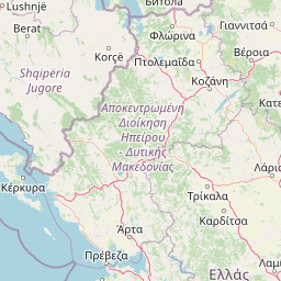
Use this park location map to pinpoint Bogovë Nature Park in Albania, understand its exact geographic position, and read its mapped placement within the surrounding landscape more clearly.

Pigeon | © OpenStreetMap contributors

Explore national park photography highlighting limestone ravines, mixed forests, and cascading waters.

Bogovë Nature Park Photos and Landscapes: Visual Guide to Waterfalls and Terrain

Examine detailed park imagery capturing the rugged limestone hills and wooded ravines of southern Albania. Visual documentation reveals the distinct terrain, forest habitats, and waterfall corridors defining the protected area.

A multi-tiered waterfall flows down a rocky cliffside into a pool, framed by trees on one side and light-colored rock walls on the other.

A multi-tiered waterfall cascading down rocky cliffs into a turquoise stream, surrounded by lush green trees and foliage.

A waterfall cascades down a rocky canyon wall surrounded by lush greenery and shaded cliffs.

A close-up view of a rugged, light-colored rocky cliff face covered in patches of moss and small green shrubs, with a small patch of grass visible at the base.

Park atlas

Compare adjacent limestone landscapes and regional forest ecosystems across southern Albania

Explore Other Parks Near Bogovë Nature Park and Surrounding Protected Areas

Continue geographic discovery beyond Bogovë Nature Park by browsing nearby protected areas and regional forest reserves. Comparing adjacent Balkan ecoregions reveals broader patterns in Mediterranean woodland terrain and watershed geography.
Watercolor painting showing mountains, a river, and vegetation
National parkAlbania
About 2.3 km away#1 closest

North

Tomorr Mountain National Park: Sacred Peak & Karst Protected Landscape in Albania

Explore Albania's dramatic mountain geography and protected areas.

Tomorr Mountain National Park offers a unique exploration of southern Albania's dramatic limestone anticline. Dominated by the sacred Mount Tomorr and featuring the spectacular Osum Canyon, this national park provides insight into karst terrain, old-growth forests, and significant biodiversity. Discover its mapped boundaries and regional geographic context within the Pindus Mountains for structured atlas exploration.

Area
271.855 km²
Established
1956
IUCN
II
Relief
Mountain
Watercolor painting showing a river valley with mountain ranges in the background and green fields
National parkGjirokastër County
About 35 km away#2 closest

South

Vjosa Wild River National Park: Europe's Pioneer Free-Flowing River Protected Area

Mapping dynamic canyons and vital river ecosystems in Gjirokastër County.

Vjosa Wild River National Park is recognized as Europe's first Wild River National Park, a groundbreaking designation protecting an entire river system from source to sea. This protected area in Gjirokastër County preserves remarkable topography, including dramatic canyons, natural rapids, and meandering islands, all shaped by the free flow of the Vjosa River and its tributaries. Explore the mapped boundaries and unique landscape context of this significant biodiversity hotspot, offering a crucial case study for river conservation and atlas discovery.

Area
127.27 km²
Established
2023
IUCN
II
Relief
Mixed relief
Watercolor painting of a landscape with green fields, scattered trees, and rolling hills under a light sky
National parkGjirokastër County
About 37 km away#3 closest

Southeast

Fir of Hotovë-Dangëlli National Park: Ancient Forests & Mountain Wilderness Atlas

Explore a premier protected landscape in Gjirokastër County, Albania.

Fir of Hotovë-Dangëlli National Park stands as a monumental protected area, celebrated for its exceptional old-growth Hotova Fir forests, which are a rare Mediterranean plant relic. This national park in Gjirokastër County offers a detailed look at a vast mountainous terrain, featuring dramatic canyons like Lengarica Canyon, and serving as a critical habitat for diverse wildlife. MoriAtlas provides structured geographic context for this significant landscape, highlighting its mapped boundaries and role as a key component of regional protected area networks.

Area
360.038 km²
Established
2008
IUCN
II
Relief
Mountain
A soft watercolor painting of layered rolling hills and mountains fading into the distance with small clusters of stylized trees in the foreground.
Protected landscapeAlbania
About 43 km away#4 closest

Northeast

Guri i Nikës-Lenie-Valamarë Protected Landscape: Albania Mountain and Forest Geography

A protected mosaic of Mediterranean woodlands and Pindus foothills

Spanning roughly 22 square kilometers near Pogradec, the Guri i Nikës-Lenie-Valamarë Protected Landscape protects a diverse array of forested slopes and freshwater habitats. This essential Balkan biological corridor provides a detailed look at the transition between dense woodland and scrub communities within the Pindus mountain system, highlighting its role as a key habitat for large carnivore populations.

Area
22 km²
Established
1996
IUCN
VI
Relief
Mountain
Protected landscapeKorçë County
About 59 km away#5 closest

East

Fir of Drenovë-Sinicë Protected Landscape: Forest and Geological Map of Korçë County

Mapping Albania's protected Silver fir woodland ecosystems

Explore the structured geography of the Fir of Drenovë-Sinicë Protected Landscape, a diverse expanse in Korçë County defined by its ancient Silver fir stands and karst cave systems. This area showcases a varied landscape of rocky monoliths, mountain lakes, and tectonic valleys that serve as a vital ecological record for the southeastern Albanian mountains.

Area
10.3 km²
Established
1966
IUCN
V
Relief
Mountain
Watercolor painting showing hills, green fields, a body of water, and vegetation under a soft sky
National parkAlbania
About 60 km away#6 closest

Northwest

Divjakë-Karavasta National Park: Albania's Expansive Coastal Wetland and Pelican Breeding Site

Mapping Albania's largest Mediterranean lagoon and its vital bird sanctuaries.

Divjakë-Karavasta National Park is a key protected coastal wetland in western Albania, centered around Karavasta Lagoon, one of the largest in the Mediterranean. This Ramsar site provides critical habitats for numerous bird species, including a globally significant population of the endangered Dalmatian pelican, making it a premier destination for understanding regional wetland geography and protected area dynamics.

Area
222.3 km²
Established
2007
IUCN
II
Relief
Lowland
Watercolor painting depicting mountains, forests, and valleys
National parkVlorë County
About 61 km away#7 closest

Southwest

Llogara National Park: Vlorë County's Dramatic Ceraunian Mountain Protected Landscape

Explore Albania's rugged national park geography and mapped terrain.

Llogara National Park stands as a vital protected area within Vlorë County, Albania, renowned for its spectacular Ceraunian Mountain topography. This page provides access to detailed geographic information, highlighting the park's unique landscape characteristics, from alpine peaks to coastal vistas. Discover the mapped extent of this national park and its significance within the regional geography, perfect for structured atlas exploration.

Area
17.69 km²
Established
1966
IUCN
II
Relief
Mountain
Protected landscapeAlbania
About 62 km away#8 closest

West

Vjosa-Nartë Protected Landscape: Geographic Boundaries and Wetland Atlas of Albania

Coastal lagoons, saltpans, and Adriatic delta systems

Vjosa-Nartë Protected Landscape offers a deep look into Albania's coastal geography. The area features a striking interplay between the Vjosa River delta and the Narta Lagoon, framed by Mediterranean pine forests and shifting sand dunes. This atlas-focused resource maps the diverse terrain and ecological zones that characterize one of the most vital wetland corridors along the Adriatic Sea.

Area
161.246 km²
Established
2004
Relief
Lowland
Climate
Mediterranean

Common questions about visiting, size, designation, and location context for Bogovë Nature Park

Bogovë Nature Park FAQs for park facts, access, geography, and protected area context

Find quick answers about Bogovë Nature Park, including protected-area facts, park geography, trail and visitor context, and how the park fits into its surrounding country and regional landscape.
MoriAtlas Explorer

Continue Your Protected Areas Search Across the Global Atlas

Deepen your exploration by continuing the structured search for national parks and protected areas worldwide. Utilize the comprehensive filtering capabilities to compare different conservation landscapes and refine your understanding of global park geography. Discover more about the distribution and characteristics of protected natural areas.

Global natural geography