

Mori Atlas logo
Nature reserveBon Bon Reserve

A vital conservation corridor featuring mulga woodlands, salt lake systems, and ephemeral wetlands.

Bon Bon Reserve: Mapping the Protected Arid Landscapes and Outback Terrain of South Australia

Bon Bon Reserve represents an expansive private protected area within the arid interior of South Australia. Spanning over 2,000 square kilometres of outback terrain, this nature reserve bridges key conservation zones to provide a critical refuge for native plant communities and arid-adapted wildlife. The landscape is defined by a mosaic of mulga woodlands, open bluebush plains, and the significant Lake Puckridge ephemeral wetland system.

arid zonemulga woodlandbluebush plainsprivate protected areasalt lakesephemeral wetland

Bon Bon Reserve

Nature reserve

Park overview

Structured park overview, official facts, and landscape profile for Bon Bon Reserve

Bon Bon Reserve park facts, protected area profile, and essential visitor context

Review the core facts for Bon Bon Reserve, including designation, size, terrain, visitor scale, habitats, and operating context in one park-focused overview.

About Bon Bon Reserve

Bon Bon Reserve stands as one of the most significant large-scale private conservation properties in central South Australia. Covering about 2,164 square kilometres of arid country west of Roxby Downs, the reserve sits within and adjacent to the Woomera Prohibited Area, a vast region historically associated with weapons testing and sparse pastoral activity. The surrounding context, including the Yellabinna Regional Reserve to the west and the Wabma Kadarbu Mound Springs Conservation Park to the north, gives Bon Bon Reserve a particular importance as a connective element in a wider network of protected arid land.

The character of the reserve is shaped by the vegetation and land systems typical of the South Australian outback. Mulga shrublands and woodlands dominate large sections, while open bluebush plains give way to salt lake basins and isolated stands of sandalwood. The ecological centrepiece of the property is Lake Puckridge, an unusually large ephemeral freshwater wetland that fills only intermittently and transforms the surrounding flats into a valuable feeding and resting ground for waders and waterbirds when conditions are right.

Through its management by Bush Heritage Australia, the reserve has been secured under a conservation covenant that guarantees its protection in perpetuity. This formal status places Bon Bon Reserve within Australia's National Reserve System and gives it an IUCN Category II designation, bringing private stewardship to a level of recognition usually reserved for state-managed national parks. The reserve's transformation from a long-running sheep station into a biodiversity-focused refuge has made it a notable example of landscape-scale conservation in Australia's arid zone.

Quick facts and research context for Bon Bon Reserve

Bon Bon Reserve is a privately owned conservation reserve of approximately 2,164 square kilometres in the South Australian outback. It lies west of Roxby Downs, within the broader Woomera Prohibited Area region. The reserve is owned and managed by Bush Heritage Australia and has been held under a conservation covenant since 2008, securing its protection in perpetuity. It is officially recognised as part of Australia's National Reserve System and carries an IUCN Category II classification, aligning it in status with national parks.

Its landscape combines mulga woodlands, bluebush plains, sandalwood stands, and salt lakes, with the episodic Lake Puckridge at its centre. The reserve functions as a connecting link between two larger protected areas in the region, Yellabinna Regional Reserve and Wabma Kadarbu Mound Springs Conservation Park, enhancing the connectivity of arid-zone conservation in South Australia.

Protection and recognition

Documented terrestrial protection scope and international recognition records

Bon Bon Reserve Protection Status and Conservation Framework Overview

Bon Bon Reserve holds a documented terrestrial protection scope within the official geographic database. Conservation researchers and regional explorers examine these structured protection records for baseline administrative data.

Protection details

Protection scope
Terrestrial
Transboundary protection
No
Park context

Deeper park guide and search-rich context for Bon Bon Reserve

Bon Bon Reserve history, landscape, wildlife, and travel context

Explore Bon Bon Reserve through its history, landscape character, ecosystems, wildlife, conservation priorities, cultural context, and seasonal travel timing in a structured park guide built for atlas discovery and search intent.

Why Bon Bon Reserve stands out

Bon Bon Reserve is best known for its exceptionally large extent of intact arid-zone habitat, particularly mulga woodlands and bluebush plains surrounding the episodic Lake Puckridge. The reserve fills an important conservation gap between major protected blocks, strengthening connectivity for arid-adapted wildlife across central South Australia. It is also recognised for supporting threatened species such as the plains-wanderer, the Major Mitchell's cockatoo, and the southern hairy-nosed wombat, and as a flagship example of how a former pastoral property can be transitioned into long-term private conservation.

Bon Bon Reserve history and protected-area timeline

Before becoming a reserve, Bon Bon was a working sheep station for around 150 years. During the late twentieth century, the property ran an average of roughly 15,000 sheep, with flocks at times exceeding 23,000 head. The long history of grazing shaped the vegetation and soil conditions that subsequent conservation efforts have worked to restore.

In 2008, the property was acquired by Bush Heritage Australia for approximately A$4 million, with the Australian and South Australian governments sharing part of the purchase cost. The sale was arranged with the station's owner, grazier Paul Blight, who had deliberately kept stock numbers comparatively low in the years leading up to the sale to allow vegetation to regenerate. His wish to see the property managed in an environmentally sensitive way underpinned the transition to conservation ownership.

Following the acquisition, the property was placed under a conservation covenant committing BHA to managing it in perpetuity, securing its place within the National Reserve System. In April 2013, the Government of South Australia formally gazetted the land encompassing the reserve as a locality under the name 'Bon Bon', further embedding its identity as a recognised place in the state's administrative geography.

Bon Bon Reserve landscape and geographic character

Bon Bon Reserve occupies a broad swathe of the South Australian arid zone, where flat to gently undulating country extends in all directions under a wide outback sky. Much of the terrain is defined by neutral to reddish desert soils that support the characteristic plant communities of this region, with vegetation patterns shifting between denser woodland patches and open shrubland.

Mulga woodlands and shrublands are among the defining landscape features, lending the reserve a textural mosaic of low tree cover interspersed with grassy understorey. Elsewhere, bluebush plains stretch across more open ground, and isolated stands of sandalwood punctuate the broader vegetation cover. Salt lake systems add another distinct dimension to the landscape, their pale surfaces contrasting with the surrounding mulga and bluebush.

At the heart of the reserve lies Lake Puckridge, an extensive ephemeral wetland roughly eight kilometres across. For most years, the lake bed is dry, but on average about once every decade the system fills with freshwater and becomes an important seasonal feature of the landscape, drawing waterbirds and dramatically altering the character of the surrounding plains.

Bon Bon Reserve ecosystems, habitats, and plant life

The ecological identity of Bon Bon Reserve is closely tied to the arid and semi-arid vegetation systems of central South Australia. Mulga shrublands and woodlands form the structural backbone of much of the reserve, providing habitat for a suite of arid-adapted fauna and supporting the characteristic patterning of low tree cover, scattered shrubs, and open ground typical of the region.

Bluebush plains add a distinctive open-country dimension, contributing to habitat mosaic diversity across the property. Sandalwood stands, anchored by the species Santalum spicatum, contribute further botanical interest and reflect the broader distribution of these plants across southern Australian arid lands. The salt lake systems, including the bed of Lake Puckridge, also support specialised vegetation patterns adapted to episodic inundation and saline-influenced soils.

The reserve's ecological significance is amplified by its role as a connecting link between larger protected blocks, namely Yellabinna Regional Reserve and Wabma Kadarbu Mound Springs Conservation Park. This positioning supports wildlife movement and ecological processes across a far broader landscape than the reserve alone, helping maintain a more continuous arid conservation estate in the region.

Bon Bon Reserve wildlife and species highlights

Bon Bon Reserve supports a characteristic range of arid-zone fauna, with several species of conservation concern either known from or considered likely to occur on the property. The presence of such species gives the reserve particular importance for the future of arid wildlife in South Australia.

Among the most notable threatened species associated with the reserve are the plains-wanderer, a small and elusive ground-dwelling bird of open grasslands; the Major Mitchell's cockatoo, recognised for its pink and white plumage and dependence on tree hollows; the chestnut-breasted whiteface, a small bird restricted to parts of the arid interior; and the thick-billed grasswren, another habitat-specialist bird of chenopod shrublands. The southern hairy-nosed wombat, one of the iconic larger mammals of the South Australian outback, is also found on the reserve.

When Lake Puckridge fills following significant rainfall, the wetland briefly becomes a focal point for waders and waterbirds, drawing migratory and nomadic species to its shallow waters. These episodic events, although infrequent, elevate the reserve's role as habitat for waterbirds and highlight how its wildlife value can shift dramatically with rainfall in the arid interior.

Bon Bon Reserve conservation status and protection priorities

Bon Bon Reserve's conservation significance rests on its substantial size, its formal protection status, and its strategic location between other protected areas. Holding the reserve under a conservation covenant commits Bush Heritage Australia to managing it in perpetuity, a level of long-term assurance that is rare for privately held land. Its place within Australia's National Reserve System and its IUCN Category II designation underscore its standing alongside formally gazetted national parks.

The reserve contributes to the connectivity of arid-zone conservation in South Australia by filling the gap between Yellabinna Regional Reserve and Wabma Kadarbu Mound Springs Conservation Park. This landscape-scale link supports wildlife movement and ecological processes that span beyond the reserve's boundaries, strengthening the resilience of protected arid habitat in the face of pressures such as grazing history, feral animals, and climate variability.

The acquisition in 2008 was also framed as an opportunity to repair the ecological legacy of more than a century of sheep grazing. By removing most livestock pressure and managing the property for biodiversity, BHA aims to allow mulga, bluebush, and other native vegetation communities to recover, while protecting habitats for threatened species that depend on intact arid landscapes.

Bon Bon Reserve cultural meaning and human context

The cultural landscape of Bon Bon Reserve is closely tied to the long pastoral history of the South Australian outback. For roughly 150 years, the property operated as Bon Bon Station, a working sheep enterprise that shaped both the land and the local economy. The transition from grazing to conservation reflects a broader shift in values for this part of Australia, where former pastoral properties have increasingly been acquired for nature conservation and cultural heritage purposes.

While the reserve does not carry detailed public documentation of Aboriginal cultural associations in available sources, its location within country traditionally associated with Aboriginal peoples of the arid interior suggests the broader region carries cultural significance. The formal gazettal of 'Bon Bon' as a South Australian locality in 2013 reflects ongoing recognition of the place as part of the state's geographic and cultural fabric.

Top sights and standout views in Bon Bon Reserve

Bon Bon Reserve's standout qualities include its sheer scale, its role as a connective link in South Australia's arid protected-area network, and the dramatic oscillation of Lake Puckridge between dry lakebed and vibrant ephemeral wetland. The reserve offers an exceptionally large example of mulga woodland and bluebush plain habitat, accompanied by sandalwood stands and salt lake systems that together represent the ecological signature of central South Australia.

Combined with its formal status in Australia's National Reserve System and its IUCN Category II classification, these qualities make the reserve a particularly strong example of how large pastoral properties can be transformed into long-term biodiversity refuges. The presence of threatened species such as the plains-wanderer, the Major Mitchell's cockatoo, the chestnut-breasted whiteface, the thick-billed grasswren, and the southern hairy-nosed wombat adds further weight to its conservation profile.

Best time to visit Bon Bon Reserve

In the arid South Australian outback, conditions vary sharply with rainfall and temperature, and this shapes the experience of visiting Bon Bon Reserve. Cooler months, generally from late autumn through early spring, are typically more comfortable for outdoor activity, with milder daytime temperatures and cooler nights. Cooler seasons also tend to be more pleasant for travel on remote outback roads.

Wildlife and landscape character can shift significantly with recent rainfall. When the region receives sustained rains, vegetation responds quickly and Lake Puckridge may fill, transforming the reserve into an active hub for waterbirds and giving the landscape a greener, more lush appearance. Periods of drought, by contrast, leave the country dry and muted, with wildlife more dispersed. Visiting with an awareness of recent seasonal conditions offers the best sense of the reserve's dynamic character.
Monthly climate preview

Long-term monthly temperature and precipitation patterns across representative South Australia terrain

Bon Bon Reserve Climate Normals and Annual Temperature Rhythm

Historical data records long-term annual temperature swings and low monthly precipitation at a representative coordinate within Bon Bon Reserve. Examining the full twelve-month profile reveals detailed monthly averages across temperature extremes and precipitation patterns.
Annual mean20 °C
11 °C29 °C
Jan29°
Feb28°
Mar24°
Apr20°
May15°
Jun12°
Jul11°
Aug13°
Sep17°
Oct20°
Nov24°
Dec26°
Warmest month
January

28.8 °C

Coolest month
July

11.3 °C

Wettest month
February

0.9 mm/day

Driest month
March

0.3 mm/day

Park location guide

Geography guide, regional context, and park location map for Bon Bon Reserve

Bon Bon Reserve park geography, regions, and map view in Australia

Understand where Bon Bon Reserve sits in Australia through a broader geographic reading of the surrounding landscape, nearby location context, and its mapped position within the national park landscape.

How Bon Bon Reserve fits into Australia

Australia is a constitutional monarchy and federal parliamentary democracy comprising six states and ten territories. With a population of nearly 28 million, it is one of the world's most urbanised countries, with most people concentrated on the eastern seaboard. The country has a high Human Development Index and is known for its cultural diversity, ancient Aboriginal heritage, and unique wildlife.

Wider geography shaping Bon Bon Reserve in Australia

Australia occupies the entire Australian continent, the island of Tasmania, and numerous smaller islands. It is the world's flattest and driest inhabited continent, featuring vast deserts in the interior (the Outback), tropical rainforests along the eastern coast, and a coastline bordering the Indian and Pacific Oceans.

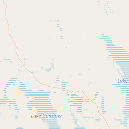
Map view of Bon Bon Reserve

Use this park location map to pinpoint Bon Bon Reserve in Australia, understand its exact geographic position, and read its mapped placement within the surrounding landscape more clearly.

Pigeon | © OpenStreetMap contributors

Location context for Bon Bon Reserve

South Australia
Park atlas

Compare surrounding arid landscapes and regional conservation reserves across South Australia

Explore Protected Areas and Parks Near Bon Bon Reserve

Continue exploring regional protected landscapes and arid-zone reserves connected to the broader South Australian outback corridor. Compare surrounding terrain types, mulga woodlands, and conserved habitats to expand your understanding of the wider geographic network.
National parkSouth Australia
About 55 km away#1 closest

South

Lake Gairdner National Park: National Park with Unique South Australian Geography and Mapped Boundaries

South Australian protected area with distinct landscape characteristics.

Lake Gairdner National Park serves as a key protected area within the geographic expanse of South Australia. This national park offers a unique focus for atlas exploration, highlighting its specific landscape features and mapped boundaries. Users can delve into the park's protected status and its contribution to the regional geography, providing valuable context for understanding Australia's diverse natural protected lands and their cartographic representation.

Area
5,531.77 km²
Established
1991
IUCN
VI
Relief
Lowland
National parkSouth Australia
About 160 km away#2 closest

East

Lake Torrens National Park: Explore South Australia's Remarkable Inland Salt Lake Geography

A unique protected landscape of arid plains and expansive salt flats.

Lake Torrens National Park offers an unparalleled exploration of Australia's remote outback, centered around a vast, ancient salt lake basin. This national park in South Australia provides a canvas of stark, minimalist terrain, featuring shimmering saltpans, arid gibber plains, and rocky outcrops. Understand the park's unique geographic identity, its ecological significance as a temporary wetland habitat, and its dramatic visual appeal for landscape photography and geological interest. It is a key protected area showcasing the extreme environment of Australia's interior.

Area
5,676.68 km²
Established
1991
IUCN
VI
Relief
Lowland
Wildlife reserveSouth Australia
About 187 km away#3 closest

Northwest

Kanku-Breakaways Conservation Park: Mapping the Arid Mesa Landscapes of South Australia

Indigenous cultural heritage meets striking desert geological formations

Kanku-Breakaways Conservation Park offers a window into the arid geography of northern South Australia. This protected wildlife reserve showcases a distinctive panorama of mesas and low hills that contrast sharply with the surrounding desert plains, providing a profound study of erosion and natural landscape evolution within the outback.

Area
143.23 km²
Established
2013
IUCN
III
Relief
Upland
National parkSouth Australia
About 199 km away#4 closest

South

Gawler Ranges National Park: South Australia's Mapped Protected National Landscape

Explore the geography and protected area context of this national park.

Gawler Ranges National Park stands as a significant protected area within the geographic expanse of South Australia. Designated as a national park, it offers valuable insights into Australia's conservation landscapes and regional geography. Users can explore its mapped boundaries and understand its unique role within the national park system, making it a key point for structured geographic study and atlas-based discovery of protected lands.

Area
1,628.75 km²
Established
2002
IUCN
VI
Relief
Mountain
Wildlife reserveSouth Australia
About 224 km away#5 closest

South

Gawler Ranges Conservation Park: Mallee Landscapes and Regional Protected Areas

Semi-arid habitat and rocky terrain of South Australia

Gawler Ranges Conservation Park protects a core area of tree mallee woodland and rocky rises near the southern fringe of the Gawler Ranges. This wildlife reserve serves as an essential anchor for regional biodiversity on the Eyre Peninsula, offering a look at the arid-adapted vegetation and weathered geological structures that define this remote section of South Australia.

Area
154.8 km²
Established
1993
IUCN
VI
Relief
Upland
National parkSouth Australia
About 236 km away#6 closest

East

Nilpena Ediacara National Park: South Australia National Park and Protected Landscape Identity

Mapped protected area within the regional geography of South Australia.

Nilpena Ediacara National Park represents a significant protected landscape within South Australia. This entry provides a detailed geographic context for the park, focusing on its role as a national park and its mapped boundaries. Delve into the specific atlas-driven understanding of this protected area, its landscape context, and its significance within the broader geographic framework of the Australian state.

Area
606.17 km²
Established
2021
IUCN
VI
Relief
Mountain
Wildlife reserveSouth Australia
About 244 km away#7 closest

Northeast

Elliot Price Conservation Park: Arid Wildlife Reserve and Lake Eyre Shoreline Geography

Strict protected landscape on the Hunt Peninsula, South Australia.

Elliot Price Conservation Park represents a vital, ungrazed arid-zone benchmark in South Australia. The protected area features prominent limestone cliffs, saltpans, and sand hummocks across the Hunt Peninsula, offering a unique opportunity to study the region's natural ecology and geological character without the influence of pastoral activity.

Area
634.53 km²
Established
1967
IUCN
Ia
Relief
Lowland
Nature reserveSouth Australia
About 266 km away#8 closest

Southwest

Eba Island Conservation Park: Coastal Landforms and Nature Reserve Geography in South Australia

A protected offshore sanctuary within Streaky Bay's coastal landscape.

Eba Island Conservation Park represents a key protected area within the coastal geography of South Australia. Composed primarily of calcarenite and limestone, the reserve features a diverse range of coastal landforms, including rugged jagged ridges, active blowholes, and sheltered coves, providing an essential habitat for seabird colonies.

Area
1.34 km²
Established
1966
IUCN
Ia
Relief
Lowland

Common questions about visiting, size, designation, and location context for Bon Bon Reserve

Bon Bon Reserve FAQs for park facts, access, geography, and protected area context

Find quick answers about Bon Bon Reserve, including protected-area facts, park geography, trail and visitor context, and how the park fits into its surrounding country and regional landscape.
MoriAtlas Explorer

Continue Your Protected Areas Search Across the Global Atlas

Deepen your exploration by continuing the structured search for national parks and protected areas worldwide. Utilize the comprehensive filtering capabilities to compare different conservation landscapes and refine your understanding of global park geography. Discover more about the distribution and characteristics of protected natural areas.

Global natural geography