
Islands
Park geography
Detailed spatial data covering coastal terrain, boundary measurements, and regional landscape features
Comprehensive Geographic and Environmental Profile of Booti Booti National Park, New South Wales
Review the geographic framework of Booti Booti National Park, encompassing 15.67 square kilometers of protected land in New South Wales. This structured profile details the coastal terrain, including dunes, wetlands, and temperate forests, while outlining elevation data reaching up to 224 meters.
Related tags
coastal national parkNew South Walesrainforestsclerophyll forestbirdwatching
Coastal protected area where ancient islands meet Wallis Lake on the New South Wales mid‑north coast
Booti Booti National Park
Booti Booti National Park is a coastal protected area in New South Wales, Australia, situated approximately 282 kilometres north‑north‑east of Sydney near the twin holiday towns of Forster and Tuncurry. The park covers 15.67 square kilometres and was established as a national park in 1992, having previously functioned as a state recreation area since 1977. The landscape is defined by three prominent hill complexes that were once separate islands—Cape Hawke, Booti Hill, and Charlotte Head—connected by low‑lying estuarine and aeolian sand deposits that now separate Wallis Lake from the Pacific Ocean. The park supports remarkable botanical diversity with 654 native plant species forming 46 distinct plant communities, including significant rainforest coverage and various sclerophyll forest types. Its coastal position makes it a popular destination for hiking, birdwatching, swimming, and seasonal whale watching.
- Location
- Australia
- Park type
- National park
- Established
- 1992
- Area
- 15.7 km²
- Highest point
- 224 m
Location overview
Coastal protected area geography in New South Wales, Australia
Geographic Location of Booti Booti National Park in Australia
Booti Booti National Park is situated within the state of New South Wales in Australia. Records classify the protected landscape as a coastal park, focusing on its regional administrative structure and geographic profile.
- Countries
- Australia
- Regions
- New South Wales
- Primary location
- New South Wales
- Geographic setting
- Coastal
Boundary and coordinates
Analyzing the 15.67 square kilometer spatial extent and layout
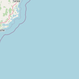
Booti Booti National Park Boundary Map and Geographic Limits
Detailed boundary geometry maps the physical shape of Booti Booti National Park to provide essential spatial context. Accompanying geographic records detail the 15.67 square kilometer area, perimeter, and coordinate limits.
- Boundary area
- 15.4 km²
- Boundary perimeter
- 82.1 km
- Northernmost point
- 32.203° S
- Southernmost point
- 32.3367° S
- Easternmost point
- 152.5711° E
- Westernmost point
- 152.4713° E
- Geographic centre
- 32.2573° S, 152.538° E
- North–south span
- 14.8 km
- East–west span
- 9.4 km
Elevation and terrain
Highland relief metrics and recorded physical natural features within boundaries
Booti Booti National Park Terrain and Elevation Range Profile
Recorded elevation ranges span from 96 meters to 224 meters across the highland terrain profile. Associated feature cards detail names, types, and spatial relationships for recorded islands, beaches, and waterways.
- Minimum elevation
- 96 m
- Maximum elevation
- 224 m
- Highest point
- 224 m
Selected named natural features
Islands
Shepherd Island
Islands
Snake Island
Beaches
McBrides Beach
Beaches
Seven Mile Beach
Lakes
Wallis Lake
Environmental setting
Temperate climate zones, forest cover, and coastal wetland formations
Booti Booti National Park Environmental Setting and Physical Classifications
Recorded landscape features, habitat types, and relief attributes serve as interpretive categories for the physical setting. Linked classifications connect recorded environmental markers to corresponding atlas destinations.
- Relief
- Highland
- Climate
- Temperate
- Water
- Major water bodies
- Forest cover
- Mostly forested
- Seasonality
- Year-round
Landscape features
Hills · Cliffs · Beach · Dunes · Wetland · Lakes · Forest · Woodland
Habitat types
Temperate broadleaf forest · Wetland · Coastal habitat
Park atlas
Discover the Regional Protected Landscapes and Coastal Geography Surrounding Booti Booti National Park in New South Wales, Australia
Explore Nearby National Parks and Protected Areas Beyond Booti Booti National Park
Browse national parks and protected areas located in the geographic vicinity of Booti Booti National Park, allowing for discovery of similar coastal landscapes and diverse forest ecosystems in New South Wales. Compare park features, trace regional conservation patterns, and understand the spread of protected coastal zones beyond this specific park view.
National parkNew South Wales
1.7 km away#1 closest
Southwest

Wallingat National Park: Explore Protected Landscape and Regional Geography in New South Wales
Discover mapped park boundaries and terrain context.
Wallingat National Park in New South Wales is a protected landscape crucial for understanding Australia's natural geography. This canonical page detail provides essential information for atlas exploration, focusing on the park's protected status, mapped contours, and its place within the regional context. Discover the unique geographic features that distinguish this national park from others in the atlas.
- Area
- 65.57 km²
- Established
- 1999
- IUCN
- II
- Relief
- Lowland
Nature reserveNew South Wales
About 3.9 km away#2 closest
Northwest
Wallis Island Nature Reserve: Estuarine Protected Landscapes of the New South Wales Coast
Coastal heath, lagoon systems, and wetland habitat geography
Spanning over 580 hectares, Wallis Island Nature Reserve anchors the protective network around Wallis Lake. The site is defined by its characteristic wet heathland and swamp terrain, offering a clear geographic look at Australia's estuarine island environments and the layered history of coastal land management.
- Area
- 5.84 km²
- Established
- 1983
- Relief
- Lowland
- Scope
- Terrestrial
National parkNew South Wales
7.2 km away#3 closest
Southwest
Myall Lakes National Park National Park: Mapped Boundaries and Protected Landscape Exploration
Discover its regional geography and natural terrain context.
Delve into the specific protected landscape and geographic features of Myall Lakes National Park. As a national park located in New South Wales, it provides critical atlas context for understanding protected areas and their distribution. Explore its mapped terrain and boundaries to gain a deeper appreciation for this significant natural area within Australia's geography.
- Area
- 448 km²
- Established
- 1972
- IUCN
- II
- Relief
- Lowland
National parkNew South Wales
30 km away#4 closest
West
Ghin-Doo-Ee National Park: National Park Protected Area Exploration in New South Wales
Mapped landscape and regional geography for Ghin-Doo-Ee National Park.
Ghin-Doo-Ee National Park represents a key component of Australia's protected lands, situated within the diverse geography of New South Wales. This park offers a structured point of entry for understanding its specific mapped boundaries, terrain characteristics, and its role as a national park. Users can delve into its unique landscape features and regional geographic context, contributing to a broader appreciation of conservation areas and natural atlas exploration.
- Area
- 47.936 km²
- Established
- 1999
- IUCN
- II
- Relief
- Upland
Nature reserveNew South Wales
About 33 km away#5 closest
North
Coocumbac Island Nature Reserve: Mapping Rare Rainforest on the Manning River
Protected island geography in New South Wales
Coocumbac Island Nature Reserve represents a key protected area on the mid-north coast of New South Wales, safeguarding a distinct subtropical lowland rainforest community. The reserve features a dense canopy of strangler figs, mangroves, and alluvial river terrain that serves as a sanctuary for rainforest-dependent wildlife. Its geography provides a clear window into the ecological history of the Manning River and its traditional significance as an Indigenous meeting place.
- Area
- 0.06 km²
- Established
- 1981
- IUCN
- IV
- Water
- Water-dominated
Nature reserveNew South Wales
About 40 km away#6 closest
North
Wingham Brush Nature Reserve: Protected Rainforest and Manning River Floodplain Geography
An essential ecological sanctuary in coastal New South Wales.
Wingham Brush Nature Reserve represents a critical protected landscape featuring subtropical rainforests on the Manning River floodplain. This unique site, known for its massive Moreton Bay figs and successful regeneration methods, provides a sanctuary for avian and reptilian life amidst the broader coastal plains of eastern Australia.
- Area
- 0.08 km²
- Established
- 2000
- IUCN
- IV
- Relief
- Lowland
Nature reserveNew South Wales
About 42 km away#7 closest
West
The Glen Nature Reserve: Protected Forest Geography and Mapped Sanctuary in New South Wales
Conservation-focused landscape in the Hunter Region
Covering over 2,700 hectares, The Glen Nature Reserve protects a rich mosaic of sub-tropical sclerophyll forest and creek-lined gullies in the Hunter Region. The reserve provides essential habitat for threatened wildlife and represents a key node in the protected land network of eastern New South Wales, highlighting the intersection of forest types and local watershed topography.
- Area
- 27.5 km²
- Established
- 1999
- IUCN
- Ia
- Relief
- Upland
National parkNew South Wales
About 46 km away#8 closest
North
Crowdy Bay National Park: New South Wales Protected Coastal Landscape and Terrain Map
Explore mapped boundaries and diverse natural geography within this national park.
Crowdy Bay National Park offers a compelling example of coastal protected landscape in New South Wales, Australia. This page facilitates a detailed atlas exploration of its natural geography, focusing on the interaction between ocean beaches, headlands, and inland forested terrain. Understand the park's specific location and its characteristic ecosystems, providing a structured view of this significant national park for geographic discovery.
- Area
- 102 km²
- Established
- 1972
- IUCN
- II
- Relief
- Lowland
MoriAtlas Explorer
Continue Exploring Booti Booti National Park's Mapped Geography and Landscape
Deepen your understanding of Booti Booti National Park by continuing this atlas exploration. Examine its specific protected area identity and its context within the regional geography of New South Wales. This focused approach offers valuable insights into the mapped landscapes and protected natural areas that define Australia's geographic tapestry.
Browse next
Global natural geography
Explore related park routes
Explore MoriAtlas Global ParksBrowse All MoriAtlas ParksGlobal Park Map DiscoveryMoriAtlas: Browse All CountriesBrowse All MoriAtlas ContinentsNational Park Environment AtlasGrand Canyon National Park AtlasYellowstone National Park AtlasYosemite National Park Atlas and GeographySerengeti National Park AtlasGalápagos National Park Protected LandscapeBanff National Park Geography and AtlasKruger National Park Atlas EntryUluṟu-Kata Tjuṯa National Park AtlasExplore Uluru-Kata Tjuta National Park GeographyPlitvice Lakes National Park AtlasFiordland National Park Protected LandscapeGreat Smoky Mountains National Park AtlasAfghanistan National Parks and Protected AreasAlbania National Parks and Protected AreasAlgeria National Parks and Protected AreasAmerican Samoa National Parks and Protected AreasAndorra National Parks and Protected AreasAngola National Parks and Protected AreasAntarctica National Parks and Protected AreasAntigua and Barbuda Park List