Mori Atlas logo
Marine protected areaBremer Marine Park

Explore the unique submarine canyons, oceanographic currents, and vast protected boundaries off the southern coast of Western Australia.

Bremer Marine Park: A Comprehensive Geographic Atlas of Australia's Deep Sea Protected Landscapes

Bremer Marine Park serves as a critical marine protected area located off the southern coast of Western Australia. The park encompasses a massive offshore expanse defined by the deep Bremer Canyon, which reaches depths of nearly six thousand metres. This submarine topography interacts with the Leeuwin Current to generate intense biological productivity, creating a distinct environment defined by ancient submerged coastlines, complex coral gardens, and shifting oceanic fronts.

marine parksubmarine canyondeep sea habitatscoral gardenswhale watchingorca

Bremer Marine Park

Marine protected area

Park overview

Structured park overview, official facts, and landscape profile for Bremer Marine Park

Bremer Marine Park park facts, protected area profile, and essential visitor context

Review the core facts for Bremer Marine Park, including designation, size, terrain, visitor scale, habitats, and operating context in one park-focused overview.

About Bremer Marine Park

Bremer Marine Park is a substantial offshore national park in the South-west Marine Parks Network off Western Australia, and one of the most ecologically dynamic marine reserves along Australia's southern coastline. Stretching from shallower shelf waters into a network of deep submarine canyons, the park captures a vertical transition of habitats that few other Australian marine reserves combine in a single boundary.

The defining feature of the park is Bremer Canyon, a deep submarine valley whose steep walls and irregular topography interact with the regional current system to generate consistent upwelling events. These events lift nutrient-rich deep water toward the surface, fertilising the upper ocean and triggering phytoplankton blooms that underpin an exceptionally productive food web. The Leeuwin Current, which carries warm, lower-salinity tropical waters southward along the Western Australian coast, overlays these local dynamics and introduces additional tropical influences, including species such as southern bluefin tuna, Western Australian salmon, and migrant humpback whales.

Because of this oceanographic complexity, Bremer Marine Park occupies a particularly important place in marine conservation. The park supports an estimated several hundred species of bony fishes, dozens of shark and ray species, more than a hundred marine invertebrates and crustaceans, numerous seabirds, penguins, sea turtles, pinnipeds such as Australian sea lions and fur seals, and a wide array of cetaceans ranging from large baleen whales to resident and migratory dolphins. The most iconic residents are the orca that aggregate seasonally over the canyon, drawing international visitors, researchers, and media attention.

Alongside its ecological significance, the park has growing cultural, social, and economic meaning. The waters and adjacent coast fall within the Sea Country of the Noongar people and the broader cultural landscape managed with the South West Aboriginal Land and Sea Council. Tourism operations centred on whale watching and wildlife viewing are now a major economic driver for Bremer Bay and surrounding communities, while ongoing scientific exploration continues to reveal new features of the park's deep-sea environment, including extensive coral gardens documented during expeditions by the Schmidt Ocean Institute and the University of Western Australia.

Quick facts and research context for Bremer Marine Park

Bremer Marine Park lies off the south coast of Western Australia, near Bremer Bay, and is part of Australia's South-west Network of marine parks. It is managed by the Director of National Parks under the Environment Protection and Biodiversity Conservation Act and is classified as an IUCN Category II protected area.

The park encompasses deep submarine canyons, ancient submerged coastline terraces, and continental shelf habitats that interact with the Leeuwin Current to produce highly productive waters. Its biological richness, including one of the largest known seasonal aggregations of orca anywhere in the southern hemisphere, has made it both a conservation priority and a focus for marine research and nature-based tourism.

Protection and recognition

Documented marine protection scope, official status records, and management details

Bremer Marine Park Protection Status and Conservation Designations

Marine conservation metrics and formal protection categories for Bremer Marine Park outline the documented management framework for this offshore area. Structured records provide verified governance details and official designation context without assuming conservation outcomes.

Protection details

Protection scope
Marine
Park context

Deeper park guide and search-rich context for Bremer Marine Park

Bremer Marine Park history, landscape, wildlife, and travel context

Explore Bremer Marine Park through its history, landscape character, ecosystems, wildlife, conservation priorities, cultural context, and seasonal travel timing in a structured park guide built for atlas discovery and search intent.

Why Bremer Marine Park stands out

Bremer Marine Park is best known for the extraordinary seasonal aggregation of orca in and around Bremer Canyon, which hosts what is widely regarded as the largest known congregation of killer whales in the southern hemisphere. The park is also recognised for Bremer Canyon's role as an upwelling-driven hotspot of marine biodiversity. The upwelling dynamics within the canyon's geomorphology concentrate nutrients near the surface, fuelling enormous blooms of phytoplankton and krill. This primary productivity cascades through the food web, sustaining squid, hundreds of species of fish, sharks, seabirds, seals, and the great whales and dolphins that the region has become famous for. Deep-sea coral gardens discovered on the canyon's walls have further added to the park's scientific significance.
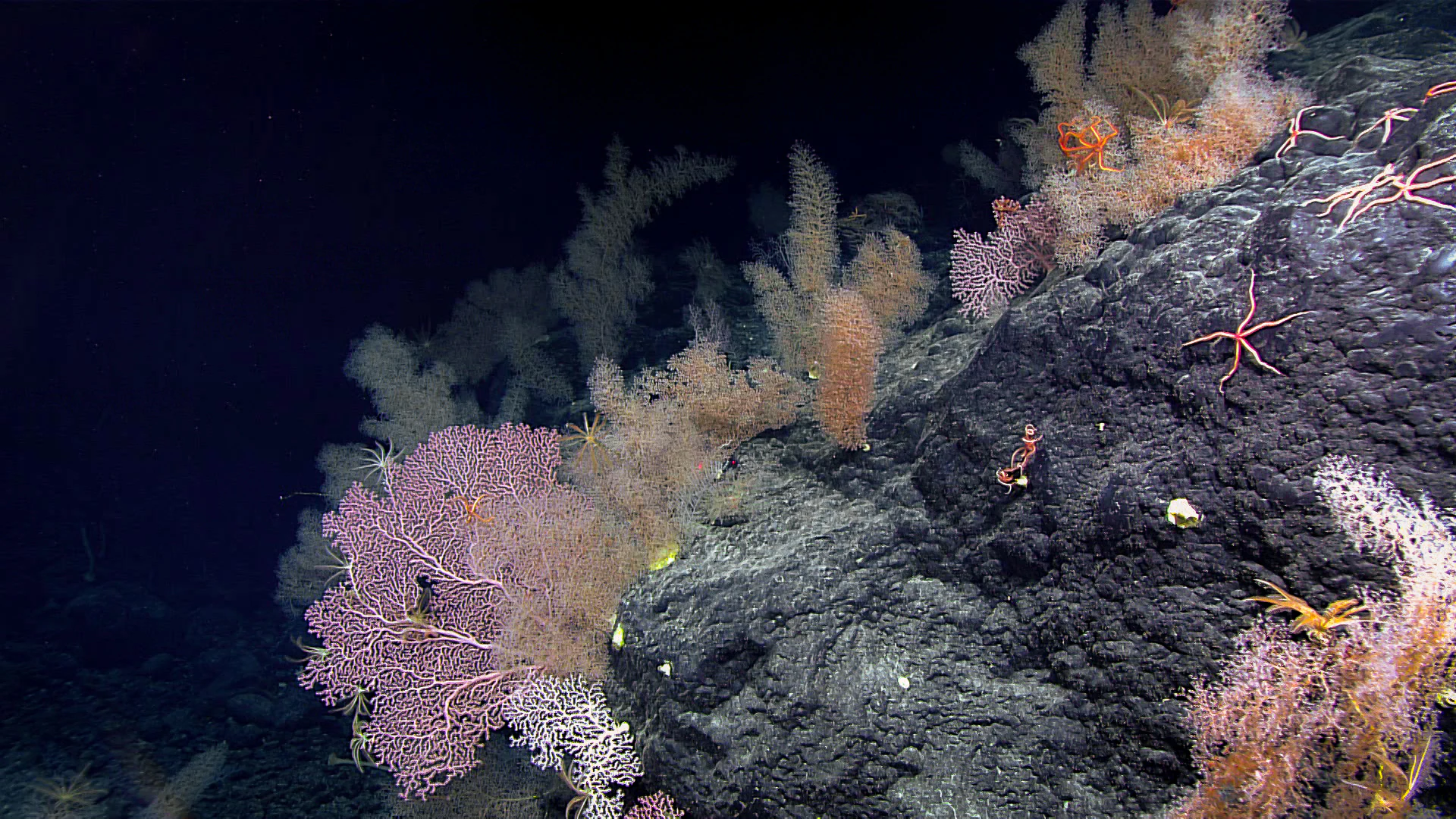
A close-up view of deep-sea corals and echinoderms attached to a dark rock surface in a dark, underwater environment.
Deep-sea coral and crinoids on the Sibelius Seamount within the Bremer Marine Park.

Bremer Marine Park history and protected-area timeline

Bremer Marine Park was officially established on 14 December 2013 as part of the Australian government's commitment to expanding its network of marine protected areas. Initially proclaimed as a marine park, it was subsequently zoned as an IUCN Category II national park under the South-west Marine Parks Management Plan adopted in 2018.

Its formal designation recognised long-standing knowledge of the extraordinary biodiversity concentrated around Bremer Canyon, particularly the seasonal aggregation of orca that had become internationally known through ecotourism and research expeditions. The legal framework of the Environment Protection and Biodiversity Conservation Act underpins the park's management, providing protection for both the national park zone and an associated special purpose zone within the broader marine park boundary.

Since its establishment, Bremer Marine Park has moved from a relatively under-explored offshore region to a recognised focus of Australian marine science. Between 2016 and 2020, researchers intensified investigations of orca populations, pelagic fish, and the oceanographic drivers of the region's productivity. In 2021, the University of Western Australia published findings from deep-sea exploration aboard the Schmidt Ocean Institute's RV Falkor, documenting significant deep-sea coral gardens in Bremer Canyon and confirming the park's importance as a deep-water ecological refuge. Today, the park stands as one of Australia's flagship marine reserves, combining formal protection with active research and community engagement.

Bremer Marine Park landscape and geographic character

Although Bremer Marine Park is entirely offshore, its landscape is shaped by dramatic submarine topography rather than terrestrial landforms. The park is dominated by deep submarine canyons, most notably Bremer Canyon, whose walls and floors plunge to depths of roughly 5,900 metres. These canyons are part of a broader Albany Canyon group that incises the continental shelf along the south coast of Western Australia.

An ancient submerged coastline runs through the park at approximately 90 to 120 metres depth, leaving behind terrace and step-like formations that can create local escarpments on the seafloor. These features further structure the underwater environment, producing small-scale upwelling and concentrating marine life in zones that would otherwise be relatively uniform open seabed.

Above these deep structures, the park's 'surface landscape' is defined by the waters of the Southern Ocean and its interactions with the Leeuwin Current and locally generated eddies. The result is an ocean environment characterised by shifting fronts, productive surface waters, and clear ecological gradients that make the park's submarine scenery both visually and biologically distinctive on a global scale.

Bremer Marine Park ecosystems, habitats, and plant life

The ecological identity of Bremer Marine Park is defined by its exceptionally high biological productivity, which is rooted in the interaction of submarine topography with regional ocean currents. Cold, nutrient-rich deep water is lifted towards the surface through upwelling within and around Bremer Canyon, while the southward-flowing Leeuwin Current modulates temperatures and introduces tropical and subtropical influences. The combination fuels dense phytoplankton blooms that support swarms of krill, copepods, and other zooplankton.

The park lies at the intersection of two significant marine bioregions: the Southern Province, characterised by its deep submarine canyons and abyssal habitats, and the Southwest Shelf Province, which is strongly influenced by the Leeuwin Current and supports a rich mixture of tropical, temperate, and endemic species. Together, these bioregions give the park unusually broad habitat diversity, ranging from shallow shelf benthos to deeper slope communities and the open pelagic zone.

Coral gardens documented on the canyon's walls, sponge gardens, and diverse invertebrate communities, including cephalopods, echinoderms, crustaceans, and cnidarians, contribute to a habitat mosaic that supports highly complex food webs. Two key ecological features recognised under Australian management arrangements, the Albany Canyon group and adjacent shelf break, and the Ancient Coastline at the 90 to 120 metre contour, anchor the park's ecological character and are central to why the area has been singled out for national-level protection.

Bremer Marine Park wildlife and species highlights

Wildlife is the defining feature of Bremer Marine Park. The park's waters support over four hundred species of bony fishes, including commercially and ecologically significant species such as southern bluefin tuna, Western Australian salmon, blue groper, herring, and trevally. At least forty species of sharks and rays have been documented, ranging from coastal and continental shelf species such as bronze whalers, dusky sharks, and gummy sharks to deeper-pelagic species such as blue sharks, megamouth sharks, and scalloped hammerheads. Wobbegongs, including cobbler, western, dwarf spotted, floral-banded, gulf, and spotted wobbegongs, are also notable residents.

Marine mammals are abundant and varied. Australian sea lions, long-nosed fur seals, brown fur seals, and southern elephant seals haul out and forage within the region, while occasional leopard seals are recorded as vagrants from more southern waters. Cetaceans are a particular highlight, with humpback, southern right, blue, sperm, common minke, and strap-toothed whales all recorded, alongside long-finned pilot whales, Indo-Pacific and common bottlenose dolphins, striped dolphins, common dolphins, and Risso's dolphins.

The park's most famous wildlife inhabitants are its orca. Bremer Canyon is thought to host close to two hundred orca during peak season, making it one of the largest known seasonal aggregations of killer whales in the southern hemisphere. Seabirds and shorebirds are similarly diverse, with around sixty species of wading and shorebirds present, plus shearwaters, petrels, cormorants, albatrosses, and occasional little penguins, fiordland penguins, and southern rockhopper penguins. Sea turtles, including green, hawksbill, and loggerhead turtles, as well as marine snakes such as the elegant and yellow-bellied sea snakes, round out the park's rich vertebrate fauna.

Bremer Marine Park conservation status and protection priorities

Bremer Marine Park is a cornerstone of marine conservation along Australia's southern coast, established to protect the exceptional biodiversity associated with Bremer Canyon and its surrounding waters. Its designation as an IUCN Category II national park within the South-west Marine Parks Network reflects both its ecological significance and its role in safeguarding representative examples of Australia's marine heritage.

The park's conservation value is closely linked to its key ecological features, including the Albany Canyon group and adjacent shelf break, and the Ancient Coastline at the 90 to 120 metre depth contour. These features concentrate nutrients and biological productivity, supporting food webs that include keystone species such as squid, krill, and phytoplankton, and apex predators such as orca and large sharks. Protecting these habitats in turn helps preserve the broader ecological connectivity of the south-west marine environment.

Conservation management in the park addresses a range of pressures. Climate change and ocean warming threaten phytoplankton abundance and increase the risk of coral bleaching, while fishing pressure, including the potential for overfishing of keystone species, requires continued monitoring. Human-related disturbances, ranging from vessel noise to potential oil and fuel leaks, have prompted the establishment of management measures, zoning arrangements, and legal protections under the Environment Protection and Biodiversity Conservation Act. These frameworks allow for ongoing research, regulated tourism, and cultural use while reducing the risk of irreversible damage to the park's ecosystems.

Bremer Marine Park cultural meaning and human context

The waters within and around Bremer Marine Park form part of the Sea Country of the Noongar people, who have lived sustainably with the land and sea of the Western Australian south coast for tens of thousands of years. The concept of Sea Country encompasses not only the marine environment itself but also the beliefs, values, creation stories, spirits, and cultural obligations that connect Indigenous communities to the ocean.

Many of the marine species found in the park, including whales, sharks, dolphins, and other megafauna, hold totemic significance for Noongar communities and are considered important cultural as well as ecological entities. Cultural oversight of the park is shared with the South West Aboriginal Land and Sea Council, which works alongside the Director of National Parks to ensure that Indigenous cultural values are recognised in management decisions.

While the park has no formal heritage listings in the conventional sense, its broader cultural significance is woven into tourism, education, and conservation narratives. Visitors and operators engaging in whale watching and wildlife tours are increasingly encouraged to acknowledge and respect the depth of Indigenous connection to this marine environment, alongside the more visible socioeconomic activities such as fishing and recreational marine use.

Top sights and standout views in Bremer Marine Park

Bremer Marine Park's standout features cluster around its submarine canyon system, its oceanographic complexity, and its iconic wildlife. Bremer Canyon, with depths reaching nearly six thousand metres, is the most prominent highlight, generating consistent upwelling that fuels one of the most productive marine ecosystems in the Southern Hemisphere. Its slopes host newly documented deep-sea coral gardens that have only recently come to scientific attention.

The seasonal aggregation of orca in the canyon region is the park's most famous drawcard, attracting wildlife-focused tourism and ongoing research. Equally noteworthy are the area's biodiversity hotspots, including shark and ray diversity, large whale migrations, resident dolphin populations, and dense seabird and shorebird communities. Together, these features distinguish Bremer Marine Park as both a conservation stronghold and a focus for marine discovery.

Best time to visit Bremer Marine Park

Bremer Marine Park's character shifts with the seasons, mostly in response to whale and orca movements, ocean conditions, and biologically driven aggregation patterns. The warmer months of the Australian summer and early autumn typically correspond with the peak presence of orca in and around Bremer Canyon, as well as broader activity by migratory cetaceans and pelagic species, making this an especially rewarding period for wildlife-focused visitors and research expeditions.

Cooler months still bring active marine life, with different species dominating the scene, including certain shark species, pinnipeds, and migratory seabirds. Because the park is entirely offshore and experiences weather that can influence access and viewing conditions, visitors often plan trips around both biological seasonality and the calmer sea conditions typical of particular windows. The underlying oceanographic processes, including upwelling in Bremer Canyon and the influence of the Leeuwin Current, continue year-round, meaning the park retains ecological richness in every season.
Monthly climate preview

Long term temperature and monthly precipitation records for Western Australia

Bremer Marine Park Climate Normals and Annual Weather Patterns

Historical monitoring data from 1991 to 2020 documents the measured annual temperature rhythm and monthly precipitation variations across Bremer Marine Park. Examining the complete twelve month climate profile provides detailed historical baseline records for analytical research.
Annual mean17 °C
15 °C19 °C
Jan19°
Feb19°
Mar19°
Apr19°
May18°
Jun17°
Jul16°
Aug15°
Sep15°
Oct16°
Nov16°
Dec17°
Warmest month
February

19.2 °C

Coolest month
September

15.2 °C

Wettest month
August

2.5 mm/day

Driest month
December

0.7 mm/day

Park location guide

Geography guide, regional context, and park location map for Bremer Marine Park

Bremer Marine Park park geography, regions, and map view in Australia

Understand where Bremer Marine Park sits in Australia through a broader geographic reading of the surrounding landscape, nearby location context, and its mapped position within the national park landscape.

How Bremer Marine Park fits into Australia

Australia is a constitutional monarchy and federal parliamentary democracy comprising six states and ten territories. With a population of nearly 28 million, it is one of the world's most urbanised countries, with most people concentrated on the eastern seaboard. The country has a high Human Development Index and is known for its cultural diversity, ancient Aboriginal heritage, and unique wildlife.

Wider geography shaping Bremer Marine Park in Australia

Australia occupies the entire Australian continent, the island of Tasmania, and numerous smaller islands. It is the world's flattest and driest inhabited continent, featuring vast deserts in the interior (the Outback), tropical rainforests along the eastern coast, and a coastline bordering the Indian and Pacific Oceans.

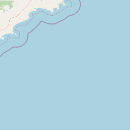
Map view of Bremer Marine Park

Use this park location map to pinpoint Bremer Marine Park in Australia, understand its exact geographic position, and read its mapped placement within the surrounding landscape more clearly.

Pigeon | © OpenStreetMap contributors

Location context for Bremer Marine Park

Western Australia

Explore submarine canyons, deep sea habitats, and protected marine environments through dedicated visual media

Bremer Marine Park Photos and Submarine Landscapes: Visualizing Western Australia Protected Area Scenery

Visual documentation reveals the dramatic submarine topography and rich pelagic habitats defining Bremer Marine Park. Examining official photography provides clearer insight into deep sea canyons, cold water coral gardens, and offshore marine ecosystems.

A close-up view of deep-sea corals and echinoderms attached to a dark rock surface in a dark, underwater environment.

A blue shark swims past a metal pole underwater while a small striped fish swims nearby.

Park atlas

Compare surrounding marine environments and regional conservation landscapes

Explore Protected Areas and Parks Near Bremer Marine Park

Discover related marine parks and protected areas located throughout the surrounding coastal region. Extending the geographic comparison reveals broader oceanic ecosystems and connected conservation zones across the southern margin.
Watercolor illustration showing mountains in the background, green vegetation, and pink meadows
National parkWestern Australia
5.5 km away#1 closest

North

Fitzgerald River National Park: A Western Australian Protected Landscape of Global Botanical Importance

Discover its mapped terrain, endemic flora, and UNESCO Biosphere Reserve status.

Fitzgerald River National Park stands as a protected landscape of immense ecological value in Western Australia. This national park is celebrated for its extraordinary botanical diversity, featuring more endemic plant species than any other conservation reserve in Australia. Its varied terrain, from rugged mountain ranges to coastal cliffs, provides a rich tapestry of natural habitats. As a designated UNESCO Biosphere Reserve, it offers a unique opportunity to explore mapped geographic features and understand the critical role of protected areas in conserving rare flora and distinct Mediterranean ecosystems.

Area
2,972.11 km²
Established
1973
IUCN
II
Visitors
40K annual
Marine protected areaWestern Australia
49 km away#2 closest

Northeast

South-west Corner Marine Park: An Atlas of Deep-Sea Landscapes and Marine Protected Areas

Western Australia offshore marine and seabed geography

South-west Corner Marine Park represents one of the most ecologically diverse marine reserves in Australian Commonwealth waters. Stretching from the coast of Western Australia into the depths of the Southern Ocean, the park protects unique underwater terrain including extensive reef systems, submarine canyons, and isolated plateaus. This area serves as a primary migratory corridor for whales and provides a vital, mapped environment for threatened shark and seabird populations within the regional marine food web.

Area
271,833 km²
Established
2013
Climate
Temperate
Access
Remote access
Nature reserveWestern Australia
74 km away#3 closest

Northwest

Beringa Reserve Nature Reserve: Western Australia Protected Woodland Geography

Restoration landscapes and riparian corridors near Peniup Creek

Beringa Reserve serves as a significant private nature reserve in Western Australia, focusing on the restoration of eucalyptus woodland and mallee heath. This landscape acts as a functional buffer within the Gondwana Link, protecting riparian vegetation along Peniup Creek and fostering the recovery of native mammal habitats through intensive revegetation efforts.

Area
25.06 km²
Established
2007
Relief
Lowland
Climate
Mediterranean
Nature reserveWestern Australia
84 km away#4 closest

Northwest

Chereninup Creek Reserve: Geographic Identity and Protected Land Context

Explore the landscape and regional geography of this Western Australian nature reserve.

Chereninup Creek Reserve represents a key site within the Gondwana Link initiative of Western Australia. This nature reserve serves as an important ecological connection, featuring a diverse patchwork of eucalypt woodlands and Kwongan heath. Gain insight into its role as a protected area that restores former farmland into a continuous landscape for local flora and fauna.

Area
8.77 km²
Established
2003
Relief
Upland
Scope
Terrestrial
National parkWestern Australia
99 km away#5 closest

West

Hassell National Park National Park: Mapped Protected Landscape in Western Australia

Explore the geographic identity and park boundaries of Hassell National Park.

Hassell National Park offers a focused view of protected natural landscapes within Western Australia. This atlas entry details the park's specific geographic scope and its designation as a national park, providing essential context for understanding its mapped features and regional landscape. Explore how Hassell National Park contributes to the protected area geography of the state.

Area
12.65 km²
Established
1971
IUCN
II
Scope
Mixed
National parkWestern Australia
102 km away#6 closest

Northeast

Stokes National Park National Park: Mapped Boundaries and Regional Geography

Western Australia's protected landscape identity.

Stokes National Park represents a significant protected entity within the expansive geography of Western Australia. This detailed page provides users with essential mapping information, focusing on the park's designated boundaries and its role within the broader atlas of Australian conservation landscapes. Explore the specific geographic context that defines this national park and understand its natural landscape features.

Area
97.26 km²
Established
1976
IUCN
II
Relief
Lowland
National parkWestern Australia
107 km away#7 closest

West

Waychinicup National Park: National Park Protected Landscape Atlas Entry

Explore Western Australia's mapped natural landscapes and park geography.

Gain a structured understanding of Waychinicup National Park as a key protected landscape within Western Australia. This detailed atlas entry focuses on its geographic distribution and mapped boundaries, providing essential context for regional park and natural landscape exploration. Discover the unique characteristics of this national park's setting and its place within the broader mapped terrain.

Area
39.82 km²
Established
1990
IUCN
II
Relief
Mixed relief
Watercolor illustration showing a landscape with mountains, a winding river, and grassy fields.
National parkWestern Australia
109 km away#8 closest

West

Stirling Range National Park: National Park Protected Area and Geographic Mapping

Discover its mapped boundaries and regional landscape context.

Stirling Range National Park is a protected national park in Western Australia, offering critical insights into regional geography and landscape mapping. This page provides structured information on the park's protected area status, its geographic setting, and its value for atlas-based exploration. Understand the extent of its mapped boundaries and discover its unique natural terrain within the broader context of Western Australia's vast geography.

Area
1,159.2 km²
Established
1913
IUCN
II
Relief
Mountain

Common questions about visiting, size, designation, and location context for Bremer Marine Park

Bremer Marine Park FAQs for park facts, access, geography, and protected area context

Find quick answers about Bremer Marine Park, including protected-area facts, park geography, trail and visitor context, and how the park fits into its surrounding country and regional landscape.
MoriAtlas Explorer

Continue Your Protected Areas Search Across the Global Atlas

Deepen your exploration by continuing the structured search for national parks and protected areas worldwide. Utilize the comprehensive filtering capabilities to compare different conservation landscapes and refine your understanding of global park geography. Discover more about the distribution and characteristics of protected natural areas.

Global natural geography