Volcanoes
Mount Bromo
2,329 m

Structured data on boundary dimensions, elevation gradients, and volcanic terrain features
This geographic profile details the physical scope and environmental characteristics of Bromo Tengger Semeru National Park. The data covers a 502.76 square kilometer area, mapping diverse terrain ranging from 750 to 3676 meters in elevation, including major volcanic peaks and complex montane forest landscapes.
Related tags
Indonesia's volcanic wonderland of sand seas and Java's highest peak
Bromo Tengger Semeru National Park is a dramatic volcanic landscape in East Java, Indonesia, protecting one of the most geologically active and visually spectacular regions in Southeast Asia. The park encompasses the Tengger Caldera, an ancient volcanic crater spanning approximately 5,250 hectares at an elevation of around 2,100 meters, within which four younger volcanic cones have emerged. This unique terrain includes Indonesia's only sand sea, a vast expanse of volcanic sand known as the Tengger Sand Sea, creating an almost desert-like atmosphere in the heart of tropical Java. The park also contains Mount Semeru, the highest peak on Java at 3,676 meters, together with a network of four scenic lakes and over fifty rivers draining the massif. Established as a national park in 1982 and formally designated in 1992, this protected area represents a rare combination of volcanic geology, ecological diversity, and living cultural heritage maintained by the Tenggerese people.
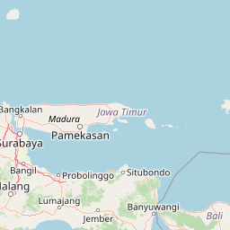
Regional mapping and country alignment across East Java
Tracing the 502.76 square kilometer geographic footprint and coordinates
Protected mountain relief and recorded natural features
Volcanoes
2,329 m
Peaks
Peaks
Peaks
Peaks
Peaks
Mountain relief, forest cover, and habitat classifications across the terrain
Mountains · Volcano · Valleys · Grassland · Lakes · Rivers · Waterfalls · Dunes · Cave · Cliffs
Tropical forest · Montane forest · Alpine meadow · Riverine habitat · Lacustrine habitat
Compare additional national parks and protected landscapes across East Java, tracing their geographic spread and unique volcanic features.
Southeast

Discover the terrain and geography of this national park.
Meru Betiri National Park in East Java, Indonesia, offers a rich tapestry of mapped landscapes, from its distinctive sandy beaches and mangrove ecosystems along the southern coast to its interior volcanic highlands and tropical rainforests. This protected area is crucial for understanding the regional geography and the distribution of conservation lands across Java. Explore its topographic diversity and unique ecological settings that define this significant national park.
East
Mapped boundaries and natural terrain in Situbondo Regency.
Delve into the geographic identity of Baluran National Park, a national park located in Indonesia's Situbondo Regency. This protected area offers a compelling subject for atlas exploration, highlighting its specific landscape characteristics and mapped extent. Understanding the park's placement within its regional geography provides essential context for appreciating its significance as a protected natural landscape.
East
Understand its mapped boundaries and regional natural terrain.
West Bali National Park is a significant protected landscape offering a focal point for geographic discovery within Indonesia. This national park provides context for the region's natural terrain and the spread of conservation lands. Explore its identity as a mapped protected area and understand its contribution to the broader atlas of Indonesian geography and protected landscapes, perfect for detailed landscape exploration.
Southeast
Mapped natural terrain and national park status in East Java.
Delve into the atlas-specific details of Alas Purwo National Park, a key protected area located in the East Java region of Indonesia. This page focuses on its identity as a national park, highlighting its geographic significance and the value of its mapped landscape for structured discovery. Understand the context of this protected land within the broader geography of East Java, contributing to a comprehensive overview of Indonesia's conservation territories.
West
Explore mapped boundaries and regional natural terrain within Indonesia.
Gunung Merapi National Park stands as a distinct protected area within the Indonesian atlas, offering insights into its specific landscape and geographic identity. This page provides a focused entry point for understanding the park's designation as a national park, detailing its mapped environmental features and regional context. Discover the characteristics that define Gunung Merapi National Park as a key component of Indonesia's protected lands, facilitating a structured approach to geographic exploration.
West
Explore its mapped protected area boundaries and regional setting.
Gunung Merbabu National Park represents a distinct protected area entity within Indonesia's expansive geography. This page provides detailed information on the park's status as a national park, emphasizing its mapped territory and contribution to the understanding of protected landscapes. Discover its geographic context and how it fits into the broader atlas of Indonesian natural areas, offering a focused view for those interested in regional park geography and landscape exploration.
Northwest
Mapped protected boundaries and landscape context.
Gain a structured atlas-based understanding of Karimunjawa National Park, a designated national park located in Central Java, Indonesia. This detailed view focuses on the park's geographic footprint and its significance as a protected landscape. Explore its mapped territory and regional context, contributing to a comprehensive overview of natural areas within the Central Java region.
East
Mapped geography and ecological transitions of a prominent Indonesian national park.
Mount Rinjani National Park is a key protected area in Indonesia, distinguished by its active stratovolcano and the striking Segara Anak crater lake. The park's landscape features steep volcanic slopes and diverse vegetation zones, from tropical rainforest to subalpine terrain. This detailed entry provides essential atlas context, focusing on the park's geographic boundaries, its unique volcanic geology, and its significance as a protected natural landscape within Indonesia's archipelagic geography.
Further your understanding of Bromo Tengger Semeru National Park by examining its precise mapped boundaries and protected landscape features within East Java. This deep dive into its regional context offers valuable atlas-driven insights into Indonesia's protected areas. Discover how its terrain and geographic placement contribute to the natural landscape of the Indonesian archipelago.