

Mori Atlas logo
National parkCape Palmerston National Park

Discover the diverse terrain and protected boundaries of this key national park in the Mackay Region.

Cape Palmerston National Park: Mapped Protected Landscape and Coastal Geography

Cape Palmerston National Park, situated within Queensland's Mackay Region, offers a unique opportunity to explore a dynamic coastal protected landscape. This national park is defined by approximately 28 kilometers of diverse coastline, encompassing sandy beaches, extensive dune systems, vibrant mangrove forests, and coastal woodlands. Its geography includes the prominent Mount Funnel, a 344-meter peak providing panoramic views, and wetlands that contribute to its rich ecological character. As a significant example of coastal ecosystems in the Central Mackay Coast bioregion, Cape Palmerston National Park provides a valuable atlas context for understanding protected lands along Australia's eastern seaboard.

Coastal national parksQueensland parksMangrove ecosystemsBirdwatching destinationsWetland conservationAustralian wilderness

Cape Palmerston National Park

National park

Park overview

Structured park overview, official facts, and landscape profile for Cape Palmerston National Park

Cape Palmerston National Park park facts, protected area profile, and essential visitor context

Review the core facts for Cape Palmerston National Park, including designation, size, terrain, visitor scale, habitats, and operating context in one park-focused overview.

About Cape Palmerston National Park

Cape Palmerston National Park occupies a significant position on Queensland's central coast, protecting a mosaic of coastal ecosystems that include beaches, dunes, woodlands, grasslands, wetlands, and dense mangrove forests. The park's 28-kilometer coastline stretches along both sides of Cape Palmerston, a prominent headland that provides scenic coastal views and defines the character of the protected area. Within the park's boundaries lies Mount Funnel, a 344-meter peak that adds topographic diversity to the coastal landscape. The park sits within the Plane Creek catchment area and forms part of the Central Mackay Coast bioregion, reflecting its ecological significance within Queensland's broader environmental framework. The area's protection ensures the preservation of coastal habitats that support diverse flora and fauna, while providing opportunities for visitors to experience a relatively undeveloped section of the Queensland coast. Access to the park is restricted to four-wheel drive vehicles, which helps maintain its wilderness character and protects the sensitive dune and wetland environments from heavier traffic. The three camping areas within the park offer basic facilities for overnight visitors, with a self-registration permit system managing access.

Quick facts and research context for Cape Palmerston National Park

Cape Palmerston National Park covers 7,160 hectares along the Central Queensland coast in the Mackay Region. Established in 1976, the park features 28 kilometers of coastline flanking Cape Palmerston, named by Captain James Cook in 1770 after Viscount Palmerston. The park's highest point is Mount Funnel at 344 meters elevation. The area is managed by the Queensland Parks and Wildlife Service and features three camping areas accessible only by four-wheel drive vehicles, with permits required via self-registration.

Protection and recognition

Verifying official terrestrial designations and global environmental database listings

Cape Palmerston National Park Protection Status and Conservation Scope

Cape Palmerston National Park is established as a terrestrial protected area to preserve the regional coastal wilderness and native habitats. Reviewing the official protection framework provides critical insights into the conservation boundaries and management records of the coastal Queensland reserve.

Protection details

Protection scope
Terrestrial
Transboundary protection
No
Park context

Deeper park guide and search-rich context for Cape Palmerston National Park

Cape Palmerston National Park history, landscape, wildlife, and travel context

Explore Cape Palmerston National Park through its history, landscape character, ecosystems, wildlife, conservation priorities, cultural context, and seasonal travel timing in a structured park guide built for atlas discovery and search intent.

Why Cape Palmerston National Park stands out

Cape Palmerston is best known for its remarkable coastal diversity, combining pristine beaches, dune systems, and extensive mangrove forests within a relatively compact protected area. The park protects critical habitat for the threatened water mouse (false water rat), one of several rare or threatened species found within its boundaries. The coastline provides excellent conditions for birdwatching, with ospreys and sea eagles commonly spotted hovering over the shore, while white-breasted woodswallows nest in flowering grasstrees throughout the woodland areas. The park's accessibility by four-wheel drive only and its three camping areas make it a destination for those seeking a more remote and less developed coastal wilderness experience in Queensland.

Cape Palmerston National Park history and protected-area timeline

Cape Palmerston National Park was established in 1976 as part of Queensland's expanding network of national parks protecting the state's natural landscapes. The park is named after Cape Palmerston itself, which was named by British explorer Captain James Cook during his 1770 voyage along the Australian coast, honoring Henry Temple, 2nd Viscount Palmerston, who served as a Lord Commissioner of the Admiralty at that time. The naming of the cape reflects the historical pattern of British naval exploration along the Queensland coast, with many geographic features receiving names connected to political and military figures of the era. The subsequent designation of the area as a national park recognized the ecological and scenic values of the coastal landscape, formalizing protection for the diverse habitats found along this section of the Central Queensland coast.

Cape Palmerston National Park landscape and geographic character

The landscape of Cape Palmerston National Park is defined by its coastal position and the interaction between marine and terrestrial environments. The park features approximately 28 kilometers of coastline along the Coral Sea, with beaches and dune systems forming the interface between land and sea. Behind the coastal fringe, the terrain transitions through woodland and grassy areas before reaching the inland wetland systems. The standout topographic feature is Mount Funnel, a 344-meter peak that rises from the coastal plain, providing elevated views over the surrounding landscape and coastline. The dune systems along the shore are particularly notable, representing dynamic coastal landforms that support specialized plant communities. Mangrove forests dominate the estuarine areas, creating dense vegetation along tidal channels and shoreline zones. The combination of sandy beaches, rolling dunes, woodland-covered slopes, and wetland basins creates a visually varied landscape within a relatively compact area.

Cape Palmerston National Park ecosystems, habitats, and plant life

The nature of Cape Palmerston National Park centers on its diverse coastal ecosystems that support both terrestrial and marine-influenced habitats. The mangrove forests represent one of the park's most ecologically significant features, providing critical habitat for marine and terrestrial species while stabilizing shorelines and filtering water quality. The dune systems support specialized vegetation adapted to sandy, often nutrient-poor conditions, while the woodlands and grasslands inland provide transition habitat connecting the coastal zone to broader forested areas. The wetlands within the park form important ecological nodes, particularly for waterfowl and amphibians during wetter periods. The park lies within the Central Mackay Coast bioregion, which encompasses the coastal landscapes between Mackay and the broader Isaac region, characterized by its mix of tropical and subtropical influences.

Cape Palmerston National Park wildlife and species highlights

Cape Palmerston National Park supports significant wildlife populations, including several species of conservation concern. The park provides critical habitat for the threatened water mouse, also known as the false water rat, a species that depends on wetland and riparian environments. Three other rare or threatened species have been identified within the park's boundaries, highlighting its conservation importance. The coastal environment attracts numerous bird species, making the park particularly popular with birdwatching enthusiasts. Ospreys and sea eagles can be observed hunting along the coastline, their distinctive silhouettes visible as they hover over the water searching for prey. White-breasted woodswallows are commonly seen throughout the park, particularly nesting in flowering grasstrees where they find both food resources and suitable nesting sites. The diverse habitat types from beach to woodland support a range of vertebrate and invertebrate species that benefit from the protected status the park provides.

Cape Palmerston National Park conservation status and protection priorities

Cape Palmerston National Park represents an important conservation asset for Queensland, protecting a coastal landscape that faces ongoing development pressure along much of the state's coastline. The park's mangrove forests, dune systems, and wetlands provide ecosystem services including coastal protection, water filtration, and carbon storage while supporting biodiversity. The presence of the threatened water mouse and several other rare or threatened species demonstrates the park's significance for species conservation, particularly within the Central Mackay Coast bioregion. By maintaining a relatively undeveloped coastal area with restricted vehicle access, the park preserves natural processes and ecological integrity that would be compromised by more intensive use. The protection of the 28-kilometer coastline ensures that coastal habitats remain functional for wildlife and that natural coastal dynamics continue without significant human interference.

Cape Palmerston National Park cultural meaning and human context

Cape Palmerston National Park carries historical significance stemming from its naming by Captain James Cook during his 1770 voyage along the Australian coast. The cape was named after Henry Temple, 2nd Viscount Palmerston, who held the position of Lord Commissioner of the Admiralty at the time of Cook's exploration. This naming reflects the broader pattern of British colonial exploration and naming conventions applied to the Queensland coast, connecting geographic features to political and administrative figures of the era. The park exists within the traditional lands of indigenous peoples whose connections to this coastal landscape extend far longer than the European naming history, though detailed information about specific traditional owners is not provided in available source material.

Top sights and standout views in Cape Palmerston National Park

Cape Palmerston National Park stands out for its exceptional coastal diversity within a protected area, combining beach, dune, mangrove, woodland, and wetland environments across a relatively compact 71.9-square-kilometer area. The 344-meter Mount Funnel provides a scenic hiking destination with panoramic views over the coastline and surrounding landscape. The park's 28 kilometers of relatively undeveloped coastline represent a rare opportunity to experience Queensland's central coast in a more natural state. The birdwatching opportunities, particularly for ospreys, sea eagles, and white-breasted woodswallows, draw visitors interested in observing coastal raptors in their natural habitat. The presence of the threatened water mouse highlights the park's conservation significance beyond its scenic appeal.

Monthly climate preview

Examine long-term temperature ranges and monthly precipitation cycles in the Mackay Region.

Cape Palmerston National Park Climate Normals and Monthly Weather Patterns

Long-term climatology data for Cape Palmerston National Park shows a warm annual cycle where average maximum temperatures reach over thirty-two degrees Celsius. Accessing the full monthly breakdown reveals detailed historical patterns to compare average temperature ranges and precipitation rhythms across the calendar year.
Annual mean23 °C
19 °C27 °C
Jan27°
Feb27°
Mar26°
Apr24°
May22°
Jun20°
Jul19°
Aug20°
Sep22°
Oct24°
Nov25°
Dec26°
Warmest month
January

26.6 °C

Coolest month
July

18.8 °C

Wettest month
February

8.7 mm/day

Driest month
September

0.7 mm/day

Park location guide

Geography guide, regional context, and park location map for Cape Palmerston National Park

Cape Palmerston National Park park geography, regions, and map view in Australia

Understand where Cape Palmerston National Park sits in Australia through a broader geographic reading of the surrounding landscape, nearby location context, and its mapped position within the national park landscape.

How Cape Palmerston National Park fits into Australia

Australia is a constitutional monarchy and federal parliamentary democracy comprising six states and ten territories. With a population of nearly 28 million, it is one of the world's most urbanised countries, with most people concentrated on the eastern seaboard. The country has a high Human Development Index and is known for its cultural diversity, ancient Aboriginal heritage, and unique wildlife.

Wider geography shaping Cape Palmerston National Park in Australia

Australia occupies the entire Australian continent, the island of Tasmania, and numerous smaller islands. It is the world's flattest and driest inhabited continent, featuring vast deserts in the interior (the Outback), tropical rainforests along the eastern coast, and a coastline bordering the Indian and Pacific Oceans.

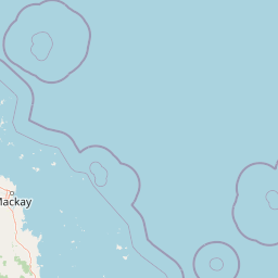
Map view of Cape Palmerston National Park

Use this park location map to pinpoint Cape Palmerston National Park in Australia, understand its exact geographic position, and read its mapped placement within the surrounding landscape more clearly.

Pigeon | © OpenStreetMap contributors

Location context for Cape Palmerston National Park

Mackay RegionQueensland
Park atlas

Expand your exploration of Queensland's coastal protected landscapes, mapped across the Central Mackay Coast bioregion.

Other National Parks and Protected Areas Near Cape Palmerston National Park, Queensland

After exploring Cape Palmerston National Park, continue browsing other protected areas and national parks located within Queensland's diverse coastal regions and surrounding landscapes. Compare geographical features, conservation priorities, and the spread of protected land across this region to deepen your atlas-based understanding.
Marine protected areaQueensland
About 2.9 km away#1 closest

North

Great Barrier Reef Marine Park: Atlas and Geographic Context for Queensland Protected Waters

Exploring the reef system and marine conservation zones in northeastern Australia

The Great Barrier Reef Marine Park stands as an internationally significant marine protected area. By spanning a massive stretch of the Queensland coast, this protected landscape provides a critical framework for marine governance and reef conservation. Users can examine the unique zoning and distribution of coral reef habitats that define this extensive tropical ecosystem.

Area
343,966 km²
Established
1975
Climate
Tropical
Scope
Marine
National parkQueensland
About 15 km away#2 closest

East

Northumberland Islands National Park: Queensland's Protected Landscape and Atlas Context

Mapping the unique geography and protected area identity of this national park.

Gain insight into Northumberland Islands National Park, a distinct protected area within Queensland, Australia. This entry details its geographic scope and protected landscape features, offering a clear view of its mapped boundaries and regional context. Understand its significance as a national park and its contribution to the mapped natural atlas of northeastern Australia.

Area
15 km²
Established
1994
IUCN
II
Relief
Lowland
National parkQueensland
About 24 km away#3 closest

Southeast

Broad Sound Islands National Park: Queensland National Park Geographic Atlas

Mapped protected boundaries and landscape context in Queensland.

Broad Sound Islands National Park serves as a vital point of reference for exploring Queensland's protected natural areas. This canonical detail entry provides essential insights into the park's geographic positioning, its role as a national park, and its contribution to the regional atlas. Understand its mapped boundaries and unique landscape characteristics as part of a structured geographic discovery.

Area
16 km²
IUCN
II
Relief
Lowland
Climate
Subtropical
National parkQueensland
About 26 km away#4 closest

South

West Hill National Park: Explore Queensland's National Park Geography and Mapped Protected Boundaries

Central Queensland Protected Landscape and Atlas Context

West Hill National Park represents a key protected area within Queensland's natural environment network. As a national park, it offers insights into the region's geography and landscape character, contributing to a structured understanding of protected lands. Explore the mapped boundaries and discover its specific place within the atlas of Australian parks, providing context for its conservation significance in central Queensland.

Area
10.8 km²
Established
1971
IUCN
II
Scope
Terrestrial
National parkQueensland
About 49 km away#5 closest

North

Round Top Island National Park: Protected Island Landscape in Queensland

Explore mapped boundaries and regional conservation context.

Round Top Island National Park preserves the natural character of a small coastal island in Queensland's Coral Sea region. This national park offers a clear example of an entire island protected area, contributing to the broader atlas of Australian conservation landscapes. Understanding its mapped boundaries and its place within North Queensland's geography provides insight into the diversity of protected island ecosystems preserved for their ecological significance.

Area
0.19 km²
IUCN
II
Relief
Mixed relief
Scope
Mixed
National parkQueensland
About 68 km away#6 closest

Northwest

Reliance Creek National Park: Preserving Queensland's Coastal Palm Forest Ecosystem

Mapped protected landscape on Queensland's central coast.

Reliance Creek National Park is a critical conservation site in Queensland, safeguarding the most significant remaining area of coastal palm forest. This compact national park protects a unique subtropical ecosystem that has largely vanished from the surrounding regional landscape. Users can explore its precise location and geographic context, understanding its importance as a preserved natural heritage and a testament to the original coastal plain environment.

Area
0.14 km²
Established
1980
IUCN
II
Access
Remote access
National parkQueensland
About 71 km away#7 closest

Northwest

Pioneer Peaks National Park: Queensland National Park Geography and Mapped Boundaries

Explore its protected landscape and regional context.

Pioneer Peaks National Park represents a distinct protected area within Queensland, Australia, offering valuable insights into regional geography and mapped natural landscapes. This canonical page focuses on the park's identity as a national park, detailing its geographic setting and the significance of its protected boundaries. It serves as a crucial point for understanding its place within the Australian atlas and the broader context of conservation landscapes.

Area
18.4 km²
Established
1992
IUCN
II
Relief
Mountain
National parkIsaac Region
About 73 km away#8 closest

West

Homevale National Park: Central Queensland's Protected Sandstone and Fossil Landscape

Explore dramatic cliffs, peaks, and ancient Permian fossil sites.

Homevale National Park in Australia's Isaac Region is a testament to geological time and conservation. Its landscape is defined by striking sandstone formations, including dramatic cliffs, rugged peaks, and distinctive spires. Beyond its visual appeal, the park is scientifically vital for its Permian-period fossil discoveries, dating back 280 to 225 million years. This protected area offers a unique glimpse into ancient marine environments and the geological evolution of Central Queensland, making it a key destination for atlas-driven landscape discovery.

Area
218 km²
Established
1995
IUCN
II
Relief
Mountain

Common questions about visiting, size, designation, and location context for Cape Palmerston National Park

Cape Palmerston National Park FAQs for park facts, access, geography, and protected area context

Find quick answers about Cape Palmerston National Park, including protected-area facts, park geography, trail and visitor context, and how the park fits into its surrounding country and regional landscape.
MoriAtlas Explorer

Continue Your Protected Areas Search Across the Global Atlas

Deepen your exploration by continuing the structured search for national parks and protected areas worldwide. Utilize the comprehensive filtering capabilities to compare different conservation landscapes and refine your understanding of global park geography. Discover more about the distribution and characteristics of protected natural areas.

Global natural geography