Mori Atlas logo
National parkCapricornia Cays National Park

Discover the protected landscape identity and regional geographic context of this Queensland national park.

Capricornia Cays National Park: Queensland National Park Geography and Mapped Boundaries

Capricornia Cays National Park stands as a distinct protected area within Queensland, Australia, offering a unique focus for geographic discovery. This page serves as an entry point to understanding the park's mapped boundaries and its place within the state's diverse natural landscapes. Explore the inherent atlas value of this national park, focusing on its terrain and regional context without operational details.

Coral CaysSeabird ColoniesMarine TurtlesGreat Barrier ReefIsland EcosystemsImportant Bird Area

Capricornia Cays National Park

National park

Park overview

Structured park overview, official facts, and landscape profile for Capricornia Cays National Park

Capricornia Cays National Park park facts, protected area profile, and essential visitor context
Review the core facts for Capricornia Cays National Park, including designation, size, terrain, visitor scale, habitats, and operating context in one park-focused overview.

About Capricornia Cays National Park

Capricornia Cays National Park represents one of Queensland's most ecologically significant protected areas, safeguarding a chain of isolated coral islands that form part of the Capricorn and Bunker group in the southern Great Barrier Reef. The park encompasses both a standard national park designation protecting eight vegetated cays open to visitors, and a separate scientific national park zone covering six additional cays that remain closed to public access to preserve their ecological integrity. These islands are entirely built from coral deposits, rising just above sea level as vegetated sand cays surrounded by extensive reef systems. The park's isolation and relative accessibility from coastal Queensland towns like Gladstone, Bundaberg, and 1770 make it a destination for marine recreation while also serving as a critical conservation reserve. The islands form part of the Great Barrier Reef World Heritage Area, linking their terrestrial conservation value with the broader marine ecosystem protection framework that makes this region one of the world's most significant reef ecosystems.

Quick facts and research context for Capricornia Cays National Park

Capricornia Cays National Park covers 1.78 square kilometers across eight vegetated coral cays plus an additional scientific zone of six cays with no public access. Established in 1994 and managed by the Queensland Parks and Wildlife Service, the islands lie within the Great Barrier Reef World Heritage Area and support more than 1% of global populations for several seabird species. The park also protects 233 recorded mollusc species and provides critical habitat for endangered marine turtles. Access to visiting islands is available from Gladstone, Bundaberg, and 1770 in Queensland.

Park context

Deeper park guide and search-rich context for Capricornia Cays National Park

Capricornia Cays National Park history, landscape, wildlife, and travel context
Explore Capricornia Cays National Park through its history, landscape character, ecosystems, wildlife, conservation priorities, cultural context, and seasonal travel timing in a structured park guide built for atlas discovery and search intent.

Why Capricornia Cays National Park stands out

Capricornia Cays is globally renowned for its extraordinary seabird colonies and marine turtle nesting. The islands support over half a million breeding pairs of wedge-tailed shearwaters and approximately 300,000 black noddy nests, representing the majority of east Australian populations for these species. The cays hold the distinction of supporting the largest loggerhead turtle breeding population in the South Pacific, making the park critically important for the conservation of this endangered marine reptile. The islands are completely coral-built and surrounded by reef systems, creating a distinctive low-lying vegetated landscape dominated by Pisonia grandis forests.

Capricornia Cays National Park history and protected-area timeline

Capricornia Cays National Park was established in 1994 when the Queensland government protected these coral islands under national park legislation. The establishment reflected growing recognition of the islands' extraordinary ecological significance, particularly as seabird nesting grounds and marine turtle rookeries. Prior to formal protection, the cays faced pressures from human disturbance and habitat degradation. The creation of both a general-use national park and a separate scientific national park zone demonstrated a nuanced approach to management, allowing public access and recreation on some islands while maintaining strict protection on others for research and conservation purposes. The scientific national park designation (IUCN Category Ia) indicates areas managed primarily for scientific research with minimal human interference, distinguishing these islands from the more accessible recreational areas.

Capricornia Cays National Park landscape and geographic character

The Capricornia Cays consist of low-lying coral cays that rise only a few meters above sea level, formed entirely from accumulated coral sand and debris deposited by ocean currents around reef systems. These islands are completely built by corals and are surrounded by extensive shallow and deep reef platforms that form part of the greater Great Barrier Reef system. The vegetation on the cays is dominated by Pisonia grandis, a large flowering tree species that forms dense forest stands on these island ecosystems. The landscape is characterized by sandy beaches, coastal vegetation zones, and interior forest canopies, with the islands offering relatively flat terrain compared to the mountainous mainland. The surrounding marine environment features clear tropical waters, coral reef formations, and seagrass beds that support the park's marine biodiversity.

Capricornia Cays National Park ecosystems, habitats, and plant life

The Capricornia Cays support remarkably concentrated biodiversity despite their small physical size. The islands function as an Important Bird Area, supporting more than 1% of global populations for several seabird species, making them globally significant for avian conservation. The marine environment surrounding the cays contains at least 233 recorded mollusc species, demonstrating substantial molluscan diversity within the reef systems. The islands sit within the Great Barrier Reef World Heritage Area, connecting the terrestrial cays with one of the world's most biodiverse marine ecosystems. The Pisonia grandis forest vegetation creates a distinctive terrestrial habitat that supports both nesting seabirds and provides shelter for other wildlife, while the surrounding reef systems support fish, invertebrates, and marine megafauna including turtles and whales.

Capricornia Cays National Park wildlife and species highlights

The wildlife of Capricornia Cays is defined by extraordinary concentrations of breeding seabirds and marine turtles. The islands support the largest breeding populations of wedge-tailed shearwaters in eastern Australia, with up to 560,000 nests recorded, and black noddies with approximately 300,000 nests, representing the majority of east Australian breeding populations for these species. Brown boobies nest in smaller but still globally significant numbers of 1,000 to 4,000 nests. The islands hold global importance as the primary nesting site for loggerhead turtles in the South Pacific, with the largest breeding population of this endangered species in the Australasian region. Seasonal closures are imposed on some areas to protect breeding seabirds during their most vulnerable periods. The surrounding reef waters support diverse marine life including whales visible from the islands and numerous fish species associated with coral reef habitats.

Capricornia Cays National Park conservation status and protection priorities

Capricornia Cays National Park plays a critical role in protecting some of the most significant seabird and marine turtle colonies in the Southern Hemisphere. The park's designation as both a standard national park (IUCN Category II) and a scientific national park (IUCN Category Ia) reflects a sophisticated conservation approach that balances public education and recreation with strict scientific protection. The islands' inclusion in the Great Barrier Reef World Heritage Area connects local conservation efforts with the broader international framework protecting this globally significant marine ecosystem. The designation of certain cays as scientific areas with no public access demonstrates management that prioritizes long-term ecological monitoring and research over tourism, ensuring that some colonies remain free from human disturbance. The protection of loggerhead turtle breeding populations addresses the conservation needs of an endangered species that depends on these specific island beaches for successful reproduction.

Capricornia Cays National Park cultural meaning and human context

The Capricornia Cays lie within the traditional maritime territory of the Capricorn region of Queensland, an area with indigenous coastal heritage. The islands have historically been used by marine organisms, seabirds, and turtles for thousands of years as nesting sites, with the turtle colonies in particular representing an ancient pattern of marine animal behavior tied to these specific geographic locations. The region's proximity to 1770 (named for Captain James Cook's 1770 landing) connects the islands to the broader historical narrative of European exploration of the Queensland coast. The modern management of the park reflects Queensland's ongoing commitment to protecting unique island ecosystems while providing controlled public access for environmental education and appreciation.

Top sights and standout views in Capricornia Cays National Park

The overriding highlight of Capricornia Cays is the extraordinary concentration of wildlife on these small coral islands, with over half a million seabird pairs breeding annually and the largest loggerhead turtle rookery in the South Pacific. The accessible islands including Lady Musgrave Island, Masthead Island, North West Island, and Wilson Island offer visitors opportunities for camping, snorkeling, diving, and wildlife observation in a relatively pristine island setting. The distinction between the recreational national park and the scientific national park provides both visitor engagement and research protection. The park's position within the Great Barrier Reef World Heritage Area situates it within the world's most extensive coral reef system, adding marine scope beyond the island ecosystems themselves.

Best time to visit Capricornia Cays National Park

The Capricornia Cays can be visited throughout the year, though different seasons offer different wildlife experiences. Turtle nesting occurs on the islands, with Masthead Island specifically limiting camper numbers from October to March to reduce disturbance during the critical egg-laying and hatching period. Whale watching opportunities exist during migration seasons when humpbacks and other cetaceans pass through the region. Bird viewing is rewarding year-round but breeding seasons bring the highest concentrations of nesting seabirds. The winter months (May to September) typically offer more comfortable conditions for camping and outdoor activities, while the summer period coincides with turtle activity but also brings higher temperatures and potential storms. Boat access from the mainland is weather-dependent year-round.

Park location guide

Geography guide, regional context, and park location map for Capricornia Cays National Park

Capricornia Cays National Park park geography, regions, and map view in Australia
Understand where Capricornia Cays National Park sits in Australia through a broader geographic reading of the surrounding landscape, nearby location context, and its mapped position within the national park landscape.

How Capricornia Cays National Park fits into Australia

Australia is a constitutional monarchy and federal parliamentary democracy comprising six states and ten territories. With a population of nearly 28 million, it is one of the world's most urbanised countries, with most people concentrated on the eastern seaboard. The country has a high Human Development Index and is known for its cultural diversity, ancient Aboriginal heritage, and unique wildlife.

Wider geography shaping Capricornia Cays National Park in Australia

Australia occupies the entire Australian continent, the island of Tasmania, and numerous smaller islands. It is the world's flattest and driest inhabited continent, featuring vast deserts in the interior (the Outback), tropical rainforests along the eastern coast, and a coastline bordering the Indian and Pacific Oceans.

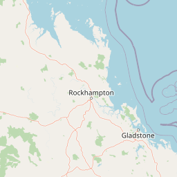
Map view of Capricornia Cays National Park

Use this park location map to pinpoint Capricornia Cays National Park in Australia, understand its exact geographic position, and read its mapped placement within the surrounding landscape more clearly.

Pigeon | © OpenStreetMap contributors

Location context for Capricornia Cays National Park

Queensland
Park atlas

Trace the mapped geography of surrounding Queensland protected areas, comparing their unique island and marine conservation profiles.

Discover More Protected Areas Near Capricornia Cays National Park, Queensland, Australia
Discover other national parks and protected areas surrounding Capricornia Cays National Park, including a diverse range of marine, island, and coastal conservation landscapes across Queensland. This geographic comparison helps contextualize the unique coral cays within the broader Great Barrier Reef ecosystem, enhancing your understanding of regional protected area distribution.
National parkQueensland

Curtis Island National Park: National Park Protected Area in Queensland, Australia

Explore its mapped landscape and regional geography.

Curtis Island National Park is a designated national park offering a distinct protected landscape within Queensland, Australia. This atlas-focused entry details its geographic setting and mapped boundaries, providing essential context for understanding its place within the natural terrain of northeastern Australia. It serves as a key reference for exploring the park's specific regional geography and protected-area identity.

Area
15.5 km²
Established
1909
IUCN
II
Relief
Lowland
National parkQueensland

Wild Cattle Island National Park: Queensland National Park and Protected Landscape Discovery

Mapped boundaries and regional geographic context for exploration.

Wild Cattle Island National Park, situated in Queensland, Australia, is identified as a national park focused on preserving its natural landscape. This page provides a detailed view of its protected area status and geographic placement within the broader Australian context. Users can explore the park's specific mapped boundaries and its relation to Queensland's diverse terrain, supporting structured discovery for those interested in protected lands and their regional atlas representation.

Area
5.8 km²
Established
1992
IUCN
II
Relief
Lowland
National parkQueensland

Rundle Range National Park: Queensland's National Park Protected Landscape Exploration

Explore its mapped boundaries and regional geographic context.

Delve into the protected landscape of Rundle Range National Park, a designated national park situated within Queensland, Australia. This entry provides focused insights into its geographic setting, mapped park boundaries, and its significance as a protected area. It is designed to aid in understanding the park's specific natural context and its place within the broader Queensland regional geography for detailed atlas discovery.

Area
21.7 km²
Established
1993
IUCN
II
Scope
Terrestrial
National parkQueensland

Keppel Bay Islands National Park: Queensland's Coastal National Park and Archipelago Discovery

Explore protected islands, mapped coral reefs, and marine ecosystems.

Delve into the geographic identity of Keppel Bay Islands National Park, a significant protected area comprising thirteen islands off the coast of Queensland. This national park showcases a dynamic coastal landscape, featuring distinct island terrains, diverse marine life, and essential coral reef systems. Through its mapped boundaries and conservation focus, the park offers a unique lens for understanding island geography and the importance of marine protected areas within the broader Australian atlas.

Area
7.2 km²
Established
1994
IUCN
II
Relief
Lowland
Watercolor illustration showing green trees and distant hills under a pastel sky
National parkQueensland

Eurimbula National Park: Central Queensland's Diverse Coastal Protected Landscape

Explore mapped terrain and protected ecosystem boundaries.

Eurimbula National Park in Queensland is an exceptional example of a protected coastal wilderness, featuring a remarkable array of habitats including mangroves, littoral rainforests, and extensive paperbark wetlands. Its diverse landscape supports significant biodiversity and offers a clear representation of central Queensland's natural heritage. Understanding Eurimbula National Park's geography through its mapped protected area helps situate its ecological importance within the broader Australian atlas.

Area
125 km²
Established
1977
IUCN
II
Relief
Lowland
National parkShire of Livingstone

Capricorn Coast National Park: Mapped Protected Area and Regional Geography

Explore its geographic setting within Shire of Livingstone.

Capricorn Coast National Park is a key protected landscape offering significant geographic detail for atlas exploration. Situated within the Shire of Livingstone, this national park's mapped boundaries and regional context are crucial for understanding its role as a protected natural area. Delve into the specific geography that shapes this Australian park and its contribution to conservation landscapes.

Area
1.14 km²
Established
1992
IUCN
II
Relief
Lowland
National parkQueensland

Castle Tower National Park: Queensland National Park with Granite Peaks and Woodland

Mapped terrain and protected landscape in the Gladstone Region.

Castle Tower National Park in Queensland represents a significant protected natural area characterized by striking granite peak formations and expansive eucalypt woodlands. Established in 1932, the park's rugged terrain, including Mount Stanley, offers a unique geographic perspective within Central Queensland. This national park provides an opportunity to explore its mapped boundaries and distinctive landscape context, distinguishing it as a notable protected area in the Gladstone Region.

Area
49.8 km²
Established
1932
IUCN
II
Relief
Mountain
National parkQueensland

Deepwater National Park: Queensland National Park Geography and Protected Landscape

Explore mapped boundaries and regional geographic context.

Deepwater National Park represents a vital point of discovery within Queensland's extensive geography. As a designated national park, it provides crucial insights into protected landscape identity and mapped features. This page serves as a focused entry for understanding the park's specific geographic setting and its contribution to the atlas of Australian protected areas, offering a clear view of its distinct regional context.

Area
43.9 km²
Established
1988
IUCN
II
Relief
Lowland

Common questions about visiting, size, designation, and location context for Capricornia Cays National Park

Capricornia Cays National Park FAQs for park facts, access, geography, and protected area context
Find quick answers about Capricornia Cays National Park, including protected-area facts, park geography, trail and visitor context, and how the park fits into its surrounding country and regional landscape.
MoriAtlas Explorer

Continue Your Protected Areas Search Across the Global Atlas

Deepen your exploration by continuing the structured search for national parks and protected areas worldwide. Utilize the comprehensive filtering capabilities to compare different conservation landscapes and refine your understanding of global park geography. Discover more about the distribution and characteristics of protected natural areas.

Global natural geography