Mori Atlas logo
Wildlife reserveChakrashila Wildlife Sanctuary

Understanding the mapped boundaries and natural terrain of this Brahmaputra basin conservation landscape

Chakrashila Wildlife Sanctuary: A Comprehensive Geographic Profile of the Assam Wildlife Reserve

Chakrashila Wildlife Sanctuary serves as a critical protected landscape within the Brahmaputra River basin of western Assam. This sanctuary protects a distinct north-to-south running hill range flanked by the Dheer Beel and Diplai Beel wetlands. The area provides essential habitat connectivity for primate conservation and supports a varied terrain of sal-dominated forests and riparian zones.

wildlife sanctuaryAssamBrahmaputra basinfoothill forestmixed deciduous forestsal forest

Chakrashila Wildlife Sanctuary

Wildlife reserve

Park overview

Structured park overview, official facts, and landscape profile for Chakrashila Wildlife Sanctuary

Chakrashila Wildlife Sanctuary park facts, protected area profile, and essential visitor context

Review the core facts for Chakrashila Wildlife Sanctuary, including designation, size, terrain, visitor scale, habitats, and operating context in one park-focused overview.

About Chakrashila Wildlife Sanctuary

Chakrashila Wildlife Sanctuary occupies a distinctive position among India's wildlife reserves, combining a compact hilly forest tract with the surrounding wetlands of the Brahmaputra basin. The protected area straddles Kokrajhar and Dhubri districts in the western part of Assam, lying about six kilometers from Kokrajhar town. Its location places it at the interface between foothill forests and the alluvial lowlands of the Brahmaputra valley, a transition zone that creates unusually rich habitat diversity for such a small reserve.

The sanctuary is defined physically by a north to south running hill range, with lower slopes marked by sal coppice regeneration and middle and upper slopes carrying mixed deciduous forest. On either side of the hills sit the two lakes known as Dheer Beel and Diplai Beel, freshwater wetland bodies that anchor the sanctuary's ecological structure and support much of its aquatic and semi-aquatic biodiversity.

Although Chakrashila is modest in size compared with many of India's famous tiger reserves and hill parks, its conservation significance is anchored in the golden langur population it harbors. The sanctuary functions as the second dedicated protected habitat for this species in India, complementing the larger Kakoijana Reserved Forest landscape nearby. Together with surrounding forests, it forms a key component of the golden langur's remaining range.

Beyond primates, the sanctuary supports an unusually broad range of life for its size, including mammals such as rhesus macaque, Asiatic jackal, Bengal fox, Chinese pangolin, and various bats. Reptile diversity is also notable, with twenty three recorded species of snakes, lizards, and turtles, and the butterfly fauna includes more than forty documented species, a measure of habitat quality on the forest edges and clearings.

Chakrashila is supported by basic tourist infrastructure at Choraikhola near Kokrajhar. Activities centered on the sanctuary include bird watching, forest trekking, and nature photography, while the adjoining beels offer opportunities for wetland observation. Nature's Beckon, a local environmental group, has played a long-standing role in protecting and promoting the sanctuary.

Quick facts and research context for Chakrashila Wildlife Sanctuary

Chakrashila Wildlife Sanctuary falls primarily in Kokrajhar district of Assam, with adjacent areas in Dhubri district, and lies close to the town of Kokrajhar. It is administered as a wildlife sanctuary under India's protected area system, corresponding to IUCN Category IV.

The sanctuary covers roughly 45 square kilometers of hilly terrain, dominated by mixed deciduous forest with sal coppice on lower slopes. Two lakes, Dheer Beel and Diplai Beel, border the hill tract and are an integral part of its ecosystem.

Park context

Deeper park guide and search-rich context for Chakrashila Wildlife Sanctuary

Chakrashila Wildlife Sanctuary history, landscape, wildlife, and travel context

Explore Chakrashila Wildlife Sanctuary through its history, landscape character, ecosystems, wildlife, conservation priorities, cultural context, and seasonal travel timing in a structured park guide built for atlas discovery and search intent.

Why Chakrashila Wildlife Sanctuary stands out

Chakrashila Wildlife Sanctuary is best known as one of the most important strongholds of the golden langur, a primate species of high conservation significance that is restricted to a small portion of western Assam and the adjoining foothills of Bhutan. The sanctuary's combination of sal-dominated hill forest, mixed deciduous cover, and adjoining freshwater beels gives the golden langur a relatively secure habitat mosaic. Birdwatchers also value Chakrashila for its 119 recorded bird species, including several globally threatened species such as the red-headed vulture and greater spotted eagle.

Chakrashila Wildlife Sanctuary history and protected-area timeline

The hill tract that forms the heart of Chakrashila Wildlife Sanctuary was first declared a reserve forest in 1966 under forest management provisions, providing it an initial layer of legal protection. For nearly three decades it remained a reserve forest, known locally by the name Sikhri-Sikhla Hill.

On 14 July 1994, the Government of Assam formally upgraded the area to the status of wildlife sanctuary, establishing the present-day Chakrashila Wildlife Sanctuary. This reclassification reflected growing recognition of the area's importance for the golden langur and other wildlife, and it strengthened the legal framework for habitat protection.

The transformation from reserve forest to sanctuary was driven in significant part by sustained local advocacy. Nature's Beckon, an environmental activist group working in the region, played a vital role in pushing for formal sanctuary designation and has remained closely associated with the area's conservation efforts, including public awareness campaigns for the golden langur.

Chakrashila Wildlife Sanctuary landscape and geographic character

The landscape of Chakrashila Wildlife Sanctuary is shaped by a narrow, north to south oriented hill range that rises modestly above the surrounding lowlands. These hills form the central spine of the protected area, giving the sanctuary a slightly elevated, undulating topography rather than the flat alluvial terrain typical of much of Assam.

Flanking the hill tract on either side are two freshwater lakes, Dheer Beel and Diplai Beel, which give the sanctuary a characteristic mix of dry hill forest and wetland habitat. The lower hill slopes support sal coppice regeneration, while middle and upper elevation zones are clothed in mixed deciduous forest.

Together, this combination of forest-clad ridges and lowland beels creates a varied landscape mosaic for a relatively compact reserve. The transition from hill to wetland also shapes the sanctuary's visual character, supporting both closed-canopy forest scenery and open, water-dominated vistas typical of the Brahmaputra basin foothills.

Chakrashila Wildlife Sanctuary ecosystems, habitats, and plant life

Chakrashila Wildlife Sanctuary protects a layered ecological mosaic that combines hill forest with associated wetlands, a configuration that supports unusually high biological diversity for a small reserve. The dominant vegetation is mixed deciduous forest on the upper and middle hill slopes, with sal in various stages of regeneration on the lower slopes. These forest types provide habitat structure for arboreal mammals, ground-dwelling species, and forest birds.

The adjoining Dheer Beel and Diplai Beel wetlands are integral to the sanctuary's ecological functioning. They extend habitat availability well beyond the forested hills, supporting aquatic and semi-aquatic species and adding a strong wetland dimension to what would otherwise be a purely hill forest ecosystem. This forest to wetland interface contributes to the sanctuary's overall biodiversity profile.

Across the sanctuary, twenty three species of reptiles and over forty butterfly species have been documented, alongside a mammal community that includes bats, primates, small carnivores, and pangolins. Such figures indicate a healthy mix of habitat types and suggest that the forest cover continues to support complex food webs, from pollinators and small mammals to raptors and mammalian predators.

Chakrashila Wildlife Sanctuary wildlife and species highlights

The wildlife profile of Chakrashila Wildlife Sanctuary is dominated by its association with the golden langur, a primate of major conservation concern in northeastern India. The sanctuary functions as the second protected habitat for this species in India, making it central to the species' long-term survival.

Beyond the golden langur, the sanctuary supports a diverse mammal community that includes the rhesus macaque, Asiatic jackal, Bengal fox, Chinese pangolin, Indian flying fox, short-nosed fruit bat, Indian false vampire, Indian pipistrelle, and Indian short-tailed mole. This mix of primates, bats, small carnivores, and insectivores indicates that the habitat accommodates species across multiple forest strata.

The sanctuary is also notable for its avifauna. A total of 119 bird species have been recorded, a figure that includes three globally threatened species. Notable records include the black francolin, jungle bush quail, lesser whistling duck, cinnamon bittern, Indian pond heron, cattle egret, purple heron, red-necked falcon, red-headed vulture, greater spotted eagle, and bronze-winged jacana. Hornbills are also regularly sighted, reinforcing the sanctuary's importance for forest birds typical of Assam's foothill forests.

Reptiles and butterflies add further breadth to the wildlife list. Twenty three species of reptiles, including snakes, lizards, and turtles, and more than forty species of butterflies, have been documented, highlighting the presence of healthy insect populations and diverse microhabitats across the sanctuary.

Chakrashila Wildlife Sanctuary conservation status and protection priorities

Chakrashila Wildlife Sanctuary carries significant conservation weight because of its central role in protecting the golden langur, a primate with a very restricted global range. As the second protected habitat dedicated to the species in India, the sanctuary is a critical buffer for golden langur populations that would otherwise be heavily exposed to habitat loss in this part of Assam.

The upgrade from reserve forest to wildlife sanctuary in 1994 strengthened the legal framework for habitat protection and reflected the area's recognized ecological importance. The sanctuary's status also brought it under more structured management regimes typical of Indian wildlife sanctuaries, including restrictions on land use and extractive activities within its boundaries.

The habitat diversity within the sanctuary, combining sal and mixed deciduous hill forest with adjoining beel wetlands, enhances its conservation value beyond primate protection. The presence of globally threatened birds such as the red-headed vulture and greater spotted eagle, alongside a mammal community that includes pangolins and bats, means the reserve contributes to broader conservation goals for the Brahmaputra basin.

Activism has also shaped the sanctuary's conservation trajectory. Local groups, notably Nature's Beckon, have long worked to raise awareness around the golden langur and to push for stronger protection of the forest, supplementing official conservation efforts with community engagement and public outreach.

Chakrashila Wildlife Sanctuary cultural meaning and human context

Chakrashila lies in the Bodoland Territorial Region and adjoining parts of western Assam, a landscape where Bodo, Assamese, and other local communities have long interacted with the foothill forests. The sanctuary's former name, Sikhri-Sikhla Wildlife Sanctuary, reflects local place-name traditions tied to the Sikhrigaon area and the hill itself.

Local environmental activism, particularly through groups such as Nature's Beckon, has become part of the area's cultural footprint. Conservation campaigns here have emphasized both the ecological and identity-related importance of the golden langur, situating wildlife protection within broader community conversations about the region's natural heritage.

The sanctuary also plays a role in the local economy through small-scale tourism, with nature photography, bird watching, and trekking drawing visitors to facilities at Choraikhola near Kokrajhar. This modest visitor economy connects the nearby communities to the protected area in practical, day-to-day ways.

Top sights and standout views in Chakrashila Wildlife Sanctuary

Chakrashila Wildlife Sanctuary stands out for its role as a key sanctuary for the endangered golden langur, supported by a landscape that mixes sal and mixed deciduous hill forest with freshwater beels.

Birdwatching is a major draw thanks to 119 recorded species, including threatened raptors and a wide array of herons, ducks, and game birds. The sanctuary also offers accessible trekking and wildlife photography opportunities within close range of Kokrajhar town, making it one of the more approachable primate-focused reserves in Assam.

Best time to visit Chakrashila Wildlife Sanctuary

The most rewarding periods to experience Chakrashila Wildlife Sanctuary tend to align with the cooler, drier months typical of Assam, when forest trails are easier to walk, vegetation is less dense, and wildlife viewing around the beels and forest edges is generally better. Late autumn through early spring often brings clearer mornings suitable for bird watching and nature photography.

The monsoon season transforms the surrounding landscape into a lush, vividly green setting, with the beels expanding and forest cover thriving, but heavy rainfall can make hill trails slippery and limit accessibility. Visitors interested in butterfly diversity may find the post-monsoon period particularly rewarding, when insect activity peaks in the lower hill slopes and forest clearings.

Monthly climate preview

Long-term representative measurements of annual temperature and precipitation rhythm

Chakrashila Wildlife Sanctuary Climate Normals and Monthly Weather Patterns

Representative coordinate records show average monthly temperatures ranging from 15.62 degrees Celsius to 29.09 degrees Celsius alongside marked shifts in daily precipitation rates. Opening the complete monthly climate profile provides deeper tabular normals for detailed temperature and rainfall comparisons.
Annual mean24 °C
16 °C29 °C
Jan16°
Feb18°
Mar23°
Apr26°
May28°
Jun29°
Jul29°
Aug29°
Sep28°
Oct25°
Nov21°
Dec17°
Warmest month
June

29.1 °C

Coolest month
January

15.6 °C

Wettest month
July

12.1 mm/day

Driest month
December

0.1 mm/day

Park location guide

Geography guide, regional context, and park location map for Chakrashila Wildlife Sanctuary

Chakrashila Wildlife Sanctuary park geography, regions, and map view in India

Understand where Chakrashila Wildlife Sanctuary sits in India through a broader geographic reading of the surrounding landscape, nearby location context, and its mapped position within the national park landscape.

How Chakrashila Wildlife Sanctuary fits into India

India is a South Asian country bordered by the Indian Ocean, Arabian Sea, and Bay of Bengal. It shares land borders with Pakistan, China, Nepal, Bhutan, Bangladesh, and Myanmar. The country has a population of over 1.4 billion people and operates as a federal parliamentary republic with its capital in New Delhi.

Wider geography shaping Chakrashila Wildlife Sanctuary in India

India occupies the Indian subcontinent in South Asia, bordered by the Arabian Sea to the southwest, the Bay of Bengal to the southeast, and the Indian Ocean to the south. It shares land borders with Pakistan to the west, China, Nepal, and Bhutan to the north, and Bangladesh and Myanmar to the east. The territory also includes the Andaman and Nicobar Islands in the Indian Ocean.

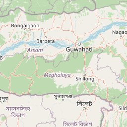
Map view of Chakrashila Wildlife Sanctuary

Use this park location map to pinpoint Chakrashila Wildlife Sanctuary in India, understand its exact geographic position, and read its mapped placement within the surrounding landscape more clearly.

Pigeon | © OpenStreetMap contributors

Location context for Chakrashila Wildlife Sanctuary

Assam
Park atlas

Compare surrounding regional geography and connected foothill conservation landscapes

Parks Near Chakrashila Wildlife Sanctuary and Related Protected Areas

Browsing parks near Chakrashila Wildlife Sanctuary reveals wider biological corridors and wetland habitats across the Brahmaputra basin. Extending regional comparison helps trace similar foothill terrain and protected reserves throughout western Assam.
National parkAssam
About 42 km away#1 closest

North

Sikhna Jwhwlao National Park: Atlas Mapping of Assam's Indo-Bhutan Frontier Landscapes

Protected corridors and sub-Himalayan forest terrain

Sikhna Jwhwlao National Park provides a vital link between four neighbouring protected areas in the Bodoland region. The park landscape features a complex mosaic of riverine corridors and moist deciduous forests that anchor wildlife movement near the Indo-Bhutan frontier. Beyond its role as a flagship habitat for primates and rhinoceros, the park contains significant cultural heritage sites tied to Bodo history within its distinct sub-Himalayan topography.

Area
316.29 km²
Established
2025
IUCN
II
Relief
Lowland
National parkKokrajhar District
About 50 km away#2 closest

Northwest

Raimona National Park: National Park Protected Landscape and Geographic Atlas Exploration

Discover mapped terrain and regional geography within Raimona National Park.

Raimona National Park, designated as a national park within India's Kokrajhar District, offers rich opportunities for atlas-based geographic discovery. This page details the park's protected landscape, providing insights into its mapped boundaries and the surrounding natural terrain. Understanding Raimona National Park's placement within the regional geography allows for a deeper appreciation of its role as a significant protected area, perfect for detailed map exploration and landscape context.

Area
422 km²
Established
2021
IUCN
II
Relief
Mountain
Wildlife reserveBhutan
About 58 km away#3 closest

Northwest

Phibsoo Wildlife Sanctuary: Bhutan's Wildlife Reserve Atlas and Geographic Identity

Mapping the protected landscape and natural terrain of this Bhutanese sanctuary.

Delve into the specifics of Phibsoo Wildlife Sanctuary, a protected wildlife reserve situated within the geographic expanse of Bhutan. This park detail page focuses on its identity as a conservation landscape, offering insights into its mapped terrain and its significance within the broader regional geography of the Eastern Himalayas. Understand the protected boundaries and the unique natural context that Phibsoo Wildlife Sanctuary represents.

Area
268.93 km²
Established
2009
IUCN
IV
Relief
Mixed relief
National parkAssam
About 73 km away#4 closest

Northeast

Manas National Park: Assam's National Park Protected Landscape and Geographic Atlas

Explore mapped boundaries and regional landscape context.

Manas National Park offers a distinct protected landscape within the state of Assam, India. This national park is a key feature in the geography of the Brahmaputra River valley, providing valuable context for atlas-driven exploration. Understand its mapped territory and regional setting as a protected natural area.

Area
850 km²
Established
1990
IUCN
II
Relief
Mountain
National parkBhutan
About 75 km away#5 closest

Northeast

Royal Manas National Park: Bhutan's Premier Protected Area and Oldest National Park

Explore the mapped terrain and diverse ecosystems of this landmark Bhutanese conservation area.

Royal Manas National Park, Bhutan's first national park established in 1966, serves as a critical conservation hub in the Eastern Himalayas. Spanning over 1,057 square kilometers, it protects a vast array of landscapes, from lowland tropical forests to permanent ice fields. Its designation as the kingdom's conservation showpiece and its role in transboundary protection underscore its immense geographic and ecological importance within Bhutan.

Area
1,057 km²
Established
1966
IUCN
II
Relief
Mountain
National parkAlipurduar district
About 82 km away#6 closest

Northwest

Buxa Tiger Reserve National Park: Protected Landscape Exploration in Alipurduar District

Mapped boundaries and diverse ecosystems within India's easternmost tiger reserve.

Buxa Tiger Reserve, a designated national park in India's Alipurduar district, offers a profound look into a protected landscape at the crossroads of major biogeographic zones. Its terrain ascends from the Gangetic Plains to the Himalayan foothills, showcasing a rich tapestry of forest types and supporting significant faunal diversity. This reserve functions as a crucial international elephant corridor, facilitating wildlife movement between India and Bhutan, and stands as a testament to the importance of mapped protected areas in transboundary conservation efforts.

Area
760 km²
Established
1983
IUCN
II
Relief
Mixed relief
Watercolor painting of rolling green hills, a meandering stream, and a soft pastel sky
National parkWest Garo Hills district
About 92 km away#7 closest

South

Nokrek National Park: Protected Mountain Landscape and Regional Geography

Explore its mapped boundaries and diverse natural terrain.

Nokrek National Park is a vital protected mountain wilderness situated in the West Garo Hills district, Meghalaya, India. Its rugged terrain, characterized by ancient geological formations and dense evergreen forests, supports remarkable biodiversity. As a key component of the Nokrek Biosphere Reserve, it offers a unique glimpse into the region's ecological significance, serving as an important source for major rivers and a sanctuary for diverse flora and fauna.

Area
47.48 km²
Established
1986
IUCN
II
Relief
Mountain
National parkTrongsa District
About 105 km away#8 closest

North

Jigme Singye Wangchuck National Park: Bhutan National Park's Geographic and Landscape Atlas

Mapped protected area within Trongsa District's natural terrain.

Delve into the detailed geographic identity of Jigme Singye Wangchuck National Park, a protected national park situated in Bhutan's Trongsa District. This park provides essential context for understanding Bhutanese geography and conservation landscapes. Examine its mapped boundaries and place within the regional terrain, offering a structured exploration for anyone interested in national park geography and protected natural areas.

Area
1,730 km²
Established
1995
IUCN
II
Relief
Mountain

Common questions about visiting, size, designation, and location context for Chakrashila Wildlife Sanctuary

Chakrashila Wildlife Sanctuary FAQs for park facts, access, geography, and protected area context

Find quick answers about Chakrashila Wildlife Sanctuary, including protected-area facts, park geography, trail and visitor context, and how the park fits into its surrounding country and regional landscape.
MoriAtlas Explorer

Continue Your Protected Areas Search Across the Global Atlas

Deepen your exploration by continuing the structured search for national parks and protected areas worldwide. Utilize the comprehensive filtering capabilities to compare different conservation landscapes and refine your understanding of global park geography. Discover more about the distribution and characteristics of protected natural areas.

Global natural geography