Mori Atlas logo
National parkCheile Bicazului-Hășmaș National Park

Discover the mapped boundaries and regional setting of this protected national park.

Cheile Bicazului-Hășmaș National Park: Romania's Protected Landscape Identity and Geographic Context

Cheile Bicazului-Hășmaș National Park stands as a significant protected area within Romania, offering a unique perspective on the country's natural geography and conservation landscapes. As a national park, its mapped boundaries encompass a distinct natural terrain, providing essential context for atlas exploration. Understanding this protected landscape is key to appreciating its regional significance and the broader geographical tapestry of protected areas in Romania. This page serves as your authoritative entry point to explore the park's identity and its place within the national atlas.

National ParksRomaniaEastern CarpathiansKarst LandscapeGorgesLimestone Formations

Cheile Bicazului-Hășmaș National Park

National park

Park overview

Structured park overview, official facts, and landscape profile for Cheile Bicazului-Hășmaș National Park

Cheile Bicazului-Hășmaș National Park park facts, protected area profile, and essential visitor context
Review the core facts for Cheile Bicazului-Hășmaș National Park, including designation, size, terrain, visitor scale, habitats, and operating context in one park-focused overview.

About Cheile Bicazului-Hășmaș National Park

Cheile Bicazului-Hășmaș National Park protects one of Romania's most geologically significant and scenically dramatic mountain landscapes. Located in the heart of the Eastern Carpathians, the park derives its name from the two principal features it encompasses: the Bicaz Gorges and the Hășmaș Mountains. The territory stretches across both Neamț and Harghita counties, with park administration centered in Izvoru Mureșului. The landscape is characterized by rounded limestone ridges that maintain a peneplain appearance, from which the gorge walls drop away in precipitous cliffs. The Bicaz River, flowing from Lacu Roșu, descends through the canyon covering a significant elevation difference, creating a landscape of towering vertical faces where trees occasionally anchor in small habitat pockets. Beyond the main gorge, tributaries including those of Lapoșului, Cupașului, Șugăului and Bicăjelului have carved their own smaller gorges, decorated with rapids, waterfalls, and pothole formations. The park's natural reserves include Bicaz Gorge spanning 3,728 hectares combined across both counties, Lacu Roșu, the 10-hectare Cheile Șugăului reserve, the 5-hectare Avenul Licaș cave system, and an 800-hectare section protecting the Hășmașul Mare Massif, Piatra Singuratică, and Hășmașul Negru.

Quick facts and research context for Cheile Bicazului-Hășmaș National Park

The park is situated in the Eastern Carpathians of northeastern Romania, straddling Neamț and Harghita counties. Its defining features include the deep Bicaz Canyon, the Red Lake (Lacu Roșu) formed by a natural dam, and the Hășmaș Mountains with their characteristic rounded limestone ridges. The park contains several designated natural reserves including Bicaz Gorge, Lacu Roșu, Cheile Șugăului, and Avenul Licaș, protecting unique geological and ecological features across the 6,575-hectare territory.

Park context

Deeper park guide and search-rich context for Cheile Bicazului-Hășmaș National Park

Cheile Bicazului-Hășmaș National Park history, landscape, wildlife, and travel context
Explore Cheile Bicazului-Hășmaș National Park through its history, landscape character, ecosystems, wildlife, conservation priorities, cultural context, and seasonal travel timing in a structured park guide built for atlas discovery and search intent.

Why Cheile Bicazului-Hășmaș National Park stands out

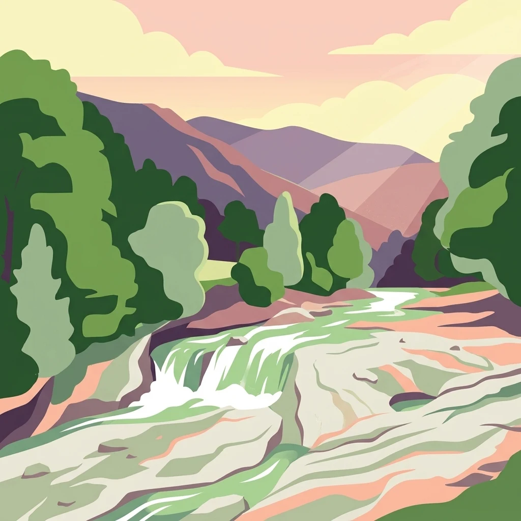
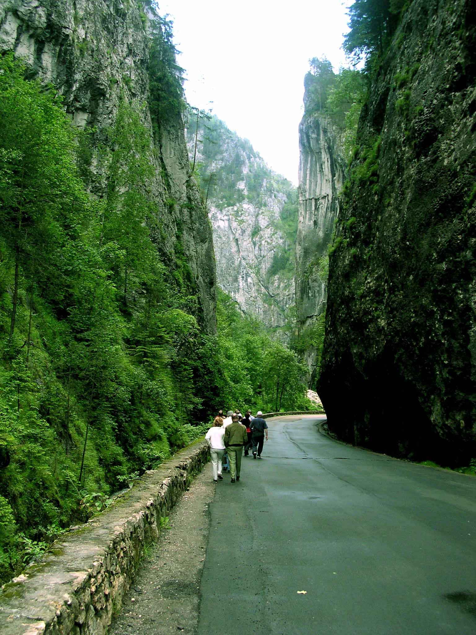
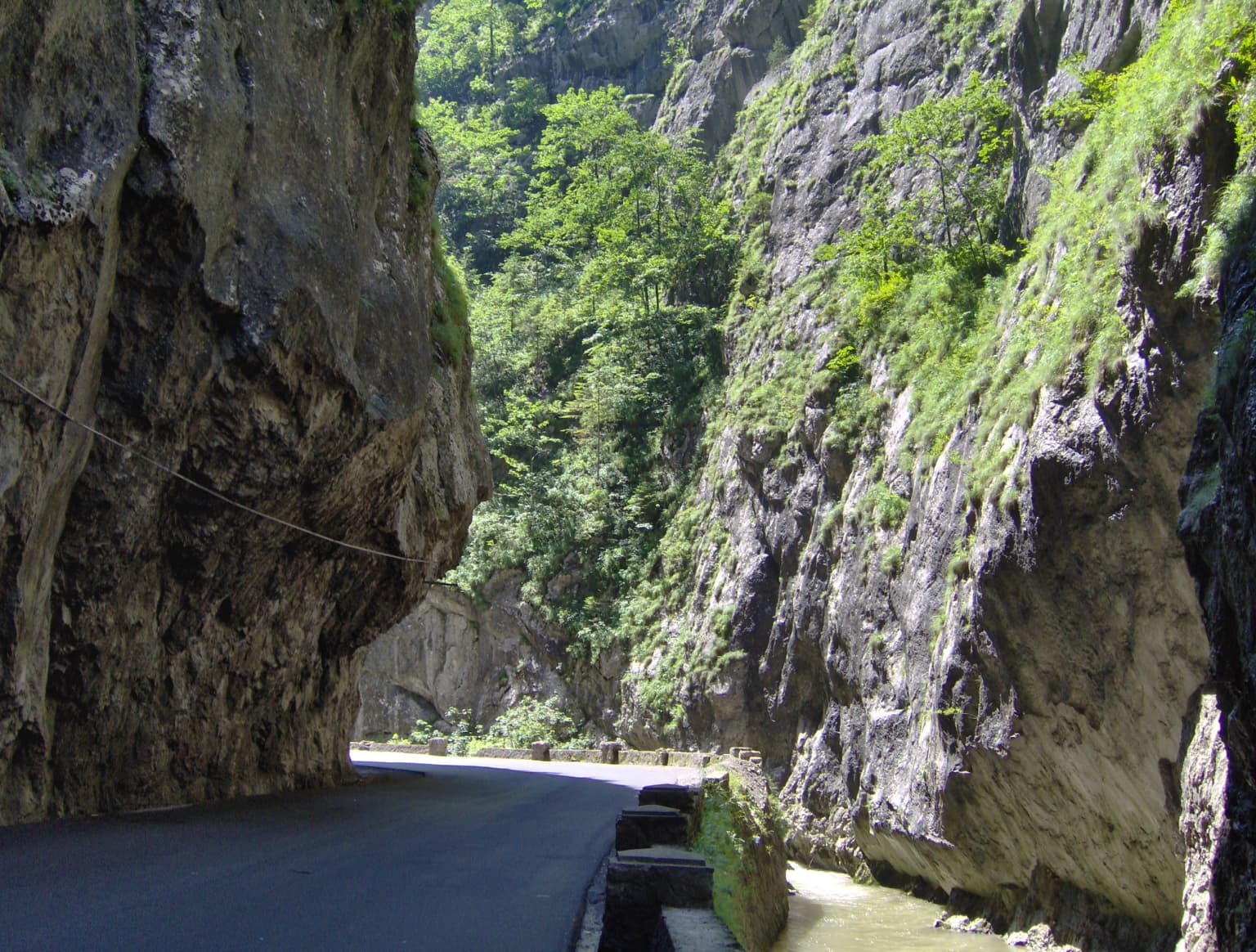
Cheile Bicazului-Hășmaș is best known for its dramatic gorges and exceptional karst landscapes. The Bicaz Canyon itself is a spectacular deep gorge with monumental vertical rock walls that rank among the most impressive in Romania. Lacu Roșu (Red Lake) provides a striking visual anchor, a natural dam lake with a unique setting. The park also protects an extensive karst system featuring limestone towers, needles, chimneys, caves, sinkholes, and erosion potholes, with landmarks such as Piatra Altarului and Piatra Singuratică adding to the landscape's distinctive character.

Cheile Bicazului-Hășmaș National Park history and protected-area timeline

The park was established as a national protected area to preserve the exceptional geological and landscape values of the Eastern Carpathians region. The geological history that shaped this landscape stretches back to the Paleozoic, when orogenic and tectonic processes pushed older Proterozoic rocks over more recent Cambrian formations. During the Triassic, sea transgressions covered the crystalline base with layers of conglomerates and hard limestone sediments, a process repeated over six major phases interrupted by terrestrial stages. The end of the Lower Cretaceous brought volcanic intrusions into the accumulating sediments. Marine creatures from the Jurassic and Cretaceous seas left abundant fossil traces throughout the area, providing scientific insight into the region's ancient geological history. The formation of Lacu Roșu itself resulted from a natural landslide that dammed the Bicaz River in the 19th century, creating the lake that remains one of the park's most recognizable features.

Cheile Bicazului-Hășmaș National Park landscape and geographic character

The landscape of Cheile Bicazului-Hășmaș presents a dramatic interplay of geological forces expressed through gorges, karst formations, and mountain ridges. The Hășmaș Mountains rise as rounded limestone ridges with a distinctive peneplain appearance, their summits providing viewpoints where cliffs intersect with quasi-vertical walls and forest cover. The Bicaz Canyon itself is the park's most impressive geological feature, a deep incision carved by the river through limestone and conglomerate, with walls rising dramatically above the water. The landscape features various karst elements including vertical and overhanging walls, limestone towers and needles, chimneys, diaclastic blocks nearly detached from parent rock, rocky peaks, clints, karst saddles, scree slopes, sinkholes, and pit caves. Tributary streams have carved their own gorges throughout the area, each adding to the complexity of the terrain. Subalpine meadows cover the ridges and patches of grassy vegetation appear on slopes and terraces, while forests of compact spruce or mixed beech, fir, and occasionally larch cover the steep conglomerate slopes.

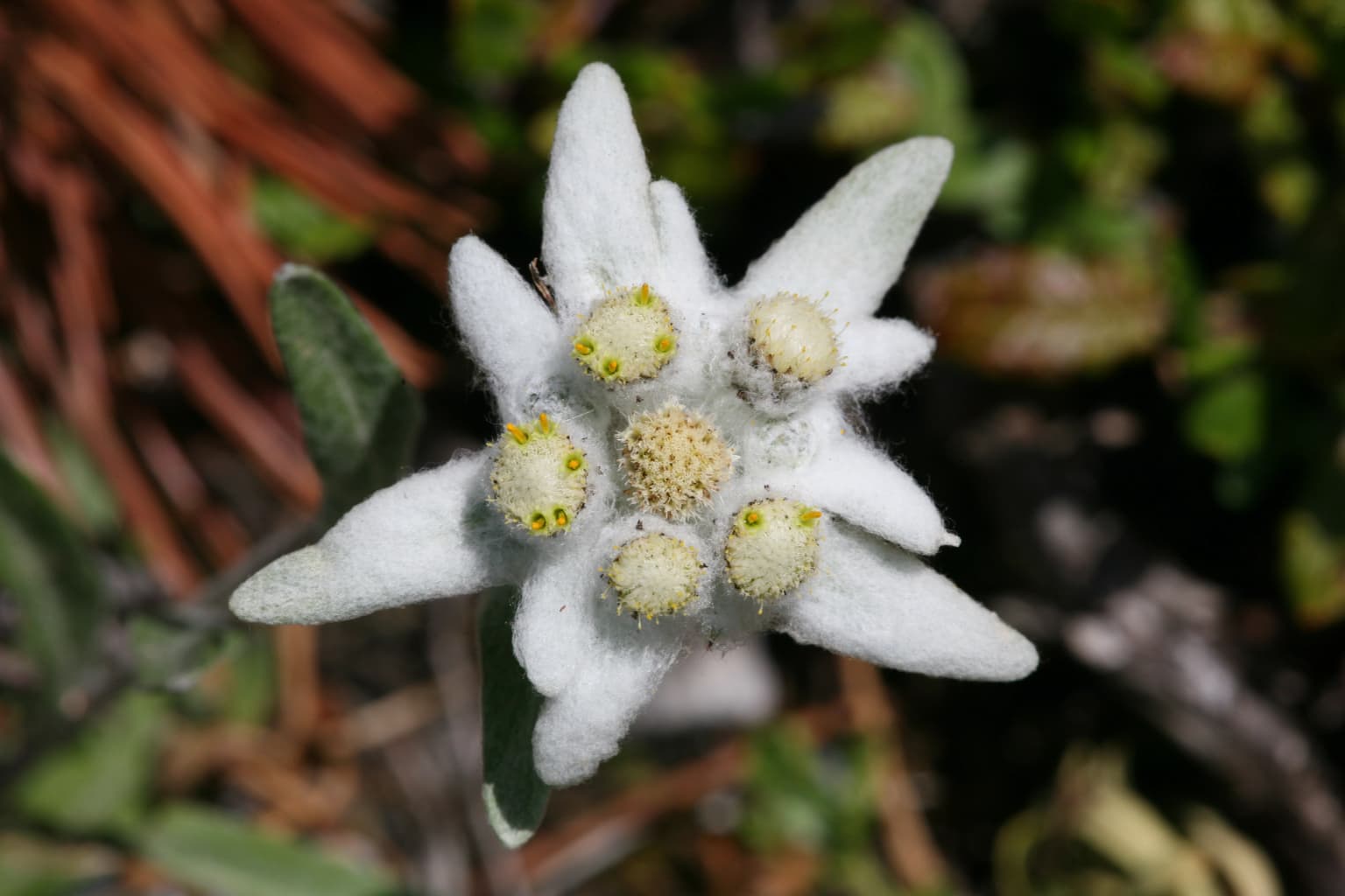
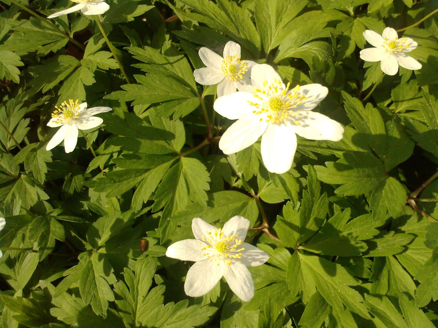
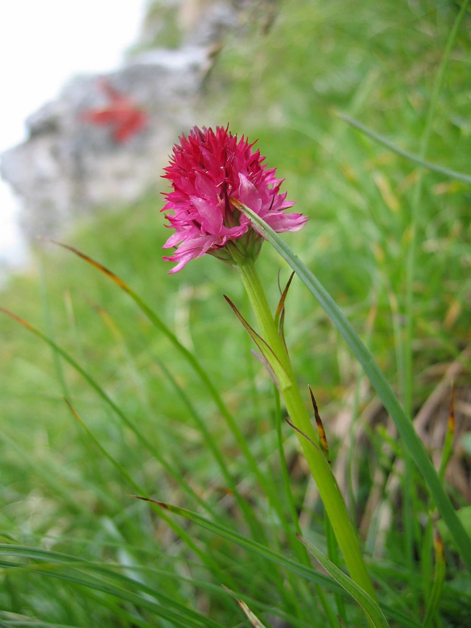
Cheile Bicazului-Hășmaș National Park ecosystems, habitats, and plant life

The ecological character of the park reflects its altitudinal range and geological diversity. The subalpine meadow-covered ridges combine with patches of grassy vegetation on slopes and terraces, creating a mosaic of open and forested habitats. The forests that clothe the steep slopes feature compact spruce formations, with occasional mixed areas including European beech, fir, and less commonly larch. In some locations, spruce or pine trees grow directly in rock crevices, demonstrating the adaptation of forest cover to the challenging terrain. The karst landscape influences soil development and water movement, creating specialized microhabitats throughout the area. The diverse terrain, from deep gorges to exposed ridges, supports varied ecological communities that respond to differences in aspect, moisture, and substrate.

Cheile Bicazului-Hășmaș National Park wildlife and species highlights

The park's diverse habitats support wildlife adapted to the mountain and karst environments of the Eastern Carpathians. The forest communities, primarily composed of spruce and mixed broadleaf species, provide habitat for forest-dwelling species. The karst landscape with its caves, sinkholes, and rocky formations creates specialized environments for species adapted to these conditions. The water systems, from the Bicaz River flowing through the gorge to the Lacu Roșu lake, support aquatic communities. The subalpine meadows and forest edges offer foraging and shelter opportunities for species utilizing the transition between forested and open habitats.

Cheile Bicazului-Hășmaș National Park conservation status and protection priorities

Cheile Bicazului-Hășmaș holds significant conservation value as a protected area preserving both geological and ecological diversity within the Eastern Carpathians. The park's zoning reflects conservation priorities, with 78% designated as a special conservation zone and 22% as a protection zone. The natural reserves within the park, including Bicaz Gorge, Lacu Roșu, Cheile Șugăului, and Avenul Licaș, protect particularly significant features. The geological formations, including the complex karst system with its caves and fossil deposits, represent scientific and educational value beyond their scenic importance. The protection of this mountain landscape preserves habitats for species adapted to the Carpathian environment and maintains ecological processes in a region of significant biodiversity.

Cheile Bicazului-Hășmaș National Park cultural meaning and human context

The park occupies a region with historical significance in northeastern Romania. The area has been part of traditional land use patterns in the Carpathian foothills, with communities in Harghita and Neamț counties maintaining connections to the mountain landscape. The park administration is located in Izvoru Mureșului, a settlement that serves as a gateway to the protected area. The landscape has been shaped by geological processes over millions of years, with human activity integrating into the broader mountain environment over centuries.

Best time to visit Cheile Bicazului-Hășmaș National Park

The park can be visited throughout the year, with each season offering distinct characteristics. The summer months provide the most accessible conditions for hiking and exploring the gorges, with the full extent of the landscape visible and trail conditions favorable. Autumn brings colorful forest displays as the beech and mixed forests change, adding visual interest to the mountain scenery. Winter transforms the landscape dramatically, with snow covering the ridges and creating a different character, though conditions become more challenging for general visitation. Spring brings increased water flow to the rivers and waterfalls as snowmelt and precipitation refresh the landscape.

Park location guide

Geography guide, regional context, and park location map for Cheile Bicazului-Hășmaș National Park

Cheile Bicazului-Hășmaș National Park park geography, regions, and map view in Romania
Understand where Cheile Bicazului-Hășmaș National Park sits in Romania through a broader geographic reading of the surrounding landscape, nearby location context, and its mapped position within the national park landscape.

How Cheile Bicazului-Hășmaș National Park fits into Romania

Romania is a unitary semi-presidential republic located in Southeast and Central Europe. It borders Ukraine, Hungary, Serbia, Bulgaria, Moldova, and the Black Sea. The country has a population of approximately 19 million and covers an area of 238,397 km². Bucharest is the capital and largest city. Romania joined the European Union in 2007.

Wider geography shaping Cheile Bicazului-Hășmaș National Park in Romania

Romania lies on the lower course of the Danube River, north of the Balkan Peninsula, and on the northwestern shore of the Black Sea. The terrain is varied, featuring the Carpathian Mountains in the center, the Transylvanian Plateau, the Moldavian Plateau, and plains along the Danube and in the south. The country has a diverse landscape that includes forests, meadows, and wetland areas.

Map view of Cheile Bicazului-Hășmaș National Park

Use this park location map to pinpoint Cheile Bicazului-Hășmaș National Park in Romania, understand its exact geographic position, and read its mapped placement within the surrounding landscape more clearly.

Pigeon | © OpenStreetMap contributors

Location context for Cheile Bicazului-Hășmaș National Park

Harghita CountyNeamț County
Park atlas

Map and compare protected landscapes throughout the Eastern Carpathians, revealing diverse gorges, karst systems, and mountain park geography.

Discover More National Parks and Protected Areas Near Cheile Bicazului-Hășmaș National Park
Explore other national parks and protected areas within the Eastern Carpathians region, expanding discovery beyond the dramatic gorges and karst landscapes of Cheile Bicazului-Hășmaș National Park. Compare their diverse geological formations, mountain scenery, and conservation efforts to trace the broader geographic context of Romania's protected landscapes.
Protected landscapeNeamț County

Vânători-Neamț Natural Park: Protected Landscape within Neamț County, Romania

Mapped protected area and regional landscape context.

Vânători-Neamț Natural Park is a designated protected landscape located in Romania's Neamț County. This MoriAtlas entry provides detailed geographic information, focusing on the park's mapped boundaries and its role within the regional atlas of protected natural areas. Understand the park's specific landscape context and its place within the wider geography of Western Moldavia, essential for any structured exploration of Romanian protected lands.

Area
306.31 km²
Established
2003
IUCN
V
Scope
Terrestrial
Protected landscapeMureș County

Defileul Mureșului Superior Natural Park: Protected Landscape Mapping and Geography

Explore Mureș County's premier protected landscape.

Access detailed mapping and geographic context for Defileul Mureșului Superior Natural Park. As a protected landscape situated in Romania's Mureș County, this entity offers crucial insights into regional natural terrain and protected area distribution. Explore its mapped boundaries and understand its significance within the broader atlas of protected lands.

Area
91.56 km²
Established
2007
IUCN
V
Relief
Mixed relief
National park

Călimani National Park: Romania's Premier National Park Protected Landscape

Explore mapped boundaries and regional geographic context.

Uncover the geographic identity of Călimani National Park, a designated national park in Romania. This resource offers detailed insights into its protected landscape, mapped terrain, and surrounding natural context. Navigate through its specific park boundaries and understand how it fits into the wider regional geography, providing a clear atlas-style overview for dedicated discovery.

Area
240.41 km²
Established
2000
IUCN
II
Relief
Mountain
Protected landscapeVrancea County

Putna-Vrancea Natural Park: A Protected Landscape in Vrancea County's Carpathian Mountains

Explore mapped terrain, natural park boundaries, and regional geography.

Putna-Vrancea Natural Park, designated as a protected landscape, offers detailed geographic insights into the Vrancea Mountains in Romania. Users can explore the park's mapped terrain, understand its protected boundaries, and contextualize its natural park status within Vrancea County and the broader Eastern Carpathians region. This atlas-focused view highlights the unique landscape features and regional geographic significance of this Romanian protected area.

Area
302.04 km²
Established
2005
IUCN
V
Relief
Mountain
National park

Rodna Mountains National Park: Explore Protected Landscape and Geographic Atlas

Discover the mapped terrain and protected area context.

Rodna Mountains National Park represents a key protected landscape within Romania, offering rich opportunities for geographic discovery. This page provides detailed insight into its mapped boundaries and how it integrates into the regional terrain. Delve into the structured atlas data to understand the park's protected area status and its significance within the natural geography.

Relief
Mountain
Scope
Terrestrial
Watercolor illustration of a mountainous landscape with forests, a lake, and distant peaks.
National parkChernivtsi Oblast

Cheremosh National Nature Park: Protected Landscape and Geographic Context in UA

Explore mapped boundaries within Chernivtsi Oblast

Cheremosh National Nature Park represents a vital protected area within Ukraine's Chernivtsi Oblast. This entry offers a structured exploration of the park's geographic identity, focusing on its mapped boundaries and its significance as part of the regional natural landscape. Delve into the terrain and understand how Cheremosh National Nature Park contributes to the mapped geography of western Ukraine, providing a foundation for atlas-based discovery.

Area
71 km²
Established
2009
IUCN
II
Relief
Mountain
Watercolor illustration of a mountainous landscape with rolling hills, a river, and green vegetation
Protected landscapeMaramureș County

Maramureș Mountains Natural Park: Protected Landscape and Carpathian Geography

Explore the mapped boundaries and dramatic terrain of Romania's largest nature park.

Delve into the Maramureș Mountains Natural Park, a protected landscape covering extensive tracts of the northern Carpathian Mountains. This page provides detailed geographic context, showcasing the park's mapped boundaries, diverse alpine terrain, and its role within the broader regional geography of Maramureș County. Understand the natural features and protected area significance of this expansive Carpathian wilderness for structured atlas exploration.

Area
1,488.5 km²
Established
2004
IUCN
V
Relief
Mountain
National park

Piatra Craiului National Park: Protected Landscape Atlas and Geographic Context

Explore Romania's unique national park and its mapped terrain.

Navigate the protected geography of Piatra Craiului National Park, a key national park entity. This page details its mapped boundaries and situates its natural landscape within Romania's regional geography, offering a structured point of discovery for geographic atlas enthusiasts. Understand the park's identity as a protected natural area and its contribution to the mapped terrain of the region.

Area
147.66 km²
Established
2000
IUCN
II
Relief
Mountain

Common questions about visiting, size, designation, and location context for Cheile Bicazului-Hășmaș National Park

Cheile Bicazului-Hășmaș National Park FAQs for park facts, access, geography, and protected area context
Find quick answers about Cheile Bicazului-Hășmaș National Park, including protected-area facts, park geography, trail and visitor context, and how the park fits into its surrounding country and regional landscape.
MoriAtlas Explorer

Continue Your Protected Areas Search Across the Global Atlas

Deepen your exploration by continuing the structured search for national parks and protected areas worldwide. Utilize the comprehensive filtering capabilities to compare different conservation landscapes and refine your understanding of global park geography. Discover more about the distribution and characteristics of protected natural areas.

Global natural geography