Mori Atlas logo
National parkChiloé National Park

Explore mapped park boundaries and regional geography within this significant national park.

Chiloé National Park: Protected Landscape and Geographic Context in Los Lagos Region, Chile

(Parque Nacional Chiloé)

Chiloé National Park stands as a vital protected area, offering a unique window into the geography of Chile's Los Lagos Region. This page provides an atlas-driven perspective on the park's mapped boundaries and its role within the broader natural landscape context of southern Chile, facilitating a deeper geographic understanding for explorers and researchers alike.

Temperate RainforestMarine MammalsCoastal Protected AreaBirdwatchingWhale WatchingPeat Bogs

Chiloé National Park

National park

Park overview

Structured park overview, official facts, and landscape profile for Chiloé National Park

Chiloé National Park park facts, protected area profile, and essential visitor context
Review the core facts for Chiloé National Park, including designation, size, terrain, visitor scale, habitats, and operating context in one park-focused overview.

About Chiloé National Park

Chiloé National Park represents one of Chile's most significant protected areas, preserving the unique ecology of Chiloé Island, a place deeply intertwined with Chilean cultural identity and natural heritage. The park's location on the western coast places it directly adjacent to the productive waters of the Pacific Ocean and Gulf of Corcovado, creating a landscape where forest meets sea in dramatic fashion. The terrain is characterized by the rolling foothills of the Cordillera del Piuchén, a coastal mountain range that rises from the ocean and creates diverse microclimates and habitat zones. Within the park's boundaries, visitors encounter everything from windswept coastal dunes to pristine old-growth forests, from nutrient-rich peat bogs to the narrow fiords where whales come to feed and rest. The park was created following public opposition to the Chiloé Chip Project in the 1970s, reflecting the strong connection between local communities and this landscape. However, the park's boundaries have evolved over time as some areas with Huilliche indigenous communities were excised from the protected zone, with collaborative conservation and tourism projects now underway between CONAF and these communities.

Quick facts and research context for Chiloé National Park

Chiloé National Park covers 431 km² on Chiloé Island in southern Chile, established in 1983 under IUCN Category II protection. The park is managed by Chile's National Forestry Corporation (CONAF) and is divided into two main sectors: Chepu in the north and Anay in the south. The landscape is dominated by the Cordillera del Piuchén foothills, with coastal dunes, extensive peat bogs, and old-growth rainforests. The climate is wet and temperate with average temperatures around 11°C and annual precipitation ranging from 2,500mm to nearly 5,000mm depending on elevation and location. The park is an Important Bird Area supporting significant populations of several endemic bird species.

Park context

Deeper park guide and search-rich context for Chiloé National Park

Chiloé National Park history, landscape, wildlife, and travel context
Explore Chiloé National Park through its history, landscape character, ecosystems, wildlife, conservation priorities, cultural context, and seasonal travel timing in a structured park guide built for atlas discovery and search intent.

Why Chiloé National Park stands out

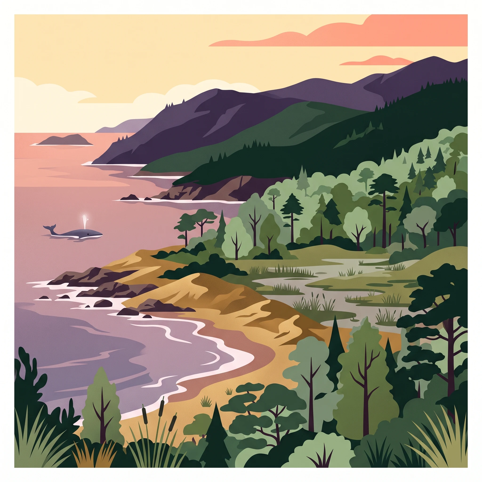
Chiloé National Park is best known for its remarkable marine mammal populations, particularly the resident population of pygmy blue whales in the Gulf of Corcovado, one of only four or five known feeding grounds for this species globally. The park also protects exceptional examples of Valdivia temperate rain forest, including ancient alerce trees, and features dramatic coastal landscapes with dunes, rocky shores, and islets. The combination of terrestrial and marine biodiversity makes this park a critical conservation area, with whales, including humpbacks, finbacks, and potentially critically endangered southern right whales, frequently observable from the island's southern shores.

Chiloé National Park history and protected-area timeline

Chiloé National Park was established in 1983 through Supreme Decree N° 734, a direct consequence of the controversy surrounding the Chiloé Chip Project of the previous decade. This industrial forestry initiative had proposed massive tree harvesting on Chiloé Island and generated significant public opposition, ultimately leading to the creation of this protected area as a conservation response. Originally encompassing a larger territory, the park's surface area has been reduced by more than 45 square kilometers due to the removal of inhabited lands. Several Huilliche communities that had been included within the initial park boundaries could not exercise property rights or conduct legal resource extraction activities. Over time, zones including the Huelde Lake area near Chanquín, coastal strips between Huentemó and the Colecole River, and areas between the Colecole and Anay Rivers were removed from the protected status and placed under the management of local indigenous communities. These excised areas now host joint conservation and tourism initiatives between CONAF and the Huilliche communities, representing a model of collaborative land management.

Chiloé National Park landscape and geographic character

The landscape of Chiloé National Park is defined by the meeting of the Pacific Ocean with the lush forests of the Chilean Coastal Range. The park encompasses a remarkable variety of terrain, from the sandy beaches and coastal dunes that line the western shores to the steep foothills of the Cordillera del Piuchén that rise inland. Along the coast, rocky headlands alternate with stretches of sand, while small islets such as Metalqui provide nesting habitat for seabirds and marine mammals. The interior features a terrain of rounded hills covered in dense forest, interspersed with wetlands, peat bogs, and the valleys carved by rivers like the Abtao, Anay, and Chepu. The contrast between the rain-shadowed eastern slopes and the wetter western exposures creates distinct ecological zones within relatively short distances. This topographic and ecological diversity, compressed into a relatively compact area, makes the park a remarkably complete representation of the Chiloé island environment.

Chiloé National Park ecosystems, habitats, and plant life

The nature of Chiloé National Park is characterized by the globally significant Valdivia temperate rain forest ecosystem, one of the world's most distinctive and threatened forest types. This dense forest ecosystem is composed of evergreen trees, shrubs, and climbing plants, with southern beech (Nothofagus) species forming the dominant canopy. Among the most notable trees is the alerce (Fitzroya cupressoides), a long-lived conifer that can live for thousands of years and which forms nearly pure stands or associates with other species in the wettest areas. The forest understory is rich with native bamboo (Chusquea quila), myrtles, and epiphytes. At higher elevations and in areas with poor drainage, extensive peat bogs and swamps develop, supporting specialized plant communities adapted to waterlogged conditions. The tepual forest formation, a dense thicket of tepú trees with interlaced trunks, creates a maze-like environment where mosses and epiphytes form false soil layers several meters above the ground, making navigation hazardous for the unwary. Coastal dune communities feature specialized vegetation adapted to nutrient-poor, saline conditions.

Chiloé National Park wildlife and species highlights

The wildlife of Chiloé National Park is notable for both its terrestrial and marine components. The park's waters have become internationally famous as one of the few regular feeding grounds for pygmy blue whales, with the Cetacean Conservation Center's Blue Whale Project documenting these gatherings. Humpback whales, fin whales, and sei whales also frequent the area, while the critically endangered Peru/Chile stock of southern right whales, with only around 30 remaining individuals, may occasionally be observed. On land, the park supports the pudú, one of the world's smallest deer species, and the endangered Darwin's fox, found only on Chiloé Island. River otters hunt in the estuaries, while the coastal islets host colonies of South American sea lions. As an Important Bird Area, the park supports significant populations of the Chilean pigeon, slender-billed parakeet, black-throated huet-huet, and chucao tapaculo, all species characteristic of the southern Chilean forests.

Chiloé National Park conservation status and protection priorities

Chiloé National Park plays a crucial role in conserving one of Earth's most distinctive temperate rain forest ecosystems and some of the world's most endangered marine mammals. The park protects significant portions of the Valdivia forest, including old-growth alerce stands, some of which have been declared National Monuments. The designation as an Important Bird Area by BirdLife International recognizes its importance for endemic bird species. The marine waters, though not formally part of the park boundary, are intimately connected to its conservation mission, providing critical habitat for pygmy blue whales whose presence has brought international attention to the region. The park's management involves collaboration with Huilliche communities in former park areas, demonstrating a model for integrating indigenous land use with conservation objectives. The excision of community lands from the park highlights the ongoing challenge of balancing strict protection with the rights and livelihoods of traditional inhabitants.

Chiloé National Park cultural meaning and human context

Chiloé National Park exists within the cultural landscape of Chiloé Island, a place with deep indigenous heritage and strong cultural identity. The Huilliche communities whose lands were incorporated into and subsequently removed from the park represent the original inhabitants of this region. Their traditional relationship with the landscape includes activities such as resource extraction that were incompatible with strict protected area management. The collaborative conservation and tourism projects now underway in former park areas represent an evolution in how Chile approaches protected area management, recognizing that effective conservation must consider the needs and rights of local communities. The park's creation itself was driven by community opposition to industrial development, reflecting the strong connection between Chiloé's residents and their natural environment. The landscape contains places of cultural significance, and the park boundaries traverse areas where human communities and wild nature have co-existed for generations.

Top sights and standout views in Chiloé National Park

The park offers several standout features that distinguish it within Chile's protected area network. The pygmy blue whale population of the Gulf of Corcovado represents one of the most remarkable marine mammal spectacles in the Southern Hemisphere, with these enormous animals often entering narrow fiords to feed. The ancient alerce forests, some of the oldest living organisms on Earth, provide a tangible connection to the prehistoric past. The coastal landscapes with their dunes, beaches, and islets create dramatic scenery where the Pacific Ocean meets the forest. The biodiversity of the Valdivia rain forest, with its endemic species and complex ecological relationships, represents a globally important ecosystem. The opportunity to observe whales from shore, particularly near Caleta Zorra on the island's southern side, provides visitors with encounters with some of the ocean's most magnificent creatures without needing boat excursions.

Best time to visit Chiloé National Park

The park can be visited throughout the year, with each season offering distinct experiences. The wet temperate climate means rainfall is common in all seasons, though the amount varies with elevation and exposure. Summer months (December to March in the Southern Hemisphere) generally bring more stable weather and longer daylight hours, making this the most popular time for visitors. Winter months offer a different character, with moody landscapes, fewer visitors, and the opportunity to experience the forest in its wettest, most lush condition. The whale watching opportunity is not strictly seasonal, as pygmy blue whales and other species can be observed throughout the year, though the probability of sightings may vary. The park's rain forest character means that visitors should be prepared for wet conditions regardless of when they visit, with appropriate clothing and footwear essential for enjoying the trails and coastal areas.
Park location guide

Geography guide, regional context, and park location map for Chiloé National Park

Chiloé National Park park geography, regions, and map view in Chile
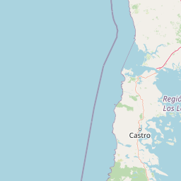
Understand where Chiloé National Park sits in Chile through a broader geographic reading of the surrounding landscape, nearby location context, and its mapped position within the national park landscape.

How Chiloé National Park fits into Chile

Chile is a presidential republic in western South America, extending as a narrow strip along the western edge of the continent between the Andes Mountains and the Pacific Ocean. It is the southernmost country in the world and the closest to Antarctica. The country is bordered by Peru, Bolivia, and Argentina, and administers several Pacific islands including Easter Island. Chile is a major copper producer and has a population of approximately 19.6 million.

Wider geography shaping Chiloé National Park in Chile

Chile occupies a narrow strip of land along the western edge of South America, extending approximately 4,300 km north to south but only about 350 km east to west at its widest point. The country is sandwiched between the Andes Mountains to the east and the Pacific Ocean to the west. It shares borders with Peru to the north, Bolivia to the northeast, and Argentina to the east. Southern Chile borders the Drake Passage. Chile also administers several Pacific islands including Juan Fernández Islands, Isla Salas y Gómez, Desventuradas Islands, and Easter Island, plus the Chilean Antarctic Territory.

Map view of Chiloé National Park

Use this park location map to pinpoint Chiloé National Park in Chile, understand its exact geographic position, and read its mapped placement within the surrounding landscape more clearly.

Pigeon | © OpenStreetMap contributors

Location context for Chiloé National Park

Los Lagos Region
Park atlas

Compare surrounding protected landscapes and Valdivia temperate rainforest ecosystems in Chile's Los Lagos region.

Explore More Parks Near Chiloé National Park: Discover Chilean Coastal Protected Areas
Browse other national parks and protected areas geographically connected to Chiloé National Park, including diverse coastal zones and Valdivia temperate rainforests. Deepen your understanding of Chile's Los Lagos region by comparing park features, conservation efforts, and regional ecological patterns.
National parkLos Lagos Region

Alerce Andino National Park: Protected Landscape Within Los Lagos Region Geography

Explore the national park's mapped boundaries and regional context.

Delve into the protected landscape of Alerce Andino National Park, a distinct national park entity situated in Chile's Los Lagos Region. This focus provides a clear understanding of its geographic setting, highlighting its importance within regional conservation efforts and offering a detailed view of its mapped terrain. Understand the park's place in the southern Chile geography through this detailed exploration.

Area
393 km²
Established
1982
IUCN
II
Visitors
12.2K annual
National parkLos Lagos Region

Hornopirén National Park: Mapped Protected Landscape and Geographic Identity

Explore the national park's mapped boundaries and regional context.

Hornopirén National Park serves as a crucial protected landscape within Chile's Los Lagos Region. This dedicated park page offers detailed insight into its geographic setting, emphasizing mapped boundaries and its identity as a national park. Users can explore how Hornopirén National Park contributes to the regional geography and protected-area framework, providing a grounded point for landscape discovery.

Area
482 km²
Established
1988
IUCN
II
Relief
Mountain
National parkLos Lagos Region

Vicente Pérez Rosales National Park: Protected Landscape & Regional Geography Atlas

Mapped park boundaries and natural terrain in Los Lagos Region.

Delve into the protected area identity of Vicente Pérez Rosales National Park, a significant national park situated in Chile's Los Lagos Region. This detailed exploration focuses on understanding the park's geographic setting, its mapped landscape features, and its contribution to the regional atlas of protected territories. Discover the natural terrain and boundary context that define this unique Chilean landscape.

Area
2,530 km²
Established
1926
IUCN
II
Visitors
332.3K annual
Watercolor painting depicting mountains, a lake, and grassy shoreline
National parkArgentina

Los Alerces National Park: Ancient Alerce Forests and Glacial Terrain in Argentina

Discover the park's protected landscape and regional geography.

Los Alerces National Park in Argentina is a globally significant protected area, celebrated for its ancient alerce forests, some of the longest-living trees on Earth. This national park showcases a dramatic landscape shaped by glaciers, featuring a series of interconnected lakes and rugged Andean terrain. Explore the unique ecosystem and mapped geography of this UNESCO World Heritage site to understand its profound natural and conservation value.

Area
2,599 km²
Established
1937
IUCN
II
Relief
Mountain
Watercolor illustration showing a lake surrounded by forested hills and mountains
National parkChubut Province

Lago Puelo National Park: A Unique Protected Landscape at the Intersection of Biomes

Explore its glacial terrain and Andean-Patagonian geographic context.

Lago Puelo National Park, located in Argentina's Chubut Province, stands out as a significant protected area due to its remarkable ecological diversity. This park is distinguished by its rare transition zone where the Patagonian forest converges with the Andean steppe, incorporating flora typically found in the Valdivian temperate rainforest. The mountainous landscape, carved by glaciers, features the striking turquoise waters of Puelo Lake and surrounding river systems. Understanding Lago Puelo National Park's geography provides insight into the complex natural systems of Patagonia and its unique protected biomes.

Area
276.74 km²
Established
1971
IUCN
II
Relief
Mountain
National parkLos Ríos Region

Alerce Costero National Park: Explore Protected Landscapes and Ancient Forests in Los Ríos Region

Discover mapped terrain and unique Valdivian ecosystem geography.

Alerce Costero National Park stands as a significant protected landscape in Chile's Los Ríos Region, celebrated for its ancient Fitzroya trees and as a sanctuary for the Valdivian temperate rainforest. The park's protected boundaries encompass rugged terrain within the Cordillera Pelada, offering insights into unique watershed geography and the resilience of an ancient forest ecosystem. Its diverse landscape, a mosaic of old-growth woods and natural clearings, provides essential habitat and a remarkable geographic context for atlas exploration.

Area
139.75 km²
Established
2010
IUCN
III
Relief
Mountain
Watercolor illustration of a mountain range with a lake and forested hills in soft green, pink, and beige tones
National parkLos Lagos Region

Puyehue National Park: Mapped Boundaries and Volcanic Landscape in Los Lagos Region

Explore Chile's dramatic Andean protected area.

Puyehue National Park is a key protected area in the Los Lagos Region of Chile, recognized for its distinctive volcanic landscapes and geothermal features. This detail page offers an atlas-centric view, highlighting the park's mapped boundaries, the terrain shaped by volcanoes like Puyehue, and its ancient temperate rainforest ecosystems. Understand its geographic context within the Andes and its significance as a protected national park.

Area
1,070 km²
Established
1941
IUCN
II
Visitors
133K annual
National parkRío Negro Province

Nahuel Huapi National Park: Protected Area Landscape and Geographic Context in Río Negro

Explore mapped natural terrain and park boundaries within Patagonia.

Nahuel Huapi National Park is a crucial protected area offering a deep dive into the Patagonian landscape. Situated in Argentina's Río Negro Province, this national park provides a detailed view of mapped natural terrain and its environmental context. Users can explore the park's geographic identity and protected boundaries, making it an essential stop for understanding the regional geography and conservation significance of this part of South America.

Area
7,050 km²
Established
1934
IUCN
II
Relief
Mountain

Common questions about visiting, size, designation, and location context for Chiloé National Park

Chiloé National Park FAQs for park facts, access, geography, and protected area context
Find quick answers about Chiloé National Park, including protected-area facts, park geography, trail and visitor context, and how the park fits into its surrounding country and regional landscape.
MoriAtlas Explorer

Continue Your Protected Areas Search Across the Global Atlas

Deepen your exploration by continuing the structured search for national parks and protected areas worldwide. Utilize the comprehensive filtering capabilities to compare different conservation landscapes and refine your understanding of global park geography. Discover more about the distribution and characteristics of protected natural areas.

Global natural geography