
Mori Atlas logo
National parkChréa National Park

Discover the unique geography, mapped boundaries, and protected wildlife of this vital Algerian mountain ecosystem.

Chréa National Park: Algeria's Premier National Park and Ancient Atlas Cedar Landscape

Chréa National Park stands as a significant protected area within Algeria's Blidean Atlas mountains, part of the wider Tell Atlas range. This park offers a unique window into North African geography and conservation, distinguished by its ancient Atlas cedar forests that are among the last of their kind. As a national park, it protects a varied terrain shaped by mountain ridgelines and diverse habitats, providing critical context for understanding the region's natural heritage and mapped landscapes.

National ParkCedar ForestMountain LandscapeWildlife ConservationBarbary MacaqueAlgeria
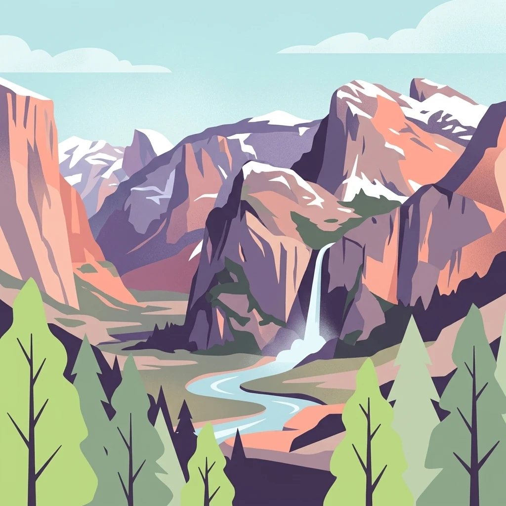
Illustration of a mountainous landscape featuring a river, forest, and snow-capped peaks

Chréa National Park

National park

Park overview

Structured park overview, official facts, and landscape profile for Chréa National Park

Chréa National Park park facts, protected area profile, and essential visitor context

Review the core facts for Chréa National Park, including designation, size, terrain, visitor scale, habitats, and operating context in one park-focused overview.

About Chréa National Park

Chréa National Park occupies a significant position in Algeria's protected area network as one of the nation's largest national parks and a key center of biodiversity conservation. The park's territory spans the mountainous terrain of the Blidean Atlas, a range that separates the Mediterranean coastal lowlands from the Sahara Desert to the south. This transitional location gives the park exceptional ecological importance, supporting species from both temperate European and African biomes within a relatively compact geographic area. The park's establishment in 1985 reflected Algeria's commitment to preserving its natural heritage, particularly the iconic Atlas cedar forests that have long been valued for their timber, ecological functions, and cultural significance. Today, Chréa serves not only as a conservation area but also as a living laboratory for understanding mountain ecology in North Africa and the impacts of climate change on Mediterranean forest ecosystems. The presence of a functional ski station within the park boundaries demonstrates the unique character of this protected area, where winter tourism coexists with conservation objectives despite the inherent tensions such dual use can create.

Quick facts and research context for Chréa National Park

Chréa National Park spans roughly 260 square kilometers in the Blidean Atlas mountains of northern Algeria, rising to elevations that support both alpine vegetation and winter snow sports. The park was formally established in 1985 and protects one of the most biologically diverse ecosystems in the country, with over 1240 documented plant and animal species. Its signature species include the Atlas cedar, a culturally and ecologically important conifer that dominates the park's forest cover, and the endangered Barbary macaque, which persists in significant numbers within the park's cedar forest habitats. The park also contains the Grotto of Chiffa, a notable geological feature that adds to the area's natural heritage.

Protection and recognition

Analyzing terrestrial management boundaries and global biosphere recognition

Chréa National Park Protection Status and International Designation

Explorers can analyze the terrestrial protection scope and documented conservation frameworks established for Chréa National Park. Geographic data highlights official management profiles alongside international records, including its designated status as a UNESCO Biosphere Reserve.

International recognition

Protection details

Protection scope
Terrestrial
Designated year
2002
Transboundary protection
No
Core area
44.19 km²
Buffer area
157.09 km²
Park context

Deeper park guide and search-rich context for Chréa National Park

Chréa National Park history, landscape, wildlife, and travel context

Explore Chréa National Park through its history, landscape character, ecosystems, wildlife, conservation priorities, cultural context, and seasonal travel timing in a structured park guide built for atlas discovery and search intent.

Why Chréa National Park stands out

Chréa National Park is best known for two remarkable natural features: its ancient Atlas cedar forests, which form one of the most extensive and well-preserved cedar ecosystems in the Atlas region, and its population of endangered Barbary macaques, which represent one of only a handful of viable sub-populations remaining in Algeria. The park's elevational range creates a diverse mosaic of habitats, from dense cedar forests at higher elevations to more open woodland and scrub at lower altitudes. This ecological diversity, combined with the park's location at the northern edge of the Sahara and its proximity to the Mediterranean climate zone, makes it a critical refuge for species adapted to both temperate and semi-arid conditions.
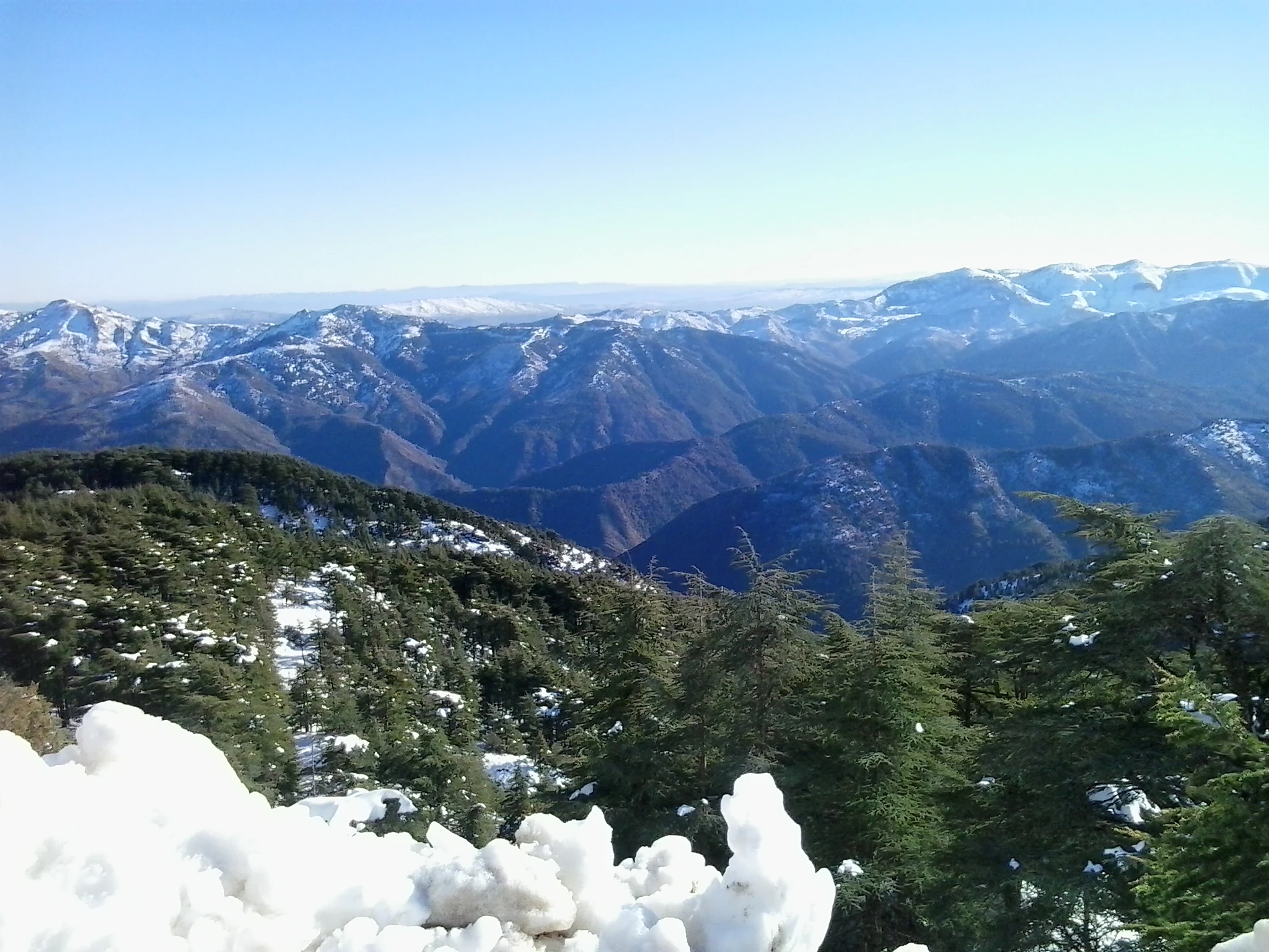
Snow-covered mountain peaks and pine forests under a clear blue sky
Panoramic view of snow-capped mountain peaks and coniferous forests in Chréa National Park

Chréa National Park history and protected-area timeline

Chréa National Park was officially established in 1985, though the area had long been recognized for its ecological and scenic value prior to formal protection. The creation of the park reflected growing environmental awareness in Algeria during the late twentieth century and a desire to safeguard the nation's natural heritage, particularly its forest resources which had faced significant pressure from logging and grazing. The park was founded with the dual mandate of conserving biodiversity and maintaining the ecological integrity of the Atlas mountain forest ecosystems. Over the years, the park has faced various challenges including pressure from agricultural expansion, illegal logging, and the impacts of climate change on forest health and water resources. The establishment of the ski station predates the park's formal creation, representing an earlier era of resource use that continues to shape management decisions today.

Chréa National Park landscape and geographic character

The landscape of Chréa National Park is characterized by mountainous terrain within the Blidean Atlas, a subrange of the Tell Atlas that runs parallel to Algeria's Mediterranean coast. The terrain rises from lower hillsides covered in scrub and open woodland to more steep and rugged peaks where dense forest cover predominates. The park's elevation range supports distinct ecological zones, with Atlas cedar dominating the higher elevations while Aleppo pine and various oak species occupy lower slopes. Rock outcrops and cliffs interrupt the forest cover in places, and the park contains several small watercourses that drain the mountain slopes. The Grotto of Chiffa represents a notable geological feature within the park, offering evidence of the karst processes that have shaped portions of the Atlas landscape over geological time. The combination of snow-capped peaks, ancient forests, and dramatic ridgelines creates a landscape of considerable scenic beauty that differs markedly from the more familiar desert imagery often associated with Algeria.

Chréa National Park ecosystems, habitats, and plant life

The natural environment of Chréa National Park supports an exceptional diversity of plant and animal species, with over 1240 species documented within park boundaries. The park's vegetation reflects its position at the intersection of Mediterranean and mountain ecosystems, with Atlas cedar forming the dominant forest type at higher elevations. These ancient cedar forests represent one of the most significant remaining stands of this species, which has been culturally important throughout North African history for its durable timber and aromatic properties. The forest structure supports a complex community of understory plants, fungi, and invertebrates that depend on the unique conditions created by the cedar canopy. At lower elevations, the vegetation transitions through zones of mixed woodland and maquis-type shrubland, creating a vertically stratified habitat mosaic that supports diverse ecological communities.

Chréa National Park wildlife and species highlights

Chréa National Park is home to a remarkable assembly of wildlife, most notably the endangered Barbary macaque which represents one of Africa's few surviving populations of this primates species. These Barbary macaques inhabit the cedar forests of the park, where they live in social groups among the ancient trees and exploit the diverse food resources the forest provides. The park's position along bird migration routes and its varied habitats support numerous bird species, including several raptor species that hunt over the mountain slopes and forests. The reptile and small mammal communities include various species adapted to both forested and more open habitats, while the park's streams support aquatic communities adapted to the cool, fast-flowing mountain waters. The overall wildlife assemblage reflects the park's role as a critical refugium for species that have declined elsewhere in Algeria due to habitat loss and human pressure.

Chréa National Park conservation status and protection priorities

Chréa National Park plays a critical role in conserving both the Atlas cedar ecosystem and the endangered Barbary macaque, two conservation priorities of international significance. The park's cedar forests represent a vital reservoir of genetic diversity for this iconic tree species, which has faced declining populations across its range due to over-exploitation and climate change. Similarly, the Barbary macaque populations in the park constitute one of the few viable sub-populations remaining in Algeria, making the protected area essential for the species' long-term survival in the country. The park's designation as an IUCN Category II protected area reflects its primary mandate of preserving natural ecosystems while allowing for sustainable visitor access and limited recreation. Effective conservation in Chréa requires addressing ongoing pressures including illegal resource extraction, forest degradation, and the broader challenges posed by climate change to Mediterranean mountain ecosystems.

Chréa National Park cultural meaning and human context

The Chréa region carries cultural significance that extends beyond its ecological value, with the park's name derived from the local community of Chréa which lies adjacent to the protected area. The Atlas cedar has deep cultural resonance throughout North Africa, having been valued for millennia for its timber, resin, and spiritual associations. The presence of the Grotto of Chiffa adds a cultural dimension to the park, as such geological features often hold traditional significance in local communities. The ski station represents a more recent layer of human activity in the landscape, reflecting Algeria's engagement with winter sports and mountain recreation during the twentieth century. The park exists within a broader regional context of Berber cultural heritage, as the Tell Atlas region has been inhabited by Amazigh communities for centuries whose traditional land use practices have shaped the landscape over millennia.

Top sights and standout views in Chréa National Park

Chréa National Park offers a distinctive combination of ecological significance and recreational opportunity that sets it apart among North African protected areas. The ancient Atlas cedar forests represent one of the most impressive forest ecosystems in the region, with trees of considerable age and size creating a atmospheric landscape unlike anywhere else in Algeria. The Barbary macaque populations provide a unique wildlife viewing opportunity, as these primates can be observed in their natural forest habitat, a experience available at few other locations in Africa. The park's ski facilities offer winter recreation possibilities that are extremely rare on the African continent, allowing visitors to experience mountain snow sports in an unexpected setting. The Grotto of Chiffa provides an additional point of interest for those interested in geology and natural history, while the panoramic views from the mountain ridges offer sweeping vistas across the Tell Atlas landscape.

Best time to visit Chréa National Park

The optimal time to visit Chréa National Park depends on the experience sought, with different seasons offering distinct advantages. Spring and early summer bring mild temperatures and active wildlife activity, making this period ideal for hiking and wildlife observation as the Barbary macaques are more visible as they forage in the forest. The summer months can be warm but provide the opportunity to escape lower elevation heat and enjoy the mountain forests. Autumn offers another excellent visiting window with pleasant temperatures and the possibility of seeing the forest in its fall colors. Winter brings the ski season for those interested in the park's snow sports facilities, though accessibility may be affected by weather conditions. The shoulder seasons of spring and autumn generally offer the most comfortable conditions for general exploration and wildlife viewing.
Monthly climate preview

Long term monthly temperature ranges and precipitation patterns for Chréa National Park

Chréa National Park Climate Normals, Average Temperature and Precipitation

Representative coordinate records indicate a measured annual rhythm of monthly average temperatures ranging from 9.23 °C to 27.38 °C alongside varying precipitation levels. Detailed monthly climate normals provide full visibility into historical temperature extremes and precipitation distribution across the protected area.
Annual mean17 °C
9 °C27 °C
Jan
Feb10°
Mar12°
Apr15°
May19°
Jun23°
Jul27°
Aug27°
Sep23°
Oct19°
Nov14°
Dec10°
Warmest month
August

27.4 °C

Coolest month
January

9.2 °C

Wettest month
November

2.7 mm/day

Driest month
July

0.2 mm/day

Park location guide

Geography guide, regional context, and park location map for Chréa National Park

Chréa National Park park geography, regions, and map view in Algeria

Understand where Chréa National Park sits in Algeria through a broader geographic reading of the surrounding landscape, nearby location context, and its mapped position within the national park landscape.

How Chréa National Park fits into Algeria

Algeria is a North African country spanning over 2.38 million km², making it the largest country in Africa. It borders the Mediterranean Sea to the north and shares land borders with seven countries. The population exceeds 47 million, with most concentrated in the northern coastal region.

Wider geography shaping Chréa National Park in Algeria

Algeria occupies the central portion of the Maghreb region in North Africa. It is bordered by Tunisia and Libya to the northeast, Niger to the southeast, Mali, Mauritania, and Western Sahara to the southwest, and Morocco to the west. The Mediterranean Sea forms its northern border. The terrain consists of the Tell Atlas mountain range and coastal plains in the north, transitioning to the Sahara desert in the south.

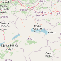
Map view of Chréa National Park

Use this park location map to pinpoint Chréa National Park in Algeria, understand its exact geographic position, and read its mapped placement within the surrounding landscape more clearly.

Pigeon | © OpenStreetMap contributors

Location context for Chréa National Park

Blida Province

Explore the distinctive scenery and diverse habitats that define Algeria's mountainous protected environment.

Chréa National Park Photos: Visualizing Atlas Cedar Forests and Mountain Landscapes in Algeria

Browse detailed imagery showcasing the rugged mountain terrain, ancient Atlas cedar forests, and unique wildlife habitats of Chréa National Park. These visual insights offer a deeper understanding of the park's ecological significance and its distinctive protected-area landscape within the Blidean Atlas range.

Snow-covered mountain peaks and pine forests under a clear blue sky

Park atlas

Discover other national parks and protected landscapes across the Blidean Atlas mountain range, comparing diverse habitats adjacent to Chréa National Park.

Explore More Protected Areas Near Chréa National Park, Tracing Algeria's Tell Atlas Landscapes

Continue exploring Algeria's protected areas by browsing national parks and conservation landscapes adjacent to Chréa National Park within the Tell Atlas system. Comparing these nearby protected areas offers key geographic context, highlighting the distribution of Atlas cedar forests and Barbary macaque habitats across the region.
National parkKabylie
About 114 km away#1 closest

East

Djurdjura National Park: A National Park within Algeria's Kabylie Region Landscape

Explore its mapped boundaries and protected area geography.

Djurdjura National Park offers a focused exploration of a key protected landscape in Algeria. As a national park, it serves as a vital point for understanding regional geography and the distribution of conservation lands within Kabylie. Discover the park's mapped extent and its significance as a protected natural area, providing a crucial layer for geographic analysis and atlas exploration.

Area
185 km²
Established
1983
IUCN
II
Visitors
500K annual
National parkAlgeria
About 125 km away#2 closest

Southwest

Théniet El Had National Park: Atlas Cedar Forests in Algeria's Tell Atlas Mountains

Discover protected montane landscape and regional geography.

Théniet El Had National Park represents a significant protected landscape in Algeria, characterized by its towering Atlas cedar forests and dramatic mountainous terrain within the Tell Atlas range. Spanning elevations from 1,200 to over 2,200 meters, this national park offers a distinct example of Mediterranean mountain ecosystems. Its unique forest cover and rugged topography provide crucial habitat and watershed functions, making it a key location for understanding protected area geography and landscape context in North Africa.

IUCN
II
Relief
Mountain
Climate
Mediterranean
Scope
Terrestrial
National parkBéjaïa Province
About 193 km away#3 closest

East

Gouraya National Park: Algeria's Protected Landscape in Béjaïa Province

Discover its mapped boundaries and regional geography.

Gouraya National Park is a designated national park in Algeria, located within the administrative region of Béjaïa Province. This MoriAtlas entry focuses on its protected-area status and geographic identity, providing key details for atlas-driven exploration. Users can understand the park's mapped landscape, its regional context, and its significance as a protected natural area for geographic study and discovery.

Area
20.8 km²
Established
1984
IUCN
II
Visitors
60K annual
National parkJijel Province
About 237 km away#4 closest

East

Taza National Park: Protected Mediterranean Coast and Tell Atlas Forest Landscape

Explore its unique mapped geography and conservation significance.

Taza National Park, situated in Algeria's Jijel Province, represents a crucial protected landscape where the Tell Atlas mountains meet the Mediterranean Sea. This 3,807-hectare national park is celebrated for its dramatic coastal cliffs, extensive cork oak and gall oak forests, the largest in Algeria, and its designation as a UNESCO biosphere reserve. The park's geography facilitates unique habitat zones, making it a key area for atlas-based discovery of North African biodiversity, including the Barbary macaque and Algerian nuthatch, within a landscape of exceptional natural beauty and conservation priority.

Area
38.07 km²
Established
1923
IUCN
II
Relief
Mountain
National parkBatna Province
About 299 km away#5 closest

East

Belezma National Park National Park: Mapped Protected Landscape and Geographic Context in Batna Province

Explore its protected area boundaries and regional natural terrain.

Gain a clear understanding of Belezma National Park's protected landscape and geographic position. This entry details its mapped boundaries within Batna Province, providing essential context for atlas-based exploration of Algeria's natural terrain and protected areas. Discover the specific geographic identity that makes Belezma National Park a key feature within its regional landscape.

Area
262.5 km²
Established
1984
IUCN
II
Visitors
100K annual
Watercolor painting showing green hills, mountain ranges, and soft pastel skies
Protected areaSpain
About 305 km away#6 closest

North

Cabrera National Park: A Mapped Protected Area in the Balearic Islands

Explore Mediterranean island geography and protected marine ecosystems.

Cabrera National Park, a protected maritime-terrestrial area in Spain's Balearic Islands, offers a unique focus for geographic discovery. This entry details the archipelago's distinct island geography, its mapped coastal and marine ecosystems, and its role within the Mediterranean. Users can explore the park's protected boundaries and understand its place in the regional atlas for a comprehensive view of Spain's island conservation landscapes.

IUCN
II
Scope
Mixed
Water
Water-dominated
Nature reserveIslas Baleares
About 306 km away#7 closest

Northwest

Parque natural de las Salinas: Protected Coastal Geography in the Balearic Islands

Nature reserve featuring historic salt pans and marine Posidonia habitats.

Spanning the southern Ibiza and northern Formentera coastlines, Parque natural de las Salinas is defined by its characteristic salt-pan geography and protected coastal wetlands. The reserve offers deep insight into the Mediterranean coastal environment, from its shallow marine channels and Es Freus islets to the preserved heritage of traditional salt production landscapes.

Area
158.38 km²
Established
1999
Scope
Mixed
Water
Water-dominated
National parkTlemcen Province
About 413 km away#8 closest

Southwest

Tlemcen National Park National Park: Mapped Boundaries and Regional Geographic Context

Discover protected landscapes within Tlemcen Province.

Delve into Tlemcen National Park, an important protected landscape situated within Tlemcen Province. This detail page offers a focused exploration of its specific geographic identity, mapped park boundaries, and the natural terrain it encompasses, providing essential context for understanding its role in regional geography and protected land exploration within Algeria.

Area
82.25 km²
Established
1993
IUCN
II
Relief
Mixed relief

Common questions about visiting, size, designation, and location context for Chréa National Park

Chréa National Park FAQs for park facts, access, geography, and protected area context

Find quick answers about Chréa National Park, including protected-area facts, park geography, trail and visitor context, and how the park fits into its surrounding country and regional landscape.
MoriAtlas Explorer

Continue Your Protected Areas Search Across the Global Atlas

Deepen your exploration by continuing the structured search for national parks and protected areas worldwide. Utilize the comprehensive filtering capabilities to compare different conservation landscapes and refine your understanding of global park geography. Discover more about the distribution and characteristics of protected natural areas.

Global natural geography